Moor End

Settlement in Yorkshire Harrogate

England

Moor End

Harewood Bridge Bridge on the A61 over the River Wharfe.
Harewood Bridge Credit: Chris McLean

Moor End is a small village located in the West Riding of Yorkshire, England. Situated in the picturesque countryside, it is nestled in the heart of the Yorkshire Dales National Park. With a population of around 300 residents, Moor End offers a tranquil and idyllic setting for those seeking a peaceful retreat from the bustling city life.

The village is characterized by its charming stone-built houses, many of which date back several centuries, adding to the area's historical charm. The surrounding landscape is dominated by rolling hills, lush green meadows, and picturesque valleys, making it a haven for nature enthusiasts and outdoor adventurers. Moor End's close proximity to the Dales provides ample opportunities for hiking, cycling, and horseback riding, allowing visitors to explore the breathtaking beauty of the region.

Although small, Moor End boasts a strong sense of community. The village features a local pub, a community hall, and a small primary school, which serves the needs of the local children. The villagers often gather for various events and activities, fostering a close-knit and friendly atmosphere.

For those seeking a taste of traditional Yorkshire cuisine, Moor End offers a few charming tearooms and cafes, serving homemade treats and locally sourced produce. Visitors can also explore the nearby market towns, such as Skipton and Hawes, which provide a wider range of amenities, including shops, restaurants, and cultural attractions.

Overall, Moor End is a hidden gem in the Yorkshire countryside, offering a peaceful and picturesque retreat for those seeking a break from the hustle and bustle of modern life.

If you have any feedback on the listing, please let us know in the comments section below.
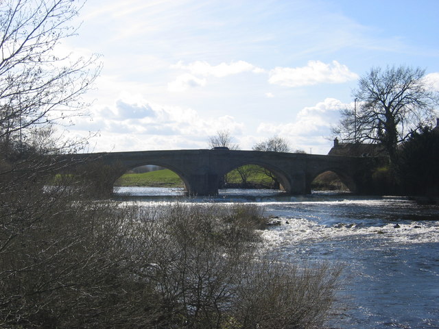
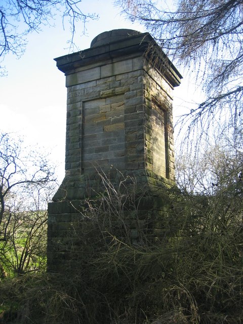
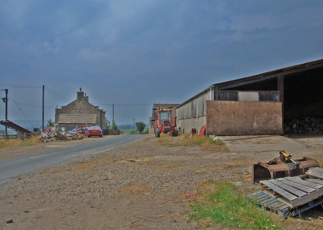
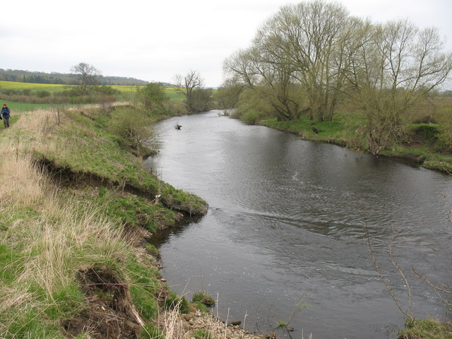
Moor End Images

Images are sourced within 2km of 53.921306/-1.532296 or Grid Reference SE3047. Thanks to Geograph Open Source API. All images are credited.

Harewood Bridge Bridge on the A61 over the River Wharfe.
Harewood Bridge
Bridge on the A61 over the River Wharfe.
Chimney This old chimney is located on the footpath south of the River Wharfe in the south-west corner of this square. I can't find any more information about it and it is not shown on any map I have.
Chimney
This old chimney is located on the footpath south of the River Wharfe in the south-west corner of this square. I can't find any more information about it and it is not shown on any map I have.
River Wharfe View east from Harewood Bridge along the River Wharfe.
River Wharfe
View east from Harewood Bridge along the River Wharfe.
Swindon Lane Bottom Showing the point where the lane from North Rigton meets the A61 Harrogate/Leeds Road
Swindon Lane Bottom
Showing the point where the lane from North Rigton meets the A61 Harrogate/Leeds Road
Dunkeswick Hamlet just to the west of the A61 Leeds/Harrogate Road
Dunkeswick
Hamlet just to the west of the A61 Leeds/Harrogate Road
Low Barrowby Farm Situated on Spring Lane between Netherby and the A61. Looking west towards the A61.
Low Barrowby Farm
Situated on Spring Lane between Netherby and the A61. Looking west towards the A61.
Farmland near Dunkeswick Looking east from the bridge over Keswick Beck on Swindon Lane. The ridge on the skyline (two kilometres away and 90 metres higher) marks the watershed between the Wharfe and the Nidd.
Farmland near Dunkeswick
Looking east from the bridge over Keswick Beck on Swindon Lane. The ridge on the skyline (two kilometres away and 90 metres higher) marks the watershed between the Wharfe and the Nidd.
Keswick Beck, Dunkeswick Looking northwest from the bridge on Swindon Lane. This shot was taken in the heatwave of July 2006 and the beck is drying up. Keswick Beck flows southeast for about two kilometres into the River Wharfe at Netherby.
Keswick Beck, Dunkeswick
Looking northwest from the bridge on Swindon Lane. This shot was taken in the heatwave of July 2006 and the beck is drying up. Keswick Beck flows southeast for about two kilometres into the River Wharfe at Netherby.
A61, Moor End, Dunkeswick Looking north up the A61 as it heads towards Harrogate about one mile north of the crossing of the River Wharfe.
A61, Moor End, Dunkeswick
Looking north up the A61 as it heads towards Harrogate about one mile north of the crossing of the River Wharfe.
Milestone, A61, Moor End The top reads, "Leeds & Harrogate Road Dunkeswick". The south face reads, "Harrogate 5 miles". The north face reads, "Harewood 2 miles Leeds 10 miles".
Milestone, A61, Moor End
The top reads, "Leeds & Harrogate Road Dunkeswick". The south face reads, "Harrogate 5 miles". The north face reads, "Harewood 2 miles Leeds 10 miles".
Bridleway to Swindon Hall This short bridleway (about 1km in length) heads northeast from the A61 to Swindon Lane via Swindon Hall. Here it has just crossed Keswick Beck and follows the hedge before veering right below Swindon Wood seen in the distance.
Bridleway to Swindon Hall
This short bridleway (about 1km in length) heads northeast from the A61 to Swindon Lane via Swindon Hall. Here it has just crossed Keswick Beck and follows the hedge before veering right below Swindon Wood seen in the distance.
Swindon Hall, Kirkby Overblow The bridleway from the A61 to Swindon Lane turns right in front of this impressive farmhouse.
Swindon Hall, Kirkby Overblow
The bridleway from the A61 to Swindon Lane turns right in front of this impressive farmhouse.
Harewood Bridge from the Harewood Estate A view from Sandygate on the Harewood Estate, of Harewood Bridge which carries the A61 Leeds to Harrogate road over the River Wharfe.
See also <a href="https://www.geograph.org.uk/photo/366790">SE3145 : North Park from Sandygate</a>
Harewood Bridge from the Harewood Estate
A view from Sandygate on the Harewood Estate, of Harewood Bridge which carries the A61 Leeds to Harrogate road over the River Wharfe. See also SE3145 : North Park from Sandygate
Weir at Harewood Bridge The weirs upstream of the bridge control the water level for the sawmill. This weir was constructed to provide a paved invert under the bridge, thereby preventing scour damage to the foundations in time of flood. The weir also provides opportunities for local anglers.
Weir at Harewood Bridge
The weirs upstream of the bridge control the water level for the sawmill. This weir was constructed to provide a paved invert under the bridge, thereby preventing scour damage to the foundations in time of flood. The weir also provides opportunities for local anglers.
Narrow Bridge at Harewood This is the narrowest section of the A61 between Leeds and Harrogate. It has been the site of numerous accidents with the masonry parapets being demolished on several occasions. The bridge is a listed Building and therefore cannot easily be widened under current Planning legislation. A scheme for a Harewood  bridge by-pass was investigated around 1990 but failed to gain sufficient support in the Local Transport Plan.
Narrow Bridge at Harewood
This is the narrowest section of the A61 between Leeds and Harrogate. It has been the site of numerous accidents with the masonry parapets being demolished on several occasions. The bridge is a listed Building and therefore cannot easily be widened under current Planning legislation. A scheme for a Harewood bridge by-pass was investigated around 1990 but failed to gain sufficient support in the Local Transport Plan.
Steps and Stile at Harewood bridge A rather unconventional stile meets the walker on the footpath from the sawmill across the busy A61 at Harewood bridge. Perhaps the horizontal bar is there to warn the unwary that he or she is about to step out into live traffic - there is no footway on this north side of the narrow main road between Leeds and Harrogate.
Steps and Stile at Harewood bridge
A rather unconventional stile meets the walker on the footpath from the sawmill across the busy A61 at Harewood bridge. Perhaps the horizontal bar is there to warn the unwary that he or she is about to step out into live traffic - there is no footway on this north side of the narrow main road between Leeds and Harrogate.
The Wharfe below Harewood A pleasant stretch of the River Wharfe a mile downstream from Harewood Bridge.
The Wharfe below Harewood
A pleasant stretch of the River Wharfe a mile downstream from Harewood Bridge.
Footpath between Rougemont and Harewood Bridge Following this footpath beside the River Wharfe towards the A61 Harrogate/Leeds Road at Harewood Bridge.
Footpath between Rougemont and Harewood Bridge
Following this footpath beside the River Wharfe towards the A61 Harrogate/Leeds Road at Harewood Bridge.
Show me another place!

Moor End is located at Grid Ref: SE3047 (Lat: 53.921306, Lng: -1.532296)

Division: West Riding

Administrative County: North Yorkshire

District: Harrogate

Police Authority: North Yorkshire

What 3 Words

///evolving.fall.fractions. Near Pannal, North Yorkshire

Nearby Locations

Moor End Dunkeswick Moor

Related Wikis

Dunkeswick

Dunkeswick is a hamlet in the civil parish of Kirkby Overblow, in North Yorkshire, England, just north of the River Wharfe, off the A61, around a kilometre...

Knight Air Flight 816

Knight Air Flight 816, being flown by G-OEAA, an Embraer 110 Bandeirante belonging to Knight Air, was an internal (domestic) scheduled flight operating...

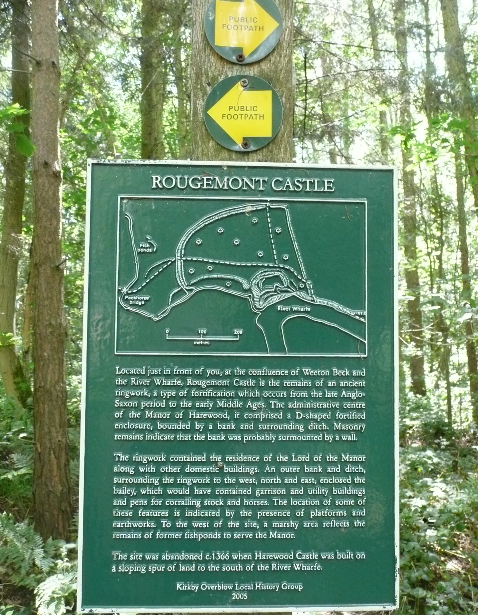
Rougemont Castle, Weeton

Rougemont Castle in the manor of Harewood, in the parish of Weeton, North Yorkshire, England, is a ruined ringwork castle, now largely hidden within over...

Weardley

Weardley is a village on the Harewood Estate in the parish of Harewood, at the northern edge of the City of Leeds metropolitan borough, West Yorkshire...

Weeton, North Yorkshire

Weeton is a village and civil parish in the Harrogate district of North Yorkshire, England. The name is first attested in the Domesday Book of 1086 as...

Harewood Castle

Harewood Castle is a 14th-century stone hall house and courtyard fortress, located on the Harewood Estate, Harewood, in West Yorkshire, England (Grid Reference...

All Saints' Church, Harewood

All Saints' Church is a 15th-century redundant church in the park of Harewood House, the seat of the Lascelles Earls of Harewood, near the village of Harewood...

Kirkby Overblow

Kirkby Overblow is a village and civil parish in North Yorkshire, England. It is situated between Wetherby and Harrogate and lies to the west of Sicklinghall...

Nearby Amenities

Located within 500m of 53.921306,-1.532296
Dunkeswick
Is In: UK, Yorkshire, North Yorkshire, Wharfedale
Is In Valley: Wharfedale
Place: hamlet
Lat/Long: 53.9178203/-1.5354967
Bus Stop
Bus: yes
Departures Board: no
Naptan AtcoCode: 3200YNE04758
Naptan NaptanCode: 32004758
Public Transport: platform
Shelter: no
Source: survey
Lat/Long: 53.9177015/-1.5291142
Bus Stop
Harrogate Road Weeton Lane
Bus: yes
Local Ref: 45014861
Naptan AtcoCode: 450014861
Naptan Bearing: S
Naptan BusStopType: CUS
Naptan CommonName: Harrogate Road Weeton Lane
Naptan Crossing: Weeton Lane
Naptan Indicator: Stop 45014861
Naptan ShortCommonName: Weeton Lane
Naptan Street: Harrogate Road
Naptan Verified: no
Public Transport: platform
Source: naptan_import
Lat/Long: 53.917577/-1.5287217
Bus Stop
Harrogate Road Weeton Lane
Bus: yes
Local Ref: 45014862
Naptan AtcoCode: 450014862
Naptan Bearing: N
Naptan BusStopType: CUS
Naptan CommonName: Harrogate Road Weeton Lane
Naptan Crossing: Weeton Lane
Naptan Indicator: Stop 45014862
Naptan ShortCommonName: Weeton Lane
Naptan Street: Harrogate Road
Naptan Verified: no
Public Transport: platform
Shelter: yes
Source: naptan_import
Lat/Long: 53.9179962/-1.5290818
Power: tower
Source: Bing
Lat/Long: 53.9188986/-1.5341324
Power: pole
Source: Bing
Lat/Long: 53.9194621/-1.5367757
Power: pole
Source: Bing
Lat/Long: 53.9195731/-1.5314121
Power: pole
Source: Bing
Lat/Long: 53.9202791/-1.5274509
Power: pole
Source: Bing
Lat/Long: 53.9201121/-1.5291627
Power: tower
Source: Bing
Lat/Long: 53.9187533/-1.5340331
Power: tower
Source: Bing
Lat/Long: 53.9189075/-1.5337691
Material: wood
Power: pole
Lat/Long: 53.9186948/-1.53038
Power: pole
Lat/Long: 53.9185937/-1.5316808
Power: pole
Lat/Long: 53.9186237/-1.5326169
Power: pole
Lat/Long: 53.9186506/-1.5335852
Bench
Backrest: yes
Lat/Long: 53.9175413/-1.5316361
Power: tower
Source: Bing
Lat/Long: 53.9188984/-1.5340166
The data included in this document is from www.openstreetmap.org. The data is made available under ODbL.

Have you been to Moor End?

Leave your review of Moor End below (or comments, questions and feedback).