Middle Deal

Settlement in Kent Dover

England

Middle Deal

Water tower, Walmer A water tower is an elevated structure supporting a water tank constructed at a height sufficient to pressurize a water supply system for the distribution of drinkable water, and to provide emergency storage for fire protection.
Wikipedia: <span class="nowrap"><a title="http://en.wikipedia.org/wiki/Water_tower" rel="nofollow ugc noopener" href="http://en.wikipedia.org/wiki/Water_tower">Link</a><img style="margin-left:2px;" alt="External link" title="External link - shift click to open in new window" src="https://s1.geograph.org.uk/img/external.png" width="10" height="10"/></span>
Water tower, Walmer Credit: N Chadwick

Middle Deal is a small village located in the county of Kent, England. It is situated on the southeastern coast of the country, overlooking the English Channel. The village is part of the larger civil parish of Deal, which also includes Upper Deal and Lower Deal.

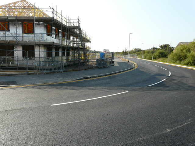
Middle Deal is known for its picturesque setting, with charming cottages and houses lining its streets. The village is surrounded by beautiful countryside and enjoys a mild climate due to its proximity to the coast. It offers stunning views of the sea, making it a popular destination for nature lovers and tourists seeking a peaceful retreat.

Despite its small size, Middle Deal has a strong sense of community and offers a range of amenities for its residents. These include a local convenience store, a post office, and a selection of independent shops. There are also several pubs and restaurants, providing options for dining and socializing.

The village benefits from good transport links, with regular bus services connecting it to the nearby towns of Deal and Dover. The A258 road runs through Middle Deal, providing easy access to other parts of Kent and beyond.

Middle Deal is also known for its historical significance, with several notable landmarks in the area. These include the Middle Deal Conservation Area, which preserves the village's historic architecture, and Middle Deal Castle, a 16th-century fortification that stands as a testament to the area's rich history.

Overall, Middle Deal offers a tranquil and picturesque setting, making it an attractive place to live or visit for those seeking a peaceful coastal village experience.

If you have any feedback on the listing, please let us know in the comments section below.

Middle Deal Images

Images are sourced within 2km of 51.219642/1.3957743 or Grid Reference TR3752. Thanks to Geograph Open Source API. All images are credited.

Water tower, Walmer A water tower is an elevated structure supporting a water tank constructed at a height sufficient to pressurize a water supply system for the distribution of drinkable water, and to provide emergency storage for fire protection.
Wikipedia: <span class="nowrap"><a title="http://en.wikipedia.org/wiki/Water_tower" rel="nofollow ugc noopener" href="http://en.wikipedia.org/wiki/Water_tower">Link</a><img style="margin-left:2px;" alt="External link" title="External link - shift click to open in new window" src="https://s1.geograph.org.uk/img/external.png" width="10" height="10"/></span>
Water tower, Walmer
A water tower is an elevated structure supporting a water tank constructed at a height sufficient to pressurize a water supply system for the distribution of drinkable water, and to provide emergency storage for fire protection. Wikipedia: LinkExternal link
Walmer water tower A water tower is an elevated structure supporting a water tank constructed at a height sufficient to pressurize a water supply system for the distribution of drinkable water, and to provide emergency storage for fire protection.
Wikipedia: <span class="nowrap"><a title="http://en.wikipedia.org/wiki/Water_tower" rel="nofollow ugc noopener" href="http://en.wikipedia.org/wiki/Water_tower">Link</a><img style="margin-left:2px;" alt="External link" title="External link - shift click to open in new window" src="https://s1.geograph.org.uk/img/external.png" width="10" height="10"/></span>
Walmer water tower
A water tower is an elevated structure supporting a water tank constructed at a height sufficient to pressurize a water supply system for the distribution of drinkable water, and to provide emergency storage for fire protection. Wikipedia: LinkExternal link
Walmer Station Walmer Station is located on the Kent Coast line. It was opened in 1881.
Walmer Station
Walmer Station is located on the Kent Coast line. It was opened in 1881.
Kent Coast Line The Kent Coast Line runs between Margate and Dover. The line allows access to the Thanet towns via either Canterbury or Dover.
Kent Coast Line
The Kent Coast Line runs between Margate and Dover. The line allows access to the Thanet towns via either Canterbury or Dover.
King Street, Deal A very wet King Street. The photo is taken from the former Royal Leisure Centre, which used to house a snooker club and an amusement arcade.  On the opposite side is a Barnado’s shop below the Royal British Legion and to the left a public toilets.
King Street, Deal
A very wet King Street. The photo is taken from the former Royal Leisure Centre, which used to house a snooker club and an amusement arcade. On the opposite side is a Barnado’s shop below the Royal British Legion and to the left a public toilets.
Deal railway station  Deal railway station and footbridge seen from platform 2. The gap between the tracks is unique to Deal as compared to other stations along this line, formerly containing a middle siding.
Deal railway station
Deal railway station and footbridge seen from platform 2. The gap between the tracks is unique to Deal as compared to other stations along this line, formerly containing a middle siding.
Forrest Family Funfair The funfair was due to run from 28-31 July 2021.
Forrest Family Funfair
The funfair was due to run from 28-31 July 2021.
Forrest Family Funfair The funfair was due to run from 28-31 July 2021.
Forrest Family Funfair
The funfair was due to run from 28-31 July 2021.
Citizens Advice Bureau, 26, Victoria Road Two notices inside the windows, either side of the front entrance, read: soon we will be moving to a new more central location [at] The Deal Centre, 3 Park St, Deal, CT14 6AG.
Citizens Advice Bureau, 26, Victoria Road
Two notices inside the windows, either side of the front entrance, read: soon we will be moving to a new more central location [at] The Deal Centre, 3 Park St, Deal, CT14 6AG.
Halifax, 63, High Street This view shows the <a href="https://www.geograph.org.uk/photo/6794247">TR3752 : Halifax, 63, High Street</a> when the building was undergoing renovation and repairs to its exterior.
Halifax, 63, High Street
This view shows the TR3752 : Halifax, 63, High Street when the building was undergoing renovation and repairs to its exterior.
Sondes Lodge, 14, Sondes Road Planning permission has been granted by Dover District Council under application number DOV/21/00929 for a “change of use to a dwelling house”. At the time of the photograph, Sondes Lodge was a bed and breakfast establishment.
Sondes Lodge, 14, Sondes Road
Planning permission has been granted by Dover District Council under application number DOV/21/00929 for a “change of use to a dwelling house”. At the time of the photograph, Sondes Lodge was a bed and breakfast establishment.
Lady Irene on Deal beach She is a traditional wooden fishing boat, which is hauled up the beach by means of a cable. These are two further images of <a href="https://www.geograph.org.uk/photo/6155535">TR3752 : Lady Irene Fishing Boat on Deal Beach</a> & <a href="https://www.geograph.org.uk/photo/2737181">TR3752 : Lady Irene</a>.
Lady Irene on Deal beach
She is a traditional wooden fishing boat, which is hauled up the beach by means of a cable. These are two further images of TR3752 : Lady Irene Fishing Boat on Deal Beach & TR3752 : Lady Irene.
The Wandering Man A micropub located beside the England Coast Path; there was a sign, beyond the cyclist, directing patrons to the micropub.
The Wandering Man
A micropub located beside the England Coast Path; there was a sign, beyond the cyclist, directing patrons to the micropub.
Court Marsh Road, Pottery Grove This was <a href="https://www.geograph.org.uk/photo/6671271">TR3752 : Court Marsh Road, Pottery Grove</a> in October 2020. 

Pottery Grove is the name, which has been given to this housing estate.
Court Marsh Road, Pottery Grove
This was TR3752 : Court Marsh Road, Pottery Grove in October 2020. Pottery Grove is the name, which has been given to this housing estate.
Poplar Drive, Pottery Grove Pottery Grove is the name, which has been given to this housing estate.
Poplar Drive, Pottery Grove
Pottery Grove is the name, which has been given to this housing estate.
The Droveway, Pottery Grove Pottery Grove is the name, which has been given to this housing estate.
The Droveway, Pottery Grove
Pottery Grove is the name, which has been given to this housing estate.
Court Marsh Road, Pottery Grove Pottery Grove is the name, which has been given to this housing estate.
Court Marsh Road, Pottery Grove
Pottery Grove is the name, which has been given to this housing estate.
Gas Holder Station, Cannon Street Dover District Council has authorized that prior approval was not required under application number DOV/ 21/00951 for the “prior approval for the demolition and dismantling of redundant gasholder station”. 

The view was from Golf Road.
Gas Holder Station, Cannon Street
Dover District Council has authorized that prior approval was not required under application number DOV/ 21/00951 for the “prior approval for the demolition and dismantling of redundant gasholder station”. The view was from Golf Road.
Show me another place!

Middle Deal is located at Grid Ref: TR3752 (Lat: 51.219642, Lng: 1.3957743)

Administrative County: Kent

District: Dover

Police Authority: Kent

What 3 Words

///august.ruler.branded. Near Deal, Kent

Nearby Locations

Middle Deal Deal

Related Wikis

Goodwin Academy

Goodwin Academy (formerly Castle Community College) is a mixed secondary school and sixth form located in Deal in the English county of Kent.The school...

Deal railway station

Deal railway station serves Deal in Kent, England. The station and all trains serving it are operated by Southeastern. The station is on the Kent Coast...

Deal, Kent

Deal is a coastal town in Kent, England, which lies where the North Sea and the English Channel meet, 8 miles (13 km) north-east of Dover and 8 miles...

Royal Marine Depot, Deal

The Royal Marine Depot, Deal (also called the Royal Marine Depot, Walmer) was a military installation occupied by the Royal Marines and located in South...

Nearby Amenities

Located within 500m of 51.219642,1.3957743
Deal
Public Transport: stop_position
Railway: stop
Train: yes
Lat/Long: 51.2231021/1.3986147
Crossing
Crossing: uncontrolled
Crossing Island: yes
Lat/Long: 51.2224688/1.3960733
Traffic Signals
Lat/Long: 51.2227044/1.3999602
Cycleway: asl
Lat/Long: 51.222771/1.3997183
Post Box
Postal Code: CT14
Ref: CT14 7
Source: survey
Lat/Long: 51.2213039/1.3937192
Crossing
Crossing: uncontrolled
Crossing Ref: zebra
Lat/Long: 51.2191882/1.3979436
Traffic Calming: hump
Lat/Long: 51.2213859/1.398963
Traffic Calming: hump
Lat/Long: 51.2210158/1.3989897
Traffic Calming: hump
Lat/Long: 51.2207069/1.3989968
Toilets
Lat/Long: 51.2192443/1.3986359
Parking
Lat/Long: 51.220069/1.3988602
Post Box
Collection Times: Mo-Fr 09:00; Sa 07:00
Operator: Royal Mail
Operator Wikidata: Q638098
Post Box Mounting: brick_wall
Post Box Type: wall
Postal Code: CT14
Ref: CT14 2
Royal Cypher: GR
Source: survey
Lat/Long: 51.2196513/1.3957235
Post Box
Postal Code: CT14
Ref: CT14 57
Source: survey
Lat/Long: 51.2185622/1.3893699
Crossing
Crossing: uncontrolled
Crossing Ref: zebra
Lat/Long: 51.2185338/1.3971189
Post Box
Collection Times: Mo-Fr 09:00, Sa 07:00
Mapillary: 1152126945271441
Operator: Royal Mail
Operator Wikidata: Q638098
Post Box Design: type_b
Post Box Type: pillar
Postal Code: CT14
Ref: CT14 56
Royal Cypher: EIIR
Royal Cypher Wikidata: Q33102113
Source: survey
Survey Date: 2021-06-19
Lat/Long: 51.2190543/1.4027124
Post Box
Collection Times: Mo-Fr 09:00; Sa 07:00
Operator: Royal Mail
Operator Wikidata: Q638098
Post Box Mounting: brick_wall
Post Box Type: wall
Postal Code: CT14
Ref: CT14 27
Royal Cypher: GR
Source: survey
Lat/Long: 51.2167571/1.399716
Bus Stop
Victoria Hospital
Bench: no
Bin: no
Bus: yes
Naptan AtcoCode: 240096908
Naptan Bearing: SW
Naptan CommonName: Victoria Hospital
Naptan Indicator: opp
Naptan Landmark: Hospital
Naptan NaptanCode: kntgjtpm
Naptan PlusbusZoneRef: DEAL
Naptan Street: London Road
Naptan Verified: no
Public Transport: platform
Shelter: no
Source: naptan_import
Lat/Long: 51.2191821/1.3906867
Bus Stop
Grange Road
Bus: yes
Naptan AtcoCode: 240096910
Naptan Bearing: NE
Naptan CommonName: Grange Road
Naptan Indicator: adj
Naptan Landmark: Grange Road
Naptan NaptanCode: kntgjtpt
Naptan PlusbusZoneRef: DEAL
Naptan Street: London Road
Naptan Verified: no
Public Transport: platform
Source: naptan_import
Lat/Long: 51.2207483/1.3928216
Bus Stop
Grange Road
Bus: yes
Naptan AtcoCode: 240096912
Naptan Bearing: SW
Naptan CommonName: Grange Road
Naptan Indicator: opp
Naptan Landmark: Grange Road
Naptan NaptanCode: kntgjtwd
Naptan PlusbusZoneRef: DEAL
Naptan Street: London Road
Naptan Verified: no
Public Transport: platform
Source: naptan_import
Lat/Long: 51.2204008/1.3927101
Bus Stop
Fire Station
Alt Name: Beechwood Avenue
Bus: yes
Naptan AltCommonName: Beechwood Avenue
Naptan AltStreet: Not Specified
Naptan AtcoCode: 240096914
Naptan Bearing: NE
Naptan CommonName: Fire Station
Naptan Indicator: adj
Naptan NaptanCode: kntgjtpw
Naptan PlusbusZoneRef: DEAL
Naptan Street: London Road
Naptan Verified: no
Public Transport: platform
Source: naptan_import
Lat/Long: 51.2225136/1.3958453
Bus Stop
Deal Castle
Bench: no
Bin: no
Bus: yes
Lit: no
Local Ref: opp
Naptan AtcoCode: 240096916
Naptan Bearing: N
Naptan BusStopType: MKD
Naptan CommonName: Deal Castle
Naptan Indicator: opp
Naptan Landmark: Castle
Naptan NaptanCode: kntgjtwa
Naptan PlusbusZoneRef: DEAL
Naptan RevisionNumber: 2
Naptan Status: act
Naptan Street: Victoria Road
Naptan Verified: no
Public Transport: platform
Ref: kntgjtwa
Shelter: no
Source: naptan_import
Source Date: 2018-04-12
Tactile Paving: no
Lat/Long: 51.2190711/1.4026772
Bus Stop
Beechwood Avenue
Bus: yes
Naptan AtcoCode: 240096920
Naptan Bearing: SW
Naptan CommonName: Beechwood Avenue
Naptan Indicator: opp
Naptan Landmark: Victoria Park
Naptan NaptanCode: kntgjmdw
Naptan PlusbusZoneRef: DEAL
Naptan Street: Mill Road
Naptan Verified: no
Public Transport: platform
Source: naptan_import
Lat/Long: 51.2207557/1.3977006
Bus Stop
Mill Road
Bench: no
Bus: yes
Naptan AtcoCode: 240096922
Naptan Bearing: SW
Naptan CommonName: Brickmakers Arms
Naptan Indicator: adj
Naptan NaptanCode: kntgmjdg
Naptan PlusbusZoneRef: DEAL
Naptan Street: Mill Road
Naptan Verified: no
Public Transport: platform
Shelter: no
Source: naptan_import
Lat/Long: 51.2187786/1.394586
Bus Stop
Allenby Avenue
Bus: yes
Naptan AtcoCode: 240096924
Naptan Bearing: SW
Naptan CommonName: Allenby Avenue
Naptan Indicator: opp
Naptan NaptanCode: kntgjmgw
Naptan PlusbusZoneRef: DEAL
Naptan Street: Mill Road
Naptan Verified: no
Public Transport: platform
Source: naptan_import
Lat/Long: 51.2173359/1.3929286
Bus Stop
Fire Station
Bus: yes
Naptan AtcoCode: 240099714
Naptan Bearing: SW
Naptan CommonName: Fire Station
Naptan Indicator: o/s
Naptan Landmark: Fire Station
Naptan NaptanCode: kntgtajt
Naptan PlusbusZoneRef: DEAL
Naptan Street: Albert Road
Naptan Verified: no
Public Transport: platform
Source: naptan_import
Lat/Long: 51.2228322/1.3960263
Bus Stop
Bowling Green Lane Victoria Hospital
Bench: no
Bin: no
Bus: yes
Flag: no
Lit: no
Naptan AtcoCode: 240099859
Naptan Bearing: NW
Naptan BusStopType: CUS
Naptan CommonName: Bowling Green Lane Victoria Hospital
Naptan Indicator: adj
Naptan Landmark: Victoria Hospital
Naptan NaptanCode: kntgtdag
Naptan PlusbusZoneRef: DEAL
Naptan Street: Bowling Green Lane
Naptan Verified: no
Public Transport: platform
Shelter: no
Source: naptan_import
Tactile Paving: no
Lat/Long: 51.2196717/1.3899348
Bus Stop
Bowling Green Lane Victoria Hospital
Bench: no
Bin: no
Bus: yes
Flag: no
Naptan AtcoCode: 240099861
Naptan Bearing: SE
Naptan BusStopType: CUS
Naptan CommonName: Bowling Green Lane Victoria Hospital
Naptan Indicator: opp
Naptan Landmark: Victoria Hospital
Naptan NaptanCode: kntgtapt
Naptan PlusbusZoneRef: DEAL
Naptan Street: Bowling Green Lane
Naptan Verified: no
Public Transport: platform
Shelter: no
Source: naptan_import
Lat/Long: 51.2199939/1.3893712
Bus Stop
Allenby Avenue
Bus: yes
Naptan AtcoCode: 2400A033120A
Naptan Bearing: NE
Naptan CommonName: Allenby Avenue
Naptan Indicator: adj
Naptan Landmark: Allenby Avenue
Naptan NaptanCode: kntdjtwa
Naptan PlusbusZoneRef: DEAL
Naptan Street: Mill Road
Naptan Verified: no
Public Transport: platform
Source: naptan_import
Lat/Long: 51.2176077/1.3928627
Bus Stop
Mill Road
Bench: no
Bus: yes
Naptan AtcoCode: 2400A033130A
Naptan Bearing: N
Naptan CommonName: Brickmakers Arms
Naptan Indicator: opp
Naptan NaptanCode: kntdjtwd
Naptan PlusbusZoneRef: DEAL
Naptan Street: Mill Rd
Naptan Verified: no
Public Transport: platform
Shelter: no
Source: naptan_import
Lat/Long: 51.2188204/1.3944703
Bus Stop
Beechwood Avenue
Bus: yes
Naptan AtcoCode: 2400A033140A
Naptan Bearing: NE
Naptan CommonName: Beechwood Avenue
Naptan Indicator: adj
Naptan Landmark: Beechwood Ave
Naptan NaptanCode: kntdjtwg
Naptan PlusbusZoneRef: DEAL
Naptan Street: Mill Rd
Naptan Verified: no
Public Transport: platform
Source: naptan_import
Lat/Long: 51.2211264/1.398078
Bus Stop
Fire Station
Alt Name: Beechwood Avenue
Bus: yes
Naptan AltCommonName: Beechwood Avenue
Naptan AltStreet: Not Specified
Naptan AtcoCode: 2400A033150A
Naptan Bearing: W
Naptan CommonName: Fire Station
Naptan Indicator: opp
Naptan Landmark: Fire Station
Naptan NaptanCode: kntdjtwj
Naptan PlusbusZoneRef: DEAL
Naptan Street: London Road
Naptan Verified: no
Public Transport: platform
Shelter: yes
Source: naptan_import
Lat/Long: 51.2224255/1.3967126
Bus Stop
Victoria Hospital
Bus: yes
Naptan AtcoCode: 2400A033160A
Naptan Bearing: NE
Naptan CommonName: Victoria Hospital
Naptan Indicator: adj
Naptan Landmark: RTI
Naptan NaptanCode: kntdjtwm
Naptan PlusbusZoneRef: DEAL
Naptan Street: London Road
Naptan Verified: no
Public Transport: platform
Source: naptan_import
Lat/Long: 51.2189874/1.3899562
Bus Stop
Abbey Close
Bus: yes
Naptan AtcoCode: 2400A033420A
Naptan Bearing: NE
Naptan CommonName: Abbey Close
Naptan Indicator: adj
Naptan Landmark: Abbey Close
Naptan NaptanCode: kntdjwjg
Naptan PlusbusZoneRef: DEAL
Naptan Street: Middle Deal Road
Naptan Verified: no
Public Transport: platform
Source: naptan_import
Lat/Long: 51.2179483/1.3903309
Bus Stop
Railway Station
Bench: no
Bin: no
Bus: yes
Lit: no
Local Ref: o/s
Naptan AtcoCode: 2400A060240R
Naptan Bearing: E
Naptan BusStopType: MKD
Naptan CommonName: Railway Station
Naptan Indicator: o/s
Naptan Landmark: Railway Station
Naptan NaptanCode: kntgawda
Naptan PlusbusZoneRef: DEAL
Naptan RevisionNumber: 7
Naptan Status: act
Naptan Street: Station Forecourt
Naptan Verified: no
Public Transport: platform
Ref: kntgawda
Shelter: no
Source: naptan_import
Source Date: 2018-04-12
Tactile Paving: no
Lat/Long: 51.2230869/1.3989361
Taxi
Deal Rail Station
Capacity: 5
Naptan AtcoCode: 2400A060250R
Naptan CommonName: Deal Rail Station
Naptan Indicator: taxi rank
Naptan Landmark: Deal Rail Station
Naptan PlusbusZoneRef: DEAL
Naptan RevisionNumber: 4
Naptan Status: act
Naptan Street: Queen Street
Naptan Verified: no
Source: naptan_import
Source Date: 2013-11-28
Lat/Long: 51.22317/1.3991714
Post Box
Collection Times: Mo-Fr 09:00; Sa 07:00
Operator: Royal Mail
Operator Wikidata: Q638098
Post Box Mounting: lamp_post
Post Box Type: lamp
Postal Code: CT14
Ref: CT14 25
Royal Cypher: EIIR
Royal Cypher Wikidata: Q33102113
Source: survey
Lat/Long: 51.2213507/1.3892787
Post Box
Collection Times: Mo-Fr 09:00, Sa 07:00
Ref: CT14 12
Royal Cypher: GR
Royal Cypher Wikidata: Q33102273
Lat/Long: 51.2197948/1.4001196
Bicycle Parking
Bicycle Parking: front_wheel
Capacity: 5
Covered: no
Cyclestreets Id: 39132
Source: survey
Lat/Long: 51.2230059/1.398968
Bicycle Parking
Bicycle Parking: front_wheel
Capacity: 18
Covered: yes
Cyclestreets Id: 39129
Note: On platform
Source: survey
Lat/Long: 51.2229028/1.3988504
Bicycle Parking
Bicycle Parking: stands
Capacity: 18
Check Date: 2024-05-04
Covered: no
Cyclestreets Id: 39125;39124
Source: survey
Lat/Long: 51.2234924/1.3987014
Bicycle Parking
Bicycle Parking: front_wheel
Capacity: 6
Check Date: 2024-05-04
Covered: no
Cyclestreets Id: 39126;39124
Source: survey
Lat/Long: 51.2234447/1.3987182
Bicycle Parking
Bicycle Parking: stands
Capacity: 4
Check Date: 2024-05-04
Covered: no
Cyclestreets Id: 39127;39124
Source: survey
Lat/Long: 51.2234108/1.3987303
Bicycle Parking
Bicycle Parking: front_wheel
Capacity: 10
Check Date: 2024-03-29
Covered: no
Cyclestreets Id: 39128;26733
Note: These are Sheffield stands in a toast rack style that have been side mounted onto a fence. Hence the whole bike frame can't be secured properly.
Source: survey
Lat/Long: 51.2233592/1.398752
Post Box
Ref: CT14 33
Lat/Long: 51.2236645/1.3968503
Middle Deal
Place: suburb
Source: OS_OpenData_StreetView
Lat/Long: 51.2199067/1.3976966
Cycleway: asl
Lat/Long: 51.222936/1.400046
Bicycle Parking
Access: customers
Bicycle Parking: stands
Capacity: 22
Covered: no
Cyclestreets Id: 38398
Operator: Your Leisure
Operator Type: private_non_profit
Lat/Long: 51.21852/1.3968891
Bicycle Parking
Access: customers
Bicycle Parking: stands
Capacity: 4
Covered: no
Cyclestreets Id: 38399
Fee: no
Operator: Your Leisure
Operator Type: private_non_profit
Lat/Long: 51.2184003/1.3970779
Crossing
Crossing: uncontrolled
Crossing Ref: zebra
Lat/Long: 51.2186472/1.3969004
Crossing
Crossing: uncontrolled
Crossing Ref: zebra
Lat/Long: 51.2187556/1.3966914
Traffic Calming: hump
Lat/Long: 51.2202778/1.3989351
Fire Station
Lat/Long: 51.2227594/1.396251
Cycleway: asl
Lat/Long: 51.2225876/1.3995946
Cycleway: asl
Lat/Long: 51.2227846/1.4003353
Crossing
Crossing: unmarked
Crossing Ref: zebra
Tactile Paving: no
Lat/Long: 51.2228268/1.3991112
Crossing
Check Date Crossing: 2024-05-04
Crossing: uncontrolled
Crossing Ref: zebra
Tactile Paving: yes
Lat/Long: 51.2228613/1.3993558
Crossing
Check Date Crossing: 2024-05-04
Crossing: uncontrolled
Crossing Ref: zebra
Tactile Paving: yes
Lat/Long: 51.2231211/1.3990508
Entrance: yes
Naptan AtcoCode: 2400DEAL1
Naptan CommonName: Deal Rail Station
Naptan Indicator: rear entrance
Naptan Landmark: Platform 2 Entrance
Naptan RevisionNumber: 3
Naptan Status: act
Naptan Street: London Road
Source: naptan_import
Source Date: 2013-12-05
Lat/Long: 51.2230201/1.3984917
Deal
Naptan AtcoCode: 9100DEAL
Network: SouthEastern
Public Transport: stop_position
Railway: stop
Ref: DEAL
Train: yes
Wikidata: Q2281278
Lat/Long: 51.2231113/1.3986775
Entrance: main
Lat/Long: 51.2205534/1.3924053
Bicycle Parking
Access: customers
Bicycle Parking: stands
Capacity: 12
Check Date Capacity: 2023-07-22
Covered: no
Fee: no
Operator: English Heritage
Operator Type: private_non_profit
Lat/Long: 51.2190527/1.4028772
Bicycle Parking
Access: yes
Bicycle Parking: stands
Capacity: 8
Covered: no
Fee: no
Lat/Long: 51.2181122/1.397591
Deal
Naptan AtcoCode: 9100DEAL
Network: National Rail
Network Website: https://www.nationalrail.co.uk/stations/dea/
Network Wikidata: Q26334
Operator: Southeastern
Operator Website: https://www.southeasternrailway.co.uk/travel-information/more-travel-help/station-information/stations/deal
Operator Wikidata: Q1696490
Public Transport: station
Railway: station
Ref Crs: DEA
Train: yes
Wheelchair: yes
Wikidata: Q2281278
Wikipedia: en:Deal railway station
Lat/Long: 51.2231068/1.3986457
Generator Output Electricity: yes
Generator Source: solar
Generator Type: solar_photovoltaic_panel
Location: roof
Power: generator
Lat/Long: 51.2166818/1.3993165
Generator Output Electricity: yes
Generator Source: solar
Generator Type: solar_photovoltaic_panel
Location: roof
Power: generator
Lat/Long: 51.2156687/1.3974778
Generator Output Electricity: yes
Generator Source: solar
Generator Type: solar_photovoltaic_panel
Location: roof
Power: generator
Lat/Long: 51.2194454/1.4017814
Generator Output Electricity: yes
Generator Source: solar
Generator Type: solar_photovoltaic_panel
Location: roof
Power: generator
Lat/Long: 51.2195067/1.401473
Generator Output Electricity: yes
Generator Source: solar
Generator Type: solar_photovoltaic_panel
Location: roof
Power: generator
Lat/Long: 51.2205298/1.3998086
Generator Output Electricity: yes
Generator Source: solar
Generator Type: solar_photovoltaic_panel
Location: roof
Power: generator
Lat/Long: 51.2179217/1.3918076
Generator Output Electricity: yes
Generator Source: solar
Generator Type: solar_photovoltaic_panel
Location: roof
Power: generator
Lat/Long: 51.2179292/1.3918814
Generator Output Electricity: yes
Generator Source: solar
Generator Type: solar_photovoltaic_panel
Location: roof
Power: generator
Lat/Long: 51.2172219/1.3897464
Generator Output Electricity: yes
Generator Source: solar
Generator Type: solar_photovoltaic_panel
Location: roof
Power: generator
Lat/Long: 51.2232135/1.3918143
Generator Output Electricity: yes
Generator Source: solar
Generator Type: solar_photovoltaic_panel
Location: roof
Power: generator
Lat/Long: 51.2238089/1.3954179
Generator Output Electricity: yes
Generator Source: solar
Generator Type: solar_photovoltaic_panel
Location: roof
Power: generator
Lat/Long: 51.2153764/1.3935457
Generator Output Electricity: yes
Generator Source: solar
Generator Type: solar_photovoltaic_panel
Location: roof
Power: generator
Lat/Long: 51.220618/1.4004511
Generator Output Electricity: yes
Generator Source: solar
Generator Type: solar_photovoltaic_panel
Location: roof
Power: generator
Lat/Long: 51.2187541/1.3925962
Kwik Fit
Brand: Kwik Fit
Brand Wikidata: Q958053
Brand Wikipedia: en:Kwik Fit
Opening Hours: Mo-Fr 08:30-18:00; Sa 08:30-17:00; PH,Su 10:00-16:00
Operator: Kwik Fit
Shop: car_repair
Lat/Long: 51.2223803/1.4001186
Brigh and Bright
Office: estate_agent
Lat/Long: 51.2209304/1.4023766
Jenkinson Estates
Office: estate_agent
Lat/Long: 51.2230043/1.3998749
Place Of Worship
St Thomas of Canterbury Roman Catholic Church
Denomination: catholic
Religion: christian
Lat/Long: 51.2214299/1.4000712
Social Facility
Social Facility: group_home
Social Facility For: senior
Lat/Long: 51.2217341/1.4000226
The Green and Found
Addr City: Deal
Addr Country: GB
Addr Housename: The Gallery, The Captains Garden
Addr Street: Victoria Road
Contact Email: info@thegreenandfound.com
Contact Mobile: +44 7895 725778
Contact Phone: +44 1304 373907
Contact Website: https://www.thegreenandfound.com
Contact Whatsapp: +44 7895 725778
Opening Hours: We-Su 10:00-18:00
Operator: Adolfo & James
Tourism: gallery
Lat/Long: 51.2194267/1.4022549
The Cutting Room
Addr City: Deal
Addr Housenumber: 41
Addr Postcode: CT14 6EY
Addr Street: Queen Street
Phone: +44 1304 360632
Shop: hairdresser
Website: https://thecuttingroomsalon.wixsite.com/thecuttingroom
Lat/Long: 51.2227729/1.4007253
Pub
The Queen Street Tap
Addr City: Deal
Addr County: Kent
Addr Housenumber: 42
Addr Postcode: CT14 6EY
Addr Street: Queen Street
Fhrs Id: 1014270
Operator: Stonegate
Operator Wikidata: Q7619176
Phone: +44 1304 803644
Website: https://www.crafted-social.co.uk/queen-street-tap-deal
Lat/Long: 51.2229333/1.4002252
Deal Garden Centre
Addr City: Deal
Addr Housenumber: 48
Addr Postcode: CT14 6HD
Addr Street: Queen Street
Opening Hours: We 09:00-16:30; Th-Sa 08:30-16:30; Su 10:00-16:00; Mo,Tu off
Operator: Young's Nurseries
Phone: +44 1304 373069
Shop: garden_centre
Website: https://www.youngsnurseries.co.uk/
Lat/Long: 51.2228476/1.3998121
Pub
Eagle Tavern
Indoor Seating: yes
Outdoor Seating: yes
Lat/Long: 51.222846/1.3995654
Cherish
Shop: hairdresser
Lat/Long: 51.2230656/1.3998996
Historic: memorial
Material: stone
Lat/Long: 51.2190069/1.4025845
Deal Mobility
Office: yes
Lat/Long: 51.220324/1.4023136
Walmer Batteries & Signs
Addr City: Deal
Addr Housenumber: 36
Addr Postcode: CT14 7DU
Addr Street: North Barrack Road
Email: walmerbatteries@hotmail.com
Phone: +44 1304 372164
Shop: car_parts
Website: https://www.walmerbatteries.co.uk/
Lat/Long: 51.2162606/1.4003848
Deal Indoor Tennis Centre
Leisure: sports_centre
Sport: tennis
Lat/Long: 51.2180509/1.3963825
Deal Bowling Club
Addr City: Deal
Addr Postcode: CT14 9AE
Addr Street: The Drive
Club: sport
Lit: no
Operator: D
Phone: +44 1304 374701
Sport: bowls;bowling
Surface: grass
Website: https://deal.bowlsclub.net/
Lat/Long: 51.220662/1.3980318
Deal Bowling Club and Social Club
Addr City: Deal
Addr Postcode: CT14 9AE
Addr Street: The Drive
Club: sport
Lit: no
Operator: D
Phone: +44 1304 374701
Sport: bowls;bowling
Surface: grass
Website: https://deal.bowlsclub.net/
Lat/Long: 51.2209803/1.3959799
North Barracks Memorial
Historic: memorial
Lat/Long: 51.2156164/1.3986393
The Post Room
Note: Could be a micropub? Not sure, defintely using modern type fonts
Source: survey
Survey Date: 2019-04-06
Lat/Long: 51.2229766/1.398882
Entrance: main
Naptan AtcoCode: 2400DEAL0
Naptan CommonName: Deal Rail Station
Naptan Indicator: main entrance
Naptan Landmark: Ticket Office
Naptan RevisionNumber: 4
Naptan Status: act
Naptan Street: Queen Street
Source: naptan_import
Source Date: 2013-11-28
Lat/Long: 51.2231522/1.398855
Fuel
Compressed Air: yes
Operator: Motor Fuel Group
Operator Website: https://www.motorfuelgroup.com/locations/deal-service-station-ps1030/
Operator Wikidata: Q107271358
Lat/Long: 51.221946/1.3951993
Telephone
Booth: K6
Covered: booth
Payment Coins: yes
Payment Credit Cards: yes
Payment Debit Cards: yes
Phone: +44 1304 374370
Lat/Long: 51.2188295/1.3902993
Noexit: yes
Lat/Long: 51.2231626/1.3996223
Budgens
Addr Housenumber: 47-51
Addr Postcode: CT14 9TF
Addr Street: London Road
Brand: Budgens
Brand Wikidata: Q4985016
Opening Hours: Mo-Su 06:30-23:00
Operator: Motor Fuel Group
Operator Website: https://www.motorfuelgroup.com/locations/deal-service-station-ps1030/
Operator Wikidata: Q107271358
Shop: convenience
Website: https://www.budgens.co.uk/our-stores/deal
Lat/Long: 51.2218477/1.3951161
Generator Output Electricity: yes
Generator Source: solar
Generator Type: solar_photovoltaic_panel
Location: roof
Power: generator
Lat/Long: 51.2217226/1.3961327
Generator Output Electricity: yes
Generator Source: solar
Generator Type: solar_photovoltaic_panel
Location: roof
Power: generator
Lat/Long: 51.221736/1.3972257
Generator Output Electricity: yes
Generator Source: solar
Generator Type: solar_photovoltaic_panel
Location: roof
Power: generator
Lat/Long: 51.2217663/1.3971935
Generator Output Electricity: yes
Generator Source: solar
Generator Type: solar_photovoltaic_panel
Location: roof
Power: generator
Lat/Long: 51.2217117/1.3971667
Generator Output Electricity: yes
Generator Source: solar
Generator Type: solar_photovoltaic_panel
Location: roof
Power: generator
Lat/Long: 51.2211363/1.401367
Generator Output Electricity: yes
Generator Source: solar
Generator Type: solar_photovoltaic_panel
Location: roof
Power: generator
Lat/Long: 51.2200922/1.4015293
Generator Output Electricity: yes
Generator Source: solar
Generator Type: solar_photovoltaic_panel
Location: roof
Power: generator
Lat/Long: 51.2195781/1.4006844
Generator Output Electricity: yes
Generator Source: solar
Generator Type: solar_photovoltaic_panel
Location: roof
Power: generator
Lat/Long: 51.2192505/1.399692
Generator Output Electricity: yes
Generator Source: solar
Generator Type: solar_photovoltaic_panel
Location: roof
Power: generator
Lat/Long: 51.2182384/1.4006992
Crossing
Crossing: uncontrolled
Crossing Markings: yes
Lat/Long: 51.2163012/1.3920985
Bus Stop
Park Avenue
Bus: yes
Public Transport: platform
Lat/Long: 51.2187401/1.3908769
The data included in this document is from www.openstreetmap.org. The data is made available under ODbL.

Have you been to Middle Deal?

Leave your review of Middle Deal below (or comments, questions and feedback).