Manvers

Settlement in Yorkshire

England

Manvers

Nesting wall, RSPB Old Moor Near the south shore of the Mere.
Nesting wall, RSPB Old Moor Credit: Christine Johnstone

Manvers is a small village located in the metropolitan borough of Barnsley, South Yorkshire, England. It is situated approximately five miles north-west of the town of Rotherham and six miles south-east of Barnsley. The village is part of the larger township of Wath-upon-Dearne and falls within the historic county boundaries of Yorkshire.

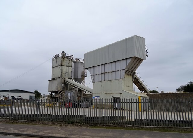
Although historically an agricultural area, Manvers underwent significant changes in the 20th century due to the development of the Manvers Main Colliery. The colliery, which opened in 1906, became one of the largest coal mines in the region and played a vital role in the local economy. However, like many coal mines, it eventually closed in the 1980s, leading to the decline of the industry in the area.

Today, Manvers is known for its industrial estate, which has developed on the site of the former colliery. The estate houses a range of businesses, including distribution centers, manufacturing plants, and offices, providing employment opportunities for the local population.

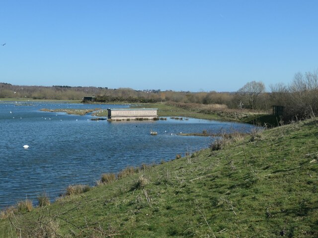
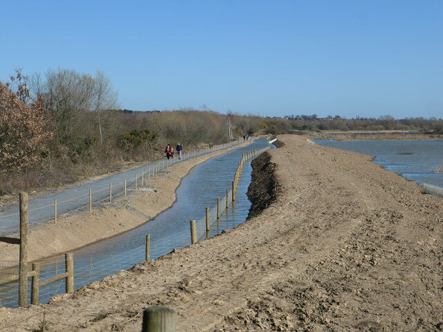
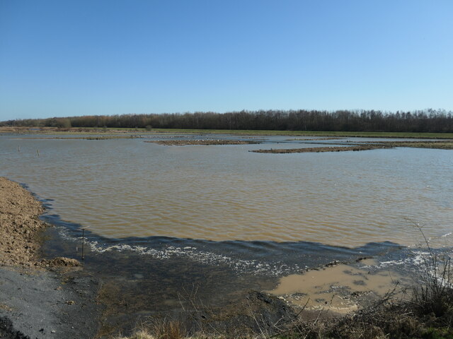
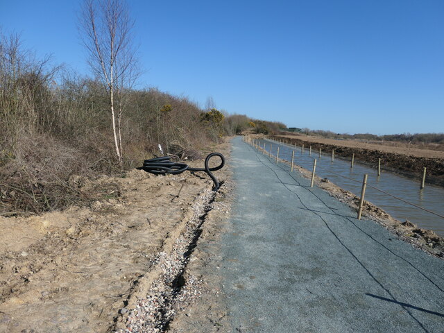
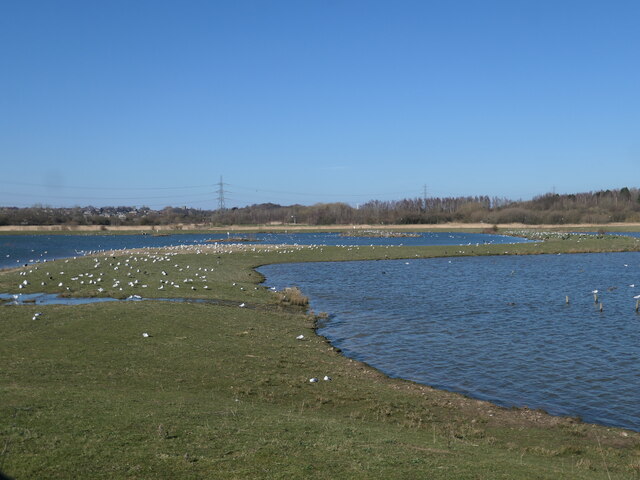
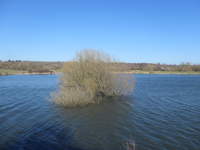
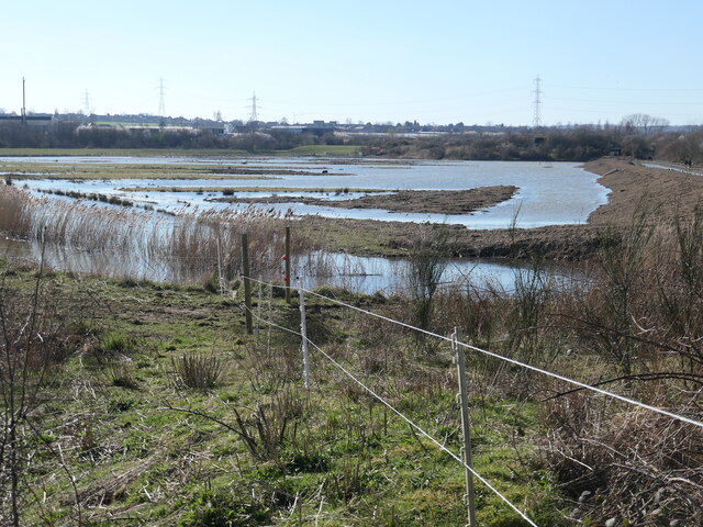
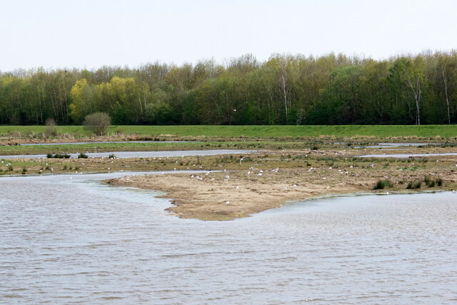
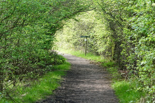
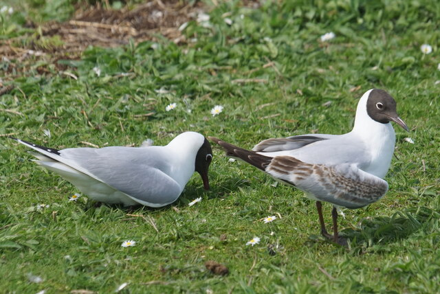
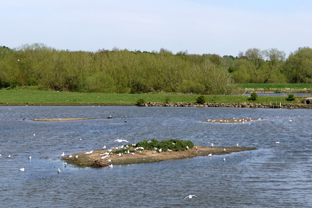
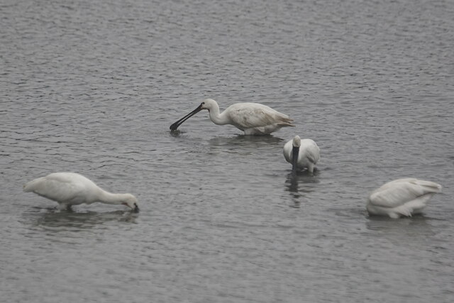
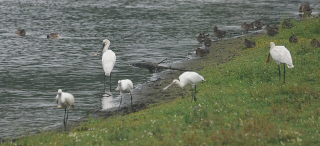
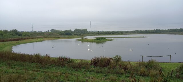
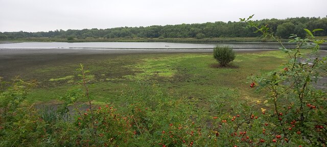
In addition to its industrial significance, Manvers is also surrounded by natural beauty. The village lies close to the southern edge of the Dearne Valley, offering picturesque countryside views and opportunities for outdoor activities such as walking, cycling, and birdwatching.

Overall, Manvers remains a blend of industrial heritage and rural charm, offering a unique juxtaposition of landscapes and a sense of community for its residents.

If you have any feedback on the listing, please let us know in the comments section below.
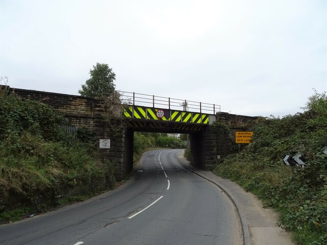
Manvers Images

Images are sourced within 2km of 53.508881/-1.3358801 or Grid Reference SE4401. Thanks to Geograph Open Source API. All images are credited.

Nesting wall, RSPB Old Moor Near the south shore of the Mere.
Nesting wall, RSPB Old Moor
Near the south shore of the Mere.
All change at Field Pool, RSPB Old Moor A new path has been opened along this side of the hedge, because the parallel one on the other side of the hedge has been damaged by floods. The fence in the water is designed to stop mammals predating birds on islands.
All change at Field Pool, RSPB Old Moor
A new path has been opened along this side of the hedge, because the parallel one on the other side of the hedge has been damaged by floods. The fence in the water is designed to stop mammals predating birds on islands.
Field Pool, from Field Pool West hide, RSPB Old Moor Brown with suspended sediment, after flooding.
Field Pool, from Field Pool West hide, RSPB Old Moor
Brown with suspended sediment, after flooding.
Installing new drains, RSPB Old Moor On the new path by Field Pool.
Installing new drains, RSPB Old Moor
On the new path by Field Pool.
Bank between the Mere and the wader scrape Occupied by many, many black headed gulls at RSPB Old Moor.
Bank between the Mere and the wader scrape
Occupied by many, many black headed gulls at RSPB Old Moor.
Tree on a former field boundary, RSPB Old Moor Now partly under water in Wath Ings. Seen from Wath Ings hide.
Tree on a former field boundary, RSPB Old Moor
Now partly under water in Wath Ings. Seen from Wath Ings hide.
Field Pool, from Field Pool East hide At RSPB Old Moor, in the Dearne valley.
Field Pool, from Field Pool East hide
At RSPB Old Moor, in the Dearne valley.
Field Pool from the West Hide, Old Moor
Path between hides at Old Moor RSPB
Male Orange-tip (Anthocharis cardamines), Old Moor RSPB
Black-headed Gulls (Chroicocephalus ridibundus), Old Moor RSPB
View from one of the hides at Old Moor RSPB
Spoonbills (Platalea leucorodia) from the Wath Ings Hide, RSPB Dearne Valley Old Moor Part of a family party of seven.
Spoonbills (Platalea leucorodia) from the Wath Ings Hide, RSPB Dearne Valley Old Moor
Part of a family party of seven.
Spoonbills (Platalea leucorodia) from the Wath Ings Hide, RSPB Dearne Valley Old Moor
View of the Mere from the Wader Scrape Hide, RSPB Dearne Valley Old Moor
View from the Wath Ings Hide, RSPB Dearne Valley Old Moor
Concrete plant, Wath Upon Dearne See <a title="https://www.geograph.org.uk/photo/2980211" href="https://www.geograph.org.uk/photo/2980211">Link</a>
Concrete plant, Wath Upon Dearne
See Link
Railway bridge over Wath Road (A6023)
Show me another place!

Manvers is located at Grid Ref: SE4401 (Lat: 53.508881, Lng: -1.3358801)

Division: West Riding

Unitary Authority: Rotherham

Police Authority: South Yorkshire

What 3 Words

///windmill.sank.octagonal. Near Wath upon Dearne, South Yorkshire

Nearby Locations

Manvers

Related Wikis

Wath North railway station

Wath North railway station was on the Midland Railway's Sheffield - Cudworth - Normanton - Leeds main line, serving the town of Wath-upon-Dearne, South...

Wath (Hull and Barnsley) railway station

Wath railway station was one of three railway stations in Wath-upon-Dearne, South Yorkshire, England. It was the southern terminus of The Hull & South...

Wath Central railway station

Wath Central railway station was on the South Yorkshire Railway's Doncaster–Barnsley Exchange line in England. It was the closest of Wath-upon-Dearne's...

Wath Main Colliery

Wath Main Colliery was a coal mine situated in the Dearne Valley, close by the township of Wath-upon-Dearne, South Yorkshire, England. The colliery was...

Wath TMD

Wath TMD was a motive power depot located in Wath upon Dearne, South Yorkshire, England. The depot was located near Wath station. The depot code is WH...

Wath upon Dearne

Wath upon Dearne (shortened to Wath or often hyphenated) is a town south of the River Dearne in the Metropolitan Borough of Rotherham, South Yorkshire...

Manvers

Manvers is a suburb of Wath upon Dearne in the Metropolitan Borough of Rotherham in South Yorkshire, England. It lies across the border with the Metropolitan...

Manvers Main Colliery

Manvers Main Colliery was a coal mine, sunk on land belonging to the Earl Manvers on the northern edge of Wath-upon-Dearne, between that town and Mexborough...

Nearby Amenities

Located within 500m of 53.508881,-1.3358801
Mini Roundabout
Direction: clockwise
Odbl: clean
Source: Bing
Lat/Long: 53.5064454/-1.3374421
Bus Stop
Station Road/Manvers Way
Alt Name: Station Road/Manvers Way
Bus: yes
Naptan AltCommonName: Station Road/Manvers Way
Naptan AtcoCode: 370030390
Naptan Bearing: NE
Naptan CommonName: Station Road/Manvers Way
Naptan Indicator: 30390
Naptan Landmark: WATH GARDEN AND PET CENTRE
Naptan PlusbusZoneRef: ROTHCEN
Naptan Street: Station Road
Naptan Verified: no
Public Transport: platform
Source: naptan_import
Lat/Long: 53.5094833/-1.3354983
Bus Stop
Manvers Way/Station Road
Alt Name: Manvers Way/Station Road
Bus: yes
Naptan AltCommonName: Manvers Way/Station Road
Naptan AtcoCode: 370031307
Naptan Bearing: N
Naptan CommonName: Manvers Way/Station Road
Naptan Indicator: 31307
Naptan Landmark: 31307
Naptan PlusbusZoneRef: ROTHCEN
Naptan Street: Manvers Way
Naptan Verified: no
Public Transport: platform
Source: naptan_import
Lat/Long: 53.5075703/-1.3325728
Bus Stop
Station Road/Manvers Way
Alt Name: Station Road/Manvers Way
Bus: yes
Naptan AltCommonName: Station Road/Manvers Way
Naptan AtcoCode: 370035180
Naptan Bearing: SW
Naptan CommonName: Station Road/Manvers Way
Naptan Indicator: 35180
Naptan Landmark: S.LIGHT NO. 23/WATH GARDEN AND
Naptan PlusbusZoneRef: ROTHCEN
Naptan Street: Station Road
Naptan Verified: no
Public Transport: platform
Source: naptan_import
Lat/Long: 53.5092584/-1.3354716
Bus Stop
Manvers Way
Alt Name: Manvers Way
Bus: yes
Naptan AltCommonName: Manvers Way
Naptan AtcoCode: 370035498
Naptan Bearing: NW
Naptan CommonName: Manvers Way
Naptan Indicator: 35498
Naptan Landmark: Ventura
Naptan PlusbusZoneRef: ROTHCEN
Naptan Street: Manvers Way
Naptan Verified: no
Public Transport: platform
Source: naptan_import
Lat/Long: 53.5070772/-1.3311933
Bus Stop
Manvers Way/Station Road
Bus: yes
Naptan AtcoCode: 370035504
Naptan Bearing: NW
Naptan CommonName: Manvers Way/Station Road
Naptan Indicator: 35504
Naptan Landmark: Roundabout
Naptan PlusbusZoneRef: ROTHCEN
Naptan Street: Manvers Way
Naptan Verified: no
Public Transport: platform
Source: naptan_import
Lat/Long: 53.5078342/-1.334755
Bus Stop
Manvers Way/Station Road
Naptan AtcoCode: 370035799
Naptan Bearing: NE
Naptan CommonName: Manvers Way/Station Road
Naptan Indicator: 35799
Naptan Landmark: 35799
Naptan PlusbusZoneRef: ROTHCEN
Naptan Street: Manvers Way
Naptan Verified: no
Source: naptan_import
Lat/Long: 53.5082912/-1.3377335
Ventura House
Naptan AtcoCode: 370035837
Naptan Bearing: NE
Naptan BusStopType: CUS
Naptan CommonName: Ventura House
Naptan Indicator: 35837
Naptan Landmark: VENTURA HOUSE
Naptan PlusbusZoneRef: ROTHCEN
Naptan Street: Manvers Way
Naptan Verified: no
Source: naptan_import
Lat/Long: 53.5089286/-1.331134
Bus Stop
Station Road/Manvers Way
Bus: yes
Naptan AtcoCode: 370035847
Naptan Bearing: SW
Naptan CommonName: Station Road/Manvers Way
Naptan Indicator: 35847
Naptan Landmark: 35847
Naptan PlusbusZoneRef: ROTHCEN
Naptan Street: Station Road
Naptan Verified: no
Public Transport: platform
Source: naptan_import
Lat/Long: 53.5076259/-1.3364966
Bus Stop
Station Road/Manvers Way
Bus: yes
Naptan AtcoCode: 370035848
Naptan Bearing: NE
Naptan BusStopType: CUS
Naptan CommonName: Station Road/Manvers Way
Naptan Indicator: 35848
Naptan Landmark: 35848
Naptan PlusbusZoneRef: ROTHCEN
Naptan Street: Station Road
Naptan Verified: no
Public Transport: platform
Source: naptan_import
Lat/Long: 53.5076452/-1.3367376
Wath North
Historic Railway: station
Operator: BR Eastern Region
Railway: site
Wikidata: Q7974648
Wikipedia: en:Wath North railway station
Lat/Long: 53.5097577/-1.3331583
Wath Central
Historic Railway: station
Railway: site
Wikidata: Q7974644
Wikipedia: en:Wath Central railway station
Lat/Long: 53.5062041/-1.3365098
Power: tower
Lat/Long: 53.5112205/-1.3332874
Power: tower
Lat/Long: 53.5119385/-1.3366091
Power: pole
Lat/Long: 53.5057086/-1.3325881
Power: pole
Lat/Long: 53.5065918/-1.334019
Power: pole
Lat/Long: 53.5074767/-1.3354526
Power: pole
Lat/Long: 53.5085478/-1.3356208
Barrier: stile
Bicycle: no
Foot: yes
Material: metal
Stile: squeezer
Lat/Long: 53.5077612/-1.3425948
Barrier: stile
Bicycle: no
Foot: yes
Material: metal
Stile: squeezer
Lat/Long: 53.5079297/-1.3396433
Parking
Lat/Long: 53.5090847/-1.3294408
Parking
Lat/Long: 53.5086596/-1.3295394
Parking
Lat/Long: 53.507945/-1.3310183
Parking
Lat/Long: 53.5095758/-1.3309999
Parking
Lat/Long: 53.5088821/-1.3347387
Parking
Lat/Long: 53.5098624/-1.3341829
Parking Entrance
Access: private
Lat/Long: 53.5072486/-1.3332262
Traffic Signals
Traffic Signals: signal
Lat/Long: 53.5077994/-1.334204
Noexit: yes
Lat/Long: 53.5090734/-1.3285217
Barrier: yes
Lat/Long: 53.508249/-1.3316294
Cafe
Manvers Lake Trust
Addr City: Rotherham
Addr Housename: The Boathouse
Addr Postcode: S63 7DG
Addr Street: Station Road
Internet Access: yes
Internet Access Fee: no
Internet Access Ssid: Public Wifi
Website: https://www.manverslaketrust.co.uk/cafe
Lat/Long: 53.5107148/-1.3371648
Crossing
Lat/Long: 53.5079558/-1.3364001
Crossing
Lat/Long: 53.5077052/-1.3317634
Crossing
Lat/Long: 53.5086177/-1.3360887
Crossing
Lat/Long: 53.5074505/-1.3323876
Crossing
Lat/Long: 53.507371/-1.3324325
Crossing
Lat/Long: 53.5081239/-1.3357519
Wath (Hull and Barnsley)
Historic Railway: station
Railway: site
Wikidata: Q7974640
Wikipedia: en:Wath (Hull and Barnsley) railway station
Lat/Long: 53.5076007/-1.3371602
The data included in this document is from www.openstreetmap.org. The data is made available under ODbL.

Have you been to Manvers?

Leave your review of Manvers below (or comments, questions and feedback).