Mannington

Settlement in Wiltshire

England

Mannington

Waitrose, Mill Lane, Wichelstowe, Swindon This rather futuristic looking building is Swindon's first Waitrose supermarket, which opened in April 2014. Built on former farmland, it is at the moment almost in the middle of nowhere. But the mainly residential area known as Wichelstowe continues to be developed and before long the building will be adjacent to large numbers of houses. On the building's west side is an attractively restored section of the long closed Wilts & Berks Canal. Wichelstowe seems to be the general name given to the land between the old railway line skirting Swindon's Old Town and the M4 motorway. It used to be described as Swindon's front garden and the Borough Council years ago promised it would never be built on. A policy which was soon reversed.
Waitrose, Mill Lane, Wichelstowe, Swindon Credit: P L Chadwick

Mannington is a small village located in the county of Wiltshire, England. Situated approximately 3 miles northeast of the town of Pewsey, Mannington is nestled in a picturesque rural setting, surrounded by rolling hills and farmland.

The village is home to a modest population, with a close-knit community that takes pride in its rich history and natural beauty. Mannington is known for its charming thatched cottages and traditional English architecture, which adds to its idyllic charm.

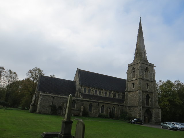
One of the prominent features of Mannington is its historic church, St. James' Church, which dates back to the 13th century. This beautiful medieval church is a testament to the village's long-standing presence and serves as a focal point for both locals and visitors.

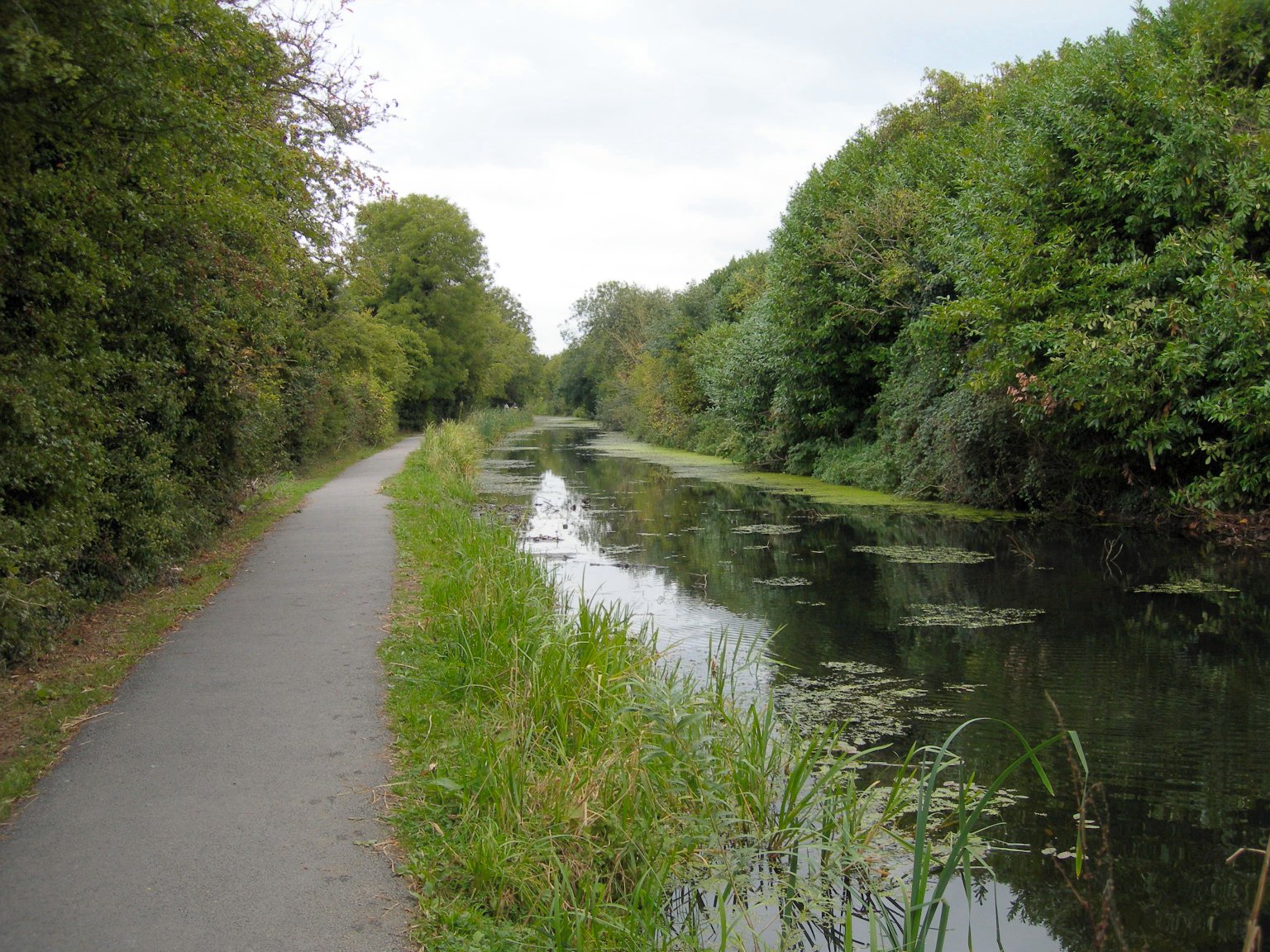
The area surrounding Mannington offers several opportunities for outdoor enthusiasts. The nearby Pewsey Downs National Nature Reserve provides breathtaking landscapes and walking trails, offering stunning views of the surrounding countryside. Additionally, the village is conveniently located near the Kennet and Avon Canal, offering opportunities for boating, fishing, and leisurely walks along the water's edge.

Despite its small size, Mannington is well-connected to nearby towns and cities. The bustling market town of Marlborough is just a short drive away, offering a wide range of amenities, shops, and restaurants. The village also benefits from good transport links, with Pewsey train station providing regular services to larger cities such as London and Bristol.

In summary, Mannington is a quaint and picturesque village in Wiltshire, offering a peaceful and rural lifestyle, rich history, and access to stunning natural landscapes.

If you have any feedback on the listing, please let us know in the comments section below.
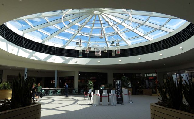
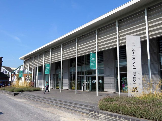
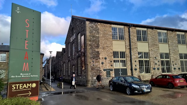
Mannington Images

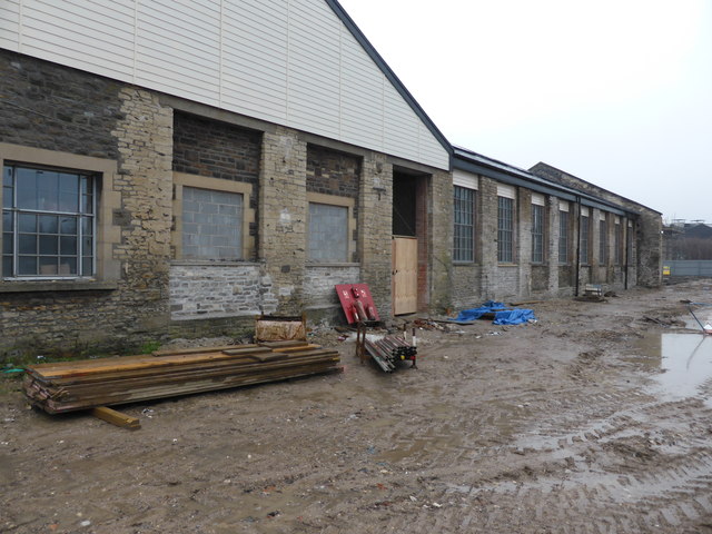
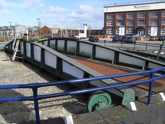
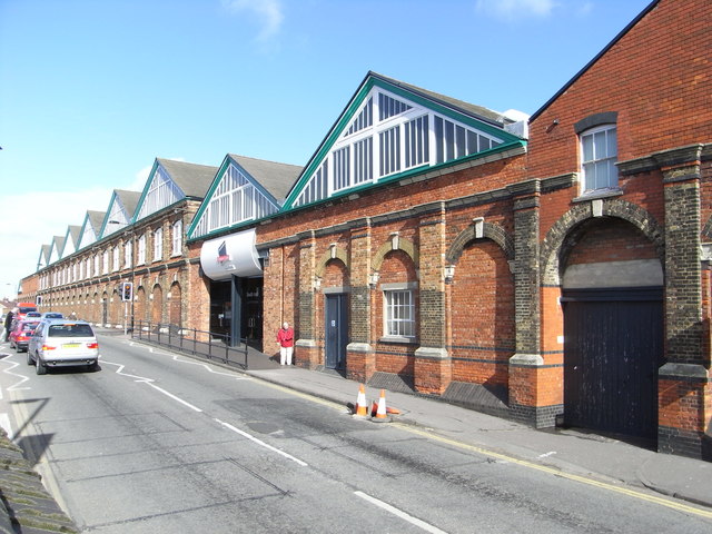
Images are sourced within 2km of 51.553316/-1.8128854 or Grid Reference SU1383. Thanks to Geograph Open Source API. All images are credited.

Waitrose, Mill Lane, Wichelstowe, Swindon This rather futuristic looking building is Swindon's first Waitrose supermarket, which opened in April 2014. Built on former farmland, it is at the moment almost in the middle of nowhere. But the mainly residential area known as Wichelstowe continues to be developed and before long the building will be adjacent to large numbers of houses. On the building's west side is an attractively restored section of the long closed Wilts & Berks Canal. Wichelstowe seems to be the general name given to the land between the old railway line skirting Swindon's Old Town and the M4 motorway. It used to be described as Swindon's front garden and the Borough Council years ago promised it would never be built on. A policy which was soon reversed.
Waitrose, Mill Lane, Wichelstowe, Swindon
This rather futuristic looking building is Swindon's first Waitrose supermarket, which opened in April 2014. Built on former farmland, it is at the moment almost in the middle of nowhere. But the mainly residential area known as Wichelstowe continues to be developed and before long the building will be adjacent to large numbers of houses. On the building's west side is an attractively restored section of the long closed Wilts & Berks Canal. Wichelstowe seems to be the general name given to the land between the old railway line skirting Swindon's Old Town and the M4 motorway. It used to be described as Swindon's front garden and the Borough Council years ago promised it would never be built on. A policy which was soon reversed.
Wilts & Berks Canal by Waitrose Supermarket, Mill Lane, Wichelstowe, Swindon This section of the long closed Wilts & Berks Canal has been restored and runs alongside the new Waitrose store which opened in April 2014. The Wilts & Berks Canal Trust operates a trip boat which stops here. In the distance is a new bridge which was required to carry a new road across the canal.

<a href="https://www.geograph.org.uk/photo/4631383">SU1382 : New bridge over Wilts & Berks Canal, Foxham Way, Wichelstowe, Swindon</a>.
Wilts & Berks Canal by Waitrose Supermarket, Mill Lane, Wichelstowe, Swindon
This section of the long closed Wilts & Berks Canal has been restored and runs alongside the new Waitrose store which opened in April 2014. The Wilts & Berks Canal Trust operates a trip boat which stops here. In the distance is a new bridge which was required to carry a new road across the canal. SU1382 : New bridge over Wilts & Berks Canal, Foxham Way, Wichelstowe, Swindon.
New bridge over Wilts & Berks Canal, Foxham Way, Wichelstowe, Swindon This recently constructed bridge carries Foxham Way over a restored section of the Wilts & Berks Canal. Also restored is the canal's towpath, which can be seen on the left, behind the railings.

<a href="https://www.geograph.org.uk/photo/4631364">SU1382 : Wilts & Berks Canal by Waitrose Supermarket, Mill Lane, Wichelstowe, Swindon</a>.
New bridge over Wilts & Berks Canal, Foxham Way, Wichelstowe, Swindon
This recently constructed bridge carries Foxham Way over a restored section of the Wilts & Berks Canal. Also restored is the canal's towpath, which can be seen on the left, behind the railings. SU1382 : Wilts & Berks Canal by Waitrose Supermarket, Mill Lane, Wichelstowe, Swindon.
Restored section of Wilts & Berks Canal, near Mill Lane, Wichelstowe, Swindon This restored section of canal is near to the Waitrose supermarket in Mill Lane. The Wilts & Berks Canal Trust have a trip boat which stops here. Some years ago the only trace of a canal here was a faint indentation in the ground although there was a little used public right of way over the route of the former towpath, on the other side of the canal. That towpath has also been restored.
Restored section of Wilts & Berks Canal, near Mill Lane, Wichelstowe, Swindon
This restored section of canal is near to the Waitrose supermarket in Mill Lane. The Wilts & Berks Canal Trust have a trip boat which stops here. Some years ago the only trace of a canal here was a faint indentation in the ground although there was a little used public right of way over the route of the former towpath, on the other side of the canal. That towpath has also been restored.
Wilts & Berks Canal Trust information board, near Mill Lane, Wichelstowe, Swindon This information board, adjacent to the canal and the Waitrose supermarket, gives some details of the ambitious plans for further restoration of the canal in Swindon.
Wilts & Berks Canal Trust information board, near Mill Lane, Wichelstowe, Swindon
This information board, adjacent to the canal and the Waitrose supermarket, gives some details of the ambitious plans for further restoration of the canal in Swindon.
Glass roof in the Great Western Outlet Village
Heelis Heelis is the headquarters of the National Trust. There is a shop and a cafe for the general public.
Heelis
Heelis is the headquarters of the National Trust. There is a shop and a cafe for the general public.
The Church of St Marks at Swindon Viewed from the north-east.
The Church of St Marks at Swindon
Viewed from the north-east.
Steam, Museum of the Great Western Railway After heavy rain had just passed, on the day the National Trust held its AGM in the museum.
Steam, Museum of the Great Western Railway
After heavy rain had just passed, on the day the National Trust held its AGM in the museum.
Heelis The National Trust's headquarters opposite Steam, the Great Western Railway Museum where their Annual General Meeting was being held. The sun has returned after a morning of very heavy rain.
Heelis
The National Trust's headquarters opposite Steam, the Great Western Railway Museum where their Annual General Meeting was being held. The sun has returned after a morning of very heavy rain.
Steam Museum
Steam Museum
Brickwork on the skew railway bridge over the Wilts & Berks Canal The skew bridge was built to carry the Midland and South Western Junction Railway (M&SWJR) across the Wilts & Berks canal. The bridge and this section of the canal have been restored by the Wilts & Berks Canal Trust. <span class="nowrap"><a title="http://www.wbct.org.uk/" rel="nofollow ugc noopener" href="http://www.wbct.org.uk/">Link</a><img style="margin-left:2px;" alt="External link" title="External link - shift click to open in new window" src="https://s1.geograph.org.uk/img/external.png" width="10" height="10"/></span>
Brickwork on the skew railway bridge over the Wilts & Berks Canal
The skew bridge was built to carry the Midland and South Western Junction Railway (M&SWJR) across the Wilts & Berks canal. The bridge and this section of the canal have been restored by the Wilts & Berks Canal Trust. LinkExternal link
Mechanics' Institute, Swindon This was opened in 1854 in the Railway Village to serve as a library, community centre, market place and forum for grievances, among others. It was built as a result of the efforts of the railway company's workers rather than as a benevolent action by the company. It has been claimed it was used to train apprentices but this was a use it never had.

As can be seen, it is very sadly deteriorated but there is a trust with ambitious plans for its future and it is to be hoped that this very important link to the past can be saved.
Mechanics' Institute, Swindon
This was opened in 1854 in the Railway Village to serve as a library, community centre, market place and forum for grievances, among others. It was built as a result of the efforts of the railway company's workers rather than as a benevolent action by the company. It has been claimed it was used to train apprentices but this was a use it never had. As can be seen, it is very sadly deteriorated but there is a trust with ambitious plans for its future and it is to be hoped that this very important link to the past can be saved.
The Great Western Underpass This once provided passage for railway workers from the railway village to the GWR's Swindon works. It now mainly carries shoppers between the town centre and the designer outlet village. It also gives access, for lesser numbers, to the Steam Museum and the National Monuments Record Centre.
The Great Western Underpass
This once provided passage for railway workers from the railway village to the GWR's Swindon works. It now mainly carries shoppers between the town centre and the designer outlet village. It also gives access, for lesser numbers, to the Steam Museum and the National Monuments Record Centre.
Former railway works - redevelopment Another corner of the once vast Swindon Works is being converted to houses. I believe the former chain testing shop is in this area and I believe it is to be preserved, at least in part.

See an earlier view from a slightly different angle - <a href="https://www.geograph.org.uk/photo/757413">SU1485 : Former GWR Works, Swindon</a>.
Former railway works - redevelopment
Another corner of the once vast Swindon Works is being converted to houses. I believe the former chain testing shop is in this area and I believe it is to be preserved, at least in part. See an earlier view from a slightly different angle - SU1485 : Former GWR Works, Swindon.
Old Railway Quarter redevelopment, Swindon One of the original buildings from the Great Western Railway's massive locomotive works. This is being converted to apartments but does include a Listed chain test house that is to be preserved. This includes a hydraulic chain tester with a 130 ton pull and I look forward to seeing this one day.
Old Railway Quarter redevelopment, Swindon
One of the original buildings from the Great Western Railway's massive locomotive works. This is being converted to apartments but does include a Listed chain test house that is to be preserved. This includes a hydraulic chain tester with a 130 ton pull and I look forward to seeing this one day.
Preserved turntable, Swindon This is in a car park for the designer outlet. The big building beyond is the former pattern store of the locomotive works and is now a restaurant.
Preserved turntable, Swindon
This is in a car park for the designer outlet. The big building beyond is the former pattern store of the locomotive works and is now a restaurant.
Designer Outlet Centre, Swindon This is in part of the former Great Western Railway locomotive works in Swindon.
Designer Outlet Centre, Swindon
This is in part of the former Great Western Railway locomotive works in Swindon.
Show me another place!

Mannington is located at Grid Ref: SU1383 (Lat: 51.553316, Lng: -1.8128854)

Unitary Authority: Swindon

Police Authority: Wiltshire

What 3 Words

///spike.hands.freed. Near Swindon, Wiltshire

Nearby Locations

Mannington

Related Wikis

Rushey Platt railway station

Rushey Platt railway station is a former station on the Midland and South Western Junction Railway at Rushey Platt, south west of the centre of Swindon...

Wilts & Berks Canal

The Wilts & Berks Canal is a canal in the historic counties of Wiltshire and Berkshire, England, linking the Kennet and Avon Canal at Semington near Melksham...

South Leaze

South Leaze is a hamlet within the Borough of Swindon, Wiltshire, United Kingdom. It is south of the nearby village of Toothill and is nearby to the Mannington...

Princess Margaret Hospital, Swindon

The Princess Margaret Hospital was a large hospital situated in Okus Road, Swindon, Wiltshire, England. It was managed by the Swindon and Marlborough NHS...

Nearby Amenities

Located within 500m of 51.553316,-1.8128854
Traffic Signals
Traffic Signals: on_demand
Traffic Signals Direction: forward
Lat/Long: 51.5551124/-1.8146249
Traffic Signals
Traffic Signals: on_demand
Traffic Signals Direction: forward
Lat/Long: 51.5552051/-1.8147972
Traffic Signals
Traffic Signals: on_demand
Traffic Signals Direction: forward
Lat/Long: 51.5548018/-1.8143455
Traffic Signals
Traffic Signals: on_demand
Traffic Signals Direction: forward
Lat/Long: 51.5554006/-1.8140189
Turning Circle
Turning Circle: circle
Lat/Long: 51.5565131/-1.8160635
Turning Circle
Turning Circle: knuckle
Lat/Long: 51.5531928/-1.8167833
Crossing
Bicycle: yes
Crossing: traffic_signals
Crossing Ref: toucan
Tactile Paving: yes
Lat/Long: 51.5547376/-1.8067512
Traffic Signals
Crossing: traffic_signals
Crossing Ref: toucan
Traffic Signals: pedestrian_crossing
Lat/Long: 51.5552253/-1.8093925
Post Box
Brand: Royal Mail
Brand Wikidata: Q638098
Operator: Royal Mail
Operator Wikidata: Q638098
Post Box Mounting: pier
Post Box Type: lamp
Ref: SN5 419
Royal Cypher: EIIR
Royal Cypher Wikidata: Q33102113
Lat/Long: 51.5532325/-1.8066716
Traffic Signals
Bicycle: yes
Check Date Crossing: 2022-07-18
Crossing Ref: toucan
Tactile Paving: yes
Traffic Signals: pedestrian_crossing
Lat/Long: 51.5550107/-1.8119214
Traffic Signals
Bicycle: yes
Check Date Crossing: 2022-07-18
Crossing Ref: toucan
Tactile Paving: yes
Traffic Signals: pedestrian_crossing
Lat/Long: 51.5551162/-1.8118034
Power: tower
Ref: MST18
Lat/Long: 51.5533503/-1.8121756
Power: tower
Ref: MST18
Lat/Long: 51.5546069/-1.8118537
Power: tower
Ref: MST18
Lat/Long: 51.5513941/-1.8158604
Barrier: block
Motor Vehicle: private
Lat/Long: 51.5526761/-1.8124509
Traffic Signals
Crossing: traffic_signals
Crossing Ref: toucan
Traffic Signals: traffic_lights
Traffic Signals Direction: forward
Lat/Long: 51.5552021/-1.8089563
Rushey Platt
Place: neighbourhood
Lat/Long: 51.5528789/-1.8057047
Power: tower
Lat/Long: 51.5561163/-1.8120982
Crossing
Bicycle: yes
Crossing: uncontrolled
Crossing Markings: dashes
Lat/Long: 51.5556952/-1.8171552
Crossing
Bicycle: yes
Crossing: uncontrolled
Crossing Markings: dashes
Lat/Long: 51.5558335/-1.8169947
Seat
Brand: Seat
Brand Wikidata: Q188217
Operator: Fish Brothers
Shop: car
Lat/Long: 51.5556507/-1.8133888
Fish Brothers Select Used Cars
Addr City: Swindon
Addr Postcode: SN5 7YQ
Addr Street: Great Western Way
Operator: Fish Brothers
Phone: +44 1793 642591
Second Hand: only
Service Vehicle Brakes: yes
Service Vehicle Car Repair: yes
Service Vehicle Diagnostics: yes
Service Vehicle Inspection: yes
Service Vehicle Tyres: yes
Service Vehicle Used Car Sales: yes
Shop: car
Lat/Long: 51.5554754/-1.8130989
Crossing
Bicycle: yes
Crossing: unmarked
Crossing Markings: no
Lat/Long: 51.5520974/-1.8064573
Bus Stop
Mannington Roundabout
Bench: yes
Bus: yes
Naptan AtcoCode: 4680SWA10742
Naptan Bearing: W
Naptan CommonName: Mannington Roundabout
Naptan Indicator: W-bound
Naptan NaptanCode: swiamta
Naptan PlusbusZoneRef: SDON
Naptan Street: Wootton Bassett Road
Naptan Verified: no
Public Transport: platform
Shelter: yes
Source: naptan;bing
Lat/Long: 51.5549351/-1.8110326
Bus Stop
Mannington Roundabout
Bench: yes
Bus: yes
Naptan AtcoCode: 4680SWA10741
Naptan Bearing: E
Naptan CommonName: Mannington Roundabout
Naptan Indicator: E-bound
Naptan NaptanCode: swiampt
Naptan PlusbusZoneRef: SDON
Naptan Street: Wootton Bassett Road
Naptan Verified: no
Public Transport: platform
Shelter: yes
Source: naptan;bing
Lat/Long: 51.5551888/-1.8116662
Traffic Signals
Traffic Signals: signal
Traffic Signals Direction: backward
Lat/Long: 51.5550806/-1.8091881
Crossing
Crossing: traffic_signals
Tactile Paving: yes
Lat/Long: 51.5551592/-1.8092055
Crossing
Crossing: unmarked
Crossing Markings: no
Tactile Paving: yes
Lat/Long: 51.5554068/-1.8086863
Crossing
Crossing: unmarked
Crossing Markings: no
Tactile Paving: yes
Lat/Long: 51.5555043/-1.8087663
Bus Stop
Mannington House
Bench: no
Bus: yes
Naptan AtcoCode: 4680SWA10739
Naptan Bearing: SE
Naptan CommonName: Mannington House
Naptan Indicator: SE-bound
Naptan NaptanCode: swiamdp
Naptan PlusbusZoneRef: SDON
Naptan Street: Mannington Lane
Naptan Verified: no
Public Transport: platform
Shelter: no
Lat/Long: 51.5557229/-1.8171095
Bus Stop
Mannington House
Bench: no
Bus: yes
Naptan AtcoCode: 4680SWA10740
Naptan Bearing: W
Naptan CommonName: Mannington House
Naptan Indicator: W-bound
Naptan NaptanCode: swiamdt
Naptan PlusbusZoneRef: SDON
Naptan Street: Mannington Lane
Naptan Verified: no
Public Transport: platform
Shelter: no
Lat/Long: 51.5557881/-1.8170132
Crossing
Bicycle: yes
Crossing: unmarked
Crossing Markings: no
Supervised: no
Lat/Long: 51.5531592/-1.8066773
Crossing
Crossing Island: yes
Lat/Long: 51.5534512/-1.8068196
Traffic Signals
Traffic Signals: signal
Traffic Signals Direction: forward
Lat/Long: 51.554692/-1.8068601
Crossing
Bicycle: yes
Button Operated: yes
Crossing: traffic_signals
Crossing Markings: dots
Crossing Ref: toucan
Tactile Paving: yes
Lat/Long: 51.5547/-1.8065851
Traffic Signals
Traffic Signals: signal
Traffic Signals Direction: forward
Lat/Long: 51.5547211/-1.8065211
Crossing
Bicycle: yes
Crossing: traffic_signals
Crossing Ref: toucan
Tactile Paving: yes
Lat/Long: 51.5547347/-1.8068623
Traffic Signals
Traffic Signals: signal
Traffic Signals Direction: forward
Lat/Long: 51.5548008/-1.8064266
Crossing
Bicycle: yes
Check Date Crossing: 2023-09-26
Crossing: traffic_signals
Crossing Ref: toucan
Tactile Paving: yes
Lat/Long: 51.5548072/-1.8065003
Crossing
Bicycle: yes
Button Operated: yes
Crossing: traffic_signals
Crossing Ref: toucan
Tactile Paving: yes
Traffic Signals Sound: yes
Traffic Signals Vibration: yes
Lat/Long: 51.5548866/-1.8062254
Traffic Signals
Traffic Signals: signal
Traffic Signals Direction: forward
Lat/Long: 51.5549451/-1.8070034
Power: pole
Lat/Long: 51.550387/-1.8076412
Material: wood
Power: pole
Lat/Long: 51.5506862/-1.8089772
Material: wood
Power: pole
Lat/Long: 51.5511399/-1.8109521
Material: wood
Power: pole
Lat/Long: 51.5520278/-1.8124604
Man Made: tower
Lat/Long: 51.5541959/-1.8114355
Traffic Signals
Traffic Signals: signal
Traffic Signals Direction: forward
Lat/Long: 51.5551048/-1.8096192
Power: transformer
Lat/Long: 51.554099/-1.8109229
Power: transformer
Lat/Long: 51.5543392/-1.8109739
Power: transformer
Lat/Long: 51.5545776/-1.8110222
Crossing
Crossing: traffic_signals
Lat/Long: 51.5500495/-1.8120212
Somerset Beds and Bedrooms
Shop: bed
Lat/Long: 51.557047/-1.8128348
Dreams
Brand: Dreams
Brand Wikidata: Q5306688
Brand Wikipedia: en:Dreams (bed retailer)
Contact Website: https://dreams.co.uk/store/swindon
Shop: bed
Lat/Long: 51.5572105/-1.8128831
Carpetright
Brand: Carpetright
Brand Wikidata: Q5045782
Operator: Carpetright
Shop: carpet
Website: https://www.carpetright.co.uk/store/swindon-bridgemead
Lat/Long: 51.5574957/-1.8129475
Easy Bathrooms
Addr City: Swindon
Addr Housename: Unit F4 Bridgemead Retail Park
Addr Postcode: SN5 7YF
Addr Street: Great Western Way
Brand: Easy Bathrooms
Brand Wikidata: Q114348566
Shop: bathroom_furnishing
Website: https://www.easybathrooms.com/our-showrooms/swindon-bathroom-tile-store
Lat/Long: 51.5566292/-1.8125181
Pets at Home
Addr City: Swindon
Addr Housename: Unit F3, Bridgemead Retail Park
Addr Postcode: SN5 7YE
Addr Street: Great Western Way
Brand: Pets at Home
Brand Wikidata: Q7179258
Brand Wikipedia: en:Pets at Home
Shop: pet
Website: https://community.petsathome.com/store/swindon-bridgemead/
Lat/Long: 51.5566026/-1.8127936
Bensons for Beds
Addr City: Swindon
Addr Housename: Unit F2, Bridgemead Retail Park
Addr Postcode: SN5 7YF
Addr Street: Great Western Way
Brand: Bensons for Beds
Brand Wikidata: Q4890299
Brand Wikipedia: en:Bensons for Beds
Contact Website: https://stores.bensonsforbeds.co.uk/swindon/unit-f3-bridgemead-retail-park
Shop: bed
Lat/Long: 51.5565755/-1.8130894
Rushey Platt
Historic Railway: station
Railway: site
Wikidata: Q7380819
Wikipedia: en:Rushey Platt railway station
Lat/Long: 51.5509161/-1.8076153
Rushey Platt Junction
Railway: site
Lat/Long: 51.5507923/-1.8073079
Traffic Signals
Traffic Signals: signal
Traffic Signals Direction: backward
Lat/Long: 51.555063/-1.8087186
Barrier: yes
Lat/Long: 51.5500302/-1.8146048
Crossing
Lat/Long: 51.550013/-1.8142323
Crossing
Crossing: unmarked
Crossing Markings: no
Lat/Long: 51.5558003/-1.8174626
Birds in Flight
Artist Name: Duncan Kitson
Artwork Type: sculpture
Material: steel
Tourism: artwork
Lat/Long: 51.5498657/-1.8132333
Hibberds Yard
Junction: yes
Lat/Long: 51.5548351/-1.8068085
DFS
Brand: DFS
Brand Wikidata: Q5204927
Shop: furniture
Lat/Long: 51.5543986/-1.8099638
Sofology
Brand: Sofology
Brand Wikidata: Q5014159
Shop: furniture
Website: https://www.sofology.co.uk/stores/swindon
Lat/Long: 51.5546361/-1.809628
Man Made: insect_hotel
Lat/Long: 51.5536778/-1.8146721
Crossing
Bicycle: yes
Crossing: marked
Crossing Island: yes
Crossing Markings: dots
Kerb: lowered
Tactile Paving: no
Lat/Long: 51.5553518/-1.8175767
Traffic Signals
Traffic Signals: on_demand
Traffic Signals Direction: forward
Lat/Long: 51.5550644/-1.8136453
Traffic Signals
Traffic Signals: on_demand
Traffic Signals Direction: forward
Lat/Long: 51.5547048/-1.8145343
Traffic Signals
Traffic Signals: on_demand
Traffic Signals Direction: forward
Lat/Long: 51.5549617/-1.813483
Traffic Signals
Traffic Signals: on_demand
Traffic Signals Direction: forward
Lat/Long: 51.5555051/-1.8138847
Crossing
Crossing: traffic_signals
Tactile Paving: yes
Lat/Long: 51.5551512/-1.8089572
Give Way
Direction: forward
Lat/Long: 51.5553368/-1.8090294
Give Way
Direction: forward
Lat/Long: 51.5549711/-1.8125203
Give Way
Direction: forward
Lat/Long: 51.5547985/-1.8182248
Bus Stop
Stratford Close
Bus: yes
Naptan AtcoCode: 4680SWA10743
Naptan Bearing: W
Naptan CommonName: Stratford Close
Naptan Indicator: W-bound
Naptan NaptanCode: swiamag
Naptan PlusbusZoneRef: SDON
Naptan Street: Bodiam Drive
Naptan Verified: no
Public Transport: platform
Lat/Long: 51.5547988/-1.8195963
Bus Stop
Warneford Close
Bus: yes
Naptan AtcoCode: 4680SWA10770
Naptan Bearing: E
Naptan CommonName: Warneford Close
Naptan Indicator: E-bound
Naptan NaptanCode: swiamap
Naptan PlusbusZoneRef: SDON
Naptan Street: Dunwich Drive
Naptan Verified: no
Public Transport: platform
Lat/Long: 51.5518978/-1.8188731
ScS
Addr City: Swindon
Addr Housename: Unit F1 Bridgemead Retail Park
Addr Postcode: SN5 7YF
Addr Street: Great Western Way
Brand: ScS
Brand Wikidata: Q19654399
Shop: furniture
Website: https://www.scs.co.uk/stores/swindon.html
Lat/Long: 51.5565527/-1.8133346
Crossing
Crossing: zebra
Kerb: lowered
Tactile Paving: yes
Lat/Long: 51.5539151/-1.8126898
Leisure: playground
Lat/Long: 51.5534761/-1.8184023
Charging Station
Bridgemead Retail Park
Access: yes
Addr Postcode: SN5 7YF
Capacity: 2
Fee: yes
Operator: InstaVolt
Operator Wikidata: Q111173904
Socket Chademo: 2
Socket Chademo Output: 50kW
Socket Type2 Combo: 2
Socket Type2 Combo Output: 150kW
Lat/Long: 51.5576448/-1.8133816
The data included in this document is from www.openstreetmap.org. The data is made available under ODbL.

Have you been to Mannington?

Leave your review of Mannington below (or comments, questions and feedback).