Mangarstadh

Settlement in Ross-shire

Scotland

Mangarstadh

Mangurstadh Coastline Looking South The cliffs here are spectacular and the Lewisian Gneiss makes for some great climbing.
Mangurstadh Coastline Looking South Credit: RIJones

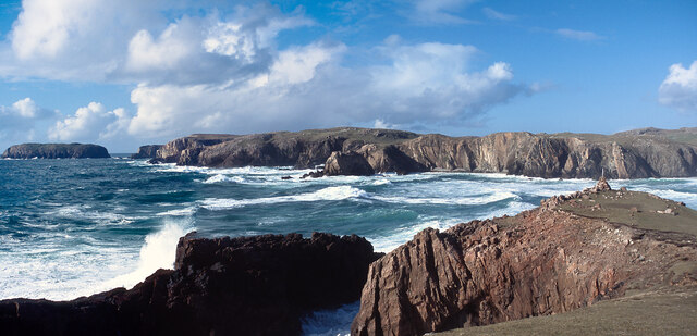
Mangarstadh is a small village located in the county of Ross-shire, in the Scottish Highlands. Situated on the northwest coast of Scotland, it is nestled between the towns of Ullapool and Gairloch. The village is known for its picturesque surroundings, offering stunning views of the rugged mountains and the nearby Loch Broom.

With a population of around 200 residents, Mangarstadh exudes a peaceful and tranquil atmosphere. The village primarily consists of traditional stone cottages, giving it a charming and authentic Scottish feel. It is a popular destination for those seeking a quiet retreat away from the hustle and bustle of city life.

Nature enthusiasts are drawn to Mangarstadh for its proximity to the beautiful Highland landscapes. Outdoor activities such as hiking, fishing, and wildlife spotting are popular among both locals and visitors. The nearby Inverpolly Nature Reserve provides opportunities for birdwatching and the chance to spot rare species such as golden eagles and otters.

Although Mangarstadh is a small village, it is well-connected to the surrounding area. The town of Ullapool, with its shops, restaurants, and amenities, is just a short drive away. Additionally, the village hosts an annual Highland Games event, attracting visitors from near and far to enjoy traditional Scottish sports and festivities.

Overall, Mangarstadh offers a tranquil and idyllic setting for those seeking to immerse themselves in the natural beauty of the Scottish Highlands.

If you have any feedback on the listing, please let us know in the comments section below.
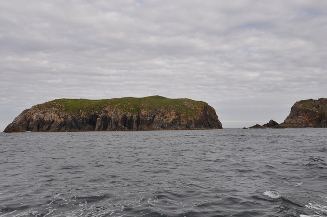
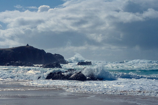
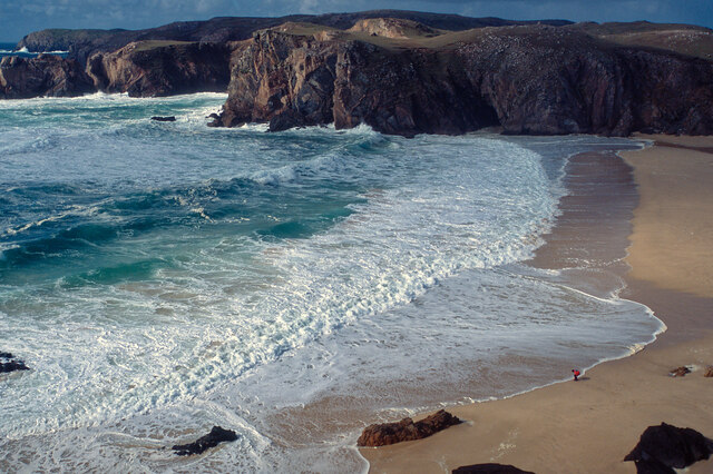
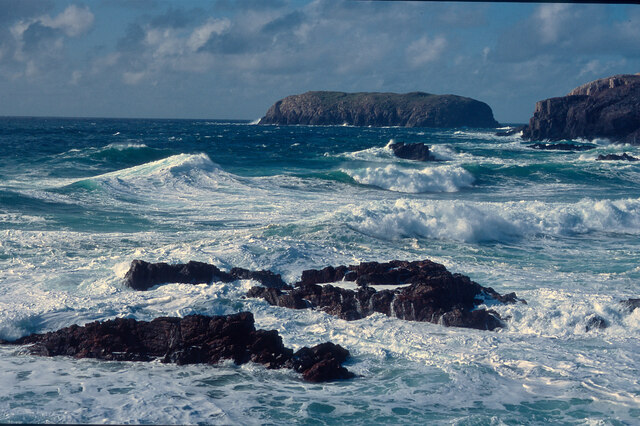
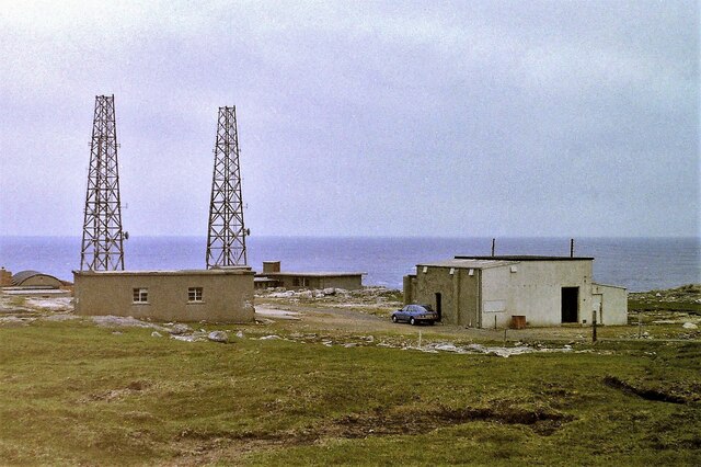
Mangarstadh Images

Images are sourced within 2km of 58.170701/-7.086284 or Grid Reference NB0131. Thanks to Geograph Open Source API. All images are credited.

Mangurstadh Coastline Looking South The cliffs here are spectacular and the Lewisian Gneiss makes for some great climbing.
Mangurstadh Coastline Looking South
The cliffs here are spectacular and the Lewisian Gneiss makes for some great climbing.
Eilean Molach Showing the narrow gap between it and mainland Lewis.
Eilean Molach
Showing the narrow gap between it and mainland Lewis.
A pretty lochan This is Lochan Mealabhat, two thirds of which is in this square. It is a pleasing geograph photo, because it clearly shows what you can see on the map: I'm standing on a little tongue of land that sticks out into the lochan, the tongue is in the square, and I'm looking across to a similar tongue.
A pretty lochan
This is Lochan Mealabhat, two thirds of which is in this square. It is a pleasing geograph photo, because it clearly shows what you can see on the map: I'm standing on a little tongue of land that sticks out into the lochan, the tongue is in the square, and I'm looking across to a similar tongue.
Rubh' an Taroin headland
Rubh' an Taroin
Rubh' an Taroin
Coastal moor at Mullach an Tàroin
North end of Traigh Mhangarstaidh A beautiful beach with a fine Atlantic swell pounding in.
North end of Traigh Mhangarstaidh
A beautiful beach with a fine Atlantic swell pounding in.
Atlantic swell, Traigh Mhangarstaidh An exciting time being beside to a tumultuous sea - and at close range.
Atlantic swell, Traigh Mhangarstaidh
An exciting time being beside to a tumultuous sea - and at close range.
Looking down on Traigh Mhangarstaidh A walk for the view with my son on the beach.
Looking down on Traigh Mhangarstaidh
A walk for the view with my son on the beach.
Sea off Traigh Mhangarstaidh Exhilarating!
Sea off Traigh Mhangarstaidh
Exhilarating!
Coast line near Traigh Mhangarstaidh A wide view from stitching images.  An amazing experience.
Coast line near Traigh Mhangarstaidh
A wide view from stitching images. An amazing experience.
Radio masts at Mangastra/Mhangarstaidh, Lewis, 1989 Compared to more recent images, it would appear a number of these buildings and one mast have been demolished in the intervening years.
Radio masts at Mangastra/Mhangarstaidh, Lewis, 1989
Compared to more recent images, it would appear a number of these buildings and one mast have been demolished in the intervening years.
Rubh an Taroin The headland of Rubh an Taroin is a good feature of this coast.  In this view northwards Ard More Mangersta dominates the skyline.
Rubh an Taroin
The headland of Rubh an Taroin is a good feature of this coast. In this view northwards Ard More Mangersta dominates the skyline.
Rubha an Taroin Some of the splendid cliffs of pink Uig granite south of Mangurstadh.
Rubha an Taroin
Some of the splendid cliffs of pink Uig granite south of Mangurstadh.
Spring Squill (Scilla verna) Surprisingly, given how exposed the headland at Mangarstadh is, and how scarce the soil, there was a carpet of stunted wildflowers including this Spring Squill.
Spring Squill (Scilla verna)
Surprisingly, given how exposed the headland at Mangarstadh is, and how scarce the soil, there was a carpet of stunted wildflowers including this Spring Squill.
Thrift (Armeria maritima) A cushion of thrift provides a splash of colour on the bleak and windswept clifftop. The flower stalks are taller in more benign conditions, but here they are stunted by the wind and weather. I wonder whether any insects brave the wind to pollinate the flowers>
Thrift (Armeria maritima)
A cushion of thrift provides a splash of colour on the bleak and windswept clifftop. The flower stalks are taller in more benign conditions, but here they are stunted by the wind and weather. I wonder whether any insects brave the wind to pollinate the flowers>
Show me another place!

Mangarstadh is located at Grid Ref: NB0131 (Lat: 58.170701, Lng: -7.086284)

Unitary Authority: Na h-Eileanan an Iar

Police Authority: Highlands and Islands

Also known as: Mangersta

What 3 Words

///shows.segregate.purifier. Near Carloway, Na h-Eileanan Siar

Related Wikis

Stac Dhòmhnaill Chaim

Stac Dhòmnuill Chaim, or Stac Dhòmhnaill Chaim, or Stac Domhnuill Chaim, is a fortified promontory located near Mangursta (or Mangersta, Scottish Gaelic...

Abhainn Dearg distillery

Abhainn Dearg distillery ( AV-in JAIRG) or Red River distillery is a Scotch whisky distillery in Uig, on the west coast of the Isle of Lewis in the Outer...

Ardroil

Ardroil (Scottish Gaelic: Eadar Dhà Fhadhail) is a village on the Isle of Lewis in the Outer Hebrides, Scotland. Ardroil is within the parish of Uig....

Gasker

Gasker is a small uninhabited islet in the Outer Hebrides of Scotland, 8 kilometres (4+1⁄2 nautical miles) southwest of Scarp, off the west coast of Harris...

Nearby Amenities

Located within 500m of 58.170701,-7.086284
Bus Stop
Mangersta Village
Bus: yes
Naptan AtcoCode: 6010731745
Naptan Bearing: E
Naptan CommonName: Mangersta Village
Naptan Indicator: Mangersta Village
Naptan Landmark: Mangersta Village
Naptan NaptanCode: 94723789
Naptan Street: Mangersta Village
Naptan Verified: no
Shelter: no
Source: naptan_import
Lat/Long: 58.1697704/-7.0918812
Passing Place
Lat/Long: 58.1710374/-7.092411
Mangurstadh
Name En: Mangersta
Name Gd: Mangurstadh
Place: village
Lat/Long: 58.1711859/-7.0895096
Turning Circle
Lat/Long: 58.1697077/-7.0918304
Barrier: cattle_grid
Lat/Long: 58.1719751/-7.087541
Post Box
Post Box Type: lamp
Lat/Long: 58.1721539/-7.0873239
Telephone
Booth: K6
Check Date: 2021-08-09
Covered: booth
Operator: BT
Phone: +44 1851 672219
Lat/Long: 58.1722123/-7.0872717
Barrier: cattle_grid
Lat/Long: 58.1698227/-7.0917505
Barrier: cattle_grid
Lat/Long: 58.1708142/-7.0920543
Barrier: cattle_grid
Lat/Long: 58.1700064/-7.0866777
Barrier: cattle_grid
Lat/Long: 58.1701948/-7.0845985
Power: pole
Lat/Long: 58.1727325/-7.0905038
Power: pole
Lat/Long: 58.1729867/-7.0898416
Power: pole
Lat/Long: 58.1732544/-7.0892158
Power: pole
Lat/Long: 58.1729838/-7.0885471
Power: pole
Lat/Long: 58.1727844/-7.0879864
Power: pole
Lat/Long: 58.1725027/-7.0873607
Power: pole
Lat/Long: 58.1727455/-7.0860285
Power: pole
Lat/Long: 58.170578/-7.0864945
Power: pole
Lat/Long: 58.1709273/-7.08604
Power: pole
Lat/Long: 58.1712777/-7.0854781
Power: pole
Lat/Long: 58.1715572/-7.0850309
Power: pole
Lat/Long: 58.1719315/-7.0853275
Power: pole
Lat/Long: 58.1724299/-7.0857659
Power: pole
Lat/Long: 58.1733748/-7.0865463
Power: pole
Lat/Long: 58.1742267/-7.0876872
Power: pole
Lat/Long: 58.1748625/-7.0885213
Power: pole
Lat/Long: 58.1709602/-7.0923922
Power: pole
Lat/Long: 58.1696804/-7.0908782
Power: pole
Lat/Long: 58.1696556/-7.0897536
Power: pole
Lat/Long: 58.1695841/-7.088589
Power: pole
Lat/Long: 58.1695006/-7.0877037
Power: pole
Lat/Long: 58.1696501/-7.0868289
Power: pole
Lat/Long: 58.1699012/-7.0853308
Power: pole
Lat/Long: 58.1700559/-7.0843986
Power: pole
Lat/Long: 58.1699499/-7.083518
Power: pole
Lat/Long: 58.1690313/-7.0878131
Power: pole
Lat/Long: 58.1706489/-7.0781941
Power: pole
Lat/Long: 58.1708489/-7.0795235
Power: pole
Lat/Long: 58.1710346/-7.0809251
Power: pole
Lat/Long: 58.1712239/-7.0822636
Power: pole
Lat/Long: 58.1713661/-7.0835987
Generator Method: photovoltaic
Generator Output Electricity: small_installation
Generator Source: solar
Generator Type: solar_photovoltaic_panel
Power: generator
Lat/Long: 58.1727698/-7.0915433
Power: pole
Lat/Long: 58.169992/-7.0871292
Power: pole
Lat/Long: 58.1697358/-7.0863321
Passing Place
Lat/Long: 58.1719501/-7.0873543
Barrier: cattle_grid
Lat/Long: 58.1697068/-7.0825928
The data included in this document is from www.openstreetmap.org. The data is made available under ODbL.

Have you been to Mangarstadh?

Leave your review of Mangarstadh below (or comments, questions and feedback).