Lower Cockleford

Settlement in Gloucestershire Cotswold

England

Lower Cockleford

Farmland Coberley View to the west across farmland between Coberley and Cowley.
Farmland Coberley Credit: Philip Halling

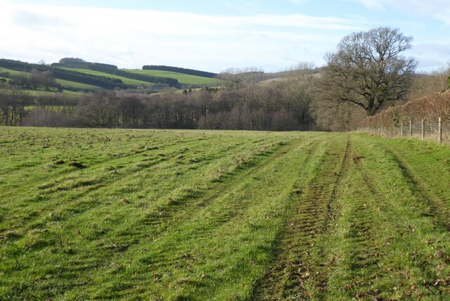
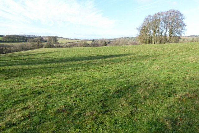
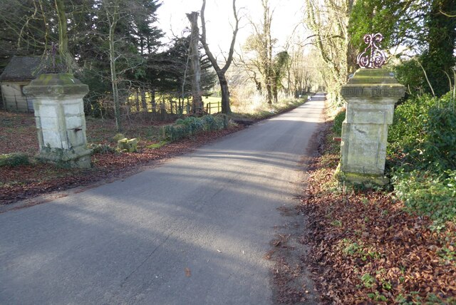
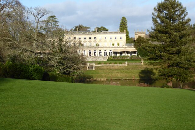
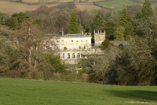
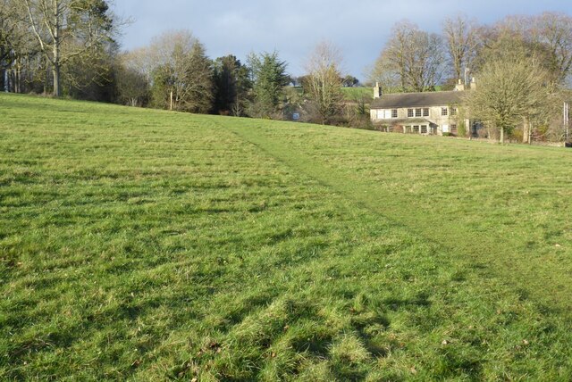
Lower Cockleford is a small village located in the county of Gloucestershire, in the southwestern part of England. Situated in the Cotswolds, an Area of Outstanding Natural Beauty, Lower Cockleford is surrounded by picturesque countryside, rolling hills, and charming stone-built houses.

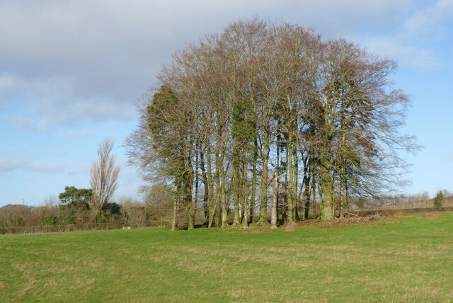
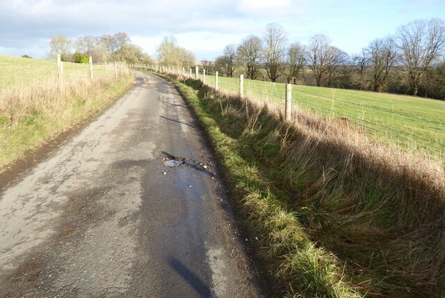
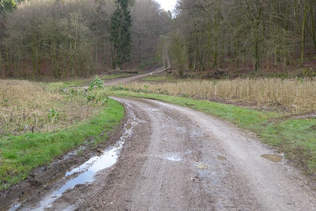
The village is nestled in a valley along the winding River Coln, which adds to its scenic appeal. It is just a short distance away from the larger town of Cirencester and is easily accessible by road. The area is renowned for its idyllic landscapes, making it a popular destination for nature lovers, hikers, and those seeking a peaceful retreat.

Lower Cockleford has a small population, with a tight-knit community that contributes to its friendly and welcoming atmosphere. The village boasts a few amenities, including a quaint local pub that serves traditional English food and ales. The pub often acts as a social hub for locals and visitors alike.

In terms of architecture, Lower Cockleford exhibits the classic Cotswold style, with many buildings constructed from the locally quarried honey-colored limestone. The village retains its historic charm, with some houses dating back several centuries.

The surrounding area offers ample opportunities for outdoor activities such as hiking, cycling, and fishing. The nearby Cotswold Water Park provides opportunities for water sports, birdwatching, and picnicking. Overall, Lower Cockleford offers a serene and beautiful setting, making it an ideal place for those seeking a peaceful countryside escape.

If you have any feedback on the listing, please let us know in the comments section below.

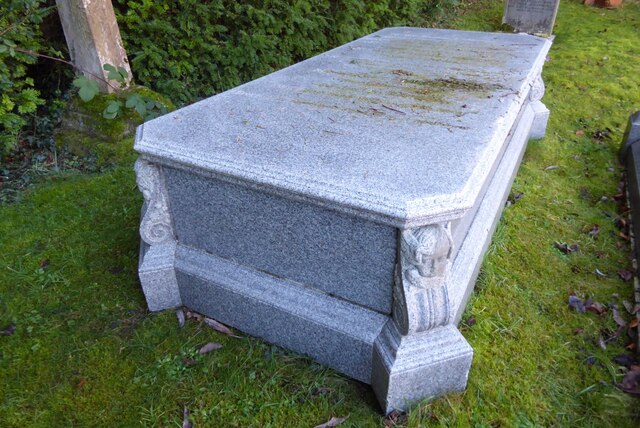
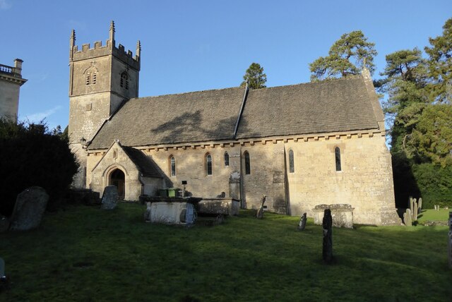
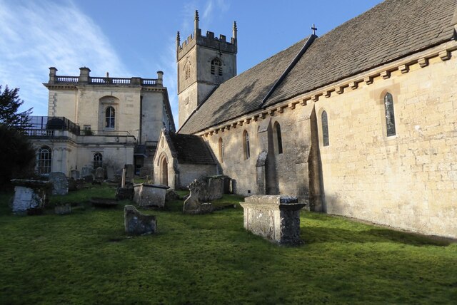
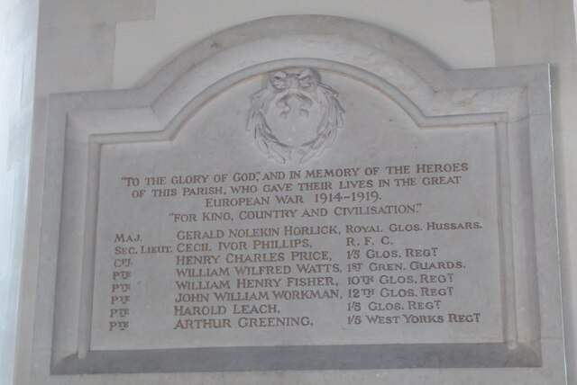
Lower Cockleford Images

Images are sourced within 2km of 51.822591/-2.0379661 or Grid Reference SO9713. Thanks to Geograph Open Source API. All images are credited.

Farmland Coberley View to the west across farmland between Coberley and Cowley.
Farmland Coberley
View to the west across farmland between Coberley and Cowley.
Clump of trees Clump of trees beside a footpath between Cowley and Coberley.
Clump of trees
Clump of trees beside a footpath between Cowley and Coberley.
Field at Cowley in the Churn valley This field between Cowley and Coberley was the site of a Channel 4 'Time Team' dig.  The programme was entitled "Mysteries of the Mosaic" in which they unearthed mosaics and a Roman villa.  The site is a scheduled monument, see: <span class="nowrap"><a title="https://historicengland.org.uk/listing/the-list/list-entry/1405896" rel="nofollow ugc noopener" href="https://historicengland.org.uk/listing/the-list/list-entry/1405896">Link</a><img style="margin-left:2px;" alt="External link" title="External link - shift click to open in new window" src="https://s1.geograph.org.uk/img/external.png" width="10" height="10"/></span>
Field at Cowley in the Churn valley
This field between Cowley and Coberley was the site of a Channel 4 'Time Team' dig. The programme was entitled "Mysteries of the Mosaic" in which they unearthed mosaics and a Roman villa. The site is a scheduled monument, see: LinkExternal link
Gate pillars on the road to Cowley This pair of gate pillars flank this road at its junction with the A435.  The road leads to Cowley and originally this was a private drive to a manor.  There used to be a lodge to the left but it was demolished in the 1960s.
Gate pillars on the road to Cowley
This pair of gate pillars flank this road at its junction with the A435. The road leads to Cowley and originally this was a private drive to a manor. There used to be a lodge to the left but it was demolished in the 1960s.
Grave of Sir James Horlick, 1st Baronet Grave of Sir James Horlick, 1st Baronet in Cowley churchyard.  He lived in Cowley Manor which is next to the church and now a luxury hotel.  James and his brother William were born in Ruardean in the Forest of Dean and went off to the United States where they developed the Horlicks brand.
Grave of Sir James Horlick, 1st Baronet
Grave of Sir James Horlick, 1st Baronet in Cowley churchyard. He lived in Cowley Manor which is next to the church and now a luxury hotel. James and his brother William were born in Ruardean in the Forest of Dean and went off to the United States where they developed the Horlicks brand.
Cowley church Cowling church is dedicated to St Mary.  The church dates from the 13th century and is Grade II* listed, see: <span class="nowrap"><a title="https://historicengland.org.uk/listing/the-list/list-entry/1340154?section=official-listing" rel="nofollow ugc noopener" href="https://historicengland.org.uk/listing/the-list/list-entry/1340154?section=official-listing">Link</a><img style="margin-left:2px;" alt="External link" title="External link - shift click to open in new window" src="https://s1.geograph.org.uk/img/external.png" width="10" height="10"/></span>
Cowley church
Cowling church is dedicated to St Mary. The church dates from the 13th century and is Grade II* listed, see: LinkExternal link
Cowley church and Cowley Manor Hotel St Mary's church which is situated next to Cowley Manor  Hotel which can be seen in the background.
Cowley church and Cowley Manor Hotel
St Mary's church which is situated next to Cowley Manor Hotel which can be seen in the background.
War memorial in Cowley church A World War I war memorial which is in Cowley church.  It is interesting at the time of the memorial the war was usually known as the Great War, this memorial calls it the 'Great European War' which is contradictory as the first name on the memorial Maj. Gerald Nolekin Horlick is buried in Alexandria in Egypt.  He was the son of Sir James Horlick who lived in Cowley Manor.
War memorial in Cowley church
A World War I war memorial which is in Cowley church. It is interesting at the time of the memorial the war was usually known as the Great War, this memorial calls it the 'Great European War' which is contradictory as the first name on the memorial Maj. Gerald Nolekin Horlick is buried in Alexandria in Egypt. He was the son of Sir James Horlick who lived in Cowley Manor.
Cowley Manor Hotel Cowley Manor is now a 5 star hotel See: <span class="nowrap"><a title="https://www.cowleymanor.com/" rel="nofollow ugc noopener" href="https://www.cowleymanor.com/">Link</a><img style="margin-left:2px;" alt="External link" title="External link - shift click to open in new window" src="https://s1.geograph.org.uk/img/external.png" width="10" height="10"/></span>. This impressive country house was almost entirely rebuilt in 1855-7 for James Hutchinson, a London Stockbroker. The design was by George Somers Clarke who built the new house on the site of an earlier 1695 house of Henry Brett. St Mary's church, Cowley, is in the grounds of Cowley Manor and can be seen on the right.  The building is Grade II listed, see: <span class="nowrap"><a title="https://historicengland.org.uk/listing/the-list/list-entry/1340155?section=official-listing" rel="nofollow ugc noopener" href="https://historicengland.org.uk/listing/the-list/list-entry/1340155?section=official-listing">Link</a><img style="margin-left:2px;" alt="External link" title="External link - shift click to open in new window" src="https://s1.geograph.org.uk/img/external.png" width="10" height="10"/></span>
Cowley Manor Hotel
Cowley Manor is now a 5 star hotel See: LinkExternal link. This impressive country house was almost entirely rebuilt in 1855-7 for James Hutchinson, a London Stockbroker. The design was by George Somers Clarke who built the new house on the site of an earlier 1695 house of Henry Brett. St Mary's church, Cowley, is in the grounds of Cowley Manor and can be seen on the right. The building is Grade II listed, see: LinkExternal link
Cowley Manor Hotel Cowley Manor is now a 5 star hotel See: <span class="nowrap"><a title="https://www.cowleymanor.com/" rel="nofollow ugc noopener" href="https://www.cowleymanor.com/">Link</a><img style="margin-left:2px;" alt="External link" title="External link - shift click to open in new window" src="https://s1.geograph.org.uk/img/external.png" width="10" height="10"/></span> This impressive country house was almost entirely rebuilt in 1855-7 for James Hutchinson, a London Stockbroker. The design was by George Somers Clarke who built the new house on the site of an earlier 1695 house of Henry Brett. St Mary's church, Cowley, is in the grounds of Cowley Manor and can be seen on the right.  The building is Grade II listed, see: <span class="nowrap"><a title="https://historicengland.org.uk/listing/the-list/list-entry/1340155?section=official-listing" rel="nofollow ugc noopener" href="https://historicengland.org.uk/listing/the-list/list-entry/1340155?section=official-listing">Link</a><img style="margin-left:2px;" alt="External link" title="External link - shift click to open in new window" src="https://s1.geograph.org.uk/img/external.png" width="10" height="10"/></span>  The tower of St Mary's church can be seen on the right.
Cowley Manor Hotel
Cowley Manor is now a 5 star hotel See: LinkExternal link This impressive country house was almost entirely rebuilt in 1855-7 for James Hutchinson, a London Stockbroker. The design was by George Somers Clarke who built the new house on the site of an earlier 1695 house of Henry Brett. St Mary's church, Cowley, is in the grounds of Cowley Manor and can be seen on the right. The building is Grade II listed, see: LinkExternal link The tower of St Mary's church can be seen on the right.
Cross inside Cowley church Until 2010 this wooden cross which was covered with lead and was on the roof of Cowley church.  When the church was being re-roofed it was taken down and found to be in poor condition and replaced.
Cross inside Cowley church
Until 2010 this wooden cross which was covered with lead and was on the roof of Cowley church. When the church was being re-roofed it was taken down and found to be in poor condition and replaced.
Font in Cowley church
Field and house Field and house in Cowley.
Field and house
Field and house in Cowley.
Country road to Cowley Country road to the south of Cowley.
Country road to Cowley
Country road to the south of Cowley.
Track into Cowley Track into Cowley Wood in Harcombe Bottom south of the village of Cowley.
Track into Cowley
Track into Cowley Wood in Harcombe Bottom south of the village of Cowley.
Game cover in Harcombe Bottom
Game cover crop Game cover crop in Harcombe Bottom.
Game cover crop
Game cover crop in Harcombe Bottom.
Stone Stile, Elkstone Not on a registered footpath, this affords access to the woodland and the well trodden path leads to the private house "Highgate". This is the view from the woodland, the alternative view from the road is <a href="https://www.geograph.org.uk/photo/7104422">SO9512 : Stone Stile, Elkstone</a>.
Stone Stile, Elkstone
Not on a registered footpath, this affords access to the woodland and the well trodden path leads to the private house "Highgate". This is the view from the woodland, the alternative view from the road is SO9512 : Stone Stile, Elkstone.
Show me another place!

Lower Cockleford is located at Grid Ref: SO9713 (Lat: 51.822591, Lng: -2.0379661)

Administrative County: Gloucestershire

District: Cotswold

Police Authority: Gloucestershire

What 3 Words

///meant.falls.recliner. Near Charlton Kings, Gloucestershire

Nearby Locations

Lower Cockleford

Related Wikis

Cockleford Marsh

Cockleford Marsh (grid reference SO977133) is a 3.2-hectare (7.9-acre) biological Site of Special Scientific Interest in Gloucestershire, notified in 1991...

Cowley, Gloucestershire

Cowley is a village and civil parish in the Cotswold District of Gloucestershire, England. It lies between the A417 and A435 roads between Cheltenham...

Church of St John the Evangelist, Elkstone

The Anglican Church of St John the Evangelist at Elkstone in the Cotswold District of Gloucestershire, England was built in the 12th century. It is a grade...

Elkstone

Elkstone is a village and civil parish in the English county of Gloucestershire. In the 2001 United Kingdom census, the parish had a population of 203...

Nearby Amenities

Located within 500m of 51.822591,-2.0379661
Bus Stop
Cockleford Mill
Bus: yes
Naptan AtcoCode: 1600GLC151
Naptan Bearing: SE
Naptan CommonName: Cockleford Mill
Naptan Indicator: Opp
Naptan NaptanCode: glodwgpw
Naptan Street: A435
Public Transport: platform
Route Ref: 151
Shelter: no
Source: naptan_import
Lat/Long: 51.8247824/-2.0375481
Bus Stop
Cockleford Mill
Bus: yes
Naptan AtcoCode: 1600GLC152
Naptan Bearing: NW
Naptan CommonName: Cockleford Mill
Naptan NaptanCode: glodwgta
Naptan Street: A435
Public Transport: platform
Route Ref: 151
Shelter: no
Source: naptan_import
Lat/Long: 51.8247161/-2.0376178
Bus Stop
Cockleford Trout Farm
Bus: yes
Naptan AtcoCode: 1600GLC153
Naptan Bearing: SE
Naptan CommonName: Cockleford Trout Farm
Naptan Indicator: Opp
Naptan NaptanCode: glodwjad
Naptan Street: A435
Naptan Verified: no
Public Transport: platform
Source: naptan_import
Lat/Long: 51.8237899/-2.0331835
Bus Stop
Cockleford Trout Farm
Bus: yes
Naptan AtcoCode: 1600GLC154
Naptan Bearing: NW
Naptan CommonName: Cockleford Trout Farm
Naptan NaptanCode: glodwgwp
Naptan Street: A435
Naptan Verified: no
Public Transport: platform
Source: naptan_import
Lat/Long: 51.8237359/-2.033343
Post Box
Brand: Royal Mail
Brand Wikidata: Q638098
Brand Wikipedia: en:Royal Mail
Operator: Royal Mail
Operator Wikidata: Q638098
Ref: GL53 277
Lat/Long: 51.8246761/-2.0375576
Power: pole
Lat/Long: 51.8238071/-2.0430165
Power: pole
Lat/Long: 51.8265938/-2.0362084
Westbury Farm
Power: pole
Transformer: distribution
Voltage Primary: 11000
Lat/Long: 51.825828/-2.0361634
Cockleford Farm Piggeries
Power: pole
Transformer: distribution
Voltage Primary: 11000
Lat/Long: 51.825508/-2.0406072
Power: pole
Lat/Long: 51.8249767/-2.0354185
Power: pole
Lat/Long: 51.8222807/-2.0324318
Vine Cottage
Power: pole
Transformer: distribution
Voltage Primary: 11000
Lat/Long: 51.8220631/-2.031491
Power: pole
Lat/Long: 51.8224792/-2.0332968
Power: pole
Lat/Long: 51.8241433/-2.0347291
Cockleford Farm Buildings
Power: pole
Transformer: distribution
Voltage Primary: 11000
Lat/Long: 51.823575/-2.0345159
Power: pole
Lat/Long: 51.8226732/-2.0341243
Location Transition: yes
Power: pole
Lat/Long: 51.822955/-2.0353326
Location Transition: yes
Power: pole
Lat/Long: 51.8230934/-2.0359951
Cockleford Farm House
Location Transition: yes
Power: pole
Transformer: distribution
Voltage Primary: 11000
Lat/Long: 51.823057/-2.0373449
Cockleford Mill
Location Transition: yes
Power: pole
Transformer: distribution
Voltage Primary: 11000
Lat/Long: 51.823367/-2.0398119
Location Transition: yes
Power: pole
Lat/Long: 51.8233877/-2.040978
Location Transition: yes
Power: pole
Lat/Long: 51.8232352/-2.0387082
Location Transition: yes
Power: pole
Lat/Long: 51.8236273/-2.0419979
Location Transition: yes
Power: pole
Lat/Long: 51.8239862/-2.0439546
The data included in this document is from www.openstreetmap.org. The data is made available under ODbL.

Have you been to Lower Cockleford?

Leave your review of Lower Cockleford below (or comments, questions and feedback).