Lower Ascott
Settlement in Buckinghamshire
England
Lower Ascott

Lower Ascott is a small village located in the county of Buckinghamshire, in the southeastern region of England. It is situated approximately 5 miles northeast of the town of Aylesbury and 40 miles northwest of London. With a population of around 300 residents, Lower Ascott is a close-knit community that offers a peaceful and rural atmosphere.
The village is characterized by its picturesque countryside setting, with rolling hills, lush green fields, and charming cottages. It is surrounded by beautiful natural landscapes, including the nearby Wendover Woods and the Chiltern Hills, providing ample opportunities for outdoor activities such as hiking, cycling, and nature walks.
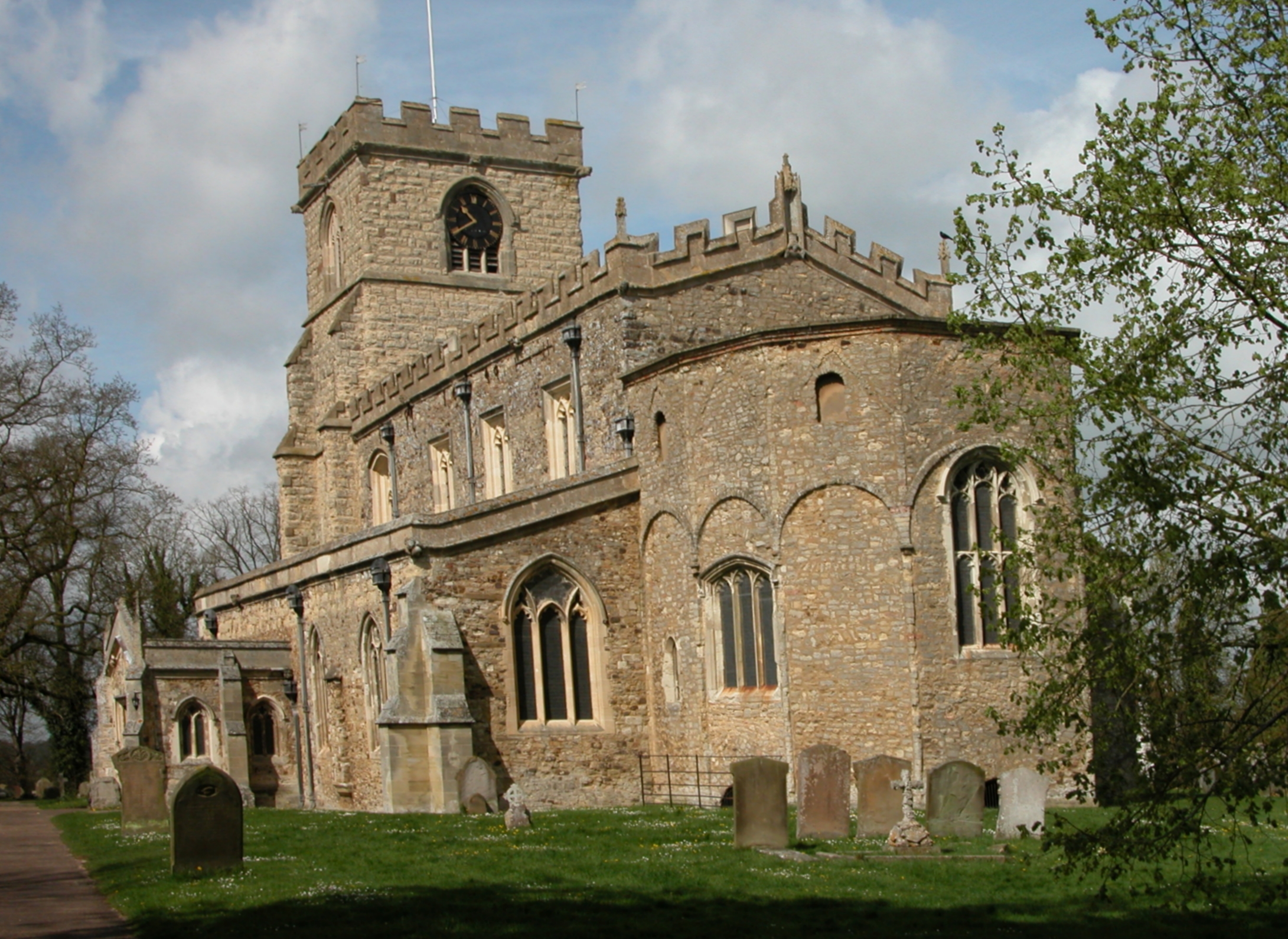
Lower Ascott is known for its traditional architecture, with many of its buildings dating back several centuries. The village is home to St. Michael's Church, a historic place of worship that has stood for over 800 years. The church features a stunning medieval interior and is a popular attraction for visitors interested in the region's rich history.
Despite its small size, Lower Ascott benefits from good transport links, with the A413 road running nearby, connecting it to other towns and cities in the area. The village is also within easy reach of Aylesbury, where residents can access a wider range of amenities, including shops, schools, and healthcare facilities.
Overall, Lower Ascott offers a tranquil and idyllic setting for those seeking a peaceful countryside lifestyle, while still providing convenient access to nearby towns and cities.
If you have any feedback on the listing, please let us know in the comments section below.
Lower Ascott Images
Images are sourced within 2km of 51.895427/-0.70787857 or Grid Reference SP8922. Thanks to Geograph Open Source API. All images are credited.


Lower Ascott is located at Grid Ref: SP8922 (Lat: 51.895427, Lng: -0.70787857)
Unitary Authority: Buckinghamshire
Police Authority: Thames Valley
What 3 Words
///hairstyle.remodels.holidays. Near Wing, Buckinghamshire
Nearby Locations
Related Wikis
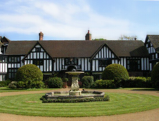
Ascott House
Ascott House, sometimes referred to as simply Ascott, is a Grade II* listed building in the hamlet of Ascott near Wing in Buckinghamshire, England. It...

Ascott, Buckinghamshire
Ascott is a hamlet and country house in the parish of Wing, Buckinghamshire, England. The hamlet lies completely within the boundary of the Ascott Estate...

Wing Rural District
Wing Rural District was a rural district in the administrative county of Buckinghamshire, England. It was created in 1894 with the name Linslade Rural...
Wing, Buckinghamshire
Wing, known in antiquated times as Wyng, is a village and civil parish in east Buckinghamshire, England. The village is on the main A418 road between Aylesbury...
Nearby Amenities
Located within 500m of 51.895427,-0.70787857Have you been to Lower Ascott?
Leave your review of Lower Ascott below (or comments, questions and feedback).