Littleton Common

Settlement in Middlesex Spelthorne

England

Littleton Common

On Anderson Drive
On Anderson Drive Credit: Dave Thompson

Littleton Common is a picturesque village located in the Middlesex County of Massachusetts, United States. Situated in the northeastern part of the state, the village is part of the town of Littleton and is surrounded by natural beauty and a rich historical heritage.

The heart of Littleton Common is defined by its charming town center, which is characterized by a mix of residential and commercial buildings. The village exudes a small-town atmosphere, with its tree-lined streets, well-preserved historic buildings, and a sense of community that is evident in the friendly interactions among its residents.

Littleton Common offers a range of amenities to its residents and visitors. The village boasts a variety of local businesses, including shops, restaurants, and cafes, that cater to the needs of the community. Additionally, the town center hosts various events throughout the year, such as farmers markets, craft fairs, and cultural festivals, which contribute to its vibrant and lively atmosphere.

Nature enthusiasts will find plenty to explore in and around Littleton Common. The village is surrounded by picturesque landscapes, including parks, forests, and lakes, providing ample opportunities for outdoor activities such as hiking, biking, and boating. The nearby Nashoba Valley Ski Area also offers winter sports activities for those seeking adventure during the colder months.

Littleton Common is well-connected to other parts of Massachusetts, with easy access to major highways and public transportation. The village's proximity to Boston, located approximately 30 miles east, allows residents to enjoy the benefits of a small-town lifestyle while having convenient access to the amenities and opportunities of a larger city.

Overall, Littleton Common offers a blend of natural beauty, historical charm, and community spirit, making it an attractive place to live, work, and visit in Middlesex County.

If you have any feedback on the listing, please let us know in the comments section below.

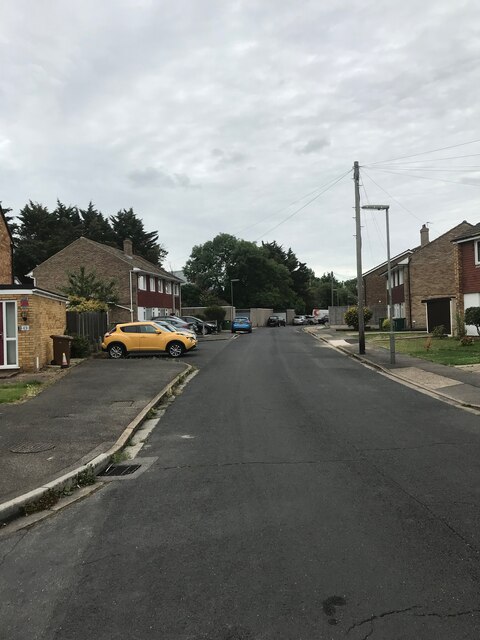
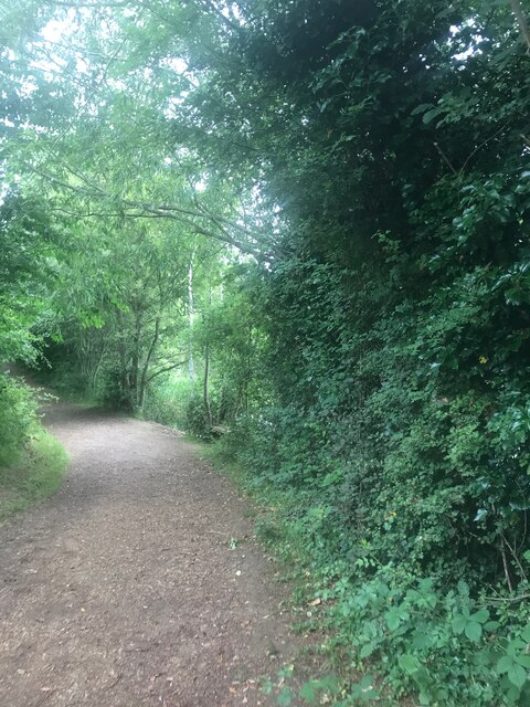
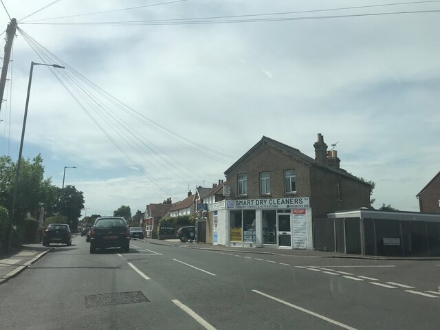
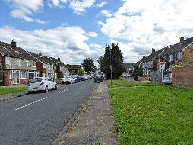
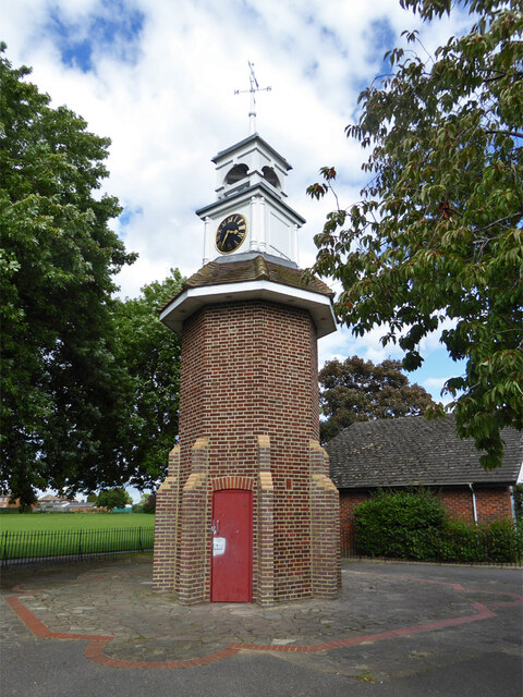
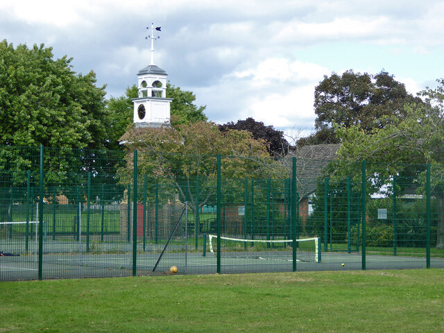
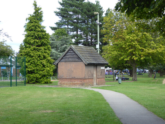
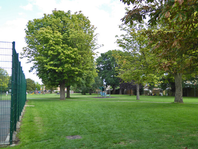
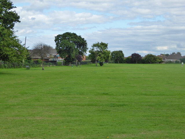
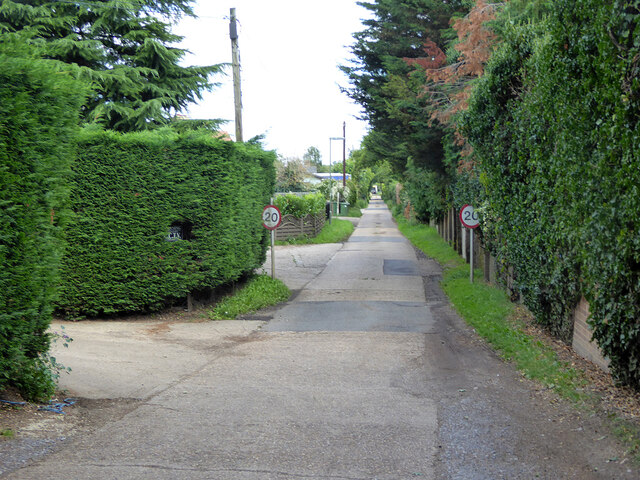
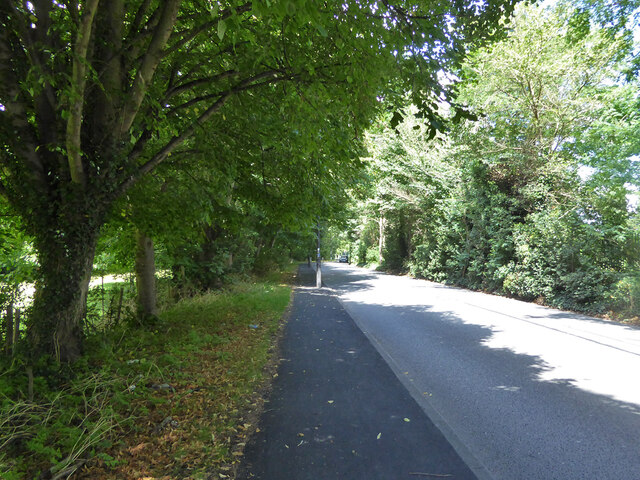
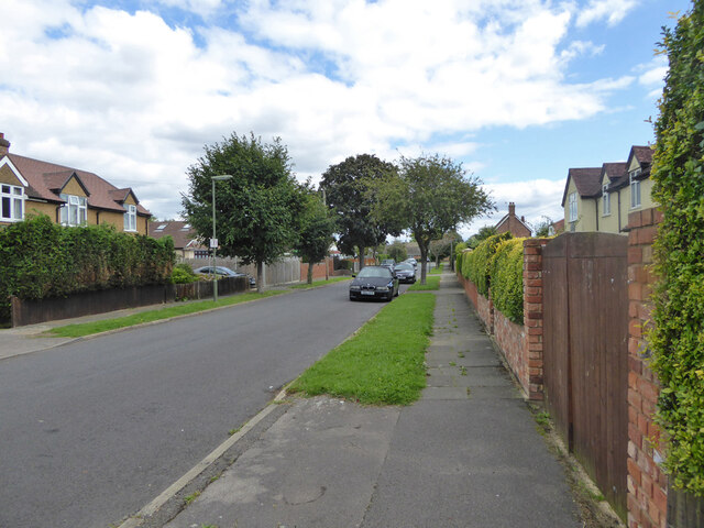
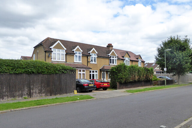
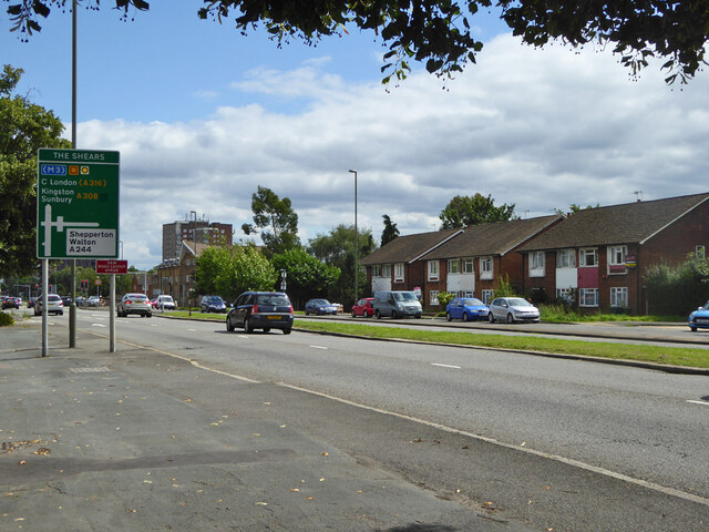
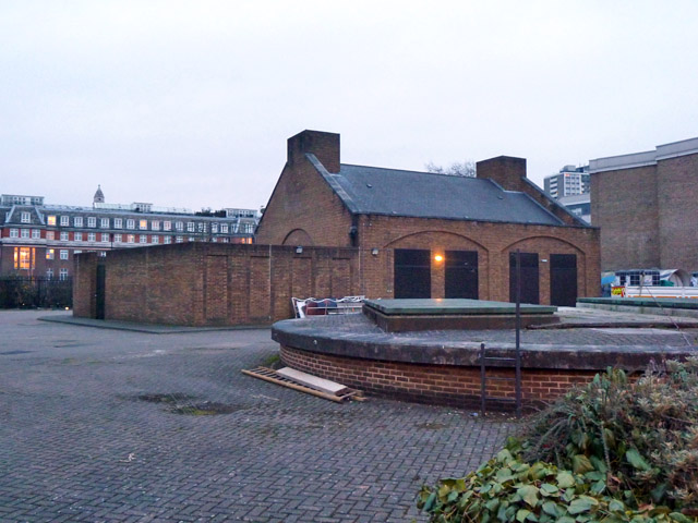
Littleton Common Images

Images are sourced within 2km of 51.421132/-0.44239448 or Grid Reference TQ0870. Thanks to Geograph Open Source API. All images are credited.

On Anderson Drive
On Anderson Drive
Path in Bedford Lakes Country Park
Smart Dry Cleaners - near Ashford
On the B377
On the B377
Ashford Road
Ashford Road
Ashford Road
Ashford Road
Postbox TW15 162D, School Road, Ashford A George V box, with attached drop box.
Postbox TW15 162D, School Road, Ashford
A George V box, with attached drop box.
Sundown Road, Ashford
Clock tower, Clockhouse Lane Park A surprising feature of a small park and recreation ground. A 1962 photograph reveals that this is the remaining core of an octagonal shelter or pavilion. Clockhouse Lane is named after Clock House, that was on the other side of the road, but now demolished. Was the clock, assuming there was one, transferred here?
Clock tower, Clockhouse Lane Park
A surprising feature of a small park and recreation ground. A 1962 photograph reveals that this is the remaining core of an octagonal shelter or pavilion. Clockhouse Lane is named after Clock House, that was on the other side of the road, but now demolished. Was the clock, assuming there was one, transferred here?
Clock tower and tennis courts, Clockhouse Lane Park A surprising feature of a small park and recreation ground. A 1962 photograph reveals that this is the remaining core of an octagonal shelter or pavilion. Clockhouse Lane is named after Clock House, that was on the other side of the road, but now demolished. Was the clock, assuming there was one, transferred here?
Clock tower and tennis courts, Clockhouse Lane Park
A surprising feature of a small park and recreation ground. A 1962 photograph reveals that this is the remaining core of an octagonal shelter or pavilion. Clockhouse Lane is named after Clock House, that was on the other side of the road, but now demolished. Was the clock, assuming there was one, transferred here?
Small building, Clockhouse Lane Park Of unknown purpose, which does not appear to have been recently exercised.
Small building, Clockhouse Lane Park
Of unknown purpose, which does not appear to have been recently exercised.
In Clockhouse Lane Park, Ashford
Clockhouse Lane Park, Ashford
Private road, Ashford Smallholdings Estate A Surrey County Council estate.
Private road, Ashford Smallholdings Estate
A Surrey County Council estate.
A244 Chertsey Road Heading north.
A244 Chertsey Road
Heading north.
Scotts Way, Ashford Common
Houses on Scotts Way, Ashford Common
A308 Staines Road West Heading east.
A308 Staines Road West
Heading east.
Show me another place!

Littleton Common is located at Grid Ref: TQ0870 (Lat: 51.421132, Lng: -0.44239448)

Administrative County: Surrey

District: Spelthorne

Police Authority: Surrey

What 3 Words

///glaze.cake.firm. Near Ashford, Surrey

Nearby Locations

Littleton Common

Related Wikis

Spelthorne Sports F.C.

Spelthorne Sports F.C. is a football club based in the borough of Spelthorne. They play in the Combined Counties League Premier Division South. == History... ==

Queen Mary Reservoir

The Queen Mary Reservoir is one of the largest of London's reservoirs supplying fresh water to London and parts of surrounding counties, and is located...

Thames Water Ring Main

The Thames Water Ring Main (TWRM, formerly the London Water Ring Main) is a system of approximately 80 km (50 mi) of concrete tunnels which transfer drinking...

Upper Halliford railway station

Upper Halliford railway station serves the village of Upper Halliford in Surrey, England. It is 17 miles 34 chains (28.0 km) down the line from London...

Spelthorne (UK Parliament constituency)

Spelthorne is a constituency in Surrey represented in the House of Commons of the UK Parliament since 2010 by Kwasi Kwarteng, a Conservative, who served...

Sunbury-on-Thames

Sunbury-on-Thames (or commonly Sunbury) is a town on the north bank of the River Thames in the Borough of Spelthorne, Surrey, centred 13 mi (21 km) southwest...

Sunbury-on-Thames Urban District

Sunbury on Thames Urban District, also known as Sunbury Urban District, was a local government district from 1894 to 1974 comprising the town and parish...

Sunbury Manor School

Sunbury Manor School is a secondary academy school in Sunbury-on-Thames, in Surrey, England. == Admissions == The school educates an overwhelmingly number...

Related Videos

Walking Around Ashford, Surrey: Exploring the Beauty of this Quaint Town (Old & New) |4K|

Ashford has a rich history, dating back to the Roman times when it was a small settlement known as 'Essetesford.' The town ...

Move ya body girl | #travel #shorts @ BP Sunbury| London

england #uk #travel #shortsvideo #youtubeshorts #beautiful #birds.

Nearby Amenities

Located within 500m of 51.421132,-0.44239448
Bus Stop
Napier Road
Bus: yes
Naptan AtcoCode: 40004402067A
Naptan Bearing: E
Naptan CommonName: Napier Road
Naptan Indicator: Just Before
Naptan Landmark: Napier Road
Naptan NaptanCode: surdjpgp
Naptan Street: Staines Road West
Naptan Verified: no
Public Transport: platform
Ref: 48849
Source: naptan_import
Lat/Long: 51.4215107/-0.4364308
Bus Stop
Napier Road
Bus: yes
Naptan AtcoCode: 40004402067B
Naptan Bearing: W
Naptan CommonName: Napier Road
Naptan Indicator: Opp
Naptan Landmark: Napier Road
Naptan NaptanCode: surdjpjg
Naptan Street: Staines Road West
Naptan Verified: no
Public Transport: platform
Ref: 52008
Shelter: no
Source: naptan_import
Lat/Long: 51.4211847/-0.4354942
Bus Stop
Thorne Close
Naptan AtcoCode: 40004402090A
Naptan Bearing: S
Naptan CommonName: Thorne Close
Naptan Indicator: Just after
Naptan Landmark: Spelthorne Lane / Thorne Close
Naptan NaptanCode: surdmgdt
Naptan Street: Spelthorne Lane
Naptan Verified: no
Public Transport: platform
Source: naptan_import
Lat/Long: 51.4201393/-0.4424766
Bus Stop
Thorne Close
Naptan AtcoCode: 40004402090B
Naptan Bearing: N
Naptan CommonName: Thorne Close
Naptan Indicator: Just Before
Naptan Landmark: Spelthorne Lane / Thorne Close
Naptan NaptanCode: surdmgdw
Naptan Street: Spelthorne Lane
Naptan Verified: no
Public Transport: platform
Source: naptan_import
Lat/Long: 51.4203626/-0.4426123
Bus Stop
Chertsey Road
Bus: yes
Naptan AtcoCode: 40004402091A
Naptan Bearing: E
Naptan CommonName: Black Dog
Naptan Indicator: O/s
Naptan Landmark: Black Dog
Naptan NaptanCode: surdmgpj
Naptan Street: Staines Road West
Naptan Verified: no
Public Transport: platform
Shelter: yes
Source: naptan_import
Lat/Long: 51.4221918/-0.4413761
Bus Stop
Chertsey Road
Bus: yes
Naptan AtcoCode: 40004402091B
Naptan Bearing: W
Naptan CommonName: Black Dog
Naptan Indicator: Opp
Naptan Landmark: Black Dog
Naptan NaptanCode: surdmgtd
Naptan Street: Staines Road West
Naptan Verified: no
Public Transport: platform
Ref: 74526
Shelter: no
Source: naptan_import
Lat/Long: 51.4220314/-0.4420059
Bus Stop
Norman Road
Naptan AtcoCode: 40004402091C
Naptan Bearing: NE
Naptan CommonName: Black Dog
Naptan Indicator: adj
Naptan Landmark: Black Dog
Naptan NaptanCode: surdmgtg
Naptan Street: Chertsey Road
Naptan Verified: no
Public Transport: platform
Ref: 74755
Source: naptan_import
Lat/Long: 51.4226187/-0.4393264
Bus Stop
Norman Road
Naptan AtcoCode: 40004402091D
Naptan Bearing: SW
Naptan CommonName: Black Dog
Naptan Indicator: Nr
Naptan Landmark: Black Dog
Naptan NaptanCode: surdmgtj
Naptan Street: Chertsey Road
Public Transport: platform
Ref: 48103
Source: naptan_import
Lat/Long: 51.4225712/-0.4391305
Bus Stop
Black Dog
Naptan AtcoCode: 40004402091E
Naptan Bearing: NE
Naptan CommonName: Black Dog
Naptan Indicator: Just Before
Naptan Landmark: Black Dog
Naptan NaptanCode: surdmgtm
Naptan Street: Littleton Road
Naptan Verified: no
Public Transport: platform
Source: naptan_import
Lat/Long: 51.4214587/-0.4415438
Bus Stop
Black Dog
Naptan AtcoCode: 40004402091F
Naptan Bearing: NE
Naptan CommonName: Black Dog
Naptan Indicator: Just after
Naptan Landmark: Black Dog
Naptan NaptanCode: surdmjmt
Naptan Street: Littleton Road
Naptan Verified: no
Public Transport: platform
Source: naptan_import
Lat/Long: 51.4217467/-0.4412119
Bus Stop
Ashford Road
Naptan AtcoCode: 40004402098A
Naptan Bearing: E
Naptan CommonName: Ashford Road
Naptan Indicator: Just after
Naptan Landmark: Ashford Road
Naptan NaptanCode: surdmptg
Naptan Street: Staines Road West
Naptan Verified: no
Public Transport: platform
Shelter: no
Source: naptan_import
Lat/Long: 51.4229688/-0.4476591
Noexit: yes
Lat/Long: 51.4221896/-0.4408509
Turning Circle
Lat/Long: 51.4230279/-0.4419665
Direction: both
Surface: asphalt
Traffic Calming: hump
Lat/Long: 51.4237284/-0.4372967
Compressed Air
Source: survey
Lat/Long: 51.4221646/-0.4445953
Littleton Common
Place: neighbourhood
Lat/Long: 51.4217179/-0.4445943
Daily Needs
Shop: newsagent;grocery;off_licence
Lat/Long: 51.4223103/-0.4413496
Eyre & Elliston
Phone: +44 1784 251051
Shop: electronics
Lat/Long: 51.4223451/-0.4416359
Fancy Floors
Phone: +44 1784 420883;+44 1784 420230
Shop: flooring
Lat/Long: 51.4224116/-0.4420875
Finishing Touches
Shop: homeware
Lat/Long: 51.4224442/-0.4426887
Cafe
Freddie's Cafe
Lat/Long: 51.4224065/-0.4423512
Restaurant
Indian Ocean
Cuisine: indian
Phone: +44 1784 421414
Lat/Long: 51.4223714/-0.4418745
LKY 7
Contact Facebook: https://www.facebook.com/lky7sports/
Contact Instagram: lky7sports
Contact Twitter: lky7s
Contact Website: https://lky7sports.com/
Email: info@lky7.co.uk
Phone: +44 1784 258111
Shop: bicycle
Lat/Long: 51.4223592/-0.4417637
Leonard Henry
Addr Housenumber: 341
Phone: +44 1784 256715
Shop: hairdresser
Lat/Long: 51.4222524/-0.4408236
Masons Barber Shop
Shop: hairdresser
Lat/Long: 51.4224224/-0.4421786
Restaurant
Pizza Hut
Brand Wikidata: Q191615
Cuisine: italian
Phone: +44 1784 240506
Takeaway: yes
Lat/Long: 51.4223178/-0.4414239
Professional Dry Cleaners
Shop: dry_cleaning
Lat/Long: 51.4222609/-0.4408865
Riverside Upholstery
Addr Housenumber: 367
Phone: +44 1784 254000
Shop: upholstery
Lat/Long: 51.4224162/-0.442458
Restaurant
Rock 'N Sole
Cuisine: fish_and_chips
Opening Hours: Mo-Sa 11:30-14:00,16:30-21:00
Lat/Long: 51.422326/-0.4415051
Rowlands Clearance
Shop: furniture
Lat/Long: 51.4224316/-0.4425865
The Jolly Baker
Shop: bakery
Lat/Long: 51.4222705/-0.440965
William Hill
Brand: William Hill
Brand Wikidata: Q4053147
Shop: bookmaker
Lat/Long: 51.4224036/-0.4420191
Atm
Lat/Long: 51.4222038/-0.4405201
Addr City: Ashford (Middlesex)
Addr Housenumber: 364
Addr Postcode: TW15 1RY
Addr Street: Staines Road West
Lat/Long: 51.4219057/-0.4419895
Addr City: Ashford (Middlesex)
Addr Housenumber: 366
Addr Postcode: TW15 1RY
Addr Street: Staines Road West
Lat/Long: 51.4219344/-0.4420638
Addr City: Ashford (Middlesex)
Addr Housenumber: 368
Addr Postcode: TW15 1RY
Addr Street: Staines Road West
Lat/Long: 51.4219487/-0.4421682
Addr City: Ashford (Middlesex)
Addr Housenumber: 370
Addr Postcode: TW15 1RY
Addr Street: Staines Road West
Lat/Long: 51.4219664/-0.4422478
Addr City: Ashford (Middlesex)
Addr Housenumber: 372
Addr Postcode: TW15 1RY
Addr Street: Staines Road West
Lat/Long: 51.4219785/-0.4423275
Addr City: Ashford (Middlesex)
Addr Housenumber: 374
Addr Postcode: TW15 1RY
Addr Street: Staines Road West
Lat/Long: 51.4219918/-0.4424035
Addr City: Ashford (Middlesex)
Addr Housenumber: 376
Addr Postcode: TW15 1RY
Addr Street: Staines Road West
Lat/Long: 51.4220127/-0.4425009
Addr City: Ashford (Middlesex)
Addr Housenumber: 378
Addr Postcode: TW15 1RY
Addr Street: Staines Road West
Lat/Long: 51.422026/-0.4425752
Addr City: Ashford (Middlesex)
Addr Housenumber: 380
Addr Postcode: TW15 1RY
Addr Street: Staines Road West
Lat/Long: 51.4220348/-0.4426601
Addr City: Ashford (Middlesex)
Addr Housenumber: 382
Addr Postcode: TW15 1RY
Addr Street: Staines Road West
Lat/Long: 51.4220503/-0.4427663
Addr City: Ashford (Middlesex)
Addr Housenumber: 384
Addr Postcode: TW15 1RY
Addr Street: Staines Road West
Lat/Long: 51.4220624/-0.4428459
Addr City: Ashford (Middlesex)
Addr Housenumber: 386
Addr Postcode: TW15 1RY
Addr Street: Staines Road West
Lat/Long: 51.4220712/-0.4429521
Addr City: Ashford (Middlesex)
Addr Housenumber: 388
Addr Postcode: TW15 1RY
Addr Street: Staines Road West
Lat/Long: 51.4220911/-0.4430353
Barrier: lift_gate
Lat/Long: 51.4194207/-0.4442333
Fast Food
Domino's
Addr City: Ashford (Middlesex)
Addr Country: GB
Addr Housenumber: 339
Addr Postcode: TW15 1RP
Addr Street: Staines Road West
Brand: Domino's
Brand Wikidata: Q839466
Brand Wikipedia: en:Domino's Pizza
Contact Website: https://www.dominos.co.uk/pizza-near-me/ashford/339-staines-road-west
Cuisine: pizza
Delivery: yes
Takeaway: only
Lat/Long: 51.4221599/-0.440766
Barrier: bollard
Lat/Long: 51.4223811/-0.4398457
Give Way
Direction: forward
Lat/Long: 51.4219976/-0.440076
Give Way
Direction: forward
Lat/Long: 51.4219256/-0.4410506
Crossing
Bicycle: yes
Crossing: traffic_signals
Crossing Island: yes
Crossing Ref: toucan
Tactile Paving: yes
Lat/Long: 51.422993/-0.4482725
Crossing
Bicycle: yes
Crossing: traffic_signals
Crossing Island: yes
Crossing Ref: toucan
Tactile Paving: yes
Lat/Long: 51.4228924/-0.4482265
Traffic Signals
Traffic Signals: signal
Traffic Signals Direction: backward
Lat/Long: 51.4228672/-0.4486689
Traffic Signals
Traffic Signals: crossing
Traffic Signals Direction: forward
Lat/Long: 51.4230022/-0.4483476
Traffic Signals
Traffic Signals: signal
Traffic Signals Direction: forward
Lat/Long: 51.4228788/-0.4480994
Give Way
Direction: forward
Lat/Long: 51.4228105/-0.4485285
The data included in this document is from www.openstreetmap.org. The data is made available under ODbL.

Have you been to Littleton Common?

Leave your review of Littleton Common below (or comments, questions and feedback).