Kirkhill

Settlement in Berwickshire

Scotland

Kirkhill

Scattered housing by East Morriston
Scattered housing by East Morriston Credit: Barbara Carr

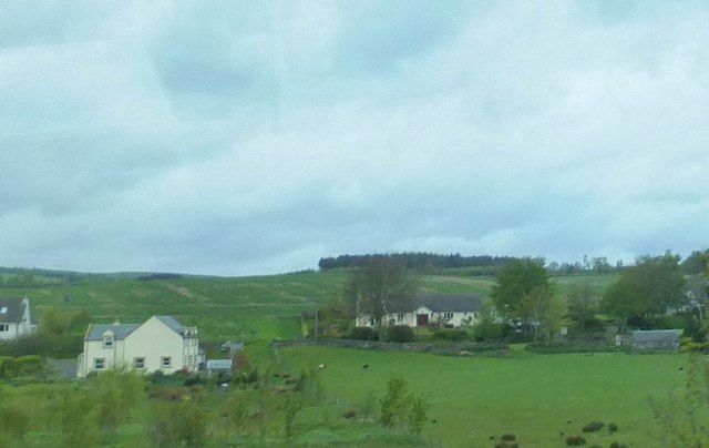
Kirkhill is a small village located in the Scottish Borders region of Berwickshire, in the southeastern part of Scotland. Situated on the A6105 road, the village is approximately 4 miles southwest of the town of Coldstream and 55 miles southeast of Edinburgh.

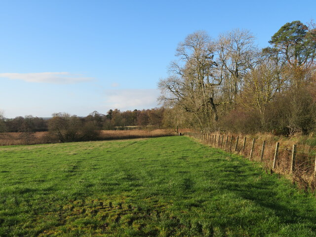
The village of Kirkhill is known for its picturesque surroundings and tranquil atmosphere. It is surrounded by rolling hills and beautiful farmland, making it an ideal location for those seeking a peaceful rural setting. The nearby River Tweed also adds to the natural beauty of the area, offering opportunities for fishing and scenic walks along its banks.

In terms of amenities, Kirkhill is a relatively small village with limited facilities. However, there is a village hall and a small community center that host various events and activities throughout the year. For more extensive amenities, residents can easily access the nearby town of Coldstream, which offers a range of services including shops, schools, and medical facilities.

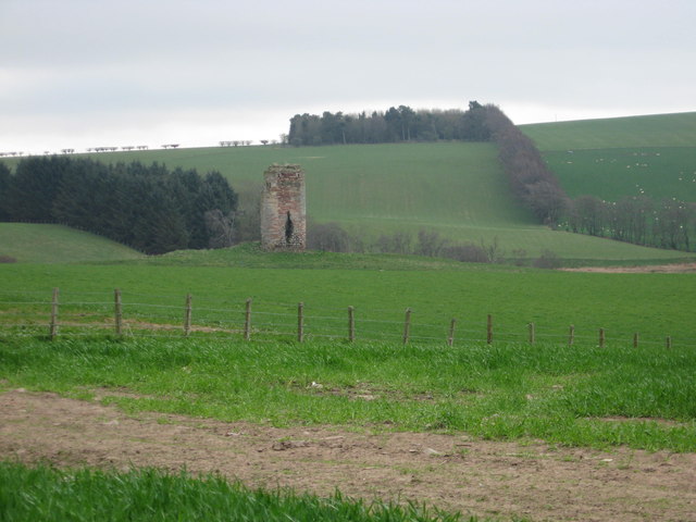
The village has a rich history, with some notable landmarks and historical sites in the surrounding area. Nearby attractions include the historic Hirsel Estate, which features a country house, gardens, and a museum. The estate is also known for its nature trails and bird-watching opportunities.

Overall, Kirkhill offers a charming and idyllic setting for those looking to escape the hustle and bustle of urban life and enjoy the beauty of the Scottish countryside.

If you have any feedback on the listing, please let us know in the comments section below.

Kirkhill Images

Images are sourced within 2km of 55.68351/-2.6465283 or Grid Reference NT5943. Thanks to Geograph Open Source API. All images are credited.
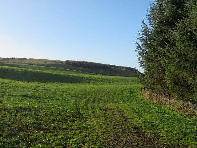
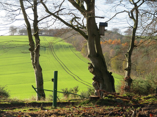
Scattered housing by East Morriston
Pasture lands at Corsbie 17th. century Corsbie Tower, built by the Cranstouns of Oxenfoord (north of Pathhead in Midlothian) can be seen in the background.
Pasture lands at Corsbie
17th. century Corsbie Tower, built by the Cranstouns of Oxenfoord (north of Pathhead in Midlothian) can be seen in the background.
Rural building site At East Morriston, between Earlston and Gordon.
Rural building site
At East Morriston, between Earlston and Gordon.
Field access near Boon Through a shelter belt from the track between Boon and Legerwood. See two earlier images from the same location - <a href="https://www.geograph.org.uk/photo/526605">NT5744 : Barley field</a> from 2007, <a href="https://www.geograph.org.uk/photo/2848537">NT5744 : Field access track</a> from 2012.
Field access near Boon
Through a shelter belt from the track between Boon and Legerwood. See two earlier images from the same location - NT5744 : Barley field from 2007, NT5744 : Field access track from 2012.
Shelter belt near Boon A deciduous woodland strip between track and field between Boon and Legerwood.
Shelter belt near Boon
A deciduous woodland strip between track and field between Boon and Legerwood.
Pasture south of Legerwood Looking southwest to hillside plantations, overlooking the valley of the Legerwood Burn.
Pasture south of Legerwood
Looking southwest to hillside plantations, overlooking the valley of the Legerwood Burn.
National Grid gas installation Boon 4937 - presumably the ID. I was struck by the spelling of 'unodourised'; it did not look right, although odour is the normal British spelling. <span class="nowrap"><a title="https://www.gasodorizer.com/what-is-natural-gas-odorization/" rel="nofollow ugc noopener" href="https://www.gasodorizer.com/what-is-natural-gas-odorization/">Link</a><img style="margin-left:2px;" alt="External link" title="External link - shift click to open in new window" src="https://s1.geograph.org.uk/img/external.png" width="10" height="10"/></span>
National Grid gas installation
Boon 4937 - presumably the ID. I was struck by the spelling of 'unodourised'; it did not look right, although odour is the normal British spelling. LinkExternal link
National Grid gas installation Gas pipes at the installation on the country road between Dods and Legerwood.
National Grid gas installation
Gas pipes at the installation on the country road between Dods and Legerwood.
Field and shelterbelt near Boon On the road from Dods to Legerwood.
Field and shelterbelt near Boon
On the road from Dods to Legerwood.
Pasture near Legerwood Looking west from just north of Legerwood.
Pasture near Legerwood
Looking west from just north of Legerwood.
Scottish Borders Landscape Looking northeast to West Hill. Extensive grassland and winter cereal.
Scottish Borders Landscape
Looking northeast to West Hill. Extensive grassland and winter cereal.
Roadside Rowans With a warning of timber operations. The largest flock of Fieldfare I have ever seen was moving around while I was here - I estimated 2-300.
Roadside Rowans
With a warning of timber operations. The largest flock of Fieldfare I have ever seen was moving around while I was here - I estimated 2-300.
Roadside fungi Fruit bodies of a species of Mycena growing in grass at the base of a Rowan <a href="https://www.geograph.org.uk/photo/7350294">NT5941 : Roadside Rowans</a> near Morriston Strip.
Roadside fungi
Fruit bodies of a species of Mycena growing in grass at the base of a Rowan NT5941 : Roadside Rowans near Morriston Strip.
Winter cereal at Morriston Looking southeast, to beech trees on the field margin and a pair of electricity pylons.
Winter cereal at Morriston
Looking southeast, to beech trees on the field margin and a pair of electricity pylons.
Tramlines in winter cereal The crop is likely to be Winter Wheat [rather than Barley]. Looking towards Easter Morriston farm.
Tramlines in winter cereal
The crop is likely to be Winter Wheat [rather than Barley]. Looking towards Easter Morriston farm.
Field access through a shelter belt With stacks of harvested timber waiting to be collected.
Field access through a shelter belt
With stacks of harvested timber waiting to be collected.
The valley of the Legerwood Burn With a small mixed wood and a crop of unidentified brassicas.
The valley of the Legerwood Burn
With a small mixed wood and a crop of unidentified brassicas.
Nest box in the Prison Strip A large bird box in a Beech tree on the edge of the woodland, possibly for an owl or other raptor, with a winter cereal crop beyond.
Nest box in the Prison Strip
A large bird box in a Beech tree on the edge of the woodland, possibly for an owl or other raptor, with a winter cereal crop beyond.
Show me another place!

Kirkhill is located at Grid Ref: NT5943 (Lat: 55.68351, Lng: -2.6465283)

Unitary Authority: The Scottish Borders

Police Authority: The Lothians and Scottish Borders

What 3 Words

///funky.tycoons.concluded. Near Earlston, Scottish Borders

Nearby Locations

Kirkhill

Related Wikis

Legerwood Kirk

Legerwood Kirk is an ancient and historic Church of Scotland church in the former county of Berwickshire, Scotland. It is situated half a mile east of...

Legerwood

Legerwood is a village by the Eden Water, in the Scottish Borders area of Scotland, near Lauder, near the Southern Upland Way. Legerwood Kirk is outside...

Corsbie Castle

Corsbie Castle is a ruined 16th-century tower house, about 2.5 miles (4.0 km) west of Gordon, Scottish Borders, Scotland, and north of the Eden Water....

Boon Farm

Boon is a farm and former barony located near Lauder, Scotland. == History == === Name origins === Boon (aka "Boune" or "Bounn"), derives from the Breton...

Nearby Amenities

Located within 500m of 55.68351,-2.6465283
Place Of Worship
Legerwood Kirk
Denomination: church_of_scotland
Religion: christian
Wikidata: Q6518004
Wikipedia: en:Legerwood Kirk
Lat/Long: 55.6825622/-2.6470942
Kirkhill
Place: hamlet
Lat/Long: 55.6834155/-2.6466326
Power: pole
Lat/Long: 55.6828504/-2.6390445
Power: pole
Lat/Long: 55.6824312/-2.6520315
Power: pole
Lat/Long: 55.6822528/-2.6515058
Power: pole
Lat/Long: 55.6818506/-2.6504436
Power: pole
Lat/Long: 55.6816313/-2.6492608
Power: pole
Lat/Long: 55.6813924/-2.6480269
Power: pole
Lat/Long: 55.6815814/-2.6464713
Power: pole
Lat/Long: 55.6817719/-2.6449236
Power: pole
Lat/Long: 55.6819594/-2.6432902
Power: pole
Lat/Long: 55.6822883/-2.6420175
Power: pole
Lat/Long: 55.6826233/-2.6407743
Power: pole
Lat/Long: 55.683777/-2.6396678
Power: pole
Lat/Long: 55.6834671/-2.6399696
Power: pole
Lat/Long: 55.6823526/-2.6536354
The data included in this document is from www.openstreetmap.org. The data is made available under ODbL.

Have you been to Kirkhill?

Leave your review of Kirkhill below (or comments, questions and feedback).