Deeping, Market

Settlement in Lincolnshire South Kesteven

England

Deeping, Market

River scene, Market Deeping, Lincs Landscaped gardens beside a branch of the River Welland; view SE from the A16 bridge.
River scene, Market Deeping, Lincs Credit: Rodney Burton

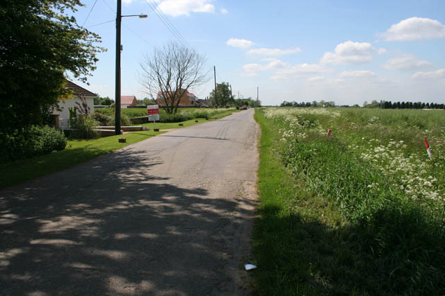
Deeping Market is a small village located in the county of Lincolnshire, England. It is situated in the district of South Kesteven, approximately 10 miles north of the city of Peterborough. The village is part of the larger area known as The Deepings, which includes Market Deeping and Deeping St. James.

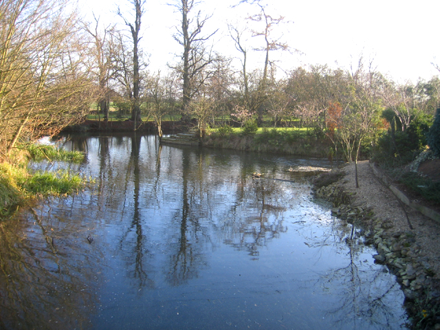
Deeping Market has a rich history that dates back to the medieval period. It was originally developed as a market town due to its strategic location on the River Welland, which provided a means of transportation for goods and agricultural produce. The market in Deeping Market still takes place every Friday, attracting locals and visitors alike.

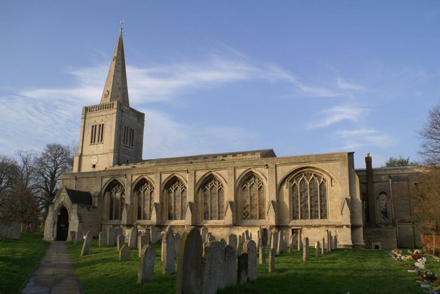
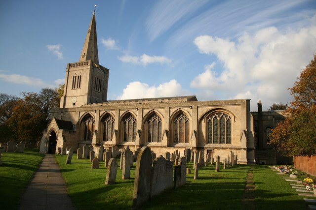
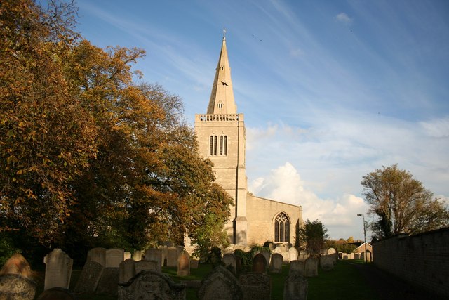
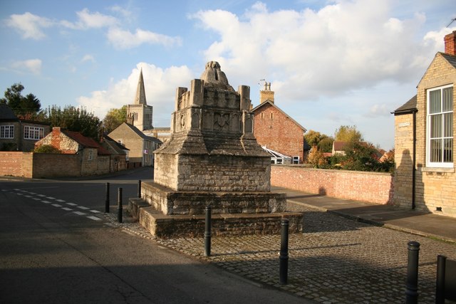
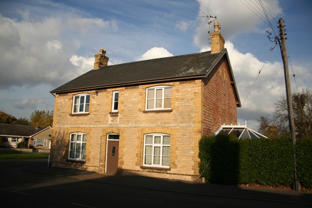
The village is known for its charming and picturesque setting, with traditional stone cottages and historic buildings lining the streets. The main focal point of the village is the Grade I listed St. Guthlac's Church, which dates back to the 13th century and features stunning architectural details.

In terms of amenities, Deeping Market offers a range of local shops, pubs, and restaurants, providing residents with all the necessary conveniences. The village also benefits from excellent transport links, with the A15 road passing nearby and providing easy access to neighbouring towns and cities.

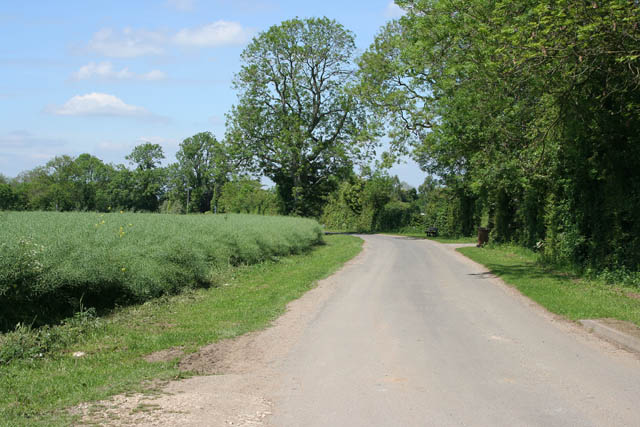
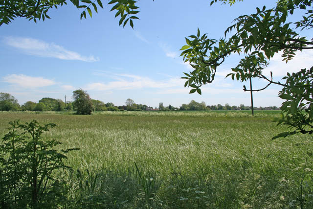
Deeping Market is surrounded by the beautiful Lincolnshire countryside, offering opportunities for outdoor activities such as walking, cycling, and fishing. Overall, it is a peaceful and idyllic village, perfect for those seeking a tranquil rural lifestyle.

If you have any feedback on the listing, please let us know in the comments section below.

Deeping, Market Images

Images are sourced within 2km of 52.675383/-0.3176 or Grid Reference TF1310. Thanks to Geograph Open Source API. All images are credited.

River scene, Market Deeping, Lincs Landscaped gardens beside a branch of the River Welland; view SE from the A16 bridge.
River scene, Market Deeping, Lincs
Landscaped gardens beside a branch of the River Welland; view SE from the A16 bridge.
Cherry Tree Cottage, Maxey, Peterborough on the High Street at the junction with Castle End Road.
Cherry Tree Cottage, Maxey, Peterborough
on the High Street at the junction with Castle End Road.
River Welland from Market Deeping bridge This view is from the parapet of the stone bridge built in 1842, looking east. The left bank is the back of the properties on the south side of the Market Place, and beyond.
River Welland from Market Deeping bridge
This view is from the parapet of the stone bridge built in 1842, looking east. The left bank is the back of the properties on the south side of the Market Place, and beyond.
Market Deeping town centre road junction Both the A15 and A16 trunk roads used to thunder through here before the 4 mile western bypass was built and opened in 1998 at a cost of £7M. This view is now the B1524; it links the south and north access points of the bypass with the town centre. The B1525 (west to east routes) used to be part of the A16, prior to the bypass opening.
Market Deeping town centre road junction
Both the A15 and A16 trunk roads used to thunder through here before the 4 mile western bypass was built and opened in 1998 at a cost of £7M. This view is now the B1524; it links the south and north access points of the bypass with the town centre. The B1525 (west to east routes) used to be part of the A16, prior to the bypass opening.
Market Deeping bridge This view of the bridge is from the footpath which meanders alongside the south riverbank of the Welland, or one of the tributaries as far as Maxey mill.
Market Deeping bridge
This view of the bridge is from the footpath which meanders alongside the south riverbank of the Welland, or one of the tributaries as far as Maxey mill.
The Priory Church of Deeping St James Larger than your average Parish Church because it was a priory until the reformation. Norman arches, a graveside shelter and 12th C font to be found inside.
The Priory Church of Deeping St James
Larger than your average Parish Church because it was a priory until the reformation. Norman arches, a graveside shelter and 12th C font to be found inside.
Sutton's Lane, Deeping Gate On the opposite side of the River Welland to Market Deeping, Deeping Gate is stretched out along Sutton's Lane with most of the houses being on the river side of the road. Spot the wheelie bin!
The oilseed rape on the left has finished flowering and the long seed pods are forming.
Sutton's Lane, Deeping Gate
On the opposite side of the River Welland to Market Deeping, Deeping Gate is stretched out along Sutton's Lane with most of the houses being on the river side of the road. Spot the wheelie bin! The oilseed rape on the left has finished flowering and the long seed pods are forming.
Arable farmland off Sutton's Lane It looks like wheat but it's difficult to tell this time of the year.
Arable farmland off Sutton's Lane
It looks like wheat but it's difficult to tell this time of the year.
Sutton's Lane, Deeping Gate Looking towards the B1524.
Sutton's Lane, Deeping Gate
Looking towards the B1524.
Gate on the B1524 You can just see the old Lincoln Road going from left to right in the centre of this photograph. It was diverted to run slightly to the west when the A15 was built. The old road is marked as an "other route with public access" on the map. There are concrete bollards to stop cars at the start of this path several metres to the left. Here the land owner has "parked" a large piece of farm machinery to stop determined drivers using this gate.
Gate on the B1524
You can just see the old Lincoln Road going from left to right in the centre of this photograph. It was diverted to run slightly to the west when the A15 was built. The old road is marked as an "other route with public access" on the map. There are concrete bollards to stop cars at the start of this path several metres to the left. Here the land owner has "parked" a large piece of farm machinery to stop determined drivers using this gate.
The B1524, Lincoln Road This seems to be the preferred the main route out of Market Deeping to the A15 and Peterborough. Note that it has been built on an embankment. A lot of roads are like this through the Fens, keeping routes open in case of flooding.
The B1524, Lincoln Road
This seems to be the preferred the main route out of Market Deeping to the A15 and Peterborough. Note that it has been built on an embankment. A lot of roads are like this through the Fens, keeping routes open in case of flooding.
Field off Lincoln Road This field sits between the new <a href="https://www.geograph.org.uk/photo/442601">TF1408 : The B1524, Lincoln Road</a> and the old Lincoln Road which is now a public access route popular with joggers, cyclists and walkers. See <a href="https://www.geograph.org.uk/photo/442591">TF1408 : Gate on the B1524</a>
The yellow signs advertising the Deeping Show were posted far and wide in this area.
Field off Lincoln Road
This field sits between the new TF1408 : The B1524, Lincoln Road and the old Lincoln Road which is now a public access route popular with joggers, cyclists and walkers. See TF1408 : Gate on the B1524 The yellow signs advertising the Deeping Show were posted far and wide in this area.
Rippon's Drove Many of the lanes, tracks and country roads through the Fens carry the name "Drove", an old name given to routes that were used to move livestock.
Rippon's Drove
Many of the lanes, tracks and country roads through the Fens carry the name "Drove", an old name given to routes that were used to move livestock.
A granary barn close to the Market Place This barn, with many openings to provide ventilation, was perhaps a store house for grain in the days of travel by stage coaches.
A granary barn close to the Market Place
This barn, with many openings to provide ventilation, was perhaps a store house for grain in the days of travel by stage coaches.
Priory church of Deeping St.James Originally founded in 1139 as part of a Benedictine Priory
Priory church of Deeping St.James
Originally founded in 1139 as part of a Benedictine Priory
Priory church of Deeping St.James West tower of the Priory church, though it looks medieval, it's actually c1730
Priory church of Deeping St.James
West tower of the Priory church, though it looks medieval, it's actually c1730
Deeping St.James cross 15th century market cross converted into a lockup in 1819
Deeping St.James cross
15th century market cross converted into a lockup in 1819
Eastgate house House on Eastgate near the church with a datestone of 1884
Eastgate house
House on Eastgate near the church with a datestone of 1884
Show me another place!

Deeping, Market is located at Grid Ref: TF1310 (Lat: 52.675383, Lng: -0.3176)

Division: Parts of Kesteven

Administrative County: Lincolnshire

District: South Kesteven

Police Authority: Lincolnshire

What 3 Words

///depth.observers.washing. Near Market Deeping, Lincolnshire

Nearby Locations

Deeping, Market Towngate

Related Wikis

Market Deeping Town Hall

Market Deeping Town Hall is a municipal structure in the Market Place, Market Deeping, Lincolnshire, England. The structure, which is the meeting place...

Market Deeping

Market Deeping is a market town and civil parish in the South Kesteven district of Lincolnshire, England, on the north bank of the River Welland and the...

St Guthlac's Church, Market Deeping

Saint Guthlac's Church, Market Deeping is a parish church of the Church of England in Market Deeping, Lincolnshire, England. == Background == The largely...

The Deepings

The Deepings (grid reference TF150094) are a series of settlements close to the River Welland near the borders of southern Lincolnshire and north western...

Nearby Amenities

Located within 500m of 52.675383,-0.3176
Crossing
Crossing: unmarked
Crossing Markings: no
Kerb: lowered
Lat/Long: 52.6718529/-0.3139414
Market Deeping
Place: town
Population: 6,008
Lat/Long: 52.67537/-0.3174702
Mini Roundabout
Direction: clockwise
Lat/Long: 52.6789425/-0.3139496
Crossing
Crossing: uncontrolled
Crossing Ref: zebra
Kerb: lowered
Lat/Long: 52.6751595/-0.3165659
Mini Roundabout
Direction: clockwise
Lat/Long: 52.6741041/-0.3106787
Post Office
Market Deeping Village Store
Addr City: Market Deeping
Addr Housenumber: 88A
Addr Postcode: PE6 8HY
Addr Street: Godsey Lane
Brand: Londis
Brand Wikidata: Q21008564
Brand Wikipedia: en:Londis (United Kingdom)
Fhrs Authority: South Kesteven
Fhrs Id: 1153964
Fhrs Local Authority Id: 88285
Opening Hours: Mo-Sa 07:00-21:00; Su 09:00-21:00
Shop: convenience
Lat/Long: 52.6788642/-0.3135834
Post Box
Lat/Long: 52.6789005/-0.3138255
Bus Stop
The Stage PH
Bus: yes
Naptan AtcoCode: 270000009478
Naptan Bearing: NW
Naptan CommonName: The Stage PH
Naptan Indicator: adj
Naptan Landmark: The Stage PH
Naptan NaptanCode: linjdagj
Naptan Street: Market Place
Naptan Verified: no
Public Transport: platform
Shelter: yes
Source: naptan_import
Lat/Long: 52.6750753/-0.3164506
Bus Stop
Godsey Lane
Bus: yes
Naptan AtcoCode: 270000009479
Naptan Bearing: NW
Naptan CommonName: Godsey Lane
Naptan Indicator: opp
Naptan Landmark: Godsey Lane
Naptan NaptanCode: linjdagm
Naptan Street: High Street
Naptan Verified: no
Public Transport: platform
Source: naptan_import
Lat/Long: 52.674082/-0.3117232
Bus Stop
Douglas Road
Bus: yes
Naptan AtcoCode: 270000009480
Naptan Bearing: SE
Naptan CommonName: Douglas Road
Naptan Indicator: adj
Naptan Landmark: Douglas Road
Naptan NaptanCode: linjdagp
Naptan Street: Godsey Lane
Naptan Verified: no
Public Transport: platform
Source: naptan_import
Lat/Long: 52.6748364/-0.3110285
Bus Stop
Douglas Road
Bus: yes
Naptan AtcoCode: 270000009481
Naptan Bearing: NW
Naptan CommonName: Douglas Road
Naptan Indicator: opp
Naptan Landmark: Douglas Road
Naptan NaptanCode: linjdagt
Naptan Street: Godsey Lane
Naptan Verified: no
Public Transport: platform
Source: naptan_import
Lat/Long: 52.6747482/-0.3111503
Bus Stop
Clover Road
Bus: yes
Naptan AtcoCode: 270000009482
Naptan Bearing: NW
Naptan CommonName: Clover Road
Naptan Indicator: adj
Naptan Landmark: Clover Road
Naptan NaptanCode: linjdagw
Naptan Street: Godsey Lane
Naptan Verified: no
Public Transport: platform
Shelter: no
Source: naptan_import
Lat/Long: 52.6766089/-0.3123802
Bus Stop
Clover Road
Bus: yes
Naptan AtcoCode: 270000009483
Naptan Bearing: SE
Naptan CommonName: Clover Road
Naptan Indicator: opp
Naptan Landmark: Clover Road
Naptan NaptanCode: linjdaja
Naptan Street: Godsey Lane
Naptan Verified: no
Public Transport: platform
Shelter: no
Source: naptan_import
Lat/Long: 52.6767154/-0.3122873
Bus Stop
Godsey Lane
Bus: yes
Naptan AtcoCode: 270000009500
Naptan Bearing: E
Naptan CommonName: Godsey Lane
Naptan Indicator: E - bound
Naptan Landmark: Godsey Lane
Naptan NaptanCode: linjdapj
Naptan Street: Thackers Way
Naptan Verified: no
Public Transport: platform
Source: naptan_import
Lat/Long: 52.6759847/-0.3108511
Bus Stop
Godsey Lane
Bus: yes
Naptan AtcoCode: 270000009501
Naptan Bearing: W
Naptan CommonName: Godsey Lane
Naptan Indicator: W - bound
Naptan Landmark: Godsey Lane
Naptan NaptanCode: linjdapm
Naptan Street: Thackers Way
Naptan Verified: no
Public Transport: platform
Source: naptan_import
Lat/Long: 52.6759111/-0.3107356
Bus Stop
St Guthlac's Church
Bus: yes
Naptan AtcoCode: 270000009525
Naptan Bearing: NW
Naptan CommonName: St Guthlac's Church
Naptan Indicator: opp
Naptan Landmark: St Guthlac's Church
Naptan NaptanCode: linjdgda
Naptan Street: Church Street
Naptan Verified: no
Public Transport: platform
Shelter: no
Source: naptan_import
Lat/Long: 52.6780819/-0.3198677
Bus Stop
Red Cross Shop
Alt Name: Pelican Crossing
Bus: yes
Naptan AltCommonName: Pelican Crossing
Naptan AltIndicator: nr
Naptan AltLandmark: Pelican Crossing
Naptan AltStreet: Church Street
Naptan AtcoCode: 270000009526
Naptan Bearing: SE
Naptan CommonName: Red Cross Shop
Naptan Indicator: adj
Naptan Landmark: Red Cross Shop
Naptan NaptanCode: linjdgdg
Naptan Street: Church Street
Naptan Verified: no
Public Transport: platform
Shelter: yes
Source: naptan_import
Lat/Long: 52.6761776/-0.3180918
Bus Stop
Red Cross Shop
Alt Name: Pelican Crossing
Bus: yes
Naptan AltCommonName: Pelican Crossing
Naptan AltIndicator: adj
Naptan AltLandmark: Pelican Crossing
Naptan AltStreet: Church Street
Naptan AtcoCode: 270000009527
Naptan Bearing: NW
Naptan CommonName: Red Cross Shop
Naptan Indicator: opp
Naptan Landmark: Red Cross Shop
Naptan NaptanCode: linjdgdj
Naptan Street: Church Street
Naptan Verified: no
Public Transport: platform
Shelter: no
Source: naptan_import
Lat/Long: 52.6759352/-0.3181159
Bus Stop
St Guthlac's Church
Bus: yes
Naptan AtcoCode: 2700LMDC2685
Naptan Bearing: SE
Naptan CommonName: St Guthlac's Church
Naptan Indicator: adj
Naptan Landmark: St Guthlac's Church
Naptan NaptanCode: linatjtp
Naptan Street: Church Street
Naptan Verified: no
Public Transport: platform
Shelter: yes
Source: naptan_import
Lat/Long: 52.6782066/-0.319789
Bus Stop
The Stage PH
Bus: yes
Naptan AtcoCode: 2700LMDM2696
Naptan Bearing: SE
Naptan CommonName: Barclays Bank
Naptan Indicator: adj
Naptan Landmark: Barclays Bank
Naptan NaptanCode: linatmad
Naptan Street: Market Place
Naptan Verified: no
Public Transport: platform
Shelter: yes
Source: naptan_import
Lat/Long: 52.6750887/-0.3161219
Telephone
Booth: K6
Covered: booth
Listed Status: Grade II
Lat/Long: 52.6754209/-0.3172208
Post Box
Collection Times: Mo-Fr 17:15; Sa 12:00
Note: new ref is not a typo: it's the old ref with 1 added on the end.
Post Box Apertures: 2
Post Box Design: type_c
Post Box Type: pillar
Ref: PE6 1711
Royal Cypher: EIIR
Royal Cypher Wikidata: Q33102113
Lat/Long: 52.6754581/-0.3173818
Mini Roundabout
Direction: clockwise
Lat/Long: 52.6763859/-0.3122076
Fast Food
Lindfords Fish And Chip Shop
Addr City: Market Deeping
Addr Housenumber: 6
Addr Postcode: PE6 8EA
Addr Street: Market Place
Fhrs Authority: South Kesteven
Fhrs Id: 238190
Fhrs Local Authority Id: 5421
Lat/Long: 52.6751581/-0.3169715
Fast Food
Deeping Kebab House
Addr City: Market Deeping
Addr Housenumber: 14
Addr Postcode: PE6 8EA
Addr Street: Market Place
Fhrs Authority: South Kesteven
Fhrs Id: 238303
Fhrs Local Authority Id: 7246
Lat/Long: 52.6750574/-0.3165153
Crossing
Lat/Long: 52.6778559/-0.3121939
Recycling
Lat/Long: 52.6762852/-0.3128465
Pub
The Bull
Addr City: Market Deeping
Addr Housenumber: 19
Addr Postcode: PE6 8EA
Addr Street: Market Place
Fhrs Authority: South Kesteven
Fhrs Id: 238393
Fhrs Local Authority Id: 5435
Lat/Long: 52.6754176/-0.316674
Bench
Lat/Long: 52.6761754/-0.3128144
Power: pole
Lat/Long: 52.6711509/-0.317546
Power: pole
Lat/Long: 52.6713635/-0.3163569
Power: pole
Lat/Long: 52.6718634/-0.3151678
Power: pole
Lat/Long: 52.6721703/-0.3141168
Power: pole
Lat/Long: 52.6725538/-0.3128107
Noexit: yes
Lat/Long: 52.674839/-0.3142573
Generator Method: photovoltaic
Generator Output Electricity: yes
Generator Source: solar
Generator Type: solar_photovoltaic_panel
Location: roof
Power: generator
Lat/Long: 52.6758405/-0.3227368
Generator Method: photovoltaic
Generator Output Electricity: yes
Generator Solar Modules: 6
Generator Source: solar
Generator Type: solar_photovoltaic_panel
Location: roof
Power: generator
Lat/Long: 52.6758991/-0.322777
Generator Method: photovoltaic
Generator Output Electricity: yes
Generator Source: solar
Generator Type: solar_photovoltaic_panel
Location: roof
Power: generator
Lat/Long: 52.6779156/-0.3212321
Generator Method: photovoltaic
Generator Output Electricity: yes
Generator Source: solar
Generator Type: solar_photovoltaic_panel
Location: roof
Power: generator
Lat/Long: 52.6777839/-0.3204328
Generator Method: photovoltaic
Generator Output Electricity: yes
Generator Solar Modules: 10
Generator Source: solar
Generator Type: solar_photovoltaic_panel
Location: roof
Power: generator
Lat/Long: 52.6777676/-0.3205454
Generator Method: photovoltaic
Generator Output Electricity: yes
Generator Source: solar
Generator Type: solar_photovoltaic_panel
Location: roof
Power: generator
Lat/Long: 52.6738906/-0.3138788
Generator Method: photovoltaic
Generator Output Electricity: yes
Generator Source: solar
Generator Type: solar_photovoltaic_panel
Location: roof
Power: generator
Lat/Long: 52.6738727/-0.3140572
Generator Method: photovoltaic
Generator Output Electricity: yes
Generator Solar Modules: 12
Generator Source: solar
Generator Type: solar_photovoltaic_panel
Location: roof
Power: generator
Lat/Long: 52.677566/-0.317941
Generator Method: photovoltaic
Generator Output Electricity: yes
Generator Source: solar
Generator Type: solar_photovoltaic_panel
Location: roof
Power: generator
Lat/Long: 52.6780262/-0.3188288
Generator Method: photovoltaic
Generator Output Electricity: yes
Generator Solar Modules: 6
Generator Source: solar
Generator Type: solar_photovoltaic_panel
Location: roof
Power: generator
Lat/Long: 52.6780311/-0.318751
Generator Method: photovoltaic
Generator Output Electricity: yes
Generator Solar Modules: 17
Generator Source: solar
Generator Type: solar_photovoltaic_panel
Location: roof
Power: generator
Lat/Long: 52.6790865/-0.3155002
Generator Method: photovoltaic
Generator Output Electricity: yes
Generator Solar Modules: 17
Generator Source: solar
Generator Type: solar_photovoltaic_panel
Location: roof
Power: generator
Lat/Long: 52.6790962/-0.3153259
Generator Method: photovoltaic
Generator Output Electricity: yes
Generator Solar Modules: 17
Generator Source: solar
Generator Type: solar_photovoltaic_panel
Location: roof
Power: generator
Lat/Long: 52.6791434/-0.3150871
Generator Method: photovoltaic
Generator Output Electricity: yes
Generator Solar Modules: 17
Generator Source: solar
Generator Type: solar_photovoltaic_panel
Location: roof
Power: generator
Lat/Long: 52.6783872/-0.3165194
Generator Method: photovoltaic
Generator Output Electricity: yes
Generator Solar Modules: 17
Generator Source: solar
Generator Type: solar_photovoltaic_panel
Location: roof
Power: generator
Lat/Long: 52.6784165/-0.3164417
Generator Method: photovoltaic
Generator Output Electricity: yes
Generator Source: solar
Generator Type: solar_photovoltaic_panel
Location: roof
Power: generator
Lat/Long: 52.6784669/-0.3163156
Generator Method: photovoltaic
Generator Output Electricity: yes
Generator Solar Modules: 12
Generator Source: solar
Generator Type: solar_photovoltaic_panel
Location: roof
Power: generator
Lat/Long: 52.6783742/-0.3145909
Generator Method: photovoltaic
Generator Output Electricity: yes
Generator Source: solar
Generator Type: solar_photovoltaic_panel
Location: roof
Power: generator
Lat/Long: 52.6779644/-0.3157577
Generator Method: photovoltaic
Generator Output Electricity: yes
Generator Source: solar
Generator Type: solar_photovoltaic_panel
Location: roof
Power: generator
Lat/Long: 52.6779563/-0.3147975
Generator Method: photovoltaic
Generator Output Electricity: yes
Generator Source: solar
Generator Type: solar_photovoltaic_panel
Location: roof
Power: generator
Lat/Long: 52.6751347/-0.3117022
Generator Method: photovoltaic
Generator Output Electricity: yes
Generator Source: solar
Generator Type: solar_photovoltaic_panel
Location: roof
Power: generator
Lat/Long: 52.6750989/-0.3116351
Generator Method: photovoltaic
Generator Output Electricity: yes
Generator Solar Modules: 8
Generator Source: solar
Generator Type: solar_photovoltaic_panel
Location: roof
Power: generator
Lat/Long: 52.6747298/-0.3133866
Generator Method: photovoltaic
Generator Output Electricity: yes
Generator Solar Modules: 10
Generator Source: solar
Generator Type: solar_photovoltaic_panel
Location: roof
Power: generator
Lat/Long: 52.6749444/-0.31294
Generator Method: photovoltaic
Generator Output Electricity: yes
Generator Solar Modules: 10
Generator Source: solar
Generator Type: solar_photovoltaic_panel
Location: roof
Power: generator
Lat/Long: 52.674981/-0.3127818
Generator Method: photovoltaic
Generator Output Electricity: yes
Generator Source: solar
Generator Type: solar_photovoltaic_panel
Location: roof
Power: generator
Lat/Long: 52.6749965/-0.3126369
Generator Method: photovoltaic
Generator Output Electricity: yes
Generator Source: solar
Generator Type: solar_photovoltaic_panel
Location: roof
Power: generator
Lat/Long: 52.6786084/-0.312649
Generator Method: photovoltaic
Generator Output Electricity: yes
Generator Solar Modules: 13
Generator Source: solar
Generator Type: solar_photovoltaic_panel
Location: roof
Power: generator
Lat/Long: 52.6777237/-0.3118444
Generator Method: photovoltaic
Generator Output Electricity: yes
Generator Source: solar
Generator Type: solar_photovoltaic_panel
Location: roof
Power: generator
Lat/Long: 52.6758031/-0.3103182
Noexit: yes
Lat/Long: 52.6751276/-0.3157421
Noexit: yes
Lat/Long: 52.6751005/-0.315327
Bicycle Parking
Bicycle Parking: stands
Covered: no
Fee: no
Lat/Long: 52.6754085/-0.3169725
Barrier: kerb
Kerb: regular
Lat/Long: 52.6743492/-0.3107034
Bicycle Parking
Bicycle Parking: stands
Covered: no
Fee: no
Lat/Long: 52.6754697/-0.3162201
Crossing
Crossing: unmarked
Crossing Markings: no
Lat/Long: 52.6760321/-0.3134296
Crossing
Crossing: marked
Crossing Island: no
Crossing Markings: yes
Lat/Long: 52.6760715/-0.3136188
Crossing
Crossing: unmarked
Crossing Island: no
Crossing Markings: no
Tactile Paving: no
Lat/Long: 52.6748793/-0.3156702
Crossing
Lat/Long: 52.6764377/-0.3182304
Crossing
Crossing: unmarked
Crossing Markings: no
Lat/Long: 52.6772234/-0.3188038
Crossing
Lat/Long: 52.6756151/-0.3177309
Crossing
Lat/Long: 52.6762856/-0.3181521
Crossing
Lat/Long: 52.6768972/-0.3185844
Crossing
Crossing: pelican;marked
Crossing Island: no
Tactile Paving: yes
Lat/Long: 52.6756795/-0.3178373
Crossing
Lat/Long: 52.6767058/-0.3187562
Crossing
Lat/Long: 52.674972/-0.3161572
Crossing
Crossing: marked
Crossing Markings: yes
Lat/Long: 52.6751618/-0.3165765
Charging Station
Brand: Instavolt
Capacity: 2
Operator: InstaVolt
Operator Wikidata: Q111173904
Lat/Long: 52.675684/-0.3137416
Crossing
Crossing: unmarked
Crossing Markings: no
Lat/Long: 52.6777667/-0.3192904
Crossing
Lat/Long: 52.6787069/-0.3202801
Crossing
Lat/Long: 52.678417/-0.3201743
Crossing
Lat/Long: 52.6792827/-0.3210307
Crossing
Crossing: unmarked
Crossing Markings: no
Lat/Long: 52.6779313/-0.3197856
Crossing
Lat/Long: 52.6770461/-0.3127023
Crossing
Lat/Long: 52.6777468/-0.313202
Crossing
Lat/Long: 52.6747163/-0.31112
Crossing
Lat/Long: 52.6741905/-0.3121444
Crossing
Lat/Long: 52.6755388/-0.3129359
Bench
Lat/Long: 52.6779539/-0.3118326
Entrance: yes
Lat/Long: 52.6742025/-0.3104541
Crossing
Lat/Long: 52.6753578/-0.3184876
Crossing
Lat/Long: 52.6753443/-0.3186717
Crossing
Lat/Long: 52.6753402/-0.3194207
Crossing
Lat/Long: 52.6760857/-0.3240586
Crossing
Lat/Long: 52.6767383/-0.3245942
Crossing
Lat/Long: 52.6758554/-0.3245293
Crossing
Lat/Long: 52.6788452/-0.3222274
Crossing
Lat/Long: 52.676701/-0.3123061
Cafe
Godsey Lane Coffee
Addr City: Market Deeping
Addr Housenumber: 89
Addr Postcode: PE6 8ED
Addr Street: High Street
Cuisine: coffee_shop
Fhrs Authority: South Kesteven
Fhrs Id: 1069413
Fhrs Local Authority Id: 87949
Lat/Long: 52.6742268/-0.3108583
Crossing
Crossing: unmarked
Crossing Markings: no
Lat/Long: 52.6774264/-0.3232508
Crossing
Lat/Long: 52.6768711/-0.3134982
Crossing
Lat/Long: 52.6762655/-0.3155023
Crossing
Crossing: unmarked
Crossing Island: no
Crossing Markings: no
Lat/Long: 52.6767992/-0.316053
Crossing
Lat/Long: 52.6764626/-0.3147597
Crossing
Lat/Long: 52.6787801/-0.3204612
Crossing
Lat/Long: 52.6767443/-0.3184842
Crossing
Lat/Long: 52.6782868/-0.3134452
Crossing
Lat/Long: 52.6769792/-0.3124964
Crossing
Lat/Long: 52.6776065/-0.319154
Crossing
Lat/Long: 52.6777076/-0.3195738
Crossing
Lat/Long: 52.678763/-0.3204475
Crossing
Lat/Long: 52.6790038/-0.3206823
Crossing
Lat/Long: 52.6790337/-0.3205765
Crossing
Lat/Long: 52.67924/-0.3209762
Crossing
Lat/Long: 52.6753368/-0.3187894
Crossing
Lat/Long: 52.6753273/-0.3190827
Crossing
Lat/Long: 52.6784507/-0.3202018
Crossing
Lat/Long: 52.6768776/-0.3188698
Crossing
Lat/Long: 52.6760096/-0.3180217
Defibrillator
Emergency: defibrillator
Indoor: no
Ref GB The Circuit: 35D04155-873C-49B1-8FD6-4416D228D018
Lat/Long: 52.6754756/-0.3162829
Crossing
Lat/Long: 52.6752604/-0.320558
Crossing
Lat/Long: 52.6733315/-0.315661
Crossing
Crossing: unmarked
Crossing Markings: no
Lat/Long: 52.6752131/-0.3174611
Bubbleid: 1073889595
Man Made: sewer_vent
Lat/Long: 52.6752015/-0.3170647
The Original Factory Shop
Addr City: Market Deeping
Addr Postcode: PE6 8EB
Addr Street: High Street
Brand: The Original Factory Shop
Brand Wikidata: Q7755366
Brand Wikipedia: en:The Original Factory Shop
Fhrs Authority: South Kesteven
Fhrs Id: 829100
Fhrs Local Authority Id: 72199
Shop: variety_store
Lat/Long: 52.6755286/-0.3174304
Pub
The Square
Addr City: Market Deeping
Addr Housenumber: 13
Addr Postcode: PE6 8EA
Addr Street: Market Place
Fhrs Authority: South Kesteven
Fhrs Id: 238237
Fhrs Local Authority Id: 5431
Lat/Long: 52.6754689/-0.3169037
Double & Megson Solicitors
Office: lawyer
Lat/Long: 52.6754806/-0.317038
Callows
Addr City: Market Deeping
Addr Housenumber: 5-7
Addr Postcode: PE6 8EA
Addr Street: Market Place
Shop: hairdresser
Lat/Long: 52.6755003/-0.31722
Beauty Retreat
Shop: beauty
Lat/Long: 52.6754403/-0.3178766
Shop: yes
Lat/Long: 52.6754893/-0.3178935
Deeping Ink
Addr City: Market Deeping
Addr Housenumber: 116
Addr Postcode: PE6 8AL
Addr Street: Church Street
Shop: tattoo
Lat/Long: 52.6755324/-0.3179108
Empire Gym
Leisure: fitness_centre
Lat/Long: 52.6756241/-0.3179361
The Salon Suite
Shop: beauty
Lat/Long: 52.6756605/-0.3179521
Car Wash
Market Deeping Hand Car Wash Ltd
Addr City: Market Deeping
Addr Housenumber: 106
Addr Postcode: PE6 8EL
Addr Street: Church Street
Lat/Long: 52.6757166/-0.3180059
Restaurant
Tonino's
Addr City: Market Deeping
Addr Housenumber: 59
Addr Postcode: PE6 8AN
Addr Street: Church Street
Cuisine: pizza
Fhrs Authority: South Kesteven
Fhrs Id: 238513
Fhrs Local Authority Id: 5313
Lat/Long: 52.6757076/-0.3176767
Fast Food
Domino's
Addr City: Market Deeping
Addr Housenumber: 23
Addr Postcode: PE6 8EA
Addr Street: Market Place
Brand: Domino's
Brand Wikidata: Q839466
Brand Wikipedia: en:Domino's Pizza
Cuisine: pizza
Fhrs Authority: South Kesteven
Fhrs Id: 893997
Fhrs Local Authority Id: 87001
Takeaway: yes
Lat/Long: 52.6753596/-0.3164959
Sharman Quinney
Office: estate_agent
Lat/Long: 52.6752901/-0.3163807
Moore Thompson
Addr City: Market Deeping
Addr Housenumber: 27
Addr Postcode: PE6 8EA
Addr Street: Market Place
Email: deeping@mooret.co.uk
Office: accountant
Phone: +441778 380850
Lat/Long: 52.6752457/-0.316288
Restaurant
The Deeping Stage
Addr City: Market Deeping
Addr Housenumber: 16
Addr Postcode: PE6 8EA
Addr Street: Market Place
Fhrs Authority: South Kesteven
Fhrs Id: 237794
Fhrs Local Authority Id: 5433
Tourism: hotel
Lat/Long: 52.6749933/-0.3163965
Crossing
Crossing: unmarked
Crossing Markings: no
Lat/Long: 52.675339/-0.3172812
Crossing
Crossing: unmarked
Crossing Markings: no
Lat/Long: 52.6752912/-0.3172764
Crossing
Crossing: unmarked
Crossing Markings: no
Lat/Long: 52.6752155/-0.3175244
Deeping Convenience Store
Addr City: Market Deeping
Addr Housenumber: 14
Addr Postcode: PE6 8EB
Addr Street: High Street
Atm: yes
Brand: Family Shopper
Fhrs Authority: South Kesteven
Fhrs Id: 1525176
Fhrs Local Authority Id: 89529
Opening Hours: Mo-Su 06:00-00:00
Shop: convenience
Lat/Long: 52.6746964/-0.3155022
Liberty Partnership
Office: accountant
Lat/Long: 52.6758544/-0.3181288
Restaurant
Chester's Restaurant & Tea Room
Lat/Long: 52.6759405/-0.3182025
Social Facility
Sense
Social Facility: outreach
Lat/Long: 52.6768976/-0.3189428
Pub
The Vine Inn
Addr City: Market Deeping
Addr Housenumber: 19
Addr Postcode: PE6 8AN
Addr Street: Church Street
Fhrs Authority: South Kesteven
Fhrs Id: 238408
Fhrs Local Authority Id: 5298
Lat/Long: 52.6775717/-0.3190126
Pub
White Horse
Addr City: Market Deeping
Addr Housenumber: 27
Addr Postcode: PE6 8AN
Addr Street: Church Street
Fhrs Authority: South Kesteven
Fhrs Id: 237559
Fhrs Local Authority Id: 5301
Lat/Long: 52.6768472/-0.3184184
Social Facility
Rose Lodge Care Home
Addr City: Market Deeping
Addr Housenumber: 35a
Addr Postcode: PE6 8AN
Addr Street: Church Street
Fhrs Authority: South Kesteven
Fhrs Id: 799950
Fhrs Local Authority Id: 86629
Operator: Country Court Care
Social Facility: assisted_living
Social Facility For: senior
Lat/Long: 52.6764284/-0.317422
Social Facility
Holland House Nursing Home
Social Facility: nursing_home
Lat/Long: 52.6763951/-0.3181234
Philip Edwards Optometrist
Shop: optician
Lat/Long: 52.6762715/-0.3180791
Clinic
Deeping Osteopaths
Healthcare: clinic
Lat/Long: 52.6762089/-0.3180751
British Red Cross
Brand: British Red Cross
Brand Wikidata: Q4970966
Shop: charity
Lat/Long: 52.6761471/-0.3180416
The Oddfellows
Club: social
Lat/Long: 52.6758072/-0.3178029
Private Kollection
Shop: clothes
Lat/Long: 52.6751225/-0.3167823
P-Kai
Shop: hairdresser
Lat/Long: 52.6750957/-0.3166629
Briggs Residential
Office: estate_agent
Lat/Long: 52.675451/-0.3167903
The Cigar Box
Addr City: Market Deeping
Addr Housenumber: 5-7
Addr Postcode: PE6 8EA
Addr Street: Market Place
Fhrs Authority: South Kesteven
Fhrs Id: 1095043
Fhrs Local Authority Id: 88064
Shop: tobacco
Lat/Long: 52.6754876/-0.3172611
The Inkwell
Shop: tattoo
Lat/Long: 52.6747509/-0.3157161
Deeping Television
Shop: electronics
Lat/Long: 52.6747346/-0.3156424
Felicity
Shop: clothes
Lat/Long: 52.6745257/-0.3148524
The Deeping Bed Shop
Shop: bed
Lat/Long: 52.6740556/-0.3118403
DT Stoves
Shop: kitchen
Lat/Long: 52.673976/-0.3106025
Riverside Beads & Crafts
Shop: stationery
Lat/Long: 52.6742183/-0.3110799
Social Facility
The Laurels
Addr City: Market Deeping
Addr Housenumber: 45
Addr Postcode: PE6 8ED
Addr Street: High Street
Fhrs Authority: South Kesteven
Fhrs Id: 238409
Fhrs Local Authority Id: 5384
Social Facility: assisted_living
Social Facility For: senior
Lat/Long: 52.6744988/-0.313042
Caudle House Guest House
Addr City: Market Deeping
Addr Housenumber: 43
Addr Postcode: PE6 8ED
Addr Street: High Street
Fhrs Authority: South Kesteven
Fhrs Id: 647407
Fhrs Local Authority Id: 5382
Tourism: guest_house
Lat/Long: 52.6745102/-0.3134631
Marrkeys Wee Barber Shop
Shop: hairdresser
Lat/Long: 52.674685/-0.3148887
DC10
Shop: hairdresser
Lat/Long: 52.6747525/-0.3151502
Oakwood
Office: estate_agent
Lat/Long: 52.6747916/-0.3152441
Oakwood
Office: insurance
Lat/Long: 52.6748143/-0.3153285
Beebys
Office: estate_agent
Lat/Long: 52.6748607/-0.3154801
Fast Food
Fillers
Addr City: Market Deeping
Addr Housenumber: 9
Addr Postcode: PE6 8ED
Addr Street: High Street
Fhrs Authority: South Kesteven
Fhrs Id: 238373
Fhrs Local Authority Id: 5369
Lat/Long: 52.674894/-0.3155686
Willow & Grace
Shop: clothes
Lat/Long: 52.6749347/-0.3156947
Rosedale
Office: estate_agent
Lat/Long: 52.6749599/-0.3157657
Winkworth
Brand: Winkworth
Brand Wikidata: Q8025502
Office: estate_agent
Lat/Long: 52.674977/-0.3158207
Saxby's Hairdressing
Shop: hairdresser
Lat/Long: 52.6749932/-0.3158489
Cafe
Notty's Cafe & Wine Bar
Addr City: Market Deeping
Addr Housenumber: 5
Addr Postcode: PE6 8ED
Addr Street: High Street
Fhrs Authority: South Kesteven
Fhrs Id: 621301
Fhrs Local Authority Id: 85667
Lat/Long: 52.6750103/-0.3158985
For You Healthcare
Office: employment_agency
Lat/Long: 52.6750347/-0.3159294
Pets Pantry
Shop: pet
Lat/Long: 52.6750705/-0.3160004
Sound Advice Hearing Centre
Shop: hearing_aids
Lat/Long: 52.6751445/-0.3161091
Miss V Bridal
Shop: clothes
Lat/Long: 52.6745964/-0.310294
Hair @ 89
Shop: hairdresser
Lat/Long: 52.6745866/-0.3103799
Market Place
Place: neighbourhood
Lat/Long: 52.6753477/-0.3170006
The data included in this document is from www.openstreetmap.org. The data is made available under ODbL.

Have you been to Deeping, Market?

Leave your review of Deeping, Market below (or comments, questions and feedback).