Hyde End

Settlement in Buckinghamshire

England

Hyde End

Roald Dahl's Grave, Great Missenden This photo shows the grave of Roald Dahl, the writer of children's books, in the churchyard of Great Missenden Parish Church. The dates on the gravestone are "13 September 1916" and "23 November 1990".
Roald Dahl's Grave, Great Missenden Credit: David Hillas

Hyde End is a small village located in Buckinghamshire, England. Situated about 4 miles south of High Wycombe, it is nestled in the picturesque Chiltern Hills, known for their rolling countryside and natural beauty. The village is part of the Wycombe district and falls within the civil parish of Great and Little Hampden.

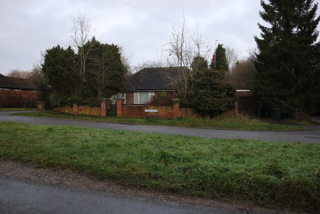
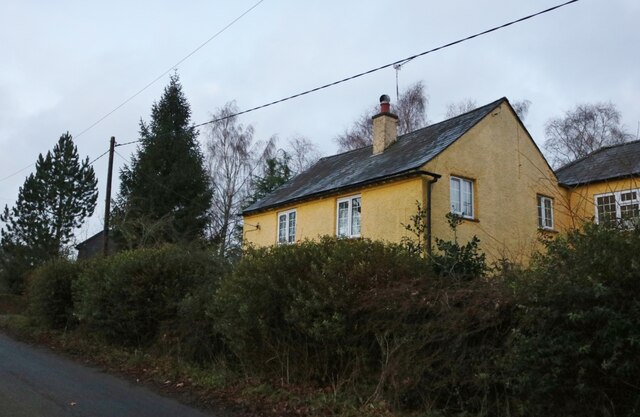
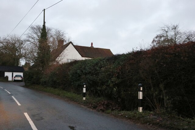
Hyde End is a tranquil and close-knit community with a population of around 200 residents. The village retains its rural charm, with traditional brick and flint cottages lining the streets. It offers a peaceful retreat from the hustle and bustle of nearby towns and cities.

Despite its small size, Hyde End has a rich history. The village dates back to medieval times and was mentioned in the Domesday Book of 1086. Many of the buildings in the village still showcase the architectural styles of bygone eras, providing a glimpse into its past.

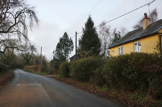
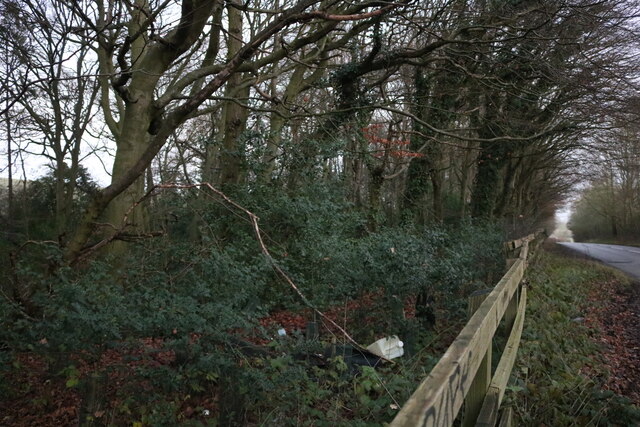
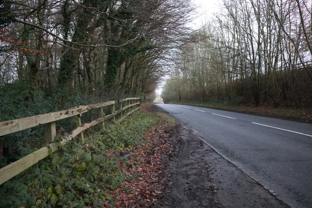
Surrounded by beautiful countryside, Hyde End is a haven for outdoor enthusiasts. The nearby Chiltern Hills offer ample opportunities for walking, hiking, and cycling, with scenic trails weaving through woodlands and fields. The area is also home to a variety of wildlife, making it a popular spot for nature lovers.

While Hyde End lacks its own amenities such as shops or schools, it benefits from being in close proximity to larger towns and cities. High Wycombe is just a short drive away, offering a range of facilities including shopping centers, schools, and leisure activities.

Overall, Hyde End is a charming village that offers a peaceful and idyllic lifestyle within a stunning natural setting.

If you have any feedback on the listing, please let us know in the comments section below.
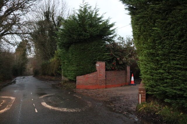
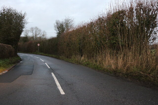
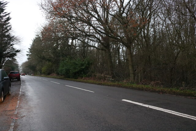
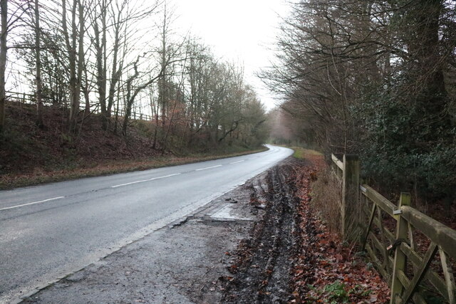
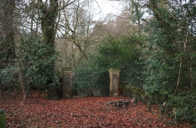
Hyde End Images

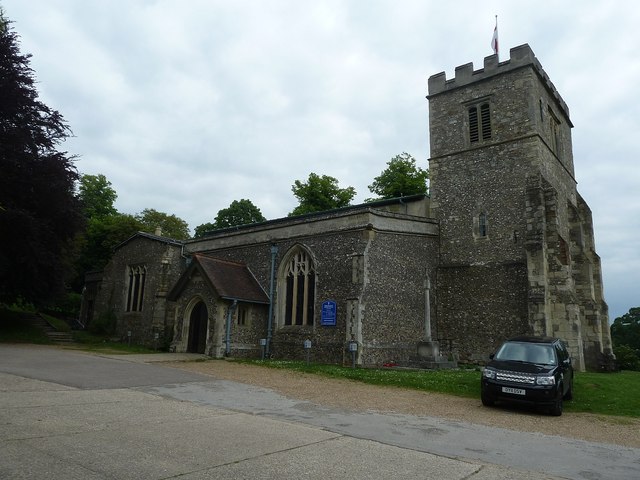
Images are sourced within 2km of 51.702065/-0.67089182 or Grid Reference SP9101. Thanks to Geograph Open Source API. All images are credited.

Roald Dahl's Grave, Great Missenden This photo shows the grave of Roald Dahl, the writer of children's books, in the churchyard of Great Missenden Parish Church. The dates on the gravestone are "13 September 1916" and "23 November 1990".
Roald Dahl's Grave, Great Missenden
This photo shows the grave of Roald Dahl, the writer of children's books, in the churchyard of Great Missenden Parish Church. The dates on the gravestone are "13 September 1916" and "23 November 1990".
Roald Dahl's Memorial Seat, Great Missenden This memorial seat to Roald Dahl, the children's writer, is in the churchyard adjacent to Great Missenden Parish Church. The wording on the stone parapet reads "We have tears in our eyes As we wave our goodbyes We so loved being with you we three So do please now and then Come and see us again The Giraffe and the Pelly and me". The names of his children Olivia, Tessa, Theo, Ophelia, Lucy, and stepchildren Neisha, Charlotte, Lorina can be seen engraved at the top of each seat.
Roald Dahl's Memorial Seat, Great Missenden
This memorial seat to Roald Dahl, the children's writer, is in the churchyard adjacent to Great Missenden Parish Church. The wording on the stone parapet reads "We have tears in our eyes As we wave our goodbyes We so loved being with you we three So do please now and then Come and see us again The Giraffe and the Pelly and me". The names of his children Olivia, Tessa, Theo, Ophelia, Lucy, and stepchildren Neisha, Charlotte, Lorina can be seen engraved at the top of each seat.
Roald Dahl's Grave and Memorial Seat, Great Missenden This photo shows Roald Dahl's grave and memorial seat in the churchyard adjacent to Great Missenden Parish Church. Two footprints can be seen marked on the ground between his grave and memorial seat.
Roald Dahl's Grave and Memorial Seat, Great Missenden
This photo shows Roald Dahl's grave and memorial seat in the churchyard adjacent to Great Missenden Parish Church. Two footprints can be seen marked on the ground between his grave and memorial seat.
Great Missenden - SS Peter & Paul - from SW SS Peter & Paul in Great Missenden is EH Grade I Listed <span class="nowrap"><a title="http://list.english-heritage.org.uk/resultsingle.aspx?uid=1124812&searchtype=mapsearch" rel="nofollow ugc noopener" href="http://list.english-heritage.org.uk/resultsingle.aspx?uid=1124812&searchtype=mapsearch">Link</a><img style="margin-left:2px;" alt="External link" title="External link - shift click to open in new window" src="https://s1.geograph.org.uk/img/external.png" width="10" height="10"/></span>
It is mainly C14th but was heightened in the next century and additions were made in the C16th and 18th and was restored at the end of the C19th.
It contains an "Aylesbury" font <a title="https://www.geograph.org.uk/photo/4021302" href="https://www.geograph.org.uk/photo/4021302">Link</a> dating originally from the C12th (see shared description below).
Great Missenden - SS Peter & Paul - from SW
SS Peter & Paul in Great Missenden is EH Grade I Listed LinkExternal link It is mainly C14th but was heightened in the next century and additions were made in the C16th and 18th and was restored at the end of the C19th. It contains an "Aylesbury" font Link dating originally from the C12th (see shared description below).
Gt. Missenden - SS Peter & Paul - from North Great Missenden's church of SS Peter & Paul taken looking across part of the car park in front of its northern flank. The church is EH Grade I listed <span class="nowrap"><a title="http://list.english-heritage.org.uk/resultsingle.aspx?uid=1124812&searchtype=mapsearch" rel="nofollow ugc noopener" href="http://list.english-heritage.org.uk/resultsingle.aspx?uid=1124812&searchtype=mapsearch">Link</a><img style="margin-left:2px;" alt="External link" title="External link - shift click to open in new window" src="https://s1.geograph.org.uk/img/external.png" width="10" height="10"/></span>
Gt. Missenden - SS Peter & Paul - from North
Great Missenden's church of SS Peter & Paul taken looking across part of the car park in front of its northern flank. The church is EH Grade I listed LinkExternal link
Gt. Missenden - SS Peter & Paul - "Aylesbury" font The font in  SS Peter & Paul, Gt. Missenden is one of the 22 (or 23) so-called "Aylesbury" fonts (see shared description below). However the upper part of the font is entirely different from any of the other surviving examples. The main differences are that it is octagonal rather than circular; there is no ornamentation below the rim and thirdly there is no fluting on the bowl.
The base however is unmistakably of the "Aylesbury" type, as is the rope-like band between the base and cup.
See also <a href="https://www.geograph.org.uk/photo/4021302">SP9001 : Gt. Missenden - SS Peter & Paul - Norman font</a> and <a href="https://www.geograph.org.uk/photo/4021309">SP9001 : Gt. Missenden - SS Peter & Paul - Font base detail</a> for other views.
Gt. Missenden - SS Peter & Paul - "Aylesbury" font
The font in SS Peter & Paul, Gt. Missenden is one of the 22 (or 23) so-called "Aylesbury" fonts (see shared description below). However the upper part of the font is entirely different from any of the other surviving examples. The main differences are that it is octagonal rather than circular; there is no ornamentation below the rim and thirdly there is no fluting on the bowl. The base however is unmistakably of the "Aylesbury" type, as is the rope-like band between the base and cup. See also SP9001 : Gt. Missenden - SS Peter & Paul - Norman font and SP9001 : Gt. Missenden - SS Peter & Paul - Font base detail for other views.
Great  Missenden : tower, Church of Saints Peter & Paul Grade I listed : brief description at this <span class="nowrap"><a title="https://historicengland.org.uk/listing/the-list/list-entry/1124812?section=official-list-entry" rel="nofollow ugc noopener" href="https://historicengland.org.uk/listing/the-list/list-entry/1124812?section=official-list-entry">Link</a><img style="margin-left:2px;" alt="External link" title="External link - shift click to open in new window" src="https://s1.geograph.org.uk/img/external.png" width="10" height="10"/></span>.
Great Missenden : tower, Church of Saints Peter & Paul
Grade I listed : brief description at this LinkExternal link.
King's Lane, South Heath
Potter Row, South Heath
Bud Cottage on Potter Row, South Heath An earlier visit <a title="https://www.geograph.org.uk/photo/5738161" href="https://www.geograph.org.uk/photo/5738161">Link</a>
Bud Cottage on Potter Row, South Heath
An earlier visit Link
Potter Row, South Heath
King's Lane, South Heath
Chesham Road, Hyde End
Chesham Road, Hundridge
Gate in Devil's Den, Hundridge It hasn't been used for a long time as a tree has grown across it.
Gate in Devil's Den, Hundridge
It hasn't been used for a long time as a tree has grown across it.
Devil's Den, Hundridge
Chesham Road, Hundridge
Show me another place!

Hyde End is located at Grid Ref: SP9101 (Lat: 51.702065, Lng: -0.67089182)

Unitary Authority: Buckinghamshire

Police Authority: Thames Valley

What 3 Words

///supplier.obscuring.theme. Near Hyde Heath, Buckinghamshire

Related Wikis

Hyde End

Hyde End is a small hamlet, in the civil parish of Great Missenden. it is located between the hamlets of Hyde Heath and South Heath along the B485 road...

Hyde House, Buckinghamshire

Hyde House is a Grade II listed early 18th-century country house near Hyde Heath in Buckinghamshire, England. It had previously belonged to Woburn Abbey...

Hundridge

Hundridge is a hamlet in the parish of Chartridge, in Buckinghamshire, England. It is located in the Chiltern Hills to the west of the town of Chesham...

Pednor House

Pednor House (formerly known as Little Pednor) is a house near Chartridge parish of Buckinghamshire. It has been listed Grade II on the National Heritage...

Nearby Amenities

Located within 500m of 51.702065,-0.67089182
Man Made: survey_point
Source: OS 1:25k
Survey Point: benchmark
Lat/Long: 51.6993834/-0.6766148
Man Made: survey_point
Source: OS 1:25k
Survey Point: benchmark
Lat/Long: 51.7018792/-0.6713037
FIXME: ?
Natural: water
Source: OS 1:25k
Water: pond
Lat/Long: 51.7000706/-0.6730203
The Hyde
Place: locality
Lat/Long: 51.6995985/-0.6739215
Friendly Lodge Farm
Place: farm
Source: OS 1:25k
Lat/Long: 51.6996051/-0.6729344
Post Box
Operator: Royal Mail
Post Box Type: lamp
Ref: HP16 81
Royal Cypher: EIIR
Royal Cypher Wikidata: Q33102113
Lat/Long: 51.7020273/-0.6706987
Power: pole
Lat/Long: 51.7020557/-0.6739667
Power: pole
Lat/Long: 51.7021903/-0.6753749
Power: pole
Lat/Long: 51.7023366/-0.6771398
Turning Loop
Lat/Long: 51.7024599/-0.6717991
Power: pole
Source: Bing
Lat/Long: 51.6980707/-0.6695166
Power: pole
Source: Bing
Lat/Long: 51.6982835/-0.6699833
Power: pole
Source: Bing
Lat/Long: 51.6994906/-0.6714317
The data included in this document is from www.openstreetmap.org. The data is made available under ODbL.

Have you been to Hyde End?

Leave your review of Hyde End below (or comments, questions and feedback).