Highfields

Settlement in Staffordshire Lichfield

England

Highfields

Preservation that went wrong – Chasewater – 1968 Peckett locomotive no.1823 of 1931 at Chasewater Railway. Intended for operation on the then relatively new heritage railway, it ended up being scrapped in the early 1970s.
Preservation that went wrong – Chasewater – 1968 Credit: Alan Murray-Rust

Highfields is a suburban area located in the county of Staffordshire, in the West Midlands region of England. Situated approximately 2 miles south-east of Stafford town center, it is a popular residential area with a population of around 10,000 people.

The area is characterized by a mix of housing types, including detached and semi-detached houses, as well as some apartment complexes. The majority of the properties are privately owned, although there are also some social housing developments.

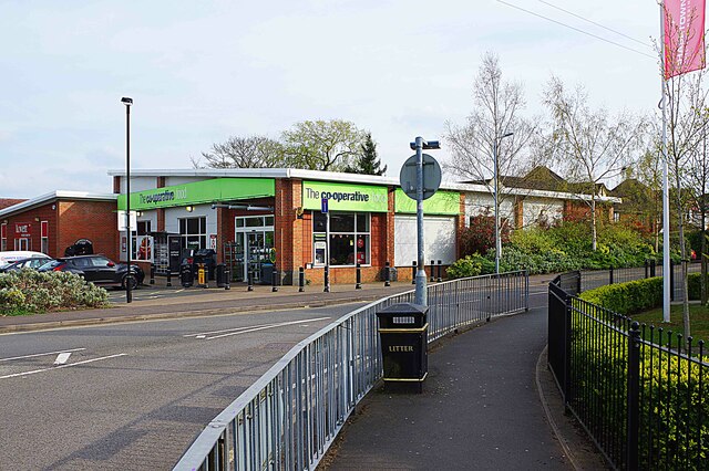
Highfields benefits from its close proximity to Stafford, which provides residents with access to a wide range of amenities and services. The town center offers a variety of shops, restaurants, and supermarkets, as well as leisure facilities such as gyms and a cinema. There are also several schools in the area, making it an attractive location for families.

For those who enjoy outdoor activities, Highfields is surrounded by beautiful countryside. The nearby Cannock Chase Area of Outstanding Natural Beauty provides opportunities for walking, cycling, and horse riding, while the Staffordshire and Worcestershire Canal offers scenic walks along its towpath.

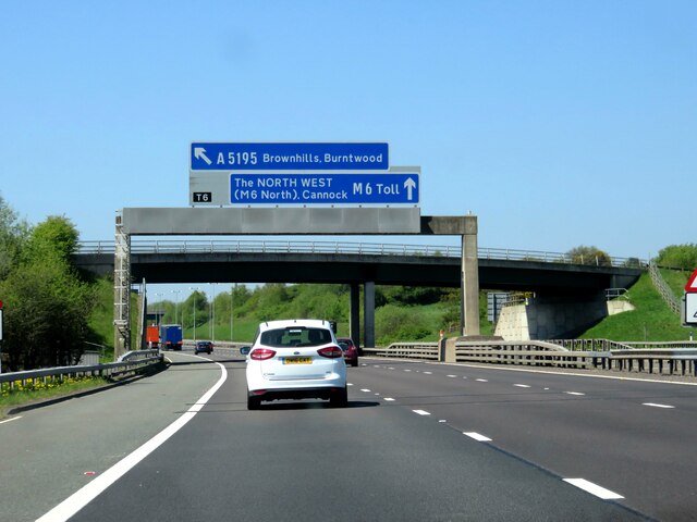
Transport links in Highfields are excellent, with regular bus services connecting the area to Stafford and other nearby towns. The M6 motorway is easily accessible, providing convenient access to Birmingham and Manchester.

Overall, Highfields offers a desirable residential location with a range of amenities, good transport links, and access to beautiful countryside.

If you have any feedback on the listing, please let us know in the comments section below.
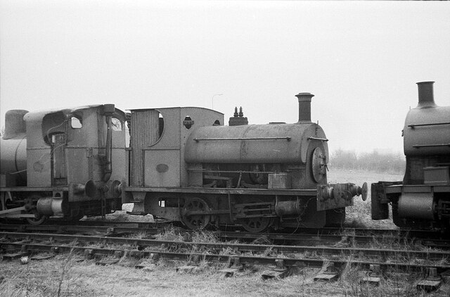
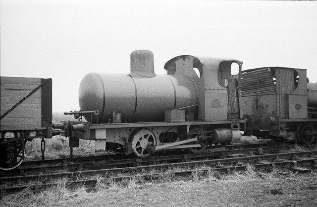
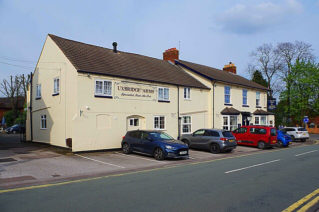
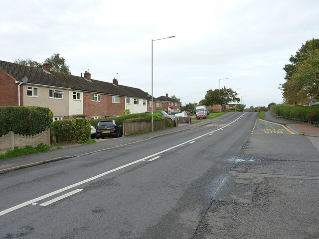
Highfields Images

Images are sourced within 2km of 52.669306/-1.9342261 or Grid Reference SK0407. Thanks to Geograph Open Source API. All images are credited.

Preservation that went wrong – Chasewater – 1968 Peckett locomotive no.1823 of 1931 at Chasewater Railway. Intended for operation on the then relatively new heritage railway, it ended up being scrapped in the early 1970s.
Preservation that went wrong – Chasewater – 1968
Peckett locomotive no.1823 of 1931 at Chasewater Railway. Intended for operation on the then relatively new heritage railway, it ended up being scrapped in the early 1970s.
Preservation that went wrong – Chasewater – 1969 Andrew Barclay fireless locomotive no.1562 of 1917 at Chasewater Railway. Intended for operation on the then relatively new heritage railway, it ended up being scrapped in the early 1970s. This view <a title="https://www.geograph.org.uk/photo/6639359" href="https://www.geograph.org.uk/photo/6639359">Link</a> shows it at work at Crawford's factory in Liverpool just 3 years previously.
Preservation that went wrong – Chasewater – 1969
Andrew Barclay fireless locomotive no.1562 of 1917 at Chasewater Railway. Intended for operation on the then relatively new heritage railway, it ended up being scrapped in the early 1970s. This view Link shows it at work at Crawford's factory in Liverpool just 3 years previously.
Chasewater Railway - assorted engines and rolling stock Seen at Brownhills West Station.
Chasewater Railway - assorted engines and rolling stock
Seen at Brownhills West Station.
Chasewater Railway - Brownhills West Station The last train of the day waiting to depart on its round trip. At this time of year only a diesel was operating with no steam engines in sight.
Chasewater Railway - Brownhills West Station
The last train of the day waiting to depart on its round trip. At this time of year only a diesel was operating with no steam engines in sight.
Chasewater Railway - last train of the day On a round trip from Brownhills West Station. This was the first point where I could cross the track to get the sun on this side. The locomotive is carrying the NCB Western Area legend and is, I believe, North British 0-4-0DH No. 27876 of 1958. It is privately owned.
Chasewater Railway - last train of the day
On a round trip from Brownhills West Station. This was the first point where I could cross the track to get the sun on this side. The locomotive is carrying the NCB Western Area legend and is, I believe, North British 0-4-0DH No. 27876 of 1958. It is privately owned.
Chasewater Railway - Brownhills West Station Looking into the station throat from the path alongside the line.
Chasewater Railway - Brownhills West Station
Looking into the station throat from the path alongside the line.
Chasewater Railway - Brownhills West Station The item on the left is a Merryweather Valiant portable steam fire pump. The stock on the right looks like it probably hasn't moved for some considerable time. I could see nothing about this particular locomotive on the website.
Chasewater Railway - Brownhills West Station
The item on the left is a Merryweather Valiant portable steam fire pump. The stock on the right looks like it probably hasn't moved for some considerable time. I could see nothing about this particular locomotive on the website.
Chasewater Railway - path crossing the formation
Water sports area, Chasewater Country Park At the southern end of the dam. Chasewater was built as a canal reservoir.
Water sports area, Chasewater Country Park
At the southern end of the dam. Chasewater was built as a canal reservoir.
'Do not feed the birds' at Chasewater Country Park Warning notice about avian flu on the bank of the canal reservoir, near the play area.
'Do not feed the birds' at Chasewater Country Park
Warning notice about avian flu on the bank of the canal reservoir, near the play area.
Boom across Chasewater reservoir Presumably to separate the water sports near the dam from other reservoir users at the country park.
Boom across Chasewater reservoir
Presumably to separate the water sports near the dam from other reservoir users at the country park.
Waterlogged grass, Chasewater Country Park The former site of a boating lake <a href="https://www.geograph.org.uk/photo/3699499">SK0307 : Boating Lake, Chasewater Country Park, Brownhills, Staffs</a>.
Waterlogged grass, Chasewater Country Park
Gantry sign over M6 Toll
The Co-operative, Unit 1-8 Highfields Road, Chasetown, Burntwood, Staffs This Co-operative store is primarily food focussed and is part of Central Co-op, a large independent co-operative group. The store is located on the corner of Highfields Road and Pool Road.
The Co-operative, Unit 1-8 Highfields Road, Chasetown, Burntwood, Staffs
This Co-operative store is primarily food focussed and is part of Central Co-op, a large independent co-operative group. The store is located on the corner of Highfields Road and Pool Road.
Uxbridge Arms (1), 2 Church Street, Chasetown, Burntwood, Staffs This public house was here by 1856 serving the growing community of Chasetown, which at that time was known as Cannock Chase, named after the nearby forest. The pub was acquired by Black Country Ales, and after major refurbishment it re-opened in August 2021.

<a href="https://www.geograph.org.uk/photo/7464733">SK0407 : Uxbridge Arms (2) - sign, 2 Church Street, Chasetown, Burntwood, Staffs</a>.
Uxbridge Arms (1), 2 Church Street, Chasetown, Burntwood, Staffs
This public house was here by 1856 serving the growing community of Chasetown, which at that time was known as Cannock Chase, named after the nearby forest. The pub was acquired by Black Country Ales, and after major refurbishment it re-opened in August 2021. SK0407 : Uxbridge Arms (2) - sign, 2 Church Street, Chasetown, Burntwood, Staffs.
Uxbridge Arms (2) - sign, 2 Church Street, Chasetown, Burntwood, Staffs The pub was purchased by Black Country Ales and re-opened in August 2021. They provided this new sign to replace the one seen in earlier photographs on this website.

<a href="https://www.geograph.org.uk/photo/7464671">SK0407 : Uxbridge Arms (1), 2 Church Street, Chasetown, Burntwood, Staffs</a>.
Uxbridge Arms (2) - sign, 2 Church Street, Chasetown, Burntwood, Staffs
The pub was purchased by Black Country Ales and re-opened in August 2021. They provided this new sign to replace the one seen in earlier photographs on this website. SK0407 : Uxbridge Arms (1), 2 Church Street, Chasetown, Burntwood, Staffs.
View along Brownhills Road
Show me another place!

Highfields is located at Grid Ref: SK0407 (Lat: 52.669306, Lng: -1.9342261)

Administrative County: Staffordshire

District: Lichfield

Police Authority: Staffordshire

What 3 Words

///prompting.button.voices. Near Chasetown, Staffordshire

Nearby Locations

Highfields

Related Wikis

Erasmus Darwin Academy

Erasmus Darwin Academy (previously Chasetown High School, then Chasetown Specialist Sports College) is a coeducational secondary school and sixth form...

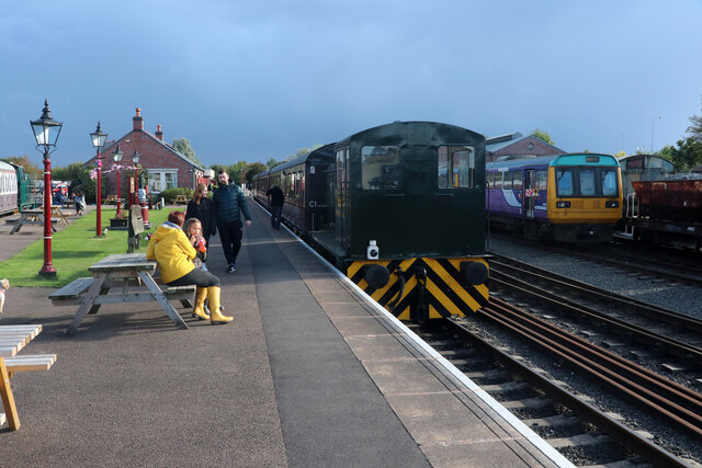
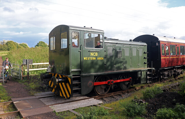
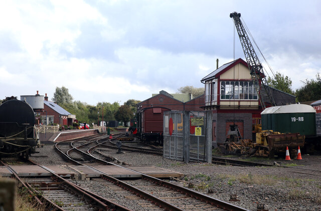
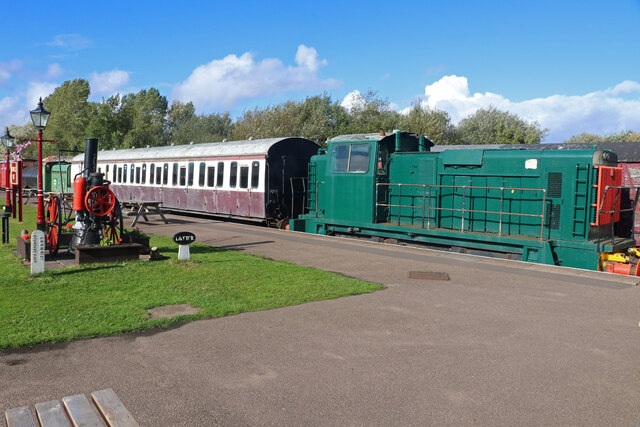
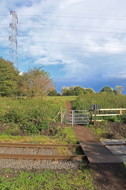
Chasetown (Church Street) railway station

Chasetown (Church Street) is a heritage railway station on the Chasewater Railway. It is the north-eastern terminus of the line and consists of a single...
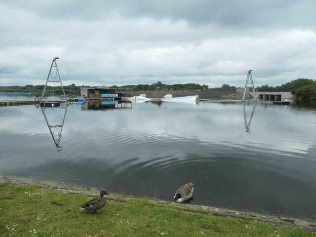
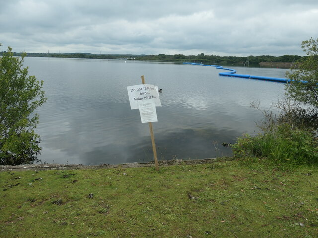
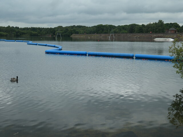
Chasewater

Chasewater is a reservoir located in the parish of Burntwood and the district of Lichfield in Staffordshire, England. Originally known as Norton Pool and...

Chasetown

Chasetown is a village in the town of Burntwood in Staffordshire, England. It is split between the civil parishes of Burntwood and Hammerwich. == History... ==

Nearby Amenities

Located within 500m of 52.669306,-1.9342261
Mini Roundabout
Direction: clockwise
Lat/Long: 52.6693286/-1.934261
Pub
The Junction
Addr Housenumber: 1
Addr Postcode: WS7 4QQ
Addr Street: Queen Street
Fhrs Id: 1249274
Source Addr: FHRS Open Data
Lat/Long: 52.670796/-1.9339937
Pub
The Uxbridge Arms
Addr Housenumber: 2
Addr Postcode: WS7 3QL
Addr Street: Church Street
Fhrs Id: 1249314
Source Addr: FHRS Open Data
Lat/Long: 52.6693941/-1.9343635
Fast Food
Queens Fish Bar
Addr Housenumber: 79
Addr Postcode: WS7 4QQ
Addr Street: Queen Street
Cuisine: fish_and_chips
Fhrs Id: 1249276
Source Addr: FHRS Open Data
Lat/Long: 52.6717109/-1.9323253
Pub
The Crown
Addr Postcode: WS7 3XF
Addr Street: High Street
Fhrs Id: 1249330
Source Addr: FHRS Open Data
Lat/Long: 52.6715786/-1.9339952
Pub
The Swan
Lat/Long: 52.672057/-1.9342705
Pub
The Miners Rest
Addr Housenumber: 29
Addr Postcode: WS7 4QS
Addr Street: Highfields Road
Fhrs Id: 1249556
Source Addr: FHRS Open Data
Lat/Long: 52.6687006/-1.9297255
Chasetown
Place: village
Wikidata: Q5087254
Wikipedia: en:Chasetown
Lat/Long: 52.6733979/-1.9328793
Bus Stop
Chestnut Court
Bus: yes
Naptan AtcoCode: 3800C415201
Naptan Bearing: SE
Naptan CommonName: Chestnut Court
Naptan Indicator: Adj
Naptan Landmark: Chestnut Court
Naptan Street: Highfields Road
Naptan Verified: no
Public Transport: platform
Source: naptan_import
Lat/Long: 52.6683564/-1.9287674
Bus Stop
Chestnut Court
Bus: yes
Naptan AtcoCode: 3800C415202
Naptan Bearing: NW
Naptan CommonName: Chestnut Court
Naptan Indicator: Opp
Naptan Landmark: Chestnut Court
Naptan Street: Highfields Rd
Naptan Verified: no
Public Transport: platform
Source: naptan_import
Lat/Long: 52.6685462/-1.9304529
Bus Stop
Queen Street
Bus: yes
Naptan AtcoCode: 3800C415901
Naptan Bearing: S
Naptan CommonName: Queen Street
Naptan Indicator: Adj
Naptan Landmark: Queen Street
Naptan Street: High Street
Naptan Verified: no
Public Transport: platform
Source: naptan_import
Lat/Long: 52.6698249/-1.9340592
Bus Stop
Queen Street
Bus: yes
Naptan AtcoCode: 3800C415902
Naptan Bearing: N
Naptan CommonName: Queen Street
Naptan Indicator: Opp
Naptan Landmark: Queen Street
Naptan Street: High Street
Naptan Verified: no
Public Transport: platform
Source: naptan_import
Lat/Long: 52.6700227/-1.934266
Bus Stop
Union Street
Bus: yes
Naptan AtcoCode: 3800C492501
Naptan Bearing: N
Naptan CommonName: Union Street
Naptan Indicator: Adj
Naptan Landmark: Union Street
Naptan Street: High Street
Naptan Verified: no
Public Transport: platform
Source: naptan_import
Lat/Long: 52.6729894/-1.934158
Bus Stop
Cottage Lane
Bus: yes
Naptan AtcoCode: 3800C493601
Naptan Bearing: NE
Naptan CommonName: Cottage Lane
Naptan Indicator: Adj
Naptan Landmark: Cottage Lane
Naptan Street: Queen Street
Naptan Verified: no
Public Transport: platform
Source: naptan_import
Lat/Long: 52.6721064/-1.9307874
Bus Stop
Lawnswood Avenue
Bus: yes
Naptan AtcoCode: 3800C493602
Naptan Bearing: SW
Naptan CommonName: Lawnswood Avenue
Naptan Indicator: Adj
Naptan Landmark: Lawnswood Avenue
Naptan Street: Queen Street
Naptan Verified: no
Public Transport: platform
Source: naptan_import
Lat/Long: 52.6720255/-1.9307432
Bus Stop
The Clock
Bus: yes
Naptan AtcoCode: 3800C493700
Naptan Bearing: SW
Naptan CommonName: The Clock
Naptan Indicator: Adj
Naptan Landmark: The Clock
Naptan Street: Queen St/High St
Naptan Verified: no
Public Transport: platform
Source: naptan_import
Lat/Long: 52.6704988/-1.9335406
Bus Stop
King Street
Bus: yes
Naptan AtcoCode: 3800C493701
Naptan Bearing: NE
Naptan CommonName: King Street
Naptan Indicator: Opp
Naptan Landmark: King Street
Naptan Street: Queen Street
Naptan Verified: no
Public Transport: platform
Source: naptan_import
Lat/Long: 52.6706516/-1.9334812
Bus Stop
High Street
Bus: yes
Naptan AtcoCode: 3800C494701
Naptan Bearing: SE
Naptan CommonName: High Street
Naptan Indicator: Adj
Naptan Landmark: High Street
Naptan Street: Highfields Road
Naptan Verified: no
Public Transport: platform
Source: naptan_import
Lat/Long: 52.6692132/-1.9333651
Pool Road
Naptan AtcoCode: 3800C494702
Naptan Bearing: NW
Naptan BusStopType: CUS
Naptan CommonName: Pool Road
Naptan Indicator: Adj
Naptan Landmark: Pool Road
Naptan Street: Highfields Road
Naptan Verified: no
Source: naptan_import
Lat/Long: 52.6691053/-1.9334244
Mini Roundabout
Source: bing
Lat/Long: 52.6701928/-1.9341587
Place Of Worship
Source: OS_OpenData_StreetView
Lat/Long: 52.6724796/-1.9346679
Access: private
Entrance: yes
Wheelchair: limited
Lat/Long: 52.6697985/-1.9372598
Power: pole
Source: Bing
Lat/Long: 52.6682733/-1.9411366
Power: pole
Source: Bing
Lat/Long: 52.6676917/-1.9404389
Power: pole
Source: Bing
Lat/Long: 52.6669739/-1.9395778
Post Office
Chasetown Post Office
Addr City: Chasetown
Addr Housenumber: 57
Addr Postcode: WS7 3XE
Addr Street: High Street
Brand: Post Office
Brand Wikidata: Q1783168
Fhrs Id: 1249328
Fixme: verify by survey
Opening Hours: Mo-Sa 08:00-19:30; Su 08:00-13:30
Ref Pol Id: 96781
Source: pol_branch_list_2018-02
Source Addr: FHRS Open Data
Website: https://www.postoffice.co.uk/branch-finder/2662426/chasetown
Lat/Long: 52.67216/-1.93428
Barrier: bollard
Lat/Long: 52.6727454/-1.9333868
Generator Method: photovoltaic
Generator Output Electricity: yes
Generator Source: solar
Generator Type: solar_photovoltaic_panel
Location: roof
Power: generator
Lat/Long: 52.6690633/-1.9294551
Generator Method: photovoltaic
Generator Output Electricity: yes
Generator Source: solar
Generator Type: solar_photovoltaic_panel
Location: roof
Power: generator
Lat/Long: 52.6690128/-1.9292298
Generator Method: photovoltaic
Generator Output Electricity: yes
Generator Source: solar
Generator Type: solar_photovoltaic_panel
Location: roof
Power: generator
Lat/Long: 52.6691804/-1.9285941
Generator Method: photovoltaic
Generator Output Electricity: yes
Generator Source: solar
Generator Type: solar_photovoltaic_panel
Location: roof
Power: generator
Lat/Long: 52.6689803/-1.9290072
Generator Method: photovoltaic
Generator Output Electricity: yes
Generator Source: solar
Generator Type: solar_photovoltaic_panel
Location: roof
Power: generator
Lat/Long: 52.6689738/-1.9289267
Generator Method: photovoltaic
Generator Output Electricity: yes
Generator Source: solar
Generator Type: solar_photovoltaic_panel
Location: roof
Power: generator
Lat/Long: 52.6689494/-1.9275293
Generator Method: photovoltaic
Generator Output Electricity: yes
Generator Source: solar
Generator Type: solar_photovoltaic_panel
Location: roof
Power: generator
Lat/Long: 52.6720641/-1.9336689
Generator Method: photovoltaic
Generator Output Electricity: yes
Generator Source: solar
Generator Type: solar_photovoltaic_panel
Location: roof
Power: generator
Lat/Long: 52.6713729/-1.9339719
Generator Method: photovoltaic
Generator Output Electricity: yes
Generator Source: solar
Generator Type: solar_photovoltaic_panel
Location: roof
Power: generator
Lat/Long: 52.6734628/-1.9339344
Stop
Direction: backward
Lat/Long: 52.6723414/-1.9341939
The data included in this document is from www.openstreetmap.org. The data is made available under ODbL.

Have you been to Highfields?

Leave your review of Highfields below (or comments, questions and feedback).