Higher Broadhalgh

Settlement in Lancashire

England

Higher Broadhalgh

Waste Water Conduit over Trout Brook A pipe bridge which transports raw sewerage from Blackburn to the treatment facility at Salmesbury.
Waste Water Conduit over Trout Brook Credit: Chris Heaton

Higher Broadhalgh is a small village located in the county of Lancashire, England. Situated in the North West region of the country, it lies approximately 12 miles north of the city of Manchester. The village is part of the borough of Rossendale and falls within the boundaries of the civil parish of Edenfield.

With a population of around 400 residents, Higher Broadhalgh is known for its picturesque and tranquil setting. Surrounded by rolling hills and green pastures, the village offers breathtaking views of the surrounding countryside. The area is predominantly rural, with a few scattered farms and cottages dotting the landscape.

Despite its small size, Higher Broadhalgh has a strong sense of community, with various community events and activities organized throughout the year. The village also benefits from a local pub, offering a gathering place for locals and visitors alike.

The village provides easy access to nearby amenities and services. The larger town of Rawtenstall is only a short drive away, offering a wider range of shops, restaurants, and other facilities. Additionally, the city of Manchester is within commuting distance, making Higher Broadhalgh an attractive location for those seeking a quieter lifestyle while still being within reach of urban amenities.

Overall, Higher Broadhalgh presents an idyllic rural retreat in the heart of Lancashire, boasting stunning natural scenery and a close-knit community spirit.

If you have any feedback on the listing, please let us know in the comments section below.

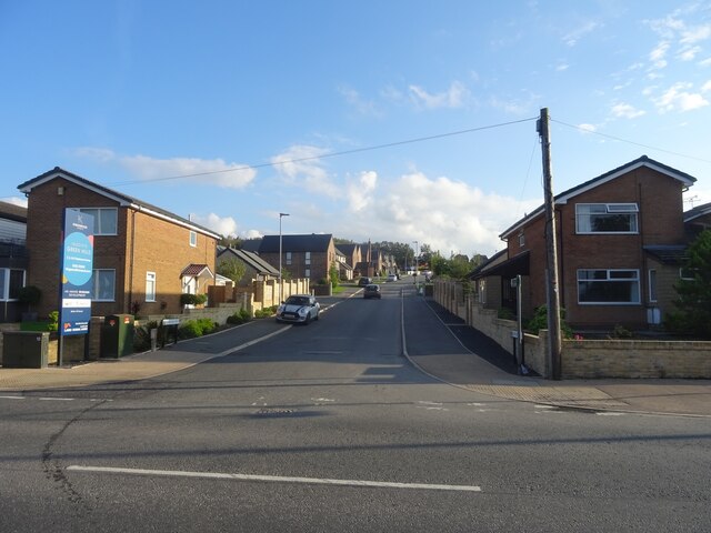
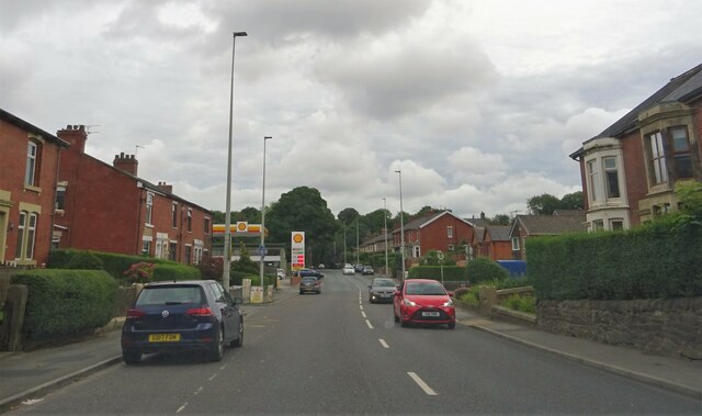
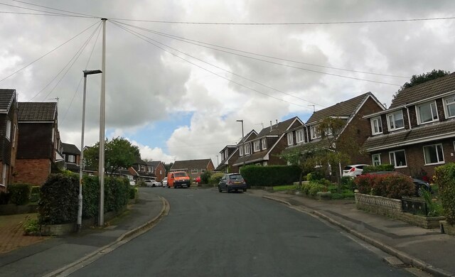
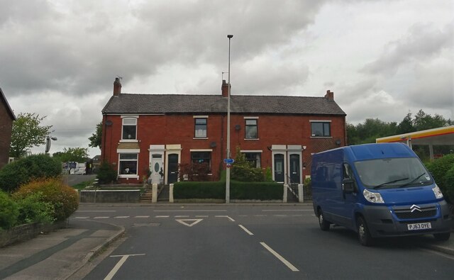
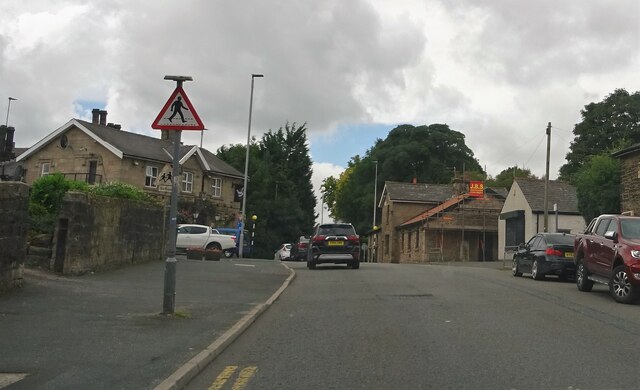
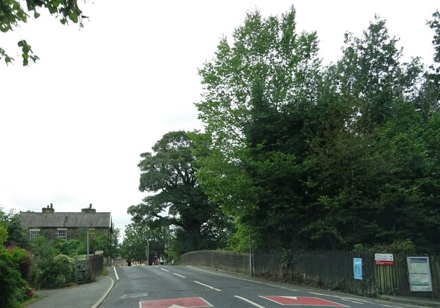
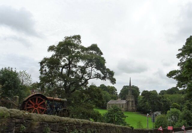
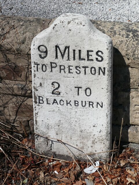
Higher Broadhalgh Images

Images are sourced within 2km of 53.725299/-2.5311681 or Grid Reference SD6525. Thanks to Geograph Open Source API. All images are credited.

Waste Water Conduit over Trout Brook A pipe bridge which transports raw sewerage from Blackburn to the treatment facility at Salmesbury.
Waste Water Conduit over Trout Brook
A pipe bridge which transports raw sewerage from Blackburn to the treatment facility at Salmesbury.
Long Lane Descending towards the community of Pleasington
Long Lane
Descending towards the community of Pleasington
Moorland Drive, Green Hills, Livesey Looking up Moorland Drive, entrance to the recently-built Green Hills estate.
Moorland Drive, Green Hills, Livesey
Looking up Moorland Drive, entrance to the recently-built Green Hills estate.
Pleasington Priory churchyard Looking north from the church door.
Pleasington Priory churchyard
Looking north from the church door.
Gateway to Pleasington Priory The R.C. church is dedicated to Ss. Mary and John the Baptist. It is within the parish of St. Oscar Romero in the Diocese of Salford.
Gateway to Pleasington Priory
The R.C. church is dedicated to Ss. Mary and John the Baptist. It is within the parish of St. Oscar Romero in the Diocese of Salford.
The Butlers Arms The pub, in Pleasington, is currently closed and the lease is for sale.
The Butlers Arms
The pub, in Pleasington, is currently closed and the lease is for sale.
Electricity Pole By Moulden Brow (A674) east of Riley Green.
Electricity Pole
By Moulden Brow (A674) east of Riley Green.
Preston Old Road In Feniscowles.
Preston Old Road
In Feniscowles.
Park Farm Road In Feniscowles.
Park Farm Road
In Feniscowles.
Preston Old Road From Park Farm Road in Feniscowles.
Preston Old Road
From Park Farm Road in Feniscowles.
Preston Old Road In Feniscowles.
Preston Old Road
In Feniscowles.
Car park entrance The church car park in Pleasington is off Priory Close.
Car park entrance
The church car park in Pleasington is off Priory Close.
Victoria Road, Pleasington At the bridge over the line at Pleasington railway station.
Victoria Road, Pleasington
At the bridge over the line at Pleasington railway station.
Church of Immanuel A C. of E. church at Feniscowles. The building is Grade II listed. The old tractor in the left foreground is currently being used as a garden ornament.
Church of Immanuel
A C. of E. church at Feniscowles. The building is Grade II listed. The old tractor in the left foreground is currently being used as a garden ornament.
Old Milestone, A674, Preston Old Road, Blackburn The milestone is located against the wall at the back of the pavement, outside Mambo’s Tanning Centre, no. 434, on the north west side of the road. Parish of Livesey (Blackburn with Darwen District). Carved stone post, erected by the Bolton & Blackburn turnpike trust (Livesey branch) in the 19th century. 

Inscription reads:-
9 MILES / TO PRESTON / 2 TO / BLACKBURN 

Milestone Society National ID: LA_PSBB09
Old Milestone, A674, Preston Old Road, Blackburn
The milestone is located against the wall at the back of the pavement, outside Mambo’s Tanning Centre, no. 434, on the north west side of the road. Parish of Livesey (Blackburn with Darwen District). Carved stone post, erected by the Bolton & Blackburn turnpike trust (Livesey branch) in the 19th century. Inscription reads:- 9 MILES / TO PRESTON / 2 TO / BLACKBURN Milestone Society National ID: LA_PSBB09
A sculpture and flower bed at Pleasington Crematorium
The graveyard in Pleasington cemetery
OS Flush Bracket Flush Bracket G3395: Feniscowles.
OS Flush Bracket
Flush Bracket G3395: Feniscowles.
Show me another place!

Higher Broadhalgh is located at Grid Ref: SD6525 (Lat: 53.725299, Lng: -2.5311681)

Unitary Authority: Blackburn with Darwen

Police Authority: Lancashire

What 3 Words

///bravo.jungle.moving. Near Blackburn, Lancashire

Related Wikis

Feniscowles railway station

Feniscowles railway station was a railway station that served the village of Feniscowles, in Blackburn with Darwen in Lancashire, England. == History... ==

Feniscowles

Feniscowles is a village in the unitary authority of Blackburn with Darwen, Lancashire, England. It lies approximately 3 miles (4.8 km) west of Blackburn...

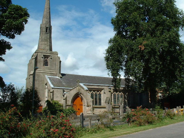
Immanuel Church, Feniscowles

Immanuel Church is in the village of Feniscowles, near Blackburn, Lancashire, England. It is an active Anglican parish church in the deanery of Blackburn...
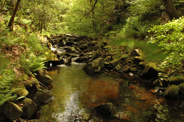
River Roddlesworth

The River Roddlesworth (also known as Rocky Brook) is a river in Lancashire, England, a tributary of the River Darwen. == Course == The source of the river...

Nearby Amenities

Located within 500m of 53.725299,-2.5311681
Feniscowles
Abandoned Railway: station
Railway: site
Source: OS 1:25k
Lat/Long: 53.7220173/-2.5332971
Feniscowles
Place: suburb
Lat/Long: 53.7255682/-2.5360317
Cherry Tree
Place: suburb
Lat/Long: 53.7294649/-2.529324
Source: npe
Lat/Long: 53.7249077/-2.5269697
Turning Circle
Lat/Long: 53.7295289/-2.5299207
Post Box
Operator: Royal Mail
Post Box Design: type_g
Post Box Type: pillar
Ref: BB2 135
Royal Cypher: EIIR
Royal Cypher Wikidata: Q33102113
Lat/Long: 53.7281316/-2.5313647
Telephone
Booth: KX100
Covered: booth
Lat/Long: 53.728195/-2.5314184
Barrier: bollard
Bollard: fixed
Foot: yes
Lat/Long: 53.7268641/-2.538265
Post Box
Collection Times: Mo-Fr 09:00; Sa 07:00
Lat/Long: 53.7252357/-2.5251688
Post Box
Postal Code: BB2
Ref: BB2 184
Lat/Long: 53.7230276/-2.5319465
Restaurant
The Foundry Tap & Kitchen
Addr City: Blackburn
Addr Housenumber: 631
Addr Postcode: BB2 5DQ
Addr Street: Livesey Branch Road
Cuisine: fish
Fhrs Id: 211145
Old Name: Hordens
Lat/Long: 53.7227457/-2.5319742
Bus Stop
Feildens Arms
Bench: yes
Bin: yes
Lit: yes
Naptan AtcoCode: 2580FCW0001
Naptan NaptanCode: blagjgt
Note: FIXME - check ref - may have changed to Blackburn with Darwen code
Public Transport: platform
Ref: landtgtm
Shelter: yes
Tactile Paving: no
Lat/Long: 53.7267837/-2.5381373
Bus Stop
Three Arches
Public Transport: platform
Lat/Long: 53.7277195/-2.5335605
Bus Stop
Three Arches
Naptan AtcoCode: 2580FCW0009
Naptan NaptanCode: blagjmw
Public Transport: platform
Lat/Long: 53.7279301/-2.533192
Bus Stop
Woodlands Avenue
Naptan AtcoCode: 2580CHT0014
Naptan NaptanCode: bladtwp
Public Transport: platform
Lat/Long: 53.7290201/-2.528656
Place Of Worship
Feniscowles Methodist church
Denomination: methodist
Religion: christian
Lat/Long: 53.7266309/-2.5380662
Bus Stop
Oyster and Otter
Operator: Transdev
Public Transport: platform
Lat/Long: 53.7230123/-2.5319436
Turning Circle
Lat/Long: 53.7287005/-2.5314496
Turning Circle
Lat/Long: 53.7212095/-2.5342096
Turning Circle
Lat/Long: 53.7271243/-2.5337201
Turning Circle
Lat/Long: 53.7246431/-2.5360322
Turning Circle
Lat/Long: 53.7244313/-2.5333259
Turning Circle
Lat/Long: 53.7239298/-2.5333473
Turning Circle
Lat/Long: 53.7234338/-2.533354
Turning Circle
Lat/Long: 53.7224316/-2.5369522
Turning Circle
Lat/Long: 53.7250597/-2.5332293
Turning Circle
Lat/Long: 53.7243011/-2.5268497
Turning Circle
Lat/Long: 53.7229413/-2.5296428
Turning Circle
Lat/Long: 53.7222266/-2.5294422
Turning Circle
Lat/Long: 53.7227998/-2.5304869
Turning Circle
Lat/Long: 53.725135/-2.5380146
Station Garage
Addr City: Blackburn
Addr Housenumber: 627
Addr Postcode: BB2 5DQ
Addr Street: Livesey Branch Road
Phone: +44 1254 201681
Shop: car_repair
Lat/Long: 53.7230244/-2.5311825
The Holiday Shop
Addr City: Blackburn
Addr Housenumber: 627
Addr Postcode: BB2 5DQ
Addr Street: Livesey Branch Road
Phone: +44 1254 727333
Shop: travel_agency
Lat/Long: 53.7229768/-2.5313299
Atm
Lat/Long: 53.7259955/-2.5238159
Bus Stop
Oyster and Otter
Operator: Transdev
Public Transport: platform
Lat/Long: 53.7228593/-2.5321225
Bus Stop
Star Drive
Naptan AtcoCode: 2580FCW0004
Naptan NaptanCode: blagjmd
Operator: Transdev
Public Transport: platform
Lat/Long: 53.7226769/-2.535799
Bus Stop
Star Drive
Bench: no
Bin: no
Operator: Transdev
Public Transport: platform
Shelter: no
Lat/Long: 53.7229616/-2.5367543
Bus Stop
Tesco
Operator: Transdev
Public Transport: platform
Lat/Long: 53.7252681/-2.5250825
Drinks 'n Things
Addr City: Blackburn
Addr Housenumber: 579
Addr Postcode: BB2 5HD
Addr Street: Preston Old Road
Addr Suburb: Cherry Tree
Shop: convenience
Lat/Long: 53.7279761/-2.5313864
Turning Circle
Lat/Long: 53.7266189/-2.5336652
Turning Circle
Lat/Long: 53.7226241/-2.5342752
Fesniscowles & Pleasington Memorial
Historic: memorial
Inscription: Lest we forget. Those formerly resident in Feniscowles and Pleasington who fell and died in the great war 1914-18 and all conflicts since. This recreation ground is a permanent tribute to their memory...
Material: stone
Memorial: stone
Lat/Long: 53.7244275/-2.5385747
Turning Circle
Lat/Long: 53.7257796/-2.5336307
Turning Circle
Lat/Long: 53.7256653/-2.5341833
Fast Food
Lee's
Addr City: Blackburn
Addr Housenumber: 702
Addr Postcode: BB2 5EP
Addr Street: Preston Old Road
Addr Suburb: Feniscowles
Cuisine: chinese
Fhrs Id: 865145
Takeaway: only
Lat/Long: 53.727034/-2.5378552
Doctors
Feniscowles Surgery
Addr City: Blackburn
Addr Housenumber: 696
Addr Postcode: BB2 5EP
Addr Street: Preston Old Road
Addr Suburb: Feniscowles
Opening Hours: Mo,We,Fr 09:00-13:00, 14:00-17:00
Lat/Long: 53.7271276/-2.5375092
Halo Hair & Beauty
Addr City: Blackburn
Addr Housenumber: 698
Addr Postcode: BB2 5EP
Addr Street: Preston Old Road
Addr Suburb: Feniscowles
Shop: beauty
Lat/Long: 53.7271118/-2.5375696
Direction: SE
Generator Method: photovoltaic
Generator Output Electricity: yes
Generator Solar Modules: 16
Generator Source: solar
Generator Type: solar_photovoltaic_panel
Location: roof
Power: generator
Lat/Long: 53.7249345/-2.5384621
Turning Circle
Lat/Long: 53.7224088/-2.531316
Direction: S
Generator Method: photovoltaic
Generator Output Electricity: yes
Generator Solar Modules: 18
Generator Source: solar
Generator Type: solar_photovoltaic_panel
Location: roof
Power: generator
Lat/Long: 53.7272125/-2.5338694
Direction: S
Generator Method: photovoltaic
Generator Output Electricity: yes
Generator Solar Modules: 18
Generator Source: solar
Generator Type: solar_photovoltaic_panel
Location: roof
Power: generator
Lat/Long: 53.7271221/-2.5344273
Direction: NW
Generator Method: photovoltaic
Generator Output Electricity: yes
Generator Solar Modules: 12
Generator Source: solar
Generator Type: solar_photovoltaic_panel
Location: roof
Power: generator
Lat/Long: 53.7291874/-2.5315064
Direction: SE
Generator Method: photovoltaic
Generator Output Electricity: yes
Generator Solar Modules: 12
Generator Source: solar
Generator Type: solar_photovoltaic_panel
Location: roof
Power: generator
Lat/Long: 53.729185/-2.5314541
Harvey McNally
Addr City: Blackburn
Addr Housenumber: 585
Addr Postcode: BB2 5HD
Addr Street: Preston Old Road
Addr Suburb: Cherry Tree
Shop: hairdresser
Lat/Long: 53.7280417/-2.5314528
The data included in this document is from www.openstreetmap.org. The data is made available under ODbL.

Have you been to Higher Broadhalgh?

Leave your review of Higher Broadhalgh below (or comments, questions and feedback).