Guay

Settlement in Perthshire

Scotland

Guay

Willie Birrell Memorial The roadside memorial to Willie Birrell at West Banald.
Willie Birrell Memorial Credit: Scott Cormie

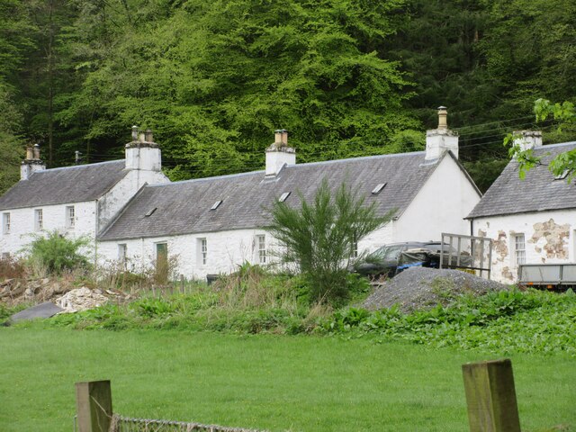
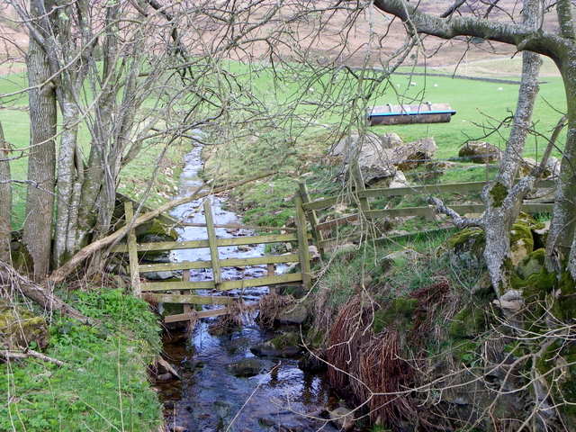
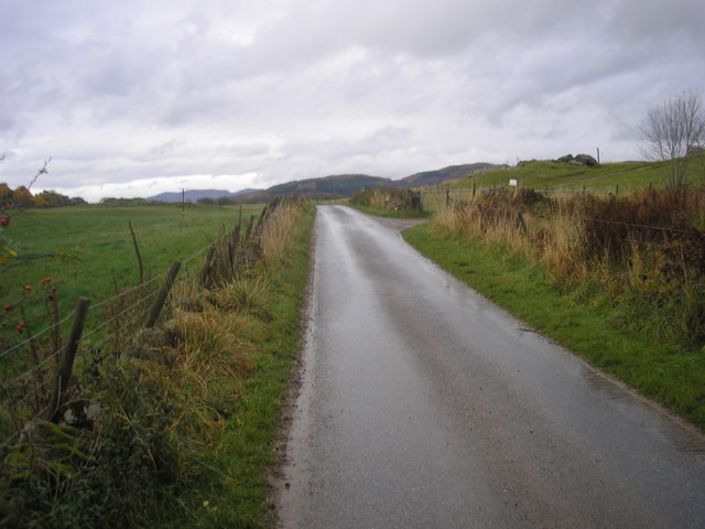
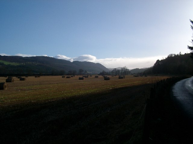
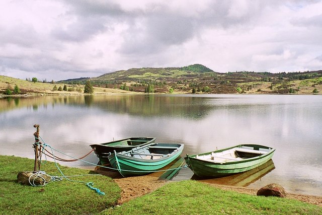
Guay is a small village located in the region of Perthshire, Scotland. Situated approximately 9 miles south of the town of Blairgowrie, Guay is nestled amidst the picturesque landscape of the Scottish Highlands. The village is surrounded by rolling hills, lush green meadows, and dense woodlands, offering breathtaking views and a tranquil atmosphere.

Guay is known for its rich history, dating back to ancient times. The area was once inhabited by the Picts, an ancient Celtic people, and evidence of their presence can still be seen in the form of standing stones and burial mounds scattered throughout the region.

Despite its small size, Guay offers a range of amenities and services to its residents and visitors. The village is home to a quaint community center, a primary school, and a traditional pub, where locals and tourists can enjoy a warm meal and a drink. Outdoor enthusiasts are also catered to, with numerous walking and hiking trails crisscrossing the surrounding countryside, providing opportunities for exploration and adventure.

The village hosts a number of annual events, including a summer festival that celebrates the local culture and heritage. This lively event attracts people from near and far, offering entertainment, food stalls, and various activities for all ages.

Overall, Guay is a charming and peaceful village, offering a serene escape from the hustle and bustle of city life. Its stunning natural surroundings and welcoming community make it an ideal destination for those seeking a true taste of rural Scotland.

If you have any feedback on the listing, please let us know in the comments section below.

Guay Images

Images are sourced within 2km of 56.624098/-3.6303237 or Grid Reference NO0049. Thanks to Geograph Open Source API. All images are credited.

Willie Birrell Memorial The roadside memorial to Willie Birrell at West Banald.
Willie Birrell Memorial
The roadside memorial to Willie Birrell at West Banald.
Railway bridge over the River Tay
A9, Strath Tay The A9 is a strategic link between the Highlands of Scotland and the Central Belt. It runs 279 miles from junction 5 of the M9 at Polmont to Scrabster. Originally it ran from Edinburgh.
<span class="nowrap"><a title="https://www.sabre-roads.org.uk/wiki/index.php?title=A9" rel="nofollow ugc noopener" href="https://www.sabre-roads.org.uk/wiki/index.php?title=A9">Link</a><img style="margin-left:2px;" alt="External link" title="External link - shift click to open in new window" src="https://s1.geograph.org.uk/img/external.png" width="10" height="10"/></span>
A9, Strath Tay
The A9 is a strategic link between the Highlands of Scotland and the Central Belt. It runs 279 miles from junction 5 of the M9 at Polmont to Scrabster. Originally it ran from Edinburgh. LinkExternal link
A9, northbound The A9 is a strategic link between the Highlands of Scotland and the Central Belt. It runs 279 miles from junction 5 of the M9 at Polmont to Scrabster. Originally it ran from Edinburgh.
<span class="nowrap"><a title="https://www.sabre-roads.org.uk/wiki/index.php?title=A9" rel="nofollow ugc noopener" href="https://www.sabre-roads.org.uk/wiki/index.php?title=A9">Link</a><img style="margin-left:2px;" alt="External link" title="External link - shift click to open in new window" src="https://s1.geograph.org.uk/img/external.png" width="10" height="10"/></span>
A9, northbound
The A9 is a strategic link between the Highlands of Scotland and the Central Belt. It runs 279 miles from junction 5 of the M9 at Polmont to Scrabster. Originally it ran from Edinburgh. LinkExternal link
Dalguise Viaduct Constructed in 1863 using two lattice girders. It was designed by one Joseph Mitchell. It incorporates Castellated Abutments supposedly to please the Duke of Atholl.
Dalguise Viaduct
Constructed in 1863 using two lattice girders. It was designed by one Joseph Mitchell. It incorporates Castellated Abutments supposedly to please the Duke of Atholl.
Signage - A9 northbound
Kinnaird House & Grounds Looking north from the B898 to Kinnaird House.
Kinnaird House & Grounds
Looking north from the B898 to Kinnaird House.
Sheep near Kincraigie Sheep with lambs in a field on the west side of the River Tay at Kincraigie.
Sheep near Kincraigie
Sheep with lambs in a field on the west side of the River Tay at Kincraigie.
Cottages at Dalguise White-washed cottages viewed from the B898 at Dalguise.
Cottages at Dalguise
White-washed cottages viewed from the B898 at Dalguise.
Small burn near Baledmund Farm Looking upstream.
Small burn near Baledmund Farm
Looking upstream.
Clydesdale horse, Kindallachan For information on the Clydesdale horse <span class="nowrap"><a title="http://www.clydesdalehorsesociety.com/index.html" rel="nofollow ugc noopener" href="http://www.clydesdalehorsesociety.com/index.html">Link</a><img style="margin-left:2px;" alt="External link" title="External link - shift click to open in new window" src="https://s1.geograph.org.uk/img/external.png" width="10" height="10"/></span>
Clydesdale horse, Kindallachan
For information on the Clydesdale horse LinkExternal link
Memorial to Willie Birrell I have been unable to find out who Willie Birrell (1909-1995) was, however he will be missed by his many friends.
Memorial to Willie Birrell
I have been unable to find out who Willie Birrell (1909-1995) was, however he will be missed by his many friends.
Road to Tullimet A single track road on a terrace above Strath Tay.
Road to Tullimet
A single track road on a terrace above Strath Tay.
Minor road near Kilmorich
Minor road from Tullimet to Guay The view of the minor road from Tullimet to Guay near Kilmorich,
Minor road from Tullimet to Guay
The view of the minor road from Tullimet to Guay near Kilmorich,
Minor road at Tom of Kilmorich The view of the minor road from Guay to Tullimet as it approaches the entrance to Tom of Kilmorich <a href="https://www.geograph.org.uk/photo/1003711">NO0050 : Tom of Kilmorich</a>.
Minor road at Tom of Kilmorich
The view of the minor road from Guay to Tullimet as it approaches the entrance to Tom of Kilmorich NO0050 : Tom of Kilmorich.
Perth and Kinross : Grassy Field Snow is falling in this scene near Guay.
Perth and Kinross : Grassy Field
Snow is falling in this scene near Guay.
Show me another place!

Guay is located at Grid Ref: NO0049 (Lat: 56.624098, Lng: -3.6303237)

Unitary Authority: Perth and Kinross

Police Authority: Tayside

What 3 Words

///caveman.diamonds.seashell. Near Pitlochry, Perth & Kinross

Nearby Locations

Guay

Related Wikis

Guay railway station

Guay railway station, Dunkeld, Perth and Kinross, Scotland, was located near the hamlet of Guay next to the A9 road and close to the River Tay. The station...

Dowally

Dowally is a village and parish in Perth and Kinross, Scotland. It lies 3+1⁄2 miles (5.6 km) north of Dunkeld on the A9 road.The village has a parish church...

Dalguise Viaduct

The Dalguise Viaduct is a lattice girder viaduct in Dalguise, Perth and Kinross, Scotland. It carries the Highland Main Line railway across the River Tay...

Dalguise

Dalguise (Scottish Gaelic Dàil Ghiuthais) is a settlement in Perth and Kinross, Scotland. It is situated on the western side of the River Tay on the B898...

Dalguise railway station

Dalguise railway station served the Scottish settlement of Dalguise, Perth and Kinross, from 1863 to 1965 on the Inverness and Perth Junction Railway....

River Tummel

The River Tummel (Scottish Gaelic: Uisge Theimheil) is a river in Perth and Kinross, Scotland. Water from the Tummel is used in the Tummel hydro-electric...

Loch Ordie

Loch Ordie is a classic freshwater hill loch east of the River Tay, and surrounded by wooded hills, in the Forest of Clunie. == Fly Fishing == Loch Ordie...

Ballinluig railway station

Ballinluig railway station served the village of Ballinluig, Perth and Kinross, Scotland from 1863 to 1965 on the Inverness and Perth Junction Railway...

Nearby Amenities

Located within 500m of 56.624098,-3.6303237
Created By: Merkaartor 0.12
Lat/Long: 56.6204369/-3.6324512
Created By: Merkaartor 0.12
Lat/Long: 56.6206612/-3.6323868
Created By: Merkaartor 0.12
Lat/Long: 56.621081/-3.632482
Created By: Merkaartor 0.12
Lat/Long: 56.6214286/-3.6320328
Created By: Merkaartor 0.12
Lat/Long: 56.6218948/-3.6319684
Created By: Merkaartor 0.12
Lat/Long: 56.6222077/-3.6318075
Created By: Merkaartor 0.12
Lat/Long: 56.6232029/-3.631056
Created By: Merkaartor 0.12
Lat/Long: 56.6235711/-3.6308204
Created By: Merkaartor 0.12
Lat/Long: 56.6239784/-3.6303591
Created By: Merkaartor 0.12
Lat/Long: 56.6242677/-3.630166
Created By: Merkaartor 0.12
Lat/Long: 56.624427/-3.6300265
Created By: Merkaartor 0.12
Lat/Long: 56.6245289/-3.6297869
Created By: Merkaartor 0.12
Lat/Long: 56.6245745/-3.629372
Created By: Merkaartor 0.12
Lat/Long: 56.624728/-3.6284708
Created By: Merkaartor 0.12
Lat/Long: 56.6248933/-3.6279558
Created By: Merkaartor 0.12
Lat/Long: 56.6254245/-3.6271941
Created By: Merkaartor 0.12
Lat/Long: 56.6256251/-3.6265933
Created By: Merkaartor 0.12
Lat/Long: 56.6258081/-3.6257993
Created By: Merkaartor 0.12
Lat/Long: 56.6259084/-3.6251342
Created By: Merkaartor 0.12
Lat/Long: 56.626085/-3.6247529
Created By: Merkaartor 0.12
Lat/Long: 56.6262271/-3.6244582
Created By: Merkaartor 0.12
Lat/Long: 56.6262861/-3.6240935
Created By: Merkaartor 0.12
Lat/Long: 56.6263156/-3.6233961
Guay
Name Gd: Galainn
Place: hamlet
Source: survey
Lat/Long: 56.6242972/-3.6307668
Parking
Layby 28
Access: yes
Fee: no
Parking: layby
Source: survey
Surface: asphalt
Lat/Long: 56.6241849/-3.6363156
Parking
Layby 27
Parking: layby
Source: survey
Lat/Long: 56.6225756/-3.6344005
Guay
Historic Railway: station
Railway: site
Wikidata: Q60569436
Wikipedia: en:Guay railway station
Lat/Long: 56.6220653/-3.6351056
Guay Level Crossing
Railway: level_crossing
Lat/Long: 56.6227301/-3.6354228
Material: wood
Power: pole
Lat/Long: 56.6204429/-3.6348921
Material: wood
Power: pole
Lat/Long: 56.6210007/-3.6349887
Material: wood
Power: pole
Lat/Long: 56.6215939/-3.6351389
Material: wood
Power: pole
Lat/Long: 56.6221738/-3.6353052
Frequency: 50
Material: wood
Power: pole
Transformer: distribution
Voltage Primary: 11000
Voltage Secondary: 400
Lat/Long: 56.6227346/-3.6355868
Material: wood
Power: pole
Lat/Long: 56.6233676/-3.6359891
Material: wood
Power: pole
Lat/Long: 56.6239682/-3.6364397
Material: wood
Power: pole
Lat/Long: 56.6244713/-3.6368904
Material: wood
Power: pole
Lat/Long: 56.6250423/-3.6374348
Material: wood
Power: pole
Switch: yes
Lat/Long: 56.6236118/-3.6353506
Power: pole
Transformer: distribution
Lat/Long: 56.6240322/-3.6345559
Power: pole
Lat/Long: 56.6243442/-3.6341677
Power: pole
Lat/Long: 56.6241418/-3.6326413
Power: pole
Lat/Long: 56.6241708/-3.6311677
Power: pole
Lat/Long: 56.6241541/-3.6307754
Power: pole
Lat/Long: 56.6241149/-3.6298547
Power: pole
Lat/Long: 56.6237672/-3.6288181
Power: pole
Lat/Long: 56.6233892/-3.6276717
Power: pole
Lat/Long: 56.6230873/-3.6267388
The data included in this document is from www.openstreetmap.org. The data is made available under ODbL.

Have you been to Guay?

Leave your review of Guay below (or comments, questions and feedback).