Gorstey Ley

Settlement in Staffordshire Lichfield

England

Gorstey Ley

Old Direction Sign - Signpost by St Matthew's Road, Pawn finial - 2 Worboys arms; by the UC road, in parish of Burntwood (Lichfield District), junction of Coulter Lane with St Matthew's Road.

To be surveyed

Milestone Society National ID: ST_SK0709A
Old Direction Sign - Signpost by St Matthew's Road, Credit: Milestone Society

Gorstey Ley is a small village located in Staffordshire, England. Situated in the West Midlands region, it is nestled within the picturesque countryside, offering a serene and tranquil environment.

The village is known for its rich history, dating back to medieval times. It boasts several well-preserved historic buildings, including the Grade II listed St. Mary's Church, which dates back to the 12th century. This architectural gem displays stunning Norman and Gothic features, making it a popular attraction among history enthusiasts.

Gorstey Ley is also renowned for its natural beauty. The surrounding area is adorned with lush green fields, meandering rivers, and charming woodland areas, providing ample opportunities for outdoor activities. Nature lovers can explore the nearby Cannock Chase, a designated Area of Outstanding Natural Beauty, offering scenic trails for walking, cycling, and horseback riding.

Despite its small size, Gorstey Ley has a close-knit community that takes pride in its village. It hosts various events throughout the year, such as village fairs and summer festivals, which bring together locals and visitors alike. The village also has a quaint village hall, serving as a hub for community gatherings and social events.

Although Gorstey Ley is a quiet and peaceful village, it benefits from its proximity to larger towns and cities. The nearby town of Stafford provides a range of amenities, including shops, restaurants, and leisure facilities, ensuring that residents have access to all necessary services.

Overall, Gorstey Ley offers a charming blend of history, natural beauty, and community spirit, making it an idyllic place to live or visit in Staffordshire.

If you have any feedback on the listing, please let us know in the comments section below.
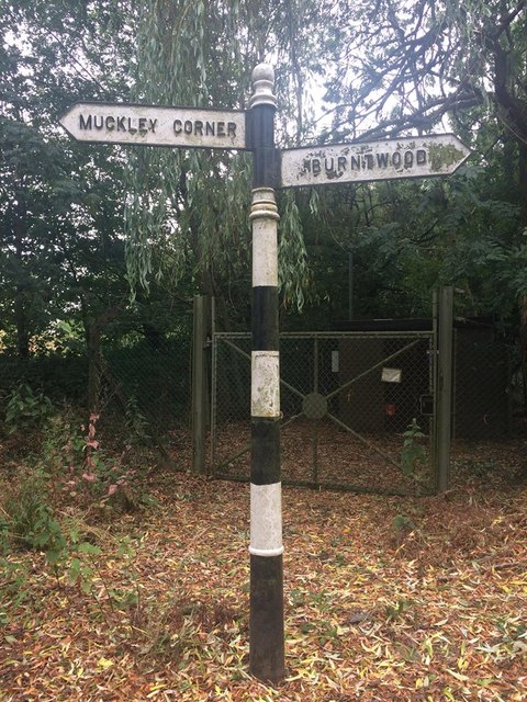
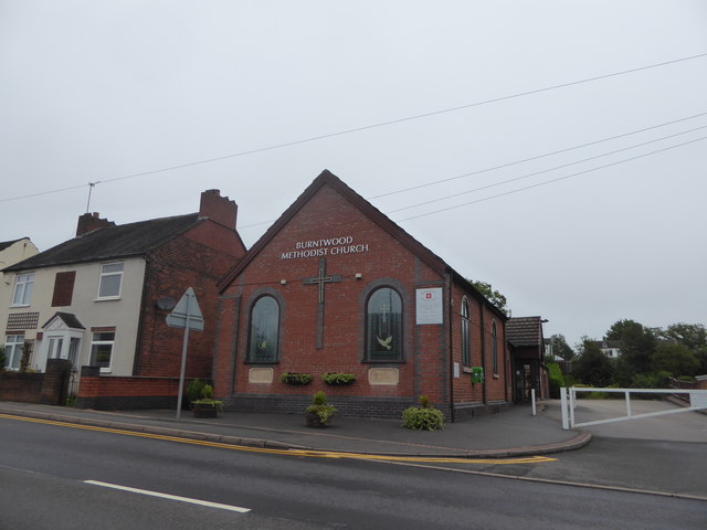
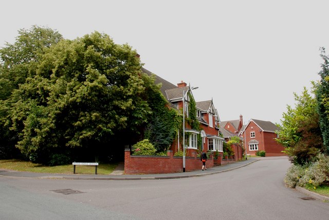
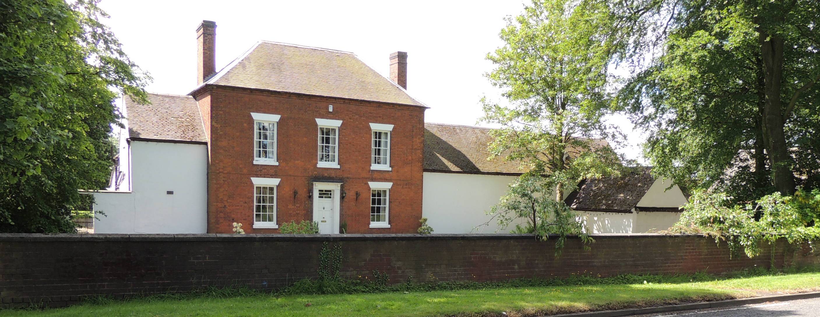
Gorstey Ley Images

Images are sourced within 2km of 52.679813/-1.9055302 or Grid Reference SK0609. Thanks to Geograph Open Source API. All images are credited.

Old Direction Sign - Signpost by St Matthew's Road, Pawn finial - 2 Worboys arms; by the UC road, in parish of Burntwood (Lichfield District), junction of Coulter Lane with St Matthew's Road.

To be surveyed

Milestone Society National ID: ST_SK0709A
Old Direction Sign - Signpost by St Matthew's Road,
Pawn finial - 2 Worboys arms; by the UC road, in parish of Burntwood (Lichfield District), junction of Coulter Lane with St Matthew's Road. To be surveyed Milestone Society National ID: ST_SK0709A
Old Direction Sign - Signpost in Burntwood parish Pawn finial - 3 arms; by the UC road, in parish of Burntwood (Lichfield District), junction of Hospital Road with Norton Lane and New Road, on grass triangle.

To be surveyed

Milestone Society National ID: ST_SK0508
Old Direction Sign - Signpost in Burntwood parish
Pawn finial - 3 arms; by the UC road, in parish of Burntwood (Lichfield District), junction of Hospital Road with Norton Lane and New Road, on grass triangle. To be surveyed Milestone Society National ID: ST_SK0508
Old Direction Sign - Signpost by Hall Lane, Hammerwich Pawn finial - 2 arms; by the UC road, in parish of Hammerwich (Lichfield District), junction of Hall Lane with Church Lane.

To be surveyed

Milestone Society National ID: ST_SK0607
Old Direction Sign - Signpost by Hall Lane, Hammerwich
Pawn finial - 2 arms; by the UC road, in parish of Hammerwich (Lichfield District), junction of Hall Lane with Church Lane. To be surveyed Milestone Society National ID: ST_SK0607
Direction Sign - Signpost by the A5190, Lichfield Road, Burntwood Lost finial - 2 arms; by the A5190, in parish of Burntwood (Lichfield District), junction of Lichfield Road with Stockley Lane and Farewell Lane, on grass strip between pavement and big hedge.

To be surveyed

Milestone Society National ID: ST_SK0708
Direction Sign - Signpost by the A5190, Lichfield Road, Burntwood
Lost finial - 2 arms; by the A5190, in parish of Burntwood (Lichfield District), junction of Lichfield Road with Stockley Lane and Farewell Lane, on grass strip between pavement and big hedge. To be surveyed Milestone Society National ID: ST_SK0708
Burntwood Cemetery: mid August 2020
Christ Church, Burntwood: mid August 2020
Burntwood Methodist Church: mid August 2020 Methodism began as a revival movement within the Church of England in the 18th century. Lead by the brothers John and Charles Wesley, it taught a methodical interpretation of Protestantism that stressed salvation was available for all. It separated from the established church in the 1790s but within 30 years it had itself split into Primitive and Wesleyan branches. Gradually these two forms converged until a formal reunification was achieved in 1932. Today it has about 80 million adherents worldwide.
Burntwood Methodist Church: mid August 2020
Methodism began as a revival movement within the Church of England in the 18th century. Lead by the brothers John and Charles Wesley, it taught a methodical interpretation of Protestantism that stressed salvation was available for all. It separated from the established church in the 1790s but within 30 years it had itself split into Primitive and Wesleyan branches. Gradually these two forms converged until a formal reunification was achieved in 1932. Today it has about 80 million adherents worldwide.
Looking from Tudor Road across Cannock Road towards Burntwood Park
St. John The Baptist, Hammerwich. The group in the foreground, were having a break from tidying the Church Yard.
St. John The Baptist, Hammerwich.
The group in the foreground, were having a break from tidying the Church Yard.
The Star Public House, Burntwood.
The Nags Head, Burntwood
Field of Wheat and Poppies This field is on the left hand side of the entrance to Edial Farm, Looking towards Lichfield.
Field of Wheat and Poppies
This field is on the left hand side of the entrance to Edial Farm, Looking towards Lichfield.
Track and Public Footpath to Edial Farm
The Old Beerholme. Woodhouses A lovely old cottage with an unusual name.
The Old Beerholme. Woodhouses
A lovely old cottage with an unusual name.
St Matthews Ave,  Burntwood
St Matthews Ave, Burntwood
Sister Dora  Ave, Burntwood
Sister Dora Ave, Burntwood
Christ Church, Burntwood This church was built around 1818, the chapel is described in an old directory as:"built almost entirely of red bricks, this edifice can hardly be described as a handsome structure", yes I suppose it is a bit unusual.
Christ Church, Burntwood
This church was built around 1818, the chapel is described in an old directory as:"built almost entirely of red bricks, this edifice can hardly be described as a handsome structure", yes I suppose it is a bit unusual.
Woodhouses lane, Burntwood Green Woodhouses lane goes from burntwood green to woodhouses.
Woodhouses lane, Burntwood Green
Woodhouses lane goes from burntwood green to woodhouses.
Show me another place!

Gorstey Ley is located at Grid Ref: SK0609 (Lat: 52.679813, Lng: -1.9055302)

Administrative County: Staffordshire

District: Lichfield

Police Authority: Staffordshire

What 3 Words

///rich.mice.cakes. Near Burntwood, Staffordshire

Related Wikis

Prince's Park, Burntwood

Prince's Park is located in the Staffordshire town of Burntwood and is featured in the Guinness Book of Records for being the smallest park in the United...

Edial

Edial is a hamlet to the east of Burntwood in Staffordshire, England. For population details taken at the 2011 census see Burntwood. Edial Hall School...

Burntwood

Burntwood is a former mining town and civil parish in the Lichfield District in Staffordshire, England, approximately 4 miles (6 km) west of Lichfield...

St Matthew's Hospital

St Matthew's Hospital was a mental health facility on Farewell Lane, Burntwood, Staffordshire, England. == History == The hospital, which was designed...

Nearby Amenities

Located within 500m of 52.679813,-1.9055302
Pub
White Swan
Lat/Long: 52.6783591/-1.9074332
Bus Stop
Gorstey Lea
Bus: yes
Naptan AtcoCode: 3800C400401
Naptan Bearing: S
Naptan CommonName: Gorstey Lea
Naptan Indicator: Opp
Naptan Landmark: Gorstey Lea
Naptan Street: Rugeley Road
Naptan Verified: no
Public Transport: platform
Source: naptan_import
Lat/Long: 52.6804584/-1.9052287
Bus Stop
Church Road
Bus: yes
Naptan AtcoCode: 3800C400402
Naptan Bearing: N
Naptan CommonName: Church Road
Naptan Indicator: Opp
Naptan Landmark: Church Road
Naptan Street: Rugeley Road
Naptan Verified: no
Public Transport: platform
Source: naptan_import
Lat/Long: 52.6801888/-1.9053624
Bus Stop
Swan Island
Bus: yes
Naptan AtcoCode: 3800C402000
Naptan Bearing: SE
Naptan CommonName: Swan Island
Naptan Indicator: Adj
Naptan Landmark: Swan Island
Naptan Street: Lichfield Rd (E)
Naptan Verified: no
Public Transport: platform
Source: naptan_import
Lat/Long: 52.6778069/-1.9059296
Bus Stop
Swan Island
Bus: yes
Naptan AtcoCode: 3800C402001
Naptan Bearing: NW
Naptan BusStopType: CUS
Naptan CommonName: Swan Island
Naptan Indicator: Adj
Naptan Landmark: Swan Island
Naptan Street: Lichfield Rd (W)
Naptan Verified: no
Public Transport: platform
Source: naptan_import
Lat/Long: 52.6777621/-1.9060628
Bus Stop
Pooles Way
Bus: yes
Naptan AtcoCode: 3800C415801
Naptan Bearing: N
Naptan CommonName: Pooles Way
Naptan Indicator: Adj
Naptan Landmark: Pooles Way
Naptan Street: Rugeley Road
Naptan Verified: no
Public Transport: platform
Source: naptan_import
Lat/Long: 52.678311/-1.906816
Bus Stop
Elder Lane
Bus: yes
Naptan AtcoCode: 3800C418802
Naptan Bearing: E
Naptan CommonName: Elder Lane
Naptan Indicator: Adj
Naptan Landmark: Elder Lane
Naptan Street: Cannock Road
Naptan Verified: no
Public Transport: platform
Source: naptan_import
Lat/Long: 52.6785752/-1.911312
Bus Stop
Mease Avenue
Bus: yes
Naptan AtcoCode: 3800C419001
Naptan Bearing: NW
Naptan CommonName: Mease Avenue
Naptan Indicator: Opp
Naptan Landmark: Mease Avenue
Naptan Street: Lichfield Road
Naptan Verified: no
Public Transport: platform
Source: naptan_import
Lat/Long: 52.6763926/-1.9023682
Bus Stop
Mease Avenue
Bus: yes
Naptan AtcoCode: 3800C419002
Naptan Bearing: SE
Naptan CommonName: Mease Avenue
Naptan Indicator: Adj
Naptan Landmark: Mease Avenue
Naptan Street: Lichfield Road
Naptan Verified: no
Public Transport: platform
Source: naptan_import
Lat/Long: 52.6762751/-1.9016289
Bus Stop
Cannock Road
Bus: yes
Naptan AtcoCode: 3800C425401
Naptan Bearing: N
Naptan BusStopType: CUS
Naptan CommonName: Cannock Road
Naptan Indicator: Adj
Naptan Landmark: Cannock Road
Naptan Street: Chase Road
Naptan Verified: no
Public Transport: platform
Source: naptan_import
Lat/Long: 52.6774667/-1.9076757
Bus Stop
Lichfield Road
Bus: yes
Naptan AtcoCode: 3800C425402
Naptan Bearing: S
Naptan CommonName: Lichfield Road
Naptan Indicator: Adj
Naptan Landmark: Lichfield Road
Naptan Street: Chase Road
Naptan Verified: no
Public Transport: platform
Source: naptan_import
Lat/Long: 52.6773228/-1.9076612
Bus Stop
Willow Avenue
Bus: yes
Naptan AtcoCode: 3800C426501
Naptan Bearing: SW
Naptan CommonName: Willow Avenue
Naptan Indicator: Adj
Naptan Landmark: Willow Avenue
Naptan Street: Chase Road
Naptan Verified: no
Public Transport: platform
Source: naptan_import
Lat/Long: 52.6761907/-1.9084327
Bus Stop
Keble Close
Bus: yes
Naptan AtcoCode: 3800C426801
Naptan Bearing: W
Naptan CommonName: Keble Close
Naptan Indicator: Opp
Naptan Landmark: Keble Close
Naptan Street: Highfield Road
Naptan Verified: no
Public Transport: platform
Source: naptan_import
Lat/Long: 52.6826206/-1.911215
Bus Stop
Acorn View
Bus: yes
Naptan AtcoCode: 3800C428601
Naptan Bearing: W
Naptan CommonName: Acorn View
Naptan Indicator: Adj
Naptan Street: Cannock Road
Naptan Verified: no
Public Transport: platform
Source: naptan_import
Lat/Long: 52.6781237/-1.9087245
Bus Stop
Laurel Drive
Bus: yes
Naptan AtcoCode: 3800C491301
Naptan Bearing: N
Naptan CommonName: Laurel Drive
Naptan Indicator: Adj
Naptan Landmark: Laurel Drive
Naptan Street: Rugeley Road
Naptan Verified: no
Public Transport: platform
Source: naptan_import
Lat/Long: 52.6819062/-1.9057877
Bus Stop
Laurel Drive
Bus: yes
Naptan AtcoCode: 3800C491302
Naptan Bearing: S
Naptan BusStopType: CUS
Naptan CommonName: Laurel Drive
Naptan Indicator: Opp
Naptan Landmark: Laurel Drive
Naptan Street: Rugeley Road
Naptan Verified: no
Public Transport: platform
Source: naptan_import
Lat/Long: 52.681915/-1.9055806
Bus Stop
Scholars Gate
Bus: yes
Naptan AtcoCode: 3800C491401
Naptan Bearing: W
Naptan CommonName: Scholars Gate
Naptan Indicator: Adj
Naptan Landmark: Scholars Gate
Naptan Street: Church Road
Naptan Verified: no
Public Transport: platform
Source: naptan_import
Lat/Long: 52.6796928/-1.9034554
Post Office
Burntwood Post Office
Addr City: Burntwood
Addr Housenumber: 1
Addr Postcode: WS7 0BL
Addr Street: Cannock Road
Brand: Post Office
Brand Wikidata: Q1783168
Opening Hours: Mo-Fr 09:00-17:30; Sa 09:00-13:30
Ref Pol Id: 8752
Source: OS OpenData StreetView
Website: https://www.postoffice.co.uk/branch-finder/2292424/burntwood
Lat/Long: 52.6777618/-1.9076819
Noexit: yes
Lat/Long: 52.681964/-1.9071035
Noexit: yes
Lat/Long: 52.6804176/-1.9077326
Noexit: yes
Lat/Long: 52.6781054/-1.904634
Noexit: yes
Lat/Long: 52.6776905/-1.9006443
Speed Camera
Lat/Long: 52.6764662/-1.9024333
Speed Camera
Lat/Long: 52.6787331/-1.9125294
Place Of Worship
Burntwood Methodist Church
Denomination: methodist
Node Id: 2285397231
Religion: christian
Source: OS_OpenData_StreetView
Source Name: OS Open Local Important Buildings Layer
Lat/Long: 52.6783987/-1.908188
Gorstey Ley
Place: locality
Source: OS_OpenData_StreetView
Lat/Long: 52.6797204/-1.9072079
Noexit: yes
Lat/Long: 52.6783701/-1.9036751
Noexit: yes
Lat/Long: 52.6790556/-1.9031788
Noexit: yes
Lat/Long: 52.6777099/-1.9037233
Noexit: yes
Lat/Long: 52.6765807/-1.9070166
Noexit: yes
Lat/Long: 52.6769477/-1.9069124
Generator Method: photovoltaic
Generator Output Electricity: yes
Generator Source: solar
Generator Type: solar_photovoltaic_panel
Location: roof
Power: generator
Lat/Long: 52.676561/-1.9068307
Generator Method: photovoltaic
Generator Output Electricity: yes
Generator Source: solar
Generator Type: solar_photovoltaic_panel
Location: roof
Power: generator
Lat/Long: 52.6755641/-1.9039553
Generator Method: photovoltaic
Generator Output Electricity: yes
Generator Source: solar
Generator Type: solar_photovoltaic_panel
Location: roof
Power: generator
Lat/Long: 52.67586/-1.902633
Generator Method: photovoltaic
Generator Output Electricity: yes
Generator Source: solar
Generator Type: solar_photovoltaic_panel
Location: roof
Power: generator
Lat/Long: 52.6759446/-1.9026062
Generator Method: photovoltaic
Generator Output Electricity: yes
Generator Source: solar
Generator Type: solar_photovoltaic_panel
Location: roof
Power: generator
Lat/Long: 52.6760308/-1.902625
Generator Method: photovoltaic
Generator Output Electricity: yes
Generator Source: solar
Generator Type: solar_photovoltaic_panel
Location: roof
Power: generator
Lat/Long: 52.6781531/-1.8993741
Generator Method: photovoltaic
Generator Output Electricity: yes
Generator Source: solar
Generator Type: solar_photovoltaic_panel
Location: roof
Power: generator
Lat/Long: 52.6790507/-1.8997094
Generator Method: photovoltaic
Generator Output Electricity: yes
Generator Source: solar
Generator Type: solar_photovoltaic_panel
Location: roof
Power: generator
Lat/Long: 52.6794426/-1.8992347
Generator Method: photovoltaic
Generator Output Electricity: yes
Generator Source: solar
Generator Type: solar_photovoltaic_panel
Location: roof
Power: generator
Lat/Long: 52.6795304/-1.9102344
Generator Method: photovoltaic
Generator Output Electricity: yes
Generator Source: solar
Generator Type: solar_photovoltaic_panel
Location: roof
Power: generator
Lat/Long: 52.6779986/-1.9026813
Generator Method: photovoltaic
Generator Output Electricity: yes
Generator Source: solar
Generator Type: solar_photovoltaic_panel
Location: roof
Power: generator
Lat/Long: 52.6788052/-1.9035128
Noexit: yes
Lat/Long: 52.6793715/-1.9047198
Noexit: yes
Lat/Long: 52.6783352/-1.9019866
Crossing
Lat/Long: 52.6764515/-1.9019399
Noexit: yes
Lat/Long: 52.6818671/-1.9070157
The data included in this document is from www.openstreetmap.org. The data is made available under ODbL.

Have you been to Gorstey Ley?

Leave your review of Gorstey Ley below (or comments, questions and feedback).