Manston

Settlement in Kent Thanet

England

Manston

Sainsbury’s Thanet supermarket Eighteen months ago there was only an <a href="https://www.geograph.org.uk/photo/4053663">TR3667 : Information board about a new Sainsbury’s store</a>.
Sainsbury’s Thanet supermarket Credit: John Baker

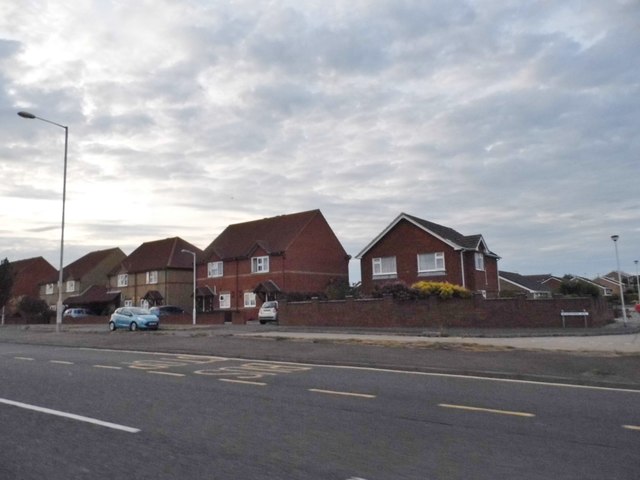
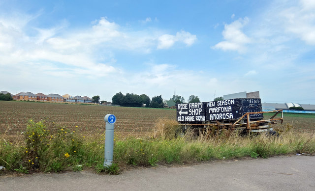
Manston is a small village located in the county of Kent, England. Situated approximately five miles north-east of the town of Ramsgate, Manston is a predominantly rural area with a population of around 1,000 people. The village is known for its picturesque countryside, with rolling hills and farmland surrounding the area.

One of the notable features of Manston is its close proximity to Manston Airport, which was a significant airfield during World War II. Today, the airport serves as a cargo hub and is occasionally used for passenger flights. The presence of the airport has brought some commercial activity to the village, with several businesses and services catering to the aviation industry.

In addition to its aviation connections, Manston is also popular among outdoor enthusiasts due to its access to nature reserves and coastal areas. The nearby Pegwell Bay Nature Reserve is a haven for wildlife, offering opportunities for birdwatching and nature walks. The village is also just a short drive away from the picturesque coastal towns of Ramsgate and Broadstairs, which offer a range of amenities and attractions, including sandy beaches, historical landmarks, and a vibrant seaside atmosphere.

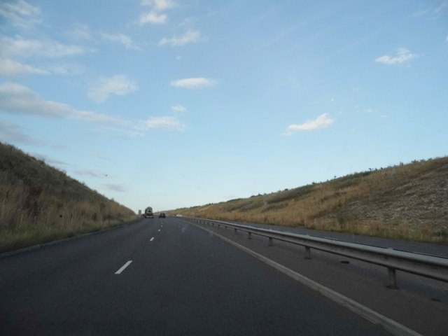
Despite being a relatively small village, Manston benefits from good transport links, with the A299 road passing nearby, providing easy access to other towns and cities in Kent. The village itself has a few local amenities, including a primary school, a village hall, and a handful of shops and pubs. Overall, Manston offers a peaceful and scenic setting, while still being within reach of larger towns and urban areas.

If you have any feedback on the listing, please let us know in the comments section below.
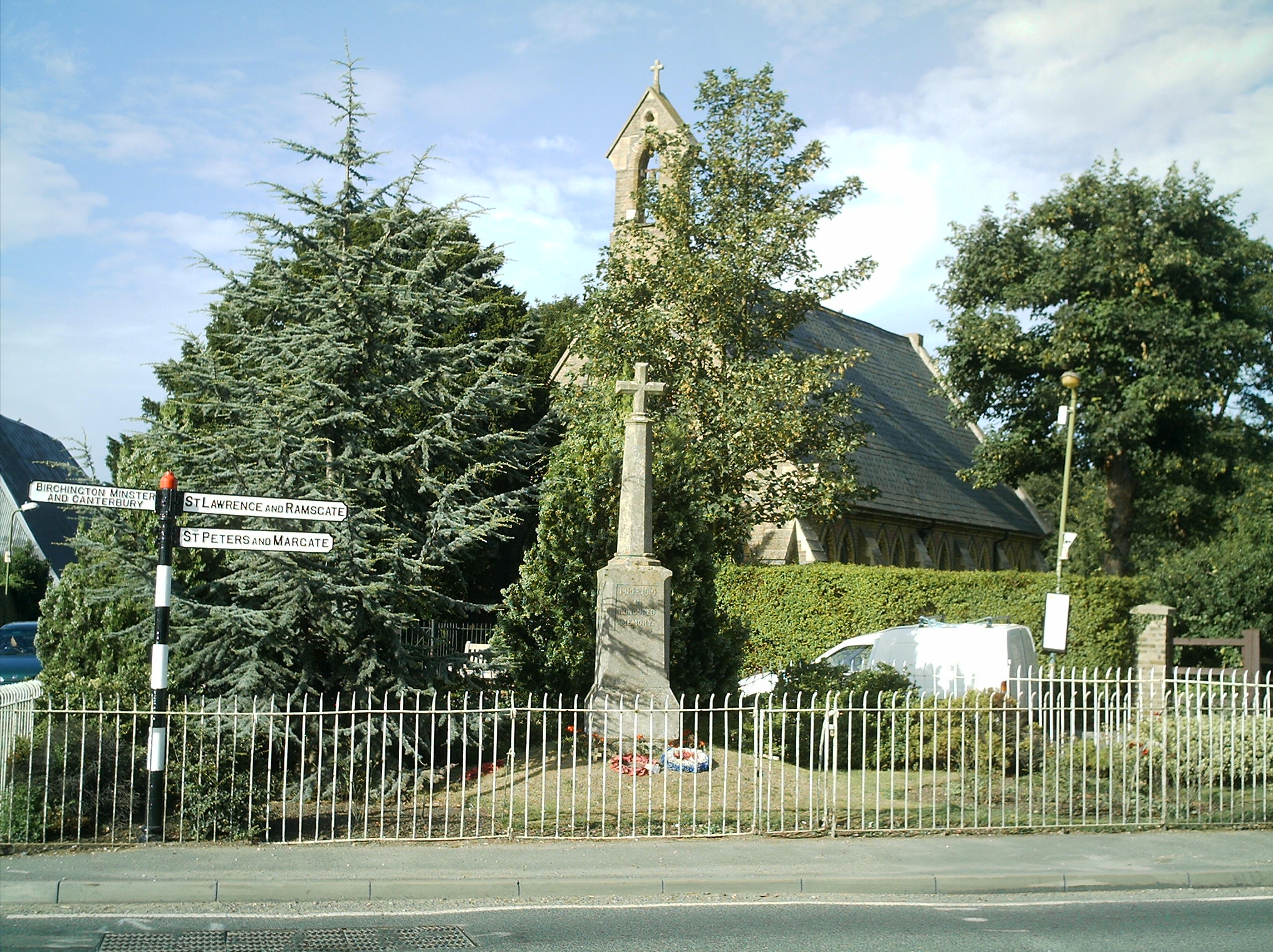
Manston Images

Images are sourced within 2km of 51.346106/1.3696308 or Grid Reference TR3466. Thanks to Geograph Open Source API. All images are credited.

Sainsbury’s Thanet supermarket Eighteen months ago there was only an <a href="https://www.geograph.org.uk/photo/4053663">TR3667 : Information board about a new Sainsbury’s store</a>.
Sainsbury’s Thanet supermarket
Eighteen months ago there was only an TR3667 : Information board about a new Sainsbury’s store.
Looking northeast from Sandwich Road Towards the back of the Lord of the Manor, which is a derelict property situated beside Canterbury Road East.
Looking northeast from Sandwich Road
Towards the back of the Lord of the Manor, which is a derelict property situated beside Canterbury Road East.
Hengist Way, Cliffsend The railway bridge is ahead
Hengist Way, Cliffsend
The railway bridge is ahead
Railway bridge over Hengist Way, Cliffsend The road is built in a cutting for around a mile, while the railway is on the original ground level.
Railway bridge over Hengist Way, Cliffsend
The road is built in a cutting for around a mile, while the railway is on the original ground level.
Hengist Way, Cliffsend
The Ramsgate exit from the Cliffsend Roundabout
Hengist Way approaching Ramsgate
Roundabout on Canterbury Road, Ramsgate
Windermere Avenue by Canterbury Road East These are the first houses coming into the Ramsgate area.
Windermere Avenue by Canterbury Road East
These are the first houses coming into the Ramsgate area.
Canterbury Road East, Nethercourt
Roundabout on Canterbury Road East, Nethercourt
Looking northeast from Sandwich Road It appears that the construction work beside Sandwich Road and Chalk Hill is to enable repairs to be made to the underground cable that supplies Thanet Array Wind Farm.
Looking northeast from Sandwich Road
It appears that the construction work beside Sandwich Road and Chalk Hill is to enable repairs to be made to the underground cable that supplies Thanet Array Wind Farm.
Future site of Thanet Parkway railway station Kent County Council is continuing to promote the building of a new ‘parkway’ railway station in Thanet, located on the Ashford International to Ramsgate line, and just to the west of the village of Cliffsend. The station is designed to be unstaffed with two platforms and a variety of facilities, including ticket vending machines and passenger help and information points providing remote assistance. Road access is currently proposed from the A299 Hengist Way with additional pedestrian and cycle access via Cliffsend village. A 300 space car park is included within the proposal, along with a forecourt with bus stops, drop-off and pick-up zones, a dedicated taxi area, electric car charging points and an area for cycle storage <span class="nowrap"><a title="http://www.kent.gov.uk/roads-and-travel/travelling-around-kent/thanet-parkway-railway-station#" rel="nofollow ugc noopener" href="http://www.kent.gov.uk/roads-and-travel/travelling-around-kent/thanet-parkway-railway-station#">Link</a><img style="margin-left:2px;" alt="External link" title="External link - shift click to open in new window" src="https://s1.geograph.org.uk/img/external.png" width="10" height="10"/></span>
Future site of Thanet Parkway railway station
Kent County Council is continuing to promote the building of a new ‘parkway’ railway station in Thanet, located on the Ashford International to Ramsgate line, and just to the west of the village of Cliffsend. The station is designed to be unstaffed with two platforms and a variety of facilities, including ticket vending machines and passenger help and information points providing remote assistance. Road access is currently proposed from the A299 Hengist Way with additional pedestrian and cycle access via Cliffsend village. A 300 space car park is included within the proposal, along with a forecourt with bus stops, drop-off and pick-up zones, a dedicated taxi area, electric car charging points and an area for cycle storage LinkExternal link
Building site, Cliffs End Road Planning permission has been granted by Thanet District Council under application number OL/TH/15/0537 for an “outline application for the erection of 31 dwellings and retail unit, including access”. The location was given as Cliffsend Farm Cottages, Cliffs End Road.
Building site, Cliffs End Road
Planning permission has been granted by Thanet District Council under application number OL/TH/15/0537 for an “outline application for the erection of 31 dwellings and retail unit, including access”. The location was given as Cliffsend Farm Cottages, Cliffs End Road.
Sign to Rose Farm Shop One of the original businesses is still trading next to the brand new superstores and warehouses on the edge of town retail area.
Sign to Rose Farm Shop
One of the original businesses is still trading next to the brand new superstores and warehouses on the edge of town retail area.
Canterbury Road West Heading east.
Canterbury Road West
Heading east.
Pegwell Bay Hoverport, June 1992 The former Hovercraft terminal at Pegwell Bay, 1992
Pegwell Bay Hoverport, June 1992
The former Hovercraft terminal at Pegwell Bay, 1992
Derelict Terminal at Pegwell Bay Hoverport The dereliction and shattered dreams @ Pegwell Bay Hoverport. June 1992.
Derelict Terminal at Pegwell Bay Hoverport
The dereliction and shattered dreams @ Pegwell Bay Hoverport. June 1992.
Show me another place!

Manston is located at Grid Ref: TR3466 (Lat: 51.346106, Lng: 1.3696308)

Administrative County: Kent

District: Thanet

Police Authority: Kent

What 3 Words

///shallower.spades.fearfully. Near Ramsgate, Kent

Nearby Locations

Manston

Related Wikis

Manston, Kent

Manston is a village and civil parish in the Thanet district of Kent, England. The village is situated one mile northwest of Ramsgate. The parish includes...
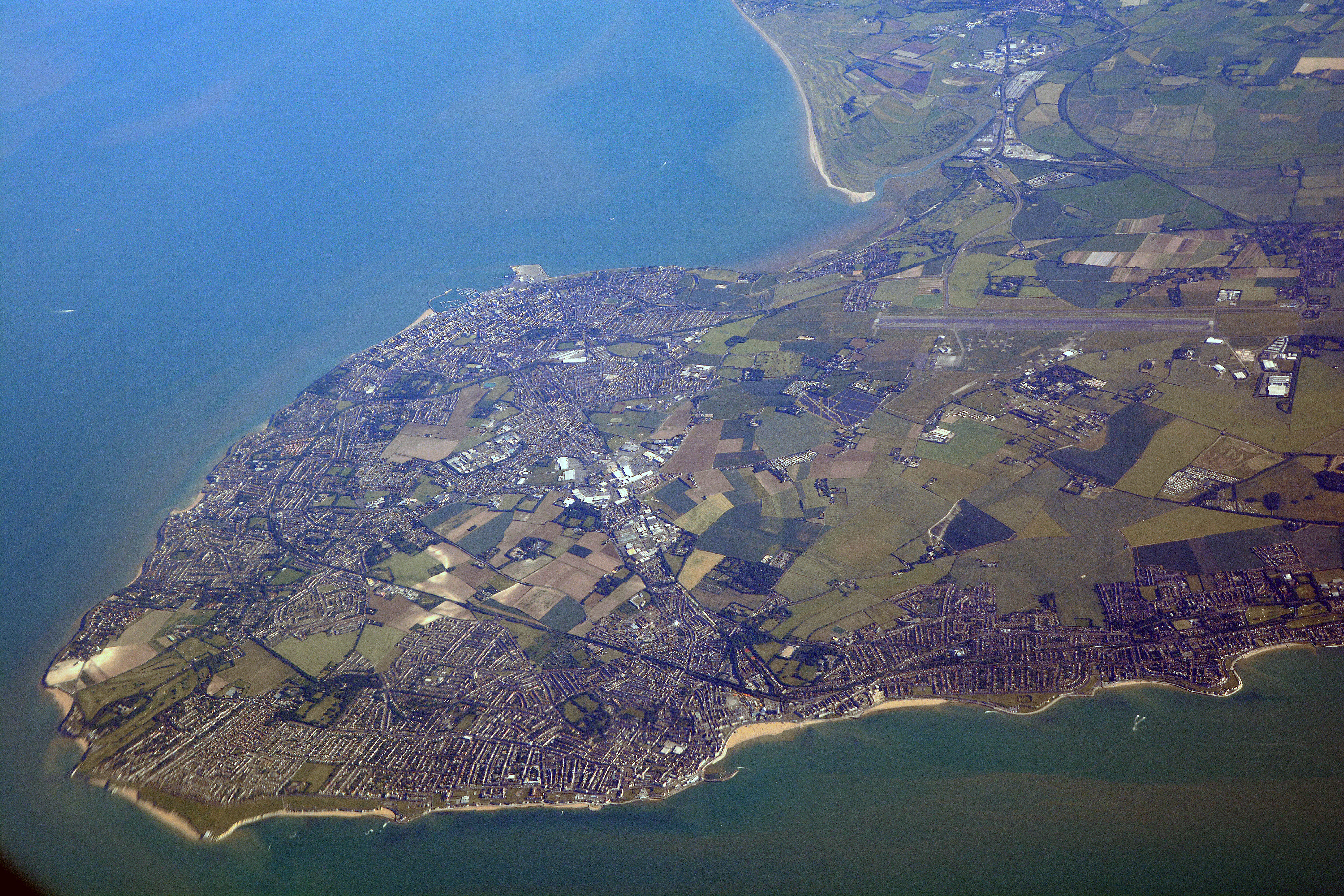
Isle of Thanet

The Isle of Thanet () is a peninsula forming the easternmost part of Kent, England. While in the past it was separated from the mainland by the 600-metre...

Defence Fire Training and Development Centre

The Defence Fire Training and Development Centre (DFTDC, formerly FSCTE Manston) was the site of the Ministry of Defence's firefighter training. It occupied...

RAF Manston

Royal Air Force Manston or more simply RAF Manston is a former Royal Air Force station located in the north-east of Kent, at grid reference TR334663 on...

Lord of the Manor, Kent

The Lord of the Manor is a former pub and road junction near Cliffsend on the Isle of Thanet in Kent. Two main roads, the A299 and A256 meet here and connect...

Newington, Thanet

Newington is a suburb in the west of the town of Ramsgate, on the eastern tip of Kent, England. == History == Ramsgate Borough Council developed the Newington...

The Royal Harbour Academy

The Royal Harbour Academy is a coeducational secondary school and sixth form located over two sites in Ramsgate in the English county of Kent.The school...

Academy FM (Thanet)

Academy FM (Thanet) is a Charity community 24-hour local radio station based in Ramsgate, Kent, England, which broadcasts to the Isle of Thanet. It launched...

Nearby Amenities

Located within 500m of 51.346106,1.3696308
Manston
Battle Of Britain Village: yes
Place: village
Source: survey
Wikidata: Q2779399
Wikipedia: en:Manston, Kent
Lat/Long: 51.3459955/1.3696746
Description: First World War memorial
Historic: memorial
Lat/Long: 51.3459636/1.3697508
Bus Stop
Manston Church
Bench: no
Public Transport: platform
Shelter: no
Tactile Paving: no
Lat/Long: 51.3458758/1.3698766
Post Box
Note Ref: Sourced from Dracos because the front information panel was missing.
Postal Code: CT12
Ref: CT12 24
Source: survey
Source Ref: http://www.dracos.co.uk/play/locating-postboxes/?pc1\eCT12
Lat/Long: 51.345669/1.369328
Pub
Jolly Farmer
Addr City: Ramsgate
Addr Housenumber: 3
Addr Place: Manston
Addr Postcode: CT12 5BG
Addr Street: High Street
Fhrs Id: 716499
Source: visual_estimate
Source Addr: FHRS Open Data
Wheelchair: no
Lat/Long: 51.3457438/1.369136
Bus Stop
Church
Bench: no
Public Transport: platform
Shelter: no
Tactile Paving: no
Lat/Long: 51.3459034/1.3696303
Bus Stop
Church
Bench: no
Naptan AtcoCode: 2400A046390A
Naptan Bearing: E
Naptan CommonName: Church
Naptan Indicator: o/s
Naptan Landmark: Manston Road
Naptan NaptanCode: kntdwmjg
Naptan PlusbusZoneRef: THANET
Naptan Street: Preston Drive
Naptan Verified: no
Public Transport: platform
Shelter: no
Source: naptan_import
Tactile Paving: no
Lat/Long: 51.3460361/1.3698292
Barrier: stile
Foot: yes
Lat/Long: 51.3486921/1.3656361
Barrier: kissing_gate
Foot: yes
Lat/Long: 51.3475888/1.3761288
Barrier: stile
Foot: yes
Lat/Long: 51.3461252/1.372743
Barrier: stile
Foot: yes
Source: survey
Lat/Long: 51.3493691/1.3718977
Power: pole
Lat/Long: 51.3484734/1.3754744
Generator Method: photovoltaic
Generator Output Electricity: yes
Generator Source: solar
Generator Type: solar_photovoltaic_panel
Location: roof
Power: generator
Lat/Long: 51.3479155/1.3737202
Turning Circle
Lat/Long: 51.348916/1.371825
Manston Sports And Social Club
Addr City: Manston
Addr Postcode: CT12 5BY
Addr Street: Daigor Lane
Club: sport
Fhrs Id: 637630
Source: FHRS Open Data
Lat/Long: 51.3447944/1.3695927
RAF Memorial Beaco
Man Made: beacon
Lat/Long: 51.3480328/1.3727503
Generator Method: photovoltaic
Generator Output Electricity: yes
Generator Source: solar
Generator Type: solar_photovoltaic_panel
Location: roof
Power: generator
Lat/Long: 51.3463123/1.3692972
Generator Method: photovoltaic
Generator Output Electricity: yes
Generator Source: solar
Generator Type: solar_photovoltaic_panel
Location: roof
Power: generator
Lat/Long: 51.3464965/1.3710755
Generator Method: photovoltaic
Generator Output Electricity: yes
Generator Source: solar
Generator Type: solar_photovoltaic_panel
Location: roof
Power: generator
Lat/Long: 51.3462486/1.3716549
Generator Method: photovoltaic
Generator Output Electricity: yes
Generator Source: solar
Generator Type: solar_photovoltaic_panel
Location: roof
Power: generator
Lat/Long: 51.3456924/1.3688278
Cafe
The Pedaler in The Yard
Cuisine: coffee_shop;cake
Lat/Long: 51.3471828/1.3698356
The data included in this document is from www.openstreetmap.org. The data is made available under ODbL.

Have you been to Manston?

Leave your review of Manston below (or comments, questions and feedback).