Freefield

Settlement in Shetland

Scotland

Freefield

West Burra: overlooking Bridge End A fine view past the war memorial and down South Voe, the marina nestling below.
West Burra: overlooking Bridge End Credit: Chris Downer

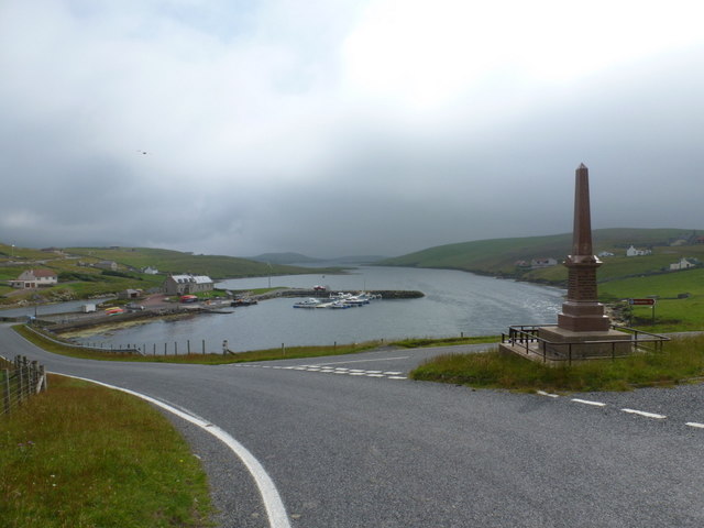
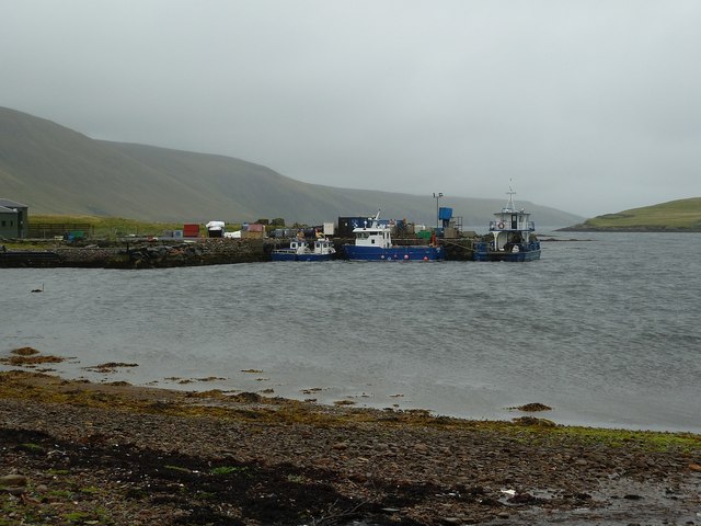
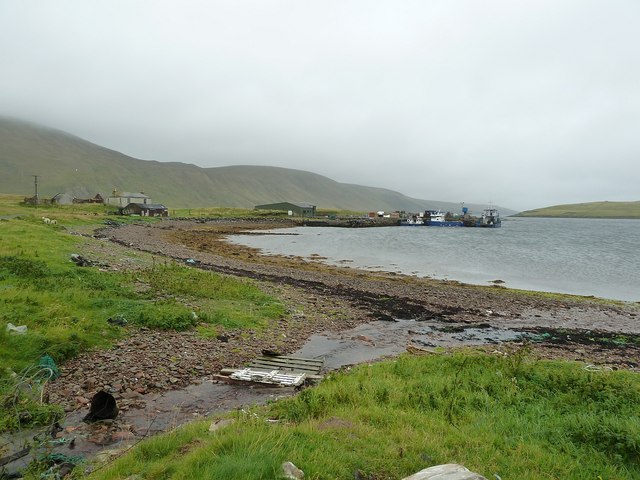
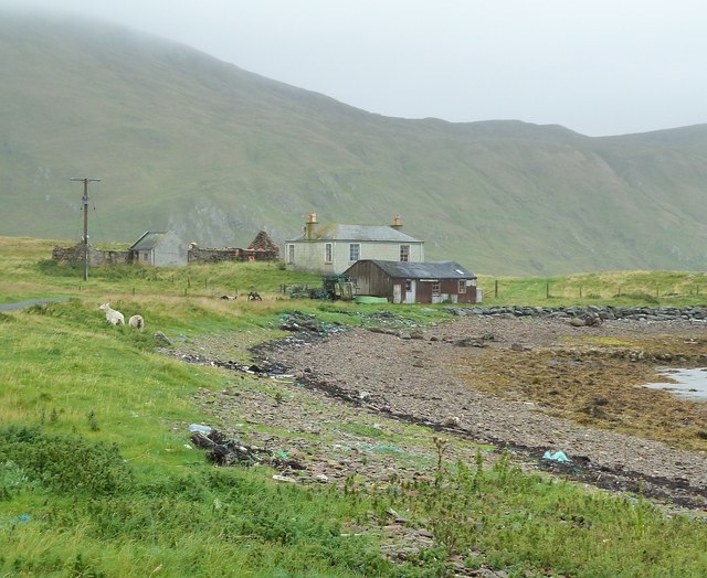
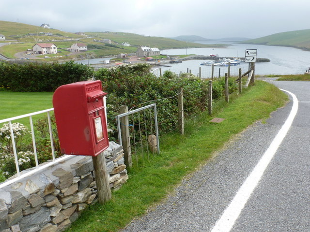
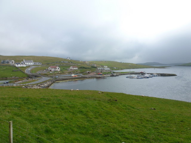
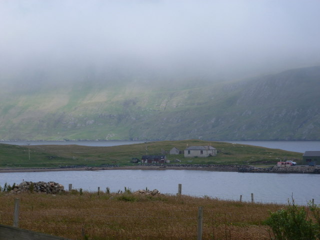
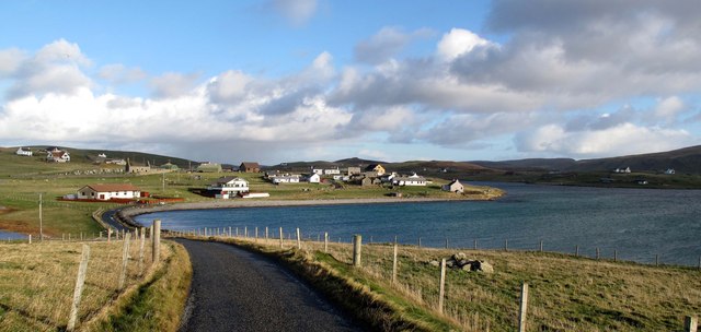
Freefield is a small settlement located in the Shetland Islands, an archipelago in Scotland, United Kingdom. It is situated on the mainland of Shetland, approximately 3 miles northeast of Lerwick, the capital town of the islands. The name "Freefield" is derived from the Old Norse word "Frjófjardar," meaning "Freya's fjord."

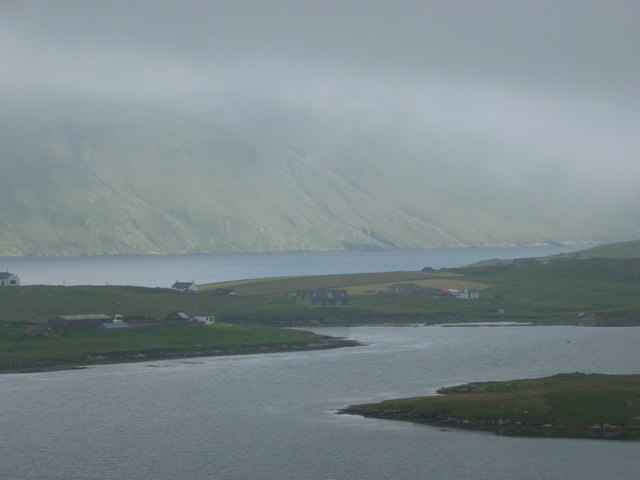
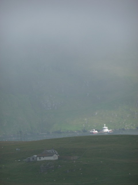
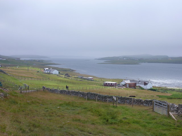
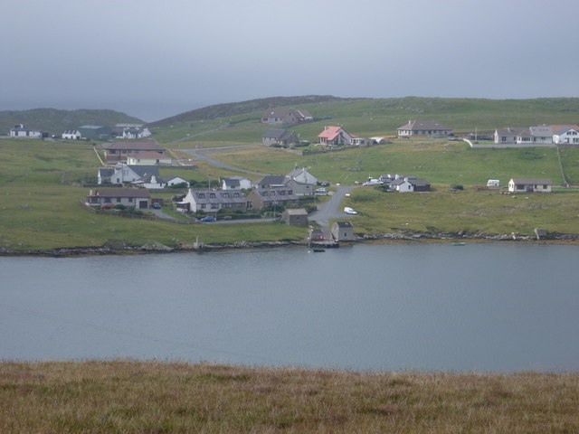
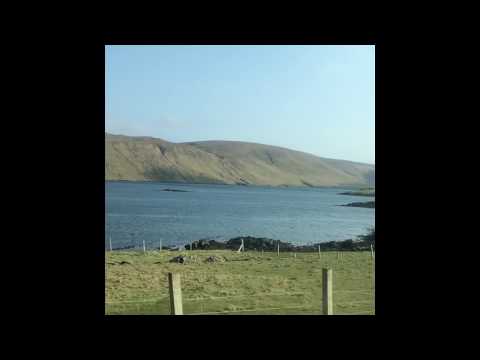
With its picturesque surroundings, Freefield offers stunning views of the North Sea and the rugged Shetland landscape. The area is characterized by rolling hills, rocky cliffs, and lush green fields, providing a beautiful backdrop for residents and visitors alike.

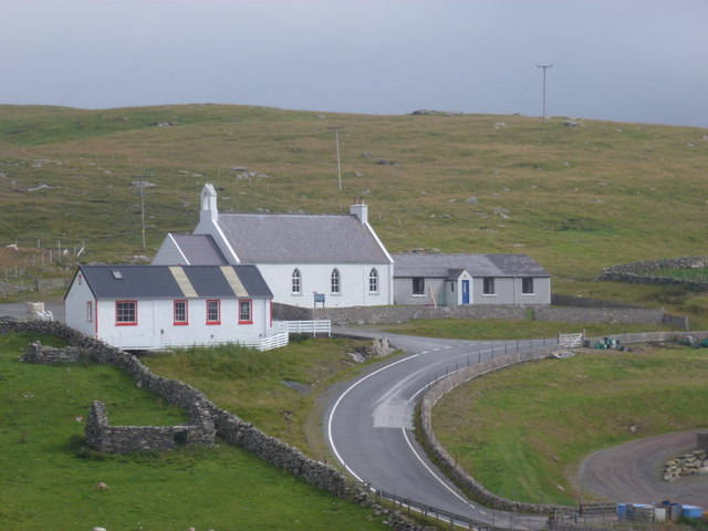
The settlement itself is mainly residential, consisting of a mix of traditional and modern houses. It is a close-knit community, with a small population that enjoys a peaceful and quiet way of life. Freefield is known for its friendly and welcoming atmosphere, making it an inviting place to live or visit.

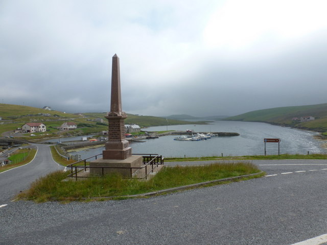
Despite its tranquil setting, Freefield is conveniently located near amenities and services. The nearby town of Lerwick offers a range of facilities, including shops, restaurants, schools, and healthcare services. Additionally, there are several transportation options available, with regular bus services connecting Freefield to Lerwick and other parts of the island.

For nature enthusiasts, Freefield is an ideal base for exploring the natural wonders of the Shetland Islands. The area boasts an abundance of wildlife, including seabirds, seals, and otters, as well as numerous walking and hiking trails that showcase the island's rugged beauty.

Overall, Freefield is a charming and scenic settlement, offering a peaceful lifestyle in a beautiful coastal location.

If you have any feedback on the listing, please let us know in the comments section below.

Freefield Images

Images are sourced within 2km of 60.080438/-1.3356824 or Grid Reference HU3733. Thanks to Geograph Open Source API. All images are credited.

West Burra: overlooking Bridge End A fine view past the war memorial and down South Voe, the marina nestling below.
West Burra: overlooking Bridge End
A fine view past the war memorial and down South Voe, the marina nestling below.
East Burra: the Baptist church Looking across the dip between the two Burras towards this small church on East Burra.
East Burra: the Baptist church
Looking across the dip between the two Burras towards this small church on East Burra.
East Burra: view along Lang Sound Looking north along the channel separating East Burra from West. In the distance is the bridge linking the Burras with Trondra en route to the mainland.
East Burra: view along Lang Sound
Looking north along the channel separating East Burra from West. In the distance is the bridge linking the Burras with Trondra en route to the mainland.
East Burra: Houss from West Burra Looking across South Voe towards the scattered dwellings of Houss with the mighty slopes of Shetland's south mainland on the far side of Clift Sound beyond.
East Burra: Houss from West Burra
Looking across South Voe towards the scattered dwellings of Houss with the mighty slopes of Shetland's south mainland on the far side of Clift Sound beyond.
Houss: a house with a dramatic backdrop Looking across to a Houss house, as it were, from West Burra. I haven't been able to exactly locate the house on the map but it's somewhere hereabouts. In the background, a couple of vessels, below the cliffs of the Clift Hills, are catching a very rare bit of sun today - the rarity of the fine weather hinted at by the low mist towards the top of the hills.
Houss: a house with a dramatic backdrop
Looking across to a Houss house, as it were, from West Burra. I haven't been able to exactly locate the house on the map but it's somewhere hereabouts. In the background, a couple of vessels, below the cliffs of the Clift Hills, are catching a very rare bit of sun today - the rarity of the fine weather hinted at by the low mist towards the top of the hills.
Boats at The Taing The boats seen here are moored at a yard on the east coast of the Voe of North House, on the small peninsula called The Taing on East Burra. East Burra is a very narrow island (as is West Burra) that is linked to Mainland Shetland via bridges to Trondra and West Burra. The bridge between West and East Burra is a simple stone arch bridge in Bridge End.
Boats at The Taing
The boats seen here are moored at a yard on the east coast of the Voe of North House, on the small peninsula called The Taing on East Burra. East Burra is a very narrow island (as is West Burra) that is linked to Mainland Shetland via bridges to Trondra and West Burra. The bridge between West and East Burra is a simple stone arch bridge in Bridge End.
The Taing and Voe of North House The Taing is a small promontory of East Burra island into Clift Sound, with the Voe of North House on the right. The little stream entering the Voe at this point is a drain from the small Loch of Houss a few hundred yards to the north.
A closer view of the end of the Taing can be seen here <a href="https://www.geograph.org.uk/photo/2586774">HU3831 : Boats at The Taing</a> and of the cottages on the left of the image, here <a href="https://www.geograph.org.uk/photo/2695373">HU3831 : Cottages on The Taing</a>
The Taing and Voe of North House
The Taing is a small promontory of East Burra island into Clift Sound, with the Voe of North House on the right. The little stream entering the Voe at this point is a drain from the small Loch of Houss a few hundred yards to the north. A closer view of the end of the Taing can be seen here HU3831 : Boats at The Taing and of the cottages on the left of the image, here HU3831 : Cottages on The Taing
Cottages on The Taing A cluster of current and former dwellings at the northern end of The Taing, a small promontory of East Burra island. The Clift Hills of Mainland Shetland rise up behind them as a quite dramatic backdrop.
Cottages on The Taing
A cluster of current and former dwellings at the northern end of The Taing, a small promontory of East Burra island. The Clift Hills of Mainland Shetland rise up behind them as a quite dramatic backdrop.
West Burra: war memorial The war memorial at Bridge End stands at a fantastic viewpoint as we look beyond it down South Voe, separating East Burra (left) from West Burra.
West Burra: war memorial
The war memorial at Bridge End stands at a fantastic viewpoint as we look beyond it down South Voe, separating East Burra (left) from West Burra.
West Burra: postbox № ZE2 14, Bridge End This small postbox serves the southern villages of West Burra, as well as East Burra, and is emptied each weekday and Saturday morning at half past seven.
West Burra: postbox № ZE2 14, Bridge End
This small postbox serves the southern villages of West Burra, as well as East Burra, and is emptied each weekday and Saturday morning at half past seven.
West Burra: the marina Looking down on the marina, which is at the head of South Voe which separates the island of West Burra from East Burra (background).
West Burra: the marina
Looking down on the marina, which is at the head of South Voe which separates the island of West Burra from East Burra (background).
East Burra: view down South Voe Looking down South Voe, the long inlet separating the islands of East Burra and West Burra.
East Burra: view down South Voe
Looking down South Voe, the long inlet separating the islands of East Burra and West Burra.
West Burra: Toogs from across Lang Sound Looking across Lang Sound from the island of East Burra, towards the hamlet of Toogs on West Burra.
West Burra: Toogs from across Lang Sound
Looking across Lang Sound from the island of East Burra, towards the hamlet of Toogs on West Burra.
East Burra: Clift Sound view Looking along Clift Sound from East Hogaland, with the Clift Hills, on the western side of mainland Shetland, shrouded in a mist that clung on throughout the day.
East Burra: Clift Sound view
Looking along Clift Sound from East Hogaland, with the Clift Hills, on the western side of mainland Shetland, shrouded in a mist that clung on throughout the day.
East Burra: across Voe of North House Looking across this small bay, towards a house with coastal outlooks both front and back - Clift Sound is beyond, with the Clift Hills on the Shetland mainland rising into the mist.
East Burra: across Voe of North House
Looking across this small bay, towards a house with coastal outlooks both front and back - Clift Sound is beyond, with the Clift Hills on the Shetland mainland rising into the mist.
East Burra: New Grunasound and Lang Sound The house at New Grunasound, extreme left, stands by the edge of Lang Sound, which separates the islands of East and West Burra.
East Burra: New Grunasound and Lang Sound
The house at New Grunasound, extreme left, stands by the edge of Lang Sound, which separates the islands of East and West Burra.
West Burra: postbox № ZE2 8, Southerhouse A small postbox serving the Southerhouse hamlet, emptied on weekdays and Saturdays at 7:30am. The backdrop is the Clift Hills, on the western edge of the Shetland mainland, rising into the mist.
West Burra: postbox № ZE2 8, Southerhouse
A small postbox serving the Southerhouse hamlet, emptied on weekdays and Saturdays at 7:30am. The backdrop is the Clift Hills, on the western edge of the Shetland mainland, rising into the mist.
Papil, West Burra
Papil, West Burra
Show me another place!

Freefield is located at Grid Ref: HU3733 (Lat: 60.080438, Lng: -1.3356824)

Unitary Authority: Shetland Islands

Police Authority: Highlands and Islands

What 3 Words

///domain.translate.less. Near Scalloway, Shetland Islands

Related Wikis

Scalloway Islands

The Scalloway Islands are in Shetland opposite Scalloway on south west of the Mainland. They form a mini-archipelago and include: Burra (two islands linked...

West Burra

West Burra is one of the Scalloway Islands, a subgroup of the Shetland Islands in Scotland. It is connected by bridge to East Burra. With an area of 743...

Burra, Shetland

Burra (Old Norse: Barrey ) is the collective name for two of the Shetland Islands, West (pop. 753) and East Burra (pop. 66), which are connected by bridge...

East Burra

East Burra (Scots: East Burra; Old Norse: "Barrey") is one of the Scalloway Islands, a subgroup of the Shetland Islands in Scotland. It is connected by...

South Mainland

The South Mainland of the Shetland Islands is the southern peninsula of Mainland island. It lies south of Hellister (60° 14′N). The greater southern part...

Oxna

Oxna is one of the Scalloway Islands, lying north west of Burra in Shetland, Scotland. Oxna has an area of 68 hectares (170 acres). The island has been...

Papa, Shetland

Papa (Scots: Papa; Old Norse: Papey, meaning "the island of the priests") is an uninhabited island in the Scalloway Islands, Shetland, Scotland. Papa lies...

Trondra

Trondra (Scots: Trondra) is one of the Scalloway Islands, a subgroup of the Shetland Islands in Scotland. It shelters the harbour of Scalloway and has...

Related Videos

MEAL BEACH,SHETLAND-2017

Mealbeach #Atlanticocean #Shetland Traveling Shetland Meal beach is a lovely southward facing beach with deep sand and a ...

Minn & Kettla Ness, Burra

A blustery but beautiful day exploring the Kettla Ness circular in Burra, Shetland Islands. Read all about it on the blog: ...

Isle of Burra, Shetland

The Isle of Burra is a slither of land on the west of Shetland's mainland to which it is joined by bridges. We walk over the tombolo ...

Minn Beach Burra, Shetland

A wee trip to Minn Beach we the drone. #shetland #beach #sea #cliffs #sand #island #islandlife #tourism #scotland ...

Nearby Amenities

Located within 500m of 60.080438,-1.3356824
Bridge End
Place: village
Lat/Long: 60.0830695/-1.3332492
Post Box
Brand: Royal Mail
Brand Wikidata: Q638098
Fixme: This post box has been moved as it can't be seen on mapillary images from 2022.
Operator: Royal Mail
Operator Wikidata: Q638098
Post Box Mounting: wooden_post
Post Box Type: lamp
Ref: ZE2 14
Survey Date: 2021-10-02
Wikimedia Commons: File:West Burra, postbox № ZE2 14, Bridge End - geograph.org.uk - 2701325.jpg
Lat/Long: 60.0829772/-1.3321291
Barrier: cattle_grid
Lat/Long: 60.0817624/-1.3308779
Power: pole
Lat/Long: 60.0812742/-1.3269264
Power: pole
Lat/Long: 60.0800634/-1.3268057
Power: pole
Lat/Long: 60.0806307/-1.327318
Power: pole
Lat/Long: 60.0810227/-1.3276827
Power: pole
Lat/Long: 60.0817116/-1.328533
Power: pole
Lat/Long: 60.0820554/-1.3290077
Power: pole
Lat/Long: 60.0826989/-1.3300565
Power: pole
Lat/Long: 60.0830066/-1.3305661
Power: pole
Lat/Long: 60.083547/-1.3314378
Power: pole
Lat/Long: 60.0838587/-1.3323873
Power: pole
Lat/Long: 60.0803685/-1.3349596
Power: pole
Lat/Long: 60.0790065/-1.3377169
Power: pole
Lat/Long: 60.079337/-1.3390338
Power: pole
Lat/Long: 60.0797999/-1.3352224
Power: pole
Lat/Long: 60.0792875/-1.336011
Power: pole
Lat/Long: 60.0787924/-1.3368505
Power: pole
Lat/Long: 60.078066/-1.3370141
Power: pole
Lat/Long: 60.0773956/-1.3371938
Power: pole
Lat/Long: 60.0766678/-1.3373601
Power: pole
Lat/Long: 60.082632/-1.3339216
Power: pole
Lat/Long: 60.0833771/-1.3336024
Power: pole
Lat/Long: 60.0841343/-1.3332322
Telephone
Booth: K6
Covered: booth
Man Made: telephone_box
Lat/Long: 60.0813853/-1.3353941
Power: pole
Lat/Long: 60.0791885/-1.3404046
Power: pole
Lat/Long: 60.079054/-1.3418287
Power: pole
Lat/Long: 60.0794114/-1.3428472
Power: pole
Lat/Long: 60.0798241/-1.3440432
Power: pole
Lat/Long: 60.0811551/-1.3345906
Power: pole
Lat/Long: 60.0818907/-1.3342634
Power: pole
Lat/Long: 60.080162/-1.3293966
Power: pole
Lat/Long: 60.0804218/-1.3290947
Power: pole
Lat/Long: 60.0806746/-1.3288066
Power: pole
Lat/Long: 60.0818424/-1.331035
Power: pole
Lat/Long: 60.0823274/-1.3304589
The data included in this document is from www.openstreetmap.org. The data is made available under ODbL.

Have you been to Freefield?

Leave your review of Freefield below (or comments, questions and feedback).