Fort End

Settlement in Buckinghamshire

England

Fort End

Old Milepost by the A418, north of Haddenham Cast iron post by the A418, in parish of Haddenham (Aylesbury Vale District), Aylesbury Road; Roundhill Farm, West of Dadbrook Mill, on the curves North of lay-by, on South side of road. Seymour iron casting, erected by the Aylesbury, Thame, Oxford & Shillingford turnpike trust in the 19th century. Broken.

Inscription reads:-
: (TO) / (THAM)E / 4 : : (HADDENHAM) / (PARISH) : : TO / AYLES- / -BURY / 6 :  Maker:-
: SEYMOUR / AYLESBURY. : 

Buckinghamshire HER.
HER Number: 1418000000 <span class="nowrap"><a title="https://www.heritagegateway.org.uk/Gateway/Results_Single.aspx?uid=MBC26560&resourceID=1024" rel="nofollow ugc noopener" href="https://www.heritagegateway.org.uk/Gateway/Results_Single.aspx?uid=MBC26560&resourceID=1024">Link</a><img style="margin-left:2px;" alt="External link" title="External link - shift click to open in new window" src="https://s1.geograph.org.uk/img/external.png" width="10" height="10"/></span>

Milestone Society National ID: BU_AYTH06
Old Milepost by the A418, north of Haddenham Credit: A Rosevear & J Higgins

Fort End is a small village located in the county of Buckinghamshire, England. Situated approximately 3 miles southeast of the town of Buckingham, it is nestled in the picturesque countryside of the region. The village is easily accessible by road, with the A421 passing nearby, connecting it to neighboring towns and cities.

Fort End is characterized by its charming rural setting, surrounded by rolling green fields and meandering streams. The village itself is scattered with traditional English cottages, many of which date back several centuries, giving the area a quaint and timeless atmosphere. The local church, St. James the Great, stands as a prominent feature, showcasing beautiful architectural details and serving as a gathering place for the community.

Despite its small size, Fort End has a strong sense of community and offers a range of amenities to its residents. These include a local pub, providing a warm and welcoming environment for socializing, as well as a post office and a small convenience store catering to everyday needs. The village also benefits from its proximity to Buckingham, where residents can access a wider range of shops, schools, and recreational facilities.

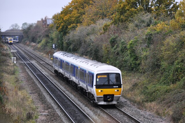
For those seeking outdoor activities, Fort End offers ample opportunities for exploring the surrounding countryside. The village is surrounded by walking and cycling trails, allowing residents and visitors to fully immerse themselves in the natural beauty of Buckinghamshire. Additionally, the nearby Buckinghamshire Railway Centre provides a fascinating glimpse into the region's railway heritage, with vintage locomotives and interactive exhibits.

Overall, Fort End is a charming and idyllic village, offering a peaceful retreat from the hustle and bustle of city life. Its picturesque surroundings, strong sense of community, and range of amenities make it an attractive place to live or visit in Buckinghamshire.

If you have any feedback on the listing, please let us know in the comments section below.
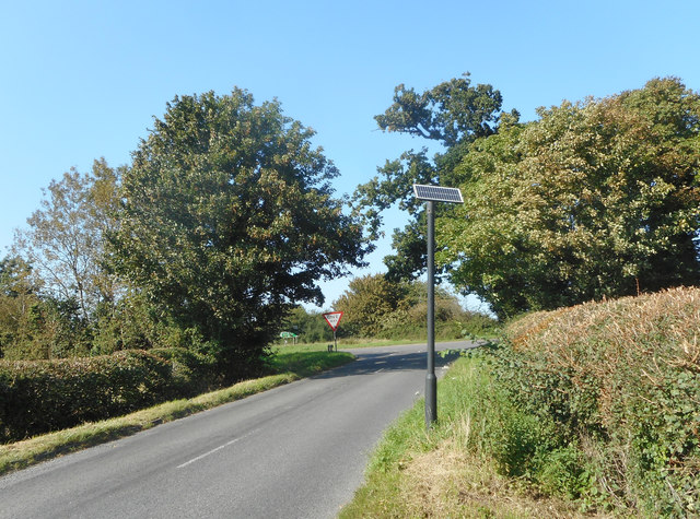
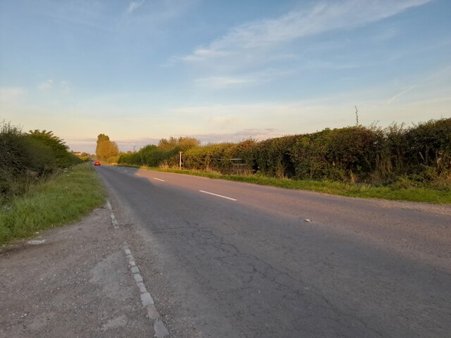
Fort End Images

Images are sourced within 2km of 51.773469/-0.93014769 or Grid Reference SP7308. Thanks to Geograph Open Source API. All images are credited.

Old Milepost by the A418, north of Haddenham Cast iron post by the A418, in parish of Haddenham (Aylesbury Vale District), Aylesbury Road; Roundhill Farm, West of Dadbrook Mill, on the curves North of lay-by, on South side of road. Seymour iron casting, erected by the Aylesbury, Thame, Oxford & Shillingford turnpike trust in the 19th century. Broken.

Inscription reads:-
: (TO) / (THAM)E / 4 : : (HADDENHAM) / (PARISH) : : TO / AYLES- / -BURY / 6 :  Maker:-
: SEYMOUR / AYLESBURY. : 

Buckinghamshire HER.
HER Number: 1418000000 <span class="nowrap"><a title="https://www.heritagegateway.org.uk/Gateway/Results_Single.aspx?uid=MBC26560&resourceID=1024" rel="nofollow ugc noopener" href="https://www.heritagegateway.org.uk/Gateway/Results_Single.aspx?uid=MBC26560&resourceID=1024">Link</a><img style="margin-left:2px;" alt="External link" title="External link - shift click to open in new window" src="https://s1.geograph.org.uk/img/external.png" width="10" height="10"/></span>

Milestone Society National ID: BU_AYTH06
Old Milepost by the A418, north of Haddenham
Cast iron post by the A418, in parish of Haddenham (Aylesbury Vale District), Aylesbury Road; Roundhill Farm, West of Dadbrook Mill, on the curves North of lay-by, on South side of road. Seymour iron casting, erected by the Aylesbury, Thame, Oxford & Shillingford turnpike trust in the 19th century. Broken. Inscription reads:- : (TO) / (THAM)E / 4 : : (HADDENHAM) / (PARISH) : : TO / AYLES- / -BURY / 6 : Maker:- : SEYMOUR / AYLESBURY. : Buckinghamshire HER. HER Number: 1418000000 LinkExternal link Milestone Society National ID: BU_AYTH06
Aylesbury Road, Westlington
Green Lane, Cuddington A well used, tree lined local footpath around the allotments.
Green Lane, Cuddington
A well used, tree lined local footpath around the allotments.
A418 Aylesbury Road Towards Aylesbury.
A418 Aylesbury Road
Towards Aylesbury.
Solar Power for Something A solar panel on a pole. It's not obvious what for.
Solar Power for Something
A solar panel on a pole. It's not obvious what for.
Bus Stop for Budnall Farm No other buildings nearby, this is the farm bus stop.
Bus Stop for Budnall Farm
No other buildings nearby, this is the farm bus stop.
Valuable Gispen at Budnall Farm Valuable Gispen are office furniture and equipment suppliers based in one of the barns along here.
Valuable Gispen at Budnall Farm
Valuable Gispen are office furniture and equipment suppliers based in one of the barns along here.
Haddenham and Thame Parkway Station Haddenham and Thame Parkway Station looking north west.  This station is a replacement for the original station further south east which closed in 1963.  It was opened in 1987 as a single platform, and was rebuilt by Chiltern Railways in 1998 when the line was redoubled.
Haddenham and Thame Parkway Station
Haddenham and Thame Parkway Station looking north west. This station is a replacement for the original station further south east which closed in 1963. It was opened in 1987 as a single platform, and was rebuilt by Chiltern Railways in 1998 when the line was redoubled.
Site of old Haddenham Station DMU No. 165038 has just left Haddenham & Thame Parkway Station with the 1113 departure from Banbury to Marylebone, whilst No.168216 is entering the station with the 1116 departure from Marylebone to Birmingham Snow Hill.
Site of old Haddenham Station
DMU No. 165038 has just left Haddenham & Thame Parkway Station with the 1113 departure from Banbury to Marylebone, whilst No.168216 is entering the station with the 1116 departure from Marylebone to Birmingham Snow Hill.
Lower Road west of Haddenham
Lower Road, Haddenham
New houses on Stanbridge Road, Haddenham
Converted barns on Stanbridge Road, Aston Sandford
Stanbridge Road, Aston Sandford
Field by Stanbridge Road, Aston Sandford
Haddenham and Thame Parkway station including the station building
Railway bridge NAJ2  UB105 The Northolt - Ashenden section of the GWR/GCR line from London to points north crosses Stanbridge Road.
Railway bridge NAJ2 UB105
The Northolt - Ashenden section of the GWR/GCR line from London to points north crosses Stanbridge Road.
A glimpse of a sewage works Looking over the railway line.
A glimpse of a sewage works
Looking over the railway line.
Show me another place!

Fort End is located at Grid Ref: SP7308 (Lat: 51.773469, Lng: -0.93014769)

Unitary Authority: Buckinghamshire

Police Authority: Thames Valley

What 3 Words

///round.rehearsal.cherished. Near Haddenham, Buckinghamshire

Related Wikis

Turn End, Haddenham

Turn End is a grade II* listed garden and group of houses in Haddenham, Buckinghamshire, England. == History == The Turn End complex was designed by architect...

Haddenham Museum

Haddenham Museum is based in Haddenham, Buckinghamshire, England. The museum, which is run by volunteers, first opened in 1998, and is housed in the Old...

Haddenham, Buckinghamshire

Haddenham is a village and civil parish in west Buckinghamshire, England. It is about 5 miles (8 km) south-west of Aylesbury and 4 miles (6 km) north-east...

Haddenham railway station (Buckinghamshire)

Haddenham railway station was on the former Great Western and Great Central Joint Railway between Princes Risborough and Ashendon Junction. It was closed...

Haddenham War Memorial

Haddenham War Memorial is located in Church End, Haddenham, Buckinghamshire, England. It is a grade II listed building with Historic England. It was built...

Haddenham Airfield

Haddenham Airfield was an airfield on the outskirts of the English village of Haddenham, Buckinghamshire. Originally a Second World War airfield called...

St Mary's Church, Haddenham

St Mary's Church is the Church of England parish church of Haddenham, Buckinghamshire It is a Grade I listed building. == History == Parts of the church...

Haddenham & Thame Parkway railway station

Haddenham & Thame Parkway railway station is a station in Buckinghamshire serving the village of Haddenham and town of Thame in the neighbouring county...

Nearby Amenities

Located within 500m of 51.773469,-0.93014769
Haddenham
Name Ru: Хадденхем
Place: village
Wikidata: Q2109493
Wikipedia: en:Haddenham, Buckinghamshire
Lat/Long: 51.7713383/-0.928466
Priority: forward
Traffic Calming: choker
Lat/Long: 51.773277/-0.9274659
Mini Roundabout
Direction: clockwise
Lat/Long: 51.7734439/-0.9249282
Crossing
Crossing: unmarked
Lat/Long: 51.7747656/-0.926796
Haddenham Museum
Tourism: museum
Website: https://www.haddenham.net/spotlight-june/spotlight.html
Wikidata: Q5637648
Wikipedia: en:Haddenham Museum
Lat/Long: 51.7707014/-0.9294083
Mini Roundabout
Direction: clockwise
Lat/Long: 51.7734236/-0.9250951
Crossing
Crossing: unmarked
Lat/Long: 51.7763609/-0.9253648
Crossing
Crossing: unmarked
Lat/Long: 51.7748317/-0.9267245
Crossing
Crossing: unmarked
Lat/Long: 51.7767415/-0.9262405
Morrisons Daily
Addr Country: GB
Addr Housenumber: 1-3
Addr Postcode: HP17 8ED
Addr Street: Banks Parade
Brand: Morrisons Daily
Brand Wikidata: Q99752411
Fhrs Id: 369542
Operator: McColl's
Operator Wikidata: Q16997477
Shop: convenience
Website: https://my.morrisons.com/storefinder/60371/morrisons-daily-haddenham-banks-parade
Lat/Long: 51.7737047/-0.9266608
Pub
The Rising Sun
Addr City: Haddenham
Addr Housenumber: 9
Addr Postcode: HP17 8EN
Addr Street: Thame Road
Fhrs Id: 369555
Opening Hours: Mo-Th 12:00-14:30,17:00-23:00; Fr-Sa 12:00-24:00; Su 12:00-22:30
Operator: Oak Taverns
Source: survey
Survey Date: 2015-08-22
Website: https://www.risingsunhaddenham.co.uk/
Lat/Long: 51.7734734/-0.9298212
Post Box
Brand: Royal Mail
Brand Wikidata: Q638098
Brand Wikipedia: en:Royal Mail
Collection Times: Mo-Fr 16:00; Sa 09:00
Operator: Royal Mail
Operator Wikidata: Q638098
Post Box Type: pillar
Ref: HP17 170
Royal Cypher: EIIR
Royal Cypher Wikidata: Q33102113
Source: survey
Survey Date: 2015-08-22
Lat/Long: 51.7708556/-0.9309451
Post Box
Brand: Royal Mail
Brand Wikidata: Q638098
Brand Wikipedia: en:Royal Mail
Collection Times: Mo-Fr 09:00; Sa 07:00
Operator: Royal Mail
Operator Wikidata: Q638098
Post Box Type: pillar
Ref: HP17 172D
Royal Cypher: EIIR
Royal Cypher Wikidata: Q33102113
Source: survey
Survey Date: 2015-08-22
Lat/Long: 51.7723503/-0.9343719
Post Box
Brand: Royal Mail
Brand Wikidata: Q638098
Brand Wikipedia: en:Royal Mail
Collection Times: Mo-Fr 09:00; Sa 07:00
Operator: Royal Mail
Operator Wikidata: Q638098
Post Box Type: pillar
Ref: HP17 173D
Royal Cypher: EIIR
Royal Cypher Wikidata: Q33102113
Source: survey
Survey Date: 2015-08-22
Lat/Long: 51.7725084/-0.9256788
Post Box
Brand: Royal Mail
Brand Wikidata: Q638098
Brand Wikipedia: en:Royal Mail
Collection Times: Mo-Fr 09:00; Sa 07:00
Operator: Royal Mail
Operator Wikidata: Q638098
Post Box Type: pillar
Ref: HP17 169D
Royal Cypher: EIIR
Royal Cypher Wikidata: Q33102113
Source: survey
Survey Date: 2015-08-22
Lat/Long: 51.7734054/-0.9286781
Communication Mobile Phone: yes
Man Made: mast
Tower Type: communication
Lat/Long: 51.7749173/-0.9346766
Waste Basket
Waste: trash
Lat/Long: 51.771523/-0.9243596
Bench
Backrest: no
Lat/Long: 51.7722126/-0.9244951
Playground: climbingframe
Lat/Long: 51.7727189/-0.9240063
Pitch: hoop
Lat/Long: 51.7725906/-0.9241181
Leisure: picnic_table
Lat/Long: 51.7727197/-0.9235235
Waste Basket
Waste: trash
Lat/Long: 51.7727686/-0.9233914
Bench
Backrest: yes
Lat/Long: 51.7728483/-0.9234242
Bench
Backrest: yes
Lat/Long: 51.7730122/-0.9231325
Crossing
Crossing: uncontrolled
Crossing Ref: zebra
Tactile Paving: yes
Lat/Long: 51.7732758/-0.9231217
Waste Basket
Waste: dog_excrement
Lat/Long: 51.7733531/-0.9234423
Traffic Calming: cushion
Lat/Long: 51.7733137/-0.9234765
Traffic Calming: cushion
Lat/Long: 51.7734062/-0.9243981
Waste Basket
Waste: trash
Lat/Long: 51.7734964/-0.9245937
Bench
Backrest: yes
Lat/Long: 51.7733329/-0.9248418
Waste Basket
Waste: trash
Lat/Long: 51.7736678/-0.9263061
Bench
Backrest: no
Lat/Long: 51.7730682/-0.9263472
Traffic Calming: bump
Lat/Long: 51.7729813/-0.9260598
Parish Council
Office: government
Lat/Long: 51.7728168/-0.9257805
Waste Basket
Waste: trash
Lat/Long: 51.7725321/-0.9256183
Bicycle Parking
Bicycle Parking: stands
Capacity: 6
Lat/Long: 51.7726288/-0.9255633
Entrance: yes
Lat/Long: 51.7731265/-0.925507
Entrance: yes
Lat/Long: 51.7731412/-0.925545
Entrance: yes
Lat/Long: 51.7732052/-0.9256683
Entrance: yes
Lat/Long: 51.7731514/-0.9257667
Entrance: yes
Lat/Long: 51.7728499/-0.9255897
Waste Basket
Waste: trash
Lat/Long: 51.7730188/-0.9254707
Fit Life
Leisure: fitness_centre
Website: https://fitlife.co.uk/
Lat/Long: 51.773211/-0.9255002
Elite Physical Medicine
Healthcare: physiotherapist
Website: https://www.elitephysicalmedicine.co.uk/contact/#haddenham-physiotherapy-clinic
Lat/Long: 51.7731105/-0.9254848
Bicycle Parking
Bicycle Parking: stands
Capacity: 6
Lat/Long: 51.7732201/-0.9257906
Community Centre
Village Hall
Lat/Long: 51.7728774/-0.9257215
Community Centre
The Mabel Parkinson Room
Lat/Long: 51.7730242/-0.9258744
Library
Haddenham Community Library
Alt Website: http://haddenhamcommunitylibrary.org.uk/
Website: https://www.buckscc.gov.uk/services/libraries/find-a-library/haddenham/
Wikidata: Q55173417
Lat/Long: 51.7732748/-0.9256679
Playground: structure
Lat/Long: 51.773001/-0.926545
Playground: swing
Lat/Long: 51.7730873/-0.9262861
Waste Basket
Waste: trash
Lat/Long: 51.7731621/-0.9261658
Atm
Lat/Long: 51.7736662/-0.9265919
Waste Basket
Waste: trash
Lat/Long: 51.7735436/-0.9260382
Waste Basket
Waste: dog_excrement
Lat/Long: 51.773545/-0.9259946
Bench
Backrest: yes
Lat/Long: 51.7735072/-0.9260836
Crossing
Crossing: unmarked
Priority: forward
Traffic Calming: choker
Lat/Long: 51.773433/-0.9260861
Bench
Backrest: yes
Lat/Long: 51.7734636/-0.926494
Waste Basket
Waste: trash
Lat/Long: 51.7734599/-0.9265316
Waste Basket
Waste: trash
Lat/Long: 51.7735035/-0.9268249
Blooming Fruity
Fhrs Id: 369870
Shop: greengrocer
Lat/Long: 51.7737827/-0.9262191
The Boutique
Shop: hairdresser
Lat/Long: 51.7737976/-0.9261198
Fast Food
Smarts Fish & Chips
Cuisine: fish_and_chips
Fhrs Id: 369541
Lat/Long: 51.7737752/-0.9262969
Cafe
Tickety Brew
Addr Housenumber: 4
Addr Postcode: HP17 8ED
Addr Street: Banks Parade
Fhrs Id: 760089
Lat/Long: 51.773752/-0.9264323
Priority: backward
Traffic Calming: choker
Lat/Long: 51.7733491/-0.9306391
Waste Basket
Waste: dog_excrement
Lat/Long: 51.7736147/-0.9301458
The Cottage Bakery
Addr City: Haddenham
Addr Housenumber: 17
Addr Postcode: HP17 8EJ
Addr Street: Fort End
Email: infothecottagebakerythame@gmail.com
Fhrs Id: 369549
Opening Hours: Mo-Fr 06:30-14:00; Sa 07:00-13:00
Phone: +44 1844 291469
Shop: bakery
Website: https://cottage-bakery.co.uk/Menu/Preview?menuId=20&vrp=34
Lat/Long: 51.7736835/-0.9286458
Hewitt's Barber Shop
Shop: hairdresser
Lat/Long: 51.7729778/-0.9282301
Waste Basket
Waste: trash
Lat/Long: 51.7731328/-0.9284767
Bench
Backrest: yes
Lat/Long: 51.7731278/-0.9284609
Bicycle Parking
Bicycle Parking: stands
Capacity: 4
Lat/Long: 51.7730807/-0.9284386
Harpers
Office: estate_agent
Phone: +44 1844 853888
Website: https://harpersestateagents.co.uk/
Lat/Long: 51.7729819/-0.9287752
Reddog Forge
Craft: blacksmith
Website: http://www.reddogforge.co.uk/
Lat/Long: 51.7729031/-0.9290099
Robert Green
Craft: blacksmith
Lat/Long: 51.7729363/-0.9289683
Bench
Backrest: yes
Lat/Long: 51.7729093/-0.9287076
Cafe
Norsk
Addr City: Haddenham
Addr Housenumber: 19
Addr Postcode: HP17 8EJ
Addr Street: Fort End
Fhrs Id: 370260
Indoor Seating: yes
Opening Hours: We-Fri 07:30-16:00; Sa 09:00-16:00; Su 09:00-14:00
Outdoor Seating: yes
Phone: 01844 290426
Reservation: no
Website: https://www.norsklifestyle.com/cafe
Lat/Long: 51.7729022/-0.928802
Bench
Backrest: yes
Lat/Long: 51.7706969/-0.9287759
Bench
Backrest: yes
Lat/Long: 51.7707301/-0.9282964
Waste Basket
Waste: dog_excrement
Lat/Long: 51.7725994/-0.9279706
Ivor Miles of Haddenham
Service: dealer;repair
Shop: car_repair
Lat/Long: 51.7705446/-0.9258369
Haddenham Carpets
Shop: carpet
Website: https://haddenhamcarpets.com/
Lat/Long: 51.7698782/-0.9265235
Waste Basket
Waste: dog_excrement
Lat/Long: 51.7700218/-0.9293465
Bench
Backrest: no
Lat/Long: 51.7757019/-0.9268877
Bench
Backrest: no
Lat/Long: 51.7756757/-0.9267884
Bench
Backrest: no
Lat/Long: 51.7756977/-0.9267636
Bench
Backrest: no
Lat/Long: 51.7757317/-0.9267683
Bench
Backrest: no
Lat/Long: 51.7757458/-0.9268159
Bench
Backrest: no
Lat/Long: 51.7757293/-0.9268642
Board Type: nature
Description: Lists the tree's and their location on a map of the orchard
Information: board
Tourism: information
Lat/Long: 51.7758548/-0.9267274
Bench
Backrest: yes
Lat/Long: 51.7762248/-0.92718
Bench
Backrest: yes
Lat/Long: 51.7760564/-0.9273724
Waste Basket
Waste: dog_excrement
Lat/Long: 51.7759332/-0.9277553
Bench
Backrest: yes
Lat/Long: 51.7760004/-0.9278364
Waste Basket
Waste: trash
Lat/Long: 51.7759904/-0.9279156
Crossing
Crossing: unmarked
Lat/Long: 51.7758431/-0.9255985
Crossing
Crossing: unmarked
Lat/Long: 51.7763809/-0.9254079
Crossing
Crossing: unmarked
Lat/Long: 51.776446/-0.925451
Crossing
Crossing: unmarked
Lat/Long: 51.7756592/-0.924994
Crossing
Crossing: unmarked
Lat/Long: 51.7756984/-0.9246393
Crossing
Crossing: unmarked
Lat/Long: 51.7746934/-0.9269212
Crossing
Crossing: unmarked
Lat/Long: 51.7742491/-0.9269031
Crossing
Crossing: unmarked
Lat/Long: 51.7735272/-0.9268761
Crossing
Crossing: unmarked
Lat/Long: 51.7733712/-0.927013
Crossing
Crossing: unmarked
Lat/Long: 51.7734567/-0.9270438
Crossing
Crossing: unmarked
Lat/Long: 51.7737914/-0.9270448
Crossing
Lat/Long: 51.7741362/-0.9302283
Crossing
Crossing: unmarked
Crossing Markings: no
Lat/Long: 51.7735603/-0.930152
Crossing
Crossing: unmarked
Lat/Long: 51.775488/-0.9285923
Crossing
Crossing: unmarked
Lat/Long: 51.7748795/-0.9292906
Crossing
Crossing: unmarked
Lat/Long: 51.7745007/-0.9298493
Crossing
Crossing: unmarked
Lat/Long: 51.7757219/-0.9250724
Crossing
Crossing: unmarked
Lat/Long: 51.7756935/-0.9244764
Crossing
Crossing: unmarked
Lat/Long: 51.7735056/-0.9248899
Crossing
Crossing: unmarked
Lat/Long: 51.7734403/-0.9253327
Crossing
Crossing: unmarked
Lat/Long: 51.7734062/-0.925861
Direction: 215
Generator Method: photovoltaic
Generator Output Electricity: yes
Generator Solar Modules: 16
Generator Source: solar
Generator Type: solar_photovoltaic_panel
Location: roof
Power: generator
Lat/Long: 51.7766602/-0.9256371
Direction: 215
Generator Method: photovoltaic
Generator Output Electricity: yes
Generator Solar Modules: 18
Generator Source: solar
Generator Type: solar_photovoltaic_panel
Location: roof
Power: generator
Lat/Long: 51.7767075/-0.9257739
Direction: 215
Generator Method: photovoltaic
Generator Output Electricity: yes
Generator Solar Modules: 12
Generator Source: solar
Generator Type: solar_photovoltaic_panel
Location: roof
Power: generator
Lat/Long: 51.7770512/-0.9263311
Direction: SW
Generator Method: photovoltaic
Generator Output Electricity: yes
Generator Solar Modules: 18
Generator Source: solar
Generator Type: solar_photovoltaic_panel
Location: roof
Power: generator
Lat/Long: 51.7773492/-0.9281741
Direction: 215
Generator Method: photovoltaic
Generator Output Electricity: yes
Generator Solar Modules: 17
Generator Source: solar
Generator Type: solar_photovoltaic_panel
Location: roof
Power: generator
Lat/Long: 51.77657/-0.9262473
Direction: 215
Generator Method: photovoltaic
Generator Output Electricity: yes
Generator Solar Modules: 17
Generator Source: solar
Generator Type: solar_photovoltaic_panel
Location: roof
Power: generator
Lat/Long: 51.7764245/-0.9259978
Direction: 215
Generator Method: photovoltaic
Generator Output Electricity: yes
Generator Solar Modules: 8
Generator Source: solar
Generator Type: solar_photovoltaic_panel
Location: roof
Power: generator
Lat/Long: 51.7762013/-0.9284457
Direction: 215
Generator Method: photovoltaic
Generator Output Electricity: yes
Generator Solar Modules: 4
Generator Source: solar
Generator Type: solar_photovoltaic_panel
Location: roof
Power: generator
Lat/Long: 51.776348/-0.9287786
Direction: SSW
Generator Method: photovoltaic
Generator Output Electricity: yes
Generator Solar Modules: 14
Generator Source: solar
Generator Type: solar_photovoltaic_panel
Location: roof
Power: generator
Lat/Long: 51.7738702/-0.9312238
Direction: SSW
Generator Method: photovoltaic
Generator Output Electricity: yes
Generator Solar Modules: 12
Generator Source: solar
Generator Type: solar_photovoltaic_panel
Location: roof
Power: generator
Lat/Long: 51.7739992/-0.9315842
Direction: SSW
Generator Method: photovoltaic
Generator Output Electricity: yes
Generator Solar Modules: 16
Generator Source: solar
Generator Type: solar_photovoltaic_panel
Location: roof
Power: generator
Lat/Long: 51.7729363/-0.9345917
Direction: 190
Generator Method: photovoltaic
Generator Output Electricity: yes
Generator Solar Modules: 16
Generator Source: solar
Generator Type: solar_photovoltaic_panel
Location: roof
Power: generator
Lat/Long: 51.7692001/-0.9285571
Direction: 185
Generator Method: photovoltaic
Generator Output Electricity: yes
Generator Solar Modules: 8
Generator Source: solar
Generator Type: solar_photovoltaic_panel
Location: roof
Power: generator
Lat/Long: 51.76954/-0.9287734
Direction: 195
Generator Method: photovoltaic
Generator Output Electricity: yes
Generator Solar Modules: 16
Generator Source: solar
Generator Type: solar_photovoltaic_panel
Location: roof
Power: generator
Lat/Long: 51.7696794/-0.929633
Direction: SSW
Generator Method: photovoltaic
Generator Output Electricity: yes
Generator Solar Modules: 6
Generator Source: solar
Generator Type: solar_photovoltaic_panel
Location: roof
Power: generator
Lat/Long: 51.7709446/-0.9298629
Direction: SSW
Generator Method: photovoltaic
Generator Output Electricity: yes
Generator Solar Modules: 6
Generator Source: solar
Generator Type: solar_photovoltaic_panel
Location: roof
Power: generator
Lat/Long: 51.7709243/-0.9297695
Direction: SSW
Generator Method: photovoltaic
Generator Output Electricity: yes
Generator Solar Modules: 15
Generator Source: solar
Generator Type: solar_photovoltaic_panel
Location: roof
Power: generator
Lat/Long: 51.7749027/-0.9269408
Direction: S
Generator Method: photovoltaic
Generator Output Electricity: yes
Generator Solar Modules: 12
Generator Source: solar
Generator Type: solar_photovoltaic_panel
Location: roof
Power: generator
Lat/Long: 51.7741714/-0.9240329
Direction: E
Generator Method: photovoltaic
Generator Output Electricity: yes
Generator Solar Modules: 4
Generator Source: solar
Generator Type: solar_photovoltaic_panel
Location: roof
Power: generator
Lat/Long: 51.7742075/-0.9239659
Direction: SSE
Generator Method: photovoltaic
Generator Output Electricity: yes
Generator Solar Modules: 4
Generator Source: solar
Generator Type: solar_photovoltaic_panel
Location: roof
Power: generator
Lat/Long: 51.7713757/-0.9341179
Direction: SSE
Generator Method: photovoltaic
Generator Output Electricity: yes
Generator Solar Modules: 4
Generator Source: solar
Generator Type: solar_photovoltaic_panel
Location: roof
Power: generator
Lat/Long: 51.7713886/-0.9340723
Direction: ESE
Generator Method: photovoltaic
Generator Output Electricity: yes
Generator Solar Modules: 8
Generator Source: solar
Generator Type: solar_photovoltaic_panel
Location: roof
Power: generator
Lat/Long: 51.775129/-0.9281104
Direction: 125
Generator Method: photovoltaic
Generator Output Electricity: yes
Generator Solar Modules: 20
Generator Source: solar
Generator Type: solar_photovoltaic_panel
Location: roof
Power: generator
Lat/Long: 51.7746922/-0.9260052
Direction: 185
Generator Method: photovoltaic
Generator Output Electricity: yes
Generator Solar Modules: 6
Generator Source: solar
Generator Type: solar_photovoltaic_panel
Location: roof
Power: generator
Lat/Long: 51.770075/-0.9255818
Addr Housenumber: 14,16
Addr Postcode: HP17 8EJ
Addr Street: Fort End
Door: no
Entrance: main
Level: 0
Lat/Long: 51.7736774/-0.9287167
Crossing
Crossing: unmarked
Crossing Markings: no
Lat/Long: 51.7736185/-0.9294378
Crossing
Crossing: unmarked
Crossing Island: no
Crossing Markings: no
Tactile Paving: yes
Lat/Long: 51.7760566/-0.9356368
The data included in this document is from www.openstreetmap.org. The data is made available under ODbL.

Have you been to Fort End?

Leave your review of Fort End below (or comments, questions and feedback).