Enfield Island Village

Settlement in Essex

England

Enfield Island Village

Eleanor Cross, Waltham Cross This has been cleaned up since I last visited.
Eleanor Cross, Waltham Cross Credit: Christine Matthews

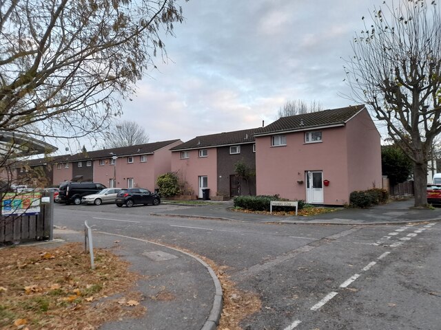
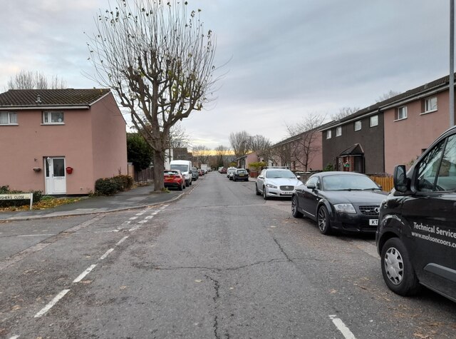
Enfield Island Village is a residential development located in the borough of Enfield, in the county of Essex, England. Situated on the eastern outskirts of London, the village is built on a former industrial site and is now home to a diverse community.

The development was established in the late 1990s, transforming the previously derelict land into a thriving residential area. Enfield Island Village offers a mix of housing options, including apartments, townhouses, and detached houses, catering to individuals, families, and professionals.

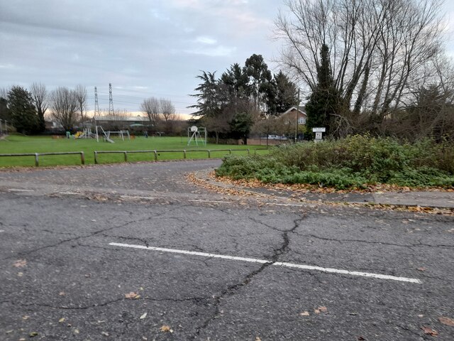
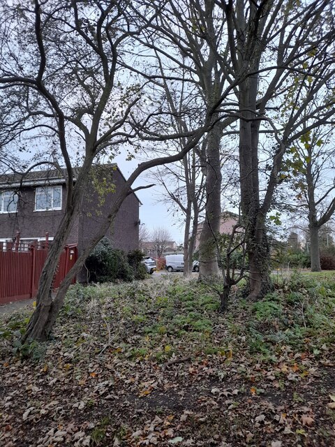
The village has a range of amenities to cater to the needs of its residents. There are several small local shops, a supermarket, a community center, and a primary school within the development. In addition, residents have access to recreational facilities, including parks, playgrounds, and sports fields, providing ample opportunities for outdoor activities.

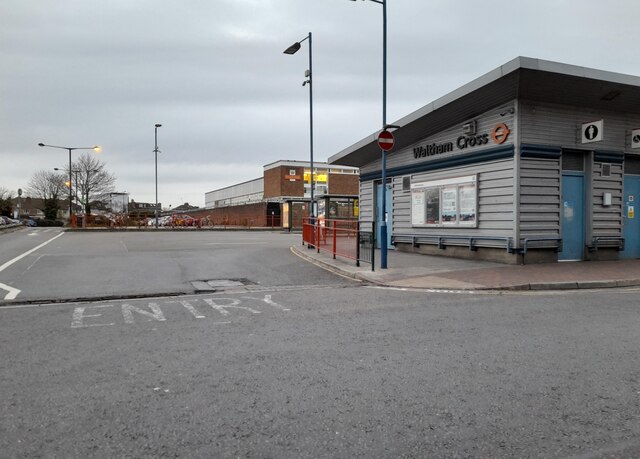
Enfield Island Village benefits from excellent transport links. The development is conveniently located near the A1055 road, providing easy access to the M25 motorway and the nearby towns of Enfield and Waltham Cross. There are also regular bus services connecting the village to surrounding areas, making it easy for residents to commute or explore the wider region.

Moreover, the village is well-served by public transportation, with Enfield Lock railway station located nearby, offering direct train services to central London and other destinations. This makes it an attractive location for those who work in the city but prefer to live in a quieter, more suburban setting.

Overall, Enfield Island Village offers a peaceful and well-connected living environment, combining modern housing with convenient amenities and excellent transport links.

If you have any feedback on the listing, please let us know in the comments section below.

Enfield Island Village Images

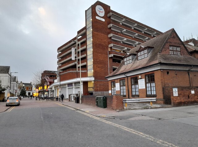
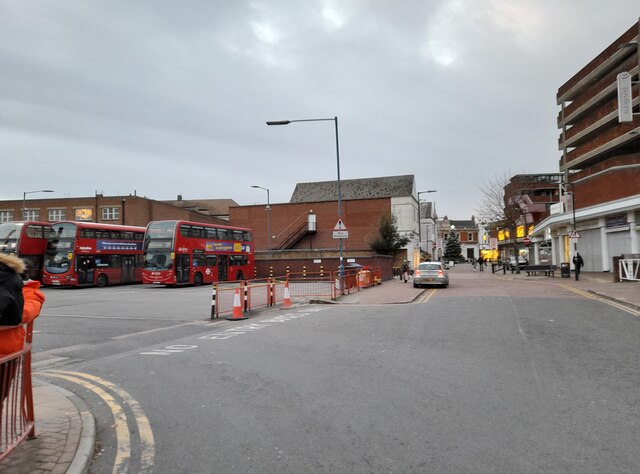
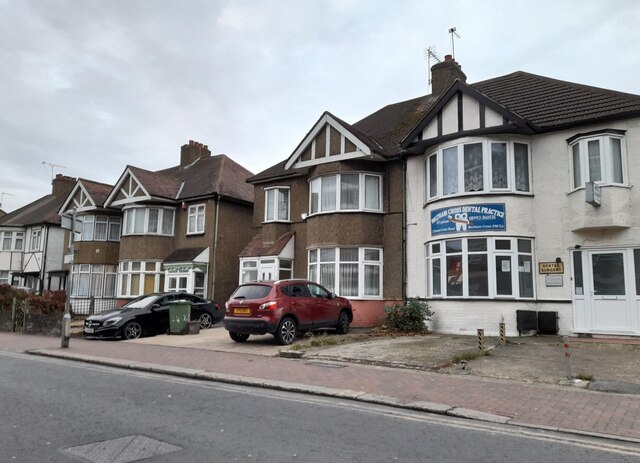
Images are sourced within 2km of 51.670333/-0.016077176 or Grid Reference TQ3798. Thanks to Geograph Open Source API. All images are credited.

Eleanor Cross, Waltham Cross This has been cleaned up since I last visited.
Eleanor Cross, Waltham Cross
This has been cleaned up since I last visited.
KFC, Waltham Cross
KFC, Waltham Cross
Eleanor Cross Road, Waltham Cross
Waltham Cross bus stand
Houses on Eleanor Cross Road, Waltham Cross
Fishers Close, Waltham Cross
Longcroft Drive, Waltham Cross
Bus stop on Longcroft Drive, Waltham Cross
Playground on Longcroft Drive, Waltham Cross
The Small River Lea, Waltham Cross
Woodland by the Small River Lea
The Small River Lea, Waltham Cross
Woodland by the Small River Lea
Rear of houses on Longcroft Drive, Waltham Cross
Woodland by the Small River Lea
The Small River Lea, Waltham Cross
Longcroft Drive, Waltham Cross Crossing the Small River Lea
Longcroft Drive, Waltham Cross
Crossing the Small River Lea
Show me another place!

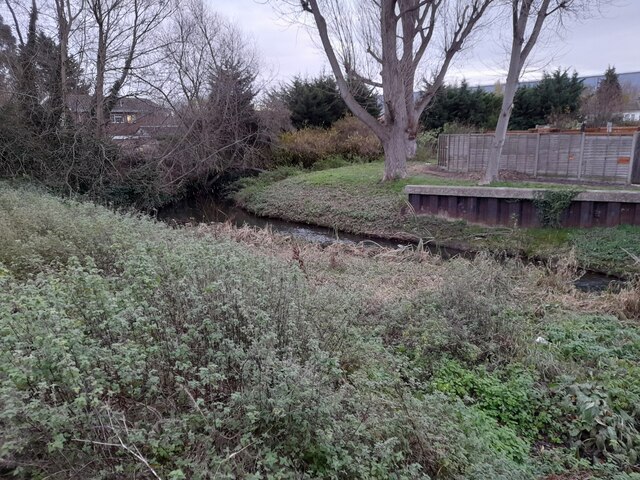
Enfield Island Village is located at Grid Ref: TQ3798 (Lat: 51.670333, Lng: -0.016077176)

Unitary Authority: Enfield

Police Authority: Metropolitan

What 3 Words

///snaps.nobody.ruler. Near Waltham Abbey, Essex

Nearby Locations

Enfield Island Village

Related Wikis

Enfield Island Village

Enfield Island Village is a modern property development in Enfield Lock, in the London Borough of Enfield, north London. Before April 1994, Enfield Island...

Royal Small Arms Factory

The Royal Small Arms Factory (RSAF), also known by the metonym Enfield, was a UK government-owned rifle factory in Enfield, adjoining the Lee Navigation...

Newmans Weir

Newmans Weir is a weir on the River Lea located near Enfield Lock. The weir has wooden sluice gates within cast-iron guide frames. It was reconstructed...
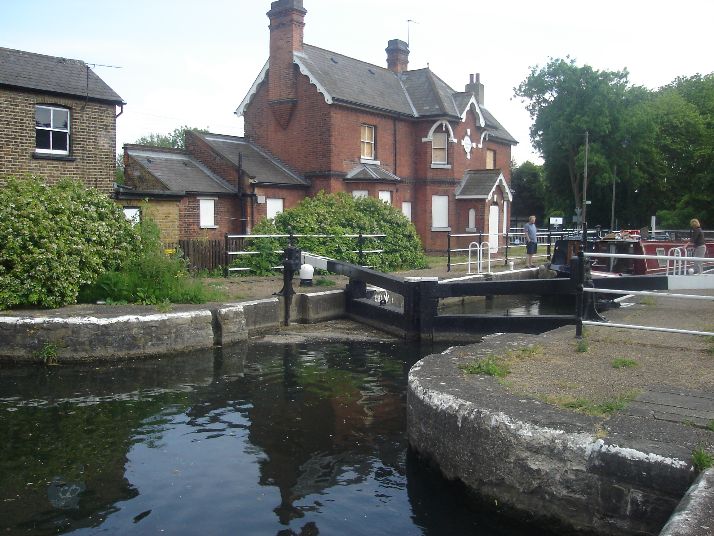
Enfield Lock (lock)

Enfield Lock (No 13) is a lock on the River Lee Navigation, in the London Borough of Enfield. It gives its name to the surrounding area of Enfield Lock...

Nearby Amenities

Located within 500m of 51.670333,-0.016077176
Seamark Type: gate
Waterway: lock_gate
Lat/Long: 51.667077/-0.0181988
Turning Circle
Lat/Long: 51.6693107/-0.0206907
Turning Circle
Lat/Long: 51.6675626/-0.0214782
Created By: YahooApplet 1.0
Lat/Long: 51.6659995/-0.0170748
Traffic Calming: table
Lat/Long: 51.6713798/-0.0150802
Traffic Calming: rumble_strip
Lat/Long: 51.6725271/-0.013732
Barrier: bollard
Lat/Long: 51.6719501/-0.0140056
Crossing
Bicycle: yes
Crossing: unmarked
Crossing Island: no
Crossing Markings: no
Tactile Paving: yes
Lat/Long: 51.6682073/-0.0154908
Mini Roundabout
Direction: clockwise
Lat/Long: 51.667496/-0.0130655
Crossing
Crossing: unmarked
Crossing Island: no
Tactile Paving: no
Lat/Long: 51.6676899/-0.0130008
Crossing
Crossing: unmarked
Crossing Island: no
Tactile Paving: no
Traffic Calming: table
Lat/Long: 51.6690494/-0.0132459
Created By: YahooApplet 1.0
Lat/Long: 51.6668666/-0.0199171
Created By: YahooApplet 1.0
Lat/Long: 51.6670284/-0.0195838
Barrier: bollard
Lat/Long: 51.6658429/-0.0156517
Barrier: bollard
Lat/Long: 51.6663209/-0.0143049
Barrier: bollard
Lat/Long: 51.6669626/-0.0139468
Power: tower
Lat/Long: 51.6718401/-0.0125204
Power: tower
Lat/Long: 51.6698014/-0.0118939
Operator: National Grid
Power: tower
Ref: ZBC-17
Lat/Long: 51.6660218/-0.0144602
Power: tower
Lat/Long: 51.6716485/-0.0129839
Power: tower
Lat/Long: 51.6698706/-0.0125462
Operator: National Grid
Power: tower
Ref: ZBD-17
Lat/Long: 51.6662507/-0.0149752
Ref GB Tflcid: RWG148113
Traffic Calming: yes
Lat/Long: 51.6666421/-0.0184438
Crossing
Crossing: unmarked
Crossing Island: no
Tactile Paving: yes
Lat/Long: 51.6664936/-0.0136491
Seamark Type: gate
Waterway: lock_gate
Lat/Long: 51.6673423/-0.0181943
Mooring: yes
Lat/Long: 51.6661428/-0.0181722
Pub
The Greyhound
Addr Housenumber: 425
Addr Postcode: EN3 6HR
Addr Street: South Ordnance Road
Toilets: yes
Toilets Access: customers
Lat/Long: 51.670387/-0.0181586
Bus Stop
Canal Side Walk
Bin: yes
Bus: yes
Naptan AtcoCode: 490004735N
Naptan Bearing: N
Naptan CommonName: Canal Side Walk
Naptan Indicator: Stop
Naptan Street: THORNEYCROFT DRIVE
Naptan Verified: no
Public Transport: platform
Ref: 76151
Source Ref: naptan
Lat/Long: 51.6686013/-0.0154154
Bus Stop
Canal Side Walk
Bench: no
Bin: yes
Bus: yes
Naptan AtcoCode: 490004735S
Naptan Bearing: S
Naptan CommonName: Canal Side Walk
Naptan Indicator: Stop
Naptan Street: THORNEYCROFT DRIVE
Naptan Verified: no
Public Transport: platform
Ref: 71273
Shelter: no
Source Ref: naptan
Tactile Paving: no
Lat/Long: 51.6679266/-0.0154555
Bus Stop
Causeway Bridge / River Lee
Bench: no
Bin: yes
Bus: yes
Lit: yes
Naptan AtcoCode: 490004882E
Naptan Bearing: N
Naptan CommonName: Causeway Bridge River Lee
Naptan Street: SMEATON ROAD
Naptan Verified: no
Public Transport: platform
Ref: 49581
Shelter: yes
Source Ref: naptan
Tactile Paving: no
Wheelchair: yes
Lat/Long: 51.6708595/-0.0177949
Bus Stop
Causeway Bridge / River Lee
Bench: yes
Bin: yes
Bus: yes
Naptan AtcoCode: 490004882W
Naptan Bearing: N
Naptan CommonName: Causeway Bridge River Lee
Naptan Street: SMEATON ROAD
Naptan Verified: no
Public Transport: platform
Ref: 55081
Shelter: yes
Source Ref: naptan
Tactile Paving: no
Wheelchair: yes
Lat/Long: 51.6707774/-0.0181023
Bus Stop
Enfield Island Village
Bus: yes
Naptan AtcoCode: 490006582N
Naptan Bearing: N
Naptan CommonName: Enfield Island Village
Naptan Street: BRUNSWICK ROAD
Naptan Verified: no
Public Transport: platform
Ref: 59097
Source Ref: naptan
Lat/Long: 51.6660558/-0.01539
Bus Stop
Gunner Drive
Bus: yes
Naptan AtcoCode: 490007600E
Naptan Bearing: E
Naptan CommonName: Gunner Drive
Naptan NaptanCode: 52575
Naptan Verified: no
Public Transport: platform
Ref: 52575
Shelter: no
Source Ref: naptan
Lat/Long: 51.6703161/-0.0149788
Bus Stop
Gunner Drive
Bin: yes
Bus: yes
Naptan AtcoCode: 490007600W
Naptan Bearing: W
Naptan CommonName: Gunner Drive
Naptan NaptanCode: 47260
Naptan Verified: no
Public Transport: platform
Ref: 47260
Source Ref: naptan
Lat/Long: 51.6703069/-0.0154998
Bus Stop
Ordnance Road / Mollison Avenue
Bench: yes
Bin: yes
Bus: yes
Lit: yes
Naptan AtcoCode: 490009964W
Naptan Bearing: N
Naptan CommonName: Mollison Avenue
Naptan Street: ORDNANCE ROAD
Naptan Verified: no
Public Transport: platform
Ref: 48626
Shelter: yes
Source Ref: naptan
Tactile Paving: no
Wheelchair: yes
Lat/Long: 51.6707128/-0.0202233
Bus Stop
Mollison Avenue
Bench: no
Bin: yes
Bus: yes
Lit: yes
Naptan AtcoCode: 490011869E
Naptan Bearing: E
Naptan CommonName: Salisbury Road Ordnance Road
Naptan Indicator: Stop
Naptan Street: ORDNANCE ROAD
Naptan Verified: no
Public Transport: platform
Ref: 77230
Shelter: no
Source Ref: naptan
Tactile Paving: no
Wheelchair: yes
Lat/Long: 51.6709728/-0.0229208
Crossing
Bicycle: yes
Crossing: unmarked
Lat/Long: 51.6715457/-0.0211928
Ref GB Tflcid: RWG145580
Traffic Calming: hump
Lat/Long: 51.6716404/-0.0212896
Ref GB Tflcid: RWG145579
Traffic Calming: hump
Lat/Long: 51.6716137/-0.0217403
Ref GB Tflcid: RWG147425
Traffic Calming: hump
Lat/Long: 51.6708371/-0.0215862
Traffic Signals
Lat/Long: 51.670591/-0.0195709
Addr Street: Joslyn Close
Lat/Long: 51.66616/-0.0164889
Addr Street: Joslyn Close
Lat/Long: 51.6662839/-0.0161034
Crossing
Crossing: unmarked
Crossing Island: yes
Kerb: lowered
Tactile Paving: yes
Lat/Long: 51.6666558/-0.0156049
Crossing
Crossing: unmarked
Crossing Island: no
Tactile Paving: yes
Traffic Calming: table
Lat/Long: 51.6679497/-0.0127459
Enfield Island Village
Place: quarter
Wikidata: Q5377307
Lat/Long: 51.6693018/-0.0152295
Barrier: spikes
Lat/Long: 51.6689088/-0.0170548
Barrier: bollard
Bollard: rising
Lat/Long: 51.6688954/-0.0162607
Barrier: bollard
Lat/Long: 51.6710624/-0.0163118
Barrier: bollard
Lat/Long: 51.6724949/-0.014049
Crossing
Crossing: unmarked
Crossing Island: no
Tactile Paving: yes
Lat/Long: 51.6702513/-0.0147857
Crossing
Bicycle: yes
Crossing: unmarked
Lat/Long: 51.6710226/-0.0207854
Barrier: bollard
Lat/Long: 51.671531/-0.0212241
Crossing
Crossing: unmarked
Crossing Island: no
Kerb: lowered
Tactile Paving: yes
Lat/Long: 51.6689423/-0.0127954
Crossing
Crossing: unmarked
Crossing Island: no
Kerb: lowered
Tactile Paving: no
Lat/Long: 51.6684966/-0.0124143
Waste Basket
Waste: dog
Lat/Long: 51.6670023/-0.013877
Waste Basket
Lat/Long: 51.6670901/-0.0138736
Addr Housenumber: 50
Addr Street: Manton Road
Source: gps+mapnoter
Lat/Long: 51.6684916/-0.0122258
Addr Housenumber: 9
Addr Street: Hodson Place
Source: gps+mapnoter
Lat/Long: 51.6679773/-0.0145161
Addr Housenumber: 60
Addr Street: Manton Road
Source: gps+mapnoter
Lat/Long: 51.6679923/-0.0125085
Addr Housenumber: 20
Addr Street: Fogerty Close
Source: gps+mapnoter
Lat/Long: 51.6692192/-0.0117713
Bench
Backrest: yes
Source: gps+mapnoter
Lat/Long: 51.6714573/-0.0095345
Information: map and posters
Source: gps+mapnoter
Tourism: information
Lat/Long: 51.671019/-0.0099749
Fixme: continue?
Lat/Long: 51.6723938/-0.021262
Shelpa Express
Addr Housenumber: 389
Addr Postcode: EN3 6HN
Addr Street: Ordnance Road
Check Date: 2023-05-06
Shop: convenience
Source: gps+mapnoter
Lat/Long: 51.6707391/-0.0211445
Bench
Source: gps+mapnoter
Lat/Long: 51.670431/-0.0118741
Waste Basket
Check Date: 2021-01-16
Source: gps+mapnoter
Waste: dog_excrement
Lat/Long: 51.6705208/-0.0122523
Barrier: bollard
Bollard: removable
Lat/Long: 51.670648/-0.011723
Bench
Backrest: no
Check Date: 2021-01-16
Source: gps+mapnoter
Lat/Long: 51.6705075/-0.0121209
Waste Basket
Check Date: 2021-01-16
Source: gps+mapnoter
Lat/Long: 51.6704655/-0.0122342
Addr Housenumber: 33-40
Addr Postcode: EN3 6WQ
Addr Street: Fisher Close
Entrance: main
Source: gps+mapnoter
Lat/Long: 51.6701175/-0.0131085
Waste Basket
Source: gps+mapnoter
Waste: dog_excrement
Lat/Long: 51.6707387/-0.0110775
Addr Housenumber: 1-8
Addr Postcode: EN3 6WQ
Addr Street: Fisher Close
Entrance: main
Source: gps+mapnoter
Lat/Long: 51.6706205/-0.0132859
Traffic Calming: rumble_strip
Lat/Long: 51.6701541/-0.0128094
Addr Housenumber: 41-46
Addr Postcode: EN3 6WQ
Addr Street: Fisher Close
Entrance: main
Source: gps+mapnoter
Lat/Long: 51.6700006/-0.0130479
Addr Housenumber: 16
Addr Street: George Lovell Drive
Source: gps+mapnoter
Lat/Long: 51.6706788/-0.013702
Addr Housenumber: 6
Addr Postcode: EN3 6GZ
Addr Street: Rigby Place
Source: gps+mapnoter
Lat/Long: 51.6709423/-0.0147183
Addr Housenumber: 14
Addr Street: George Lovell Drive
Source: gps+mapnoter
Lat/Long: 51.6706938/-0.0137933
Addr Housenumber: 1
Addr Street: George Lovell Drive
Source: gps+mapnoter
Lat/Long: 51.6709457/-0.0143945
Addr Housenumber: 7
Addr Street: George Lovell Drive
Source: gps+mapnoter
Lat/Long: 51.6709032/-0.0137842
Addr Housenumber: 16
Addr Postcode: EN3 6GW
Addr Street: Martini Drive
Source: gps+mapnoter
Lat/Long: 51.6711103/-0.0156806
Addr Housenumber: 26
Addr Postcode: EN3 6GW
Addr Street: Martini Drive
Source: gps+mapnoter
Lat/Long: 51.6710606/-0.0153691
Information: map
Map Size: local
Map Type: street
Tourism: information
Lat/Long: 51.6705673/-0.0177996
Barrier: cycle_barrier
Lat/Long: 51.6687456/-0.0153426
Barrier: bollard
Lat/Long: 51.668297/-0.0155258
Crossing
Bicycle: yes
Crossing: uncontrolled
Crossing Island: no
Tactile Paving: yes
Lat/Long: 51.6705878/-0.0164098
Crossing
Bicycle: yes
Crossing: uncontrolled
Crossing Island: no
Tactile Paving: yes
Lat/Long: 51.6705144/-0.0164472
Crossing
Bic: yes
Crossing: unmarked
Crossing Island: no
Lat/Long: 51.6699633/-0.016393
Crossing
Bicycle: yes
Crossing: unmarked
Crossing Island: no
Lat/Long: 51.6695705/-0.0164097
Crossing
Bicycle: yes
Button Operated: yes
Crossing: traffic_signals
Crossing Ref: toucan
Traffic Signals Sound: yes
Lat/Long: 51.6709563/-0.0195036
Crossing
Bicycle: yes
Button Operated: yes
Crossing: traffic_signals
Crossing Ref: toucan
Traffic Signals Sound: yes
Lat/Long: 51.6709026/-0.0193697
Traffic Signals
Traffic Signals Direction: forward
Lat/Long: 51.6709612/-0.0192071
Crossing
Bicycle: yes
Button Operated: yes
Crossing: traffic_signals
Crossing Ref: toucan
Traffic Signals Sound: yes
Lat/Long: 51.6709213/-0.0191551
Crossing
Bicycle: yes
Crossing: unmarked
Crossing Island: yes
Lat/Long: 51.6705856/-0.0182104
Crossing
Bicycle: yes
Crossing: unmarked
Crossing Island: yes
Lat/Long: 51.6708195/-0.0183597
Crossing
Bicycle: yes
Button Operated: yes
Crossing: traffic_signals
Crossing Ref: toucan
Traffic Signals Sound: yes
Lat/Long: 51.670808/-0.0197429
Addr Street: Island Centre Way
Lat/Long: 51.668253/-0.0164653
Crossing
Bicycle: yes
Crossing: uncontrolled
Crossing Island: no
Tactile Paving: yes
Lat/Long: 51.6707051/-0.0160646
Crossing
Bicycle: yes
Crossing: uncontrolled
Crossing Island: no
Tactile Paving: yes
Lat/Long: 51.6706888/-0.0159592
Waste Basket
Waste: dog_excrement
Lat/Long: 51.6658716/-0.0156949
Barrier: bollard
Lat/Long: 51.6662157/-0.0144612
Waste Basket
Lat/Long: 51.6662705/-0.0143056
Barrier: bollard
Lat/Long: 51.6670242/-0.0137833
Crossing
Crossing: unmarked
Crossing Island: no
Kerb: flush
Tactile Paving: yes
Lat/Long: 51.666924/-0.0132471
Barrier: kerb
Kerb: flush
Tactile Paving: yes
Lat/Long: 51.6670495/-0.0134064
Crossing
Crossing: unmarked
Kerb: flush
Tactile Paving: yes
Lat/Long: 51.6670414/-0.0133627
Give Way
Direction: forward
Give Way Direction: forward
Traffic Sign: GB:1003B
Lat/Long: 51.6669428/-0.01346
Bench
Backrest: yes
Lat/Long: 51.669452/-0.0101776
Waste Basket
Check Date: 2023-05-06
Lat/Long: 51.6711121/-0.009959
Barrier: cycle_barrier
Lat/Long: 51.6668759/-0.0180452
Crossing
Bicycle: yes
Button Operated: yes
Crossing: traffic_signals
Crossing Ref: toucan
Traffic Signals Sound: yes
Lat/Long: 51.6705847/-0.0194172
Crossing
Bicycle: yes
Button Operated: yes
Crossing: traffic_signals
Crossing Ref: toucan
Traffic Signals Sound: yes
Lat/Long: 51.6706259/-0.0195662
Crossing
Button Operated: yes
Crossing: traffic_signals
Crossing Ref: pelican
Traffic Signals Sound: yes
Lat/Long: 51.6708205/-0.0191595
Crossing
Button Operated: yes
Crossing: traffic_signals
Crossing Ref: pelican
Traffic Signals Sound: yes
Lat/Long: 51.6707297/-0.0192168
Traffic Signals
Lat/Long: 51.6709512/-0.0193608
Barrier: bollard
Source: Bing
Lat/Long: 51.6705832/-0.0185245
Traffic Signals
Lat/Long: 51.6707381/-0.0191004
Traffic Signals
Lat/Long: 51.6708032/-0.0198226
Crossing
Bicycle: yes
Button Operated: yes
Crossing: traffic_signals
Crossing Ref: toucan
Traffic Signals Sound: yes
Lat/Long: 51.6707163/-0.0198193
Barrier: bollard
Lat/Long: 51.6715683/-0.0211272
Crossing
Crossing: unmarked
Tactile Paving: yes
Lat/Long: 51.6708452/-0.0207971
Barrier: bollard
Source: Bing
Lat/Long: 51.6706115/-0.0191643
Crossing
Crossing: uncontrolled
Crossing Island: yes
Crossing Ref: zebra
Lat/Long: 51.6707639/-0.0206027
Barrier: bollard
Lat/Long: 51.6671053/-0.0202691
Crossing
Crossing: traffic_signals
Crossing Markings: dots
Crossing Ref: pelican
Lat/Long: 51.6745425/-0.0182999
Traffic Signals
Crossing: no
Traffic Signals: traffic_lights
Lat/Long: 51.6745598/-0.018473
Addr Housename: Mill House
Addr Postcode: EN3 6DF
Addr Street: Swan and Pike Road
Lat/Long: 51.666558/-0.0175307
Addr Housenumber: 21-27
Addr Street: Joslyn Close
Entrance: main
Source: gps+mapnoter
Lat/Long: 51.6661863/-0.0164071
Addr Housenumber: 29-39
Addr Interpolation: all
Addr Street: Joslyn Close
Entrance: main
Source: gps+mapnoter
Lat/Long: 51.6661537/-0.0166781
Addr Housenumber: 30-40
Addr Interpolation: all
Addr Street: Joslyn Close
Entrance: main
Source: gps+mapnoter
Lat/Long: 51.6662548/-0.0167584
Addr Housenumber: 20
Addr Street: Joslyn Close
Source: gps+mapnoter
Lat/Long: 51.6664368/-0.0163957
Addr Housenumber: 2
Addr Street: Joslyn Close
Source: gps+mapnoter
Lat/Long: 51.6666252/-0.0157962
Addr Housenumber: 13
Addr Street: Joslyn Close
Source: gps+mapnoter
Lat/Long: 51.6662996/-0.0160047
Addr Housenumber: 1
Addr Street: Joslyn Close
Source: gps+mapnoter
Lat/Long: 51.6664234/-0.0156389
Addr Housenumber: 17
Addr Street: Joslyn Close
Source: gps+mapnoter
Lat/Long: 51.6662673/-0.01611
Addr Housenumber: 19
Addr Street: Joslyn Close
Source: gps+mapnoter
Lat/Long: 51.6662105/-0.0162739
Addr Housenumber: 16-21
Addr Interpolation: all
Addr Street: Soper Mews
Entrance: main
Source: gps+mapnoter
Lat/Long: 51.6664431/-0.0168043
Addr Housenumber: 10-15
Addr Interpolation: all
Addr Street: Soper Mews
Entrance: main
Source: gps+mapnoter
Lat/Long: 51.6665953/-0.0168043
Addr Housenumber: 36
Addr Street: Government Row
Source: gps+mapnoter
Lat/Long: 51.6709443/-0.0171531
Addr Housenumber: 14
Addr Postcode: EN3 6GZ
Addr Street: Rigby Place
Source: gps+mapnoter
Lat/Long: 51.6711143/-0.0146428
Addr Housenumber: 56
Addr Street: Government Row
Source: gps+mapnoter
Lat/Long: 51.6729003/-0.0155299
Addr Housenumber: 57
Addr Street: Government Row
Source: gps+mapnoter
Lat/Long: 51.6730299/-0.0153329
Addr Housenumber: 58
Addr Street: Government Row
Source: gps+mapnoter
Lat/Long: 51.6731244/-0.0150918
Addr Housenumber: 4
Addr Street: Government Row
Lat/Long: 51.668073/-0.0178758
Addr Housenumber: 33
Addr Street: Government Row
Entrance: home
Source: gps+mapnoter
Lat/Long: 51.6701541/-0.0175377
Addr Housenumber: 14
Addr Street: Government Row
Source: gps+mapnoter
Lat/Long: 51.6689451/-0.0178569
Addr Flats: 19-21
Addr Interpolation: all
Entrance: main
Source: gps+mapnoter
Lat/Long: 51.6703818/-0.0165657
Addr Housenumber: 69
Addr Street: Harston Drive
Source: gps+mapnoter
Lat/Long: 51.6667965/-0.0169036
Addr Housenumber: 79
Addr Street: Harston Drive
Source: gps+mapnoter
Lat/Long: 51.6670258/-0.0168887
Addr Flats: 7-18
Addr Interpolation: all
Entrance: main
Source: gps+mapnoter
Lat/Long: 51.6702453/-0.0165733
Addr Housenumber: 1
Addr Street: Government Row
Source: gps+mapnoter
Lat/Long: 51.6692463/-0.0171246
Addr Housenumber: 6
Addr Street: Turpin Close
Source: gps+mapnoter
Lat/Long: 51.6694784/-0.0171126
Addr Housenumber: 7
Addr Street: Government Row
Source: gps+mapnoter
Lat/Long: 51.6696921/-0.0170233
Addr Housenumber: 11
Addr Street: Government Row
Source: gps+mapnoter
Lat/Long: 51.6698808/-0.0169375
Addr Housename: Regent Court
Addr Housenumber: 1-6
Addr Postcode: EN3 6DF
Addr Street: Swan and Pike Road
Source: gps+mapnoter
Lat/Long: 51.6669305/-0.0177908
Addr Housenumber: 3-5
Addr Interpolation: odd
Addr Postcode: EN3 6DF
Addr Street: Swan and Pike Road
Entrance: main
Source: gps+mapnoter
Lat/Long: 51.6666989/-0.0177171
Addr Housenumber: 2
Addr Street: Government Row
Source: gps+mapnoter
Lat/Long: 51.6673679/-0.0178313
Addr Housenumber: 1
Addr Street: Government Row
Source: gps+mapnoter
Lat/Long: 51.6671241/-0.0178347
Addr Housenumber: 3
Addr Street: Government Row
Source: gps+mapnoter
Lat/Long: 51.667746/-0.0178713
Addr Housenumber: 71
Addr Street: Government Row
Source: gps+mapnoter
Lat/Long: 51.6732522/-0.0148088
Addr Housenumber: 76
Addr Street: Government Row
Source: gps+mapnoter
Lat/Long: 51.6733563/-0.0144851
Addr Housenumber: 40
Addr Street: Government Row
Source: gps+mapnoter
Lat/Long: 51.6711737/-0.0170183
Addr Housenumber: 39
Addr Street: Government Row
Source: gps+mapnoter
Lat/Long: 51.6713178/-0.0168924
Addr Housenumber: 46
Addr Street: Government Row
Source: gps+mapnoter
Lat/Long: 51.6718368/-0.0164847
Addr Housenumber: 47
Addr Street: Government Row
Source: gps+mapnoter
Lat/Long: 51.6720655/-0.0163305
Addr Housenumber: 48
Addr Street: Government Row
Source: gps+mapnoter
Lat/Long: 51.6721906/-0.0161784
Addr Housenumber: 49
Addr Street: Government Row
Source: gps+mapnoter
Lat/Long: 51.6722999/-0.0160736
Addr Housenumber: 50
Addr Street: Government Row
Source: gps+mapnoter
Lat/Long: 51.6723857/-0.0159887
Addr Housenumber: 535-545
Addr Street: South Ordnance Road
Entrance: main
Source: gps+mapnoter
Lat/Long: 51.6671806/-0.0185814
Addr Housenumber: 114
Addr Street: Somerset Road
Source: gps+mapnoter
Lat/Long: 51.6683436/-0.0190159
Addr Housenumber: 523-533
Addr Street: South Ordnance Road
Entrance: main
Source: gps+mapnoter
Lat/Long: 51.667317/-0.0185818
Addr Housenumber: 1
Addr Street: Shepley Mews
Source: gps+mapnoter
Lat/Long: 51.6693232/-0.0185913
Addr Housenumber: 131
Addr Street: Somerset Road
Source: gps+mapnoter
Lat/Long: 51.6681083/-0.01896
Addr Housenumber: 427
Addr Street: South Ordnance Road
Source: gps+mapnoter
Lat/Long: 51.6702293/-0.0181961
Addr Housenumber: 45
Addr Street: South Ordnance Road
Source: gps+mapnoter
Lat/Long: 51.6695573/-0.0185314
Addr Housenumber: 449
Addr Street: South Ordnance Road
Source: gps+mapnoter
Lat/Long: 51.6697338/-0.0184915
Addr Housenumber: 445
Addr Street: South Ordnance Road
Source: gps+mapnoter
Lat/Long: 51.6699307/-0.018345
Addr Housenumber: 489
Addr Street: South Ordnance Road
Source: gps+mapnoter
Lat/Long: 51.6686753/-0.0186483
Addr Housenumber: 453
Addr Street: South Ordnance Road
Source: gps+mapnoter
Lat/Long: 51.6692776/-0.0185731
Addr Housenumber: 485
Addr Street: South Ordnance Road
Source: gps+mapnoter
Lat/Long: 51.6687429/-0.0186122
Addr Housenumber: 499
Addr Street: South Ordnance Road
Source: gps+mapnoter
Lat/Long: 51.668136/-0.0186517
Addr Housenumber: 497
Addr Street: South Ordnance Road
Source: gps+mapnoter
Lat/Long: 51.6682881/-0.0186527
Addr Housenumber: 547-557
Addr Street: South Ordnance Road
Entrance: main
Source: gps+mapnoter
Lat/Long: 51.6670621/-0.0185811
Addr Housenumber: 521
Addr Street: South Ordnance Road
Source: gps+mapnoter
Lat/Long: 51.6674769/-0.0186646
Traffic Calming: cushion
Lat/Long: 51.6695443/-0.0222999
Traffic Calming: cushion
Lat/Long: 51.6702969/-0.0222246
Traffic Calming: hump
Lat/Long: 51.6718582/-0.0225291
Traffic Calming: hump
Lat/Long: 51.6722625/-0.0225193
Traffic Calming: hump
Lat/Long: 51.6723589/-0.0220358
Traffic Calming: hump
Lat/Long: 51.6719954/-0.0225258
Traffic Calming: hump
Lat/Long: 51.6720794/-0.0225238
Traffic Calming: hump
Lat/Long: 51.6717114/-0.0225327
Traffic Calming: hump
Lat/Long: 51.6723603/-0.022255
Traffic Calming: hump
Lat/Long: 51.6716163/-0.0223225
Addr Street: Heron Mead
Lat/Long: 51.6666253/-0.0190642
Addr Street: Heron Mead
Lat/Long: 51.6666087/-0.0189322
Addr Street: Heron Mead
Lat/Long: 51.6668175/-0.0194003
Addr Street: Heron Mead
Lat/Long: 51.66674/-0.0193586
Addr Housenumber: 7
Addr Street: Heron Mead
Lat/Long: 51.6669092/-0.019389
Addr Housenumber: 4
Addr Street: Heron Mead
Lat/Long: 51.6666482/-0.0193276
Addr Housenumber: 1
Addr Street: Heron Mead
Lat/Long: 51.6666013/-0.018726
Addr Housenumber: 96
Addr Street: Aldridge Avenue
Lat/Long: 51.6671212/-0.0201725
Addr Housenumber: 101
Addr Street: Aldridge Avenue
Lat/Long: 51.6671436/-0.0205538
Display Design
Addr Housenumber: 32
Addr Postcode: EN3 6GS
Addr Street: Island Centre Way
Shop: office_supplies
Lat/Long: 51.6685012/-0.0169931
Car Rental
Practical car & van rental
Addr Housenumber: 34
Addr Postcode: EN3 6GS
Addr Street: Island Centre Way
Lat/Long: 51.6684518/-0.0169958
Library
Enfield Island Library
Addr Housenumber: 44-46
Addr Postcode: EN3 6GS
Addr Street: Island Centre Way
Internet Access: wlan
Opening Hours: Mo 15:00-19:00; Tu 11:00-17:00; Th 13:00-19:00; Sa 13:00-17:00
Phone: +44 20 8379 1719
Website: https://mylife.enfield.gov.uk/directory/providerdetails/210977
Lat/Long: 51.6684394/-0.0164703
Sift the Sun Bakery
Addr Housenumber: 50
Addr Postcode: EN3 6GS
Addr Street: Island Centre Way
Shop: pastry
Lat/Long: 51.668542/-0.0163651
The Body Factory
Addr Housenumber: 53-57
Addr Postcode: EN3 6GS
Addr Street: Island Centre Way
Leisure: fitness_centre
Lat/Long: 51.6684206/-0.016216
Telephone
Booth: K6
Covered: booth
Operator: BT
Lat/Long: 51.6684547/-0.0157191
Bench
Backrest: yes
Lat/Long: 51.6681599/-0.0157392
Bench
Backrest: yes
Lat/Long: 51.6681607/-0.0160423
Bench
Backrest: yes
Lat/Long: 51.6681636/-0.0161958
Bench
Backrest: yes
Lat/Long: 51.6681665/-0.0163501
Tesco Express
Addr Housenumber: 54-62
Addr Postcode: EN3 6GS
Addr Street: Island Centre Way
Brand: Tesco Express
Brand Wikidata: Q98456772
Brand Wikipedia: en:Tesco
Contact Website: https://www.tesco.com/store-locator/enfield/54-62-island-centre-way
Fhrs Id: 316761
Shop: convenience
Lat/Long: 51.6688734/-0.0163495
Restaurant
Peking Chef
Addr Housenumber: 66
Addr Postcode: EN3 6GS
Addr Street: Island Centre Way
Cuisine: chinese
Lat/Long: 51.6688787/-0.0166163
Pharmacy
Numark Pharmacy
Addr Housenumber: 68
Addr Postcode: EN3 6GS
Addr Street: Island Centre Way
Healthcare: pharmacy
Lat/Long: 51.6688804/-0.016703
Kindergarten
Splash Day Nursery
Addr Housenumber: 70-74
Addr Postcode: EN3 6GS
Addr Street: Island Centre Way
Website: http://splashday.co.uk/
Lat/Long: 51.6688858/-0.016973
Addr Housenumber: 18
Addr Postcode: EN3 6GS
Addr Street: Island Centre Way
Lat/Long: 51.6686511/-0.0164766
RSA Management Office
Addr Housenumber: 12
Addr Postcode: EN3 6GS
Addr Street: Island Centre Way
Office: administration
Lat/Long: 51.6687091/-0.0167142
Yord
Addr Housenumber: 10
Addr Postcode: EN3 6GS
Addr Street: Island Centre Way
Shop: glaziery
Website: http://www.yord.co.uk/
Lat/Long: 51.6687106/-0.0167984
Addr Postcode: EN3 6GS
Lat/Long: 51.668602/-0.0165442
Addr Postcode: EN3 6GS
Lat/Long: 51.6686577/-0.0165409
Badger Computing
Addr Housenumber: 2
Addr Postcode: EN3 6GS
Addr Street: Island Centre Way
Office: it
Lat/Long: 51.6688294/-0.0168907
School
New Life Academy
Addr Housenumber: 4
Addr Postcode: EN3 6GS
Addr Street: Island Centre Way
Website: https://www.newlifeacademyuk.com/our-centre.html
Lat/Long: 51.6687712/-0.0168936
Addr Housenumber: 28-30
Addr Postcode: EN3 6GS
Addr Street: Island Centre Way
Lat/Long: 51.6685565/-0.0169902
Addr Housenumber: 33
Addr Street: Island Centre Way
Lat/Long: 51.6683391/-0.0171479
Addr Housenumber: 7-14
Addr Interpolation: all
Addr Postcode: EN3 6GS
Addr Street: James Lee Square
Entrance: main
Lat/Long: 51.667959/-0.0171432
Addr Housenumber: 7
Addr Street: Island Centre Way
Lat/Long: 51.6687713/-0.0171282
Addr Housenumber: 1
Addr Street: Island Centre Way
Lat/Long: 51.6689134/-0.0171217
Addr Housenumber: 5
Addr Street: Thorneycroft Drive
Lat/Long: 51.6698533/-0.0145902
Addr Housenumber: 15
Addr Street: Thorneycroft Drive
Lat/Long: 51.669635/-0.0146818
Addr Housenumber: 17
Addr Street: Thorneycroft Drive
Lat/Long: 51.6690298/-0.0149653
Addr Housenumber: 27
Addr Street: Thorneycroft Drive
Lat/Long: 51.6688082/-0.0150646
Addr Housenumber: 1-11
Addr Interpolation: odd
Addr Street: Harston Drive
Entrance: main
Lat/Long: 51.667769/-0.015825
Waste Basket
Lat/Long: 51.6705617/-0.0191856
Addr Housenumber: 29
Addr Street: Thorneycroft Drive
Lat/Long: 51.6681212/-0.0153711
Addr Housenumber: 39
Addr Street: Thorneycroft Drive
Lat/Long: 51.6679128/-0.0153892
Addr Housenumber: 84
Addr Street: Medcalf Road
Lat/Long: 51.6687966/-0.0212967
Addr Street: Medcalf Road
Lat/Long: 51.6705395/-0.0214496
Addr Street: Medcalf Road
Lat/Long: 51.6704796/-0.0214536
Addr Street: Medcalf Road
Lat/Long: 51.66899/-0.0215764
Addr Housenumber: 87
Addr Street: Medcalf Road
Lat/Long: 51.6687941/-0.021693
Addr Housenumber: 85
Addr Street: Medcalf Road
Lat/Long: 51.6688028/-0.0216427
Addr Housenumber: 81
Addr Street: Medcalf Road
Lat/Long: 51.6689051/-0.0216387
Addr Housenumber: 70
Addr Street: Medcalf Road
Lat/Long: 51.6692145/-0.0212625
Addr Housenumber: 68
Addr Street: Medcalf Road
Lat/Long: 51.6692819/-0.0213249
Addr Housenumber: 12
Addr Street: Medcalf Road
Lat/Long: 51.6704646/-0.0212223
Addr Housenumber: 10
Addr Street: Medcalf Road
Lat/Long: 51.6705333/-0.0212163
Addr Housenumber: 3
Addr Street: Medcalf Road
Lat/Long: 51.6706867/-0.0214376
Addr Housenumber: 4
Addr Street: Medcalf Road
Lat/Long: 51.6706792/-0.0212022
Addr Housenumber: 51
Addr Street: Warwick Road
Lat/Long: 51.6693464/-0.0208193
Addr Housenumber: 11
Addr Street: Warwick Road
Lat/Long: 51.6702172/-0.0206986
Addr Housenumber: 1
Addr Street: Warwick Road
Lat/Long: 51.6706738/-0.0206946
Bench
Lat/Long: 51.6683524/-0.021451
Waste Basket
Waste: dog_excrement
Lat/Long: 51.6685121/-0.0215395
Bench
Lat/Long: 51.6685121/-0.0215073
Addr Housenumber: 13
Addr Street: Warwick Road
Lat/Long: 51.6701462/-0.020725
Addr Housenumber: 62
Addr Street: Aldridge Avenue
Lat/Long: 51.6681607/-0.0199543
Addr Housenumber: 84
Addr Street: Aldridge Avenue
Lat/Long: 51.6676055/-0.0200368
Addr Housenumber: 86
Addr Street: Aldridge Avenue
Lat/Long: 51.6674108/-0.0201273
Addr Housenumber: 67A
Addr Street: Aldridge Avenue
Lat/Long: 51.6682418/-0.0203767
Addr Housenumber: 67
Addr Street: Aldridge Avenue
Lat/Long: 51.6681944/-0.0203848
Addr Housenumber: 89
Addr Street: Aldridge Avenue
Lat/Long: 51.6676279/-0.0204773
Addr Housenumber: 18
Addr Street: Arnold Avenue East
Lat/Long: 51.6674437/-0.021569
Addr Housenumber: 17
Addr Street: Arnold Avenue East
Lat/Long: 51.6676999/-0.0215697
Addr Housenumber: 1
Addr Street: Arnold Avenue East
Lat/Long: 51.6676375/-0.0208595
Addr Housenumber: 2
Addr Street: Arnold Avenue East
Lat/Long: 51.6674241/-0.0208857
Addr Housenumber: 91
Addr Street: Aldridge Avenue
Lat/Long: 51.6674204/-0.0205055
Addr Street: Somerset Road
Lat/Long: 51.6681191/-0.0192013
Addr Street: Somerset Road
Lat/Long: 51.6681378/-0.0193401
Addr Housenumber: 123
Addr Street: Somerset Road
Lat/Long: 51.6681528/-0.0195835
Addr Street: Somerset Road
Lat/Long: 51.6683505/-0.019151
Addr Street: Somerset Road
Lat/Long: 51.6683524/-0.0193139
Addr Housenumber: 102
Addr Street: Somerset Road
Lat/Long: 51.6683774/-0.0196358
Addr Housenumber: 60
Addr Street: Aldridge Avenue
Lat/Long: 51.6683865/-0.0199731
Addr Housenumber: 54
Addr Street: Aldridge Avenue
Lat/Long: 51.6686635/-0.0199288
Addr Housenumber: 65
Addr Street: Aldridge Avenue
Lat/Long: 51.6684239/-0.0203593
Addr Housenumber: 55
Addr Street: Aldridge Avenue
Lat/Long: 51.668681/-0.020311
Addr Housename: Lee House
Addr Housenumber: 4
Addr Street: Navigation Drive
Entrance: main
Lat/Long: 51.6668525/-0.018743
Addr Housenumber: 3
Addr Street: Navigation Drive
Entrance: main
Lat/Long: 51.6668488/-0.0184788
Addr Housename: Lee House
Addr Housenumber: 1,2,5
Addr Street: Navigation Drive
Entrance: main
Lat/Long: 51.6669213/-0.0186856
Bench
Lat/Long: 51.6660257/-0.0175123
Bench
Lat/Long: 51.6659857/-0.017691
Addr Housenumber: 8
Addr Postcode: EN3 6GH
Addr Street: Harston Drive
Source: gps+mapnoter
Lat/Long: 51.6675926/-0.0168317
Addr Housenumber: 22
Addr Postcode: EN3 6GH
Addr Street: Harston Drive
Source: gps+mapnoter
Lat/Long: 51.6672243/-0.016854
Addr Housenumber: 86
Addr Street: Manton Road
Entrance: main
Lat/Long: 51.6668466/-0.0133664
Addr Housenumber: 98-106
Addr Interpolation: even
Addr Street: Manton Road
Entrance: main
Lat/Long: 51.6665368/-0.0133767
Addr Housenumber: 90-94
Addr Interpolation: even
Addr Street: Manton Road
Entrance: main
Lat/Long: 51.6666158/-0.0133346
Addr Housenumber: 108
Addr Street: Manton Road
Lat/Long: 51.6664135/-0.0131026
Addr Housenumber: 13
Addr Street: Carnegie Close
Lat/Long: 51.6673867/-0.0118386
Addr Housenumber: 1
Addr Street: Carnegie Close
Lat/Long: 51.6675057/-0.0128303
Addr Housenumber: 23
Addr Street: Thorneycroft Drive
Lat/Long: 51.6688922/-0.0150261
Addr Housenumber: 21
Addr Street: Thorneycroft Drive
Lat/Long: 51.6689399/-0.0150042
Addr Housenumber: 19
Addr Street: Manton Road
Lat/Long: 51.6690206/-0.0137088
Addr Flats: 9-16
Addr Interpolation: all
Addr Street: Manton Road
Entrance: main
Lat/Long: 51.6690735/-0.0147779
Addr Flats: 1-8
Addr Interpolation: all
Addr Street: Manton Road
Entrance: main
Lat/Long: 51.6691833/-0.0147009
Addr Housenumber: 3
Addr Street: Manton Road
Lat/Long: 51.6691243/-0.0143145
Addr Housenumber: 24
Addr Street: Manton Road
Lat/Long: 51.669236/-0.0135564
Addr Housenumber: 4
Addr Street: Manton Road
Lat/Long: 51.6693418/-0.0142124
Addr Housenumber: 5
Addr Street: Fogerty Close
Lat/Long: 51.6688897/-0.0116207
Addr Housenumber: 10
Addr Street: Fogerty Close
Lat/Long: 51.6690716/-0.0112822
Addr Housenumber: 18
Addr Street: Fogerty Close
Lat/Long: 51.6693577/-0.0116293
Addr Housenumber: 19
Addr Street: Fogerty Close
Lat/Long: 51.6692697/-0.0117475
Addr Housenumber: 21
Addr Street: Fogerty Close
Lat/Long: 51.6691502/-0.011829
Addr Housenumber: 1
Addr Street: Fogerty Close
Lat/Long: 51.6688246/-0.012004
Addr Housenumber: 42
Addr Street: Manton Road
Lat/Long: 51.6687757/-0.0120245
Addr Housenumber: 48
Addr Street: Manton Road
Lat/Long: 51.6685736/-0.0121171
Addr Housenumber: 56
Addr Street: Manton Road
Lat/Long: 51.6682784/-0.0123207
Addr Housenumber: 11
Addr Street: Haldane Close
Lat/Long: 51.6678091/-0.0122704
Addr Housenumber: 1
Addr Street: Haldane Close
Lat/Long: 51.6681037/-0.0124455
Addr Housenumber: 5
Addr Street: Haldane Close
Lat/Long: 51.6681766/-0.0118222
Addr Housenumber: 4
Addr Street: Haldane Close
Lat/Long: 51.6680413/-0.0121598
Addr Housenumber: 70
Addr Street: Manton Road
Lat/Long: 51.6676928/-0.0127271
Addr Housenumber: 2
Addr Street: Carnegie Close
Lat/Long: 51.6672844/-0.0126426
Addr Housenumber: 12
Addr Street: Carnegie Close
Lat/Long: 51.6671247/-0.0117977
Addr Housenumber: 74
Addr Street: Manton Road
Lat/Long: 51.6673967/-0.0129242
Addr Housenumber: 82
Addr Street: Manton Road
Lat/Long: 51.6671621/-0.013057
Addr Housenumber: 88
Addr Street: Manton Road
Entrance: main
Lat/Long: 51.6667517/-0.0134536
Addr Housenumber: 109
Addr Street: Manton Road
Lat/Long: 51.6662289/-0.0131696
Addr Housenumber: 47
Addr Street: Metford Crescent
Lat/Long: 51.6677531/-0.0154267
Addr Street: Metford Crescent
Lat/Long: 51.6676832/-0.0152517
Addr Street: Metford Crescent
Lat/Long: 51.6676221/-0.0151612
Addr Street: Metford Crescent
Lat/Long: 51.667541/-0.0150525
Addr Street: Metford Crescent
Lat/Long: 51.6674998/-0.0150264
Addr Housenumber: 23
Addr Street: Metford Crescent
Lat/Long: 51.6673663/-0.0149922
Addr Flats: 1-9
Addr Interpolation: all
Entrance: main
Lat/Long: 51.6674942/-0.0156238
Addr Flats: 24-32
Addr Interpolation: all
Entrance: main
Lat/Long: 51.6672005/-0.0156413
Addr Housenumber: 17
Addr Street: Metford Crescent
Lat/Long: 51.6671663/-0.0150378
Addr Street: Metford Crescent
Lat/Long: 51.6671339/-0.01507
Addr Housenumber: 9
Addr Street: Metford Crescent
Lat/Long: 51.6670241/-0.0152189
Addr Street: Metford Crescent
Lat/Long: 51.6669941/-0.0152792
Addr Housenumber: 25
Addr Street: Metford Crescent
Lat/Long: 51.6672985/-0.0149654
Addr Housenumber: 1
Addr Street: Metford Crescent
Lat/Long: 51.6669417/-0.0154723
Addr Housenumber: 12
Addr Street: Brunswick Road
Lat/Long: 51.6664626/-0.0153878
Addr Housenumber: 2
Addr Street: Brunswick Road
Lat/Long: 51.666767/-0.0154321
Addr Housenumber: 9-14
Addr Interpolation: all
Entrance: main
Lat/Long: 51.6668793/-0.0160841
Addr Housenumber: 15-22
Addr Interpolation: all
Entrance: main
Lat/Long: 51.6668861/-0.0162974
Addr Housenumber: 1-9
Addr Interpolation: all
Addr Street: Soper Mews
Entrance: main
Lat/Long: 51.6666872/-0.0168477
Addr Housenumber: 22-28
Addr Interpolation: even
Addr Street: Joslyn Close
Entrance: main
Lat/Long: 51.6663801/-0.0164487
Addr Housenumber: 1-4
Addr Interpolation: all
Addr Postcode: EN3 6GS
Addr Street: James Lee Square
Entrance: main
Lat/Long: 51.6677544/-0.0171528
Inscription: RSA Police
Memorial: plaque
Lat/Long: 51.667494/-0.0173029
Addr Housenumber: 65A
Addr Street: Harston Drive
Lat/Long: 51.6673543/-0.0172707
Addr Housenumber: 65
Addr Street: Harston Drive
Lat/Long: 51.667494/-0.0172104
Addr Housenumber: 5
Addr Street: Island Centre Way
Lat/Long: 51.6688041/-0.0171267
Addr Housenumber: 15
Addr Street: Island Centre Way
Lat/Long: 51.6686419/-0.0171341
Addr Housenumber: 23
Addr Street: Island Centre Way
Lat/Long: 51.6684881/-0.0171411
Addr Housenumber: 23-24
Addr Interpolation: all
Addr Postcode: EN3 6GS
Addr Street: James Lee Square
Entrance: main
Lat/Long: 51.6682502/-0.0171297
Addr Housenumber: 19-22
Addr Interpolation: all
Addr Postcode: EN3 6GS
Addr Street: James Lee Square
Entrance: main
Lat/Long: 51.6682102/-0.0171316
Addr Housenumber: 15-18
Addr Interpolation: all
Addr Postcode: EN3 6GS
Addr Street: James Lee Square
Entrance: main
Lat/Long: 51.6681453/-0.0171346
Addr Housenumber: 5,6
Addr Postcode: EN3 6GS
Addr Street: James Lee Square
Entrance: main
Lat/Long: 51.6678483/-0.0171484
Integrated Pest Management
Addr Housenumber: 51
Addr Postcode: EN3 6GS
Addr Street: Island Centre Way
Shop: pest_control
Website: https://www.ipmpestcontrol.co.uk/pest-control/enfield-pest-control.html
Lat/Long: 51.6682887/-0.0163863
RSA Interpretation Centre
Addr Housenumber: 12
Addr Postcode: EN3 6GS
Addr Street: Island Centre Way
Tourism: museum
Website: https://www.rsaf.org.uk/2017/04/12/discover-the-rsa-interpretation-centre-londons-industrial-lea-valley-heritage/
Lat/Long: 51.66829/-0.0164942
Doctors
Enfield Island Surgery
Addr Housenumber: 43
Addr Postcode: EN3 6GS
Addr Street: Island Centre Way
Healthcare: doctor
Website: https://www.enfieldislandsurgery.nhs.uk/
Lat/Long: 51.668295/-0.0167839
Addr Housenumber: 45
Addr Street: Island Centre Way
Lat/Long: 51.66829/-0.0166029
Addr Housenumber: 37
Addr Street: Island Centre Way
Lat/Long: 51.6683/-0.0169207
Waste Basket
Lat/Long: 51.6679606/-0.0165693
Waste Basket
Lat/Long: 51.6680871/-0.01656
Barrier: bollard
Lat/Long: 51.6678888/-0.0166592
Addr Flats: 1-8
Addr Interpolation: all
Entrance: main
Lat/Long: 51.6675829/-0.0166389
Addr Housenumber: 1-6
Addr Interpolation: all
Entrance: main
Lat/Long: 51.6669183/-0.0158637
Waste Basket
Waste: dog_excrement
Lat/Long: 51.6690038/-0.0131962
Waste Basket
Waste: dog_excrement
Lat/Long: 51.6676081/-0.0172827
Traffic Calming: island
Lat/Long: 51.6685918/-0.0152598
Traffic Calming: island
Lat/Long: 51.6684262/-0.0153247
Barrier: cycle_barrier
Lat/Long: 51.6685482/-0.0154349
Barrier: bollard
Lat/Long: 51.668212/-0.0157237
Barrier: bollard
Lat/Long: 51.6678752/-0.0156705
Addr Flats: 13-20
Addr Interpolation: all
Entrance: main
Lat/Long: 51.667217/-0.0166606
Addr Flats: 9-12
Addr Interpolation: all
Entrance: main
Lat/Long: 51.6674067/-0.016532
Barrier: bollard
Lat/Long: 51.6681553/-0.0169855
Community Centre
Community Centre
Addr Housenumber: 40-42
Addr Postcode: EN3 6GS
Addr Street: Island Centre Way
Lat/Long: 51.6684433/-0.0166347
Addr Housenumber: 16
Addr Postcode: EN3 6GS
Addr Street: Island Centre Way
Lat/Long: 51.6687066/-0.0165319
Traffic Calming: hump
Lat/Long: 51.6723566/-0.0216799
Addr Housenumber: 377
Addr Street: Ordnance Road
Entrance: home
Lat/Long: 51.6708156/-0.0223462
Addr Housenumber: 349
Addr Street: Ordnance Road
Entrance: home
Lat/Long: 51.6708637/-0.0232072
Addr Housenumber: 351
Addr Street: Ordnance Road
Entrance: home
Lat/Long: 51.6708614/-0.0231669
Addr Housenumber: 353
Addr Street: Ordnance Road
Entrance: home
Lat/Long: 51.6708571/-0.0230905
Addr Housenumber: 355
Addr Street: Ordnance Road
Entrance: home
Lat/Long: 51.6708547/-0.0230475
Addr Housenumber: 357
Addr Street: Ordnance Road
Entrance: home
Lat/Long: 51.6708502/-0.0229659
Addr Housenumber: 359
Addr Street: Ordnance Road
Entrance: home
Lat/Long: 51.6708477/-0.0229209
Addr Housenumber: 361
Addr Street: Ordnance Road
Entrance: home
Lat/Long: 51.6708433/-0.0228431
Addr Housenumber: 363
Addr Street: Ordnance Road
Entrance: home
Lat/Long: 51.6708409/-0.0227999
Addr Housenumber: 365
Addr Street: Ordnance Road
Entrance: home
Lat/Long: 51.6708364/-0.0227184
Addr Housenumber: 367
Addr Street: Ordnance Road
Entrance: home
Lat/Long: 51.6708338/-0.0226713
Addr Housenumber: 369
Addr Street: Ordnance Road
Entrance: home
Lat/Long: 51.6708298/-0.0225996
Addr Housenumber: 371
Addr Street: Ordnance Road
Entrance: home
Lat/Long: 51.6708271/-0.0225526
Addr Housenumber: 373
Addr Street: Ordnance Road
Entrance: home
Lat/Long: 51.6708227/-0.0224728
Addr Housenumber: 375
Addr Street: Ordnance Road
Entrance: home
Lat/Long: 51.6708202/-0.0224278
Addr Housenumber: 379
Addr Street: Ordnance Road
Entrance: home
Lat/Long: 51.6708131/-0.0223011
Addr Housenumber: 385
Addr Street: Ordnance Road
Lat/Long: 51.6707898/-0.0218601
Addr Housenumber: 383
Addr Street: Ordnance Road
Lat/Long: 51.6707952/-0.0219329
Addr Housenumber: 381
Addr Street: Ordnance Road
Lat/Long: 51.6708011/-0.0220132
Leisure: fitness_station
Sport: fitness
Lat/Long: 51.6677007/-0.0136458
Leisure: fitness_station
Sport: fitness
Lat/Long: 51.6675998/-0.0136245
Leisure: fitness_station
Sport: fitness
Lat/Long: 51.6679627/-0.0138157
Leisure: fitness_station
Sport: fitness
Lat/Long: 51.6677049/-0.0139436
Leisure: fitness_station
Sport: fitness
Lat/Long: 51.6674855/-0.0139666
Barrier: bollard
Lat/Long: 51.6712154/-0.0129358
Leisure: fitness_station
Sport: fitness
Lat/Long: 51.6672601/-0.0140609
Leisure: fitness_station
Sport: fitness
Lat/Long: 51.6681825/-0.0135202
Leisure: fitness_station
Sport: fitness
Lat/Long: 51.6678632/-0.0133378
Barrier: bollard
Lat/Long: 51.6724672/-0.0130702
Leisure: fitness_station
Sport: fitness
Lat/Long: 51.6677577/-0.0134867
Traffic Calming: rumble_strip
Lat/Long: 51.6709795/-0.0130584
Addr Flats: 1-8
Addr Interpolation: all
Addr Street: Hodson Place
Entrance: main
Lat/Long: 51.6682331/-0.0151563
Post Box
Lat/Long: 51.6666989/-0.0156904
Bench
Lat/Long: 51.6707993/-0.014517
Post Box
Lat/Long: 51.6690635/-0.0164557
Crossing
Crossing: unmarked
Crossing Island: no
Tactile Paving: yes
Lat/Long: 51.6718605/-0.0133347
Traffic Calming: rumble_strip
Lat/Long: 51.6702636/-0.0140051
Crossing
Crossing: unmarked
Crossing Island: no
Tactile Paving: no
Lat/Long: 51.6703962/-0.0130085
Traffic Calming: rumble_strip
Lat/Long: 51.6708105/-0.0129942
Direction: both
Traffic Calming: bump
Lat/Long: 51.6691805/-0.0163756
Traffic Calming: rumble_strip
Lat/Long: 51.6699886/-0.0141195
Traffic Calming: rumble_strip
Lat/Long: 51.6707238/-0.0138478
Crossing
Crossing: unmarked
Crossing Island: no
Tactile Paving: yes
Lat/Long: 51.671333/-0.0133224
Barrier: bollard
Lat/Long: 51.6720949/-0.0131006
Barrier: bollard
Material: wood
Lat/Long: 51.6698101/-0.0141938
Traffic Calming: rumble_strip
Lat/Long: 51.6705941/-0.0138996
Crossing
Check Date Tactile Paving: 2023-05-06
Crossing: unmarked
Crossing Island: no
Tactile Paving: no
Lat/Long: 51.6708666/-0.0131781
Addr Housenumber: 33B
Addr Street: Government Row
Entrance: home
Source: gps+mapnoter
Lat/Long: 51.6702352/-0.0175014
Addr Housenumber: 34
Addr Street: Government Row
Entrance: home
Source: gps+mapnoter
Lat/Long: 51.6702985/-0.0174731
Addr Housenumber: 34A
Addr Street: Government Row
Entrance: home
Source: gps+mapnoter
Lat/Long: 51.6703236/-0.0174619
Addr Housenumber: 34B
Addr Street: Government Row
Entrance: home
Source: gps+mapnoter
Lat/Long: 51.6703867/-0.0174337
Addr Housenumber: 33A
Addr Street: Government Row
Entrance: home
Source: gps+mapnoter
Lat/Long: 51.6702125/-0.0175115
Addr Housenumber: 35
Addr Street: Government Row
Entrance: home
Source: gps+mapnoter
Lat/Long: 51.6704082/-0.0174241
Addr Housenumber: 35A
Addr Street: Government Row
Entrance: home
Source: gps+mapnoter
Lat/Long: 51.6704782/-0.0173928
Addr Housenumber: 27
Addr Street: Government Row
Entrance: home
Source: gps+mapnoter
Lat/Long: 51.6696557/-0.0177995
Addr Housenumber: 28
Addr Street: Government Row
Entrance: home
Source: gps+mapnoter
Lat/Long: 51.6696846/-0.0177892
Addr Housenumber: 29
Addr Street: Government Row
Entrance: home
Source: gps+mapnoter
Lat/Long: 51.6697644/-0.017756
Addr Housenumber: 30
Addr Street: Government Row
Entrance: home
Source: gps+mapnoter
Lat/Long: 51.6698488/-0.0177188
Addr Housenumber: 31
Addr Street: Government Row
Entrance: home
Source: gps+mapnoter
Lat/Long: 51.6699825/-0.0176542
Addr Housenumber: 32
Addr Street: Government Row
Entrance: home
Source: gps+mapnoter
Lat/Long: 51.6700694/-0.0176152
Addr Housenumber: 20
Addr Street: Government Row
Entrance: home
Source: gps+mapnoter
Lat/Long: 51.6693143/-0.0178774
Addr Housenumber: 19
Addr Street: Government Row
Entrance: home
Source: gps+mapnoter
Lat/Long: 51.6692902/-0.0178799
Addr Housenumber: 18
Addr Street: Government Row
Entrance: home
Source: gps+mapnoter
Lat/Long: 51.6692266/-0.0178865
Addr Housenumber: 21
Addr Street: Government Row
Source: gps+mapnoter
Lat/Long: 51.6693821/-0.017871
Addr Housenumber: 22
Addr Street: Government Row
Entrance: home
Source: gps+mapnoter
Lat/Long: 51.669408/-0.0178685
Addr Housenumber: 23
Addr Street: Government Row
Entrance: home
Source: gps+mapnoter
Lat/Long: 51.6694742/-0.017862
Addr Housenumber: 24
Addr Street: Government Row
Entrance: home
Source: gps+mapnoter
Lat/Long: 51.669502/-0.0178501
Addr Housenumber: 25
Addr Street: Government Row
Entrance: home
Source: gps+mapnoter
Lat/Long: 51.6695709/-0.0178284
Addr Housenumber: 26
Addr Street: Government Row
Entrance: home
Source: gps+mapnoter
Lat/Long: 51.6695978/-0.0178195
Traffic Calming: table
Lat/Long: 51.667661/-0.0165251
Crossing
Crossing: unmarked
Crossing Island: yes
Kerb: lowered
Tactile Paving: yes
Lat/Long: 51.6664717/-0.01553
Barrier: bollard
Lat/Long: 51.668021/-0.0139495
Crossing
Crossing: unmarked
Crossing Island: no
Tactile Paving: yes
Traffic Calming: table
Lat/Long: 51.6681545/-0.0126332
Barrier: bollard
Lat/Long: 51.6675647/-0.0173182
Barrier: bollard
Lat/Long: 51.6675505/-0.0171501
Community Centre
Enact Community
Addr Housenumber: 52
Addr Postcode: EN3 6GS
Addr Street: Island Centre Way
Community Centre: youth_centre
Community Centre For: juvenile
Lat/Long: 51.6686502/-0.0163621
Addr Housenumber: 6-8
Addr Postcode: EN3 6GS
Addr Street: Island Centre Way
Lat/Long: 51.6687184/-0.0169784
Addr Housenumber: 48
Addr Postcode: EN3 6GS
Addr Street: Island Centre Way
Lat/Long: 51.6684896/-0.016368
Restaurant
Island Pizzeria
Addr Housenumber: 64
Addr Postcode: EN3 6GS
Addr Street: Island Centre Way
Lat/Long: 51.6688769/-0.0165261
Atm
Lat/Long: 51.6688751/-0.0164365
Camera Mount: pole
Camera Type: fixed
Check Date: 2023-05-06
Man Made: surveillance
Operator: Enfield Council
Surveillance: outdoor
Surveillance Type: camera
Surveillance Zone: traffic
Lat/Long: 51.6705624/-0.0164634
Generator Method: photovoltaic
Generator Output Electricity: small_installation
Generator Source: solar
Generator Type: solar_photovoltaic_panel
Location: roof
Power: generator
Lat/Long: 51.6721667/-0.0151612
Generator Method: photovoltaic
Generator Output Electricity: small_installation
Generator Source: solar
Generator Type: solar_photovoltaic_panel
Location: roof
Power: generator
Lat/Long: 51.6728662/-0.015479
Traffic Calming: bump
Lat/Long: 51.6679174/-0.0179802
Traffic Calming: bump
Lat/Long: 51.6685604/-0.0179668
Traffic Calming: bump
Lat/Long: 51.6689933/-0.0179601
Traffic Calming: bump
Lat/Long: 51.6691542/-0.0179514
Traffic Calming: rumble_strip
Lat/Long: 51.6696316/-0.0133438
Crossing
Crossing: unmarked
Crossing Island: no
Tactile Paving: yes
Traffic Calming: table
Lat/Long: 51.6689089/-0.0122175
Crossing
Crossing: unmarked
Crossing Island: no
Tactile Paving: yes
Traffic Calming: table
Lat/Long: 51.6687494/-0.0122911
Crossing
Crossing: unmarked
Crossing Island: no
Tactile Paving: no
Traffic Calming: table
Lat/Long: 51.6688689/-0.0123958
Traffic Calming: rumble_strip
Lat/Long: 51.6696125/-0.0130329
Barrier: bollard
Lat/Long: 51.6711113/-0.0162609
Waste Basket
Lat/Long: 51.6701103/-0.0148131
Waste Basket
Lat/Long: 51.6660675/-0.0151196
Camera Mount: pole
Camera Type: dome
Man Made: surveillance
Operator: Enfield Council
Surveillance: outdoor
Surveillance Type: camera
Lat/Long: 51.6659119/-0.0149587
Generator Method: photovoltaic
Generator Output Electricity: small_installation
Generator Source: solar
Generator Type: solar_photovoltaic_panel
Location: roof
Power: generator
Lat/Long: 51.6700467/-0.0136752
Generator Method: photovoltaic
Generator Output Electricity: small_installation
Generator Source: solar
Generator Type: solar_photovoltaic_panel
Location: roof
Power: generator
Lat/Long: 51.67006/-0.0137423
Generator Method: photovoltaic
Generator Output Electricity: small_installation
Generator Source: solar
Generator Type: solar_photovoltaic_panel
Location: roof
Power: generator
Lat/Long: 51.6688224/-0.0149493
Bicycle Parking
Access: yes
Bicycle Parking: stands
Covered: no
Fee: no
Lit: yes
Supervised: no
Surface: paved
Lat/Long: 51.6683774/-0.0163937
Clock
Date: 1808
Display: analog
Faces: 3
Manufacturer: John Thwaites
Support: wall_mounted
Visibility: area
Lat/Long: 51.6682138/-0.0164986
Barrier: bollard
Lat/Long: 51.66832/-0.0170768
Bicycle Parking
Access: yes
Bicycle Parking: lockers
Capacity: 6
Covered: yes
Fee: yes
Level: -1
Operator: Enfield Council
Supervised: no
Surface: asphalt
Lat/Long: 51.6678101/-0.0160979
Bicycle Parking
Access: yes
Bicycle Parking: lockers
Capacity: 7
Covered: no
Fee: yes
Lit: yes
Operator: Enfield Council
Supervised: no
Surface: asphalt
Lat/Long: 51.669993/-0.0162394
Crossing
Crossing: marked
Crossing Island: no
Tactile Paving: yes
Lat/Long: 51.6703919/-0.0157848
Crossing
Crossing: marked
Crossing Island: no
Tactile Paving: yes
Lat/Long: 51.6704505/-0.0157432
Crossing
Crossing: marked
Crossing Island: no
Tactile Paving: yes
Lat/Long: 51.6702733/-0.0161669
Crossing
Crossing: marked
Crossing Island: no
Tactile Paving: yes
Lat/Long: 51.6702859/-0.0162528
Bench
Backrest: yes
Lat/Long: 51.6697522/-0.015194
Waste Basket
Lat/Long: 51.6719174/-0.0128247
Barrier: cycle_barrier
Lat/Long: 51.6683096/-0.0203804
Parking Space
Parking Space: disabled
Lat/Long: 51.6689586/-0.0167519
Waste Basket
Lat/Long: 51.6689099/-0.0165851
Waste Basket
Lat/Long: 51.6685203/-0.0160764
Waste Basket
Waste: dog_excrement
Lat/Long: 51.6683346/-0.015526
Waste Basket
Lat/Long: 51.6689119/-0.0166685
Waste Basket
Lat/Long: 51.6685797/-0.01631
Waste Basket
Lat/Long: 51.6697355/-0.0152016
Waste Basket
Lat/Long: 51.6690558/-0.0163198
Waste Basket
Lat/Long: 51.6689067/-0.0163547
Communication Mobile Phone: yes
Man Made: mast
Tower Type: communication
Lat/Long: 51.6708801/-0.0202952
Communication Mobile Phone: yes
Man Made: mast
Tower Type: communication
Lat/Long: 51.6705688/-0.0197948
Communication Mobile Phone: yes
Man Made: mast
Tower Type: communication
Lat/Long: 51.6711764/-0.019561
Addr Housenumber: 2
Addr Street: Burton Drive
Entrance: home
Lat/Long: 51.669499/-0.016524
Addr Housenumber: 4
Addr Street: Burton Drive
Entrance: home
Lat/Long: 51.669437/-0.016528
Addr Housenumber: 6
Addr Street: Burton Drive
Entrance: home
Lat/Long: 51.6693996/-0.0165304
Addr Housenumber: 8
Addr Street: Burton Drive
Entrance: home
Lat/Long: 51.6693459/-0.0165338
Addr Housenumber: 10
Addr Street: Burton Drive
Entrance: home
Lat/Long: 51.6693082/-0.0165362
Addr Housenumber: 12
Addr Street: Burton Drive
Entrance: home
Lat/Long: 51.6692487/-0.01654
Addr Housenumber: 17
Addr Street: Burton Drive
Entrance: home
Lat/Long: 51.6692357/-0.0162122
Addr Housenumber: 15
Addr Street: Burton Drive
Entrance: home
Lat/Long: 51.6692857/-0.0162096
Addr Housenumber: 13
Addr Street: Burton Drive
Entrance: home
Lat/Long: 51.6693439/-0.0162066
Addr Housenumber: 11
Addr Street: Burton Drive
Entrance: home
Lat/Long: 51.6693792/-0.0162048
Addr Housenumber: 9
Addr Street: Burton Drive
Entrance: home
Lat/Long: 51.6694354/-0.0162019
Addr Housenumber: 7
Addr Street: Burton Drive
Entrance: home
Lat/Long: 51.6694686/-0.0162002
Addr Housenumber: 5
Addr Street: Burton Drive
Entrance: home
Lat/Long: 51.6695294/-0.0161971
Addr Housenumber: 3
Addr Street: Burton Drive
Entrance: home
Lat/Long: 51.669563/-0.0161954
Addr Housenumber: 1
Addr Street: Burton Drive
Entrance: home
Lat/Long: 51.66962/-0.0161925
Addr Flats: 47-58
Addr Interpolation: all
Entrance: main
Lat/Long: 51.6695339/-0.0155087
Addr Flats: 39-46
Addr Interpolation: all
Entrance: main
Lat/Long: 51.6696724/-0.0155032
Addr Flats: 35-38
Addr Interpolation: all
Entrance: main
Lat/Long: 51.6697793/-0.0154535
Addr Flats: 22-34
Addr Interpolation: all
Entrance: main
Lat/Long: 51.6698654/-0.015415
Addr Flats: 19-26
Addr Interpolation: all
Entrance: main
Lat/Long: 51.6699742/-0.0153677
Addr Housenumber: 7-18
Addr Interpolation: all
Entrance: main
Lat/Long: 51.670098/-0.0152853
Addr Flats: 1-6
Addr Interpolation: all
Entrance: main
Lat/Long: 51.6701426/-0.0154246
Addr Flats: 7-9
Addr Interpolation: all
Entrance: main
Lat/Long: 51.6699751/-0.0157796
Addr Flats: 1-6
Addr Interpolation: all
Entrance: main
Lat/Long: 51.6700322/-0.0161017
Addr Flats: 1-3
Addr Interpolation: all
Entrance: main
Lat/Long: 51.6700914/-0.0164448
Addr Flats: 4-6
Addr Interpolation: all
Entrance: main
Lat/Long: 51.6701496/-0.0167772
Addr Housenumber: 12
Addr Street: Sten Close
Entrance: home
Lat/Long: 51.6697843/-0.0158187
Addr Housenumber: 10
Addr Street: Sten Close
Entrance: home
Lat/Long: 51.6697965/-0.0158901
Addr Housenumber: 8
Addr Street: Sten Close
Entrance: home
Lat/Long: 51.6698076/-0.0159632
Addr Housenumber: 6
Addr Street: Sten Close
Entrance: home
Lat/Long: 51.6698204/-0.0160317
Addr Housenumber: 4
Addr Street: Sten Close
Entrance: home
Lat/Long: 51.6698336/-0.016102
Addr Housenumber: 2
Addr Street: Sten Close
Entrance: home
Lat/Long: 51.6698458/-0.0161751
Addr Housenumber: 5
Addr Street: Baddeley Close
Entrance: home
Lat/Long: 51.6699214/-0.0165955
Addr Housenumber: 3
Addr Street: Baddeley Close
Entrance: home
Lat/Long: 51.6699039/-0.0165217
Addr Housenumber: 1
Addr Street: Baddeley Close
Entrance: home
Lat/Long: 51.6698923/-0.0164513
Barrier: bollard
Lat/Long: 51.6693947/-0.0158087
Barrier: bollard
Lat/Long: 51.6693909/-0.0157425
Waste Basket
Lat/Long: 51.6680867/-0.0128659
Waste Basket
Lat/Long: 51.6679345/-0.0140933
Waste Basket
Waste: dog_excrement
Lat/Long: 51.6679822/-0.0140605
Bicycle Parking
Access: yes
Bicycle Parking: lockers
Capacity: 6
Covered: yes
Fee: yes
Operator: Enfield Council
Supervised: no
Surface: asphalt
Lat/Long: 51.6717961/-0.0148763
Recycling
Recycling Type: container
Lat/Long: 51.6670152/-0.0165707
Waste Basket
Lat/Long: 51.6684028/-0.0157251
Waste Basket
Lat/Long: 51.670439/-0.0126754
Bicycle Parking
Access: yes
Bicycle Parking: lockers
Capacity: 6
Covered: yes
Fee: yes
Operator: Enfield Council
Supervised: no
Surface: asphalt
Lat/Long: 51.6679027/-0.0156649
Waste Basket
Lat/Long: 51.6683768/-0.0164447
Cycleway: asl
Direction: forward
Lat/Long: 51.6707335/-0.0191638
Addr Flats: 10-16
Addr Interpolation: all
Entrance: main
Lat/Long: 51.6674009/-0.0158443
Addr Housenumber: 23-31
Addr Interpolation: odd
Addr Street: Harston Drive
Entrance: main
Lat/Long: 51.6677436/-0.0162251
Addr Flats: 17-23
Addr Interpolation: all
Entrance: main
Lat/Long: 51.6673074/-0.0158496
Addr Housenumber: 13-21
Addr Interpolation: odd
Addr Street: Harston Drive
Entrance: main
Lat/Long: 51.6677392/-0.0160744
Addr Housenumber: 43-51
Addr Interpolation: odd
Addr Street: Harston Drive
Entrance: main
Lat/Long: 51.6677527/-0.0166241
Addr Flats: 1-12
Addr Interpolation: all
Entrance: main
Lat/Long: 51.6674284/-0.0164012
Addr Housenumber: 33-41
Addr Interpolation: odd
Addr Street: Harston Drive
Entrance: main
Lat/Long: 51.667748/-0.0164728
Entrance: main
Lat/Long: 51.6701275/-0.0158642
Entrance: main
Lat/Long: 51.6702168/-0.0157782
Addr Housenumber: 21-32
Addr Postcode: EN3 6WQ
Addr Street: Fisher Close
Entrance: main
Source: gps+mapnoter
Lat/Long: 51.6702223/-0.013318
Addr Housenumber: 9-20
Addr Postcode: EN3 6WQ
Addr Street: Fisher Close
Entrance: main
Source: gps+mapnoter
Lat/Long: 51.6704704/-0.0134016
Addr Flats: 1-3
Addr Interpolation: all
Addr Postcode: EN3 6WB
Entrance: main
Lat/Long: 51.6710327/-0.0135978
Addr Flats: 1-6
Addr Interpolation: all
Addr Postcode: EN3 6WD
Entrance: main
Lat/Long: 51.6707224/-0.0134486
Addr Flats: 4-9
Addr Interpolation: all
Addr Postcode: EN3 6WB
Entrance: main
Lat/Long: 51.6709418/-0.0135472
Addr Flats: 39-46
Addr Interpolation: all
Addr Postcode: EN3 6WF
Entrance: main
Lat/Long: 51.6699151/-0.0144314
Addr Housenumber: 6
Addr Postcode: EN3 6WE
Addr Street: George Lovell Drive
Lat/Long: 51.6706197/-0.0142463
Addr Flats: 17-20
Addr Interpolation: all
Addr Postcode: EN3 6WF
Entrance: main
Lat/Long: 51.6702132/-0.0142998
Addr Flats: 9-16
Addr Interpolation: all
Addr Postcode: EN3 6WF
Entrance: main
Lat/Long: 51.6703186/-0.0142533
Addr Housenumber: 8
Addr Postcode: EN3 6WE
Addr Street: George Lovell Drive
Lat/Long: 51.6706946/-0.0142858
Addr Housenumber: 2
Addr Postcode: EN3 6WE
Addr Street: George Lovell Drive
Lat/Long: 51.6705339/-0.0142841
Addr Flats: 21-30
Addr Interpolation: all
Addr Postcode: EN3 6WF
Entrance: main
Lat/Long: 51.6701302/-0.0143365
Addr Housenumber: 12
Addr Postcode: EN3 6WE
Addr Street: George Lovell Drive
Lat/Long: 51.6707767/-0.0142481
Addr Flats: 31-38
Addr Interpolation: all
Addr Postcode: EN3 6WF
Entrance: main
Lat/Long: 51.6700383/-0.014377
Addr Flats: 1-8
Addr Interpolation: all
Addr Postcode: EN3 6WF
Entrance: main
Lat/Long: 51.6704277/-0.0142052
Addr Flats: 9-16
Addr Interpolation: all
Addr Street: Eden Close
Entrance: main
Lat/Long: 51.6686976/-0.0149485
Addr Flats: 1-8
Addr Interpolation: all
Addr Street: Eden Close
Entrance: main
Lat/Long: 51.6685713/-0.0149772
Addr Flats: 1-8
Addr Interpolation: all
Addr Street: Hodson Place
Entrance: main
Lat/Long: 51.6683614/-0.0150749
Addr Flats: 9-16
Addr Interpolation: all
Addr Street: Manton Road
Entrance: main
Lat/Long: 51.6695333/-0.014584
Addr Flats: 1-8
Addr Interpolation: all
Addr Street: Manton Road
Entrance: main
Lat/Long: 51.6694111/-0.0146111
Addr Housenumber: 2
Addr Postcode: EN3 6GW
Addr Street: Martini Drive
Lat/Long: 51.6714032/-0.0159334
Addr Housenumber: 9
Addr Street: Manton Road
Lat/Long: 51.6690918/-0.0141268
Addr Housenumber: 9
Addr Street: Rubin Place
Lat/Long: 51.6688308/-0.0144347
Addr Housenumber: 11
Addr Street: Manton Road
Lat/Long: 51.6690642/-0.0139653
Addr Housenumber: 2
Addr Postcode: EN3 6GZ
Addr Street: Rigby Place
Lat/Long: 51.6710123/-0.0151214
Addr Housenumber: 5
Addr Street: Rubin Place
Lat/Long: 51.6687829/-0.0141692
Addr Housenumber: 14
Addr Postcode: EN3 6GW
Addr Street: Martini Drive
Lat/Long: 51.6711668/-0.0160901
Addr Housenumber: 1
Addr Street: Rubin Place
Lat/Long: 51.6688497/-0.0139155
Addr Housenumber: 4
Addr Postcode: EN3 6GZ
Addr Street: Rigby Place
Lat/Long: 51.6710029/-0.0150557
Addr Housenumber: 4
Addr Street: Rubin Place
Lat/Long: 51.6687349/-0.0140264
Noexit: yes
Lat/Long: 51.666955/-0.0128283
Addr Housenumber: 53-59
Addr Interpolation: odd
Addr Street: Harston Drive
Entrance: main
Lat/Long: 51.6677551/-0.0167314
Barrier: bollard
Lat/Long: 51.6714063/-0.0131132
Waste Basket
Lat/Long: 51.671405/-0.0128115
Man Made: pumping_station
Operator: Thames Water
Pumping Station: sewage
Substance: sewage
Lat/Long: 51.66765/-0.0172384
Man Made: pumping_station
Operator: Thames Water
Pumping Station: sewage
Substance: sewage
Lat/Long: 51.6706034/-0.0171283
Man Made: pumping_station
Operator: Thames Water
Pumping Station: sewage
Substance: sewage
Lat/Long: 51.6671249/-0.01321
Man Made: pumping_station
Operator: Thames Water
Pumping Station: sewage
Substance: sewage
Lat/Long: 51.6662671/-0.0138516
Man Made: pumping_station
Operator: Thames Water
Pumping Station: sewage
Substance: sewage
Lat/Long: 51.6711532/-0.0145759
Man Made: pumping_station
Operator: Thames Water
Pumping Station: sewage
Substance: sewage
Lat/Long: 51.6660278/-0.0141911
Waste Basket
Waste: dog_excrement
Lat/Long: 51.6684307/-0.0157227
Bicycle Parking
Access: yes
Bicycle Parking: stands
Capacity: 10
Covered: no
Fee: no
Lit: yes
Supervised: no
Surface: paved
Lat/Long: 51.6681604/-0.0158193
Bicycle Parking
Access: yes
Bicycle Parking: stands
Covered: no
Fee: no
Lit: yes
Supervised: no
Surface: paved
Lat/Long: 51.6684417/-0.0159244
Street Lamp
Lamp Type: sodium
Operator: Enfield Island Village Trust
Lat/Long: 51.6675854/-0.0172828
Street Lamp
Lamp Type: sodium
Operator: Enfield Island Village Trust
Lat/Long: 51.6679561/-0.0164773
Street Lamp
Lamp Type: sodium
Operator: Enfield Island Village Trust
Lat/Long: 51.6680888/-0.016476
Street Lamp
Lamp Type: sodium
Lat/Long: 51.6681291/-0.0159161
Street Lamp
Lamp Type: sodium
Operator: Enfield Island Village Trust
Lat/Long: 51.6678929/-0.0159201
Street Lamp
Lamp Type: sodium
Lat/Long: 51.6681341/-0.0162312
Street Lamp
Lamp Type: sodium
Operator: Enfield Island Village Trust
Lat/Long: 51.667897/-0.0162205
Waste Basket
Lat/Long: 51.6681665/-0.0163774
Waste Basket
Lat/Long: 51.6681615/-0.016073
Street Lamp
Lamp Type: sodium
Lat/Long: 51.6682905/-0.0156894
Street Lamp
Lamp Type: sodium
Lat/Long: 51.668515/-0.0157109
Street Lamp
Lamp Type: sodium
Lat/Long: 51.668169/-0.0169554
Street Lamp
Lamp Type: sodium
Lat/Long: 51.6678546/-0.0169514
Street Lamp
Lamp Type: sodium
Lat/Long: 51.6676741/-0.0170895
Street Lamp
Lamp Type: sodium
Lat/Long: 51.6676217/-0.0167851
Street Lamp
Lamp Type: sodium
Lat/Long: 51.6674337/-0.0169997
Street Lamp
Lamp Type: sodium
Lat/Long: 51.6671459/-0.0171767
Street Lamp
Lamp Type: sodium
Lat/Long: 51.6671576/-0.0170265
Street Lamp
Lamp Type: sodium
Lat/Long: 51.6669754/-0.0171485
Street Lamp
Lamp Type: sodium
Lat/Long: 51.6667799/-0.0171123
Street Lamp
Lamp Type: sodium
Lat/Long: 51.6670445/-0.0164378
Street Lamp
Lamp Type: sodium
Lat/Long: 51.6667833/-0.0164552
Street Lamp
Lamp Type: sodium
Lat/Long: 51.6666111/-0.016545
Street Lamp
Lamp Type: sodium
Lat/Long: 51.6667542/-0.0167945
Bicycle Parking
Access: yes
Bicycle Parking: stands
Capacity: 12
Covered: no
Fee: no
Lit: yes
Supervised: no
Surface: paved
Lat/Long: 51.6681652/-0.0167963
Waste Basket
Waste: dog_excrement
Lat/Long: 51.671496/-0.0159205
Waste Basket
Waste: dog_excrement
Lat/Long: 51.6747364/-0.017405
Waste Basket
Waste: dog_excrement
Lat/Long: 51.6711755/-0.0186593
Ref GB Tflcid: RWG276210
Traffic Calming: hump
Lat/Long: 51.6709745/-0.0186132
Give Way
Direction: backward
Lat/Long: 51.6692012/-0.0164347
Barrier: bollard
Lat/Long: 51.669195/-0.0164351
Bicycle: yes
Information: guidepost
Tourism: information
Lat/Long: 51.6669975/-0.0138302
The data included in this document is from www.openstreetmap.org. The data is made available under ODbL.

Have you been to Enfield Island Village?

Leave your review of Enfield Island Village below (or comments, questions and feedback).