Elie

Settlement in Fife

Scotland

Elie

Beach at East Links, Elie St Monans in view is the next village when travelling NE on the Fife Coast path.
Beach at East Links, Elie Credit: Jim Barton

Elie is a picturesque coastal village located in the region of Fife, Scotland. Positioned on the east coast of the country, it lies on the shores of the Firth of Forth and is part of the East Neuk area. Elie is approximately 10 miles southeast of the town of St Andrews and 12 miles northeast of the town of Leven.

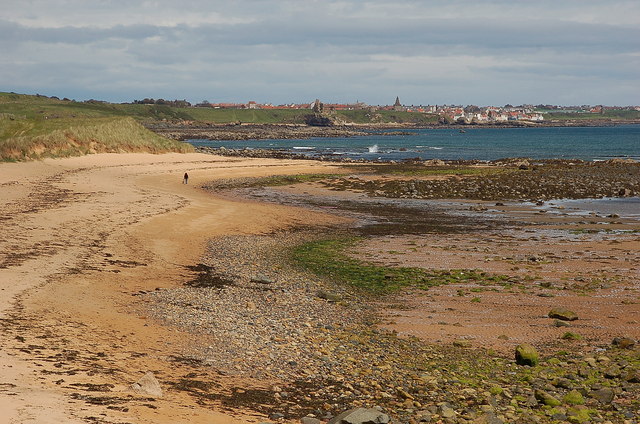
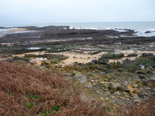
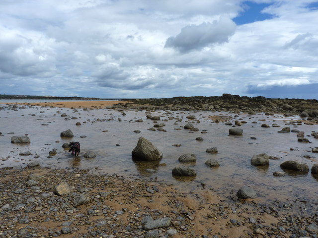
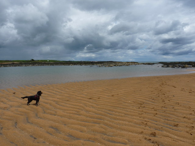
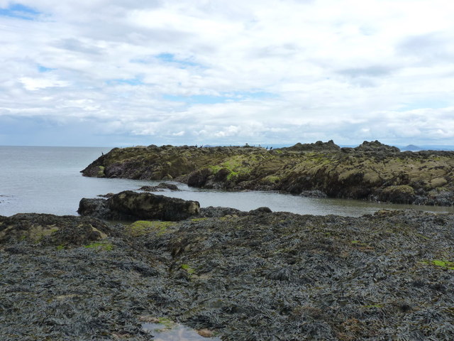
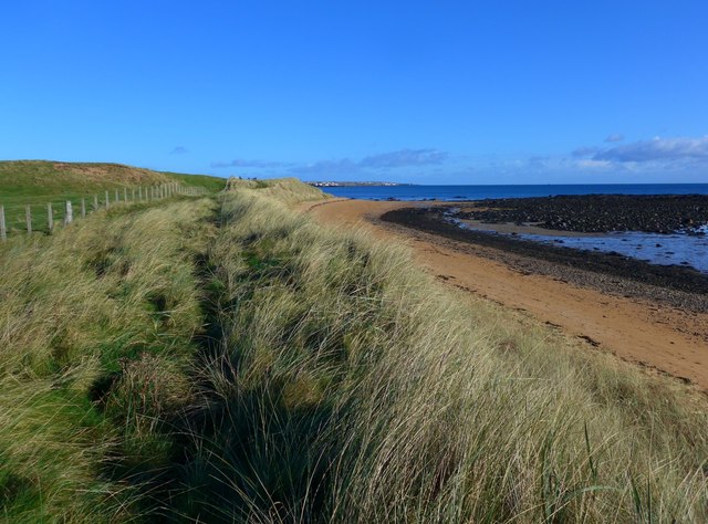
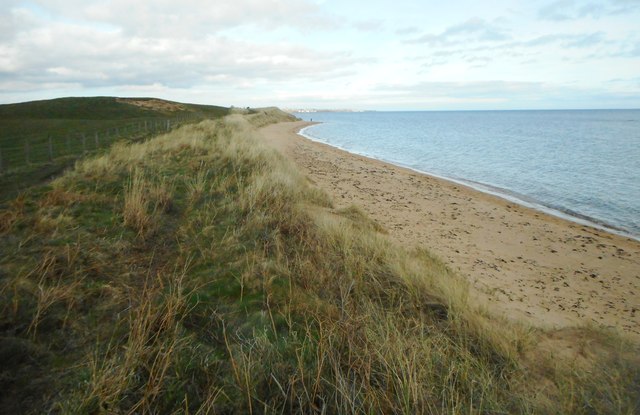
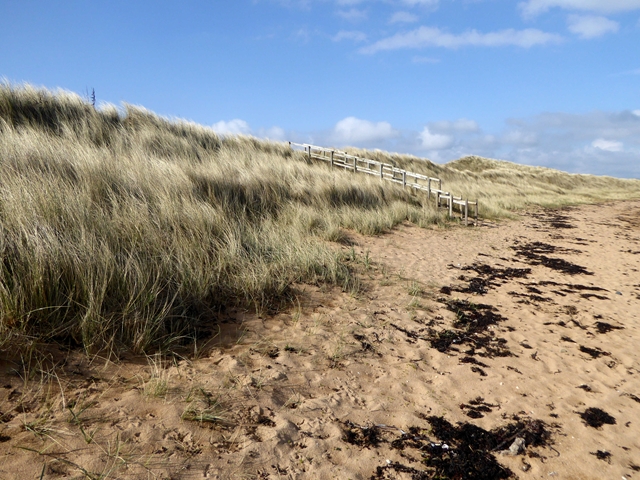
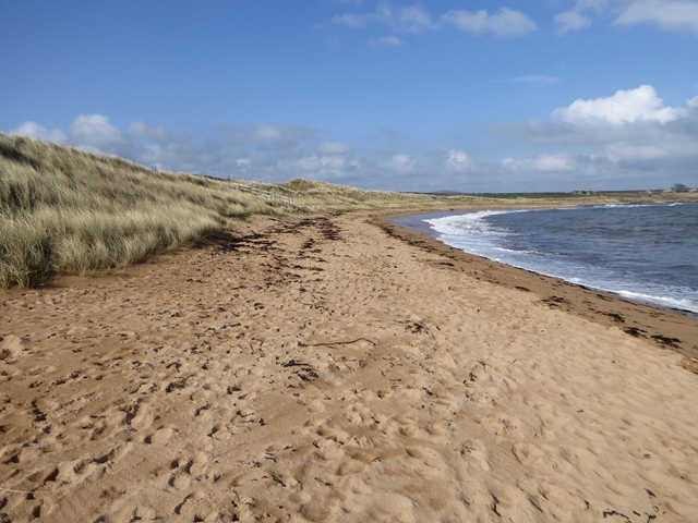
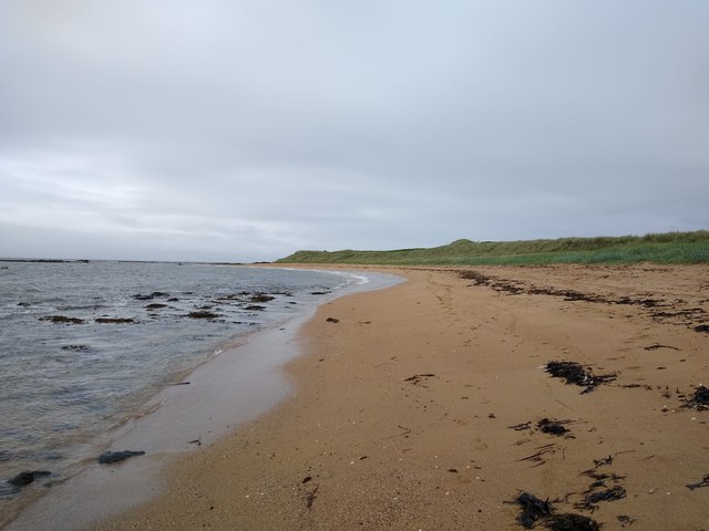
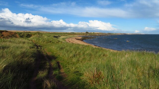
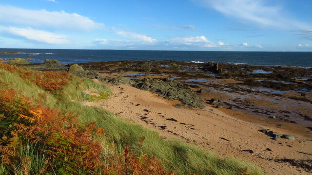
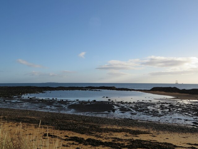
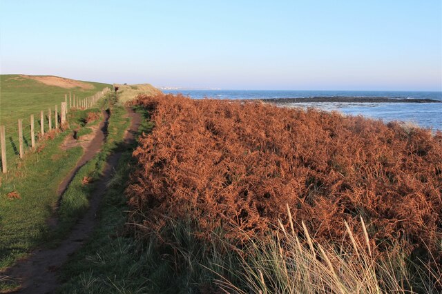
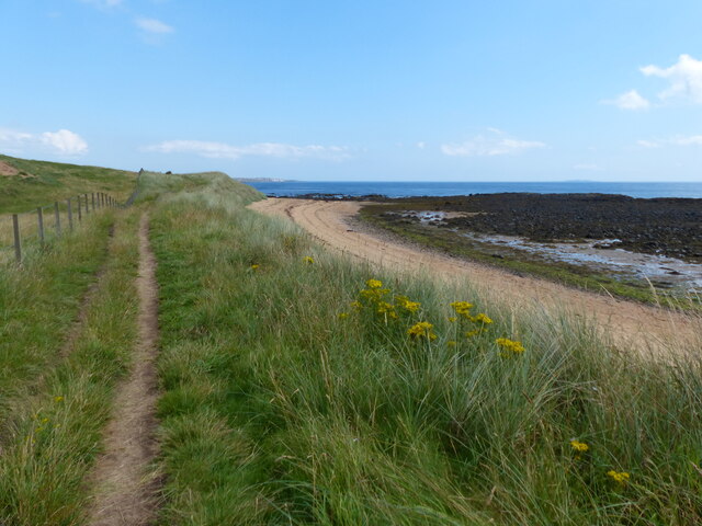
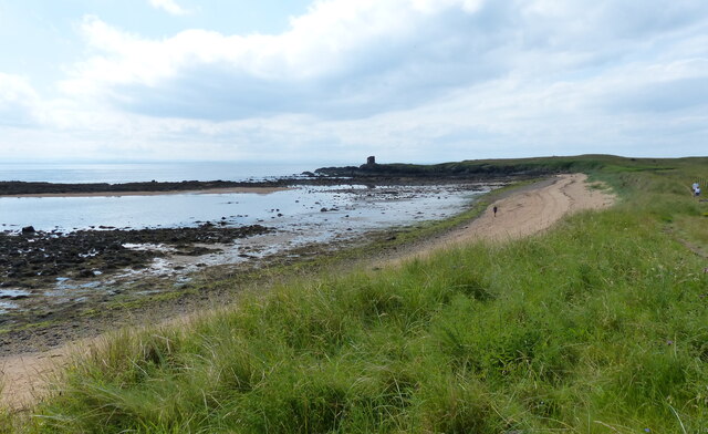
Renowned for its stunning sandy beaches, Elie attracts visitors from near and far. The main beach, known as Elie Bay, stretches for miles and offers a perfect spot for sunbathing, swimming, and water sports. The village's well-preserved architecture adds to its charm, with traditional stone cottages and historic buildings lining the streets.

Elie is also home to a picturesque harbor, where visitors can watch the local fishing boats come and go, and sample fresh seafood at the nearby restaurants. For those interested in golf, the village boasts two renowned golf courses: Elie Golf Club and the Ladybank Golf Club.

In addition to its natural beauty, Elie offers a range of amenities to cater to residents and visitors alike. These include various shops, cafes, pubs, and a post office. The village also has a primary school and a community center, which hosts various events throughout the year.

Overall, Elie is a charming coastal village that offers a tranquil escape, stunning scenery, and a welcoming community for both locals and tourists to enjoy.

If you have any feedback on the listing, please let us know in the comments section below.

Elie Images

Images are sourced within 2km of 56.190455/-2.8214645 or Grid Reference NO4900. Thanks to Geograph Open Source API. All images are credited.

Beach at East Links, Elie St Monans in view is the next village when travelling NE on the Fife Coast path.
Beach at East Links, Elie
St Monans in view is the next village when travelling NE on the Fife Coast path.
West end of Ruby Bay Sharp-eyed visitors who know what to look for can often collect 'Elie Rubies' in the patches of sand among the rocks here. They are usually pretty small (and actually garnets) but it is still fun to find them.
West end of Ruby Bay
Sharp-eyed visitors who know what to look for can often collect 'Elie Rubies' in the patches of sand among the rocks here. They are usually pretty small (and actually garnets) but it is still fun to find them.
Daft Dog enjoys Ruby Bay Near low tide, a large expanse of rock, sand and seaweed is exposed, a perfect play area for dogs. The rocks on the right form a small skerry at 'normal' high tide levels.
Daft Dog enjoys Ruby Bay
Near low tide, a large expanse of rock, sand and seaweed is exposed, a perfect play area for dogs. The rocks on the right form a small skerry at 'normal' high tide levels.
Rocks, sand and salty lagoon This small, shallow lagoon is left behind when the tide recedes in Ruby Bay.
Rocks, sand and salty lagoon
This small, shallow lagoon is left behind when the tide recedes in Ruby Bay.
The lagoon of Ruby Bay A shallow, sandy-bottomed pool that is left by the faling tide, and ideal for a sheltered swim. Its outflow is via a complex series of channels amongst the rocks on the right.
The lagoon of Ruby Bay
A shallow, sandy-bottomed pool that is left by the faling tide, and ideal for a sheltered swim. Its outflow is via a complex series of channels amongst the rocks on the right.
Rocks on the shore at low tide A few cormorants have hung themselves out to dry on these rocks, exposed at low tide near Ruby Bay.
Rocks on the shore at low tide
A few cormorants have hung themselves out to dry on these rocks, exposed at low tide near Ruby Bay.
The Fife Coastal path at the East Links
Beach at East Links A stretch of sandy beach.
Beach at East Links
A stretch of sandy beach.
East Links From the Fife Coastal Path.
East Links
From the Fife Coastal Path.
Steps up from the beach The Fife Coastal Path runs along the top of the dunes.
Steps up from the beach
The Fife Coastal Path runs along the top of the dunes.
Beach at Elie East Links
Beach east of Elie This is the view towards Ruby Bay, which is hidden behind the small sandy spit.
Beach east of Elie
This is the view towards Ruby Bay, which is hidden behind the small sandy spit.
Fife Coastal Path leading northeast from Elie Ness
Coastline between Elie Ness & Ardross
Coastline at East Links, Elie Part of the Fife Coast Path, looking towards the big pool marked on the map.
Coastline at East Links, Elie
Part of the Fife Coast Path, looking towards the big pool marked on the map.
Fife Coastal Path on the East Links
Fife Coastal Path at East Links The Fife Coastal Path runs from Kincardine to Newburgh along the coastline of Fife. It was established in 2002 and is 187 km (116 mi) in length.
Fife Coastal Path at East Links
The Fife Coastal Path runs from Kincardine to Newburgh along the coastline of Fife. It was established in 2002 and is 187 km (116 mi) in length.
Beach at East Links near Elie Ness The Fife Coastal Path runs from Kincardine to Newburgh along the coastline of Fife. It was established in 2002 and is 187 km (116 mi) in length.
Beach at East Links near Elie Ness
The Fife Coastal Path runs from Kincardine to Newburgh along the coastline of Fife. It was established in 2002 and is 187 km (116 mi) in length.
Show me another place!

Elie is located at Grid Ref: NO4900 (Lat: 56.190455, Lng: -2.8214645)

Unitary Authority: Fife

Police Authority: Fife

What 3 Words

///waltzed.tripled.butlers. Near St Monans, Fife

Nearby Locations

Elie

Related Wikis

Elie Parish Church

Elie Parish Church is a church building in Elie, Fife, Scotland. It is Category B listed, its oldest surviving part (the clock tower) dating to the 1726...

Elie and Earlsferry

Elie and Earlsferry is a coastal town and former royal burgh in Fife, and parish, Scotland, situated within the East Neuk beside Chapel Ness on the north...

Elie Primary School

Elie Primary School is a school in Elie, Fife, Scotland. It is located partly in a Category C listed building dating from 1858. The architect of the relevant...

Elie railway station

Elie railway station served the town of Elie and Earlsferry, Fife, Scotland, from 1863 to 1965 on the Fife Coast Railway. == History == The station was...

Nearby Amenities

Located within 500m of 56.190455,-2.8214645
Mini Roundabout
Lat/Long: 56.1904734/-2.8214411
Elie
Name Sco: The Elie
Place: quarter
Source: survey
Lat/Long: 56.1904515/-2.8202468
Source: www.npemap.org.uk
Uk Postcode Centroid: KY9
Lat/Long: 56.190274/-2.81819
Pub
Ship Inn
Addr City: Elie
Addr Postcode: KY9 1DT
Addr Street: The Toft
Fhrs Id: 137964
Opening Hours: Mo-Sa 12:00-21:30; Su 12:00-21:00
Source Addr: FHRS Open Data
Website: http://www.ship-elie.com
Lat/Long: 56.18833/-2.8160845
Cafe
The Pavilion
Addr City: Elie
Addr Postcode: KY9 1AS
Addr Street: Golf Club Lane
Fhrs Id: 118496
Source Addr: FHRS Open Data
Lat/Long: 56.19134/-2.8281454
Waterway: boatyard
Lat/Long: 56.1868405/-2.8176627
Elie and Earlsferry
Name Gd: An Ealaidh
Place: village
Population: 861
Wikidata: Q1010092
Wikipedia: en:Elie and Earlsferry
Lat/Long: 56.1902134/-2.8265701
Tourism: information
Lat/Long: 56.186573/-2.8180643
Bicycle Parking
Bicycle Parking: stands
Capacity: 6
Lat/Long: 56.1866047/-2.8180759
Covered: no
Leisure: picnic_table
Lat/Long: 56.1865884/-2.8179812
Covered: no
Leisure: picnic_table
Lat/Long: 56.1865576/-2.8181576
Bench
Backrest: yes
Lat/Long: 56.1866044/-2.8178778
Bench
Backrest: yes
Lat/Long: 56.1865416/-2.8182634
Bus Stop
Bench: no
Bin: no
Public Transport: platform
Shelter: no
Lat/Long: 56.1927803/-2.8220513
Bus Stop
Bench: no
Bin: no
Public Transport: platform
Shelter: no
Lat/Long: 56.1923781/-2.8218234
Crossing
Crossing: traffic_signals
Lat/Long: 56.1926492/-2.8219634
G.H. Barnett
Shop: bakery
Lat/Long: 56.1906007/-2.8216463
Crossing
Crossing: uncontrolled
Crossing Island: yes
Kerb: lowered
Tactile Paving: yes
Lat/Long: 56.1904661/-2.8216675
Pharmacy
Davidsons Chemists
Addr City: Elie
Addr Housenumber: 42
Addr Postcode: KY9 1DB
Addr Street: High Street
Dispensing: yes
Healthcare: pharmacy
Opening Hours: Mo-Fr 09:00-18:00; Sa 09:00-17:00
Payment Cash: yes
Lat/Long: 56.1903178/-2.820435
Bus Stop
Elie
Bench: yes
Bin: yes
Bus: yes
Lit: no
Public Transport: platform
Shelter: yes
Tactile Paving: no
Lat/Long: 56.1905055/-2.8206089
Telephone
Booth: K6
Covered: booth
Lat/Long: 56.1904328/-2.8193443
Bus Stop
Elie
Bench: yes
Bin: yes
Public Transport: platform
Shelter: yes
Tactile Paving: no
Lat/Long: 56.190482/-2.8191009
Pub
Station Buffet Bar
Lat/Long: 56.1907145/-2.818073
Bus Stop
Bench: no
Bin: no
Bus: yes
Naptan AtcoCode: 6500N0353
Naptan NaptanCode: 34328529
Public Transport: platform
Shelter: no
Lat/Long: 56.191223/-2.8160271
Bus Stop
Bench: yes
Bin: no
Bus: yes
Public Transport: platform
Shelter: yes
Lat/Long: 56.1915297/-2.8154759
The Courier
Check Date: 2023-06-18
Opening Hours: Mo-Sa 06:00-17:00; Su 06:00-13:00
Payment Cash: yes
Payment Credit Cards: yes
Payment Debit Cards: yes
Shop: newsagent
Lat/Long: 56.1903242/-2.8207308
Generator Method: photovoltaic
Generator Output Electricity: yes
Generator Source: solar
Generator Type: solar_photovoltaic_panel
Power: generator
Lat/Long: 56.1914059/-2.8144379
Generator Method: photovoltaic
Generator Output Electricity: yes
Generator Source: solar
Generator Type: solar_photovoltaic_panel
Power: generator
Lat/Long: 56.1914049/-2.8145387
Traffic Calming: cushion
Lat/Long: 56.1920538/-2.8184077
Generator Method: photovoltaic
Generator Output Electricity: yes
Generator Source: solar
Generator Type: solar_photovoltaic_panel
Power: generator
Lat/Long: 56.1899167/-2.8157597
Generator Method: photovoltaic
Generator Output Electricity: yes
Generator Source: solar
Generator Type: solar_photovoltaic_panel
Power: generator
Lat/Long: 56.1907294/-2.8223881
Generator Method: photovoltaic
Generator Output Electricity: yes
Generator Source: solar
Generator Type: solar_photovoltaic_panel
Power: generator
Lat/Long: 56.1907038/-2.8223209
Post Box
Brand: Royal Mail
Brand Wikidata: Q638098
Brand Wikipedia: en:Royal Mail
Collection Times: Mo-Fr 09:00; Sa 07:00
Operator: Royal Mail
Operator Wikidata: Q638098
Post Box Type: lamp
Ref: KY9 197D
Royal Cypher: GR
Royal Cypher Wikidata: Q33102273
Lat/Long: 56.1927076/-2.8218739
Post Box
Brand: Royal Mail
Brand Wikidata: Q638098
Brand Wikipedia: en:Royal Mail
Collection Times: Mo-Fr 09:00; Sa 07:00
Operator: Royal Mail
Operator Wikidata: Q638098
Post Box Type: pillar
Ref: KY9 182D
Royal Cypher: scottish_crown
Lat/Long: 56.1904823/-2.8180414
Post Box
Brand: Royal Mail
Brand Wikidata: Q638098
Brand Wikipedia: en:Royal Mail
Collection Times: Mo-Fr 09:00; Sa 07:00
Operator: Royal Mail
Operator Wikidata: Q638098
Post Box Type: lamp
Ref: KY9 233D
Royal Cypher: scottish_crown
Lat/Long: 56.1904961/-2.8255926
Defibrillator
Defibrillator Location: attached to outside of bus shelter near red phone box, Toll Green, Elie
Emergency: defibrillator
Indoor: no
Lat/Long: 56.1904526/-2.8192354
Man Made: flagpole
Lat/Long: 56.1904547/-2.818481
Barrier: bollard
Bollard: fixed
Lat/Long: 56.190532/-2.8201285
Lifeguard
Emergency: lifeguard
Opening Hours: Jun 18-Aug 21 Mo-Su 10:00-18:00
Opening Hours Url: https://rnli.org/find-my-nearest/lifeguarded-beaches/elie-harbour-beach
Operator: Royal National Lifeboat Institution
Operator Short: RNLI
Operator Wikidata: Q2166873
Seasonal: yes
Lat/Long: 56.1873969/-2.8172632
Elie South Street Sewage Pumping Station
Man Made: pumping_station
Operator: Scottish Water
Lat/Long: 56.1894327/-2.8215775
Material: wood
Power: pole
Lat/Long: 56.1936978/-2.8226077
Material: wood
Power: pole
Lat/Long: 56.19413/-2.8233868
Material: wood
Power: pole
Lat/Long: 56.194556/-2.8241411
Toilets
Access: yes
Description: Public toilets, should be open during the day. Disabled toilet requires radar key.
Fee: no
Note: Opening times are rough from what I remember, there was a sign saying something akin to "should be open between 9 and 4 pm daily".
Opening Hours: Mo-Su 09:00-16:00
Toilets Disposal: flush
Wheelchair: yes
Lat/Long: 56.190078/-2.8179098
Addr Housenumber: 29
Addr Street: South Street
Lat/Long: 56.1897306/-2.8227854
Addr Housenumber: 5
Addr Street: South Street
Lat/Long: 56.1896962/-2.8213356
Addr Housenumber: 6
Addr Street: The Terrace
Lat/Long: 56.1897045/-2.8199887
Addr Housenumber: 25
Addr Street: South Street
Lat/Long: 56.1897182/-2.8225048
Addr Housenumber: 16
Addr Street: South Street
Lat/Long: 56.189622/-2.8231382
Addr Housenumber: 13
Addr Street: South Street
Lat/Long: 56.1896876/-2.8218661
Addr Housenumber: 8
Addr Street: The Terrace
Lat/Long: 56.1896737/-2.8204037
Addr Housenumber: 7
Addr Street: The Terrace
Lat/Long: 56.1896888/-2.8202414
Addr Housenumber: 27
Addr Street: South Street
Lat/Long: 56.1897213/-2.8226607
Addr Housenumber: 17
Addr Street: South Street
Lat/Long: 56.1896977/-2.822123
Addr Housenumber: 15
Addr Street: South Street
Lat/Long: 56.1896855/-2.8219475
Addr Housenumber: 18
Addr Street: South Street
Lat/Long: 56.1896568/-2.8233823
Addr Housenumber: 3
Addr Street: South Street
Lat/Long: 56.1896973/-2.8207771
Addr Housenumber: 14
Addr Street: South Street
Lat/Long: 56.1896188/-2.822917
Addr Housenumber: 1
Addr Street: South Street
Lat/Long: 56.1896868/-2.8206608
Addr Housenumber: 23
Addr Street: South Street
Lat/Long: 56.1897123/-2.8223814
Addr Housenumber: 6
Addr Street: South Street
Lat/Long: 56.1895745/-2.8213538
Addr Housenumber: 4
Addr Street: South Street
Lat/Long: 56.1895816/-2.820908
Addr Housenumber: 2
Addr Street: South Street
Lat/Long: 56.189562/-2.8205269
Waste Basket
Lat/Long: 56.1897078/-2.8185114
Waste Basket
Lat/Long: 56.1897019/-2.8180699
Bench
Backrest: yes
Lat/Long: 56.1896826/-2.8183836
Bench
Backrest: yes
Lat/Long: 56.1896685/-2.8182873
Bench
Backrest: yes
Lat/Long: 56.1896552/-2.8181664
Bench
Backrest: yes
Lat/Long: 56.1896582/-2.8184552
Bench
Backrest: yes
Lat/Long: 56.1896415/-2.8183512
Bench
Backrest: yes
Lat/Long: 56.1896226/-2.8182465
Elie
Historic Railway: station
Railway: site
Wikidata: Q54869732
Wikipedia: en:Elie railway station
Lat/Long: 56.1913963/-2.8137778
Addr Housenumber: 24
Addr Street: Bank Street
Lat/Long: 56.1904756/-2.8242903
Harbour House
Opening Hours: We-Sa 10:00-16:00; Su 12:00-16:00
Shop: gift
Lat/Long: 56.1903824/-2.8216055
Addr Housenumber: 14
Addr Street: Bank Street
Entrance: yes
Lat/Long: 56.1904517/-2.8225155
Addr Housenumber: 30
Addr Street: Bank Street
Lat/Long: 56.1903553/-2.8247537
Addr Housenumber: 36
Addr Street: High Street
Entrance: yes
Lat/Long: 56.1903395/-2.8187252
Addr Housenumber: 30
Addr Street: High Street
Entrance: yes
Lat/Long: 56.1903482/-2.8180822
Addr Housenumber: 56
Addr Street: High Street
Lat/Long: 56.1903642/-2.8209966
Addr Housenumber: 28
Addr Street: Bank Street
Lat/Long: 56.1902773/-2.8244788
Addr Housenumber: 9
Addr Street: Bank Street
Lat/Long: 56.1905644/-2.822355
Addr Housenumber: 8
Addr Street: The Toft
Entrance: yes
Lat/Long: 56.1886131/-2.8162819
Addr Housenumber: 28
Addr Street: High Street
Entrance: yes
Lat/Long: 56.1903495/-2.8179601
Addr Housenumber: 34
Addr Street: High Street
Entrance: yes
Lat/Long: 56.1903444/-2.8185515
Addr Housenumber: 32
Addr Street: High Street
Entrance: yes
Lat/Long: 56.1903465/-2.8184402
Addr Housenumber: 16
Addr Street: Bank Street
Entrance: yes
Lat/Long: 56.1904695/-2.8227724
Addr Housenumber: 12
Addr Street: Bank Street
Entrance: yes
Lat/Long: 56.190435/-2.8223319
Addr Housenumber: 18
Addr Street: Bank Street
Entrance: yes
Lat/Long: 56.19048/-2.8229469
Addr Housenumber: 14
Addr Street: The Toft
Lat/Long: 56.1882165/-2.8160679
Defibrillator
Access: yes
Defibrillator Location: outside Elie Surgery
Emergency: defibrillator
Indoor: no
Lat/Long: 56.1908577/-2.8149006
Waste Basket
Lat/Long: 56.190522/-2.824982
Waste Basket
Lat/Long: 56.1897474/-2.8247557
elie deli
Opening Hours: Mo-Sa 08:00-17:00; Su 08:00-16:00
Payment Cash: yes
Payment Credit Cards: yes
Payment Debit Cards: yes
Shop: supermarket
Wheelchair: yes
Lat/Long: 56.1905203/-2.8198321
Toilets
Access: yes
Toilets Disposal: flush
Wheelchair: yes
Lat/Long: 56.1871652/-2.8166919
Leisure: picnic_table
Lat/Long: 56.1874286/-2.8164321
Leisure: picnic_table
Lat/Long: 56.1873981/-2.8166424
Leisure: picnic_table
Lat/Long: 56.187179/-2.8170651
Man Made: flagpole
Lat/Long: 56.1873017/-2.8168551
Cafe
Nosebag@Elie
Takeaway: yes
Lat/Long: 56.1864014/-2.8186081
Defibrillator
Defibrillator Location: On outside wall of Harbourmaster building, facing the car park
Emergency: defibrillator
Mapillary: 847435913264098
Opening Hours: 24/7
Survey Date: 2023-09-05
Lat/Long: 56.1864391/-2.8185941
The data included in this document is from www.openstreetmap.org. The data is made available under ODbL.

Have you been to Elie?

Leave your review of Elie below (or comments, questions and feedback).