Eight and Forty

Settlement in Yorkshire

England

Eight and Forty

Marr Lane A dead end at Higham Grange
Marr Lane Credit: David Brown

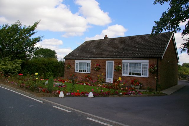
Eight and Forty is a small village located in the county of Yorkshire, England. Situated amidst the picturesque landscapes of the Yorkshire Dales, Eight and Forty is known for its charm and tranquility. The village derives its peculiar name from an ancient legend, which suggests that there were originally only eight houses in the village, which were later expanded to forty.

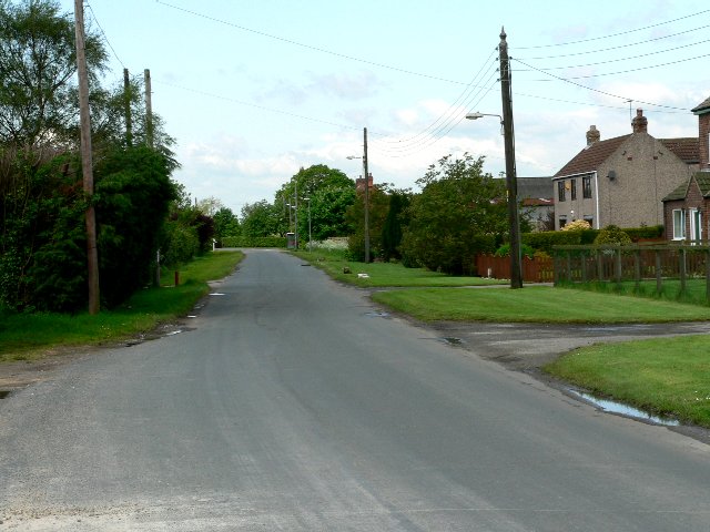
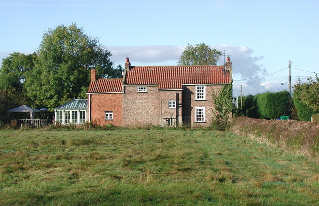
The village is characterized by its quaint stone cottages, which exude a traditional English countryside ambiance. Nestled in the heart of the Yorkshire Dales National Park, Eight and Forty offers breathtaking views of rolling hills, lush green meadows, and meandering streams. It serves as an ideal base for nature enthusiasts and avid hikers, as it is surrounded by numerous walking trails that lead to spectacular vistas.

Despite its small size, Eight and Forty boasts a vibrant community spirit. The village hosts various events throughout the year, including an annual summer fair and a Christmas market, which attract visitors from near and far. The local pub, The Fox and Hound, is a popular gathering spot for residents and visitors alike, offering a warm and welcoming atmosphere.

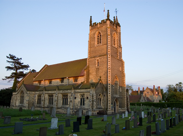
For those seeking a taste of history, Eight and Forty is home to a medieval church, St. Mary's, which dates back to the 12th century. The church's stunning architecture and beautifully preserved stained glass windows make it a must-visit for history enthusiasts and architecture aficionados.

Overall, Eight and Forty is a hidden gem within the Yorkshire Dales, offering a peaceful retreat and a glimpse into the rich history and natural beauty of the region.

If you have any feedback on the listing, please let us know in the comments section below.

Eight and Forty Images

Images are sourced within 2km of 53.757268/-0.71978314 or Grid Reference SE8429. Thanks to Geograph Open Source API. All images are credited.

Marr Lane A dead end at Higham Grange
Marr Lane
A dead end at Higham Grange
Sandholme Road Looking along Sandholme Road immediately south of the bridge over the M62.
Sandholme Road
Looking along Sandholme Road immediately south of the bridge over the M62.
Edge of Gilberdyke Looking along Sandholme Road immediately south of the bridge over the M62.
Edge of Gilberdyke
Looking along Sandholme Road immediately south of the bridge over the M62.
Shops on Clementhorpe Road The postbox has a woollen top to celebrate the coronation.
Shops on Clementhorpe Road
The postbox has a woollen top to celebrate the coronation.
Gilberdyke Village Hall The village hall and war memorial along Clementhorpe Road.
Gilberdyke Village Hall
The village hall and war memorial along Clementhorpe Road.
Level crossing on Clementhorpe Lane This crossing is over the Hull to Selby lines. A short distance ahead there is another crossing over the Hull to Sheffield lines. The two lines join just west of Gilberdyke station.
Level crossing on Clementhorpe Lane
This crossing is over the Hull to Selby lines. A short distance ahead there is another crossing over the Hull to Sheffield lines. The two lines join just west of Gilberdyke station.
Selby lines from Clementhorpe Crossing Looking along the Hull to Selby lines in the Selby direction west of the station in Gilberdyke.
Selby lines from Clementhorpe Crossing
Looking along the Hull to Selby lines in the Selby direction west of the station in Gilberdyke.
Footpath to Bellasize Park Connecting from Clementhorpe Lane.
Footpath to Bellasize Park
Connecting from Clementhorpe Lane.
Station Road in Gilberdyke Looking along Station Road near the junction with Westbrook Road.
Station Road in Gilberdyke
Looking along Station Road near the junction with Westbrook Road.
Staddlethorpe Broad Lane Looking down the bridge over the railway near Gilberdyke Station.
Staddlethorpe Broad Lane
Looking down the bridge over the railway near Gilberdyke Station.
Traffic lights on Staddlethorpe Broad Lane bridge The bridge crosses the railway lines just west of Gilberdyke Station where the lines branch from Hull to reach Selby or Sheffield. The traffic lights didn't change for my bicycle, and I eventually gave up and pushed my bike along the pavement.
Traffic lights on Staddlethorpe Broad Lane bridge
The bridge crosses the railway lines just west of Gilberdyke Station where the lines branch from Hull to reach Selby or Sheffield. The traffic lights didn't change for my bicycle, and I eventually gave up and pushed my bike along the pavement.
Gateway Business Park Looking along a road into the business park with static homes on the right.
Gateway Business Park
Looking along a road into the business park with static homes on the right.
Staddlethorpe Broad Lane near Bellasize Lane Looking along the road to the south of Gilberdyke.
Staddlethorpe Broad Lane near Bellasize Lane
Looking along the road to the south of Gilberdyke.
Broad Lane near Woodfield House Farm Looking south along the road between Gilberdyke and Blacktoft.
Broad Lane near Woodfield House Farm
Looking south along the road between Gilberdyke and Blacktoft.
Church of St Stephen
Market Weighton Canal, north from Landing Lane At Sandholme Landing, on the northern edge of Newport. The waterway was open here by 1771, as a navigable drain. This section is still navigable and still has an important role as a drain. The banks were raised in the 1960s when this section of the canal was converted to a highland carrier drain.
Market Weighton Canal, north from Landing Lane
At Sandholme Landing, on the northern edge of Newport. The waterway was open here by 1771, as a navigable drain. This section is still navigable and still has an important role as a drain. The banks were raised in the 1960s when this section of the canal was converted to a highland carrier drain.
Market Weighton Canal, south from Landing Lane At Sandholme Landing, on the northern edge of Newport. The waterway was open here by 1771, as a navigable drain. This section is still navigable and still has an important role as a drain. The banks were raised in the 1960s when this section of the canal was converted to a highland carrier drain.
Market Weighton Canal, south from Landing Lane
At Sandholme Landing, on the northern edge of Newport. The waterway was open here by 1771, as a navigable drain. This section is still navigable and still has an important role as a drain. The banks were raised in the 1960s when this section of the canal was converted to a highland carrier drain.
Buried wall, Canal Side East The waterway was open here by 1771, as a navigable drain. This section is still navigable and still has an important role as a drain. The banks were raised with this wall in the 1960s when this section of the canal was converted to a highland carrier drain.
Buried wall, Canal Side East
The waterway was open here by 1771, as a navigable drain. This section is still navigable and still has an important role as a drain. The banks were raised with this wall in the 1960s when this section of the canal was converted to a highland carrier drain.
Show me another place!

Eight and Forty is located at Grid Ref: SE8429 (Lat: 53.757268, Lng: -0.71978314)

Division: East Riding

Unitary Authority: East Riding of Yorkshire

Police Authority: Humberside

What 3 Words

///shuffles.slogans.sneezed. Near Scalby, East Yorkshire

Nearby Locations

Eight and Forty Scalby

Related Wikis

Scalby, East Riding of Yorkshire

Scalby is a hamlet in the East Riding of Yorkshire, England. It is situated approximately 7 miles (11 km) west of Brough and 7 miles (11 km) north-east...

Wallingfen railway station

Wallingfen railway station was a station on the Hull and Barnsley Railway, and served the village of Newport in the East Riding of Yorkshire, England....

Gilberdyke

Gilberdyke is a village and civil parish in the East Riding of Yorkshire, England. It is situated approximately 20 miles (32 km) south-east of York and...

Gilberdyke railway station

Gilberdyke railway station is a railway station that serves the village of Gilberdyke in the East Riding of Yorkshire, England. It was opened in 1840 by...

Newport, East Riding of Yorkshire

Newport is a village and civil parish in the East Riding of Yorkshire, England. It is approximately 7 miles (11 km) east of the market town of Howden....

Sandholme railway station

Sandholme railway station was a station on the Hull and Barnsley Railway, and served the hamlet of Sandholme in the East Riding of Yorkshire, England....

Sandholme, East Riding of Yorkshire

Sandholme is a hamlet in the East Riding of Yorkshire, England. It is situated approximately 8 miles (13 km) west of Brough and 7 miles (11 km) north...

Bennetland

Bennetland is a hamlet in the East Riding of Yorkshire, England. It is situated approximately 19 miles (31 km) west of Hull city centre and 5 miles (8...

Nearby Amenities

Located within 500m of 53.757268,-0.71978314
Scalby
Is In: East Riding of Yorkshire, England, UK
Is In County: East Riding of Yorkshire
Place: village
Wikidata: Q9334142
Lat/Long: 53.75814/-0.7174467
Gilberdyke Garden Centre
Shop: garden_centre
Lat/Long: 53.7540414/-0.7208664
Bus Stop
Newport B1230
Naptan AtcoCode: 2200YEA00757
Naptan Bearing: W
Naptan CommonName: Newport B1230
Naptan Street: Main Road
Note: no code on sign
Shelter: no
Source: naptan + survey
Lat/Long: 53.7577759/-0.7135645
The data included in this document is from www.openstreetmap.org. The data is made available under ODbL.

Have you been to Eight and Forty?

Leave your review of Eight and Forty below (or comments, questions and feedback).