Edderthorpe

Settlement in Yorkshire

England

Edderthorpe

New Hall Farm on a grey November morning
New Hall Farm on a grey November morning Credit: Neil Theasby

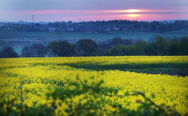
Edderthorpe is a small village located in the metropolitan borough of Barnsley, South Yorkshire, England. Situated in the heart of the Yorkshire coalfield, the village lies approximately 7 miles northeast of Barnsley town center.

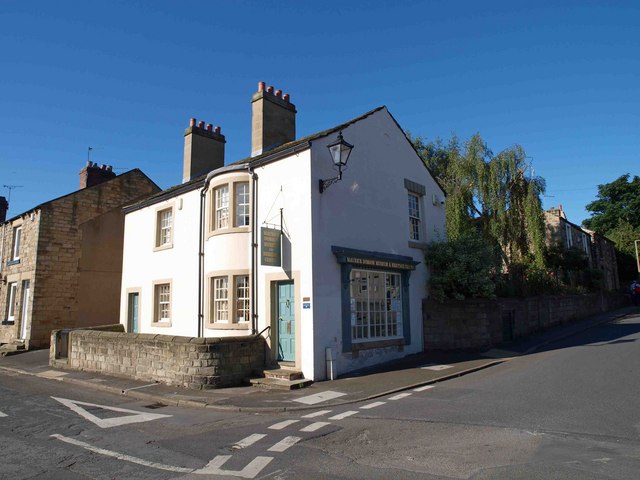
With a population of around 600 residents, Edderthorpe has a close-knit community atmosphere. The village is primarily residential, consisting of traditional stone-built houses and cottages, adding to its quaint charm. Surrounded by picturesque countryside, Edderthorpe offers beautiful views and a peaceful setting for its residents.

Although a small village, Edderthorpe benefits from its proximity to larger towns and cities. Barnsley, with its range of amenities, including shopping centers, leisure facilities, and schools, is easily accessible by road or public transport. The village also benefits from good transport links, with the A628 road passing nearby, connecting it to other major towns and cities in the region.

Edderthorpe is known for its mining heritage, with several collieries having operated in the vicinity in the past. Today, reminders of this industrial past can still be seen, such as the preserved Edderthorpe Colliery Winding Engine House, which serves as a reminder of the village's history.

Overall, Edderthorpe offers a peaceful and idyllic place to live, with its rural setting and strong community spirit. It provides a welcome retreat from the hustle and bustle of nearby urban areas, while still offering convenient access to essential amenities and transport links.

If you have any feedback on the listing, please let us know in the comments section below.

Edderthorpe Images

Images are sourced within 2km of 53.547252/-1.3809789 or Grid Reference SE4105. Thanks to Geograph Open Source API. All images are credited.

New Hall Farm on a grey November morning
A view of Cranford Hall Built on the site of a medieval hall, the current hall was built in the late eighteenth century with later additions and improvements. It is Grade II listed.
A view of Cranford Hall
Built on the site of a medieval hall, the current hall was built in the late eighteenth century with later additions and improvements. It is Grade II listed.
Edderthorpe Flash
Edderthorpe Flash
Wind turbine, Grimethorpe
Carlton Main Brickworks, Grimethorpe: aerial 2022
Bungalow on Belvedere Drive On the west side of Darfield
Bungalow on Belvedere Drive
On the west side of Darfield
Old milestone near Darfield Though half-hidden in a hedgerow, it's nice to see that this old milestone has benefited from maintenance
Old milestone near Darfield
Though half-hidden in a hedgerow, it's nice to see that this old milestone has benefited from maintenance
Lombard Crescent, Darfield On this private housing estate west of Darfield, the streets are curiously named after places in Italy.
Lombard Crescent, Darfield
On this private housing estate west of Darfield, the streets are curiously named after places in Italy.
Autumn leaf at a bus shelter, Darfield One of the glass panels was shattered - either deliberately or accidentally - I could not say.
Autumn leaf at a bus shelter, Darfield
One of the glass panels was shattered - either deliberately or accidentally - I could not say.
Modena Court, Darfield Most of the street names in this neighbourhood are named after locations in Italy.
Modena Court, Darfield
Most of the street names in this neighbourhood are named after locations in Italy.
Snape Hill Road Convenience Store, Darfield
Former cinema, Darfield The purpose-built Briton Picture House only operated as a cinema for a few years around the time of World War One. Later it served other purposes - including storage facility, roller skating rink, dance hall and snooker club. Currently it is an emporium for anglers.
Former cinema, Darfield
The purpose-built Briton Picture House only operated as a cinema for a few years around the time of World War One. Later it served other purposes - including storage facility, roller skating rink, dance hall and snooker club. Currently it is an emporium for anglers.
Old milestone This milestone is on Doncaster Road in Darfield, just east of Nanny Marr Road.   It is slightly higher up the hill than the European War Memorial.  On the left face is inscribed PON/12M/Houghton.  That is the very old packhorse route that would have forded the River Dearne, now bridged, to reach Houghton, then north to eventually arrive at Pontefract.
Old milestone
This milestone is on Doncaster Road in Darfield, just east of Nanny Marr Road. It is slightly higher up the hill than the European War Memorial. On the left face is inscribed PON/12M/Houghton. That is the very old packhorse route that would have forded the River Dearne, now bridged, to reach Houghton, then north to eventually arrive at Pontefract.
Old milestone The front face of the very old milestone on the hill in Darfield is inscribed DON/10M/?IXX.   What does that mean?   The right face had something now indecipherable with PON/12M near the base.  The very narrow paved lane leads down to the River Dearne and is part of the packhorse route from Sheffield to Pontefract.  This stone is Grade II listed 1315019.
Old milestone
The front face of the very old milestone on the hill in Darfield is inscribed DON/10M/?IXX. What does that mean? The right face had something now indecipherable with PON/12M near the base. The very narrow paved lane leads down to the River Dearne and is part of the packhorse route from Sheffield to Pontefract. This stone is Grade II listed 1315019.
Wind turbine nacelle being erected on the site of the former Houghton Main colliery
Wind turbine 1 of 3 being erected near Little Houghton
In failing light the wind turbine blades are installed
In failing light the wind turbine blades are being installed spot the rigger
Show me another place!

Edderthorpe is located at Grid Ref: SE4105 (Lat: 53.547252, Lng: -1.3809789)

Division: West Riding

Unitary Authority: Barnsley

Police Authority: South Yorkshire

What 3 Words

///proposals.ripe.splits. Near Darfield, South Yorkshire

Nearby Locations

Edderthorpe Highfield

Related Wikis

Little Houghton, South Yorkshire

Little Houghton is a hamlet and civil parish in the Metropolitan Borough of Barnsley, South Yorkshire, England. At the 2001 census it had a population...

Darfield, South Yorkshire

Darfield is a village within the Metropolitan Borough of Barnsley, South Yorkshire, England. It is historically part of the West Riding of Yorkshire. The...

Upperwood Academy

Upperwood Academy (formerly Darfield Upperwood Primary School and Darfield Upperwood Academy) is a 4–11 primary school with academy status located in Darfield...

Darfield Foulstone School of Creative Arts

Darfield Foulstone School of Creative Arts was a comprehensive school located in the village of Darfield, Barnsley, South Yorkshire. It was a specialist...

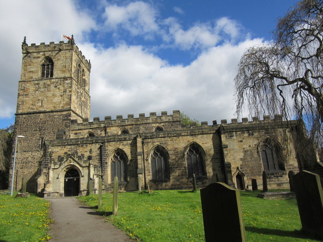
All Saints Church, Darfield

The Church of All Saints is the parish church in the village of Darfield in South Yorkshire, England. It is a Church of England church in the Diocese of...

Darfield railway station

Darfield railway station was opened in 1840 by the North Midland Railway, serving the village of Darfield in South Yorkshire, England. The original station...

Cat Hill Tunnel

Cat Hill Tunnel was a railway tunnel that ran through Darfield, South Yorkshire, England, leading to Darfield railway station (now closed). The tunnel...

Millhouses, Barnsley

Millhouses is a district of Barnsley in the English county of South Yorkshire. Millhouses adjoins the town of Darfield near the A635 road to the east of...

Nearby Amenities

Located within 500m of 53.547252,-1.3809789
Edderthorpe
Is In: South Yorkshire
Place: hamlet
Source: OS OpenData StreetView
Lat/Long: 53.5476936/-1.3814227
Operator: GPSS
Pipeline: marker
Substance: oil
Support: pole
Lat/Long: 53.5441654/-1.3806119
Generator Method: thermal
Generator Output Hot Water: yes
Generator Source: solar
Generator Type: solar_thermal_collector
Location: roof
Power: generator
Lat/Long: 53.5428296/-1.3802168
Generator Method: thermal
Generator Output Hot Water: yes
Generator Source: solar
Generator Type: solar_thermal_collector
Location: roof
Power: generator
Lat/Long: 53.5428678/-1.3802436
Generator Method: thermal
Generator Output Hot Water: yes
Generator Source: solar
Generator Type: solar_thermal_collector
Location: roof
Power: generator
Lat/Long: 53.5427674/-1.3805574
Generator Method: thermal
Generator Output Hot Water: yes
Generator Source: solar
Generator Type: solar_thermal_collector
Location: roof
Power: generator
Lat/Long: 53.5427579/-1.3806245
Barrier: stile
Lat/Long: 53.5467535/-1.3807204
The data included in this document is from www.openstreetmap.org. The data is made available under ODbL.

Have you been to Edderthorpe?

Leave your review of Edderthorpe below (or comments, questions and feedback).