Dyer's End

Settlement in Essex Braintree

England

Dyer's End

Stambourne, St Peter & St Thomas
Stambourne, St Peter & St Thomas Credit: Dave Kelly

Dyer's End is a small village located in the county of Essex, England. Situated near the town of Chelmsford, Dyer's End is known for its picturesque countryside and tranquil atmosphere. The village is home to a close-knit community, with a population of approximately 500 residents.

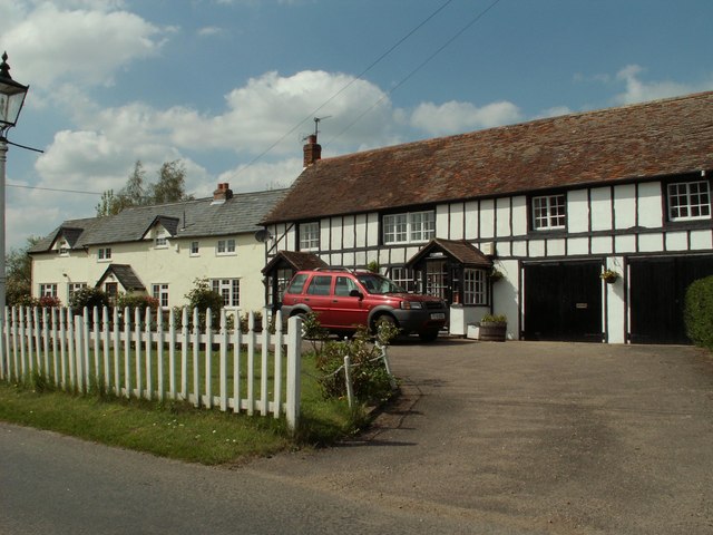
Dyer's End is characterized by its charming thatched-roof cottages and traditional architecture, giving it a quaint and timeless appeal. The village is surrounded by rolling green fields, providing stunning views and a sense of serenity. The nearby River Chelmer adds to the village's natural beauty, with its meandering waters and lush vegetation.

Despite its small size, Dyer's End boasts a number of amenities. The village has a local pub, The Green Man, which serves as a popular gathering spot for both residents and visitors. There is also a village hall that hosts various community events throughout the year, such as fairs and social gatherings.

For outdoor enthusiasts, Dyer's End offers plenty of opportunities for exploration. The village is surrounded by numerous walking and cycling trails, allowing residents to immerse themselves in the idyllic countryside. The nearby Chelmer and Blackwater Navigation provides opportunities for boating and fishing.

Overall, Dyer's End provides a peaceful and charming escape from the hustle and bustle of city life. Its natural beauty, tight-knit community, and range of amenities make it a desirable place to live for those seeking a tranquil rural lifestyle.

If you have any feedback on the listing, please let us know in the comments section below.
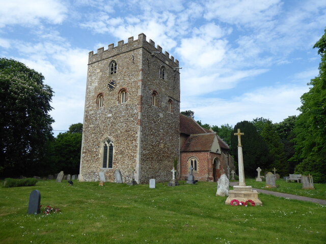
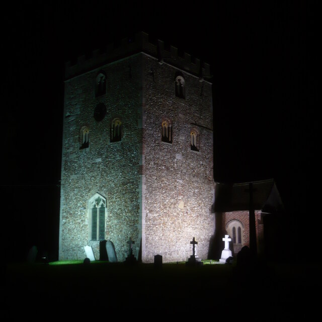
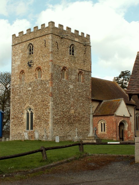
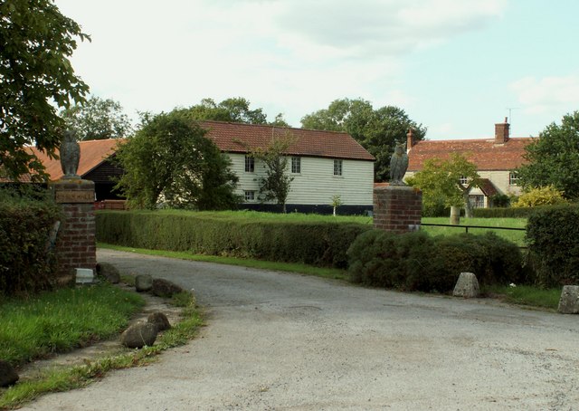
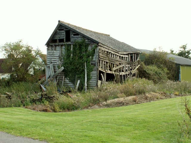
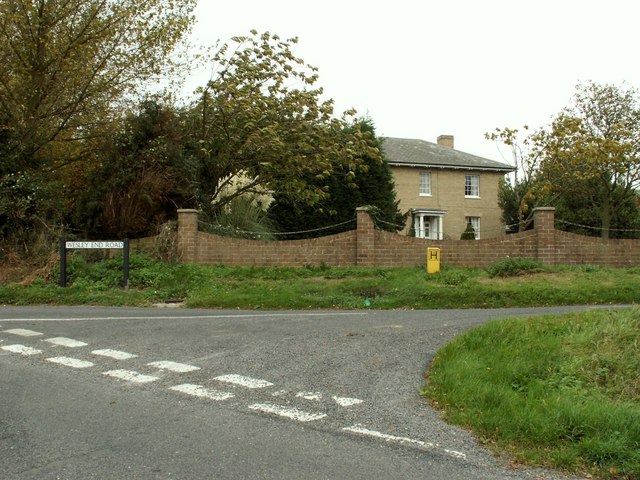
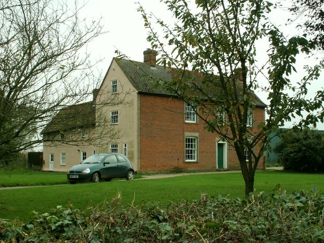
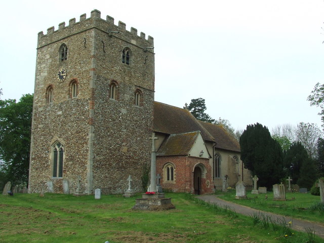
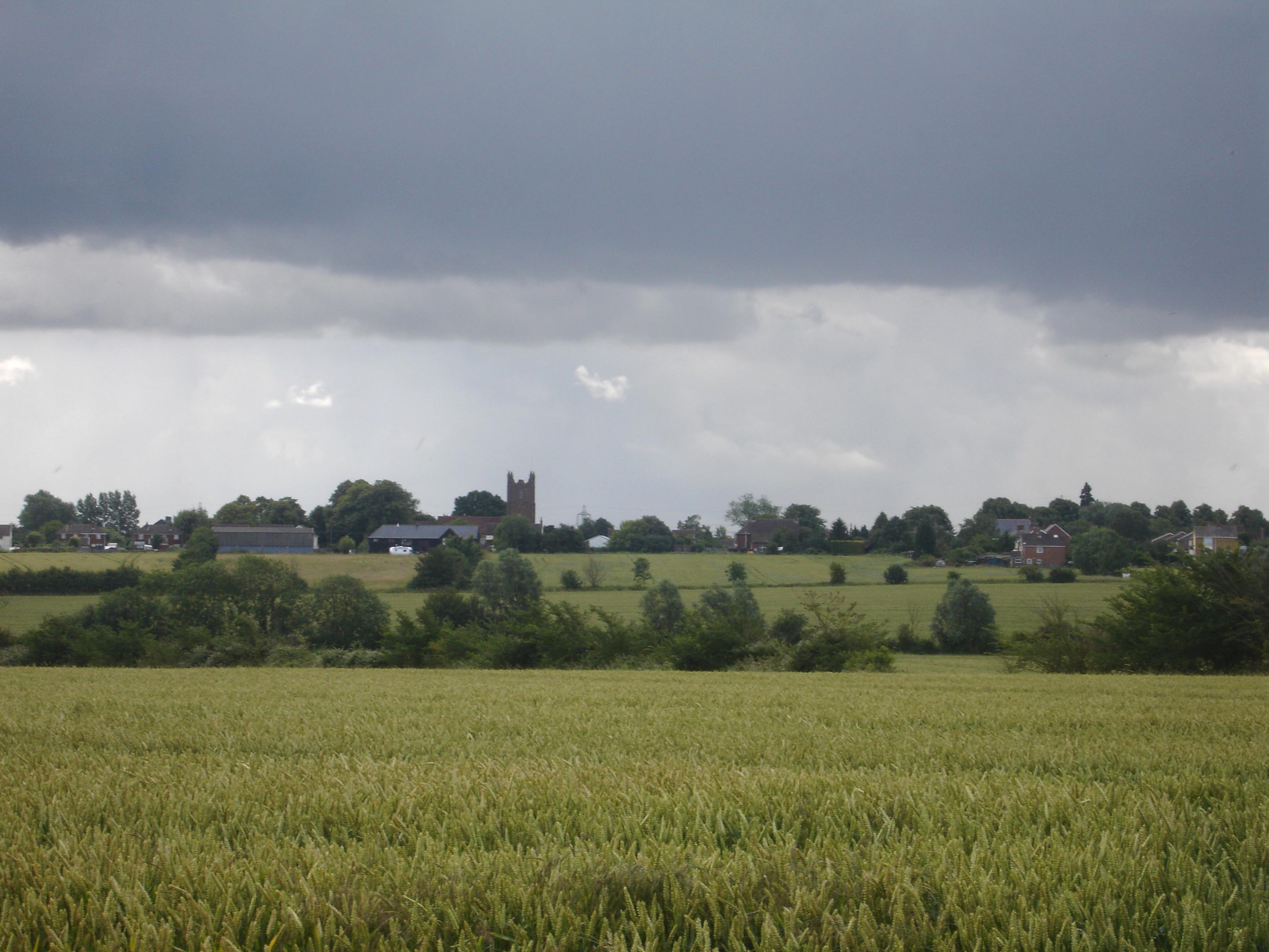
Dyer's End Images

Images are sourced within 2km of 52.01943/0.50987104 or Grid Reference TL7238. Thanks to Geograph Open Source API. All images are credited.

Stambourne, St Peter & St Thomas
Stambourne church tower at night The church tower is brilliantly floodlit at night, as are some of the gravestones in front of it.
Stambourne church tower at night
The church tower is brilliantly floodlit at night, as are some of the gravestones in front of it.
St. Peter & St. Thomas Becket church, Stambourne, Essex This magnificent 11th century Norman church tower is more like a small castle keep. It has many reused Roman bricks around the tower windows and on some corners, and the tower walls are 4ft thick. The nave is 14th century and the chancel is 16th century. This picture also shows its lovely tudor porch.
St. Peter & St. Thomas Becket church, Stambourne, Essex
This magnificent 11th century Norman church tower is more like a small castle keep. It has many reused Roman bricks around the tower windows and on some corners, and the tower walls are 4ft thick. The nave is 14th century and the chancel is 16th century. This picture also shows its lovely tudor porch.
Cottages at Stambourne Green, Essex Stambourne Green is a part of the village of Stambourne, which is quite a sprawling village in north Essex.
Cottages at Stambourne Green, Essex
Stambourne Green is a part of the village of Stambourne, which is quite a sprawling village in north Essex.
Essex Hall, near Stambourne, Essex Even though this is called Essex Hall, the buildings that made up the site gave the indication that it is, or was, a farm.
Essex Hall, near Stambourne, Essex
Even though this is called Essex Hall, the buildings that made up the site gave the indication that it is, or was, a farm.
Old barn at Grass Green Farm, Toppesfield, Essex This farm is actually located at an area known as Grass Green, which is a short distance north-west of Toppesfield.
Old barn at Grass Green Farm, Toppesfield, Essex
This farm is actually located at an area known as Grass Green, which is a short distance north-west of Toppesfield.
Farmhouse at Hill Farm
Public Footpath
Public Footpath
Farmhouse at Great Tagley Farm, close to Stambourne
Warehouse east of Stambourne Presumably built as an agricultural barn or workshop but now apparently occupied by the Balti Rice Company. There is a farmstead directly opposite on the south side of the road.
Warehouse east of Stambourne
Presumably built as an agricultural barn or workshop but now apparently occupied by the Balti Rice Company. There is a farmstead directly opposite on the south side of the road.
Bridleway and Access to Gunce's Farm This bridleway has been surfaced in concrete sections
Bridleway and Access to Gunce's Farm
This bridleway has been surfaced in concrete sections
Field and hedge south of Elm's Farm. A crop of rape on the way. A footpath runs parallel to this hedge towards Mortimer's Farm.
Field and hedge south of Elm's Farm.
A crop of rape on the way. A footpath runs parallel to this hedge towards Mortimer's Farm.
Field north of Elm's Farm A footpath follows the hedgerow north-westwards towards Stambourne.
Field north of Elm's Farm
A footpath follows the hedgerow north-westwards towards Stambourne.
St. Peter And St. Thomas Stambourne The church of St. Peter and St. Thomas Stambourne, Essex for more info on the church see <span class="nowrap"><a title="http://www.essexchurches.info/church.asp?p=Stambourne&ty=e&id=001&ts=001" rel="nofollow ugc noopener" href="http://www.essexchurches.info/church.asp?p=Stambourne&ty=e&id=001&ts=001">Link</a><img style="margin-left:2px;" alt="External link" title="External link - shift click to open in new window" src="https://s1.geograph.org.uk/img/external.png" width="10" height="10"/></span>
St. Peter And St. Thomas Stambourne
The church of St. Peter and St. Thomas Stambourne, Essex for more info on the church see LinkExternal link
Toppesfield: The village pump The pump is in the centre of the village at the junction of The Street, Park Lane, and Church Lane. Next to it is a fine old fingerpost road sign currently in need of a little care and attention. Reading rather like some good away results in the local football league the directions are:

To the left: Gt Yeldham 2 Finchingfield 4
To the right: Stambourne 2 Ridgewell 4

Also to the right but without mileages: Berwick Hall and Mortimer's Farm.

The ground height here is at 86 metres above sea level, quite high for an Essex village.

The road has just been surface dressed creating swirls of billowing dust every time a large truck passes by and a windscreen chip hazard for any motorist.
Toppesfield: The village pump
The pump is in the centre of the village at the junction of The Street, Park Lane, and Church Lane. Next to it is a fine old fingerpost road sign currently in need of a little care and attention. Reading rather like some good away results in the local football league the directions are: To the left: Gt Yeldham 2 Finchingfield 4 To the right: Stambourne 2 Ridgewell 4 Also to the right but without mileages: Berwick Hall and Mortimer's Farm. The ground height here is at 86 metres above sea level, quite high for an Essex village. The road has just been surface dressed creating swirls of billowing dust every time a large truck passes by and a windscreen chip hazard for any motorist.
St Peter and St Thomas Becket Church, Stambourne, Essex
Congregational Church  Stambourne   Essex Situated in Chapel End Way.
Congregational Church Stambourne Essex
Situated in Chapel End Way.
The Village Pump The village pumps at Toppesfield, Essex for view of the pumps see <a title="https://www.geograph.org.uk/photo/2413226" href="https://www.geograph.org.uk/photo/2413226">Link</a>
The Village Pump
The village pumps at Toppesfield, Essex for view of the pumps see Link
Show me another place!

Dyer's End is located at Grid Ref: TL7238 (Lat: 52.01943, Lng: 0.50987104)

Administrative County: Essex

District: Braintree

Police Authority: Essex

What 3 Words

///kindness.potions.toads. Near Great Yeldham, Essex

Nearby Locations

Dyer's End Stambourne

Related Wikis

Stambourne Hall

Stambourne Hall is a country house within the civil parish of Stambourne, Essex, England. It lies to behind to the northeast of St. Peter & St. Thomas...

Stambourne

Stambourne is a village and civil parish in the Braintree District in north Essex, England. The civil parish population at the 2011 Census was 409. Stambourne...

Toppesfield

Toppesfield is a village and civil parish in the Braintree district of Essex, England. The village is approximately 19 miles (31 km) north from the county...

Stambourne Green

Stambourne Green is a hamlet in Essex. A 19th century gazetteer describes it as being near another hamlet, Westley End, which no longer appears to exist...

Nearby Amenities

Located within 500m of 52.01943,0.50987104
Stambourne
Is In: Essex, England, UK
Place: village
Source: survey
Lat/Long: 52.0210074/0.5077049
Dyer's End
Place: hamlet
Lat/Long: 52.0172768/0.5080585
Barrier: yes
Lat/Long: 52.0199436/0.5138686
Public Bookcase
Booth: K6
Disused Amenity: telephone
Man Made: telephone_box
Public Bookcase Type: phone_box
Lat/Long: 52.0196911/0.5097196
Post Box
Post Box Type: lamp
Royal Cypher: EIIR
Royal Cypher Wikidata: Q33102113
Lat/Long: 52.0196592/0.5097482
Defibrillator
Defibrillator Location: on front left wall of building viewed from road
Emergency: defibrillator
Ref GB The Circuit: D9B81279-8015-493A-B845-AFF50104DC22
Lat/Long: 52.0200588/0.5094494
The data included in this document is from www.openstreetmap.org. The data is made available under ODbL.

Have you been to Dyer's End?

Leave your review of Dyer's End below (or comments, questions and feedback).