Dundreggan

Settlement in Inverness-shire

Scotland

Dundreggan

Ruin at Dundreggan
Ruin at Dundreggan Credit: Dave Fergusson

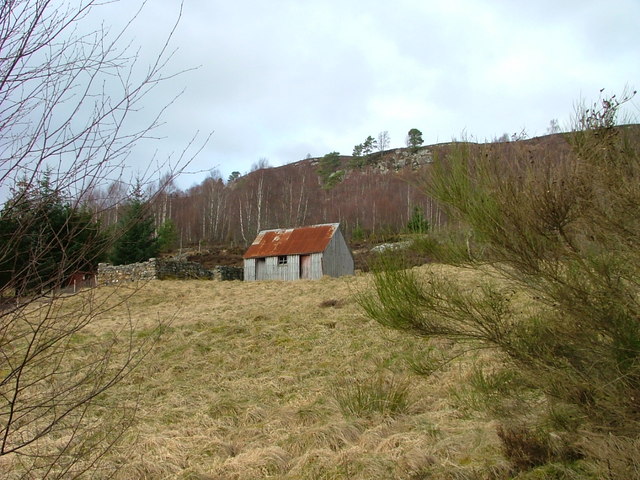
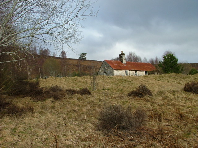
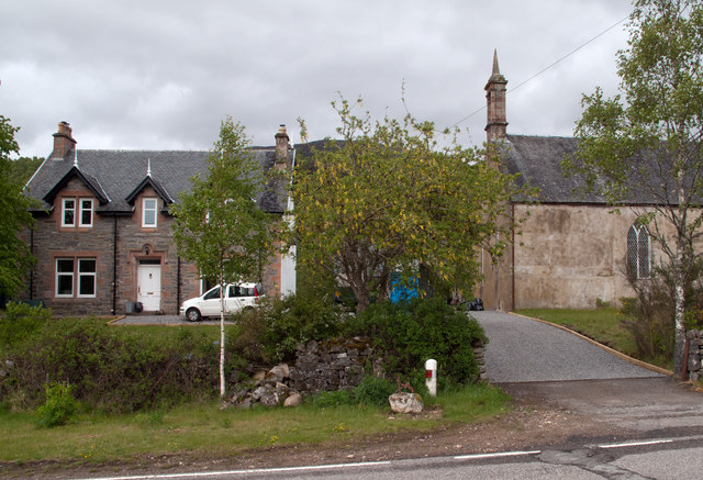
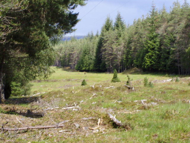
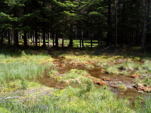
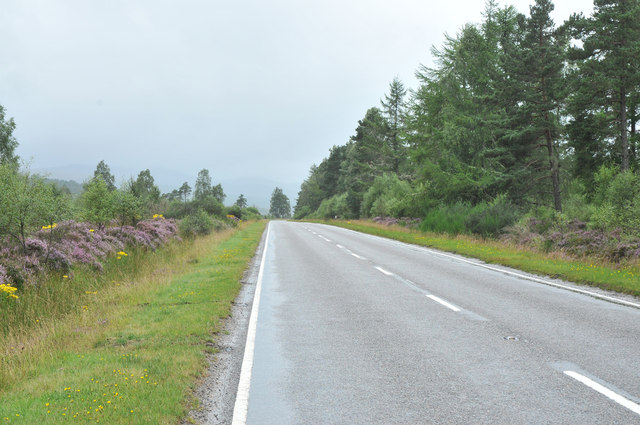
Dundreggan is a small village located in the Inverness-shire region of Scotland. Situated in the western part of the country, it lies approximately 30 miles west of the city of Inverness. The village is nestled within the scenic Glen Moriston, surrounded by beautiful landscapes and lush greenery.

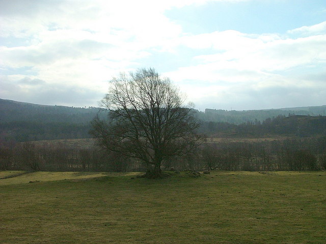
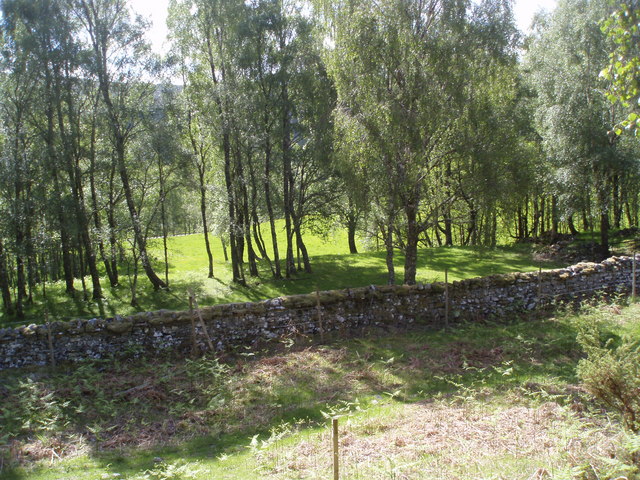
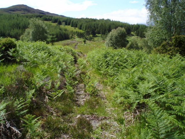
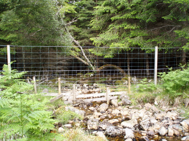
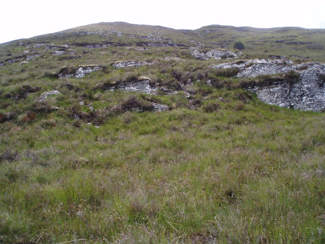
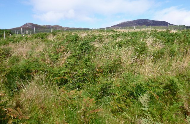
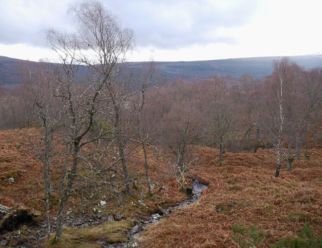
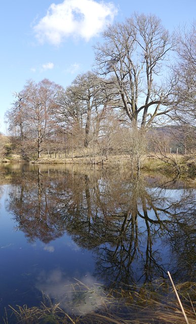
Dundreggan is renowned for its breathtaking natural beauty and is a popular destination for nature lovers and outdoor enthusiasts. The area boasts numerous walking trails and hiking routes, allowing visitors to explore the stunning Scottish Highlands. The nearby River Moriston provides opportunities for fishing and boating, while the surrounding hills offer opportunities for mountain biking and wildlife spotting.

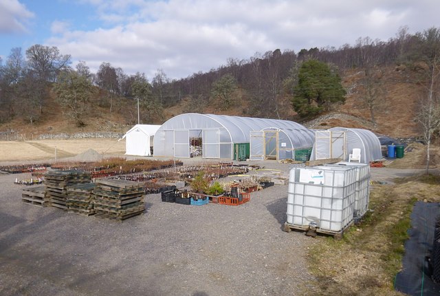
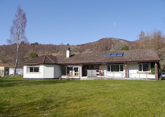
In terms of amenities, Dundreggan is a small village with limited facilities. There is a local pub and a small convenience store catering to the needs of residents and tourists alike. For more extensive services, the city of Inverness is within driving distance and offers a wider range of shops, restaurants, and cultural attractions.

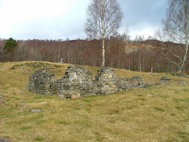
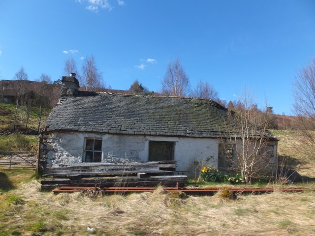
Dundreggan is also known for its rich history and heritage. The village is home to several ancient ruins and archaeological sites, including a prehistoric stone circle. These sites provide a glimpse into the area's past and offer a fascinating insight into Scotland's ancient civilizations.

Overall, Dundreggan is a picturesque village that offers a tranquil escape from the hustle and bustle of city life. Its natural beauty, outdoor activities, and historical significance make it an attractive destination for visitors seeking a peaceful retreat in the Scottish Highlands.

If you have any feedback on the listing, please let us know in the comments section below.

Dundreggan Images

Images are sourced within 2km of 57.19041/-4.7688849 or Grid Reference NH3214. Thanks to Geograph Open Source API. All images are credited.

Ruin at Dundreggan
Ruin at Dundreggan
Shed and ruin at Dundreggan
Dilapidated croft house at Dundreggan
Grazing land at Dundreggan Looking south from the A887.
Grazing land at Dundreggan
Looking south from the A887.
Manse at Dundreggan Dundreggan is in Glen Moriston. The church is now abandoned but the manse is occupied and has been renovated by a succession of owners; on its eastern gable wall is fixed OS flush bracket No. G4536.
Manse at Dundreggan
Dundreggan is in Glen Moriston. The church is now abandoned but the manse is occupied and has been renovated by a succession of owners; on its eastern gable wall is fixed OS flush bracket No. G4536.
Start of path up to Dundreggan-Tomich hill track
Footpath crossing Inverwick Forest
Burn going under forestry fence near Tom a' Chaoruinn
Looking up to Clach-bheinn from forestry boundary
Deer grazing below pylon cables in Glen Moriston
Clearings in Inverwick Forest There was a herd of hinds and their calfs in the clearings
Clearings in Inverwick Forest
There was a herd of hinds and their calfs in the clearings
A887 in Glen Moriston
Exclosure, near Dundreggan Trees for Life fenced off this area near the River Moriston in 2009. Since then, they have been planting a variety of trees, including aspen, birch, rowan, oak and pine.
Most of the trees in this corner of the exclosure are still fairly small, so not very obvious amongst the bracken and long grass.

The hills in the background are Binnilidh Bheag and Binnilidh Mhòr.
Exclosure, near Dundreggan
Trees for Life fenced off this area near the River Moriston in 2009. Since then, they have been planting a variety of trees, including aspen, birch, rowan, oak and pine. Most of the trees in this corner of the exclosure are still fairly small, so not very obvious amongst the bracken and long grass. The hills in the background are Binnilidh Bheag and Binnilidh Mhòr.
Tree nursery, Dundreggan This is the Trees for Life tree nursery, situated next to Dundreggan Lodge. A range of species from the Caledonian Forest are propagated from seeds and cuttings. They will then be planted out on the Dundreggan Estate, and elsewhere in the Trees for Life project area.

The nursery moved to Dundreggan last year, previously it was at Plodda Lodge <a href="https://www.geograph.org.uk/photo/856725">NH2824 : Plodda Lodge. Tree nursery and field centre for the charity Trees For Life.</a>.
Tree nursery, Dundreggan
This is the Trees for Life tree nursery, situated next to Dundreggan Lodge. A range of species from the Caledonian Forest are propagated from seeds and cuttings. They will then be planted out on the Dundreggan Estate, and elsewhere in the Trees for Life project area. The nursery moved to Dundreggan last year, previously it was at Plodda Lodge NH2824 : Plodda Lodge. Tree nursery and field centre for the charity Trees For Life..
Birch woodland, on the slopes of Binnilidh Bheag A small stream running through woodland on the hills above Dundreggan. Much of this woodland is birch trees, along with some aspen, Scots pine, juniper and plenty of bracken.
Birch woodland, on the slopes of Binnilidh Bheag
A small stream running through woodland on the hills above Dundreggan. Much of this woodland is birch trees, along with some aspen, Scots pine, juniper and plenty of bracken.
Dundreggan Lodge Despite the name, this is not a particularly grand historic house. The old Dundreggan Lodge was near here, but demolished in the 1960s after falling into disrepair. This bungalow was built in the 1970s, and later became the main lodge on the estate.

Dundreggan Estate is now owned by Trees for Life, with the lodge used as a field base and accommodation for volunteers.
Dundreggan Lodge
Despite the name, this is not a particularly grand historic house. The old Dundreggan Lodge was near here, but demolished in the 1960s after falling into disrepair. This bungalow was built in the 1970s, and later became the main lodge on the estate. Dundreggan Estate is now owned by Trees for Life, with the lodge used as a field base and accommodation for volunteers.
Pond reflections, by Dundreggan Lodge A small pond just down the hill from the lodge, next to the A887 road. The pond is surrounded by a variety of trees.
Pond reflections, by Dundreggan Lodge
A small pond just down the hill from the lodge, next to the A887 road. The pond is surrounded by a variety of trees.
Ruined house, Dundreggan
Show me another place!

Dundreggan is located at Grid Ref: NH3214 (Lat: 57.19041, Lng: -4.7688849)

Unitary Authority: Highland

Police Authority: Highlands and Islands

What 3 Words

///reflect.riverbank.imparts. Near Cannich, Highland

Related Wikis

Glenmoriston

Glenmoriston or Glen Moriston (Scottish Gaelic: Gleann Moireasdan) is a river glen in the Scottish Highlands, that runs from Loch Ness, at the village...

Dalchreichart

Dalchreichart (Scottish Gaelic: Dul Chreachaird) is a small hamlet in Glen Moriston, Inverness-shire, in the Highland council area of Scotland. It lies...

Loch a' Bhainne

Loch a' Bhainne is a small, upland freshwater loch approximately 2 miles (3.2 km) north of the east end of Loch Garry and 3.5 miles (5.6 km) north-west...

Achlain

Achlain is a house in Glenmoriston in the Highland council area of Scotland. It is about 15 km west of Invermoriston, next to the A887 road and the River...

Tomchrasky

Tomchrasky is a village in Glen Moriston, in Inverness-shire, Scottish Highlands and is in the Scottish council area of Highland. The village lies on the...

Fort Augustus Pier railway station

Fort Augustus Pier was a railway station in Inverness-shire, Scotland, and served as the north terminus of the Invergarry and Fort Augustus Railway between...

Fort Augustus railway station

Fort Augustus was a railway station in Inverness-shire, Scotland on the Invergarry and Fort Augustus Railway between 1903 and 1946. == Overview == The...

Kilchuimen Academy

Kilchuimen Academy is a small secondary school located in Fort Augustus in Scotland. It shares its campus with neighbouring Kilchuimen Primary. The school...

Nearby Amenities

Located within 500m of 57.19041,-4.7688849
Created By: Merkaartor 0.11
Lat/Long: 57.1889252/-4.7633457
Bus Stop
Farm Road End
Direction: E
Local Ref: AT
Naptan AtcoCode: 6700712626
Naptan Bearing: E
Naptan CommonName: Farm Road End
Naptan Indicator: at
Naptan Landmark: Dundreggan Farm
Naptan NaptanCode: 45327965
Naptan Street: A887
Naptan Verified: no
Source: naptan_import
Lat/Long: 57.1905021/-4.7687721
Bus Stop
Farm Road End
Naptan AtcoCode: 6700712626A
Naptan Bearing: W
Naptan CommonName: Farm Road End
Naptan Indicator: opp
Naptan Landmark: Dundreggan Farm
Naptan NaptanCode: 45329432
Naptan Street: A887
Naptan Verified: no
Source: naptan_import
Lat/Long: 57.1903499/-4.7687442
Bus Stop
Redburn Tearooms
Bus: yes
Direction: NE
Naptan AtcoCode: 6700713071
Naptan Bearing: W
Naptan CommonName: Redburn Tearooms
Naptan Indicator: opp Tearoom
Naptan Landmark: Houses
Naptan NaptanCode: 45328487
Naptan Street: A887
Naptan Verified: no
Public Transport: platform
Source: naptan_import
Lat/Long: 57.1884386/-4.7753794
Bus Stop
Redburn Tearooms
Bus: yes
Direction: NE
Naptan AtcoCode: 6700713071A
Naptan Bearing: E
Naptan CommonName: Redburn Tearooms
Naptan Indicator: o/s Tearoom
Naptan Landmark: Houses
Naptan NaptanCode: 45329524
Naptan Street: A887
Naptan Verified: no
Public Transport: platform
Source: naptan_import
Lat/Long: 57.1885932/-4.7753732
Barrier: cattle_grid
Lat/Long: 57.1919622/-4.761825
Dundreggan
Place: hamlet
Lat/Long: 57.189309/-4.7758128
Barrier: cattle_grid
Lat/Long: 57.190517/-4.7690134
Cafe
Redburn Cafe
Cuisine: coffee_shop
Internet Access: wlan
Outdoor Seating: yes
Phone: +44 1320 340376
Smoking: outside
Lat/Long: 57.188736/-4.7754613
Board Type: wildlife
Information: board
Tourism: information
Lat/Long: 57.1919893/-4.7627153
Leisure: picnic_table
Lat/Long: 57.192043/-4.7624149
Power: pole
Lat/Long: 57.1908298/-4.7770522
Power: pole
Lat/Long: 57.1909758/-4.7762706
Power: pole
Lat/Long: 57.1910423/-4.7745789
Power: pole
Lat/Long: 57.1911024/-4.7730218
Power: pole
Lat/Long: 57.1906935/-4.7742405
Power: pole
Lat/Long: 57.1914098/-4.7720876
Power: pole
Lat/Long: 57.1917157/-4.7711818
Power: pole
Lat/Long: 57.1920207/-4.7702476
Power: pole
Lat/Long: 57.1923808/-4.7692415
Power: pole
Lat/Long: 57.1927808/-4.7681426
Power: pole
Lat/Long: 57.1930639/-4.767382
Power: pole
Lat/Long: 57.1929096/-4.7668255
Power: pole
Lat/Long: 57.1924417/-4.7650674
Generator Method: photovoltaic
Generator Output Electricity: yes
Generator Source: solar
Generator Type: solar_photovoltaic_panel
Location: roof
Power: generator
Lat/Long: 57.1917259/-4.7680867
Generator Method: photovoltaic
Generator Output Electricity: yes
Generator Source: solar
Generator Type: solar_photovoltaic_panel
Location: roof
Power: generator
Lat/Long: 57.1913578/-4.7694719
Generator Method: photovoltaic
Generator Output Electricity: yes
Generator Source: solar
Generator Type: solar_photovoltaic_panel
Location: roof
Power: generator
Lat/Long: 57.1913521/-4.7695952
Leisure: picnic_table
Lat/Long: 57.1920914/-4.7624915
Cafe
An Nead Cafe
Addr Place: Dundreggan Estate
Lat/Long: 57.1921534/-4.7639823
The data included in this document is from www.openstreetmap.org. The data is made available under ODbL.

Have you been to Dundreggan?

Leave your review of Dundreggan below (or comments, questions and feedback).