Dudley's Fields

Settlement in Staffordshire

England

Dudley's Fields

Wyrley & Essington Canal towards Stubbs Bridge
Wyrley & Essington Canal towards Stubbs Bridge Credit: Ian S

Dudley's Fields is a charming village located in the county of Staffordshire, England. Nestled amidst the picturesque countryside, this idyllic place is known for its natural beauty and tranquil atmosphere. With a population of around 1,000 residents, Dudley's Fields offers a close-knit community that values its rich history and traditions.

The village is characterized by its stunning landscape, featuring rolling hills, lush green meadows, and meandering streams. It is a haven for nature enthusiasts and provides ample opportunities for outdoor activities such as hiking, cycling, and birdwatching. The nearby Dudley's Fields Forest provides a peaceful retreat for those seeking solitude and serenity.

The village itself boasts a range of architectural styles, with buildings dating back to the 17th and 18th centuries. The historic St. Mary's Church, with its striking spire, is a prominent landmark in the area and serves as a reminder of the village's deep-rooted heritage.

Dudley's Fields also offers a range of amenities to its residents and visitors. The village has a well-stocked local store, a cozy pub serving traditional English fare, and a vibrant community center that hosts various events and gatherings throughout the year.

For those seeking cultural experiences, the nearby town of Stafford is easily accessible and offers a range of museums, galleries, and theaters. Additionally, the village is well-connected to major transportation routes, making it an ideal location for commuting to nearby cities.

In conclusion, Dudley's Fields is a picturesque village that combines natural beauty with a strong sense of community. Its rich history, stunning landscape, and range of amenities make it a desirable place to live or visit for those seeking a peaceful and traditional English countryside experience.

If you have any feedback on the listing, please let us know in the comments section below.

Dudley's Fields Images

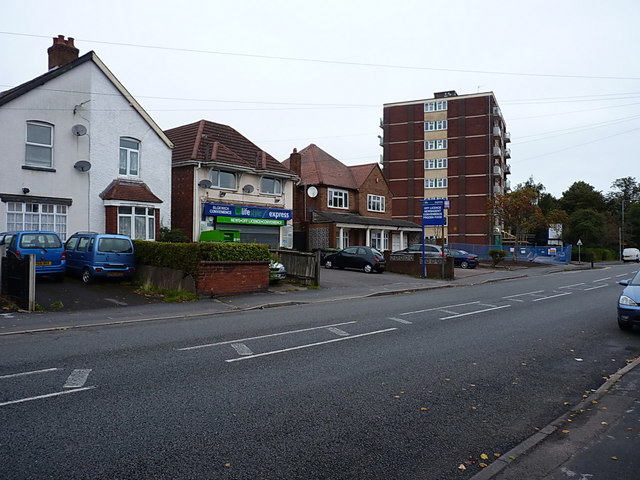
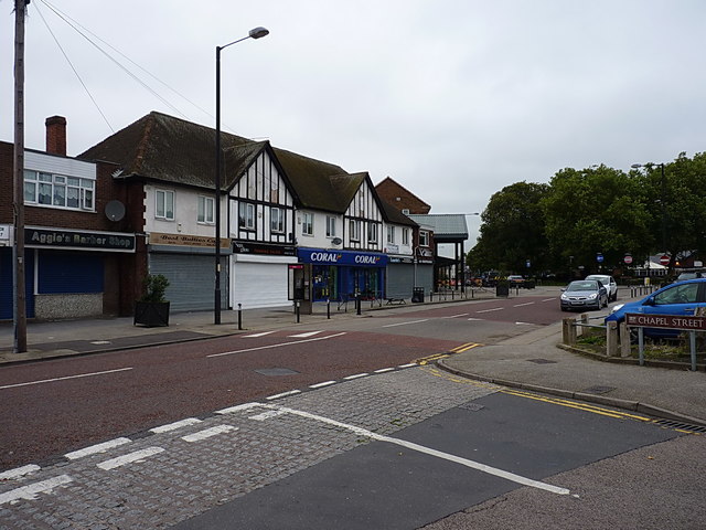
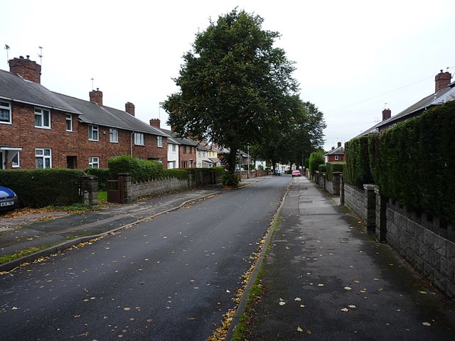
Images are sourced within 2km of 52.616103/-2.0164251 or Grid Reference SJ9802. Thanks to Geograph Open Source API. All images are credited.

Wyrley & Essington Canal towards Stubbs Bridge
Wyrley & Essington Canal at Stubbs Bridge
Victoria Avenue, Blakenhall Heath Just north of Walsall, Blakenhall Heath is primarily given over to housing. Old maps prior to WW2 suggest that it was still very rural up until about the early 1930s, but building of the estates put an end to that between the wars. Many of the houses date from that period, although the ones on the right here are clearly more recent.
Victoria Avenue, Blakenhall Heath
Just north of Walsall, Blakenhall Heath is primarily given over to housing. Old maps prior to WW2 suggest that it was still very rural up until about the early 1930s, but building of the estates put an end to that between the wars. Many of the houses date from that period, although the ones on the right here are clearly more recent.
Shops, houses and flats on Field Road Described as Field Street on some of the older maps (1880s until 1938, at any rate) Field Road runs north-south through Blakenhall Heath, joining the High St B4210 to the A4142 Lichfield Road.
Shops, houses and flats on Field Road
Described as Field Street on some of the older maps (1880s until 1938, at any rate) Field Road runs north-south through Blakenhall Heath, joining the High St B4210 to the A4142 Lichfield Road.
OS benchmark - Blakenhall Heath, 214 Field Road An OS cutmark on the NW angle of 214 Field Road; originally levelled, probably in 1957, at 161.904m above Ordnance Datum Newlyn.
OS benchmark - Blakenhall Heath, 214 Field Road
An OS cutmark on the NW angle of 214 Field Road; originally levelled, probably in 1957, at 161.904m above Ordnance Datum Newlyn.
Penderel Street crosses Hamilton Street in Blakenhall Heath Part of the extensive inter-war housing developments north of Walsall.
Penderel Street crosses Hamilton Street in Blakenhall Heath
Part of the extensive inter-war housing developments north of Walsall.
Ash Street towards Ryle Street Interwar housing developments in Blakenhall Heath
Ash Street towards Ryle Street
Interwar housing developments in Blakenhall Heath
OS benchmark - Blakenhall Heath, 30 Ryle Street An OS cutmark on the front wall of 30 Ryle Street; originally levelled, probably in 1957, at 148.87m above Ordnance Datum Newlyn.
OS benchmark - Blakenhall Heath, 30 Ryle Street
An OS cutmark on the front wall of 30 Ryle Street; originally levelled, probably in 1957, at 148.87m above Ordnance Datum Newlyn.
OS benchmark - Blakenhall Heath, 136 Valley Road An OS cutmark on the north wall of 136 Valley Road; originally levelled, probably in 1957, at 114.411m above Ordnance Datum Newlyn.
OS benchmark - Blakenhall Heath, 136 Valley Road
An OS cutmark on the north wall of 136 Valley Road; originally levelled, probably in 1957, at 114.411m above Ordnance Datum Newlyn.
OS benchmark - Blakenhall Heath, 47 Green Rock Lane An OS cutmark on the NE wall of 47 Green Rock Lane; originally levelled, probably in 1957, at 150.023m above Ordnance Datum Newlyn.
OS benchmark - Blakenhall Heath, 47 Green Rock Lane
An OS cutmark on the NE wall of 47 Green Rock Lane; originally levelled, probably in 1957, at 150.023m above Ordnance Datum Newlyn.
The Green Rock Tavern, Blakenhall Heath Mapped in the 1920s as 'Rock House', this had become a public house by the late 1930s.
The Green Rock Tavern, Blakenhall Heath
Mapped in the 1920s as 'Rock House', this had become a public house by the late 1930s.
OS benchmark - Blakenhall Heath, 1 Green Rock Lane An OS cutmark on the side wall of 1 Green Rock Lane; originally levelled, probably in 1957, at 149.483m above Ordnance Datum Newlyn.
OS benchmark - Blakenhall Heath, 1 Green Rock Lane
An OS cutmark on the side wall of 1 Green Rock Lane; originally levelled, probably in 1957, at 149.483m above Ordnance Datum Newlyn.
Shops and businesses on Blakenall Lane A very similar view to the one in <a href="https://www.geograph.org.uk/photo/1213597">SK0001 : Blakenall Lane, Blakenall Heath</a>; it's a different time of year, and there are some slight changes to the businesses in the retail units over the last 6 or 7 years.
Shops and businesses on Blakenall Lane
A very similar view to the one in SK0001 : Blakenall Lane, Blakenall Heath; it's a different time of year, and there are some slight changes to the businesses in the retail units over the last 6 or 7 years.
Foster Street, Blakenall Heath A mixture of Victorian terracing and slightly more recent (inter- and post-war) housing development.
Foster Street, Blakenall Heath
A mixture of Victorian terracing and slightly more recent (inter- and post-war) housing development.
Hollemeadow Avenue, Blakenall Heath Closely-packed inter-war housing developments in Blakenall Heath
Hollemeadow Avenue, Blakenall Heath
Closely-packed inter-war housing developments in Blakenall Heath
Shops and stores, Hollemeadow Avenue
OS benchmark - Blakenall Heath, 15 Guild Avenue An OS cutmark located on the front wall of a house on Guild Avenue; originally levelled, probably in 1957, at 159.673m above Ordnance Datum Newlyn.
OS benchmark - Blakenall Heath, 15 Guild Avenue
An OS cutmark located on the front wall of a house on Guild Avenue; originally levelled, probably in 1957, at 159.673m above Ordnance Datum Newlyn.
OS benchmark - Blakenall Heath, 88 Blakenall Lane An OS cutmark on the front wall of the house; originally levelled, probably in 1957, at 154.832m above Ordnance Datum Newlyn.
OS benchmark - Blakenall Heath, 88 Blakenall Lane
An OS cutmark on the front wall of the house; originally levelled, probably in 1957, at 154.832m above Ordnance Datum Newlyn.
Show me another place!

Dudley's Fields is located at Grid Ref: SJ9802 (Lat: 52.616103, Lng: -2.0164251)

Unitary Authority: Walsall

Police Authority: West Midlands

What 3 Words

///burst.noses.smooth. Near Bloxwich, West Midlands

Related Wikis

Bloxwich railway station

Bloxwich railway station serves Bloxwich, in the Metropolitan Borough of Walsall, West Midlands, England. The station, and all trains serving it, are...

Walsall North (UK Parliament constituency)

Walsall North is a constituency created in 1955 represented in the House of Commons of the UK Parliament since 2017 by Eddie Hughes, a member of the Conservative...

St Peter's Roman Catholic Church, Bloxwich

St Peter's Roman Catholic Church is a Roman Catholic church in the town of Bloxwich, West Midlands, England. It is an active catholic church in the centre...

Bloxwich

Bloxwich is a market town and civil parish in the Metropolitan Borough of Walsall, West Midlands, England. It is located between the towns of Walsall...

Nearby Amenities

Located within 500m of 52.616103,-2.0164251
Traffic Signals
Source: bing
Lat/Long: 52.6194805/-2.0167544
Sneyd Junction
Waterway: junction
Lat/Long: 52.6148346/-2.0231299
Public Transport: stop_position
Lat/Long: 52.6184143/-2.0116968
Kerb: raised
Lat/Long: 52.620253/-2.0136178
Turning Circle
Lat/Long: 52.6174484/-2.0196894
Bus Stop
BL
Asset Ref: 0622901
Bus: yes
Location: Croxdene Avenue;Elmore Green Road
Naptan AtcoCode: 43000622901
Naptan Bearing: SE
Naptan BusStopType: MKD
Naptan CommonName: Central Drive
Naptan Indicator: Stop BL
Naptan NaptanCode: nwmgwmwa
Naptan PlusbusZoneRef: BHAMNWS
Naptan Status: ACT
Naptan StopType: BCT
Naptan Street: CROXDENE AVE
Naptan Towards: Bloxwich
Naptan Verified: yes
Public Transport: platform
Route Ref: 326
Shelter: no
Source: WMCA
Towards: Bloxwich
Lat/Long: 52.6175155/-2.0100669
BL
Local Ref: BL
Naptan AtcoCode: 43000622902
Naptan Bearing: NW
Naptan BusStopType: CUS
Naptan CommonName: Central Drive
Naptan Indicator: Stop BL
Naptan NaptanCode: nwmwapwp
Naptan Status: ACT
Naptan StopType: BCT
Naptan Street: CROXDENE AVE
Naptan Towards: Willenhall
Naptan Verified: no
Public Transport: platform
Route Ref: 326
Source: WMCA
Lat/Long: 52.6174672/-2.0102656
Bus Stop
Moorland Rd / Willenhall Lane
NaPTANAreaCode: 43000623101
Asset Ref: 202219
Bus: yes
Location: Moorland Road;Willenhall Lane
Naptan AtcoCode: 43000623101
Naptan Bearing: NW
Naptan BusStopType: MKD
Naptan CommonName: Willenhall Lane
Naptan Indicator: after
Naptan NaptanCode: nwmgwmwd
Naptan PlusbusZoneRef: BHAMNWS
Naptan Status: ACT
Naptan StopType: BCT
Naptan Street: MOORLAND RD
Naptan Towards: Bloxwich
Naptan Verified: yes
Public Transport: platform
Route Ref: 70
Shelter: yes
Shelter Ref: 202219
Source: WMCA
Towards: Walsall
Lat/Long: 52.6121897/-2.0143737
Bus Stop
Moorland Rd / Willenhall Lane
Asset Ref: 0623102
Bus: yes
Location: Moorland Road;Willenhall Lane
Naptan AtcoCode: 43000623102
Naptan Bearing: SE
Naptan BusStopType: MKD
Naptan CommonName: Willenhall Lane
Naptan Indicator: before
Naptan NaptanCode: nwmgwmwg
Naptan PlusbusZoneRef: BHAMNWS
Naptan Status: ACT
Naptan StopType: BCT
Naptan Street: MOORLAND RD
Naptan Towards: Walsall
Naptan Verified: yes
Public Transport: platform
Route Ref: 70
Shelter: no
Source: WMCA
Towards: Walsall
Lat/Long: 52.6126171/-2.0147606
Bus Stop
Heather Rd / Heather Rd
Asset Ref: 0623201
Bus: yes
Location: Heather Road;Coalway Road
Naptan AtcoCode: 43000623201
Naptan Bearing: N
Naptan BusStopType: MKD
Naptan CommonName: Heather Rd
Naptan Indicator: before
Naptan NaptanCode: nwmgwmwj
Naptan PlusbusZoneRef: BHAMNWS
Naptan Status: ACT
Naptan StopType: BCT
Naptan Street: HEATHER RD
Naptan Towards: Bloxwich
Naptan Verified: yes
Public Transport: platform
Route Ref: 70
Shelter: no
Source: WMCA
Towards: Bloxwich
Lat/Long: 52.6137686/-2.015572
Bus Stop
Heather Rd / Heather Rd
NaPTANAreaCode: 43000623202
Asset Ref: 202259
Bus: yes
Location: Heather Road;Coalway Road
Naptan AtcoCode: 43000623202
Naptan Bearing: S
Naptan BusStopType: MKD
Naptan CommonName: Heather Rd
Naptan Indicator: after
Naptan NaptanCode: nwmgwmwm
Naptan PlusbusZoneRef: BHAMNWS
Naptan Status: ACT
Naptan StopType: BCT
Naptan Street: HEATHER RD
Naptan Towards: Walsall
Naptan Verified: yes
Public Transport: platform
Route Ref: 70
Shelter: yes
Shelter Ref: 202259
Source: WMCA
Towards: Walsall
Lat/Long: 52.6136535/-2.0154041
Bus Stop
Central Dr / Chase Rd
NaPTANAreaCode: 43000623301
Bus: yes
Location: Central Drive;Chase Road
Naptan AtcoCode: 43000623301
Naptan Bearing: W
Naptan BusStopType: MKD
Naptan CommonName: Chase Rd
Naptan Indicator: adj
Naptan NaptanCode: nwmgwmwp
Naptan PlusbusZoneRef: BHAMNWS
Naptan Status: ACT
Naptan StopType: BCT
Naptan Street: CENTRAL DR
Naptan Towards: Walsall
Naptan Verified: yes
Public Transport: platform
Route Ref: 70
Shelter: yes
Shelter Ref: 202220
Source: WMCA
Towards: Walsall
Lat/Long: 52.6158967/-2.014171
Bus Stop
Central Dr / Chase Rd
NaPTANAreaCode: 43000623302
Bus: yes
Location: Central Drive;Chase Road
Naptan AtcoCode: 43000623302
Naptan Bearing: E
Naptan BusStopType: MKD
Naptan CommonName: Chase Rd
Naptan Indicator: opp
Naptan NaptanCode: nwmgwmwt
Naptan PlusbusZoneRef: BHAMNWS
Naptan Status: ACT
Naptan StopType: BCT
Naptan Street: CENTRAL DR
Naptan Towards: Bloxwich
Naptan Verified: yes
Public Transport: platform
Route Ref: 70
Shelter: yes
Shelter Ref: 202221
Source: WMCA
Towards: Walsall
Lat/Long: 52.61581/-2.014805
Bus Stop
BM
Asset Ref: 0623401
Bus: yes
Local Ref: BM
Location: Central Drive;Central Close
Naptan AtcoCode: 43000623401
Naptan Bearing: SW
Naptan BusStopType: MKD
Naptan CommonName: Central Close
Naptan Indicator: Stop BM
Naptan NaptanCode: nwmgwpad
Naptan Status: ACT
Naptan StopType: BCT
Naptan Street: CENTRAL DR
Naptan Towards: Willenhall
Naptan Verified: yes
Public Transport: platform
Route Ref: 326
Shelter: no
Source: WMCA
Towards: Willenhall
Lat/Long: 52.6166587/-2.0120125
Bus Stop
BN
Asset Ref: 0623402
Bus: yes
Local Ref: BN
Location: Central Drive;Central Close
Naptan AtcoCode: 43000623402
Naptan Bearing: NE
Naptan BusStopType: MKD
Naptan CommonName: Central Close
Naptan Indicator: Stop BN
Naptan NaptanCode: nwmgwpag
Naptan PlusbusZoneRef: BHAMNWS
Naptan Status: ACT
Naptan StopType: BCT
Naptan Street: CENTRAL DR
Naptan Towards: Bloxwich
Naptan Verified: yes
Public Transport: platform
Route Ref: 326
Shelter: no
Source: WMCA
Towards: Bloxwich
Lat/Long: 52.6166971/-2.0120759
Bus Stop
Sneyd Hall Rd / Central Drive
Asset Ref: 0623501
Bus: yes
Location: Sneyd Hall Road;Central Drive
Naptan AtcoCode: 43000623501
Naptan Bearing: SE
Naptan BusStopType: MKD
Naptan CommonName: Central Drive
Naptan Indicator: before
Naptan NaptanCode: nwmgwpaj
Naptan PlusbusZoneRef: BHAMNWS
Naptan Status: ACT
Naptan StopType: BCT
Naptan Street: SNEYD HALL RD
Naptan Towards: Bloxwich
Naptan Verified: yes
Public Transport: platform
Route Ref: 70;326
Shelter: no
Source: WMCA
Towards: Walsall
Lat/Long: 52.6170095/-2.0142204
Bus Stop
Sneyd Hall Rd / Central Drive
Asset Ref: 0623502
Bus: yes
Location: Sneyd Hall Road;Central Drive
Naptan AtcoCode: 43000623502
Naptan Bearing: N
Naptan BusStopType: MKD
Naptan CommonName: Central Drive
Naptan Indicator: after
Naptan NaptanCode: nwmgwpam
Naptan PlusbusZoneRef: BHAMNWS
Naptan Status: ACT
Naptan StopType: BCT
Naptan Street: SNEYD HALL RD
Naptan Towards: Bloxwich, New Invention
Naptan Verified: yes
Public Transport: platform
Route Ref: 70;326
Shelter: no
Source: WMCA
Towards: Bloxwich
Lat/Long: 52.6169656/-2.0151613
Bus Stop
Sneyd Lane / Sneyd Hall Rd
Bench: no
Bin: no
Bus: yes
Naptan AtcoCode: 43000624201
Naptan Bearing: SW
Naptan BusStopType: MKD
Naptan CommonName: Sneyd Hall Rd
Naptan Indicator: adj
Naptan NaptanCode: nwmgwpdg
Naptan PlusbusZoneRef: BHAMNWS
Naptan Status: ACT
Naptan StopType: BCT
Naptan Street: SNEYD LANE
Naptan Towards: Mossley, New Invention
Naptan Verified: no
Public Transport: platform
Route Ref: 89;301;326
Shelter: no
Source: WMCA
Lat/Long: 52.6193454/-2.017046
Bus Stop
Sneyd Lane / Cresswell Crescent
NaPTANAreaCode: 43000624302
Bench: yes
Bus: yes
Naptan AtcoCode: 43000624302
Naptan Bearing: NE
Naptan BusStopType: MKD
Naptan CommonName: Cresswell Crescent
Naptan Indicator: adj
Naptan NaptanCode: nwmgwpdj
Naptan PlusbusZoneRef: BHAMNWS
Naptan Status: ACT
Naptan StopType: BCT
Naptan Street: SNEYD LANE
Naptan Towards: Bloxwich
Naptan Verified: no
Public Transport: platform
Route Ref: 89;301;326
Shelter: yes
Shelter Ref: 202260
Source: WMCA
Lat/Long: 52.6187607/-2.0191433
Bus Stop
Sneyd Lane / Cresswell Crescent
NaPTANAreaCode: 43000624303
Bus: yes
Naptan AtcoCode: 43000624303
Naptan Bearing: SW
Naptan BusStopType: MKD
Naptan CommonName: Cresswell Crescent
Naptan Indicator: opp
Naptan NaptanCode: nwmgwpdm
Naptan PlusbusZoneRef: BHAMNWS
Naptan Status: ACT
Naptan StopType: BCT
Naptan Street: SNEYD LANE
Naptan Towards: New Invention
Naptan Verified: no
Public Transport: platform
Route Ref: 89;326
Shelter: yes
Shelter Ref: 202266
Source: WMCA
Lat/Long: 52.6184883/-2.019562
Bus Stop
Sneyd Lane / Chepstow Rd
NaPTANAreaCode: 43000624501
Bus: yes
Location: Sneyd Lane;Chepstow Road
Naptan AtcoCode: 43000624501
Naptan Bearing: NE
Naptan BusStopType: MKD
Naptan CommonName: Chepstow Rd
Naptan Indicator: opp
Naptan NaptanCode: nwmgwpdw
Naptan PlusbusZoneRef: BHAMNWS
Naptan Status: ACT
Naptan StopType: BCT
Naptan Street: SNEYD LANE
Naptan Towards: Bloxwich
Naptan Verified: yes
Public Transport: platform
Route Ref: 89;326
Shelter: yes
Shelter Ref: 202262
Source: WMCA
Towards: Bloxwich
Lat/Long: 52.6177568/-2.0216854
Bus Stop
Sneyd Lane / Chepstow Rd
NaPTANAreaCode: 43000624502
Bus: yes
Location: Sneyd Lane;Chepstow Road
Naptan AtcoCode: 43000624502
Naptan Bearing: SW
Naptan BusStopType: MKD
Naptan CommonName: Chepstow Rd
Naptan Indicator: adj
Naptan NaptanCode: nwmgwpga
Naptan PlusbusZoneRef: BHAMNWS
Naptan Status: ACT
Naptan StopType: BCT
Naptan Street: SNEYD LANE
Naptan Towards: New Invention
Naptan Verified: yes
Public Transport: platform
Route Ref: 89;326
Shelter: yes
Shelter Ref: 202267
Source: WMCA
Towards: New Invitation
Lat/Long: 52.6171494/-2.0233997
Bus Stop
Sneyd Lane / Sneyd Hall Rd
NaPTANAreaCode: 43006275003
Bench: yes
Bin: no
Bus: yes
Location: Sneyd Lane;Sneyd Hall Road
Naptan AtcoCode: 43006275003
Naptan Bearing: NE
Naptan BusStopType: MKD
Naptan CommonName: Sneyd Hall Rd
Naptan Indicator: opp
Naptan NaptanCode: nwmpmdjp
Naptan PlusbusZoneRef: BHAMNWS
Naptan Status: ACT
Naptan StopType: BCT
Naptan Street: SNEYD LANE
Naptan Towards: Bloxwich
Naptan Verified: yes
Public Transport: platform
Route Ref: 70;89;301
Shelter: yes
Shelter Ref: 202223
Source: WMCA
Towards: Bloxwich
Lat/Long: 52.6197716/-2.0158039
Bus Stop
Sneyd Hall Rd / Sneyd Lane
NaPTANAreaCode: 43006275502
Bus: yes
Location: Sneyd Hall Road;Sneyd Lane
Naptan AtcoCode: 43006275502
Naptan Bearing: SE
Naptan BusStopType: MKD
Naptan CommonName: Sneyd Lane
Naptan Indicator: after
Naptan NaptanCode: nwmpmdjt
Naptan PlusbusZoneRef: BHAMNWS
Naptan Status: ACT
Naptan StopType: BCT
Naptan Street: SNEYD HALL RD
Naptan Towards: Walsall
Naptan Verified: yes
Public Transport: platform
Route Ref: 70;326
Shelter: yes
Shelter Ref: 202222
Source: WMCA
Lat/Long: 52.6192736/-2.0162313
Bus Stop
Cresswell Cres / Sneyd Lane
NaPTANAreaCode: 43006276001
Bus: yes
Naptan AtcoCode: 43006276001
Naptan Bearing: NW
Naptan BusStopType: MKD
Naptan CommonName: Sneyd Lane
Naptan Indicator: after
Naptan NaptanCode: nwmpmdjw
Naptan PlusbusZoneRef: BHAMNWS
Naptan Status: ACT
Naptan StopType: BCT
Naptan Street: CRESSWELL CRES
Naptan Towards: Mossley
Naptan Verified: no
Public Transport: platform
Route Ref: 301
Shelter: yes
Shelter Ref: 202247
Source: WMCA
Lat/Long: 52.6187606/-2.0198966
Mini Roundabout
Direction: clockwise
Lat/Long: 52.6173164/-2.0097521
Mini Roundabout
Lat/Long: 52.6188801/-2.0214781
Midlands Canoe Centre
Shop: water_sports
Lat/Long: 52.6152708/-2.0223645
Crossing
Crossing: traffic_signals
Crossing Ref: pelican
Lat/Long: 52.6175737/-2.0220471
Turning Circle
Noexit: yes
Source: bing
Lat/Long: 52.614801/-2.0111469
Post Box
Brand: Royal Mail
Brand Wikidata: Q638098
Collection Times: Mo-Fr 17:15; Sa 12:00; Su off
Colour: red
Drive Through: no
Operator: Royal Mail
Operator Wikidata: Q638098
Post Box Apertures: 1
Post Box Design: type_b
Post Box Type: pillar
Ref: WS3 263
Royal Cypher: EIIR
Royal Cypher Wikidata: Q33102113
Lat/Long: 52.6163314/-2.0135547
Toilets
Key: BW
Lat/Long: 52.615201/-2.0216399
Grit Bin
Lat/Long: 52.6156542/-2.0216516
Post Box
Postal Code: WS3
Ref: WS3 354
Source: GPS Survey
Lat/Long: 52.6176822/-2.0216349
Turning Circle
Lat/Long: 52.6122318/-2.0156571
The Co-operative Food
Operator: The Midcounties Co-operative
Shop: convenience
Lat/Long: 52.6163791/-2.0134052
Toilets
Lat/Long: 52.6152248/-2.0216435
Bloxwich
Naptan AtcoCode: 9100BLOXWCH
Network: National Rail
Network Website: https://www.nationalrail.co.uk/stations/blx/
Network Wikidata: Q26334
Public Transport: station
Railway: station
Ref Crs: BLX
West Midlands Fare Zone: 5
Wikidata: Q1993493
Wikipedia: en:Bloxwich railway station
Lat/Long: 52.6184313/-2.0116594
Traffic Signals
Source: bing
Lat/Long: 52.6193296/-2.0163265
Traffic Signals
Source: bing
Lat/Long: 52.6196846/-2.0163989
Traffic Signals
Source: bing
Lat/Long: 52.6196569/-2.0160663
Source: bing
Traffic Calming: choker
Lat/Long: 52.6196678/-2.0204417
Sporting Supplies
Addr City: Walsall
Addr Postcode: WS3 2XN
Addr Street: Willenhall Lane
Name En: Sporting Supplies
Phone: +44 1922 406777
Shop: sports
Website: http://www.sportingsupplies.co.uk
Lat/Long: 52.6130488/-2.0122325
Generator Method: photovoltaic
Generator Output Electricity: yes
Generator Source: solar
Generator Type: solar_photovoltaic_panel
Location: roof
Power: generator
Lat/Long: 52.6199988/-2.0186842
Generator Method: photovoltaic
Generator Output Electricity: yes
Generator Source: solar
Generator Type: solar_photovoltaic_panel
Location: roof
Power: generator
Lat/Long: 52.6198393/-2.0192474
Dudley's Fields
Place: suburb
Source: Ordnance Survey
Lat/Long: 52.6151626/-2.012483
Barrier: bollard
Lat/Long: 52.6147442/-2.0112939
Generator Method: photovoltaic
Generator Output Electricity: yes
Generator Source: solar
Generator Type: solar_photovoltaic_panel
Location: roof
Power: generator
Lat/Long: 52.6186611/-2.0187861
Generator Method: photovoltaic
Generator Output Electricity: yes
Generator Source: solar
Generator Type: solar_photovoltaic_panel
Location: roof
Power: generator
Lat/Long: 52.6188679/-2.0221643
Generator Method: photovoltaic
Generator Output Electricity: yes
Generator Source: solar
Generator Type: solar_photovoltaic_panel
Location: roof
Power: generator
Lat/Long: 52.6188451/-2.0219846
Generator Method: photovoltaic
Generator Output Electricity: yes
Generator Source: solar
Generator Type: solar_photovoltaic_panel
Location: roof
Power: generator
Lat/Long: 52.6204179/-2.014399
Post Box
Brand: Royal Mail
Brand Wikidata: Q638098
Collection Times: Mo-Fr 16:15; Sa 11:30; Su off
Colour: red
Drive Through: no
Operator: Royal Mail
Operator Wikidata: Q638098
Post Box Apertures: 1
Post Box Design: type_b
Post Box Type: pillar
Ref: WS3 308
Royal Cypher: EIIR
Royal Cypher Wikidata: Q33102113
Lat/Long: 52.6124883/-2.014791
Give Way
Lat/Long: 52.6175635/-2.0103829
The data included in this document is from www.openstreetmap.org. The data is made available under ODbL.

Have you been to Dudley's Fields?

Leave your review of Dudley's Fields below (or comments, questions and feedback).