Dowbiggin

Settlement in Yorkshire South Lakeland

England

Dowbiggin

A684, Potgill Holme Towards Sedbergh.
A684, Potgill Holme Credit: JThomas

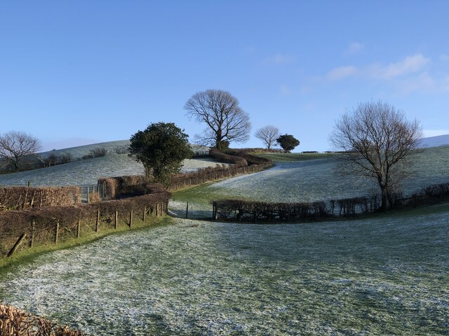
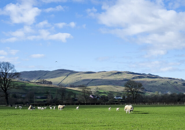
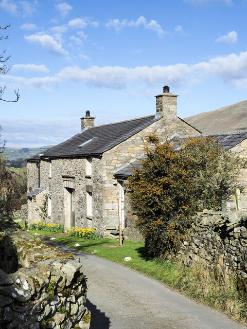
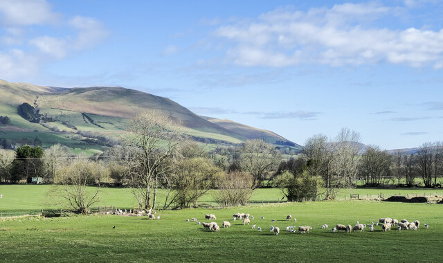
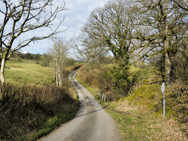
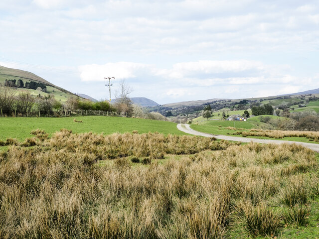
Dowbiggin is a small village located in the county of Yorkshire, England. Situated in the scenic countryside, it is nestled between the rolling hills and green pastures of the region. With a population of around 500 residents, the village exudes a tranquil and close-knit atmosphere.

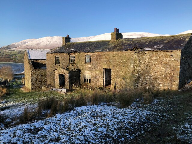
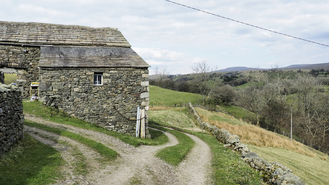
The origins of Dowbiggin can be traced back to medieval times, as evidenced by the presence of historical buildings and landmarks. The village church, St. Mary's, dates back to the 12th century and stands as a testament to the area's rich history. Its architecture showcases a mix of Norman and Gothic styles, attracting visitors with its intricate stonework and stained glass windows.

The village is primarily residential, with a small number of local businesses catering to the needs of the community. These establishments include a cozy village pub, a convenience store, and a post office, providing essential services for residents and visitors alike.

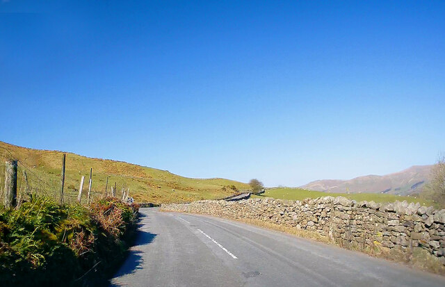
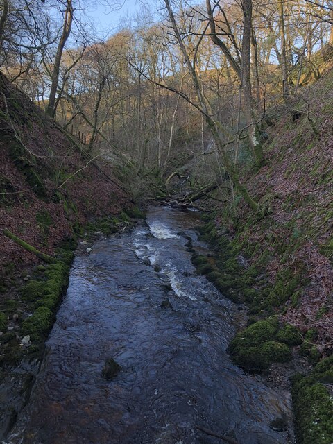
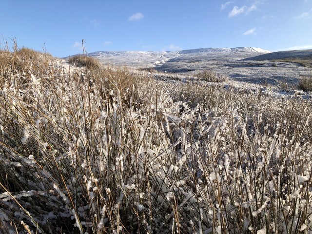
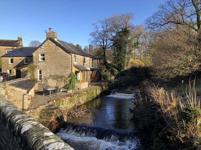
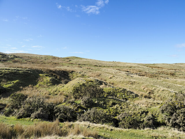
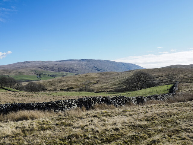
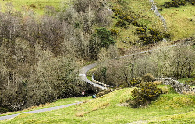
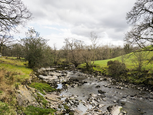
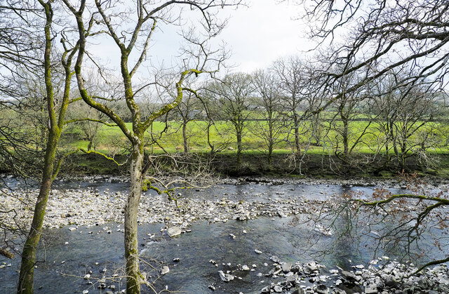
Nature enthusiasts are drawn to Dowbiggin for its picturesque surroundings. The village boasts scenic walking trails that allow visitors to immerse themselves in the beauty of the countryside. The nearby Dowbiggin Beck, a small stream, adds to the charm of the area, attracting wildlife and providing a peaceful ambiance.

Dowbiggin also hosts a variety of community events throughout the year, including a summer fair and a festive Christmas market. These gatherings foster a sense of unity among the villagers, encouraging a strong community spirit.

Overall, Dowbiggin offers a serene and idyllic lifestyle, with its rich history, natural beauty, and tight-knit community making it a delightful place to live or visit in the heart of Yorkshire.

If you have any feedback on the listing, please let us know in the comments section below.

Dowbiggin Images

Images are sourced within 2km of 54.324467/-2.4861866 or Grid Reference SD6892. Thanks to Geograph Open Source API. All images are credited.

A684, Potgill Holme Towards Sedbergh.
A684, Potgill Holme
Towards Sedbergh.
Fields Beside Road To Hebblethwaite Hall
Hebblethwaite Hall Gill
Abandoned Farmhouse at Sarthwaite
Icy Moorland Above Sarthwaite
Weirs on Hebblethwaite Hall Gill at Burntmill Bridge
Picnic Area Beside A 683
Sheep on south side of A684 Sheep with new lambs in a field close to Sedbergh.
The gradually rising upland is Middleton Fell which reaches its highest point at The Calf, 610 metres, just on 2000 feet.
Sheep on south side of A684
Sheep with new lambs in a field close to Sedbergh. The gradually rising upland is Middleton Fell which reaches its highest point at The Calf, 610 metres, just on 2000 feet.
Low Hollins A cottage or cottages at Low Hollins near to Sedbergh. The narrow road here is the route of the long distance path, Dales High Way. The road ends not far behind the camera position the route then becoming a bridleway.
Low Hollins
A cottage or cottages at Low Hollins near to Sedbergh. The narrow road here is the route of the long distance path, Dales High Way. The road ends not far behind the camera position the route then becoming a bridleway.
Frostrow Frostrow, and an area of moorland named on OS maps as Frostrow Fells which is an area of low, rolling moorland.
Frostrow
Frostrow, and an area of moorland named on OS maps as Frostrow Fells which is an area of low, rolling moorland.
Dry stone wall at foot of Frostrow Fells The area known as Frostrow Fells is close to Sedbergh. It's part of the ground which eventually resolves itself into the broad ridge rising to Aye Gill Pike on the south side of Garsdale.
The large, distant hill is Baugh Fell, on the other side of Garsdale.
Dry stone wall at foot of Frostrow Fells
The area known as Frostrow Fells is close to Sedbergh. It's part of the ground which eventually resolves itself into the broad ridge rising to Aye Gill Pike on the south side of Garsdale. The large, distant hill is Baugh Fell, on the other side of Garsdale.
Danny Bridge Danny Bridge carries the minor road, Danny Wheel, over the Clough River, which drains Garsdale.
Danny Bridge
Danny Bridge carries the minor road, Danny Wheel, over the Clough River, which drains Garsdale.
Ribs of rock in Clough River The river looking upstream, (to the south at the location), near to Hallbank, where a succession of low rock ribs extend out from the east bank, left in the image.
Ribs of rock in Clough River
The river looking upstream, (to the south at the location), near to Hallbank, where a succession of low rock ribs extend out from the east bank, left in the image.
Sheep and lambs near to Sedbergh Sheep in a field north of Bank Cottage Farm.
The Howgill Fells rise to the left with Knott being the most obvious feature.
Sheep and lambs near to Sedbergh
Sheep in a field north of Bank Cottage Farm. The Howgill Fells rise to the left with Knott being the most obvious feature.
Minor road with passing place The road is seen heading north towards the farm at Thursgill where it ends as a publicly motorable route. It's climbing from a stream crossing near to Ellerthwaite.
Minor road with passing place
The road is seen heading north towards the farm at Thursgill where it ends as a publicly motorable route. It's climbing from a stream crossing near to Ellerthwaite.
Barn at Fawcett Bank Fawcett Bank is a farm in the valley of the River Rawthey. The farm road, also a public footpath, is the course of a named long distance path based on a walk made by Alfred Wainwright in 1938, 'A Pennine Journey'.
Barn at Fawcett Bank
Fawcett Bank is a farm in the valley of the River Rawthey. The farm road, also a public footpath, is the course of a named long distance path based on a walk made by Alfred Wainwright in 1938, 'A Pennine Journey'.
River Rawthey A view across the river from the path on the north bank, east of Sedbergh.
River Rawthey
A view across the river from the path on the north bank, east of Sedbergh.
Route of 'A Pennine Journey' The road is the access route for the farm at Fawcett Bank; it's not a public road for motoring but is a public footpath and is now the route of the long distance walk. The route is not the one followed in 1938 by Alfred Wainwright and recorded by him in a version not originally intended for publication, but a similar one made in 1998 by David and Heather Pitt.
Route of 'A Pennine Journey'
The road is the access route for the farm at Fawcett Bank; it's not a public road for motoring but is a public footpath and is now the route of the long distance walk. The route is not the one followed in 1938 by Alfred Wainwright and recorded by him in a version not originally intended for publication, but a similar one made in 1998 by David and Heather Pitt.
Show me another place!

Dowbiggin is located at Grid Ref: SD6892 (Lat: 54.324467, Lng: -2.4861866)

Division: West Riding

Administrative County: Cumbria

District: South Lakeland

Police Authority: Cumbria

What 3 Words

///poetry.gathering.pricing. Near Sedbergh, Cumbria

Nearby Locations

Dowbiggin Ghyllas Wood

Related Wikis

Clough River

The Clough River is a river in Cumbria, England. A tributary of the River Rawthey, it flows for 21.8 kilometres (13.5 mi) primarily through the Garsdale...

Settlebeck School

Settlebeck School is a small coeducational secondary school with academy status. It is located in Sedbergh in the English county of Cumbria, drawing pupils...

Millthrop

Millthrop is a hamlet in the South Lakeland district of Cumbria, Northern England and the Yorkshire Dales. Millthrop lies on the south bank of the River...

Sedbergh

Sedbergh ( SED-bər or locally SEB-ər) is a town and civil parish in the ceremonial county of Cumbria. It falls within the historic boundaries of the West...

The Bull Hotel, Sedbergh

The Bull Hotel, formerly The Black Bull Hotel, is a 17th-century coaching inn in Sedbergh, Cumbria. It is located in a narrow passage parallel with the...

Sedbergh School Chapel

Sedbergh School Chapel is located to the southeast of Sedbergh School, Sedbergh, Cumbria, England. It is considered to be of architectural importance...

St Andrew's Church, Sedbergh

St Andrew's Church is in Main Street, Sedbergh, Cumbria, England. It is an active Anglican parish church in the deanery of Kendal, and the diocese of Carlisle...

Sedbergh People's Hall

Sedbergh People's Hall is a village hall in Sedbergh, unique because it was built by the people, for the people. == Land and lease == The land on which...

Related Videos

Walking in The Howgill Fells | Cautley Spout, The Calf & Calders | Stunning Waterfall & Tranquility

Fantastic waterfall and tranquility in the Howgill Fells https://www.youtube.com/@TonysTrails?sub_confirmation=1 #howgill fells ...

Sedbergh to Middleton Bridge Round

Todays bimble is a wander along the River Rawthey from Sedbergh. The weatherman threatened lots of rain and wind following ...

A Walk Up the Fell

Almost in F - Tranquillity by Kevin MacLeod is licensed under a Creative Commons Attribution licence ...

Cautley fell race 2023 - KWL // Descended wrong way :-(

Short but steep race called Cautley fell race, part of Kendal Winter League (KWL) organised by Helm Hill fell running club.

Nearby Amenities

Located within 500m of 54.324467,-2.4861866
Hiking: yes
Information: guidepost
Source: GPS survey
Tourism: information
Lat/Long: 54.3210117/-2.4835593
Barrier: kissing_gate
Lat/Long: 54.3213058/-2.4820867
Barrier: stile
Lat/Long: 54.3210383/-2.4835673
Barrier: kissing_gate
Lat/Long: 54.3208115/-2.4848011
Barrier: kissing_gate
Source: GPS survey
Lat/Long: 54.3212479/-2.4909085
Generator Method: photovoltaic
Generator Orientation: south
Generator Output Electricity: yes
Generator Solar Modules: 16
Generator Source: solar
Generator Type: solar_photovoltaic_panel
Location: roof
Power: generator
Lat/Long: 54.3251536/-2.4823462
Generator Method: photovoltaic
Generator Orientation: south
Generator Output Electricity: yes
Generator Solar Modules: 16
Generator Source: solar
Generator Type: solar_photovoltaic_panel
Location: roof
Power: generator
Lat/Long: 54.3242024/-2.4877564
Power: pole
Lat/Long: 54.3245822/-2.4829397
Power: pole
Lat/Long: 54.3246816/-2.4823469
Power: pole
Lat/Long: 54.3247817/-2.481785
Power: pole
Lat/Long: 54.324996/-2.4802065
Power: pole
Lat/Long: 54.3240715/-2.4792945
Power: pole
Lat/Long: 54.3246753/-2.4899416
Power: pole
Lat/Long: 54.3249952/-2.4894749
Power: pole
Lat/Long: 54.3253417/-2.4890524
Power: pole
Lat/Long: 54.3254598/-2.4897176
Power: pole
Lat/Long: 54.32636/-2.4927056
Power: pole
Lat/Long: 54.3261222/-2.491056
Power: pole
Lat/Long: 54.325728/-2.4895848
Power: pole
Lat/Long: 54.3244563/-2.4879782
Power: pole
Lat/Long: 54.3244907/-2.483566
Power: pole
Lat/Long: 54.3243187/-2.4844082
Power: pole
Lat/Long: 54.3242209/-2.4847461
Power: pole
Lat/Long: 54.3243578/-2.4855588
Power: pole
Lat/Long: 54.3244665/-2.4863461
Power: pole
Lat/Long: 54.3245447/-2.4862817
Power: pole
Lat/Long: 54.3253018/-2.4865218
Power: pole
Lat/Long: 54.3253127/-2.4872017
Power: pole
Lat/Long: 54.3253229/-2.4880989
Barrier: stile
Material: stone
Source: survey;gps
Stile: stepover
Lat/Long: 54.3267348/-2.480116
The data included in this document is from www.openstreetmap.org. The data is made available under ODbL.

Have you been to Dowbiggin?

Leave your review of Dowbiggin below (or comments, questions and feedback).