Danestone

Settlement in Aberdeenshire

Scotland

Danestone

Turf Zone "AirportLoop" On the A947, Bankhead.
Turf Zone "AirportLoop" Credit: Ian S

Danestone is a small suburb located in the city of Aberdeen, in the county of Aberdeenshire, Scotland. It is situated on the eastern banks of the River Don, about 4.5 miles north-west of the city center.

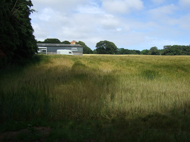
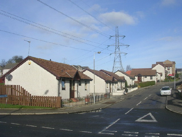
Danestone is primarily a residential area, consisting of a mix of housing developments, including detached houses, semi-detached houses, and apartments. The neighborhood is known for its peaceful and family-friendly atmosphere, making it a popular choice for those looking for a tranquil place to live.

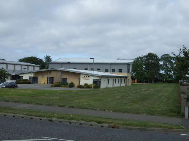
The suburb offers a range of amenities to its residents, including a local primary school, Danestone Primary School, which serves the educational needs of the community. There are also several parks and green spaces in the area, such as Danestone Country Park, which provides a peaceful retreat for nature lovers and recreational activities for families.

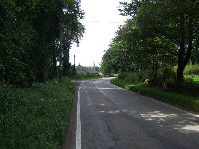
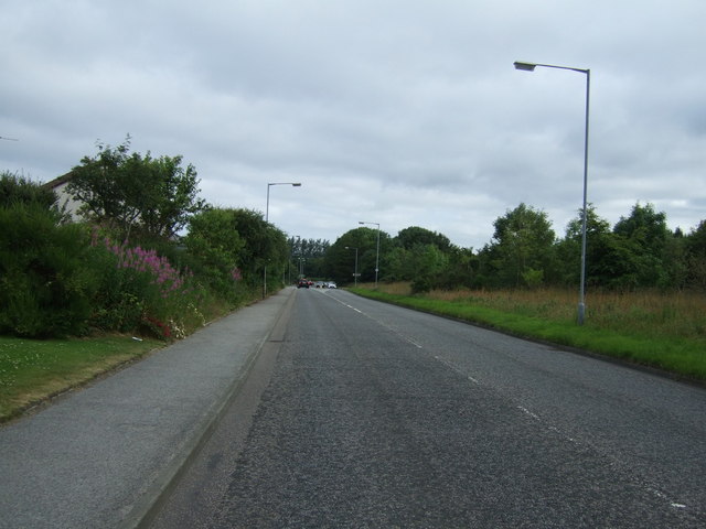
Transportation in Danestone is easily accessible, with regular bus services connecting the suburb to the city center and other nearby areas. The A90 road, which runs through the suburb, provides convenient access to the wider Aberdeenshire region and the rest of Scotland.

Despite its residential nature, Danestone is well-served by local shops and amenities. The nearby Bridge of Don area offers a range of supermarkets, retail parks, and leisure facilities, ensuring that residents have easy access to everything they need.

Overall, Danestone is a quiet and picturesque suburb, offering a peaceful living environment while still providing convenient access to the amenities and attractions of Aberdeen city.

If you have any feedback on the listing, please let us know in the comments section below.

Danestone Images

Images are sourced within 2km of 57.180203/-2.1424344 or Grid Reference NJ9109. Thanks to Geograph Open Source API. All images are credited.

Turf Zone "AirportLoop" On the A947, Bankhead.
Turf Zone "AirportLoop"
On the A947, Bankhead.
Denestone Primary School An unusual design, which looks more like a house than a school.   School roll 2022-23: 214 (estimated).
Denestone Primary School
An unusual design, which looks more like a house than a school. School roll 2022-23: 214 (estimated).
Lacrosse pitch, Balgownie Sports Ground The University of Aberdeen sports ground appears to be disused but the grass is immaculately mowed.  Balgownie means 'town of the cattle fold' according to Celtic Place-names in Aberdeenshire by John Milne.
Lacrosse pitch, Balgownie Sports Ground
The University of Aberdeen sports ground appears to be disused but the grass is immaculately mowed. Balgownie means 'town of the cattle fold' according to Celtic Place-names in Aberdeenshire by John Milne.
Crop field, Lower Persley
Minor road, Lower Persley Heading north east.
Minor road, Lower Persley
Heading north east.
Crop field towards Cothill
Oldmachar Dental Care
Jesmond Drive Heading north.
Jesmond Drive
Heading north.
Buckie Road Off Whitestripes Avenue.
Buckie Road
Off Whitestripes Avenue.
Whitestripes Avenue Heading south.
Whitestripes Avenue
Heading south.
Crop field and power lines, Danestone North of the A90.
Crop field and power lines, Danestone
North of the A90.
A90 heading west
A90 heading west
The Buckie Farm pub Off the A90.
The Buckie Farm pub
Off the A90.
Balgownie Sports Centre Students keeping a note of the number of laps of the running track completed by members of Aberdeen University Cycling Club during a sponsored cycle marathon in aid of Aberdeen Students Charities Campaign. The event raised several hundred pounds.
Balgownie Sports Centre
Students keeping a note of the number of laps of the running track completed by members of Aberdeen University Cycling Club during a sponsored cycle marathon in aid of Aberdeen Students Charities Campaign. The event raised several hundred pounds.
Oldmachar Academy, Aberdeen As of 2020, one of 11 secondary schools in Aberdeen City with a pupil roll of approximately 800.   The windowless 1970s architecture is somewhat uncompromising.
Oldmachar Academy, Aberdeen
As of 2020, one of 11 secondary schools in Aberdeen City with a pupil roll of approximately 800. The windowless 1970s architecture is somewhat uncompromising.
Jesmond sports centre, Middleton Park, Aberdeen Managed for Aberdeen City Council by the arms-length organisation Sports Aberdeen.
Jesmond sports centre, Middleton Park, Aberdeen
Managed for Aberdeen City Council by the arms-length organisation Sports Aberdeen.
Old Machar Medical Practice, Middleton Park, Aberdeen
Suburban sea views The North Sea, some 3 km to the east, can just be discerned in the blown-up photo.
Suburban sea views
The North Sea, some 3 km to the east, can just be discerned in the blown-up photo.
Show me another place!

Danestone is located at Grid Ref: NJ9109 (Lat: 57.180203, Lng: -2.1424344)

Unitary Authority: City of Aberdeen

Police Authority: North East

What 3 Words

///walks.grain.detail. Near Dyce, Aberdeen

Related Wikis

Danestone Congregational Church

Danestone Congregational Church is a Congregational Christian Church located in the Danestone community of the Bridge of Don suburb in Aberdeen, Scotland...

Danestone

Danestone is a small, village-like area of Aberdeen, Scotland, located next to the suburb of Bridge of Don. Located North of Aberdeen City Centre, Danestone...

Aberdeen North (UK Parliament constituency)

Aberdeen North is a burgh constituency of the House of Commons of the Parliament of the United Kingdom and it elects one Member of Parliament (MP) by the...

Persley railway station

Persley railway station served the area of Persley, Aberdeenshire, Scotland, from 1903 to 1937 on the Great North of Scotland Railway. == History == The...

Haudagain roundabout

The Haudagain Roundabout is a roundabout in Aberdeen that bisects the A92 and A96.As all traffic going northbound to Inverness via the A96 or southbound...

Woodside (Aberdeen) railway station

Woodside (Aberdeen) railway station served the parish of Woodside, Aberdeen, Scotland from 1858 to 1937 on the Great North of Scotland Railway. == History... ==

Bucks Burn

The Bucks Burn is a stream in Aberdeen which flows into the River Don. It lends its name to the former town of Bucksburn which is now part of Aberdeen...

Sunnybank F.C.

Sunnybank Football Club are a Scottish football club, based in the city of Aberdeen. Members of the Scottish Junior Football Association, they currently...

Nearby Amenities

Located within 500m of 57.180203,-2.1424344
Crossing
Lat/Long: 57.1807795/-2.1437225
Traffic Signals
Traffic Signals: signal
Traffic Signals Direction: backward
Lat/Long: 57.1792364/-2.1480988
Noexit: yes
Lat/Long: 57.1813548/-2.1395577
Turning Circle
Lat/Long: 57.1828048/-2.1412379
Design: barrel
Power: tower
Lat/Long: 57.1783181/-2.1389348
Design: barrel
Power: tower
Lat/Long: 57.1809113/-2.1365379
Pharmacy
Tesco Pharmacy
Dispensing: yes
Drive Through: no
Healthcare: pharmacy
Opening Hours: Mo-Sa 09:00-21:00; Su 10:00-18:00
Wheelchair: yes
Lat/Long: 57.1800382/-2.1462518
Recycling
Recycling Beverage Cartons: yes
Recycling Books: yes
Recycling Cans: yes
Recycling Cardboard: yes
Recycling Clothes: yes
Recycling Glass Bottles: yes
Recycling Magazines: yes
Recycling Newspaper: yes
Recycling Paper: yes
Recycling Paper Packaging: yes
Recycling Plastic Bags: yes
Recycling Plastic Bottles: yes
Recycling Shoes: yes
Recycling Type: container
Lat/Long: 57.179623/-2.14935
Atm
Check Date: 2022-03-05
Operator: Tesco Bank
Lat/Long: 57.1798004/-2.1469068
Atm
Check Date: 2022-03-05
Operator: Tesco Bank
Lat/Long: 57.1797742/-2.1469068
Atm
Check Date: 2022-04-16
Operator: Tesco Bank
Wheelchair: yes
Lat/Long: 57.1797511/-2.1469068
Bench
Source: survey
Lat/Long: 57.1780341/-2.1484753
Bench
Source: survey
Lat/Long: 57.1771287/-2.137048
Danestone
Is In: Aberdeen, Aberdeen City, Scotland, United Kingdom
Place: suburb
Population: 4224
Source: OS_OpenData_StreetView
Wikidata: Q5215909
Wikipedia: en:Danestone
Lat/Long: 57.1816665/-2.136533
Fast Food
Subway
Addr City: Aberdeen
Addr Postcode: AB22 8HB
Addr Street: Laurel Drive
Addr Unit: 5
Brand: Subway
Brand Wikidata: Q244457
Brand Wikipedia: en:Subway (restaurant)
Contact Website: https://restaurants.subway.com/united-kingdom/sc/aberdeen/c/o-tesco-danestone-unit-5--laurel-drive
Cuisine: sandwich
Drive Through: no
Fhrs Authority: Aberdeen City
Fhrs Id: 593682
Fhrs Local Authority Id: EHDC9794
Source Addr: fhrs
Takeaway: yes
Wheelchair: yes
Lat/Long: 57.1795046/-2.1463575
Social Facility
Woodside Care Home
Operator: FourSeasons Health Care
Social Facility: group_home
Social Facility For: senior
Lat/Long: 57.177318/-2.1429268
Bus Stop
Fairview Way
Bus: yes
Naptan AtcoCode: 639007092
Naptan CommonName: Fairview Way
Naptan Indicator: opp
Naptan NaptanCode: 23236326
Naptan Verified: no
Public Transport: platform
Lat/Long: 57.1832111/-2.1366586
Bus Stop
Fairview Way
Bus: yes
Naptan AtcoCode: 639007091
Naptan CommonName: Fairview Way
Naptan Indicator: at
Naptan NaptanCode: 23236295
Naptan Verified: no
Public Transport: platform
Lat/Long: 57.1833217/-2.1368274
Bus Stop
Fairview Road
Bus: yes
Naptan AtcoCode: 639007082
Naptan CommonName: Fairview Road
Naptan Indicator: opp
Naptan NaptanCode: 23236328
Naptan Verified: no
Public Transport: platform
Lat/Long: 57.1830935/-2.1419066
Bus Stop
Fairview Road
Bus: yes
Naptan AtcoCode: 639007081
Naptan CommonName: Fairview Road
Naptan Indicator: adj
Naptan NaptanCode: 23236294
Naptan Verified: no
Public Transport: platform
Lat/Long: 57.1833779/-2.1404616
Bus Stop
Mill Lade Wynd
Bus: yes
Naptan AtcoCode: 639007072
Naptan CommonName: Mill Lade Wynd
Naptan Indicator: opp
Naptan NaptanCode: 23236259
Naptan Verified: no
Public Transport: platform
Lat/Long: 57.1796448/-2.1450623
Bus Stop
Fairview Grange
Bus: yes
Naptan AtcoCode: 639007061
Naptan CommonName: Fairview Grange
Naptan Indicator: opp
Naptan NaptanCode: 23236276
Naptan Verified: no
Public Transport: platform
Lat/Long: 57.1807211/-2.143182
Bus Stop
Mill Lade Wynd
Bus: yes
Naptan AtcoCode: 639007071
Naptan CommonName: Mill Lade Wynd
Naptan Indicator: at
Naptan NaptanCode: 23236256
Naptan Verified: no
Public Transport: platform
Lat/Long: 57.1792401/-2.1468671
Bus Stop
Persley Bridge
Bus: yes
Naptan AtcoCode: 639005861
Naptan CommonName: Persley Bridge
Naptan Indicator: E-bound
Naptan NaptanCode: 23236247
Naptan Verified: no
Public Transport: platform
Lat/Long: 57.1790467/-2.1494928
Bus Stop
Wallacebrae Terrace
Bus: yes
Naptan AtcoCode: 639005851
Naptan CommonName: Wallacebrae Terrace
Naptan Indicator: opp
Naptan NaptanCode: 23236293
Naptan Verified: no
Public Transport: platform
Lat/Long: 57.1830573/-2.143088
Bus Stop
Fairview Grange
Bus: yes
Naptan AtcoCode: 639005841
Naptan CommonName: Fairview Grange
Naptan Indicator: adj
Naptan NaptanCode: 23236292
Naptan Verified: no
Public Transport: platform
Lat/Long: 57.1814571/-2.1451576
Bus Stop
Wallacebrae Road
Bus: yes
Naptan AtcoCode: 639003462
Naptan CommonName: Wallacebrae Road
Naptan Indicator: at
Naptan NaptanCode: 23237438
Naptan Verified: no
Public Transport: platform
Lat/Long: 57.1800839/-2.1380175
Bus Stop
Wallacebrae Road
Bus: yes
Naptan AtcoCode: 639003461
Naptan CommonName: Wallacebrae Road
Naptan Indicator: opp
Naptan NaptanCode: 23236272
Naptan Verified: no
Public Transport: platform
Lat/Long: 57.1799043/-2.1379672
Bus Stop
Laurel Place
Bus: yes
Naptan AtcoCode: 639003451
Naptan CommonName: Laurel Place
Naptan Indicator: adj
Naptan NaptanCode: 23236254
Naptan Verified: no
Public Transport: platform
Lat/Long: 57.1791252/-2.1351628
Indigo Sun
Addr City: Aberdeen
Addr Housenumber: 1
Addr Postcode: AB22 8HB
Addr Street: Laurel Drive
Beauty: tanning
Brand: Indigo Sun
Brand Wikidata: Q63436906
Phone: +44 1224 708898
Shop: beauty
Website: https://www.indigosun.co.uk
Lat/Long: 57.1794917/-2.146732
Traffic Signals
Traffic Signals: signal
Traffic Signals Direction: forward
Lat/Long: 57.1791428/-2.1477776
Traffic Signals
Traffic Signals: signal
Traffic Signals Direction: backward
Lat/Long: 57.1790824/-2.1483336
Waterway: weir
Lat/Long: 57.1784825/-2.1468308
Max Spielmann
Addr City: Aberdeen
Addr Postcode: AB22 8HB
Addr Street: Laurel Drive
Branch: Photo Centre
Brand: Max Spielmann
Brand Wikidata: Q76221051
Opening Hours: Mo-Sa 09:00-18:00; Su 10:00-16:00
Phone: +44 1224 820 852
Shop: photo
Website: https://www.maxphoto.co.uk
Wheelchair: yes
Lat/Long: 57.1796774/-2.1465249
Barnardo's
Addr City: Aberdeen
Addr Postcode: AB22 8HB
Addr Street: Laurel Drive
Addr Unit: Unit 6 [Tesco]
Brand: Barnardo's
Brand Wikidata: Q2884670
Brand Wikipedia: en:Barnardo's
Opening Hours: Mo-Sa 09:30-17:00; Su 11:00-16:00
Phone: +44 1224 822 606
Second Hand: yes
Shop: charity
Website: https://www.barnardos.org.uk
Lat/Long: 57.1794975/-2.1465618
Muse Hair Salon
Addr City: Aberdeen
Addr Postcode: AB22 8YT
Addr Street: Laurel Drive
Addr Unit: Unit 4 [Tesco]
Opening Hours: Mo-Fr 09:00-18:00; Th 09:00-19:00; Sa 09:00-16:00; Su 10:00-15:00
Phone: +44 1224 822 202
Shop: hairdresser
Unisex: yes
Website: https://musehairsalons.co.uk
Lat/Long: 57.1795084/-2.1462064
Crossing
Lat/Long: 57.183273/-2.1408295
Grit Bin
Lat/Long: 57.1811759/-2.1428485
Generator Method: photovoltaic
Generator Output Electricity: yes
Generator Source: solar
Generator Type: solar_photovoltaic_panel
Location: roof
Power: generator
Lat/Long: 57.1810109/-2.1398959
Generator Method: photovoltaic
Generator Output Electricity: yes
Generator Source: solar
Generator Type: solar_photovoltaic_panel
Location: roof
Power: generator
Lat/Long: 57.1824442/-2.1376341
Generator Method: photovoltaic
Generator Output Electricity: yes
Generator Source: solar
Generator Type: solar_photovoltaic_panel
Location: roof
Power: generator
Lat/Long: 57.182739/-2.1359986
Generator Method: photovoltaic
Generator Output Electricity: yes
Generator Source: solar
Generator Type: solar_photovoltaic_panel
Location: roof
Power: generator
Lat/Long: 57.1839585/-2.1384059
Generator Method: photovoltaic
Generator Output Electricity: yes
Generator Source: solar
Generator Type: solar_photovoltaic_panel
Location: roof
Power: generator
Lat/Long: 57.1839745/-2.1388645
Generator Method: photovoltaic
Generator Output Electricity: yes
Generator Source: solar
Generator Type: solar_photovoltaic_panel
Location: roof
Power: generator
Lat/Long: 57.1845545/-2.1436483
Generator Method: photovoltaic
Generator Output Electricity: yes
Generator Source: solar
Generator Type: solar_photovoltaic_panel
Location: roof
Power: generator
Lat/Long: 57.1843205/-2.1434457
Generator Method: photovoltaic
Generator Output Electricity: yes
Generator Source: solar
Generator Type: solar_photovoltaic_panel
Location: roof
Power: generator
Lat/Long: 57.18338/-2.1442866
Generator Method: photovoltaic
Generator Output Electricity: yes
Generator Source: solar
Generator Type: solar_photovoltaic_panel
Location: roof
Power: generator
Source: yahoo tracing
Lat/Long: 57.1832768/-2.1463533
Generator Method: photovoltaic
Generator Output Electricity: yes
Generator Source: solar
Generator Type: solar_photovoltaic_panel
Location: roof
Power: generator
Lat/Long: 57.1814096/-2.1484199
Generator Method: photovoltaic
Generator Output Electricity: yes
Generator Source: solar
Generator Type: solar_photovoltaic_panel
Location: roof
Power: generator
Lat/Long: 57.1822498/-2.145507
Generator Method: photovoltaic
Generator Output Electricity: yes
Generator Source: solar
Generator Type: solar_photovoltaic_panel
Location: roof
Power: generator
Lat/Long: 57.1815709/-2.1423045
Generator Method: photovoltaic
Generator Output Electricity: yes
Generator Source: solar
Generator Type: solar_photovoltaic_panel
Location: roof
Power: generator
Lat/Long: 57.1810781/-2.1418042
Generator Method: photovoltaic
Generator Output Electricity: yes
Generator Source: solar
Generator Type: solar_photovoltaic_panel
Location: roof
Power: generator
Lat/Long: 57.1807481/-2.1386379
Generator Method: photovoltaic
Generator Output Electricity: yes
Generator Source: solar
Generator Type: solar_photovoltaic_panel
Location: roof
Power: generator
Lat/Long: 57.1797414/-2.1358484
Generator Method: photovoltaic
Generator Output Electricity: yes
Generator Source: solar
Generator Type: solar_photovoltaic_panel
Location: roof
Power: generator
Lat/Long: 57.1762333/-2.1458544
Grit Bin
Lat/Long: 57.183118/-2.1426438
Crossing
Lat/Long: 57.1832626/-2.1367402
Generator Method: photovoltaic
Generator Output Electricity: yes
Generator Source: solar
Generator Type: solar_photovoltaic_panel
Location: roof
Power: generator
Lat/Long: 57.1794041/-2.1435544
Grit Bin
Lat/Long: 57.1830566/-2.1370869
Generator Method: photovoltaic
Generator Output Electricity: yes
Generator Source: solar
Generator Type: solar_photovoltaic_panel
Location: roof
Power: generator
Lat/Long: 57.1840505/-2.1422622
Generator Method: photovoltaic
Generator Output Electricity: yes
Generator Source: solar
Generator Type: solar_photovoltaic_panel
Location: roof
Power: generator
Source: yahoo tracing
Lat/Long: 57.1838488/-2.145841
Generator Method: photovoltaic
Generator Output Electricity: yes
Generator Source: solar
Generator Type: solar_photovoltaic_panel
Location: roof
Power: generator
Lat/Long: 57.1823341/-2.1427913
Grit Bin
Lat/Long: 57.1827113/-2.1362474
Door: automatic
Entrance: main
Level: 0
Wheelchair: yes
Lat/Long: 57.1796535/-2.1469044
Door: automatic
Entrance: yes
Level: 0
Wheelchair: yes
Lat/Long: 57.1795602/-2.1468949
Cafe
Tesco Café
Allergen Guide: https://digitalcontent.api.tesco.com/v2/media/homepage/e9cddd2c-d976-4e0a-80b6-d05a8910ef95/UK_Allergen_Matrix_January_2022_V2+2021-45+update.pdf?icid=tesco_cafe_hp_uk_allergens
Branch: Aberdeen Extra Tesco Café
Brand: Tesco
Brand Wikidata: Q487494
Cuisine: coffee_shop
Opening Hours: Mo-Sa 08:00-17:00; Su 10:00-16:00
Outdoor Seating: no
Phone: +44 345 677 8993
Takeaway: yes
Website: https://www.tesco.com/store-locator/aberdeen/laurel-drive/cafe
Lat/Long: 57.1798141/-2.1465066
Elevator
Access: customers
Fee: no
Indoor: yes
Level: 0;1
Operator: Tesco
Wheelchair: yes
Lat/Long: 57.1800511/-2.1464369
Power: pole
Lat/Long: 57.1830053/-2.1485061
Holland & Barrett
Brand: Holland & Barrett
Brand Wikidata: Q5880870
Shop: health_food
Lat/Long: 57.1796356/-2.1458946
Parcel Locker
Brand: InPost
Brand Wikidata: Q3182097
Parcel Mail In: yes
Parcel Pickup: yes
Lat/Long: 57.1799805/-2.1469539
Entrance: yes
Lat/Long: 57.1795225/-2.1460177
The data included in this document is from www.openstreetmap.org. The data is made available under ODbL.

Have you been to Danestone?

Leave your review of Danestone below (or comments, questions and feedback).