Cupid's Corner

Settlement in Essex Rochford

England

Cupid's Corner

High Street, Shoeburyness North of the railway station.
High Street, Shoeburyness Credit: Richard Vince

Cupid's Corner is a charming and idyllic village located in the county of Essex, England. Nestled amidst the picturesque countryside, this quaint settlement offers a peaceful and serene atmosphere for residents and visitors alike.

The village takes its name from a local legend which claims that the Roman god of love, Cupid, once resided in this very spot. The story adds a touch of mystique and enchantment to the already enchanting surroundings.

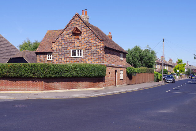
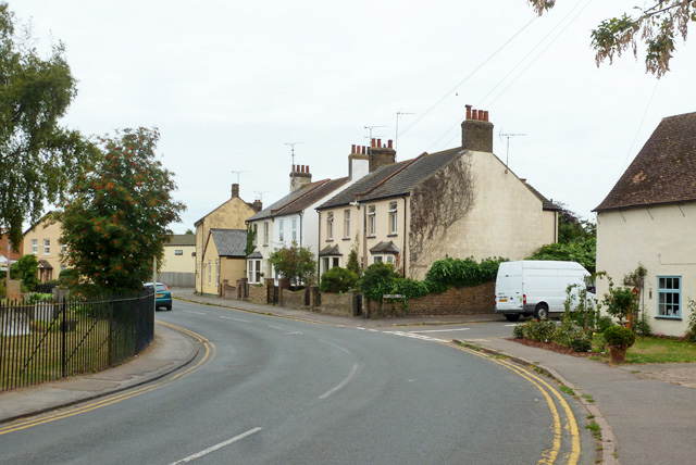
Cupid's Corner is characterized by its typical English village architecture, with charming thatched cottages, cobblestone streets, and beautifully maintained gardens. The village center is adorned with a traditional village green, where locals gather for community events and festivities throughout the year.

The heart of the village is the historic St. Mary's Church, a stunning example of medieval architecture dating back to the 12th century. The church is known for its impressive stained glass windows and intricate stone carvings, attracting architecture enthusiasts and history buffs from far and wide.

In terms of amenities, Cupid's Corner offers a range of local shops, including a bakery, a traditional pub, and a small grocery store. The village also boasts a primary school, providing education for the local children.

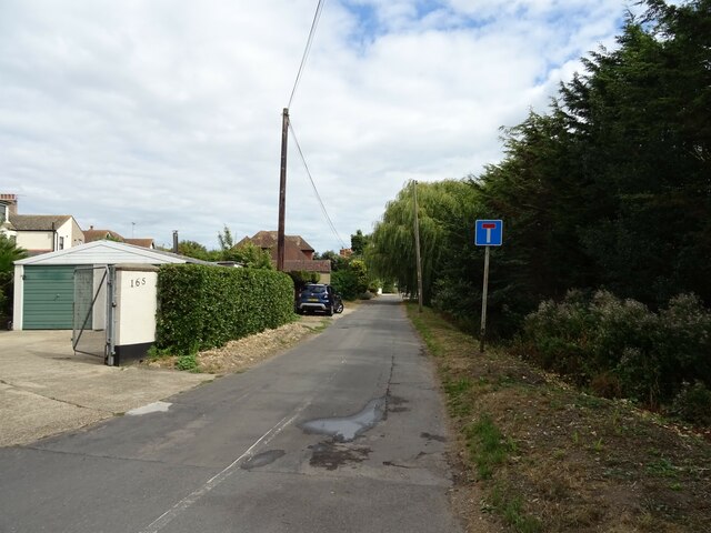
Surrounded by rolling hills and verdant meadows, Cupid's Corner offers numerous opportunities for outdoor activities. The village is a popular starting point for hiking and cycling trails, allowing visitors to explore the breathtaking countryside and enjoy the tranquility of the area.

Overall, Cupid's Corner is a captivating and enchanting village, where history, natural beauty, and a strong sense of community come together to create a truly special place.

If you have any feedback on the listing, please let us know in the comments section below.

Cupid's Corner Images

Images are sourced within 2km of 51.545893/0.81296319 or Grid Reference TQ9586. Thanks to Geograph Open Source API. All images are credited.

High Street, Shoeburyness North of the railway station.
High Street, Shoeburyness
North of the railway station.
The Red House, Shoeburyness Quite different to anything surrounding it, this brick-built house on Wakering Road dates from around 1673 and is grade II listed. According to local legend, a tunnel runs from here to the sea shore that might have been used for smuggling or moving troops in the Second World War. See also <a href="https://www.geograph.org.uk/photo/299765">TQ9485 : The Old Red House, Shoeburyness, Essex</a>.
The Red House, Shoeburyness
Quite different to anything surrounding it, this brick-built house on Wakering Road dates from around 1673 and is grade II listed. According to local legend, a tunnel runs from here to the sea shore that might have been used for smuggling or moving troops in the Second World War. See also TQ9485 : The Old Red House, Shoeburyness, Essex.
Windsurfing at Shoeburyness The windsurfer is keeping upright, for the moment at least, on this very warm August day off the East Beach at Shoeburyness. The end of the Shoeburyness Boom can be seen to the left of the ship's bows (this was a cold war period protection against submarine attacks) and the north Kent coast can just be discerned on the horizon.
Windsurfing at Shoeburyness
The windsurfer is keeping upright, for the moment at least, on this very warm August day off the East Beach at Shoeburyness. The end of the Shoeburyness Boom can be seen to the left of the ship's bows (this was a cold war period protection against submarine attacks) and the north Kent coast can just be discerned on the horizon.
National Coastwatch Southend Lookout Station The National Coastwatch Institution provides a watching and listening service from stations around the coast of England and Wales. The watchkeepers are volunteers and the organisation should not be confused with HM Coastguard. The Southend Station is actually adjacent to the East Beach at Shoeburyness but within the QinetiQ compound, so access for the public is by prior arrangement only. The cabins were delivered to site in 2020 and from here the watchkeepers have an excellent view across the southern end of the Essex coast where it turns into the Thames Estuary.
National Coastwatch Southend Lookout Station
The National Coastwatch Institution provides a watching and listening service from stations around the coast of England and Wales. The watchkeepers are volunteers and the organisation should not be confused with HM Coastguard. The Southend Station is actually adjacent to the East Beach at Shoeburyness but within the QinetiQ compound, so access for the public is by prior arrangement only. The cabins were delivered to site in 2020 and from here the watchkeepers have an excellent view across the southern end of the Essex coast where it turns into the Thames Estuary.
Shoeburyness Boom This curious structure, extending 2.01km out to sea (with two angled turns) from the East Beach at Shoeburyness, is a relic of the cold war. It was built between 1950 and 1953, replacing a Second World War boom that had been dismantled, and was originally 600m longer. Its purpose, together with a second boom stretching out from the Kent side of the Thames Estuary, was to prevent an attack on London by submarine; the open deep water channel between the booms would be protected by Royal Navy vessels at times of high alert. It wasn't long before the boom became obsolete as it offered no protection from jet fighters and nuclear weapons. The Kent side boom was removed in the 1960s but the Shoeburyness one remains, largely intact, and is now a scheduled monument.
Shoeburyness Boom
This curious structure, extending 2.01km out to sea (with two angled turns) from the East Beach at Shoeburyness, is a relic of the cold war. It was built between 1950 and 1953, replacing a Second World War boom that had been dismantled, and was originally 600m longer. Its purpose, together with a second boom stretching out from the Kent side of the Thames Estuary, was to prevent an attack on London by submarine; the open deep water channel between the booms would be protected by Royal Navy vessels at times of high alert. It wasn't long before the boom became obsolete as it offered no protection from jet fighters and nuclear weapons. The Kent side boom was removed in the 1960s but the Shoeburyness one remains, largely intact, and is now a scheduled monument.
East Beach, Shoeburyness It is almost high tide and there is just a thin strip of sand and shingle to relax on; in fact, on this very warm August day there seems to be more people in the sea than on the beach. East Beach is sandwiched between sections of the shoreline with no access due to defence activities.
East Beach, Shoeburyness
It is almost high tide and there is just a thin strip of sand and shingle to relax on; in fact, on this very warm August day there seems to be more people in the sea than on the beach. East Beach is sandwiched between sections of the shoreline with no access due to defence activities.
Learning to paddleboard at Shoeburyness Paddleboard lessons are available on the East Beach at Shoeburyness and here a couple of lads are seeing if they have what it takes. One of them has decided to take a spectacular dive into the water rather than ignominiously falling off.
Learning to paddleboard at Shoeburyness
Paddleboard lessons are available on the East Beach at Shoeburyness and here a couple of lads are seeing if they have what it takes. One of them has decided to take a spectacular dive into the water rather than ignominiously falling off.
Shop and houses on High Street, Shoeburyness
Houses on High Street, Shoeburyness
High Street, Shoeburyness
Houses on Wakering Road
House on Wakering Road
Wakering Road Towards Great Wakering.
Wakering Road
Towards Great Wakering.
Cottages on Shoebury Road
Cupids Chase
Cupids Chase
Shoebury Road Towards Great Wakering.
Shoebury Road
Towards Great Wakering.
Field and hedgerow Off Shoebury Road.
Field and hedgerow
Off Shoebury Road.
Field near Great Wakering Off Shoebury Road.
Field near Great Wakering
Off Shoebury Road.
Show me another place!

Cupid's Corner is located at Grid Ref: TQ9586 (Lat: 51.545893, Lng: 0.81296319)

Administrative County: Essex

District: Rochford

Police Authority: Essex

What 3 Words

///havens.proper.backtrack. Near Great Wakering, Essex

Related Wikis

Rochford and Southend East (UK Parliament constituency)

Rochford and Southend East is a constituency represented in the House of Commons of the UK Parliament since 2005 by Sir James Duddridge, a Conservative...

Great Wakering

Great Wakering is a village in the Rochford District in Essex, England. It is approximately four miles east of Southend. Great Wakering consists mainly...

White Ensign F.C.

White Ensign Football Club is a football club based in Southend-on-Sea, Essex, England. They are currently members of the Essex Senior League and play...

Great Wakering Rovers F.C.

Great Wakering Rovers Football Club is a football club located in Great Wakering, near Southend on Sea in Essex, England. The club are members of the Essex...

Shoeburyness

Shoeburyness ( SHOO-bree-NESS), or simply Shoebury, is a coastal town in the borough of Southend-on-Sea, in the ceremonial county of Essex, England; it...

The Broomway

The Broomway, also formerly called the "Broom Road", is a public right of way over the foreshore at Maplin Sands off the coast of Essex, England. Most...

Shoeburyness railway station

Shoeburyness railway station is the eastern terminus of the London, Tilbury and Southend Line (Engineer's Line Reference FSS), serving the suburb of Shoeburyness...

Shoeburyness Boom

The Shoeburyness Boom (also known as the Sheerness Boom, Thames Boom or Thames Estuary Boom) refers to two successive defensive barriers across most of...

Nearby Amenities

Located within 500m of 51.545893,0.81296319
Bus Stop
Landsdowne Corner
Naptan AtcoCode: 15001101402
Naptan Bearing: S
Naptan CommonName: Landsdowne Corner
Naptan Crossing: Poynters Lane
Naptan Indicator: S-bound
Naptan Landmark: Landsdowne Corner
Naptan NaptanCode: esxagpam
Naptan PlusbusZoneRef: STHCENT
Naptan Street: Wakering Road
Naptan Verified: no
Public Transport: platform
Source: naptan_import
Lat/Long: 51.5445584/0.8062187
Bus Stop
Victoria Drive
Naptan AtcoCode: 15001101404
Naptan Bearing: NW
Naptan BusStopType: CUS
Naptan CommonName: Cupids Corner
Naptan Crossing: Victoria Drive
Naptan Indicator: NW-bound
Naptan Landmark: Cupids Corner
Naptan NaptanCode: esxagpap
Naptan PlusbusZoneRef: STHCENT
Naptan Street: Shoebury Road
Naptan Verified: no
Public Transport: platform
Source: naptan_import
Lat/Long: 51.5459001/0.8129079
Bus Stop
Seaview Drive
Naptan AtcoCode: 15001101405
Naptan Bearing: S
Naptan CommonName: Seaview Drive
Naptan Crossing: Seaview Drive
Naptan Indicator: Adj
Naptan Landmark: Seaview Drive
Naptan NaptanCode: esxagpat
Naptan PlusbusZoneRef: STHCENT
Naptan Street: Shoebury Road
Naptan Verified: no
Public Transport: platform
Source: naptan_import
Lat/Long: 51.5478925/0.8115883
Bus Stop
Seaview Drive
Naptan AtcoCode: 15001101406
Naptan Bearing: N
Naptan CommonName: Seaview Drive
Naptan Crossing: Seaview Drive
Naptan Indicator: Opp
Naptan Landmark: Seaview Drive
Naptan NaptanCode: esxagpaw
Naptan PlusbusZoneRef: STHCENT
Naptan Street: Shoebury Road
Naptan Verified: no
Public Transport: platform
Source: naptan_import
Lat/Long: 51.5478949/0.8114875
Bus Stop
Victoria Drive
Naptan AtcoCode: 150011014Y4
Naptan Bearing: SE
Naptan BusStopType: CUS
Naptan CommonName: Cupids Corner
Naptan Crossing: Victoria Drive
Naptan Indicator: SE-bound
Naptan Landmark: Cupids Corner
Naptan NaptanCode: esxgpmdm
Naptan PlusbusZoneRef: STHCENT
Naptan Street: Shoebury Road
Naptan Verified: no
Public Transport: platform
Source: naptan_import
Lat/Long: 51.5460169/0.8129151
Bus Stop
Landsdowne Corner
Naptan AtcoCode: 1500POYNTERS
Naptan Bearing: E
Naptan CommonName: Landsdowne Corner
Naptan Crossing: Wakering Road
Naptan Indicator: E-bound
Naptan Landmark: Landsdowne Corner
Naptan NaptanCode: esxagwaj
Naptan PlusbusZoneRef: STHCENT
Naptan Street: Poynters Lane
Naptan Verified: no
Public Transport: platform
Source: naptan_import
Lat/Long: 51.5448116/0.8069122
Crossing
Lat/Long: 51.5460808/0.8168507
Railway: level_crossing
Lat/Long: 51.5435573/0.815429
Railway: level_crossing
Lat/Long: 51.5414165/0.8131023
Railway: crossing
Lat/Long: 51.5458215/0.8183459
Post Box
Operator: Royal Mail
Operator Wikidata: Q638098
Post Box Type: lamp
Lat/Long: 51.5480164/0.8116695
The data included in this document is from www.openstreetmap.org. The data is made available under ODbL.

Have you been to Cupid's Corner?

Leave your review of Cupid's Corner below (or comments, questions and feedback).