Crosshall Terrace
Settlement in Stirlingshire
Scotland
Crosshall Terrace

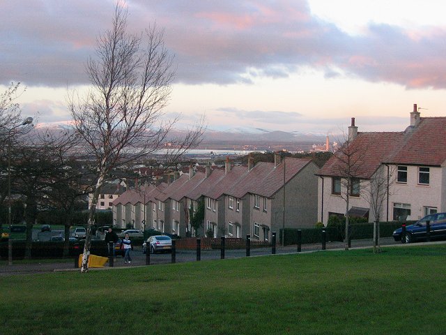
Crosshall Terrace is a charming residential area located in Stirlingshire, Scotland. Situated on the outskirts of the town of Stirling, this peaceful neighborhood offers a mix of housing options and a picturesque setting.
The terrace is comprised of a row of Victorian-style houses, each with its own unique character and architectural features. The properties on Crosshall Terrace are predominantly two-story buildings with traditional stone facades and well-maintained gardens. Many of the houses have been converted into flats, providing an array of accommodation options to suit different needs.
The area surrounding Crosshall Terrace is known for its natural beauty, with stunning views of the nearby hills and countryside. Residents can enjoy peaceful walks and outdoor activities in the nearby parks and green spaces. Additionally, the neighborhood benefits from its proximity to the River Forth, offering opportunities for boating and fishing.
Crosshall Terrace has a close-knit community feel, with friendly neighbors and a sense of community spirit. The residents take pride in their surroundings, and the area is well-maintained, with clean streets and attractive communal spaces.
The location of Crosshall Terrace is also advantageous for commuting and accessing amenities. The town of Stirling is just a short drive away, where residents can find a wide range of shops, restaurants, and entertainment options. The area is also well-served by public transportation, with regular bus services connecting it to other parts of Stirlingshire.
In summary, Crosshall Terrace is a delightful residential area in Stirlingshire, offering a peaceful and picturesque setting, a variety of housing options, and a strong sense of community.
If you have any feedback on the listing, please let us know in the comments section below.
Crosshall Terrace Images
Images are sourced within 2km of 55.972686/-3.6895531 or Grid Reference NS9476. Thanks to Geograph Open Source API. All images are credited.


Crosshall Terrace is located at Grid Ref: NS9476 (Lat: 55.972686, Lng: -3.6895531)
Unitary Authority: Falkirk
Police Authority: Forth Valley
What 3 Words
///hidden.bugs.milk. Near Maddiston, Falkirk
Nearby Locations
Related Wikis
Maddiston
Maddiston is a village in the Falkirk council area of Scotland. It lies 3.8 miles (6.1 km) west-southwest of Linlithgow, 1.3 miles (2.1 km) south of Polmont...
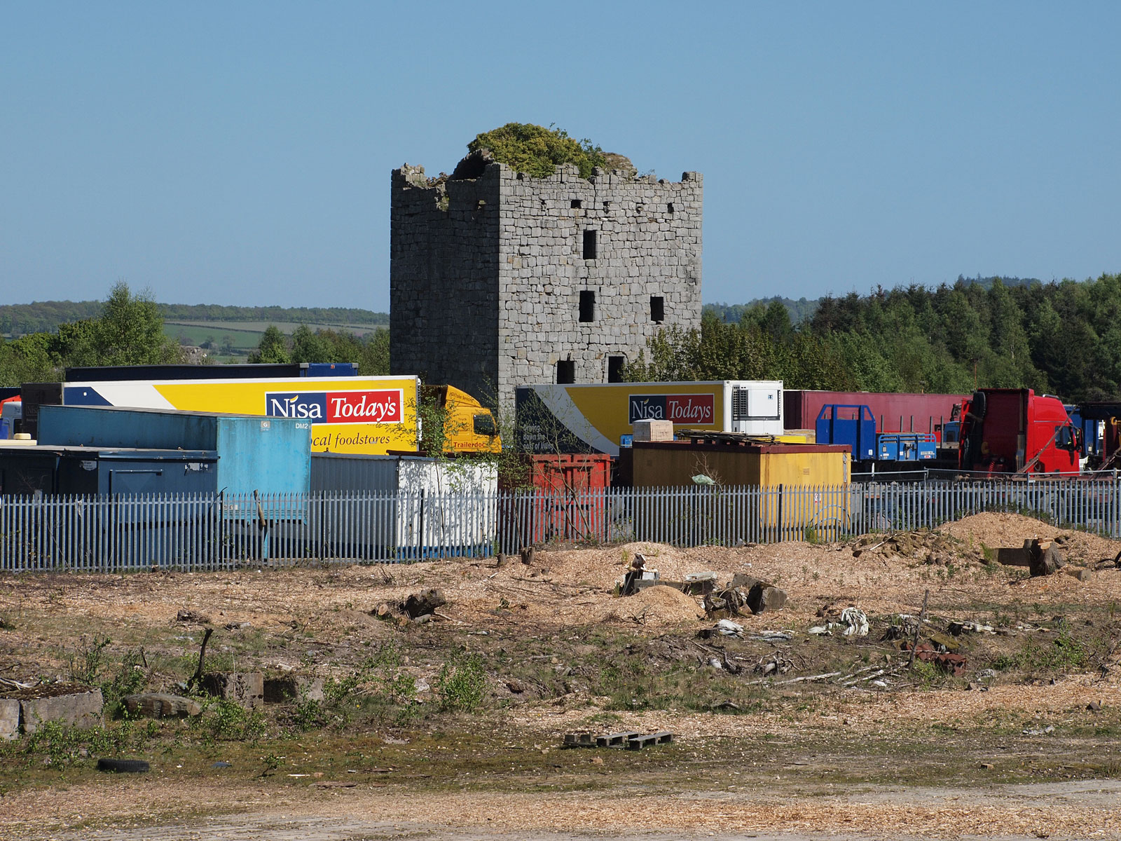
Almond Castle
Almond Castle is a ruined L-plan castle dating from the 15th century. It is located 3 miles (4.8 km) west of Linlithgow, and north of the Union Canal,...

Rumford, Falkirk
Rumford is a small village between Maddiston and Brightons in the Falkirk council area, of Scotland. The village went through a great deal of expansion...
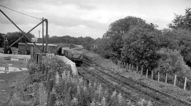
Bowhouse railway station
Bowhouse railway station served the suburb of Bowhouse, Falkirk, Scotland, from the 1840s to 1964 on the Slamannan Railway. == History == The station was...

Brightons
Brightons is a village in the east of the Falkirk council area of Scotland. It is 2.7 miles (4.3 km) south-east of Falkirk, 2.2 miles (3.5 km) south of...

Bo'ness Junction rail crash
Bo'ness Junction rail crash occurred at Bo'ness Junction in Falkirk.The junction lies on the Edinburgh and Glasgow Railway between Falkirk and Linlithgow...

Whitecross, Falkirk
Whitecross is a small village within the Falkirk council area, close to the boundary of West Lothian council in Scotland. It lies 2.0 miles (3.2 km) west...

Polmont railway station
Polmont railway station is a railway station serving the village of Polmont, Scotland as well as the other Falkirk Braes villages. It is located on the...
Nearby Amenities
Located within 500m of 55.972686,-3.6895531Have you been to Crosshall Terrace?
Leave your review of Crosshall Terrace below (or comments, questions and feedback).