Corseford

Settlement in Renfrewshire

Scotland

Corseford

Thirdpart Hall farm from the air The smaller Warbowie can also be seen across Black Cart Water.
Thirdpart Hall farm from the air Credit: Thomas Nugent

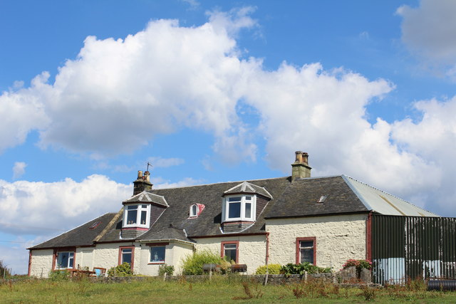
Corseford is a small village located in the historic county of Renfrewshire, Scotland. Situated in the picturesque countryside, it lies approximately 7 miles southwest of the town of Paisley and 15 miles west of Glasgow. The village is nestled between the River Gryfe and the rolling hills of the Renfrewshire countryside, offering residents and visitors a serene and tranquil environment.

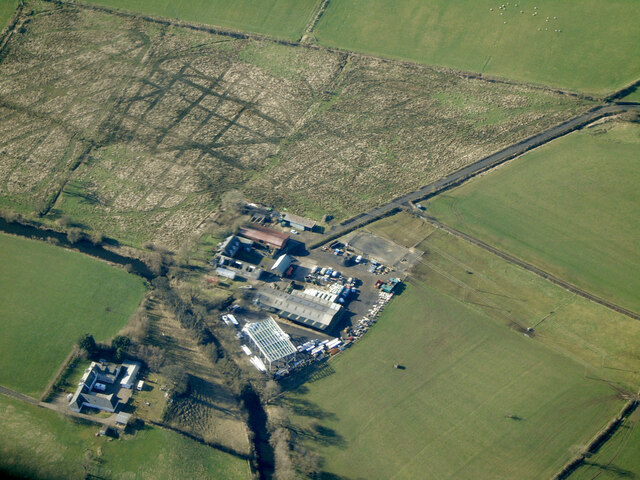
Although Corseford is a small community, it boasts a rich history dating back centuries. The village was primarily known for its agricultural activities, with farming being a significant part of the local economy. Over time, Corseford has evolved, and today it is a residential area with a close-knit community.

In terms of amenities, Corseford offers a range of facilities to cater to its residents' needs. These include a local pub, a post office, and a community center that serves as a hub for various social activities. The village is also home to a primary school, providing education for the local children.

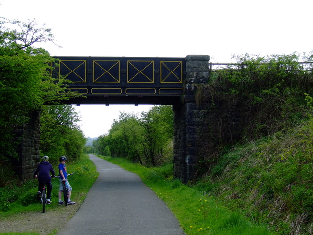
For those seeking outdoor activities, Corseford is surrounded by stunning natural landscapes. The nearby Gryfe Reservoir offers opportunities for fishing and bird watching, while the surrounding countryside provides ample space for walking, hiking, and cycling.

With its idyllic location and strong sense of community, Corseford provides a peaceful and picturesque setting for residents and visitors alike.

If you have any feedback on the listing, please let us know in the comments section below.
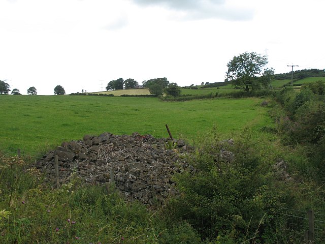
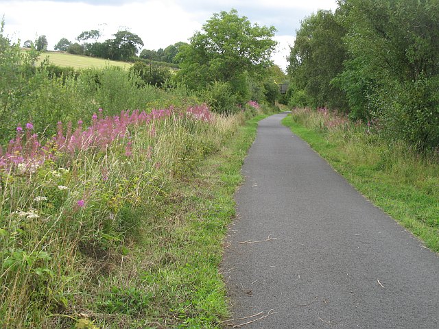
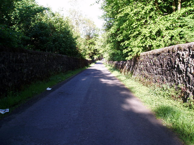
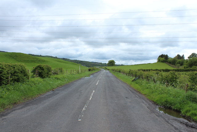
Corseford Images

Images are sourced within 2km of 55.824531/-4.5326975 or Grid Reference NS4161. Thanks to Geograph Open Source API. All images are credited.

Thirdpart Hall farm from the air The smaller Warbowie can also be seen across Black Cart Water.
Thirdpart Hall farm from the air
The smaller Warbowie can also be seen across Black Cart Water.
National Cycle Network Route 7 Looking towards Kilbarchan.
National Cycle Network Route 7
Looking towards Kilbarchan.
National Cycle Network Route 7 Between Kilbarchan and Lochwinnoch.
National Cycle Network Route 7
Between Kilbarchan and Lochwinnoch.
Kibbleston
Kibbleston
Glentyan Estate Woodland that forms part of Glentyan Estate, south of Burntshields Road, Kilbarchan.
Glentyan Estate
Woodland that forms part of Glentyan Estate, south of Burntshields Road, Kilbarchan.
Thirdpart Hall Farm View towards Howwood. The farm just over the grey bin.
Thirdpart Hall Farm
View towards Howwood. The farm just over the grey bin.
Kibbleston Road, Howwood Kibbleston farm on the right.
Kibbleston Road, Howwood
Kibbleston farm on the right.
Stone pile, Auchenames A pile of stones cleared from the fields?
Stone pile, Auchenames
A pile of stones cleared from the fields?
Kilbarchan loop Disused railway, now a cycle path. Most of its course appears to be within cuttings. The railway was built to relieve congestion between Paisley and Ayrshire. The last stretch at  Kilbirnie was finally closed in the early 1970s.
The railway is also known as the Lochwinnoch Loop or Dalry and North Johnstone Line.
Kilbarchan loop
Disused railway, now a cycle path. Most of its course appears to be within cuttings. The railway was built to relieve congestion between Paisley and Ayrshire. The last stretch at Kilbirnie was finally closed in the early 1970s. The railway is also known as the Lochwinnoch Loop or Dalry and North Johnstone Line.
Pasture, Faulds View over the road along some powerlines running from Inverkip. This is dairy farming country and a herd of Ayrshires was grazing nearby.
Pasture, Faulds
View over the road along some powerlines running from Inverkip. This is dairy farming country and a herd of Ayrshires was grazing nearby.
Power Lines Viewed from the cycle track between Kilbarchan and Lochwinnoch.
Power Lines
Viewed from the cycle track between Kilbarchan and Lochwinnoch.
Walled Road Burntshields Road  with its stone walls either side as it cuts across the Glentyan Estate.
Walled Road
Burntshields Road with its stone walls either side as it cuts across the Glentyan Estate.
Corbet Hill from the air That's it in the centre of the photo.
Corbet Hill from the air
That's it in the centre of the photo.
The Road to Kilbarchan
The Road to Howwood
The Road to Howwood
Old Railway Bridge
Old Railway Bridge
Cattle at Kibbleston
Farmland at Kibbleston
Show me another place!

Corseford is located at Grid Ref: NS4161 (Lat: 55.824531, Lng: -4.5326975)

Unitary Authority: Renfrewshire

Police Authority: Renfrewshire and Inverclyde

What 3 Words

///crabmeat.laws.directive. Near Johnstone, Renfrewshire

Related Wikis

Milliken Park railway station

Milliken Park railway station serves the west end of Johnstone and the south west of the village of Kilbarchan in Renfrewshire, Scotland. The station is...

Cochrane Castle

Cochrane Castle was a castle, 1 mile (1.6 km) west of Johnstone, Renfrewshire, Scotland, near the Black Cart Water. == History == The property was owned...

Renfrewshire

Renfrewshire () (Scots: Renfrewshire; Scottish Gaelic: Siorrachd Rinn FriĆ¹) is one of the 32 council areas of Scotland. The council area has the same name...

Nation Radio Scotland

Nation Radio Scotland (formerly XFM Scotland (2014), 96.3 Rock Radio Real XS, Q96 and 96.3QFM) is a Scottish Independent Local Radio station for Renfrewshire...

Nearby Amenities

Located within 500m of 55.824531,-4.5326975
Milliken Park
Naptan AtcoCode: 9100MILKNPK
Network: National Rail
Operator: ScotRail
Public Transport: stop_position
Railway: stop
Train: yes
Lat/Long: 55.8250361/-4.5338322
Bus Stop
Bus: yes
Public Transport: platform
Lat/Long: 55.8231946/-4.5372914
Bus Stop
Bus: yes
Naptan AtcoCode: 6140725
Naptan NaptanCode: 73923645
Public Transport: platform
Lat/Long: 55.8246052/-4.5340385
Bus Stop
Bus: yes
Naptan AtcoCode: 6140734
Naptan NaptanCode: 73924634
Public Transport: platform
Lat/Long: 55.8275539/-4.5337518
Waterway: weir
Lat/Long: 55.82526/-4.5371739
Noexit: yes
Lat/Long: 55.821077/-4.5312662
Traffic Signals
Lat/Long: 55.8207077/-4.5347137
Post Office
Dundonald Post Office
Lat/Long: 55.8260625/-4.5264145
Bicycle Parking
Bicycle Parking: stands
Capacity: 6
Covered: no
Lat/Long: 55.8246257/-4.5344274
Milliken Park
Naptan AtcoCode: 9100MILKNPK
Network: National Rail
Network Website: https://www.nationalrail.co.uk/stations/min/
Network Wikidata: Q26334
Operator: ScotRail
Operator Website: https://www.scotrail.co.uk/plan-your-journey/stations-and-facilities/min
Operator Wikidata: Q18356161
Public Transport: station
Railway: station
Ref Crs: MIN
Train: yes
Wikidata: Q2919624
Wikipedia: en:Milliken Park railway station
Lat/Long: 55.8248309/-4.5342076
Bus Stop
Bus: yes
Naptan AtcoCode: 6140703
Naptan NaptanCode: 73924947
Public Transport: platform
Lat/Long: 55.8221628/-4.5320457
Traffic Signals
Lat/Long: 55.8249359/-4.5264913
Bus Stop
Bus: yes
Public Transport: platform
Lat/Long: 55.8256925/-4.5250921
Cochranefield
Place: neighbourhood
Lat/Long: 55.820304/-4.5318737
Corseford
Place: neighbourhood
Lat/Long: 55.8224665/-4.5353633
Power: pole
Lat/Long: 55.8234782/-4.540076
Power: pole
Lat/Long: 55.8239573/-4.538987
Location Transition: yes
Power: pole
Lat/Long: 55.8249292/-4.5369136
Power: pole
Lat/Long: 55.8236409/-4.5404394
Power: pole
Lat/Long: 55.8239837/-4.5396025
Power: pole
Lat/Long: 55.8244606/-4.5387067
Power: pole
Lat/Long: 55.8248651/-4.5378967
Power: pole
Lat/Long: 55.8251371/-4.5363691
Location Transition: yes
Power: pole
Lat/Long: 55.8248267/-4.5367661
Power: pole
Lat/Long: 55.8243461/-4.5378122
Power: pole
Lat/Long: 55.8238715/-4.5388475
Power: pole
Lat/Long: 55.8233682/-4.5399553
Milliken Park
Naptan AtcoCode: 9100MILKNPK
Network: National Rail
Operator: ScotRail
Public Transport: stop_position
Railway: stop
Train: yes
Lat/Long: 55.8245412/-4.5347887
Power: pole
Lat/Long: 55.8247808/-4.5392644
The data included in this document is from www.openstreetmap.org. The data is made available under ODbL.

Have you been to Corseford?

Leave your review of Corseford below (or comments, questions and feedback).