Corrennie Croft

Settlement in Aberdeenshire

Scotland

Corrennie Croft

Minor road at Milton of Tolmauds Looking north-eastward.
Minor road at Milton of Tolmauds Credit: Peter Wood

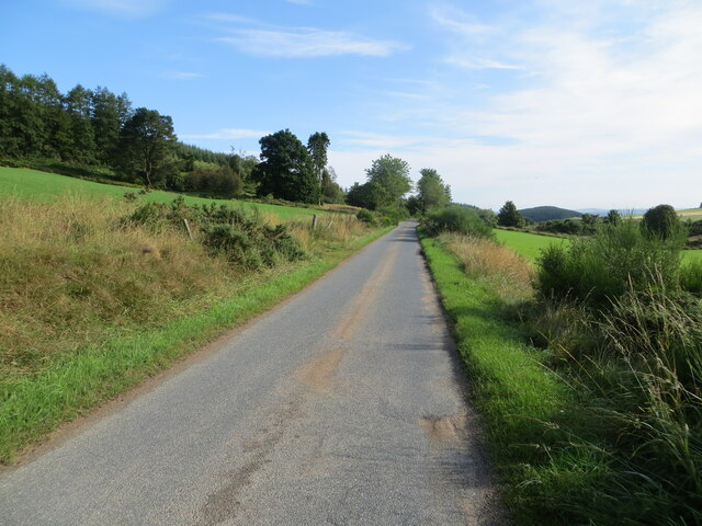
Corrennie Croft is a picturesque rural area located in Aberdeenshire, Scotland. Nestled amidst rolling hills and lush green countryside, this idyllic hamlet offers a tranquil escape from the bustling city life. Situated approximately 25 miles west of the city of Aberdeen, it is a hidden gem that showcases the natural beauty of the Scottish landscape.

The croft is characterized by its traditional stone-built cottages, which exude a sense of charm and history. These cottages are surrounded by well-maintained gardens and fields, providing a peaceful and scenic environment for residents and visitors alike. The croft is known for its rich agricultural heritage, with many locals engaging in farming and livestock rearing.

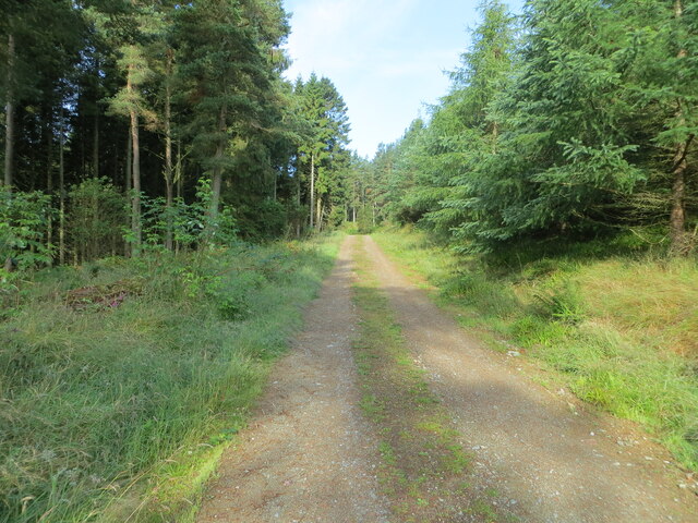
One of the notable features of Corrennie Croft is the abundance of outdoor recreational activities available. The surrounding countryside offers ample opportunities for hiking, cycling, and nature walks, with various trails and paths to explore. The nearby River Dee is also a popular spot for fishing enthusiasts, known for its salmon and trout.

Despite its rural setting, Corrennie Croft is conveniently located near amenities and facilities. The nearby town of Alford provides essential services such as schools, shops, and healthcare facilities, ensuring that residents have easy access to everyday necessities.

With its breathtaking natural surroundings and peaceful atmosphere, Corrennie Croft is an ideal destination for those seeking a serene country retreat. Whether it's for a weekend getaway or a permanent residence, this charming hamlet offers a true taste of rural Scottish life.

If you have any feedback on the listing, please let us know in the comments section below.

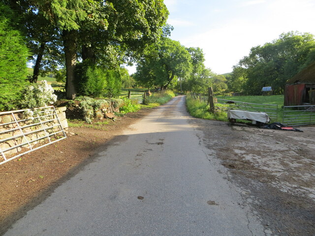
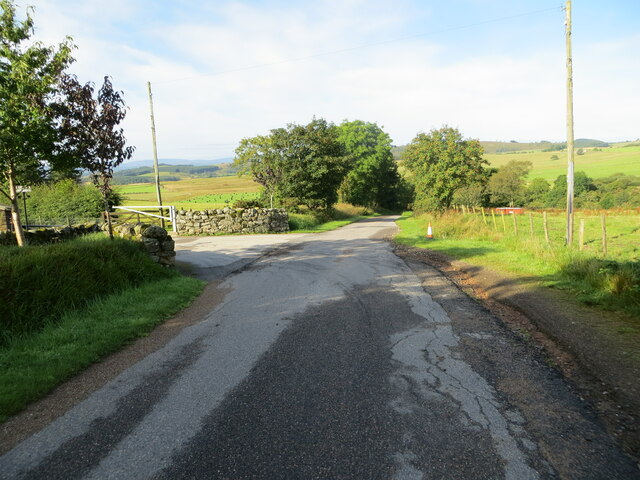
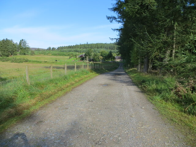
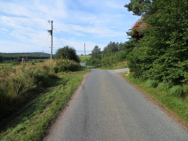
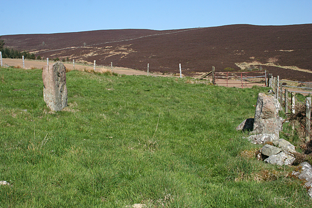
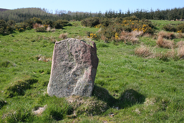
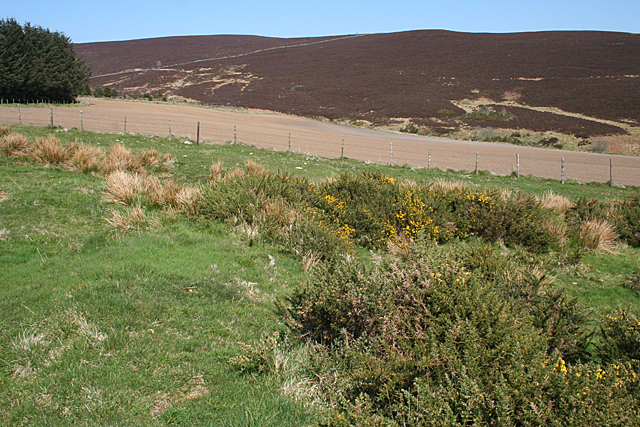
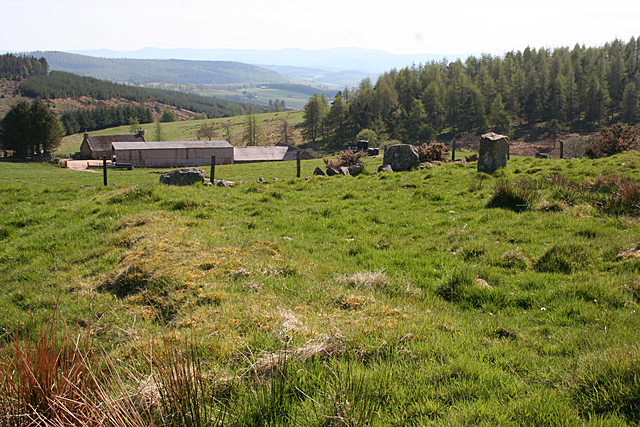
Corrennie Croft Images

Images are sourced within 2km of 57.164845/-2.6055515 or Grid Reference NJ6308. Thanks to Geograph Open Source API. All images are credited.

Minor road at Milton of Tolmauds Looking north-eastward.
Minor road at Milton of Tolmauds
Looking north-eastward.
Minor road at the entrance to Easter Tolmauds Looking south-westward.
Minor road at the entrance to Easter Tolmauds
Looking south-westward.
Track giving access to Ewens Croft Looking north-westward.
Track giving access to Ewens Croft
Looking north-westward.
Minor road near to Corrennie Looking south-westward.
Minor road near to Corrennie
Looking south-westward.
Minor road between Baudygaun and Rinalloch Looking north-eastward.
Minor road between Baudygaun and Rinalloch
Looking north-eastward.
Tree-lined track giving access to Corrennie Croft Looking westward.
Tree-lined track giving access to Corrennie Croft
Looking westward.
Ordnance Survey Cut Mark This somewhat weathered mark can be found on the wall of a barn at Milton of Tolmauds.
The recorded details give a height of 235.0877 metres above sea level.
For more details see : <span class="nowrap"><a title="https://www.bench-marks.org.uk/bm163474" rel="nofollow ugc noopener" href="https://www.bench-marks.org.uk/bm163474">Link</a><img style="margin-left:2px;" alt="External link" title="External link - shift click to open in new window" src="https://s1.geograph.org.uk/img/external.png" width="10" height="10"/></span>
Ordnance Survey Cut Mark
This somewhat weathered mark can be found on the wall of a barn at Milton of Tolmauds. The recorded details give a height of 235.0877 metres above sea level. For more details see : LinkExternal link
Wild Pansy (Viola tricolor) A cheerful patch of flowers beside the road near Denwell.
Wild Pansy (Viola tricolor)
A cheerful patch of flowers beside the road near Denwell.
Denwell From the road to Forkins of Midmar.
Denwell
From the road to Forkins of Midmar.
Old Kirk o' Tough Recumbent Stone Circle (1) The stone on the left is the only stone still in situ of this circle. The one on the right is possibly the recumbent, moved from its original site and built into the field dyke. See <span class="nowrap"><a title="https://canmore.org.uk/site/18006/old-kirk-of-tough" rel="nofollow ugc noopener" href="https://canmore.org.uk/site/18006/old-kirk-of-tough">Link</a><img style="margin-left:2px;" alt="External link" title="External link - shift click to open in new window" src="https://s1.geograph.org.uk/img/external.png" width="10" height="10"/></span> for more details. <a href="https://www.geograph.org.uk/photo/4955947">NJ6209 : Old Kirk o' Tough Recumbent Stone Circle (2)</a>
Old Kirk o' Tough Recumbent Stone Circle (1)
The stone on the left is the only stone still in situ of this circle. The one on the right is possibly the recumbent, moved from its original site and built into the field dyke. See LinkExternal link for more details. NJ6209 : Old Kirk o' Tough Recumbent Stone Circle (2)
Old Kirk o' Tough Recumbent Stone Circle (2) This is the sole remaining stone still in its original position. The rest were carried off in the late 19th century and mostly used for building. See <span class="nowrap"><a title="https://canmore.org.uk/site/18006/old-kirk-of-tough" rel="nofollow ugc noopener" href="https://canmore.org.uk/site/18006/old-kirk-of-tough">Link</a><img style="margin-left:2px;" alt="External link" title="External link - shift click to open in new window" src="https://s1.geograph.org.uk/img/external.png" width="10" height="10"/></span> for more details. <a href="https://www.geograph.org.uk/photo/4955957">NJ6209 : Old Kirk o' Tough Recumbent Stone Circle (3)</a>
Old Kirk o' Tough Recumbent Stone Circle (2)
This is the sole remaining stone still in its original position. The rest were carried off in the late 19th century and mostly used for building. See LinkExternal link for more details. NJ6209 : Old Kirk o' Tough Recumbent Stone Circle (3)
Old Kirk o' Tough Recumbent Stone Circle (3) The only stone in its original position is nearest the camera. To its right, on top of the dyke, is possibly the recumbent, and there are other stones also built into the dyke which may or may not have been part of the circle. See <span class="nowrap"><a title="https://canmore.org.uk/site/18006/old-kirk-of-tough" rel="nofollow ugc noopener" href="https://canmore.org.uk/site/18006/old-kirk-of-tough">Link</a><img style="margin-left:2px;" alt="External link" title="External link - shift click to open in new window" src="https://s1.geograph.org.uk/img/external.png" width="10" height="10"/></span> for more details. <a href="https://www.geograph.org.uk/photo/4955963">NJ6209 : Old Kirk o' Tough Recumbent Stone Circle (4)</a>
Old Kirk o' Tough Recumbent Stone Circle (3)
The only stone in its original position is nearest the camera. To its right, on top of the dyke, is possibly the recumbent, and there are other stones also built into the dyke which may or may not have been part of the circle. See LinkExternal link for more details. NJ6209 : Old Kirk o' Tough Recumbent Stone Circle (4)
Old Kirk o' Tough Recumbent Stone Circle (4) One distinguishing feature of this circle is a low bank, marked by whin bushes, right round what may have been the circumference of the circle. Archaeologists debate whether this is part of a cairn associated with the circle, or whether it is rubble discarded when the circle was dismantled. See <span class="nowrap"><a title="https://canmore.org.uk/site/18006/old-kirk-of-tough" rel="nofollow ugc noopener" href="https://canmore.org.uk/site/18006/old-kirk-of-tough">Link</a><img style="margin-left:2px;" alt="External link" title="External link - shift click to open in new window" src="https://s1.geograph.org.uk/img/external.png" width="10" height="10"/></span> for more details. <a href="https://www.geograph.org.uk/photo/4955970">NJ6209 : Old Kirk o' Tough Recumbent Stone Circle (5)</a>
Old Kirk o' Tough Recumbent Stone Circle (4)
One distinguishing feature of this circle is a low bank, marked by whin bushes, right round what may have been the circumference of the circle. Archaeologists debate whether this is part of a cairn associated with the circle, or whether it is rubble discarded when the circle was dismantled. See LinkExternal link for more details. NJ6209 : Old Kirk o' Tough Recumbent Stone Circle (5)
Old Kirk o' Tough Recumbent Stone Circle (5) Part of the low bank round the site of the circle is on the left. The only stone still in situ is on the right, and other stones, possibly including the recumbent, are built into the wall to its left. See <span class="nowrap"><a title="https://canmore.org.uk/site/18006/old-kirk-of-tough" rel="nofollow ugc noopener" href="https://canmore.org.uk/site/18006/old-kirk-of-tough">Link</a><img style="margin-left:2px;" alt="External link" title="External link - shift click to open in new window" src="https://s1.geograph.org.uk/img/external.png" width="10" height="10"/></span> for more details. <a href="https://www.geograph.org.uk/photo/4955978">NJ6209 : Old Kirk o' Tough Recumbent Stone Circle (6)</a>
Old Kirk o' Tough Recumbent Stone Circle (5)
Part of the low bank round the site of the circle is on the left. The only stone still in situ is on the right, and other stones, possibly including the recumbent, are built into the wall to its left. See LinkExternal link for more details. NJ6209 : Old Kirk o' Tough Recumbent Stone Circle (6)
Old Kirk o' Tough Recumbent Stone Circle (6) On the left, partly obscured by a whin bush, is what could be the recumbent of the circle. The other stones forming a dyke and paralleled by the fence might or might not be from the circle. The one a little way uphill is the only orthostat not displaced. See <span class="nowrap"><a title="https://canmore.org.uk/site/18006/old-kirk-of-tough" rel="nofollow ugc noopener" href="https://canmore.org.uk/site/18006/old-kirk-of-tough">Link</a><img style="margin-left:2px;" alt="External link" title="External link - shift click to open in new window" src="https://s1.geograph.org.uk/img/external.png" width="10" height="10"/></span> for more details. <a href="https://www.geograph.org.uk/photo/4955986">NJ6209 : Old Kirk o' Tough Recumbent Stone Circle (7)</a>
Old Kirk o' Tough Recumbent Stone Circle (6)
On the left, partly obscured by a whin bush, is what could be the recumbent of the circle. The other stones forming a dyke and paralleled by the fence might or might not be from the circle. The one a little way uphill is the only orthostat not displaced. See LinkExternal link for more details. NJ6209 : Old Kirk o' Tough Recumbent Stone Circle (7)
Old Kirk o' Tough Recumbent Stone Circle (7) In front, close to the fence is a large stone, built into the field dyke, which is thought to be the recumbent. Behind it is the sole undisturbed stone. See <span class="nowrap"><a title="https://canmore.org.uk/site/18006/old-kirk-of-tough" rel="nofollow ugc noopener" href="https://canmore.org.uk/site/18006/old-kirk-of-tough">Link</a><img style="margin-left:2px;" alt="External link" title="External link - shift click to open in new window" src="https://s1.geograph.org.uk/img/external.png" width="10" height="10"/></span> for more details. <a href="https://www.geograph.org.uk/photo/4955944">NJ6209 : Old Kirk o' Tough Recumbent Stone Circle (1)</a>
Old Kirk o' Tough Recumbent Stone Circle (7)
In front, close to the fence is a large stone, built into the field dyke, which is thought to be the recumbent. Behind it is the sole undisturbed stone. See LinkExternal link for more details. NJ6209 : Old Kirk o' Tough Recumbent Stone Circle (1)
Forkins of Midmar A traditional stone cottage, with a corrugated roof that doesn't quite match the building.
Forkins of Midmar
A traditional stone cottage, with a corrugated roof that doesn't quite match the building.
A Wee Red Shed A shed at Forkins of Midmar, surrounded by carefully stacked implements. The Recumbent Stone Circle, or rather what is left of it, is at the top of the grassy field.
A Wee Red Shed
A shed at Forkins of Midmar, surrounded by carefully stacked implements. The Recumbent Stone Circle, or rather what is left of it, is at the top of the grassy field.
Show me another place!

Corrennie Croft is located at Grid Ref: NJ6308 (Lat: 57.164845, Lng: -2.6055515)

Unitary Authority: Aberdeenshire

Police Authority: North East

What 3 Words

///salon.bookings.cloak. Near Torphins, Aberdeenshire

Related Wikis

Tillyfourie

Tillyfourie is a hamlet in Aberdeenshire, Scotland. It is situated at the junction between the A944 road and the B993 road. A disused quarry and a stone...

Tornaveen

Tornaveen (Scottish Gaelic: Tòrr nam Fiann) is a district to the north of the small village of Lumphanan, Aberdeenshire, Scotland. It is on the Tarland...

Aberdeenshire (historic)

Aberdeenshire or the County of Aberdeen (Scots: Coontie o Aiberdeen, Scottish Gaelic: Siorrachd Obar Dheathain) is a historic county and registration county...

Tillyfourie railway station

Tillyfourie railway station was a railway station serving Tillyfourie, Aberdeenshire, Scotland. The station opened on 2 June 1860 on the Alford Valley...

Tillycairn Castle

Tillycairn Castle is an L-plan castle, dating from the 16th century, standing on high ground around 2.0 miles (3.2 km) south-east of Cluny in Aberdeenshire...

A944 road

The A944 road connects Aberdeen with Strathdon in north-east Scotland. == Route == It originates at the Lang Stracht in the city, which is a re-routing...

Kirkton of Tough

Kirkton of Tough, usually shortened to Tough ( TUUKH), is a settlement in the Marr area of Aberdeenshire, Scotland at grid reference NJ615129. It is about...

Corsindae House

Corsindae House is a 16th-century castle, originally L-plan, about 8 miles (13 km) north of Banchory, Aberdeenshire, Scotland, and 1 mile (1.6 km) north...

Have you been to Corrennie Croft?

Leave your review of Corrennie Croft below (or comments, questions and feedback).