Coomb

Settlement in Carmarthenshire

Wales

Coomb

Cwmllyfri Farm Some 50 years ago, Welsh artist, Stanley Lewis, painted this very scene entitled 'Welsh Hill Farm, Cwmllyfri' (Carmarthen Museum Art Collection)
Cwmllyfri Farm Credit: Gethin Evans

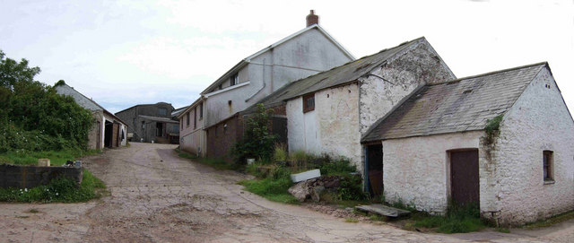
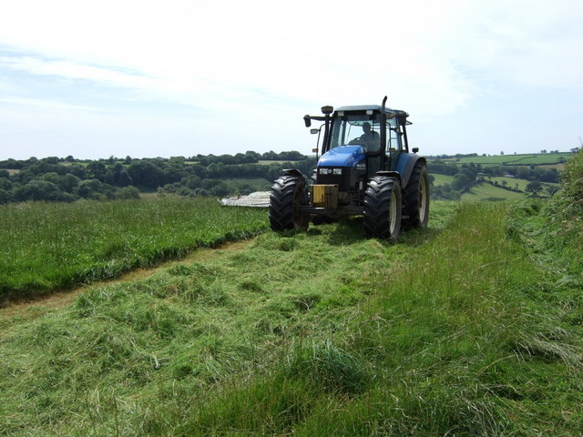
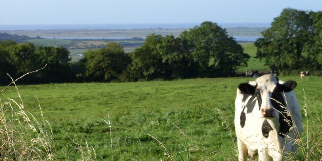
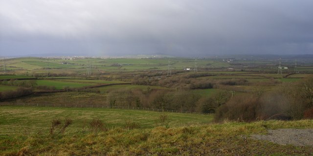
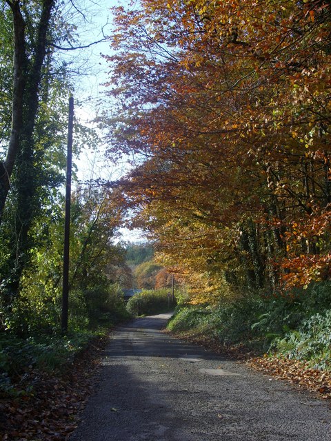
Coomb is a small village located in the county of Carmarthenshire, Wales. Situated in the picturesque countryside, Coomb is surrounded by rolling hills and lush green fields, offering residents and visitors a tranquil and idyllic setting.

The village itself is home to a close-knit community, with a population of around 500 people. The residents of Coomb are known for their warm and friendly nature, creating a welcoming atmosphere for all who visit. The village has a strong sense of community spirit, with various social events and activities organized throughout the year.

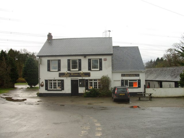
Coomb boasts a number of amenities to cater to the needs of its residents. These include a local pub, a post office, a village hall, and a small grocery store, providing essential services within easy reach. The village also has a primary school, ensuring that young families have access to education close to home.

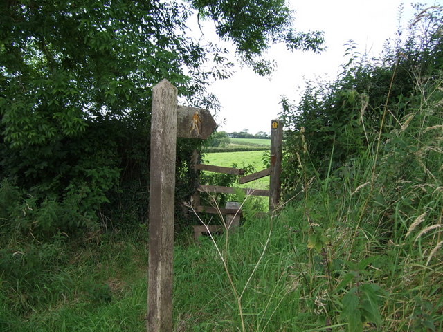
Nature lovers will find Coomb to be a paradise, with plenty of opportunities for outdoor pursuits. The nearby countryside offers beautiful walking and cycling trails, allowing visitors to explore the stunning scenery. Additionally, the village is within close proximity to several nature reserves and parks, perfect for those seeking a day out in nature.

In conclusion, Coomb is a charming village nestled in the heart of Carmarthenshire. With its peaceful surroundings, strong community spirit, and access to nature, Coomb offers a delightful place to call home or visit for a tranquil getaway.

If you have any feedback on the listing, please let us know in the comments section below.
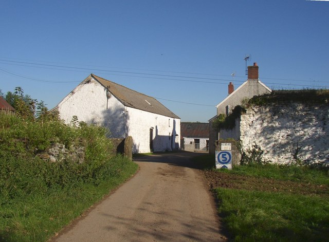
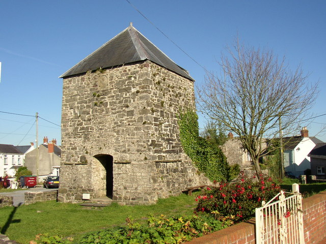
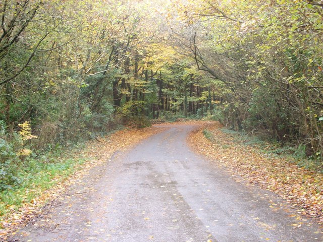
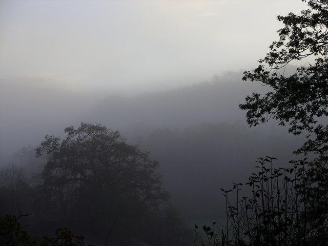
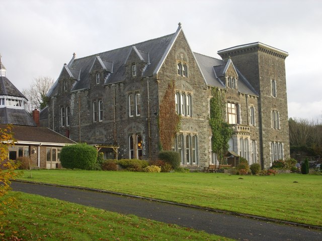
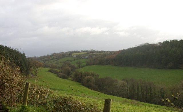
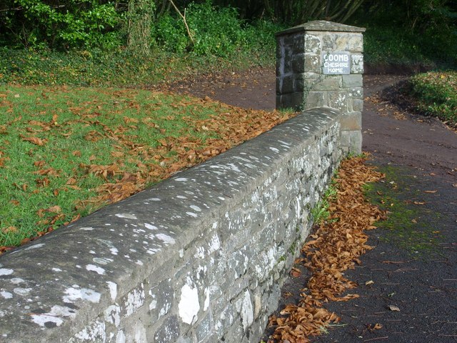
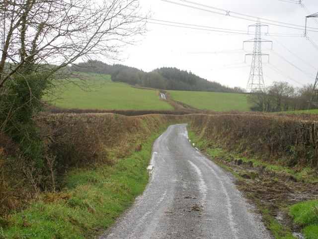
Coomb Images

Images are sourced within 2km of 51.800583/-4.4138205 or Grid Reference SN3314. Thanks to Geograph Open Source API. All images are credited.

Cwmllyfri Farm Some 50 years ago, Welsh artist, Stanley Lewis, painted this very scene entitled 'Welsh Hill Farm, Cwmllyfri' (Carmarthen Museum Art Collection)
Cwmllyfri Farm
Some 50 years ago, Welsh artist, Stanley Lewis, painted this very scene entitled 'Welsh Hill Farm, Cwmllyfri' (Carmarthen Museum Art Collection)
Tractor cutting hay Hay cutting on Penycoed Farm.
Tractor cutting hay
Hay cutting on Penycoed Farm.
Hen Gapel, Llanybri The ruins of Old Chapel in the village of Llanybri. An ancient church, last used as a Nonconformist chapel for over 200 years until 1960.
Hen Gapel, Llanybri
The ruins of Old Chapel in the village of Llanybri. An ancient church, last used as a Nonconformist chapel for over 200 years until 1960.
Stile near Maen Melyn
Hendre, Llansteffan Here the road goes through a farmyard, hence the home-made speed limit sign.
Hendre, Llansteffan
Here the road goes through a farmyard, hence the home-made speed limit sign.
The tower of the old chapel, Llanybri, Llansteffan This is a low tower with thick walls. An interesting feature is the clock, carved in stone where a real clock might be.
The tower of the old chapel, Llanybri, Llansteffan
This is a low tower with thick walls. An interesting feature is the clock, carved in stone where a real clock might be.
Lane between Llangynog and Llanybri The road between Llangynog and Llanybri near the former Coombe Cheshire Home.
Lane between Llangynog and Llanybri
The road between Llangynog and Llanybri near the former Coombe Cheshire Home.
Morning mist over Allt y Ricet
A view over the Taf estuary
The Wern Inn, Llangynog The inn as it was in 2008 before being gutted by fire in 2010, see:<a href="https://www.geograph.org.uk/photo/3405836">SN3315 : A sad sight...</a>
The Wern Inn, Llangynog
The inn as it was in 2008 before being gutted by fire in 2010, see:SN3315 : A sad sight...
The War Memorial and village hall, Llangynog See <a title="https://www.geograph.org.uk/photo/1201705" href="https://www.geograph.org.uk/photo/1201705">Link</a> for names commemorated on the memorial.
The War Memorial and village hall, Llangynog
See Link for names commemorated on the memorial.
The church of St.Cynog, Llangynog <span class="nowrap"><a title="http://www.genuki.org.uk/big/wal/CMN/Llangynog/" rel="nofollow ugc noopener" href="http://www.genuki.org.uk/big/wal/CMN/Llangynog/">Link</a><img style="margin-left:2px;" alt="External link" title="External link - shift click to open in new window" src="https://s1.geograph.org.uk/img/external.png" width="10" height="10"/></span>
The church of St.Cynog, Llangynog
Coomb Cheshire Home Cwm (Coomb) <span class="nowrap"><a title="http://carmarthenshirehistorian.org/cgi-bin/twiki/view/Historian/CwmCoombACarmarthenshireHouseAndItsFamilies" rel="nofollow ugc noopener" href="http://carmarthenshirehistorian.org/cgi-bin/twiki/view/Historian/CwmCoombACarmarthenshireHouseAndItsFamilies">Link</a><img style="margin-left:2px;" alt="External link" title="External link - shift click to open in new window" src="https://s1.geograph.org.uk/img/external.png" width="10" height="10"/></span> , between Llangynog and Llanybri. At the time that this photo was taken it was a Leonard Cheshire residential care home <span class="nowrap"><a title="http://www.lcdisability.org/" rel="nofollow ugc noopener" href="http://www.lcdisability.org/">Link</a><img style="margin-left:2px;" alt="External link" title="External link - shift click to open in new window" src="https://s1.geograph.org.uk/img/external.png" width="10" height="10"/></span> . It is soon to be re-developed for residential flats and housing now that the care home has re-located to new purpose built facilities in Carmarthen.
Coomb Cheshire Home
Cwm (Coomb) LinkExternal link , between Llangynog and Llanybri. At the time that this photo was taken it was a Leonard Cheshire residential care home LinkExternal link . It is soon to be re-developed for residential flats and housing now that the care home has re-located to new purpose built facilities in Carmarthen.
Valley View Looking towards Dre-fach farm from the entrance to Coomb Cheshire with Allt y Brain (woods) to the right.
Valley View
Looking towards Dre-fach farm from the entrance to Coomb Cheshire with Allt y Brain (woods) to the right.
Stone Wall Stone wall and sign at the eastern entrance to Coomb Cheshire Home.
Stone Wall
Stone wall and sign at the eastern entrance to Coomb Cheshire Home.
Lane and Pylons Lane heading south towards Ally y Gelli under the National Grid pylons that traverse the countryside.
Lane and Pylons
Lane heading south towards Ally y Gelli under the National Grid pylons that traverse the countryside.
Countryside A view across the Carmarthenshire countryside towards St Clears with rain on the distant hills.
Countryside
A view across the Carmarthenshire countryside towards St Clears with rain on the distant hills.
Lane towards Coomb Mill Lane towards Coomb Mill (farm) with Coed Hendre (Hendre Woods) just visible in the distance.
Lane towards Coomb Mill
Lane towards Coomb Mill (farm) with Coed Hendre (Hendre Woods) just visible in the distance.
Show me another place!

Coomb is located at Grid Ref: SN3314 (Lat: 51.800583, Lng: -4.4138205)

Unitary Authority: Carmarthenshire

Police Authority: Dyfed Powys

What 3 Words

///plotted.flattens.planting. Near Llangynog, Carmarthenshire

Related Wikis

Coed Cochion Quarry

Coed Cochion Quarry is a Site of Special Scientific Interest (SSSI) in Carmarthenshire, Wales, in which the geology of the site has preserved rare Precambrian...

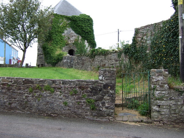
Yr Hen Gapel, Llanybri

Yr Hen Gapel (Welsh for The Old Chapel) is a now ruined religious building and scheduled ancient monument in the village of Llanybri, Carmarthenshire,...

Llanybri

Llanybri is a rural farming village situated between the estuaries of the River Tywi and River Taf in Carmarthenshire, Wales. It is one of two villages...

Llangynog, Carmarthenshire

Llangynog is a village and community located in Carmarthenshire, Wales, the main settlement of which was once called ‘Ebenezer’village. It is bordered...

River Cywyn

The River Cywyn (Welsh: Afon Cywyn) is a river that flows through Carmarthenshire, south Wales. It rises some seven miles west-north-west of Carmarthen...

Beacon Bog

Beacon Bog is a Site of Special Scientific Interest in the community of Llangynog in Carmarthenshire, Wales. == Description == Beacon Bog is a small lowland...

Dan-Lan-Y-Castell Quarry

Dan-Lan-Y-Castell Quarry is a Site of Special Scientific Interest in Carmarthen & Dinefwr, Wales. == References == == See also == List of Sites of Special...

Plas Llanstephan

Plas Llanstephan is a mansion in the county of Carmarthenshire, Wales. It is set well back from the public road among pasture fields and is reached by...

Nearby Amenities

Located within 500m of 51.800583,-4.4138205
Give Way
Direction: forward
Lat/Long: 51.7981161/-4.4177163
Give Way
Direction: backward
Lat/Long: 51.7981829/-4.4176195
Power: pole
Lat/Long: 51.8034801/-4.4114211
Power: pole
Lat/Long: 51.8039744/-4.4116652
Power: pole
Lat/Long: 51.8044188/-4.4119146
The data included in this document is from www.openstreetmap.org. The data is made available under ODbL.

Have you been to Coomb?

Leave your review of Coomb below (or comments, questions and feedback).