Coaltown of Balgonie

Settlement in Fife

Scotland

Coaltown of Balgonie

Byresloan A vicious looking cumulonimbus behind Byresloan.
Byresloan Credit: Richard Webb

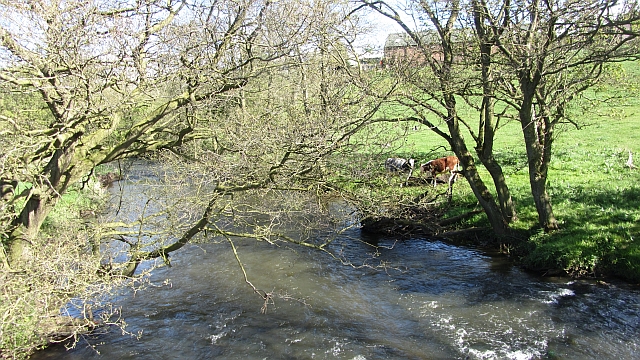
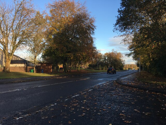
Coaltown of Balgonie is a small village located in the region of Fife, Scotland. Situated on the eastern coast of Scotland, it is approximately 19 miles northeast of the city of Edinburgh. The village is positioned on the northern bank of the River Leven, which flows through the area.

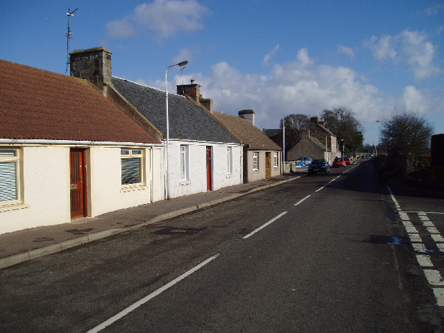
Historically, Coaltown of Balgonie was a mining community, with coal mining being the primary industry for many years. However, the coal mines have long since closed, and the village has transitioned into a more residential area. Today, it is known for its peaceful and rural surroundings, offering a tranquil atmosphere for its residents.

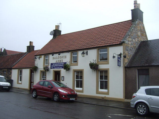
The village is home to a number of traditional stone houses, reflecting its historical character. It also boasts a few local amenities, including a primary school, a community center, and a pub. Nearby, the popular Balgonie Castle can be found, which is a well-preserved 14th-century tower house. The castle attracts visitors with its rich history and stunning architecture.

Coaltown of Balgonie benefits from its close proximity to larger towns and cities, such as Glenrothes and Kirkcaldy, both of which offer a wider range of amenities and services. The village is well-connected by road, with the A92 passing nearby, providing easy access to surrounding areas.

Overall, Coaltown of Balgonie is a picturesque village that combines a rich history with a peaceful residential atmosphere. Its charming setting, along with its close proximity to larger towns, makes it an attractive place to live for those seeking a quieter lifestyle in the beautiful Scottish countryside.

If you have any feedback on the listing, please let us know in the comments section below.

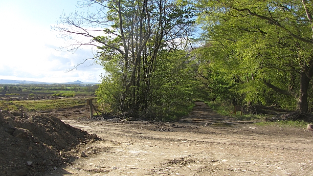
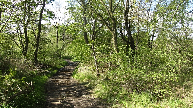
Coaltown of Balgonie Images

Images are sourced within 2km of 56.18403/-3.1290467 or Grid Reference NT3099. Thanks to Geograph Open Source API. All images are credited.

Byresloan A vicious looking cumulonimbus behind Byresloan.
Byresloan
A vicious looking cumulonimbus behind Byresloan.
Oilseed rape, Balgonie A view of the Lomond Hills from the east.
Oilseed rape, Balgonie
A view of the Lomond Hills from the east.
River Ore Downstream view from a footbridge at Tullybreck.
River Ore
Downstream view from a footbridge at Tullybreck.
New Bridge Strips A track, Queen Mary's Road, runs down through the strip wood towards the now rather old looking New Bridge (known as the Barrel Bridge). This was probably a road once. On the left some large scale ground works are in progress for either construction or open cast coal mining. On the right are existing open cast workings.
New Bridge Strips
A track, Queen Mary's Road, runs down through the strip wood towards the now rather old looking New Bridge (known as the Barrel Bridge). This was probably a road once. On the left some large scale ground works are in progress for either construction or open cast coal mining. On the right are existing open cast workings.
New Bridge Strips Queen Mary's Road approaches the Barrel Bridge over the Ore.  The road runs through a strip wood and usefully crosses an area of open cast mining.
New Bridge Strips
Queen Mary's Road approaches the Barrel Bridge over the Ore. The road runs through a strip wood and usefully crosses an area of open cast mining.
Doubledikes Road A track running down to the site of Balgonie Colliery and New Bridge. It continues southwards through an open cast site on the other side of the New Bridge.
Doubledikes Road
A track running down to the site of Balgonie Colliery and New Bridge. It continues southwards through an open cast site on the other side of the New Bridge.
The branch line to Methil leaves the main line This has been an area of open cast mining and work continues in the distance.
The branch line to Methil leaves the main line
This has been an area of open cast mining and work continues in the distance.
The Lochty Burn  Forming the northern edge of Thornton Junction Golf Course.
The Lochty Burn
Forming the northern edge of Thornton Junction Golf Course.
Coaltown of Balgonie Church
Coaltown of Balgonie Post Office
Main Street, Coaltown of Balgonie  B921 heading east.
Main Street, Coaltown of Balgonie
B921 heading east.
The Balgonie Arms, Coaltown of Balgonie On Main Street.
The Balgonie Arms, Coaltown of Balgonie
On Main Street.
War Memorial, Coaltown of Balgonie
Railway heading south at Coaltown of Balgonie East Coast Main Line towards Kirkcaldy.
Railway heading south at Coaltown of Balgonie
East Coast Main Line towards Kirkcaldy.
Railway heading south at Coaltown of Balgonie East Coast Main Line towards Kirkcaldy.
Railway heading south at Coaltown of Balgonie
East Coast Main Line towards Kirkcaldy.
Beaufort Drive, Glenrothes
Thornton Golf Course
Farmland
Farmland
Show me another place!

Coaltown of Balgonie is located at Grid Ref: NT3099 (Lat: 56.18403, Lng: -3.1290467)

Unitary Authority: Fife

Police Authority: Fife

What 3 Words

///frozen.teeth.heave. Near Coaltown of Balgonie, Fife

Nearby Locations

Coaltown of Balgonie

Related Wikis

Coaltown of Balgonie

Coaltown of Balgonie is a village of 1,059 people (2011 census) in south central Fife. It is located on the B9130 road, next to the new town of Glenrothes...
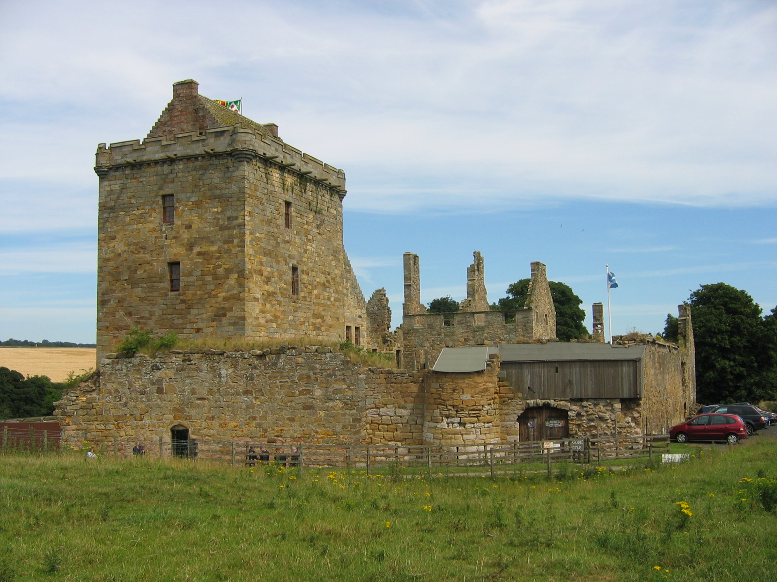
Balgonie Castle

Balgonie Castle is located on the south bank of the River Leven near Milton of Balgonie, 3.5 kilometres (2.2 mi) east of Glenrothes, Fife, Scotland. The...

Kingdom FM

Kingdom FM is an Independent Local Radio station serving Fife. It is owned and operated by DC Thomson Media and broadcasts from studios at Elizabeth House...
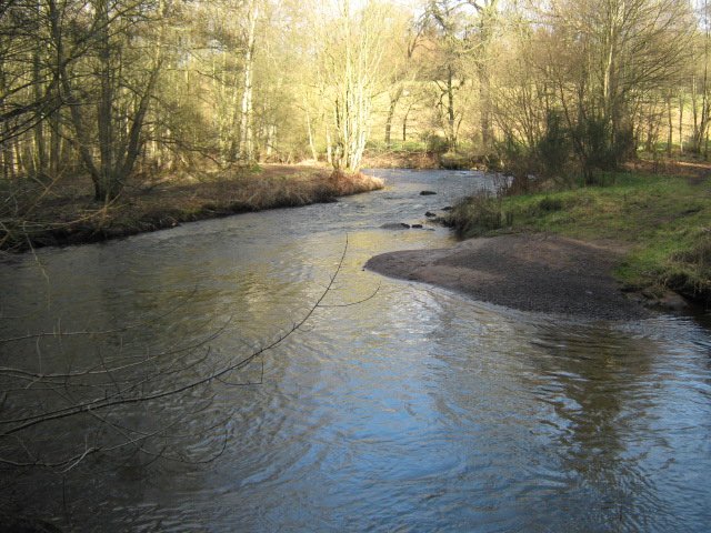
River Leven, Fife

The River Leven (Scottish Gaelic: Lìobhann / Abhainn Lìobhann) is a river in Fife, Scotland. It flows from Loch Leven into the Firth of Forth at the town...

Milton of Balgonie

Milton of Balgonie () is a small village in central Fife, Scotland. It is situated 2 miles (3.2 km) east of Glenrothes between the nearby villages of Markinch...

Markinch railway station

Markinch railway station is a railway station in Markinch, Fife, Scotland, which serves the Glenrothes, Leslie and Levenmouth areas of Fife. The station...

Thornton Junction railway station

Thornton Junction railway station served the village of Thornton, Fife, Scotland from 1847 to 1969 on the Fife Coast Railway. == History == The station...

Markinch

Markinch (, (Scottish Gaelic: Marc Innis) is both a village and a parish in the heart of Fife, Scotland. According to an estimate taken in 2008, the village...

Nearby Amenities

Located within 500m of 56.18403,-3.1290467
Coaltown of Balgonie
Place: village
Wikidata: Q16896542
Wikipedia: en:Coaltown of Balgonie
Lat/Long: 56.1842644/-3.1265319
Post Office
Coaltown Post Office
Addr Country: GB
Addr Postcode: KY7 6HX
Brand: Post Office
Brand Wikidata: Q1783168
Contact Website: https://www.postoffice.co.uk/branch-finder/1048449/coaltown
Ref Pol Id: 1386
Lat/Long: 56.1841665/-3.1288086
Queen Victoria Memorial
Historic: monument
Lat/Long: 56.1851629/-3.1252351
Barrier: block
Lat/Long: 56.1835031/-3.1271577
Post Box
Collection Times: Mo-Fr 16:30; Sa 12:00
Operator: Royal Mail
Post Box Type: pillar
Ref: KY7 94
Royal Cypher: scottish_crown
Source: survey
Lat/Long: 56.1841446/-3.1290507
Recycling
Location: overground
Recycling Cans: yes
Recycling Clothes: yes
Recycling Glass: no
Recycling Glass Bottles: yes
Recycling Paper: yes
Recycling Type: container
Lat/Long: 56.18589/-3.1273385
Atm
Operator: Cly
Lat/Long: 56.1841842/-3.1290722
Bus Stop
Shelter: yes
Lat/Long: 56.1853949/-3.1252004
Bus Stop
Shelter: yes
Lat/Long: 56.1841059/-3.1287832
Bus Stop
Bellvue
Bench: no
Lit: yes
Naptan AtcoCode: 6500K0593
Naptan NaptanCode: 34328348
Shelter: no
Tactile Paving: no
Lat/Long: 56.1837527/-3.130954
Bus Stop
Operator: Fife Council
Shelter: no
Lat/Long: 56.1835733/-3.1340707
Bus Stop
Lat/Long: 56.1834627/-3.135152
Bus Stop
Operator: Fife Council
Shelter: yes
Lat/Long: 56.1850562/-3.1255189
Recycling
Recycling Cans: yes
Recycling Clothes: yes
Recycling Glass: yes
Recycling Paper: yes
Lat/Long: 56.1849331/-3.1246452
Bus Stop
Bench: no
Covered: no
Lit: yes
Name Signed: no
Operator: Fife Council
Shelter: no
Tactile Paving: no
Lat/Long: 56.1860803/-3.1278317
Bus Stop
Operator: Fife Council
Shelter: no
Lat/Long: 56.1847528/-3.1251032
Barrier: bollard
Bicycle: yes
Foot: yes
Horse: yes
Motor Vehicle: no
Lat/Long: 56.1854557/-3.1292175
Barrier: bollard
Bicycle: yes
Foot: yes
Horse: yes
Motor Vehicle: no
Lat/Long: 56.1854738/-3.1288665
Crossing
Crossing: unmarked
Note: Crossing attendant (during school days only) 08:30 - 09:00 15:00 - 15:30
Sloped Curb: both
Tactile Paving: no
Lat/Long: 56.1851061/-3.1255895
Parking
Access: private
Lat/Long: 56.1860724/-3.1247189
Crossing
Crossing: zebra
Crossing Island: no
Tactile Paving: yes
Lat/Long: 56.1839877/-3.1293008
Generator Method: photovoltaic
Generator Output Electricity: yes
Generator Source: solar
Generator Type: solar_photovoltaic_panel
Power: generator
Lat/Long: 56.1846678/-3.1283068
Generator Method: photovoltaic
Generator Output Electricity: yes
Generator Source: solar
Generator Type: solar_photovoltaic_panel
Power: generator
Lat/Long: 56.1849337/-3.1295563
Generator Method: photovoltaic
Generator Output Electricity: yes
Generator Source: solar
Generator Type: solar_photovoltaic_panel
Power: generator
Lat/Long: 56.1841797/-3.1317733
Generator Method: photovoltaic
Generator Output Electricity: yes
Generator Source: solar
Generator Type: solar_photovoltaic_panel
Power: generator
Lat/Long: 56.1842212/-3.1347331
Generator Method: photovoltaic
Generator Output Electricity: yes
Generator Source: solar
Generator Type: solar_photovoltaic_panel
Power: generator
Lat/Long: 56.1835981/-3.1364574
Generator Method: photovoltaic
Generator Output Electricity: yes
Generator Source: solar
Generator Type: solar_photovoltaic_panel
Power: generator
Lat/Long: 56.1831688/-3.1304742
Generator Method: photovoltaic
Generator Output Electricity: yes
Generator Source: solar
Generator Type: solar_photovoltaic_panel
Power: generator
Lat/Long: 56.1832452/-3.1302963
Leisure: playground
Lat/Long: 56.1862246/-3.1268
The data included in this document is from www.openstreetmap.org. The data is made available under ODbL.

Have you been to Coaltown of Balgonie?

Leave your review of Coaltown of Balgonie below (or comments, questions and feedback).