Church Town

Settlement in Cornwall

England

Church Town

Carnon Viaducts 1969 Brunel's viaduct on the right had wooden trestles.
Carnon Viaducts 1969 Credit: Gordon Spicer

Church Town is a charming village located in the county of Cornwall, England. Situated near the coast, it is nestled amidst picturesque countryside, offering residents and visitors a tranquil and idyllic setting. With a population of around 1,000 people, the village exudes a close-knit community atmosphere.

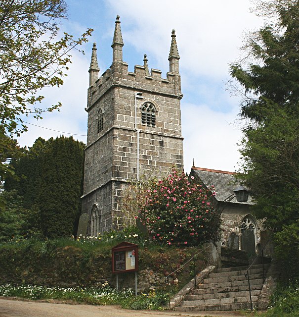
The focal point of Church Town is its historic church, which dates back to the 12th century. The church, dedicated to St. Mary, features stunning Norman architecture and is a prominent landmark in the area. Its tall spire can be seen from miles around, adding to the village's distinctive skyline.

In addition to its religious significance, Church Town boasts several other noteworthy features. The village is dotted with traditional cottages made of local stone, giving it a quaint and traditional feel. A small but charming village green is located near the church, providing a peaceful spot for residents to relax or enjoy a picnic.

Local amenities in Church Town include a village shop, a cozy pub, and a primary school, catering to the needs of the community. The village also benefits from its proximity to the stunning Cornish coastline, with beautiful beaches and coastal paths just a short distance away.

Church Town is an ideal destination for those seeking a peaceful retreat away from the hustle and bustle of city life. Its rich history, natural beauty, and strong community spirit make it a truly special place to visit or call home.

If you have any feedback on the listing, please let us know in the comments section below.
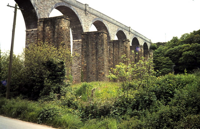
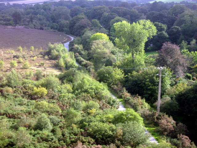
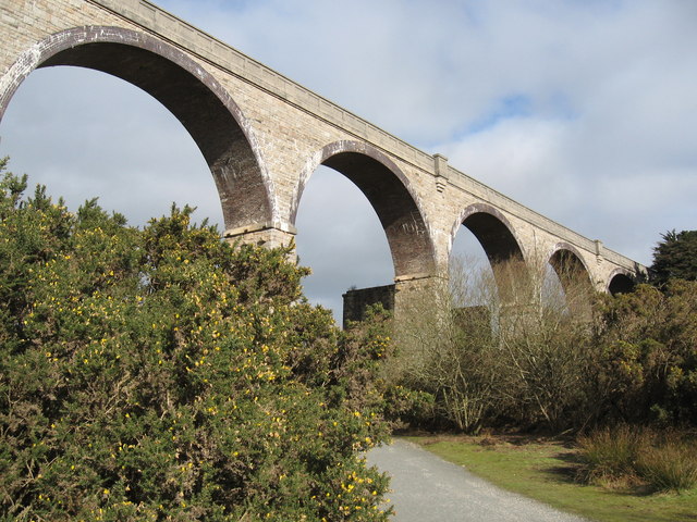
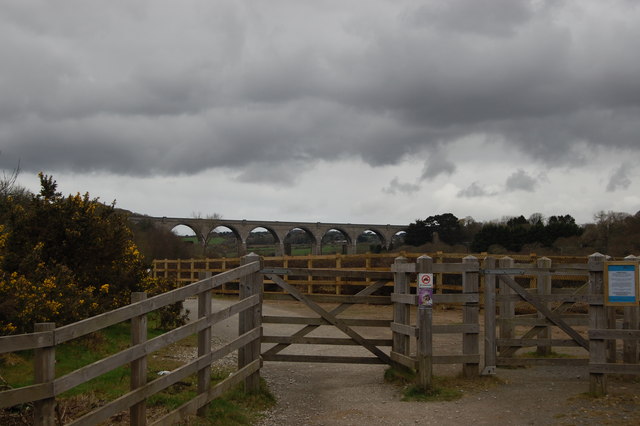
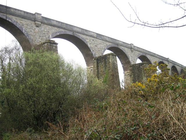
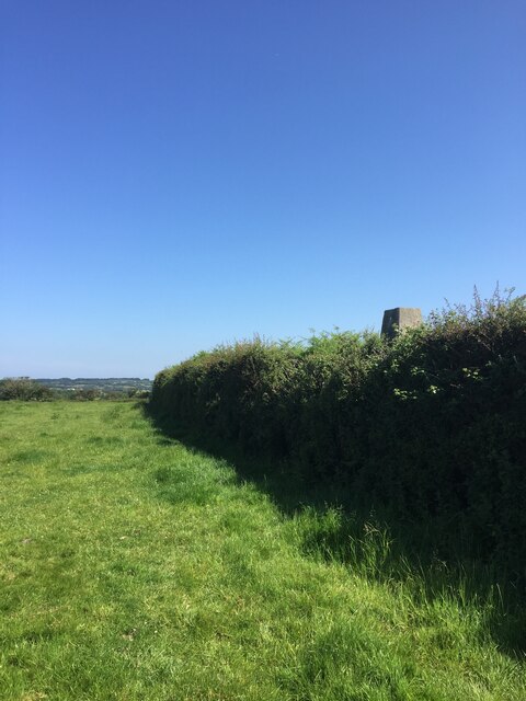
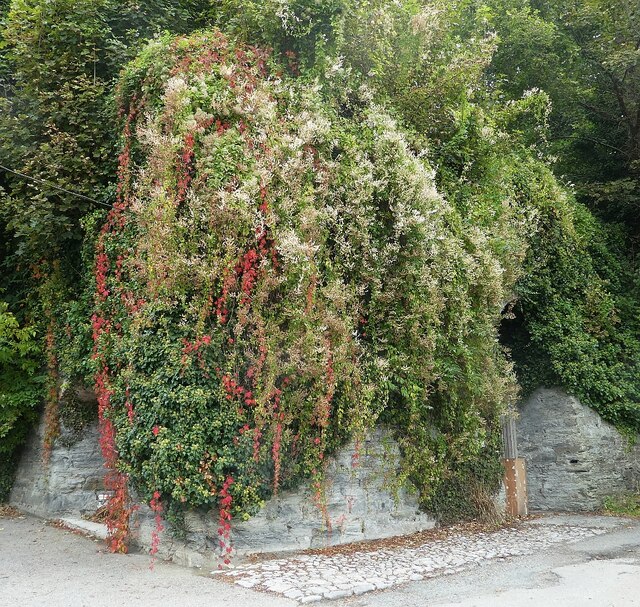
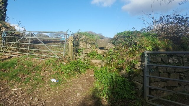
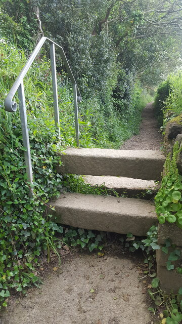
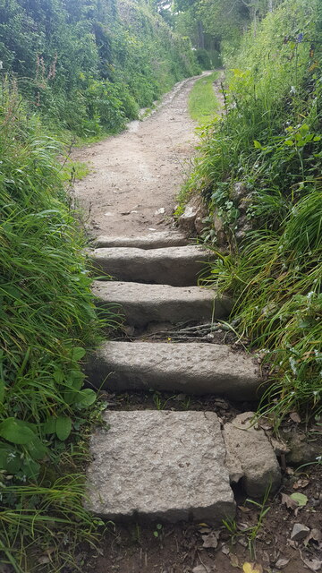
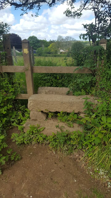
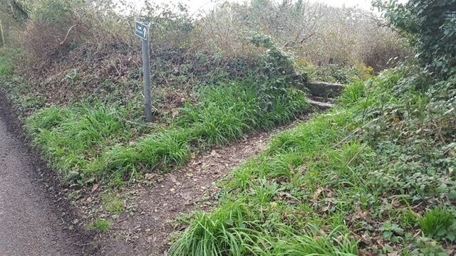
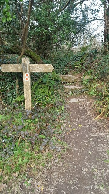
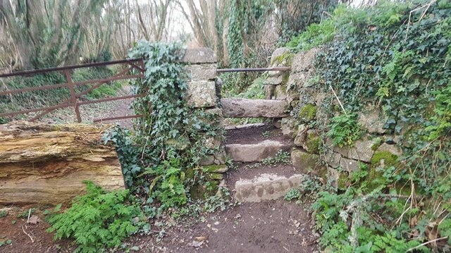
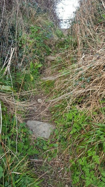
Church Town Images

Images are sourced within 2km of 50.208438/-5.1140203 or Grid Reference SW7738. Thanks to Geograph Open Source API. All images are credited.

Carnon Viaducts 1969 Brunel's viaduct on the right had wooden trestles.
Carnon Viaducts 1969
Brunel's viaduct on the right had wooden trestles.
Maritime Line Crossing the Carnon River Viaduct
Carnon Valley Viaduct
Carnon Viaduct and entrance to cycleway
Carnon Viaduct
Carnon Viaduct
Pellyn-Wartha Trig Point Flush Bracket S7872
Perranarworthal - Former lime kilns Hidden under a lot of greenery are the former lime kilns in Perranarworthal immediately to the northeast of the Norway Inn.
Perranarworthal - Former lime kilns
Hidden under a lot of greenery are the former lime kilns in Perranarworthal immediately to the northeast of the Norway Inn.
The A39 approaching Carnon Gate roundabout
Stone Stile SW7639a On byway 313/17/3&4 gold leading to Bargus Farm. Byway leads off Perranwell Station (Greenwith Road) to Frogpool road. The stile is at the west end of a footbridge, beside a ford.
Cattle stile with one ground level stone bar each side of a central raised stone bar.
Public byway 313/17/3&4 (gold) from: Perranwell Station to: Bargus Farm.
Stone Stile SW7639a
On byway 313/17/3&4 gold leading to Bargus Farm. Byway leads off Perranwell Station (Greenwith Road) to Frogpool road. The stile is at the west end of a footbridge, beside a ford. Cattle stile with one ground level stone bar each side of a central raised stone bar. Public byway 313/17/3&4 (gold) from: Perranwell Station to: Bargus Farm.
Stone Stile SW7639b At the junction of 3 footpaths 313/13/2 which runs from Trewedna Water Road to White Cottage in a west to east direction, 313/13/3 (bronze) which goes over the stile and runs from White Cottage to Bargus Farm, 313/13/1 runs from White Cottage back to Trewedna Water Road initially in a southerly direction.
East side 2 granite steps with a large flat slate slab across the top. 31 inches wide, 37 inches high.
West side the same large slate at the top, 2 granite slabs, stone step on the right side, some stones at the base. 50 inches high. 
Public footpath 313/13/3 (bronze) from White Cottage to Bargus Farm.
Stone Stile SW7639b
At the junction of 3 footpaths 313/13/2 which runs from Trewedna Water Road to White Cottage in a west to east direction, 313/13/3 (bronze) which goes over the stile and runs from White Cottage to Bargus Farm, 313/13/1 runs from White Cottage back to Trewedna Water Road initially in a southerly direction. East side 2 granite steps with a large flat slate slab across the top. 31 inches wide, 37 inches high. West side the same large slate at the top, 2 granite slabs, stone step on the right side, some stones at the base. 50 inches high. Public footpath 313/13/3 (bronze) from White Cottage to Bargus Farm.
Stone Stile SW7739a On a public path that runs from the side of the Post Office in School Hill, Perranwell Station to St Piran’s Church, Perranarworthal.
Cattle stile made with just three long horizontal granite blocks.
Public footpath 313/1/4 gold from Perranwell to Churchtown.
Stone Stile SW7739a
On a public path that runs from the side of the Post Office in School Hill, Perranwell Station to St Piran’s Church, Perranarworthal. Cattle stile made with just three long horizontal granite blocks. Public footpath 313/1/4 gold from Perranwell to Churchtown.
Stone Stile SW7739b On a public footpath that runs from the side of the Post Office in School Hill, Perranwell Station to St Piran’s Church, Perranarworthal. This stile is sited at the top of the footpath towards the church & just beyond this point the footpath becomes a public byway.
Coffen stile with five long granite blocks.
Coffen stile – a stile built over a pit – like a granite cattle grid.
Coffen is a Cornish word for a man-made hole in the ground.
Public footpath 313/1/4 gold and byway 313/1/3 gold from Perranwell to the Churchtown.
Stone Stile SW7739b
On a public footpath that runs from the side of the Post Office in School Hill, Perranwell Station to St Piran’s Church, Perranarworthal. This stile is sited at the top of the footpath towards the church & just beyond this point the footpath becomes a public byway. Coffen stile with five long granite blocks. Coffen stile – a stile built over a pit – like a granite cattle grid. Coffen is a Cornish word for a man-made hole in the ground. Public footpath 313/1/4 gold and byway 313/1/3 gold from Perranwell to the Churchtown.
Stone Stile SW7739c On a public footpath leading from the top of the footpath from Post Office on School Hill, coming out in Perranwell Station on St Pirans Hill. Where this footpath leads off, the footpath from School Hill & the Church becomes a wider public byway.
It is a granite stile with a wooden top. Two granite steps on the east side, three granite steps on the west side. The granite is very even (quite new?) and the top step Public footpath 313/1/3 gold from St Pirans Hill to the Churchtown.has cross hatched markings.
Stone Stile SW7739c
On a public footpath leading from the top of the footpath from Post Office on School Hill, coming out in Perranwell Station on St Pirans Hill. Where this footpath leads off, the footpath from School Hill & the Church becomes a wider public byway. It is a granite stile with a wooden top. Two granite steps on the east side, three granite steps on the west side. The granite is very even (quite new?) and the top step Public footpath 313/1/3 gold from St Pirans Hill to the Churchtown.has cross hatched markings.
Stone Stile SW7739d Perranwell, where footpath leads from Greenwith Road in a SW direction.
Cattle stile. Height on road side 19 inches high, 36 inches across, consist of top granite slab & a lower granite slab. On path side there is a top granite slab, 2 lower granite slabs & a lower stone. Height 39 inches. 
Public footpath 313/10/1 gold.
Stone Stile SW7739d
Perranwell, where footpath leads from Greenwith Road in a SW direction. Cattle stile. Height on road side 19 inches high, 36 inches across, consist of top granite slab & a lower granite slab. On path side there is a top granite slab, 2 lower granite slabs & a lower stone. Height 39 inches. Public footpath 313/10/1 gold.
Stone Stile SW7739e Perranwell, where footpath 313/11/1, leading south from Footpath 313/10/1, joins public Byway 313/12/2.
Cattle stile. North side of stile top granite slab, lower granite slab & stone at the bottom. Width 34 inches, height 28 inches. 
South side of stile top granite slab, lower granite slab & stone at the bottom. Height 37 inches. 
On North side of stile there is an overhanging tree that has to be ducked under.
Public footpath 313/11/1 joining public byway 313/12/2.
Stone Stile SW7739e
Perranwell, where footpath 313/11/1, leading south from Footpath 313/10/1, joins public Byway 313/12/2. Cattle stile. North side of stile top granite slab, lower granite slab & stone at the bottom. Width 34 inches, height 28 inches. South side of stile top granite slab, lower granite slab & stone at the bottom. Height 37 inches. On North side of stile there is an overhanging tree that has to be ducked under. Public footpath 313/11/1 joining public byway 313/12/2.
Stone Stile SW7739f Perranwell. About halfway along footpath 313/7/3, south of the railway bridge, beside a metal gate blocked by a tree.
Cattle stile. North side; 2 granite slabs with a metal bar across the top (metal bar looks repurposed) Width 30inches. Height to top of metal bar 36 inches. 
South side: 3 granite slabs & the same metal bar. Height 51 inches.  
A long public footpath 313/7/3 (Gold) leads south west then curving around to south after passing under Railway bridge from Byway 313/12/1, joining public Footpath 313/7/2
Stone Stile SW7739f
Perranwell. About halfway along footpath 313/7/3, south of the railway bridge, beside a metal gate blocked by a tree. Cattle stile. North side; 2 granite slabs with a metal bar across the top (metal bar looks repurposed) Width 30inches. Height to top of metal bar 36 inches. South side: 3 granite slabs & the same metal bar. Height 51 inches. A long public footpath 313/7/3 (Gold) leads south west then curving around to south after passing under Railway bridge from Byway 313/12/1, joining public Footpath 313/7/2
Stone Stile SW7739g Perranwell
Step stile through a gap in the hedge. The steps are set apart, embedded in the bank. East side 1 granite step Height 8” width 18 inches. On west side 4 steps Height 48 inches.
A long public footpath 313/7/3 (Gold) leads south west then curving around to south after passing under Railway bridge from Byway 313/12/1, joining public Footpath 313/7/2.
Stone Stile SW7739g
Perranwell Step stile through a gap in the hedge. The steps are set apart, embedded in the bank. East side 1 granite step Height 8” width 18 inches. On west side 4 steps Height 48 inches. A long public footpath 313/7/3 (Gold) leads south west then curving around to south after passing under Railway bridge from Byway 313/12/1, joining public Footpath 313/7/2.
Stone Stile SW7839a This stile runs from the old A39, (known as Devoran turning) now a layby. At the side of it is a footpath, so it is easier not to use the stile. 
On the North side: 2 granite slabs. Width 36” Height 30”
On the South side:  Width 36” Height 48” 3 granite slabs & a large granite stone at the bottom. 
The footpath is not marked as a public Right of Way but is used extensively by walkers & dog walkers. The footpath runs out along the spit of land known as The Banks, or Butney Banks.
Stone Stile SW7839a
This stile runs from the old A39, (known as Devoran turning) now a layby. At the side of it is a footpath, so it is easier not to use the stile. On the North side: 2 granite slabs. Width 36” Height 30” On the South side: Width 36” Height 48” 3 granite slabs & a large granite stone at the bottom. The footpath is not marked as a public Right of Way but is used extensively by walkers & dog walkers. The footpath runs out along the spit of land known as The Banks, or Butney Banks.
Show me another place!

Church Town is located at Grid Ref: SW7738 (Lat: 50.208438, Lng: -5.1140203)

Unitary Authority: Cornwall

Police Authority: Devon and Cornwall

What 3 Words

///beads.pavilions.riders. Near Perranarworthal, Cornwall

Related Wikis

St Piran's Church, Perranarworthal

St Piran's Church is an active Anglican parish church in Perranarworthal, Cornwall, England. It is part of a united benefice consisting of eight churches...

Tullimaar House

Tullimaar House is a mansion just east of Perranarworthal in west Cornwall, England, United Kingdom; it is not visible from the main A39 Falmouth to Truro...

Perranarworthal

Perranarworthal (Cornish: Peran ar Wodhel) is a civil parish and village in Cornwall, England, United Kingdom. The village is about four miles (6.5 km...

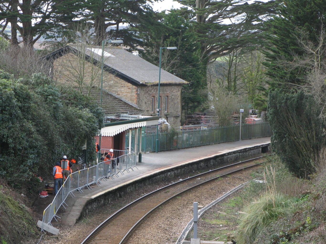
Perranwell railway station

Perranwell station (Cornish: Fentenberan) is on the Maritime Line between Truro and Falmouth Docks in south-west England. The station is managed by, and...

Nearby Amenities

Located within 500m of 50.208438,-5.1140203
Church Town
Is In County: Cornwall
Place: village
Source: OS_OpenData_StreetView
Lat/Long: 50.2080483/-5.1136645
Perranarworthal
Name Kw: Peran ar Wodhel
Place: village
Source: NLS - OS 1:25k 1st Series 1937-61
Lat/Long: 50.2086447/-5.1164014
Generator Method: photovoltaic
Generator Output Electricity: yes
Generator Source: solar
Generator Type: solar_photovoltaic_panel
Location: roof
Power: generator
Lat/Long: 50.2077113/-5.1175904
Generator Method: photovoltaic
Generator Output Electricity: yes
Generator Source: solar
Generator Type: solar_photovoltaic_panel
Location: roof
Power: generator
Lat/Long: 50.2074847/-5.1161742
Direction: S
Generator Method: photovoltaic
Generator Output Electricity: small_installation
Generator Source: solar
Generator Type: solar_photovoltaic_panel
Location: roof
Power: generator
Source: bing;survey
Survey Date: 2020-07-25
Lat/Long: 50.2099858/-5.1185721
Direction: E
Generator Method: photovoltaic
Generator Output Electricity: small_installation
Generator Source: solar
Generator Type: solar_photovoltaic_panel
Location: roof
Power: generator
Source: bing;survey
Survey Date: 2020-07-25
Lat/Long: 50.2093009/-5.1199615
Direction: S
Generator Method: photovoltaic
Generator Output Electricity: small_installation
Generator Source: solar
Generator Type: solar_photovoltaic_panel
Location: roof
Power: generator
Source: bing;survey
Survey Date: 2020-07-25
Lat/Long: 50.209512/-5.1208091
Direction: S
Generator Method: photovoltaic
Generator Output Electricity: small_installation
Generator Source: solar
Generator Type: solar_photovoltaic_panel
Location: roof
Power: generator
Source: bing;survey
Survey Date: 2020-07-25
Lat/Long: 50.2094605/-5.1204819
Direction: S
Generator Method: photovoltaic
Generator Output Electricity: small_installation
Generator Source: solar
Generator Type: solar_photovoltaic_panel
Location: roof
Power: generator
Source: bing;survey
Survey Date: 2020-07-25
Lat/Long: 50.2098193/-5.1194036
Direction: SW
Generator Method: photovoltaic
Generator Output Electricity: small_installation
Generator Source: solar
Generator Type: solar_photovoltaic_panel
Location: roof
Power: generator
Source: bing;survey
Survey Date: 2020-07-25
Lat/Long: 50.2109556/-5.1172189
Direction: SW
Generator Method: photovoltaic
Generator Output Electricity: small_installation
Generator Source: solar
Generator Type: solar_photovoltaic_panel
Location: roof
Power: generator
Source: bing;survey
Survey Date: 2020-07-25
Lat/Long: 50.2112277/-5.1170285
Direction: S
Generator Method: photovoltaic
Generator Output Electricity: small_installation
Generator Source: solar
Generator Type: solar_photovoltaic_panel
Location: roof
Power: generator
Source: bing;survey
Survey Date: 2020-07-25
Lat/Long: 50.2114912/-5.117746
Direction: S
Generator Method: photovoltaic
Generator Output Electricity: small_installation
Generator Source: solar
Generator Type: solar_photovoltaic_panel
Location: roof
Power: generator
Source: bing;survey
Survey Date: 2020-07-25
Lat/Long: 50.2120494/-5.1178231
Traffic Calming: island
Lat/Long: 50.206096/-5.1161677
Telephone
Booth: K6
Covered: booth
Listed Status: Grade II
Lat/Long: 50.2061647/-5.1161911
Bench
Lat/Long: 50.2116217/-5.1189686
The data included in this document is from www.openstreetmap.org. The data is made available under ODbL.

Have you been to Church Town?

Leave your review of Church Town below (or comments, questions and feedback).