Cefn Côch

Settlement in Montgomeryshire

Wales

Cefn Côch

Footpath above Afon Rhaeadr
Footpath above Afon Rhaeadr Credit: Row17

The requested URL returned error: 429 Too Many Requests

If you have any feedback on the listing, please let us know in the comments section below.

Cefn Côch Images

Images are sourced within 2km of 52.828402/-3.3267705 or Grid Reference SJ1026. Thanks to Geograph Open Source API. All images are credited.
Footpath above Afon Rhaeadr
Farm track to Foel-llyn
Lane at Tyn-y-celyn
Lane at Tyn-y-celyn
The Road to Pistyll falls
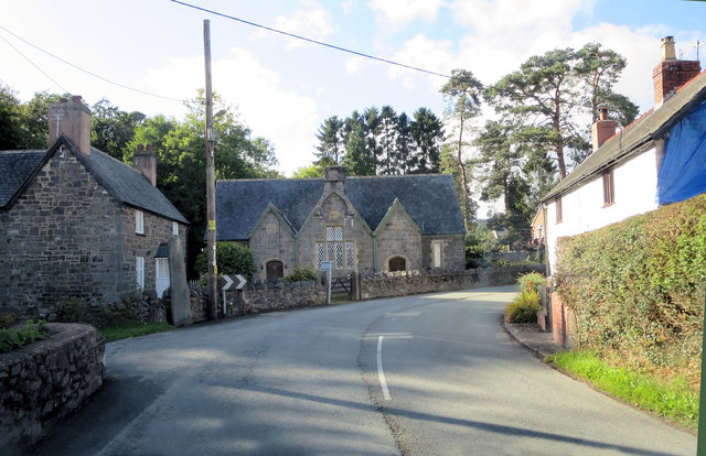
B4580 passes the former National School There is a new modern school a few hundred yards east of here; which presumably supplanted this one, with its archaic discrimination between the genders etched in stone above the separate entrances. It is nevertheless Grade II listed with Cadw Building ID: 81820.
B4580 passes the former National School
There is a new modern school a few hundred yards east of here; which presumably supplanted this one, with its archaic discrimination between the genders etched in stone above the separate entrances. It is nevertheless Grade II listed with Cadw Building ID: 81820.
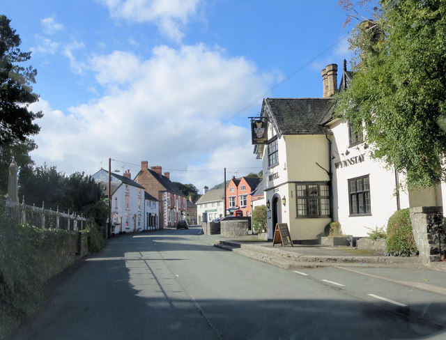
B4580 passes the Wynnstay Arms The inn is Grade II listed with Cadw Building ID: 81846.
B4580 passes the Wynnstay Arms
The inn is Grade II listed with Cadw Building ID: 81846.
Waterfall Street
Waterfall Street
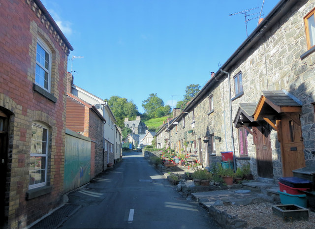
Waterfall Street north of Gwern Sebon As a non-Welsh speaker I'm on shaky ground here but the internet translation of 'Gwern Sebon' is alder soap! With the Afon Rhaeadr close at the left hand, alders would certainly grow here. I wonder if Saponaria officinalis (soapwort) is the other element? The conditions would suit it.
Waterfall Street north of Gwern Sebon
As a non-Welsh speaker I'm on shaky ground here but the internet translation of 'Gwern Sebon' is alder soap! With the Afon Rhaeadr close at the left hand, alders would certainly grow here. I wonder if Saponaria officinalis (soapwort) is the other element? The conditions would suit it.
Waterfall Street passes Tan y Ffordd Ochor In the farmyard is a Cadw listed outbuilding of cruck construction.
Waterfall Street passes Tan y Ffordd Ochor
In the farmyard is a Cadw listed outbuilding of cruck construction.
Waterfall Street south of Pen-y-bryn Hall
Sheep pasture east of Tan y Ffordd Ochor
Near Frongoch
Near Frongoch
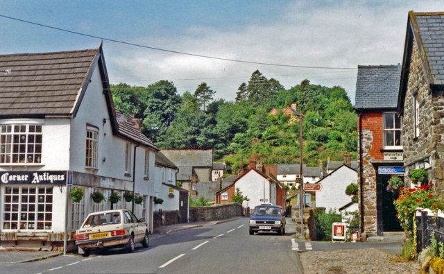
Market Street, Llanrhaeadr-ym-Mochnant
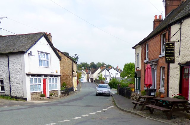
Llanrhaiadr-ym-Mochnant, 1992 View along Market Street.
Llanrhaiadr-ym-Mochnant, 1992
View along Market Street.
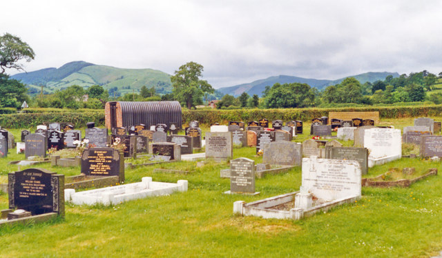
Cemetery at Llanrhaeadr-ym-Mochnant, view up Afon Rhaeadr valley, 1993 View NW to Berwyn Mountains.
Cemetery at Llanrhaeadr-ym-Mochnant, view up Afon Rhaeadr valley, 1993
View NW to Berwyn Mountains.
Field above Afon Rhaeadr
View to Craig Garwallt View across farmland to Craig Garwallt.
View to Craig Garwallt
View across farmland to Craig Garwallt.
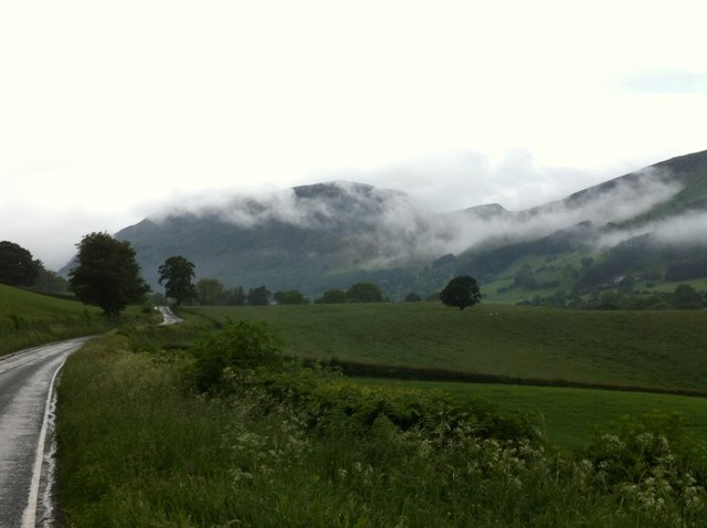
Road in Cwm Maen Gwynedd Country road in Cwm Maen Gwynedd leading upo the valley to Pistyll Rhaeadr.
Road in Cwm Maen Gwynedd
Country road in Cwm Maen Gwynedd leading upo the valley to Pistyll Rhaeadr.
Show me another place!

Cefn Côch is located at Grid Ref: SJ1026 (Lat: 52.828402, Lng: -3.3267705)

Unitary Authority: Powys

Police Authority: Dyfed Powys

What 3 Words

///prelude.vaccines.prospers. Near Llanrhaeadr-ym-Mochnant, Powys

Nearby Locations

Cefn Côch

Related Wikis

Llanrhaeadr-ym-Mochnant

Llanrhaeadr-ym-Mochnant () is a village, community and an ecclesiastical parish in the extreme north of Powys, Wales; about 9 miles west of Oswestry and...

Pedairffordd Halt railway station

Pedairffordd Halt railway station (alternatively Pedair-Ffordd Halt) was a station on the Tanat Valley Light Railway, located 1.3 miles south of Llanrhaeadr...

Llanrhaeadr F.C.

Llanrhaeadr Football Club is a Welsh football club based in Llanrhaeadr-ym-Mochnant, Powys. They currently play in the Ardal NE. The home colours are blue...

Penybontfawr railway station

Penybontfawr railway station was a station on the Tanat Valley Light Railway in Pen-y-bont-fawr, Powys, Wales. The station opened in 1904 and closed in...

Nearby Amenities

Located within 500m of 52.828402,-3.3267705
Place: farm
Lat/Long: 52.8250059/-3.3282734
Place: farm
Lat/Long: 52.8314624/-3.3298398
Addr Housename: Bryn
Place: isolated_dwelling
Lat/Long: 52.8278226/-3.3219815
Building: yes
Lat/Long: 52.826697/-3.3206136
Place: farm
Lat/Long: 52.829763/-3.33018
Direction: 185
Generator Method: photovoltaic
Generator Output Electricity: yes
Generator Solar Modules: 10
Generator Source: solar
Generator Type: solar_photovoltaic_panel
Location: roof
Power: generator
Lat/Long: 52.8289903/-3.323831
Cefn Coch
Place: hamlet
Lat/Long: 52.8283558/-3.3231143
Give Way
Direction: backward
Lat/Long: 52.8277928/-3.3230913
Man Made: utility_pole
Lat/Long: 52.8285762/-3.3234679
Man Made: utility_pole
Lat/Long: 52.8281879/-3.3223867
Man Made: utility_pole
Lat/Long: 52.8293113/-3.3294789
The data included in this document is from www.openstreetmap.org. The data is made available under ODbL.

Have you been to Cefn Côch?

Leave your review of Cefn Côch below (or comments, questions and feedback).