Castle Dene

Settlement in Durham

England

Castle Dene

Morton House 14th Durham VA Hospital in First World War.
Morton House Credit: Patrick Brennan - donmouth.co.uk

Castle Dene is a popular shopping center located in the heart of Peterlee, a town in County Durham, England. Spread over two floors, the center offers a diverse range of retail outlets, dining options, and entertainment facilities. With its convenient location and ample parking space, Castle Dene attracts both locals and visitors from surrounding areas.

The shopping center is home to a variety of well-known high street brands, including Primark, New Look, and Boots, catering to the fashion needs of all age groups. In addition to fashion retailers, Castle Dene also features a wide selection of shops offering homeware, electronics, beauty products, and more.

Visitors can take a break from shopping and enjoy a meal or snack at the center's food court, which offers a range of cuisines to suit different tastes. From fast food chains to independent cafes, there are plenty of options to satisfy hunger pangs.

Castle Dene also hosts various events and activities throughout the year, including seasonal markets, charity fundraisers, and children's entertainment. These events enhance the shopping experience and create a lively and vibrant atmosphere in the center.

The management of Castle Dene takes pride in providing a safe and accessible environment for all visitors. The center is wheelchair-friendly and offers facilities such as baby changing rooms and free Wi-Fi. The friendly and helpful staff are always on hand to ensure a pleasant shopping experience for everyone.

Overall, Castle Dene is a bustling and well-equipped shopping center that caters to the diverse needs of its customers. Whether shopping for fashion, household essentials, or enjoying a meal out, Castle Dene offers a comprehensive and enjoyable retail experience in the heart of Durham.

If you have any feedback on the listing, please let us know in the comments section below.

Castle Dene Images

Images are sourced within 2km of 54.847274/-1.5398281 or Grid Reference NZ2950. Thanks to Geograph Open Source API. All images are credited.

Morton House 14th Durham VA Hospital in First World War.
Morton House
14th Durham VA Hospital in First World War.
A1(M) near Pea Flatts Farm
Repairs to the Grass Verge, Northbound A1(M) near to Great Lumley The A1 is the longest numbered road in the UK at 410 miles long. It connects London with Edinburgh, via the east of England. 
For much of its path it follows the Great North Road the old coaching route between London and Edinburgh. Several sections of the route are classified as motorway A1(M). The modern A1 bypasses the towns the Great North Road passed through and is dual carriageway for most of its route through England.
Repairs to the Grass Verge, Northbound A1(M) near to Great Lumley
The A1 is the longest numbered road in the UK at 410 miles long. It connects London with Edinburgh, via the east of England. For much of its path it follows the Great North Road the old coaching route between London and Edinburgh. Several sections of the route are classified as motorway A1(M). The modern A1 bypasses the towns the Great North Road passed through and is dual carriageway for most of its route through England.
Little Lumley : A1(M) Looking north on the A1(M).
Little Lumley : A1(M)
Looking north on the A1(M).
Little Lumley : Grassy Field Looking along a grassy field with a fence through it.
Little Lumley : Grassy Field
Looking along a grassy field with a fence through it.
A1(M) northbound
A1(M) northbound
A1(M) northbound
A1(M) northbound
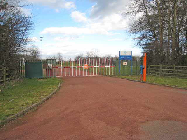
Gateway to Lumley Water Treatment Works
A1(M) near Great Lumley
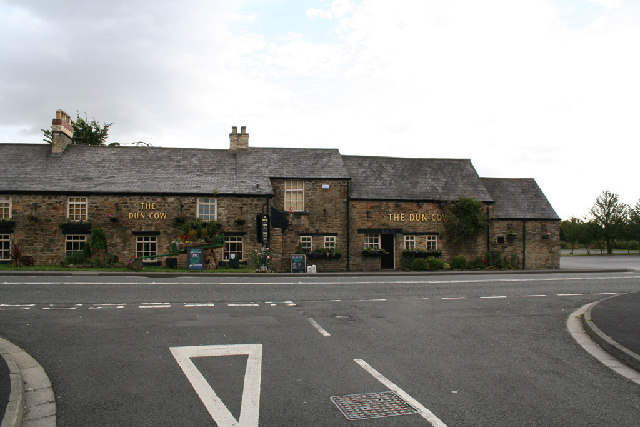
The Dun Cow The Dun Cow Public house near Houghton Gate
The Dun Cow
The Dun Cow Public house near Houghton Gate
The Floaters Mill The Floaters Mill Public house in New Lambton
The Floaters Mill
The Floaters Mill Public house in New Lambton
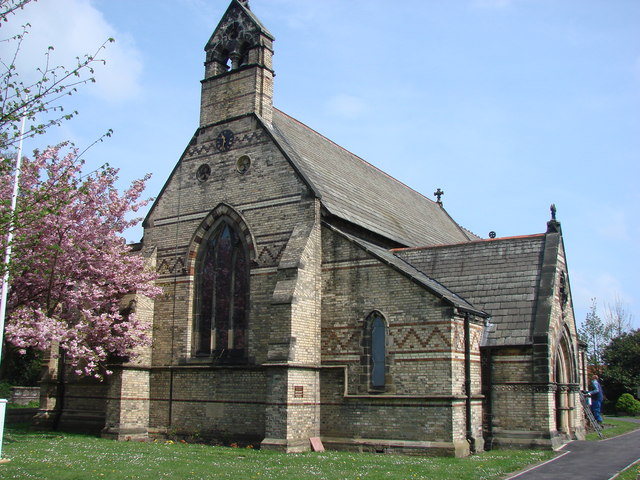
The Church of St. Barnabas Built in 1867-1868, the church is in the village of Bournmoor in County Durham.
Photographed on a cold and frosty morning in late January 2006
The Church of St. Barnabas
Built in 1867-1868, the church is in the village of Bournmoor in County Durham. Photographed on a cold and frosty morning in late January 2006
Shops and Post Office on Marigold Crescent, Bournmoor, County Durham
Shops and Post Office
on Marigold Crescent, Bournmoor, County Durham
Breckon Hill Photo taken while walking along the rivers foot path
Breckon Hill
Photo taken while walking along the rivers foot path
Fencehouses County Durham
Fence Houses old fire station Fence Houses old fire station, on the A1052, at Fence Houses, Tyne & Wear now houses a Home Improvements Company
Fence Houses old fire station
Fence Houses old fire station, on the A1052, at Fence Houses, Tyne & Wear now houses a Home Improvements Company
St. Barnabas's Church, Burnmoor Parish
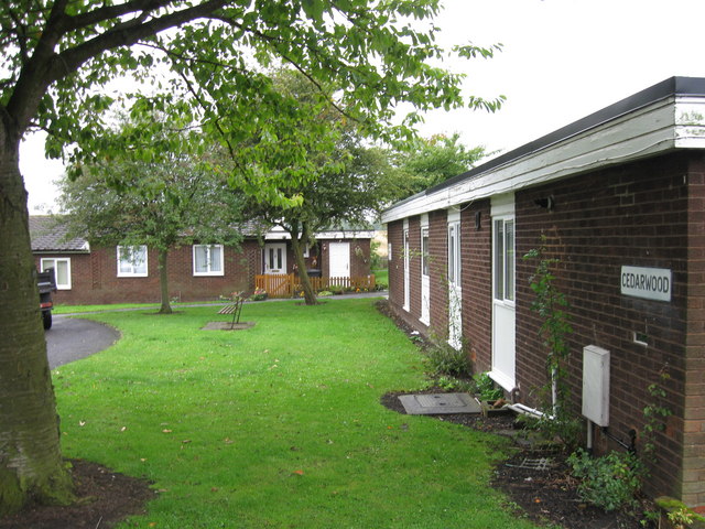
Cedarwood, Fence Houses
Show me another place!

Castle Dene is located at Grid Ref: NZ2950 (Lat: 54.847274, Lng: -1.5398281)

Unitary Authority: County Durham

Police Authority: Durham

What 3 Words

///fish.boss.serve. Near Chester-le-Street, Co. Durham

Nearby Locations

Staple Castle Dene

Related Wikis

Nearby Amenities

Located within 500m of 54.847274,-1.5398281
Bus Stop
Scorers Lane End
Naptan AtcoCode: 13002317A
Naptan Bearing: N
Naptan CommonName: Scorers Lane End
Naptan Indicator: north bound
Naptan Landmark: Landmark not known
Naptan NaptanCode: duramtdw
Naptan Notes: Scorers Lane just south of where it joins Lumley New Rd- Castle Dene- Great Lumley
Naptan Street: Scorers Lane
Shelter: yes
Source: naptan_import
Lat/Long: 54.8468195/-1.5394265
Bus Stop
Scorers Lane End
Naptan AtcoCode: 13002317E
Naptan Bearing: S
Naptan CommonName: Scorers Lane End
Naptan Indicator: south bound
Naptan Landmark: Landmark not known
Naptan NaptanCode: duramtga
Naptan Notes: Scorers Lane just south of where it joins Lumley New Rd- Castle Dene- Great Lumley
Naptan Street: Scorers Lane
Naptan Verified: no
Source: naptan_import
Lat/Long: 54.8467561/-1.5392758
Bus Stop
Castle Dene
Naptan AtcoCode: 13002318C
Naptan Bearing: E
Naptan CommonName: Castle Dene
Naptan Indicator: east bound
Naptan Landmark: Landmark not known
Naptan NaptanCode: duramtgd
Naptan Notes: W end of Tinkler Terrace- Lumley New Rd- Castle Dene- Great Lumley
Naptan Street: B1284 Lumley New Road
Naptan Verified: yes
Source: naptan_import; GPS survey
Lat/Long: 54.8474295/-1.5402843
Bus Stop
Castle Dene
Bench: no
Bin: no
Bus: yes
Naptan AtcoCode: 13002318G
Naptan Bearing: W
Naptan CommonName: Castle Dene
Naptan Indicator: west bound
Naptan Landmark: Landmark not known
Naptan NaptanCode: duramtgj
Naptan Notes: 60m e of Scorers Lane junction- Lumley New Rd- Castle Dene- Great Lumley
Naptan Street: B1284 Lumley New Road
Naptan Verified: no
Public Transport: platform
Shelter: yes
Source: naptan_import
Tactile Paving: no
Lat/Long: 54.8473809/-1.5381474
Crossing
Crossing: unmarked
Lat/Long: 54.8473872/-1.5393576
Post Box
Ref: DH3 147
Lat/Long: 54.8475524/-1.5391962
Castle Dene
Place: hamlet
Lat/Long: 54.8473844/-1.5394982
Barrier: stile
Foot: yes
Lat/Long: 54.8493987/-1.5367785
Barrier: stile
Lat/Long: 54.8437706/-1.5392078
Barrier: entrance
Lat/Long: 54.8439198/-1.5391497
Jekyll & Hideout
Addr City: Chester-le-Street
Addr Postcode: DH3 4PE
Tourism: guest_house
Website: https://jekyllandhideout.com/
Lat/Long: 54.8514482/-1.5410638
Bench
Backrest: yes
Lat/Long: 54.8446687/-1.5452649
Addr City: Chester-le-Street
Addr Housenumber: 9
Addr Postcode: DH3 4HA
Lat/Long: 54.8477844/-1.5407829
Addr City: Chester-le-Street
Addr Housenumber: 8
Addr Postcode: DH3 4HA
Lat/Long: 54.8477975/-1.5409234
Addr City: Chester-le-Street
Addr Housenumber: 7
Addr Postcode: DH3 4HA
Lat/Long: 54.8478107/-1.541064
Addr City: Chester-le-Street
Addr Housenumber: 6
Addr Postcode: DH3 4HA
Lat/Long: 54.8478238/-1.5412045
Addr City: Chester-le-Street
Addr Housenumber: 5
Addr Postcode: DH3 4HA
Lat/Long: 54.8478369/-1.5413451
Addr City: Chester-le-Street
Addr Housenumber: 4
Addr Postcode: DH3 4HA
Lat/Long: 54.84785/-1.5414856
Addr City: Chester-le-Street
Addr Housenumber: 3
Addr Postcode: DH3 4HA
Lat/Long: 54.8478184/-1.5416908
Addr City: Chester-le-Street
Addr Housenumber: 2
Addr Postcode: DH3 4HA
Lat/Long: 54.8477777/-1.5418115
Addr City: Chester-le-Street
Addr Housenumber: 1
Addr Postcode: DH3 4HA
Lat/Long: 54.8477443/-1.5419108
Crossing
Crossing: unmarked
Lat/Long: 54.8472256/-1.5396401
Crossing
Crossing: unmarked
Lat/Long: 54.8472749/-1.5396285
Crossing
Crossing: unmarked
Lat/Long: 54.8473314/-1.53905
Crossing
Crossing: unmarked
Lat/Long: 54.8472568/-1.5390298
Barrier: kissing_gate
Lat/Long: 54.8466282/-1.5322608
Barrier: kissing_gate
Lat/Long: 54.8467228/-1.533664
Power: pole
Lat/Long: 54.8506397/-1.5432277
Power: pole
Lat/Long: 54.849036/-1.5426242
Power: pole
Lat/Long: 54.8484894/-1.5424244
Location Transition: yes
Power: pole
Lat/Long: 54.8479952/-1.5422581
Power: pole
Transformer: distribution
Lat/Long: 54.8495325/-1.5353622
Power: pole
Lat/Long: 54.8478871/-1.5352616
Power: pole
Lat/Long: 54.8484407/-1.5356518
Power: pole
Lat/Long: 54.8489882/-1.5360434
Power: pole
Transformer: distribution
Lat/Long: 54.8495437/-1.5365054
Grit Bin
Ref: CH 146
Lat/Long: 54.849795/-1.5363251
Power: pole
Transformer: distribution
Lat/Long: 54.8516287/-1.5413421
Power: pole
Lat/Long: 54.8472347/-1.5376833
Power: pole
Lat/Long: 54.8470237/-1.535661
Power: pole
Lat/Long: 54.8469591/-1.5349927
Power: pole
Lat/Long: 54.8468896/-1.5343157
Power: pole
Lat/Long: 54.8461059/-1.5406137
Power: pole
Lat/Long: 54.8442078/-1.5413075
Power: pole
Lat/Long: 54.8452316/-1.5414214
Power: pole
Lat/Long: 54.8432181/-1.5411837
Power: pole
Lat/Long: 54.8470654/-1.539564
Hiking: yes
Information: guidepost
Tourism: information
Lat/Long: 54.8477385/-1.535848
Lumley Colliery (1st and 2nd Pits)
Historic: mine
Lat/Long: 54.8493356/-1.5421951
Lumley Colliery - 3rd Pit
Historic: mine
Lat/Long: 54.8456695/-1.543901
The data included in this document is from www.openstreetmap.org. The data is made available under ODbL.

Have you been to Castle Dene?

Leave your review of Castle Dene below (or comments, questions and feedback).