Carter's Corner
Settlement in Sussex Wealden
England
Carter's Corner

Carter's Corner is a small, picturesque village located in the county of Sussex, England. Situated amidst rolling green hills and scenic countryside, it is a popular destination for tourists seeking a tranquil and idyllic getaway.
The village is known for its charming, traditional architecture, with quaint cottages and historic buildings lining the streets. The centerpiece of Carter's Corner is the village square, which features a beautifully maintained village green, surrounded by a few local shops and businesses. The green serves as a gathering place for locals and visitors alike, providing a peaceful spot for picnics or leisurely strolls.
Nature enthusiasts will appreciate the natural beauty that surrounds Carter's Corner. The village is conveniently located near several stunning walking trails and nature reserves, providing ample opportunities for hiking, birdwatching, and exploring the great outdoors.
Despite its small size, Carter's Corner boasts a strong sense of community. The locals are friendly and welcoming, and the village often hosts community events and festivals throughout the year. These events offer visitors a chance to experience the village's vibrant culture and traditions, showcasing local arts, crafts, and cuisines.
In terms of amenities, Carter's Corner offers a few essential services, such as a village store, a post office, and a cozy pub. However, for a wider range of amenities and attractions, nearby towns and cities, such as Brighton and Lewes, are easily accessible by car or public transport.
Overall, Carter's Corner is a charming and peaceful village, perfect for those seeking a quintessentially English countryside experience. With its stunning natural surroundings and welcoming community, it is a hidden gem in the heart of Sussex.
If you have any feedback on the listing, please let us know in the comments section below.
Carter's Corner Images
Images are sourced within 2km of 50.882797/0.27903478 or Grid Reference TQ6011. Thanks to Geograph Open Source API. All images are credited.


Carter's Corner is located at Grid Ref: TQ6011 (Lat: 50.882797, Lng: 0.27903478)
Administrative County: East Sussex
District: Wealden
Police Authority: Sussex
What 3 Words
///prospered.silver.users. Near Hailsham, East Sussex
Nearby Locations
Related Wikis
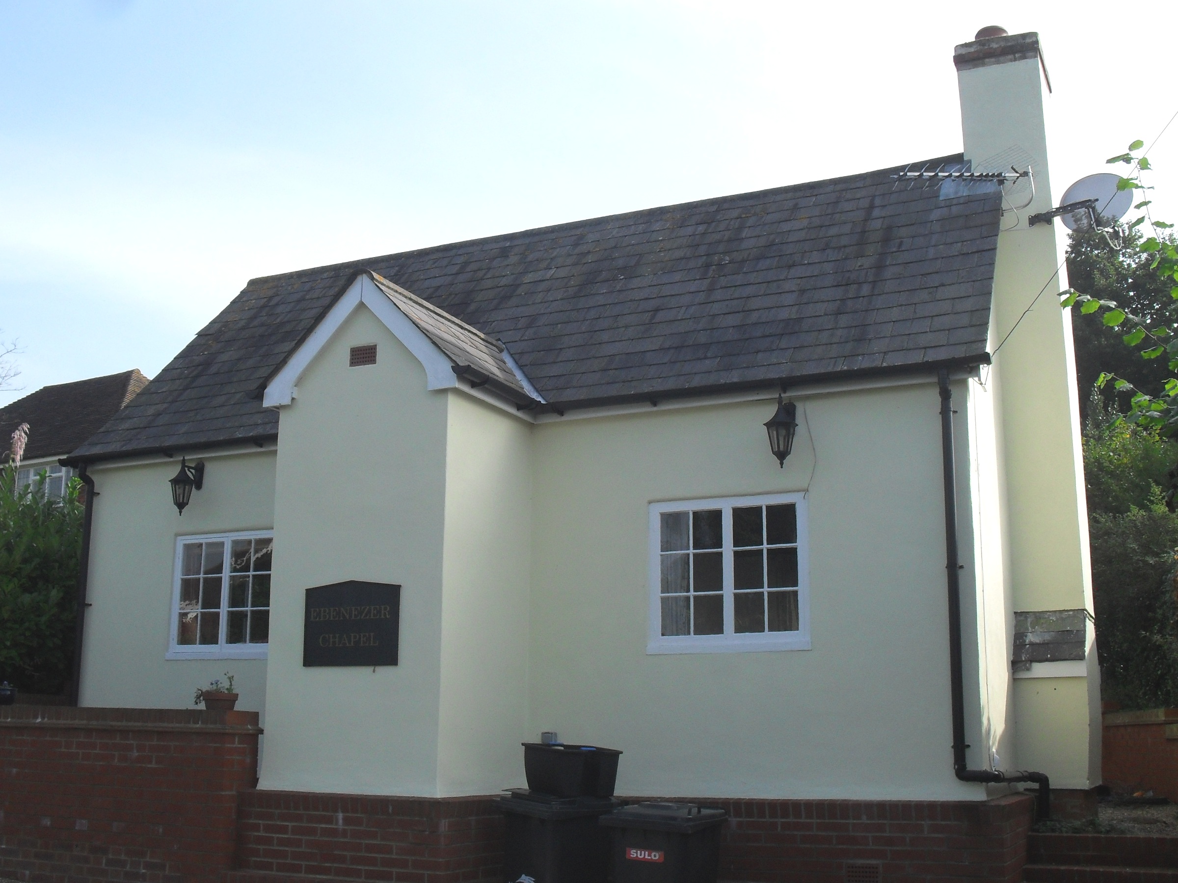
Magham Down
Magham Down is a village between Herstmonceux and Hailsham in the Wealden district of East Sussex. It lies on the A271 road. It has a Grade II listed building...

Magham Down Manor House
Magham Down Manor House is a Grade II listed building in Magham Down in the Wealden district of East Sussex. == External links == Entry on Historic England...

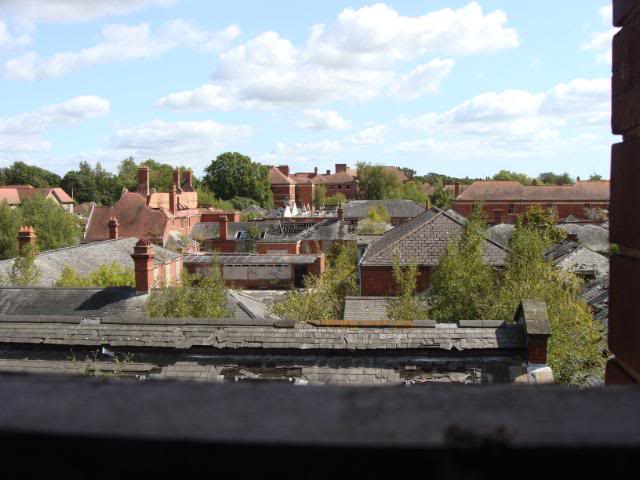
Hellingly Hospital
Hellingly Hospital, formerly the East Sussex County Asylum, was a large psychiatric hospital close to the village of Hellingly, east of Hailsham, in the...
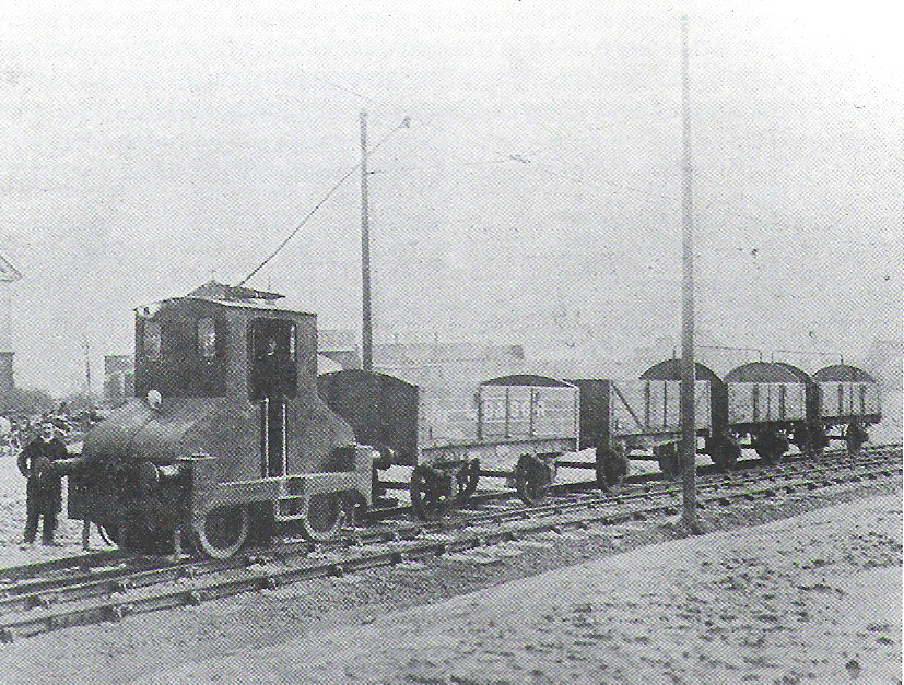
Hellingly Hospital Railway
The Hellingly Hospital Railway was a light railway owned and operated by East Sussex County Council, used for transporting coal and passengers to Hellingly...

Hellingly railway station
Hellingly was a railway station on the now closed Polegate to Eridge line (the Cuckoo Line) in East Sussex. It served the village of Hellingly. ��2�...
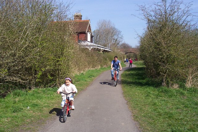
Cuckoo Trail
The Cuckoo Trail is a 14-mile (23 km) footpath and cycleway which runs from Hampden Park to Heathfield in East Sussex. It passes through the towns of Polegate...

Hellingly
Hellingly (pronounced 'Helling-lye') is a village, and can also refer to a civil parish, and to a district ward, in the Wealden District of East Sussex...

Horselunges Manor
Horselunges Manor is a 15th-century manor house in Hellingly, East Sussex, that was restored in the 20th century. The house was previously owned by Peter...
Nearby Amenities
Located within 500m of 50.882797,0.27903478Have you been to Carter's Corner?
Leave your review of Carter's Corner below (or comments, questions and feedback).