Carry Bridge

Settlement in Lancashire Pendle

England

Carry Bridge

Foulridge Upper Reservoir The second of the Foulridge reservoirs, this one was constructed in 1865  to supply water to the Leeds Liverpool Canal
Foulridge Upper Reservoir Credit: Eirian Evans

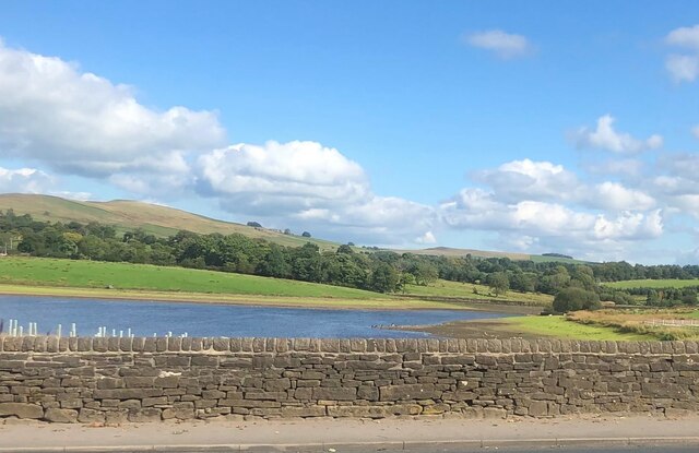
Carry Bridge is a small village located in the county of Lancashire, in the northwest region of England. Situated near the town of Burscough, Carry Bridge is nestled along the banks of the Leeds and Liverpool Canal, providing picturesque views and a tranquil atmosphere for its residents.

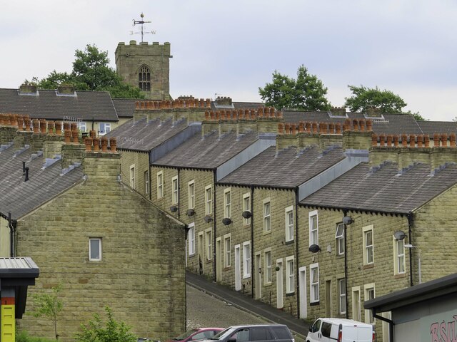
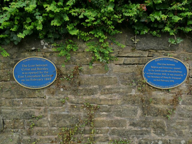
The village is known for its iconic bridge, from which it derives its name. Built in the 19th century, Carry Bridge is a stone arch bridge that spans the canal, connecting the two sides of the village. Its historic significance and architectural charm make it a notable landmark in the area.

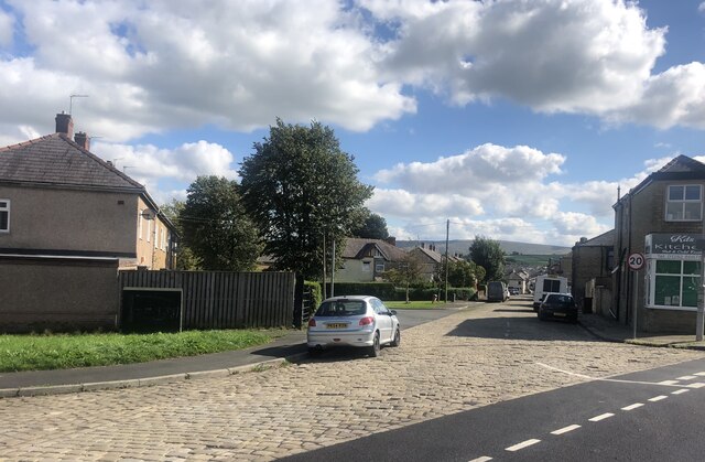
Carry Bridge is primarily a residential area, with a small population of around 500 residents. The village offers a close-knit community feel, where neighbors often know each other and come together for local events and activities. The canal, which runs through the heart of the village, provides opportunities for leisurely walks, boating, and fishing.

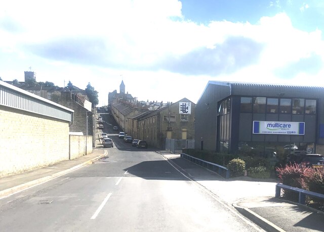
Despite its small size, Carry Bridge benefits from its proximity to nearby amenities. The town of Burscough, just a short distance away, offers a range of shops, restaurants, and services, allowing residents to easily access daily essentials.

Overall, Carry Bridge is a charming village in Lancashire, offering a peaceful and scenic setting for its residents. With its historic bridge and canal, it provides a quaint and idyllic place to call home.

If you have any feedback on the listing, please let us know in the comments section below.
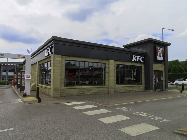
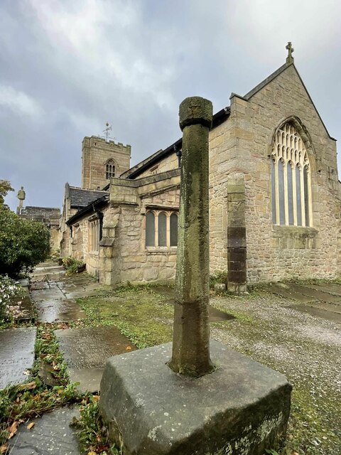
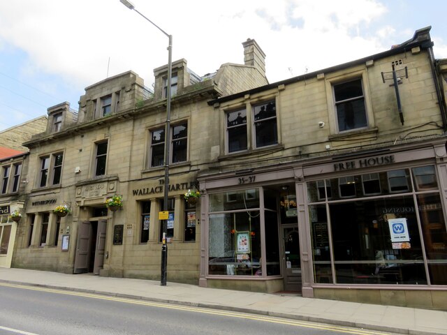
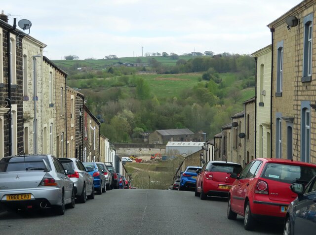
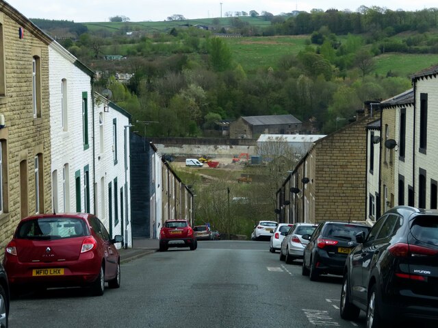
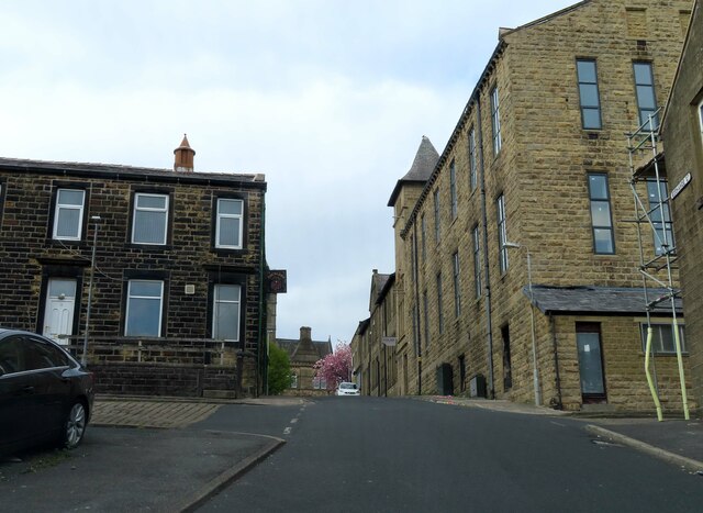
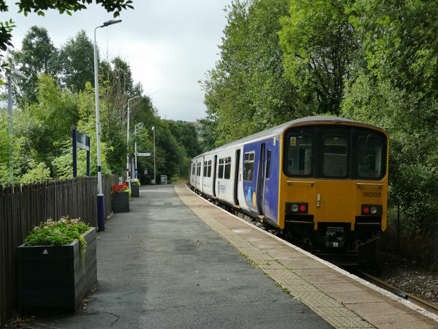
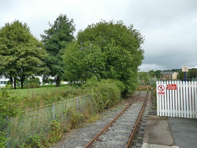
Carry Bridge Images

Images are sourced within 2km of 53.854853/-2.160181 or Grid Reference SD8939. Thanks to Geograph Open Source API. All images are credited.

Foulridge Upper Reservoir The second of the Foulridge reservoirs, this one was constructed in 1865  to supply water to the Leeds Liverpool Canal
Foulridge Upper Reservoir
The second of the Foulridge reservoirs, this one was constructed in 1865 to supply water to the Leeds Liverpool Canal
Montague Street, Colne
New Market Street, Colne A street mostly of terraced houses with Colne Town Hall at the far end
New Market Street, Colne
A street mostly of terraced houses with Colne Town Hall at the far end
Mason Street in Colne
KFC in Colne
KFC in Colne
Old Cross in St Bartholomew churchyard, Colne Emmott Cross or Touch Cross, the old shaft and base of a cross. Set in the southeast corner of the churchyard between the east end of St Bartholomew's church and the Sunday School in Colne parish. Moved here in 1967. This is reported in a Historic England Research Record <span class="nowrap"><a title="https://www.heritagegateway.org.uk/Gateway/Results_Single.aspx?uid=c45c9853-c791-41ea-876d-36874e1f820d&resourceID=19191" rel="nofollow ugc noopener" href="https://www.heritagegateway.org.uk/Gateway/Results_Single.aspx?uid=c45c9853-c791-41ea-876d-36874e1f820d&resourceID=19191">Link</a><img style="margin-left:2px;" alt="External link" title="External link - shift click to open in new window" src="https://s1.geograph.org.uk/img/external.png" width="10" height="10"/></span> as a former central cross from the junction of Windy Bank and Colne Lane or from Market Street, both about SD890401. It is also reported in The Northern Antiquarian <span class="nowrap"><a title="https://megalithix.wordpress.com/2011/03/27/emmott-cross-colne/" rel="nofollow ugc noopener" href="https://megalithix.wordpress.com/2011/03/27/emmott-cross-colne/">Link</a><img style="margin-left:2px;" alt="External link" title="External link - shift click to open in new window" src="https://s1.geograph.org.uk/img/external.png" width="10" height="10"/></span> as a former wayside cross from Emmott Hall, Laneshaw Bridge, about SD927404 or beside the Laneshaw Bridge to Haworth Road over Herders Common. Grade II Listed <span class="nowrap"><a title="https://historicengland.org.uk/listing/the-list/list-entry/1243158" rel="nofollow ugc noopener" href="https://historicengland.org.uk/listing/the-list/list-entry/1243158">Link</a><img style="margin-left:2px;" alt="External link" title="External link - shift click to open in new window" src="https://s1.geograph.org.uk/img/external.png" width="10" height="10"/></span>. 

Milestone Society National ID: LAPD_COL02
Old Cross in St Bartholomew churchyard, Colne
Emmott Cross or Touch Cross, the old shaft and base of a cross. Set in the southeast corner of the churchyard between the east end of St Bartholomew's church and the Sunday School in Colne parish. Moved here in 1967. This is reported in a Historic England Research Record LinkExternal link as a former central cross from the junction of Windy Bank and Colne Lane or from Market Street, both about SD890401. It is also reported in The Northern Antiquarian LinkExternal link as a former wayside cross from Emmott Hall, Laneshaw Bridge, about SD927404 or beside the Laneshaw Bridge to Haworth Road over Herders Common. Grade II Listed LinkExternal link. Milestone Society National ID: LAPD_COL02
Former route of Colne to Skipton railway This modern road Vivary Way did not exist when the railway came this way and must be a major obstacle to the re-opening campaign. In the trees beyond this Colne bypass is a substantial bridge carrying Barrowford Road over the railway of six lines at that point.
Former route of Colne to Skipton railway
This modern road Vivary Way did not exist when the railway came this way and must be a major obstacle to the re-opening campaign. In the trees beyond this Colne bypass is a substantial bridge carrying Barrowford Road over the railway of six lines at that point.
The Wallace Hartley on Church Street The Wallace Hartley is a Wetherspoon pub. It is named after the band leader on the Titanic, who came from Colne.
The Wallace Hartley on Church Street
The Wallace Hartley is a Wetherspoon pub. It is named after the band leader on the Titanic, who came from Colne.
Kirk Bridge Carries Skipton Road across the feed into Foulridge Lower Reservoir from the Upper Reservoir. The reservoirs were built to supply water to the Leeds & Liverpool Canal.
Kirk Bridge
Carries Skipton Road across the feed into Foulridge Lower Reservoir from the Upper Reservoir. The reservoirs were built to supply water to the Leeds & Liverpool Canal.
Trinity Baptist Church The church is now housed in the Baptist School, with the car park on Robert Street being the site of the original church
Trinity Baptist Church
The church is now housed in the Baptist School, with the car park on Robert Street being the site of the original church
Banny's British Kitchen Near the Boundary Outlet shopping centre
Banny's British Kitchen
Near the Boundary Outlet shopping centre
Duke Street in Colne
Exchange Street in Colne
Banny’s Banny’s fish restaurant, Colne.
Banny’s
Banny’s fish restaurant, Colne.
Sprinter at Colne station Unit 150102 waits at the single platform to form the 10.11 all-stations service to Preston.
Sprinter at Colne station
Unit 150102 waits at the single platform to form the 10.11 all-stations service to Preston.
End of the line at Colne From 1848 to 1970 trains ran between Colne and Skipton with three intermediate station at Earby, Thornton and Elslack and a branch to Barnoldswick. The track was removed several years ago and trains from Preston terminate here. As of 2022, a local action group SELRAP (Skipton and East Lancashire Rail Action Partnership) was proposing reinstating the 20km link with just one new station at Earby, offering through trains to Leeds.
End of the line at Colne
From 1848 to 1970 trains ran between Colne and Skipton with three intermediate station at Earby, Thornton and Elslack and a branch to Barnoldswick. The track was removed several years ago and trains from Preston terminate here. As of 2022, a local action group SELRAP (Skipton and East Lancashire Rail Action Partnership) was proposing reinstating the 20km link with just one new station at Earby, offering through trains to Leeds.
Colne station plaques The two blue plaques record that Colne was connected by rail to Skipton from 1848 to 1970 and to Burnley from 1849 to the present day.
Colne station plaques
The two blue plaques record that Colne was connected by rail to Skipton from 1848 to 1970 and to Burnley from 1849 to the present day.
Show me another place!

Carry Bridge is located at Grid Ref: SD8939 (Lat: 53.854853, Lng: -2.160181)

Administrative County: Lancashire

District: Pendle

Police Authority: Lancashire

What 3 Words

///massive.looks.undertook. Near Colne, Lancashire

Related Wikis

St Bartholomew's Church, Colne

St Bartholomew's Church is in the town of Colne in Lancashire, England. It is an active Anglican parish church in the Diocese of Blackburn. There has been...
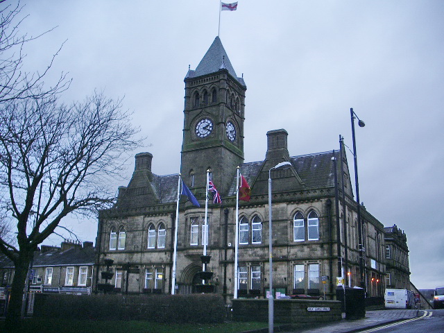
Colne Town Hall

Colne Town Hall is a municipal building in Albert Road, Colne, Lancashire, England. The town hall, which is the meeting place of Colne Town Council, is...

Pendle Hippodrome Theatre

The Pendle Hippodrome Theatre is an volunteer-run theatre in Colne, Lancashire in the north of England. It is owned by the Pendle Hippodrome Theatre Company...
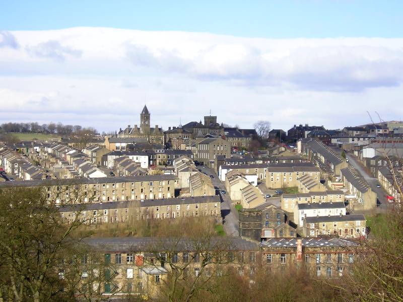
Colne

Colne () is a market town and civil parish in the Borough of Pendle in Lancashire, England. Located 3 miles (5 km) northeast of Nelson, 6 miles (10 km...

Nearby Amenities

Located within 500m of 53.854853,-2.160181
Post Office
Skipton Road Post Office
Addr City: Colne
Addr Housenumber: 17
Addr Postcode: BB8 0NQ
Addr Street: Skipton Road
Opening Hours: Mo-Sa 08:40-17:30
Ref Pol Id: 7822
Source: OS_opendata_streetview
Lat/Long: 53.8589403/-2.1631336
Pub
The Commercial
Lat/Long: 53.8574657/-2.1638892
Fast Food
Cemetery chippy
Addr City: Colne
Addr Housenumber: 75
Addr Postcode: BB8 0QF
Addr Street: Keighley Road
Cuisine: fish_and_chips
Fhrs Id: 159551
Source Addr: FHRS Open Data
Lat/Long: 53.8579308/-2.1587769
Fast Food
Skipton road chippy
Cuisine: fish_and_chips
Lat/Long: 53.8588056/-2.1628458
Tesco Express
Addr City: Colne
Addr Housenumber: 52-54
Addr Postcode: BB8 0HS
Addr Street: Market Street
Brand: Tesco Express
Brand Wikidata: Q98456772
Contact Website: https://www.tesco.com/store-locator/colne/52-market-st
Fhrs Id: 726950
Shop: convenience
Source Addr: FHRS Open Data
Lat/Long: 53.8571701/-2.16598
Atm
Check Date: 2021-04-17
Operator: Cooperative
Lat/Long: 53.8572161/-2.1661899
Bus Stop
Colne Bus Station (Stand 3)
Local Ref: 3
Public Transport: platform
Lat/Long: 53.8567779/-2.1663174
Bus Stop
Colne Bus Station (Stand 2)
Local Ref: 2
Public Transport: platform
Lat/Long: 53.8568134/-2.1660662
Bus Stop
Colne Bus Station (Stand 1)
Local Ref: 1
Public Transport: platform
Lat/Long: 53.8567343/-2.1657976
Bus Stop
Colne Bus Station (Stand 5)
Bench: yes
Local Ref: 5
Public Transport: platform
Shelter: yes
Tactile Paving: no
Lat/Long: 53.8573411/-2.1657601
Bus Stop
Colne Bus Station (Stand 4)
Bench: yes
Bin: yes
Bus Display Name: Market Street
Departures Board: timetable
Local Ref: 4
Public Transport: platform
Shelter: yes
Tactile Paving: no
Lat/Long: 53.857374/-2.1651509
Bus Stop
Gordon Street
Naptan AtcoCode: 2500DCL5723
Naptan NaptanCode: landmpat
Public Transport: platform
Lat/Long: 53.8588184/-2.1630976
Bus Stop
Gordon Street
Naptan AtcoCode: 2500LAA07259
Naptan NaptanCode: lanjadmd
Public Transport: platform
Lat/Long: 53.858985/-2.1628285
Bus Stop
British Legion
Naptan AtcoCode: 2500LAA00005
Naptan NaptanCode: langtdam
Public Transport: platform
Lat/Long: 53.8574467/-2.1618789
Bus Stop
British Legion
Naptan AtcoCode: 2500DCL5703
Naptan NaptanCode: landmjpm
Public Transport: platform
Lat/Long: 53.8574219/-2.1614223
Bus Stop
Cemetery
Naptan AtcoCode: 2500LAA00185
Naptan NaptanCode: langtmdt
Public Transport: platform
Lat/Long: 53.857913/-2.1587402
Bus Stop
Cemetery
Public Transport: platform
Lat/Long: 53.857793/-2.1588066
Crossing
Crossing: traffic_signals
Crossing Ref: pelican
Kerb: lowered
Tactile Paving: yes
Lat/Long: 53.8567436/-2.1651188
Crossing
Crossing: traffic_signals
Crossing Ref: puffin
Kerb: lowered
Tactile Paving: yes
Lat/Long: 53.8564492/-2.1672174
Bicycle Parking
Bicycle Parking: stands
Capacity: 6
Covered: no
Lat/Long: 53.8574228/-2.16597
Bus Station
Colne Bus Station
Naptan AtcoCode: 250GCOLBS
Public Transport: station
Lat/Long: 53.856676/-2.1661815
Traffic Signals
Traffic Signals: signal
Traffic Signals Direction: forward
Lat/Long: 53.8573444/-2.163924
Traffic Signals
Traffic Signals: signal
Traffic Signals Direction: forward
Lat/Long: 53.8573943/-2.1644841
Farmfoods
Addr City: Colne
Addr Housenumber: 63
Addr Postcode: BB8 0LL
Addr Street: Market Street
Brand: Farmfoods
Brand Wikidata: Q5435841
Brand Wikipedia: en:Farmfoods
Fhrs Id: 194345
Operator: Farmfoods Ltd
Shop: frozen_food
Lat/Long: 53.8574832/-2.1652293
Traffic Signals
Traffic Signals: signal
Traffic Signals Direction: forward
Lat/Long: 53.8573276/-2.1644774
Traffic Signals
Traffic Signals: signal
Traffic Signals Direction: backward
Lat/Long: 53.8574905/-2.1641471
Traffic Signals
Traffic Signals: crossing
Lat/Long: 53.8567497/-2.165083
Traffic Signals
Traffic Signals: crossing
Lat/Long: 53.8564467/-2.167164
Barrier: bollard
Lat/Long: 53.8551157/-2.167596
Bicycle Parking
Access: yes
Bicycle Parking: stands
Capacity: 4
Colour: Black
Covered: no
Fee: no
Lat/Long: 53.8570817/-2.1657326
Mighty Pound Store
Shop: variety_store
Lat/Long: 53.857103/-2.1648424
Pharmacy
Boots
Brand: Boots
Brand Wikidata: Q6123139
Healthcare: pharmacy
Website: https://www.boots.com/stores/509-colne-market-street-bb8-0hs
Lat/Long: 53.8569963/-2.1654996
Admiral
Brand: Admiral
Brand Wikidata: Q25205850
Gambling: slot_machines
Leisure: adult_gaming_centre
Lat/Long: 53.8569773/-2.1656267
Camera Mount: pole
Man Made: surveillance
Surveillance Type: camera
Lat/Long: 53.8573568/-2.1644634
Savers
Brand: Savers
Brand Wikidata: Q7428189
Official Name: Savers Health & Beauty
Shop: chemist
Lat/Long: 53.8570911/-2.1649223
Fast Food
Domino's
Brand: Domino's
Brand Wikidata: Q839466
Cuisine: pizza
Takeaway: yes
Lat/Long: 53.8570742/-2.1650593
Card Factory
Brand: Card Factory
Brand Wikidata: Q5038192
Shop: gift
Lat/Long: 53.8570468/-2.1651855
Intershape Fitness
Leisure: fitness_centre
Lat/Long: 53.8571653/-2.164542
Parcel Locker
Brand: Amazon Locker
Brand Wikidata: Q16974764
Lat/Long: 53.8577425/-2.1646954
Turkish Hair Master
Shop: hairdresser
Lat/Long: 53.8574214/-2.1655042
The data included in this document is from www.openstreetmap.org. The data is made available under ODbL.

Have you been to Carry Bridge?

Leave your review of Carry Bridge below (or comments, questions and feedback).