Capel-y-Groes

Settlement in Cardiganshire

Wales

Capel-y-Groes

Buildings at Wern-cornicyll I assume these are farm buildings.
Buildings at Wern-cornicyll Credit: M J Roscoe

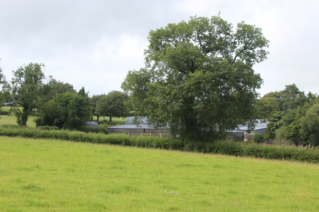
Capel-y-Groes is a small village located in the county of Cardiganshire, Wales. The village is situated in a picturesque rural setting, surrounded by rolling hills and lush green countryside. It is known for its quaint charm and peaceful atmosphere, making it a popular destination for those seeking a quiet retreat.

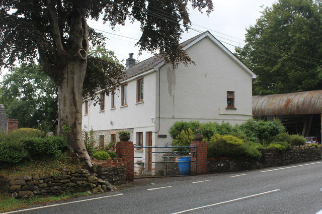
The focal point of Capel-y-Groes is its namesake chapel, which serves as a gathering place for the local community. The chapel is a historic building with a traditional design, featuring a simple yet elegant facade and a bell tower.

In addition to the chapel, Capel-y-Groes is home to a handful of residential properties, a small shop, and a pub. The village has a close-knit community, with residents who take pride in maintaining its rural character and preserving its heritage.

Visitors to Capel-y-Groes can enjoy walking along the scenic country lanes, taking in the stunning views of the surrounding countryside, and exploring the nearby woodlands and rivers. The village offers a peaceful and idyllic setting for those looking to escape the hustle and bustle of city life.

If you have any feedback on the listing, please let us know in the comments section below.

Capel-y-Groes Images

Images are sourced within 2km of 52.110733/-4.1519541 or Grid Reference SN5248. Thanks to Geograph Open Source API. All images are credited.

Buildings at Wern-cornicyll I assume these are farm buildings.
Buildings at Wern-cornicyll
I assume these are farm buildings.
Farmhouse, Pentre-Rhys Farm alongside the A475.
Farmhouse, Pentre-Rhys
Farm alongside the A475.
Former Fish & Anchor is now a Private Dwelling In the early 1980's this was a wonderful place for a pub meal.
Former Fish & Anchor is now a Private Dwelling
In the early 1980's this was a wonderful place for a pub meal.
A475 at Murco filling station
A475 at Llanwnnen village boundary
A475 west of Llanwnnen
Ordnance Survey Cut Mark This OS cut mark can be found on the gatepost SE side of the road. It marks a point 125.470m above mean sea level.
Ordnance Survey Cut Mark
This OS cut mark can be found on the gatepost SE side of the road. It marks a point 125.470m above mean sea level.
Ordnance Survey Cut Mark This OS cut mark can be found on the outbuilding of the Fish & Anchor PH. It marks a point 133.457m above mean sea level.
Ordnance Survey Cut Mark
This OS cut mark can be found on the outbuilding of the Fish & Anchor PH. It marks a point 133.457m above mean sea level.
Churn Stand
Churn Stand
Ordnance Survey Flush Bracket (S0454) This OS Flush Bracket can be found on the wall of the former post office. It marks a point 127.823m above mean sea level.
Ordnance Survey Flush Bracket (S0454)
This OS Flush Bracket can be found on the wall of the former post office. It marks a point 127.823m above mean sea level.
Milestone - Cardigan 26 The OS cut mark on the front of the stone marks a point 125.647m above mean sea level.
Milestone - Cardigan 26
The OS cut mark on the front of the stone marks a point 125.647m above mean sea level.
Barn on a sharp bend
The B4337 at Llanwnnen The parish church of St Lucia & St Gwynin is on the east side of the road
The B4337 at Llanwnnen
The parish church of St Lucia & St Gwynin is on the east side of the road
Gwesty'r Grannell Hotel Hotel at the centre of the village, at the junction of the A475 and Bro Cadarn (B4337)
Gwesty'r Grannell Hotel
Hotel at the centre of the village, at the junction of the A475 and Bro Cadarn (B4337)
Maesllan Farm
Maesllan Farm
The Grannell Hotel The hotel comes into view as the A475 makes a steep climb to a tricky crossing of the B4337. It's a bit depressing to see Christmas being advertised in early October.
The Grannell Hotel
The hotel comes into view as the A475 makes a steep climb to a tricky crossing of the B4337. It's a bit depressing to see Christmas being advertised in early October.
A275 south of Wern-cornicyll
OSBM Flush Bracket S0454 - Llanwnnen Post Office Ordnance Survey Benchmark (OSBM) used for levelling height above Ordnance Datum (OD).  
Height (1972): 127.8230m OD (Newlyn).  Mark verified by the Ordnance Survey in 1973.  Description: FL BR S0454 WALL PO LLANWNNEN E FACE.  0.4m above ground.  2nd Order BM.  The Post Office closed in 2011.

The bracket was used on the Lampeter to Carmarthen secondary line of the Second Geodetic Levelling of England & Wales in 1942. It was levelled with a height of 419.427' above OD (Newlyn).  Description: Flush Bracket on wall, 6' N. of building, W. side of road.  Abstract A 491: <span class="nowrap"><a title="http://discovery.nationalarchives.gov.uk/details/r/C11178833" rel="nofollow ugc noopener" href="http://discovery.nationalarchives.gov.uk/details/r/C11178833">Link</a><img style="margin-left:2px;" alt="External link" title="External link - shift click to open in new window" src="https://s1.geograph.org.uk/img/external.png" width="10" height="10"/></span> [OS 54/154]  It was levelled at 419.425' in the 1930s.  Abstract A 284: <span class="nowrap"><a title="http://discovery.nationalarchives.gov.uk/details/r/C11178737" rel="nofollow ugc noopener" href="http://discovery.nationalarchives.gov.uk/details/r/C11178737">Link</a><img style="margin-left:2px;" alt="External link" title="External link - shift click to open in new window" src="https://s1.geograph.org.uk/img/external.png" width="10" height="10"/></span> [OS 54/58]
OSBM Flush Bracket S0454 - Llanwnnen Post Office
Ordnance Survey Benchmark (OSBM) used for levelling height above Ordnance Datum (OD). Height (1972): 127.8230m OD (Newlyn). Mark verified by the Ordnance Survey in 1973. Description: FL BR S0454 WALL PO LLANWNNEN E FACE. 0.4m above ground. 2nd Order BM. The Post Office closed in 2011. The bracket was used on the Lampeter to Carmarthen secondary line of the Second Geodetic Levelling of England & Wales in 1942. It was levelled with a height of 419.427' above OD (Newlyn). Description: Flush Bracket on wall, 6' N. of building, W. side of road. Abstract A 491: LinkExternal link [OS 54/154] It was levelled at 419.425' in the 1930s. Abstract A 284: LinkExternal link [OS 54/58]
Show me another place!

Capel-y-Groes is located at Grid Ref: SN5248 (Lat: 52.110733, Lng: -4.1519541)

Unitary Authority: Ceredigion

Police Authority: Dyfed Powys

What 3 Words

///spoon.squares.saturate. Near Lampeter, Ceredigion

Nearby Locations

Capel-y-Groes Llanwnnen

Related Wikis

Neudd-fawr

Neudd-fawr (also spelt Neuadd Fawr) is a small village in the community of Llanwnnen, Ceredigion, Wales, which is 59.9 miles (96.4 km) from Cardiff and...

Llanwnnen

Llanwnnen is a village, parish and community located in the county of Ceredigion, Wales. The population of the community taken at the 2011 census was 490...

Llyn Pencarreg

Llyn Pencarreg is an oligotrophic lake that is Site of Special Scientific Interest in Carmarthen & Dinefwr, Wales. == See also == List of Sites of Special...

Corsydd a Rwyth Cilyblaidd

Corsydd a Rwyth Cilyblaidd is a wetland area that is a Site of Special Scientific Interest in Carmarthen & Dinefwr, Wales. == See also == List of Sites...

Nearby Amenities

Located within 500m of 52.110733,-4.1519541
Capel-y-Groes
Is In: Ceredigion, Wales, UK
Place: village
Lat/Long: 52.11118/-4.1550084
Direction: SE
Generator Method: photovoltaic
Generator Output Electricity: yes
Generator Solar Modules: 16
Generator Source: solar
Generator Type: solar_photovoltaic_panel
Location: roof
Power: generator
Lat/Long: 52.1126265/-4.1472665
Direction: 145
Generator Method: photovoltaic
Generator Output Electricity: yes
Generator Solar Modules: 8
Generator Source: solar
Generator Type: solar_photovoltaic_panel
Location: roof
Power: generator
Lat/Long: 52.1113911/-4.1571678
Direction: 145
Generator Method: photovoltaic
Generator Output Electricity: yes
Generator Solar Modules: 8
Generator Source: solar
Generator Type: solar_photovoltaic_panel
Location: roof
Power: generator
Lat/Long: 52.1114092/-4.1571853
The data included in this document is from www.openstreetmap.org. The data is made available under ODbL.

Have you been to Capel-y-Groes?

Leave your review of Capel-y-Groes below (or comments, questions and feedback).