Cannygates

Settlement in Shetland

Scotland

Cannygates

St Ninian's Ayre from the air
St Ninian's Ayre from the air Credit: Mike Pennington

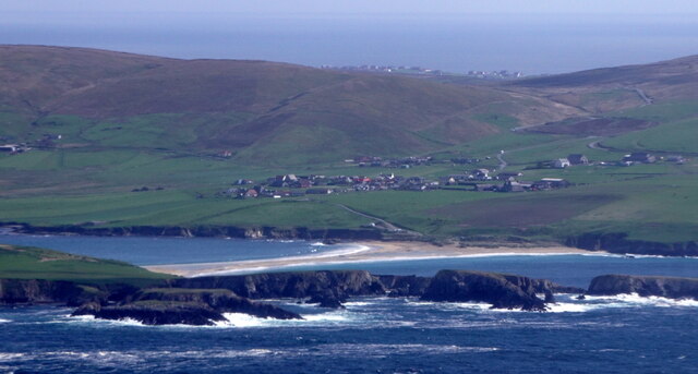
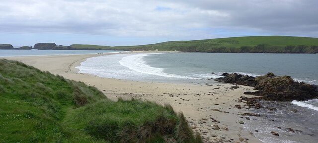
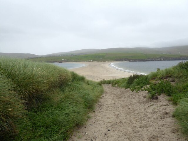
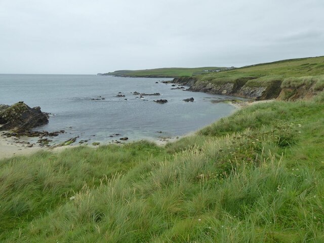
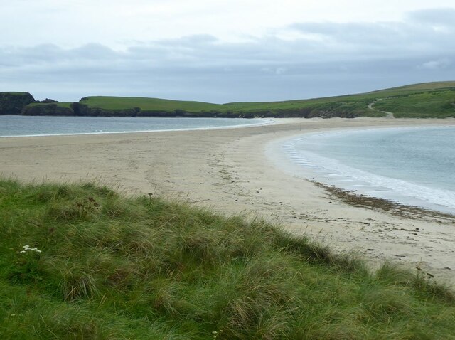
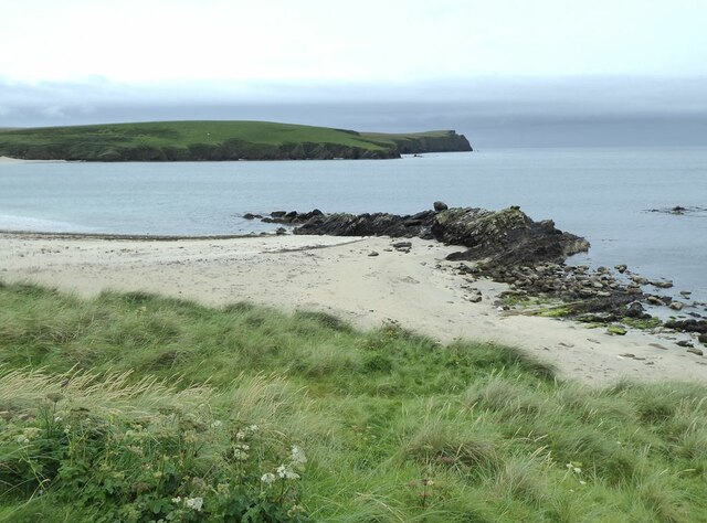
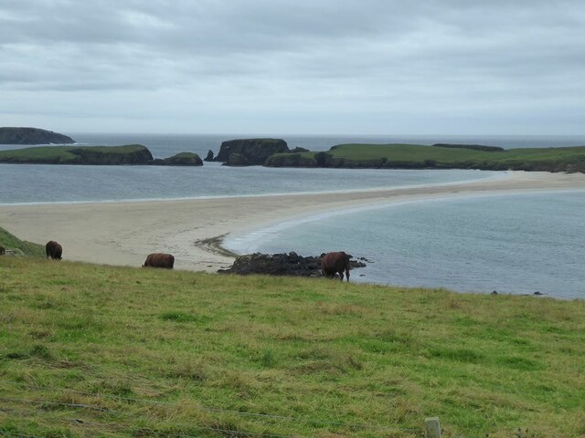
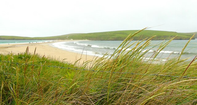
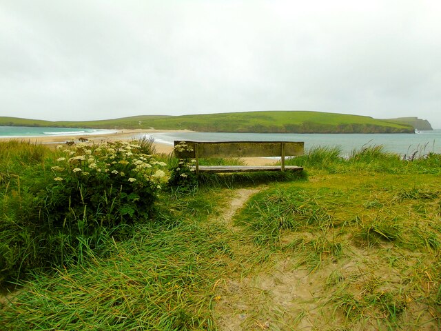
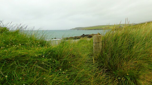
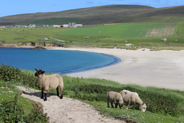
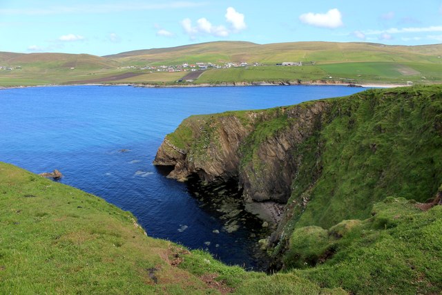
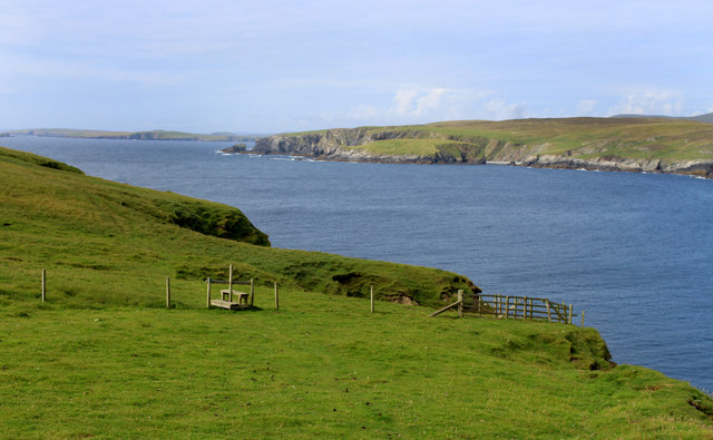
Cannygates is a small hamlet located in the northern part of the Shetland Islands in Scotland. It is situated near the town of Brae and is surrounded by picturesque countryside and rugged coastline. The area is known for its stunning natural beauty, with rolling hills, rocky cliffs, and pristine beaches.

Cannygates is a peaceful and remote place, perfect for those looking to escape the hustle and bustle of city life. The hamlet is home to a small community of residents who enjoy a close-knit and friendly atmosphere. The traditional Shetland culture is still very much alive in Cannygates, with many residents participating in activities such as traditional music, dancing, and crafts.

Visitors to Cannygates can enjoy exploring the surrounding countryside, taking in the breathtaking views, and spotting local wildlife such as seabirds, seals, and otters. The area is also a great spot for outdoor activities such as hiking, fishing, and birdwatching. Overall, Cannygates offers a peaceful and scenic retreat for those seeking a taste of rural Scottish life.

If you have any feedback on the listing, please let us know in the comments section below.

Cannygates Images

Images are sourced within 2km of 59.975971/-1.3123711 or Grid Reference HU3821. Thanks to Geograph Open Source API. All images are credited.

St Ninian's Ayre from the air
St Ninian's Ayre
St Ninian's Ayre
St Ninian's Ayre
St Ninian's Ayre
Track on St Ninian's Isle Leading down to the tombolo which ties the island to the mainland.
Track on St Ninian's Isle
Leading down to the tombolo which ties the island to the mainland.
Ruins of St Ninian's Chapel In the middle distance, the tombolo which ties St Ninian's Isle to the mainland.
Ruins of St Ninian's Chapel
In the middle distance, the tombolo which ties St Ninian's Isle to the mainland.
Rocky shore at Bigton
Tombolo linking Mainland to St Ninian's Isle A textbook example of a tombolo. Bigton Wick to the right, St Ninian's Bay to the left.
Tombolo linking Mainland to St Ninian's Isle
A textbook example of a tombolo. Bigton Wick to the right, St Ninian's Bay to the left.
Bigton Wick Looking across the bay to St Ninian's Isle.
Bigton Wick
Looking across the bay to St Ninian's Isle.
View from Bigton Looking over the tombolo towards St Ninian's Bay and the southern end of St Ninian's Isle.
View from Bigton
Looking over the tombolo towards St Ninian's Bay and the southern end of St Ninian's Isle.
View north from Bigton Ireland Wick and the hamlet of Ireland on the far hillside.
View north from Bigton
Ireland Wick and the hamlet of Ireland on the far hillside.
Tombolo at St Ninian's Isle Taken on St Ninian's beach at Bigton, Shetland, I am looking along the tombolo linking the mainland to St Ninian's Isle, site of the remains of St Ninian's Chapel.
Tombolo at St Ninian's Isle
Taken on St Ninian's beach at Bigton, Shetland, I am looking along the tombolo linking the mainland to St Ninian's Isle, site of the remains of St Ninian's Chapel.
St Ninian's Bay I am standing at the mainland end of the tombolo leading to St Ninian's Isle and looking south down St Ninian's Bay towards Inns Holm with Colsay off to the right. Northern Ness, Fora Ness and Noss Hill can be gilmpsed in the clouded distance.
St Ninian's Bay
I am standing at the mainland end of the tombolo leading to St Ninian's Isle and looking south down St Ninian's Bay towards Inns Holm with Colsay off to the right. Northern Ness, Fora Ness and Noss Hill can be gilmpsed in the clouded distance.
St Ninian's Isle I am just above the beach at Bigton Wick and looking across to the north end of St Ninian's Isle where the ruins of St Ninian's Chapel are to be found. The cliffs of Scarfi Taing are discernible to the right.
St Ninian's Isle
I am just above the beach at Bigton Wick and looking across to the north end of St Ninian's Isle where the ruins of St Ninian's Chapel are to be found. The cliffs of Scarfi Taing are discernible to the right.
Ireland Wick to Griskerry I am on St Ninian's beach, Bigton, Shetland, and looking north west along the coast past the Wick of Ireland (and the settlement of Ireland behind it) towards Griskerry, the summit of which can be glimpsed on the horizon (centre of shot).
Ireland Wick to Griskerry
I am on St Ninian's beach, Bigton, Shetland, and looking north west along the coast past the Wick of Ireland (and the settlement of Ireland behind it) towards Griskerry, the summit of which can be glimpsed on the horizon (centre of shot).
St Ninian's Sheep Looking eastwards from St Ninian's Isle over the sand bar to Bigton.
St Ninian's Sheep
Looking eastwards from St Ninian's Isle over the sand bar to Bigton.
Scarfi Taing The easternmost point of St Ninian's Isle, discounting the sand bar.
Scarfi Taing
The easternmost point of St Ninian's Isle, discounting the sand bar.
Pathway, St Ninian's Isle St Ninian's Isle seems to be mostly sandy grassland and easy to wander about on.
At least, the bits we went to were.
The Isle is home to a lot of sheep and there are a number of fences.
Pathway, St Ninian's Isle
St Ninian's Isle seems to be mostly sandy grassland and easy to wander about on. At least, the bits we went to were. The Isle is home to a lot of sheep and there are a number of fences.
Beach at St Ninian's Isle Bigton Wick beach on the north side of the sand bar.
Beach at St Ninian's Isle
Bigton Wick beach on the north side of the sand bar.
Show me another place!

Cannygates is located at Grid Ref: HU3821 (Lat: 59.975971, Lng: -1.3123711)

Unitary Authority: Shetland Islands

Police Authority: Highlands and Islands

What 3 Words

///lines.twinge.habits. Near Sandwick, Shetland Islands

Nearby Locations

Cannygates Williamsetter

Related Wikis

Bigton

Bigton is a small settlement on South Mainland, Shetland, UK. Bigton is within the civil parish of Dunrossness.Bigton lies on the Atlantic coast of the...

St Ninian's Isle

St Ninian's Isle is a small tied island connected by the largest tombolo in the UK to the south-western coast of the Mainland, Shetland, in Scotland. It...

Levenwick

Levenwick is a small village about 17 miles (27 km) south of Lerwick, on the east side of the South Mainland of Shetland, Scotland. It is part of the parish...

Scousburgh

Scousburgh is a small community in the parish of Dunrossness, in the South Mainland of Shetland, Scotland, overlooking the picturesque Scousburgh Sand...

Nearby Amenities

Located within 500m of 59.975971,-1.3123711
Bus Stop
Bigton
Bus: yes
Public Transport: platform
Lat/Long: 59.9757035/-1.3206548
Bus Stop
Bus: yes
Public Transport: platform
Shelter: yes
Lat/Long: 59.9759697/-1.312229
Entrance: yes
Lat/Long: 59.9743397/-1.3128602
Power: pole
Lat/Long: 59.972398/-1.3167045
Power: pole
Lat/Long: 59.9730905/-1.3165677
Power: pole
Lat/Long: 59.9736234/-1.3164765
Power: pole
Lat/Long: 59.9741777/-1.3163665
Power: pole
Lat/Long: 59.9748837/-1.3162324
Power: pole
Lat/Long: 59.9756178/-1.3160875
Power: pole
Lat/Long: 59.9802209/-1.311965
Power: pole
Lat/Long: 59.9796895/-1.3120267
Power: pole
Lat/Long: 59.9791393/-1.312075
Power: pole
Lat/Long: 59.9786025/-1.3121501
Power: pole
Lat/Long: 59.9781811/-1.3117665
Power: pole
Lat/Long: 59.9763063/-1.3159588
Power: pole
Lat/Long: 59.9766619/-1.3158944
Power: pole
Lat/Long: 59.9772981/-1.3157737
Power: pole
Lat/Long: 59.9774725/-1.3141724
Power: pole
Lat/Long: 59.9776523/-1.3124371
Power: pole
Lat/Long: 59.9777423/-1.3113669
Power: pole
Lat/Long: 59.977812/-1.3102001
Power: pole
Lat/Long: 59.9778966/-1.3090226
Power: pole
Lat/Long: 59.9780053/-1.3078344
Power: pole
Lat/Long: 59.9781328/-1.3066569
Power: pole
Lat/Long: 59.9783341/-1.3048813
Power: pole
Lat/Long: 59.9746466/-1.3198214
Power: pole
Lat/Long: 59.974716/-1.3186688
Power: pole
Lat/Long: 59.9748073/-1.3174168
Power: pole
Lat/Long: 59.9747345/-1.315056
Power: pole
Lat/Long: 59.97459/-1.3139079
Power: pole
Lat/Long: 59.974516/-1.3126282
Give Way
Direction: backward
Lat/Long: 59.975877/-1.3125158
Give Way
Direction: forward
Lat/Long: 59.9760257/-1.3123975
The data included in this document is from www.openstreetmap.org. The data is made available under ODbL.

Have you been to Cannygates?

Leave your review of Cannygates below (or comments, questions and feedback).