Calver Low

Settlement in Derbyshire Derbyshire Dales

England

Calver Low

Woodland behind the Eyre Arms This woodland on this hill behind the Eyre Arms is just to the south-west of the centre of SK27.
Woodland behind the Eyre Arms Credit: Roger Temple

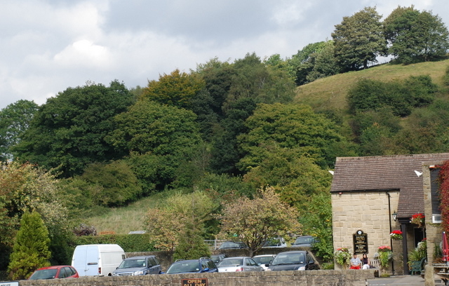
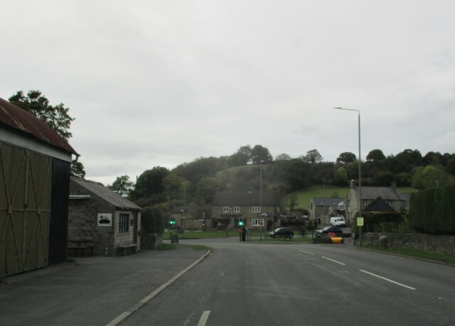
Calver Low is a small village located in the Derbyshire Dales district of Derbyshire, England. Situated on the eastern bank of the River Derwent, it is nestled within the beautiful Peak District National Park. With a population of around 800 residents, Calver Low offers a tranquil and picturesque setting.

The village is renowned for its stunning natural landscapes, with rolling hills, meandering rivers, and lush greenery dominating the scenery. It is particularly famous for its close proximity to Calver Rocks, a towering gritstone crag that attracts climbers and hikers alike. The rocks provide breathtaking views of the surrounding countryside and are a popular spot for outdoor enthusiasts.

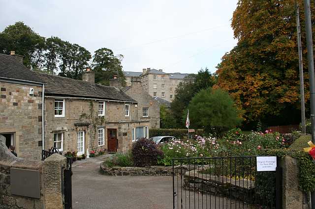
Calver Low boasts a rich history, with evidence of human habitation dating back to the Bronze Age. The village grew during the Industrial Revolution, with the construction of the Derbyshire and Staffordshire Canal and the arrival of the railway, which facilitated the transportation of limestone and gritstone from local quarries. Today, remnants of this industrial heritage can still be seen, adding to the village's character.

Despite its small size, Calver Low has a strong sense of community and offers a range of amenities for its residents. These include a primary school, a village hall, a post office, and a few local shops and pubs. It also benefits from its proximity to nearby towns and villages, such as Bakewell and Matlock, which provide additional services and attractions.

In summary, Calver Low is a charming village nestled within the stunning Peak District National Park. With its natural beauty, rich history, and close-knit community, it offers a peaceful retreat for both residents and visitors alike.

If you have any feedback on the listing, please let us know in the comments section below.

Calver Low Images

Images are sourced within 2km of 53.268579/-1.6435618 or Grid Reference SK2374. Thanks to Geograph Open Source API. All images are credited.

Woodland behind the Eyre Arms This woodland on this hill behind the Eyre Arms is just to the south-west of the centre of SK27.
Woodland behind the Eyre Arms
This woodland on this hill behind the Eyre Arms is just to the south-west of the centre of SK27.
Guide Post Stone guide post located at entrance to Knouchley Farm.
I wonder if it has been relocated from the roadside
Guide Post
Stone guide post located at entrance to Knouchley Farm. I wonder if it has been relocated from the roadside
Hassop  Road  into  Calver  Low
Hassop Road into Calver Low
Traffic  lights  at  junction  with  A623 Hassop Road B6001 into Calver Low. Eyre Arms centre over the A623
Traffic lights at junction with A623
Hassop Road B6001 into Calver Low. Eyre Arms centre over the A623
Entering  Stoney  Middleton  on  The  Avenue  A623
Entering Stoney Middleton on The Avenue A623
The  Avenue  Stoney  Middleton The A623 runs through Stoney Middleton
The Avenue Stoney Middleton
The A623 runs through Stoney Middleton
Street  scene  and  junction  in  Stoney  Middleton The large cross to the left is not mentioned in Pevsners but it has 186? carved on the cross. The A623 goes through the village
Street scene and junction in Stoney Middleton
The large cross to the left is not mentioned in Pevsners but it has 186? carved on the cross. The A623 goes through the village
Cottages  under  cliff  and  A623  through  Middleton  Dale The cliff is called Lovers Leap!!!
Cottages under cliff and A623 through Middleton Dale
The cliff is called Lovers Leap!!!
Cottages  under  cliffs  in  Middleton  Dale On A623
Cottages under cliffs in Middleton Dale
On A623
Out  of  Stoney  Middleton  on  the  A623  through  Middleton  Dale
Out of Stoney Middleton on the A623 through Middleton Dale
View from Baslow Edge  Looking over the Derwent Valley and the villages of Calver and Stoney Middleton.
View from Baslow Edge
Looking over the Derwent Valley and the villages of Calver and Stoney Middleton.
Fuel Filling Station near Calver
Autumn colour on Hassop Road The B6001 looking south west towards Hassop.
Autumn colour on Hassop Road
The B6001 looking south west towards Hassop.
The B6001 Hassop Road Looking southwest through the 'tree tunnel'.
The B6001 Hassop Road
Looking southwest through the 'tree tunnel'.
The Riley Graves Eyam the famous Plague village in Derbyshire has on its outskirts this walled area that contains a number of graves of the Riley family who died during the time of the plague.
The Riley Graves
Eyam the famous Plague village in Derbyshire has on its outskirts this walled area that contains a number of graves of the Riley family who died during the time of the plague.
Path towards St Mary's Wood
Bramley Lane
Bramley Lane
Path through Bank Wood
Show me another place!

Calver Low is located at Grid Ref: SK2374 (Lat: 53.268579, Lng: -1.6435618)

Administrative County: Derbyshire

District: Derbyshire Dales

Police Authority: Derbyshire

What 3 Words

///tiptoes.tradition.sweeter. Near Baslow, Derbyshire

Nearby Locations

Calver Low Calver

Related Wikis

Calver

Calver (Old English Calf Slope) is a village and civil parish in Derbyshire, England. The population of the civil parish at the 2011 census was 710....

Upper Derwent Valley

The Upper Derwent Valley is an area of the Peak District National Park in England. It largely lies in Derbyshire, but its north eastern area lies in Sheffield...

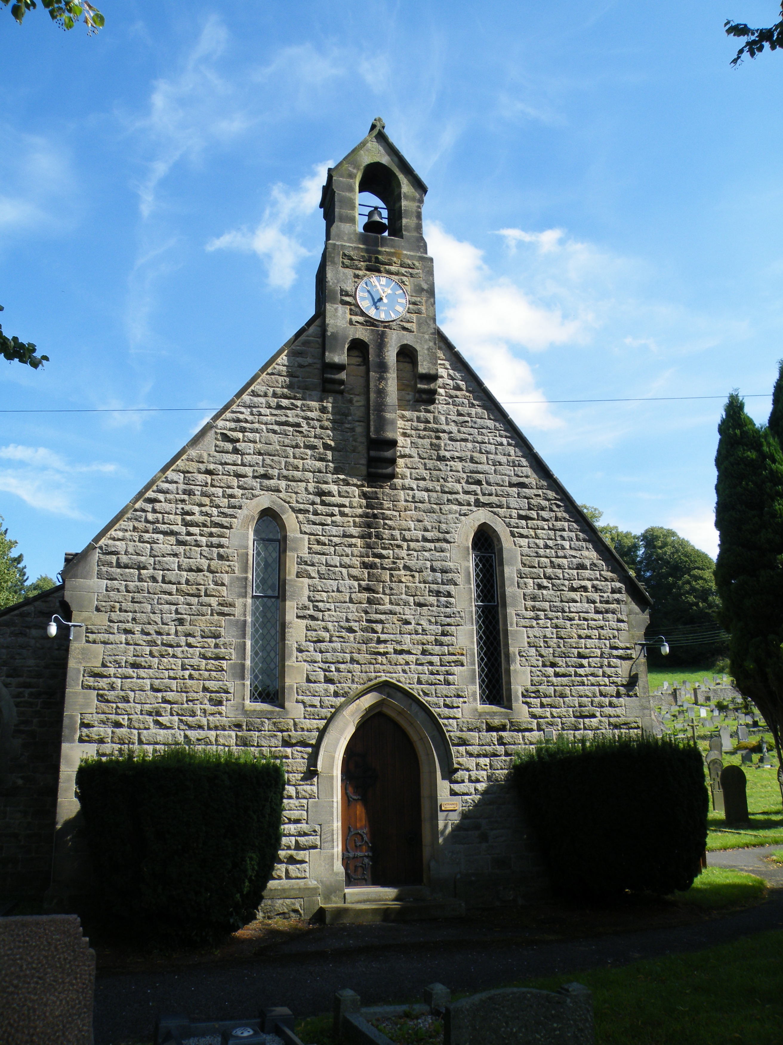
All Saints' Church, Curbar

All Saints’ Church, Curbar is a Church of England parish church in Curbar, Derbyshire. == History == Until the church was built, the nearest parish church...

Middleton Hall, Stoney Middleton

Middleton Hall is a restored 17th-century country house at Stoney Middleton, Derbyshire. It is a Grade II listed building. The house was built in the mid...

Nearby Amenities

Located within 500m of 53.268579,-1.6435618
Traffic Signals
Source: survey
Lat/Long: 53.2699173/-1.6429255
Calver
Is In: Derbyshire, England, UK
Place: village
Wikidata: Q2073921
Wikipedia: en:Calver
Lat/Long: 53.2684861/-1.6414898
Pub
The Derwentwater Arms
Lat/Long: 53.268364/-1.6411023
Hare Knoll
Natural: peak
Lat/Long: 53.2708583/-1.6384489
Calver Sough
Place: village
Lat/Long: 53.2700502/-1.6427789
Cafe
Cafe 19 at Whites
Addr City: Hope Valley
Addr Postcode: S32 3XH
Addr Street: Kingsgate
Addr Suburb: Calver
Contact Facebook: https://www.facebook.com/Cafe19atwhites/
Lat/Long: 53.2697342/-1.6424821
Barrier: stile
Source: survey;gps
Stile: squeezer
Lat/Long: 53.2688615/-1.6437036
Barrier: stile
Material: wood
Source: survey;gps
Stile: stepover
Lat/Long: 53.2691563/-1.645171
Barrier: stile
Material: stone
Source: survey;gps
Step Count: 2
Stile: stepover
Lat/Long: 53.2665639/-1.6446355
Cycleway: asl
Source: bing
Lat/Long: 53.2697268/-1.6428617
Cycleway: asl
Direction: forward
Source: bing
Lat/Long: 53.2701396/-1.6430987
Cycleway: asl
Source: bing
Lat/Long: 53.2698864/-1.6425365
Cycleway: asl
Source: bing
Lat/Long: 53.2699729/-1.6433938
Give Way
Direction: forward
Lat/Long: 53.2727962/-1.6433165
Calver (Shaldon)
Bus: yes
Public Transport: stop_position
Lat/Long: 53.2723774/-1.6434072
Barrier: stile
Material: stone
Source: survey;gps
Stile: squeezer
Lat/Long: 53.2640839/-1.6435934
Barrier: stile
Material: stone
Source: survey;gps
Stile: squeezer
Lat/Long: 53.2645368/-1.6434033
Barrier: stile
Material: stone
Source: survey;gps
Stile: squeezer
Lat/Long: 53.2665489/-1.6400864
Barrier: stile
Material: stone
Source: survey;gps
Stile: squeezer
Lat/Long: 53.266555/-1.640925
Barrier: stile
Material: stone
Source: survey;gps
Stile: squeezer
Lat/Long: 53.2665875/-1.641057
Barrier: entrance
Source: survey;gps
Lat/Long: 53.2672288/-1.6411239
Natural: stone
Lat/Long: 53.2685491/-1.6460589
Post Office
Calver Post Office
Addr City: Hope Valley
Addr Postcode: S32 3XH
Addr Suburb: Calver
Opening Hours: Mo-Su 07:00-22:00
Ref Pol Id: 126118
Lat/Long: 53.2696492/-1.6421731
Historic: memorial
Lat/Long: 53.2678153/-1.6408699
Post Box
Collection Times: Mo-Fr 16:30; Sa 11:00
Note: Re-located from old Post Office, Main Street in 2015
Post Box Type: wall
Ref: S32 200
Royal Cypher: VR
Lat/Long: 53.2697002/-1.642078
Defibrillator
Access: yes
Check Date: 2023-03-09
Defibrillator Location: On outside wall. Available 24/7.
Emergency: defibrillator
Indoor: no
Opening Hours: 24/7
Ref GB The Circuit: 9DD63F59-C1CA-4D2F-92A3-3592785CEBCA
Lat/Long: 53.2697853/-1.6422877
Calver (Shaldon)
Bus: yes
Public Transport: stop_position
Lat/Long: 53.2720283/-1.6435391
Bus Stop
Calver Hassop Road
Bus: yes
Public Transport: platform
Lat/Long: 53.2683744/-1.6435052
Calver Hassop Road
Bus: yes
Public Transport: stop_position
Lat/Long: 53.2683754/-1.6435641
Bus Stop
Calver Hassop Road
Bus: yes
Naptan AtcoCode: 1000DCHR3746
Naptan NaptanCode: dbsdpgaj
Public Transport: platform
Lat/Long: 53.2672011/-1.6443549
Calver Hassop Road
Bus: yes
Public Transport: stop_position
Lat/Long: 53.267187/-1.6442698
Bus Stop
Calver (Shaldon)
Bus: yes
Public Transport: platform
Lat/Long: 53.2723671/-1.6433448
Bus Stop
Calver (Shaldon)
Bus: yes
Public Transport: platform
Lat/Long: 53.2720274/-1.6436139
Bus Stop
Calver Sough
Bus: yes
Naptan AtcoCode: 1000DCSG3244
Naptan NaptanCode: dbsajtpj
Public Transport: platform
Lat/Long: 53.2706103/-1.6435716
Bus Stop
Calver Sough
Bus: yes
Naptan AtcoCode: 1000DCSG3312
Naptan NaptanCode: dbsajtpm
Public Transport: platform
Lat/Long: 53.2706299/-1.6433255
Calver Sough
Bus: yes
Public Transport: stop_position
Lat/Long: 53.2706388/-1.643469
Calver Sough
Bus: yes
Public Transport: stop_position
Lat/Long: 53.2706116/-1.64345
Bus Stop
Calver Crossroads
Bus: yes
Public Transport: platform
Lat/Long: 53.2700525/-1.6437771
Calver Crossroads
Bus: yes
Public Transport: stop_position
Lat/Long: 53.2700936/-1.6437577
Bus Stop
Calver Crossroads
Bus: yes
Naptan AtcoCode: 1000DCSG3080
Naptan NaptanCode: dbsajtpd
Public Transport: platform
Lat/Long: 53.2703202/-1.6441289
Calver Crossroads
Bus: yes
Public Transport: stop_position
Lat/Long: 53.2702865/-1.6441747
Defibrillator
Access: yes
Check Date: 2023-03-09
Defibrillator Location: On outside wall. Available 24/7.
Emergency: defibrillator
Indoor: no
Lat/Long: 53.2664105/-1.6374398
Generator Method: photovoltaic
Generator Output Electricity: yes
Generator Source: solar
Generator Type: solar_photovoltaic_panel
Location: roof
Power: generator
Lat/Long: 53.2682158/-1.6426185
Generator Method: photovoltaic
Generator Output Electricity: yes
Generator Source: solar
Generator Type: solar_photovoltaic_panel
Location: roof
Power: generator
Lat/Long: 53.2680875/-1.64242
Generator Method: photovoltaic
Generator Output Electricity: yes
Generator Source: solar
Generator Type: solar_photovoltaic_panel
Location: roof
Power: generator
Lat/Long: 53.2682736/-1.642015
Generator Method: photovoltaic
Generator Output Electricity: yes
Generator Source: solar
Generator Type: solar_photovoltaic_panel
Location: roof
Power: generator
Lat/Long: 53.2690644/-1.6395929
Generator Method: photovoltaic
Generator Output Electricity: yes
Generator Source: solar
Generator Type: solar_photovoltaic_panel
Location: roof
Power: generator
Lat/Long: 53.266584/-1.6370815
Generator Method: photovoltaic
Generator Output Electricity: yes
Generator Source: solar
Generator Type: solar_photovoltaic_panel
Location: roof
Power: generator
Lat/Long: 53.2666112/-1.6369983
Generator Method: photovoltaic
Generator Output Electricity: yes
Generator Source: solar
Generator Type: solar_photovoltaic_panel
Location: roof
Power: generator
Lat/Long: 53.2666209/-1.6368133
Location Transition: yes
Operator: National Grid Electricity Distribution
Power: pole
Lat/Long: 53.2661827/-1.6389075
Location Transition: yes
Material: wood
Operator: National Grid Electricity Distribution
Power: pole
Lat/Long: 53.2729472/-1.6450645
Defibrillator
Access: yes
Defibrillator Location: On outside wall of shed next to football field.
Emergency: defibrillator
Indoor: no
Ref GB The Circuit: 1926129B-D7A8-41AE-85D8-AC0E00A8C2CF
Lat/Long: 53.2718369/-1.6484435
Board Type: map
Information: board
Tourism: information
Lat/Long: 53.2719692/-1.6482105
Barrier: stile
Step Count: 3
Stile: stepover
Lat/Long: 53.2712672/-1.6495057
Direction: 38
Tourism: viewpoint
Lat/Long: 53.2684854/-1.6459943
Noexit: yes
Lat/Long: 53.2683795/-1.6450408
Access: private
Barrier: stile
Lat/Long: 53.2684006/-1.6450611
Bench
Backrest: yes
Lat/Long: 53.268996/-1.6414086
Bench
Backrest: yes
Lat/Long: 53.26887/-1.6407735
Bench
Backrest: no
Lat/Long: 53.2678159/-1.6408482
The data included in this document is from www.openstreetmap.org. The data is made available under ODbL.

Have you been to Calver Low?

Leave your review of Calver Low below (or comments, questions and feedback).