Brynhyfryd

Settlement in Carmarthenshire

Wales

Brynhyfryd

Railway curve This railway is part of the Heart of Wales railway which carries passengers from Swansea to Shrewsbury.  At this stage it's also double line which betrays the fact that it's also a mineral line carrying steel from nearby works.
Railway curve Credit: Hywel Williams

Brynhyfryd is a small village located in the county of Carmarthenshire, Wales. It is nestled in the picturesque countryside, surrounded by rolling hills and lush green fields. The village is situated approximately 4 miles north of the market town of Carmarthen, making it easily accessible for residents and visitors alike.

Despite its small size, Brynhyfryd has a close-knit community that takes pride in preserving its rural charm and traditional way of life. The village is characterized by a collection of charming cottages and a scattering of larger houses, all of which contribute to the village's quaint and idyllic atmosphere.

Although predominantly residential, Brynhyfryd benefits from a few local amenities. These include a community hall, where various events and gatherings take place, and a small village shop that caters to the daily needs of its residents. The village is also home to a primary school, providing education to the local children.

One of the main attractions of Brynhyfryd is its stunning natural surroundings. The village is situated in close proximity to the Brechfa Forest, a popular destination for outdoor enthusiasts. Here, visitors can enjoy walking, cycling, and horse riding along the numerous trails that wind through the woodland. The forest is also home to an array of wildlife, making it a haven for nature lovers.

Overall, Brynhyfryd offers a tranquil and serene living environment, perfect for those seeking a peaceful retreat amidst the beauty of the Carmarthenshire countryside.

If you have any feedback on the listing, please let us know in the comments section below.
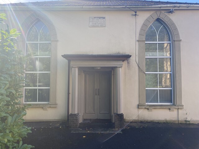
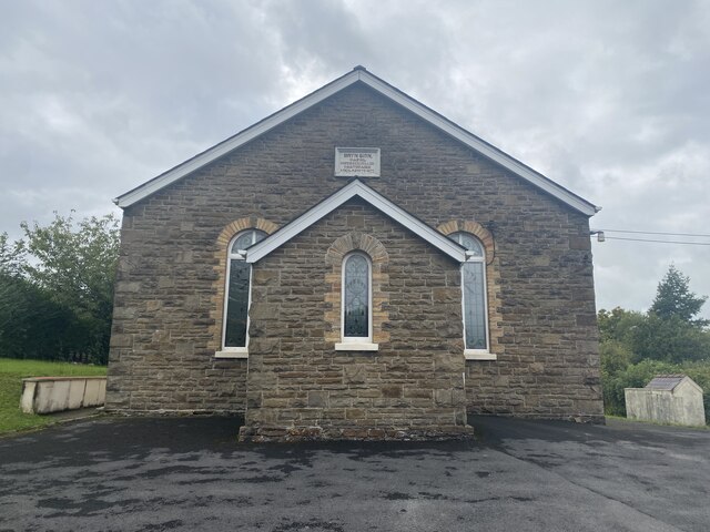
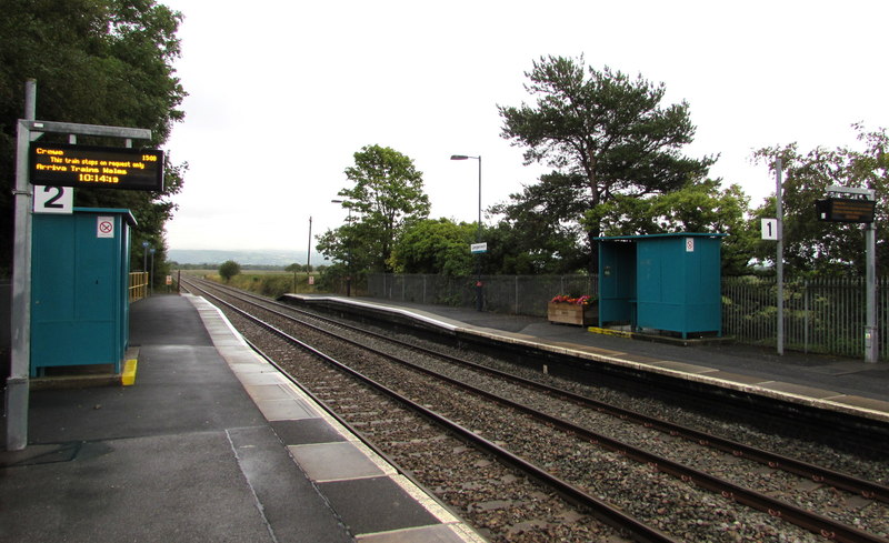
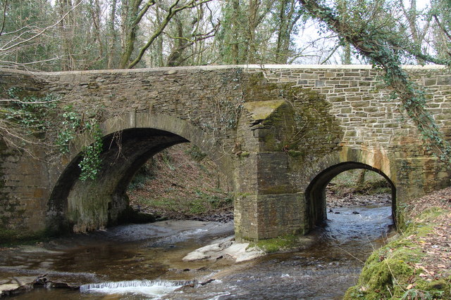
Brynhyfryd Images

Images are sourced within 2km of 51.691912/-4.0862864 or Grid Reference SN5501. Thanks to Geograph Open Source API. All images are credited.

Railway curve This railway is part of the Heart of Wales railway which carries passengers from Swansea to Shrewsbury.  At this stage it's also double line which betrays the fact that it's also a mineral line carrying steel from nearby works.
Railway curve
This railway is part of the Heart of Wales railway which carries passengers from Swansea to Shrewsbury. At this stage it's also double line which betrays the fact that it's also a mineral line carrying steel from nearby works.
Road junction in Station Road, Bynea
Footpath alongside Afon Llwchwr
New housing in Llangennech
Maes Ty Gwyn Street Sign A picture of a street sign for Maes Ty Gwyn near the river.
Maes Ty Gwyn Street Sign
A picture of a street sign for Maes Ty Gwyn near the river.
Welcome to Llangennech Sign A sign to welcome people to Llangennech. It is in Welsh and English.
Welcome to Llangennech Sign
A sign to welcome people to Llangennech. It is in Welsh and English.
Neuadd y Bryn / Bryn Hall The community hall for Bryn
Neuadd y Bryn / Bryn Hall
The community hall for Bryn
Bethesda Chapel The front of Bethesda Chapel
Bethesda Chapel
The front of Bethesda Chapel
Bethesda Capel Bach The small chapel next to the bigger Bethesda Chapel
Bethesda Capel Bach
The small chapel next to the bigger Bethesda Chapel
The Bridge restaurant and public house
Capel Bryn Seion, Llangennech The front view of the chapel in front of the gate
Capel Bryn Seion, Llangennech
The front view of the chapel in front of the gate
Llangennech Cemetery Entrance The entrance to Llangennech Cemetery with a sign
Llangennech Cemetery Entrance
The entrance to Llangennech Cemetery with a sign
Bicycle Parking at Llangennech Railway Station Four Sheffield stands located just outside the platforms at Llangennech Railway Station.
Bicycle Parking at Llangennech Railway Station
Four Sheffield stands located just outside the platforms at Llangennech Railway Station.
Llangennech Mural A mural depicting Llangennech's history in an underpass in the village. This picture shows a miner next to the now closed Morlais Colliery. Huw Edwards, who grew up in the village is also shown next to the local rugby team's logo. This graffiti art was created by JenksArt.
Llangennech Mural
A mural depicting Llangennech's history in an underpass in the village. This picture shows a miner next to the now closed Morlais Colliery. Huw Edwards, who grew up in the village is also shown next to the local rugby team's logo. This graffiti art was created by JenksArt.
Ordnance Survey Cut Mark This OS cut mark can be found on the wall SE side of the old road. It marks a point 42.526m above mean sea level.
Ordnance Survey Cut Mark
This OS cut mark can be found on the wall SE side of the old road. It marks a point 42.526m above mean sea level.
Talyclun Bus Stop A bus stop in Talyclun, Llangennech
Talyclun Bus Stop
A bus stop in Talyclun, Llangennech
Llangennech Sewage Works The entrance to Llangennech Sewage Works operated by Dŵr Cymru (Welsh Water).
Llangennech Sewage Works
The entrance to Llangennech Sewage Works operated by Dŵr Cymru (Welsh Water).
Llangennech railway level crossing Level crossing on the railway line from Llangennech.
Llangennech railway level crossing
Level crossing on the railway line from Llangennech.
Show me another place!

Brynhyfryd is located at Grid Ref: SN5501 (Lat: 51.691912, Lng: -4.0862864)

Unitary Authority: Carmarthenshire

Police Authority: Dyfed Powys

What 3 Words

///ashes.logic.remote. Near Grovesend, Swansea

Nearby Locations

Brynhyfryd Glanmwrwg

Related Wikis

Llangennech

Llangennech ([ɬæn'ɡenƏx]()) is a village and community in the area of Llanelli, Carmarthenshire, Wales, which covers an area of 1,222 hectares (4.72 sq...

Llangennech railway station

Llangennech railway station is a railway station in the village of Llangennech. It lies on the Heart of Wales line with services operated by Transport...

Bryn, Llanelli

Bryn (locally known using the Welsh: Y Bryn; meaning: "the Hill") is a village situated east of Llanelli in Carmarthenshire, Wales. It is part of the Llanelli...

Afon Morlais

The Afon Morlais is a small river in south Wales, a tributary of the River Loughor. It rises in the village of Cross Hands and then flows southwards through...

Llangennech derailment

On 26 August 2020 a freight train carrying diesel fuel and gas oil in tank wagons derailed at Morlais Junction, Llangennech, Carmarthenshire, Wales. Some...

St Michael's School, Llanelli

St. Michael's School (Welsh: Ysgol Mihangel Sant) is a private day and boarding school for pupils aged from 3 to 18 years old in Llanelli, Wales. The school...

Pen-y-graig, Carmarthenshire

Pen-y-graig, also spelled Penygraig (), is an area of Llanelli, in Carmarthenshire, Wales, bordering with Bynea, Llwynhendy, and Bryn all of which are...

Bynea

Bynea ( BIN-yə; Welsh: Bynie) is a village close to the River Loughor (Welsh: Afon Llwchwr) in Carmarthenshire, Wales. It also forms an electoral ward...

Nearby Amenities

Located within 500m of 51.691912,-4.0862864
Source: PGS
Lat/Long: 51.6888209/-4.0817021
Llangennech
Place: village
Wikidata: Q13644933
Wikipedia: en:Llangennech
Lat/Long: 51.6960022/-4.0834749
Bus: yes
Public Transport: stop_position
Lat/Long: 51.6938586/-4.0847188
Bus Stop
Brynhyfryd
Bench: yes
Bus: yes
Naptan AtcoCode: 5220CMA01567
Naptan NaptanCode: crmgmgp
Operator: First Cymru
Public Transport: platform
Shelter: yes
Lat/Long: 51.6907798/-4.0895051
Fixme: continue
Lat/Long: 51.6905204/-4.0831101
Post Box
Collection Times: Mo-Fr 09:00; Sa 07:00
Old Ref: SA14 423
Post Box Type: lamp
Ref: SA14 423D
Royal Cypher: EIIR
Royal Cypher Wikidata: Q33102113
Lat/Long: 51.6903772/-4.0899005
Barrier: cycle_barrier
Lat/Long: 51.6921103/-4.0899531
Barrier: cycle_barrier
Lat/Long: 51.6922166/-4.0898437
Barrier: kissing_gate
Lat/Long: 51.6925622/-4.0899288
Barrier: kissing_gate
Lat/Long: 51.6954065/-4.090354
Bench
Backrest: yes
Material: metal;wood
Seats: 2
Lat/Long: 51.6927081/-4.0889204
Barrier: cycle_barrier
Lat/Long: 51.6940061/-4.0865951
Pub
Farmers Arms
Outdoor Seating: yes
Smoking: outside
Wikidata: Q80856509
Lat/Long: 51.6956458/-4.0835226
Pub
Castle Arms Llangennech
Outdoor Seating: yes
Smoking: outside
Lat/Long: 51.694122/-4.0843019
Social Facility
Llandaff House Nursing Home
Social Facility: nursing_home
Social Facility For: senior
Lat/Long: 51.6929914/-4.084774
Grave Yard
Lat/Long: 51.6899254/-4.0866408
Direction: 195
Generator Method: photovoltaic
Generator Output Electricity: yes
Generator Solar Modules: 5
Generator Source: solar
Generator Type: solar_photovoltaic_panel
Location: roof
Power: generator
Lat/Long: 51.6947071/-4.0868805
Direction: 105
Generator Method: photovoltaic
Generator Output Electricity: yes
Generator Solar Modules: 10
Generator Source: solar
Generator Type: solar_photovoltaic_panel
Location: roof
Power: generator
Lat/Long: 51.6946911/-4.0867531
Direction: SSE
Generator Method: photovoltaic
Generator Output Electricity: yes
Generator Solar Modules: 20
Generator Source: solar
Generator Type: solar_photovoltaic_panel
Location: roof
Power: generator
Lat/Long: 51.6937317/-4.0800047
Direction: SSW
Generator Method: photovoltaic
Generator Output Electricity: yes
Generator Solar Modules: 16
Generator Source: solar
Generator Type: solar_photovoltaic_panel
Location: roof
Power: generator
Lat/Long: 51.6925197/-4.0811875
Direction: 175
Generator Method: photovoltaic
Generator Output Electricity: yes
Generator Solar Modules: 7
Generator Source: solar
Generator Type: solar_photovoltaic_panel
Location: roof
Power: generator
Lat/Long: 51.6878732/-4.0844357
Direction: 175
Generator Method: photovoltaic
Generator Output Electricity: yes
Generator Solar Modules: 7
Generator Source: solar
Generator Type: solar_photovoltaic_panel
Location: roof
Power: generator
Lat/Long: 51.6879039/-4.0844438
Direction: 255
Generator Method: photovoltaic
Generator Output Electricity: yes
Generator Solar Modules: 8
Generator Source: solar
Generator Type: solar_photovoltaic_panel
Location: roof
Power: generator
Lat/Long: 51.6886761/-4.0843281
Direction: 255
Generator Method: photovoltaic
Generator Output Electricity: yes
Generator Solar Modules: 8
Generator Source: solar
Generator Type: solar_photovoltaic_panel
Location: roof
Power: generator
Lat/Long: 51.6886692/-4.084364
Direction: 185
Generator Method: photovoltaic
Generator Output Electricity: yes
Generator Solar Modules: 16
Generator Source: solar
Generator Type: solar_photovoltaic_panel
Location: roof
Power: generator
Lat/Long: 51.6901853/-4.0852699
Direction: 145
Generator Method: photovoltaic
Generator Output Electricity: yes
Generator Solar Modules: 16
Generator Source: solar
Generator Type: solar_photovoltaic_panel
Location: roof
Note: module count approximate
Power: generator
Lat/Long: 51.6912407/-4.0849949
Direction: 305
Generator Method: photovoltaic
Generator Output Electricity: yes
Generator Solar Modules: 8
Generator Source: solar
Generator Type: solar_photovoltaic_panel
Location: roof
Power: generator
Lat/Long: 51.6921714/-4.0856333
Direction: 125
Generator Method: photovoltaic
Generator Output Electricity: yes
Generator Solar Modules: 8
Generator Source: solar
Generator Type: solar_photovoltaic_panel
Location: roof
Power: generator
Lat/Long: 51.6921514/-4.0855904
Direction: 185
Generator Method: photovoltaic
Generator Output Electricity: yes
Generator Solar Modules: 6
Generator Source: solar
Generator Type: solar_photovoltaic_panel
Location: roof
Power: generator
Lat/Long: 51.6904646/-4.0895239
Direction: 95
Generator Method: photovoltaic
Generator Output Electricity: yes
Generator Solar Modules: 8
Generator Source: solar
Generator Type: solar_photovoltaic_panel
Location: roof
Power: generator
Lat/Long: 51.6904945/-4.0894662
Direction: 145
Generator Method: photovoltaic
Generator Output Electricity: yes
Generator Solar Modules: 12
Generator Source: solar
Generator Type: solar_photovoltaic_panel
Location: roof
Power: generator
Lat/Long: 51.6910756/-4.088856
Direction: 235
Generator Method: photovoltaic
Generator Output Electricity: yes
Generator Solar Modules: 15
Generator Source: solar
Generator Type: solar_photovoltaic_panel
Location: roof
Power: generator
Lat/Long: 51.6910389/-4.0891135
Direction: 145
Generator Method: photovoltaic
Generator Output Electricity: yes
Generator Solar Modules: 11
Generator Source: solar
Generator Type: solar_photovoltaic_panel
Location: roof
Power: generator
Lat/Long: 51.6913508/-4.0882498
Direction: 105
Generator Method: photovoltaic
Generator Output Electricity: yes
Generator Solar Modules: 8
Generator Source: solar
Generator Type: solar_photovoltaic_panel
Location: roof
Power: generator
Lat/Long: 51.691567/-4.0893468
Direction: 195
Generator Method: photovoltaic
Generator Output Electricity: yes
Generator Solar Modules: 8
Generator Source: solar
Generator Type: solar_photovoltaic_panel
Location: roof
Power: generator
Lat/Long: 51.691547/-4.0894243
Direction: 235
Generator Method: photovoltaic
Generator Output Electricity: yes
Generator Solar Modules: 16
Generator Source: solar
Generator Type: solar_photovoltaic_panel
Location: roof
Power: generator
Lat/Long: 51.6916663/-4.0895517
Direction: SSW
Generator Method: photovoltaic
Generator Output Electricity: yes
Generator Solar Modules: 6
Generator Source: solar
Generator Type: solar_photovoltaic_panel
Location: roof
Power: generator
Lat/Long: 51.6917731/-4.0889874
Direction: 190
Generator Method: photovoltaic
Generator Output Electricity: yes
Generator Solar Modules: 23
Generator Source: solar
Generator Type: solar_photovoltaic_panel
Location: roof
Power: generator
Lat/Long: 51.6920714/-4.0887725
Direction: 185
Generator Method: photovoltaic
Generator Output Electricity: yes
Generator Solar Modules: 12
Generator Source: solar
Generator Type: solar_photovoltaic_panel
Location: roof
Power: generator
Lat/Long: 51.6923634/-4.0888694
Direction: 195
Generator Method: photovoltaic
Generator Output Electricity: yes
Generator Solar Modules: 16
Generator Source: solar
Generator Type: solar_photovoltaic_panel
Location: roof
Power: generator
Lat/Long: 51.6919777/-4.0905055
Direction: 235
Generator Method: photovoltaic
Generator Output Electricity: yes
Generator Solar Modules: 16
Generator Source: solar
Generator Type: solar_photovoltaic_panel
Location: roof
Power: generator
Lat/Long: 51.6909967/-4.0909347
Direction: SSW
Generator Method: photovoltaic
Generator Output Electricity: yes
Generator Solar Modules: 12
Generator Source: solar
Generator Type: solar_photovoltaic_panel
Location: roof
Power: generator
Lat/Long: 51.6919394/-4.0920253
Direction: SSW
Generator Method: photovoltaic
Generator Output Electricity: yes
Generator Solar Modules: 12
Generator Source: solar
Generator Type: solar_photovoltaic_panel
Location: roof
Power: generator
Lat/Long: 51.6917366/-4.0931472
Post Box
Colour: Red
Operator: Royal Mail
Lat/Long: 51.6932851/-4.0851632
Bus Stop
Brynhyfryd
Bus: yes
Naptan AtcoCode: 5220CMA01568
Naptan NaptanCode: crmgmgt
Operator: First Cymru
Public Transport: platform
Shelter: yes
Lat/Long: 51.690335/-4.0900116
Fast Food
Zilani's
Cuisine: indian
Lat/Long: 51.695598/-4.0835571
Llangennech Fish & Chip's
Cuisine: fish_and_chips
Disused Amenity: fast_food
Drive Through: no
Lat/Long: 51.6955316/-4.0836003
Defibrillator
Emergency: defibrillator
Indoor: no
Lat/Long: 51.69539/-4.0836811
Bench
Lat/Long: 51.6901473/-4.0814498
Playground: swing
Lat/Long: 51.6916547/-4.0815281
Playground: swing
Lat/Long: 51.6915813/-4.0815264
Playground: seesaw
Lat/Long: 51.6915287/-4.0812309
Barrier: swing_gate
Lat/Long: 51.691508/-4.081383
Playground: structure
Lat/Long: 51.6916671/-4.081324
Playground: structure
Lat/Long: 51.6915582/-4.0813948
Playground: structure
Playground Theme: playground
Wheelchair: no
Lat/Long: 51.6916302/-4.0812078
Man Made: mast
Tower Type: lighting
Lat/Long: 51.6911887/-4.0794609
Man Made: mast
Tower Type: lighting
Lat/Long: 51.6913496/-4.0796423
Man Made: mast
Tower Type: lighting
Lat/Long: 51.6915119/-4.079832
Man Made: mast
Tower Type: lighting
Lat/Long: 51.6916756/-4.0799834
Man Made: mast
Tower Type: lighting
Lat/Long: 51.6918305/-4.0802007
Advertising: totem
Lat/Long: 51.6939235/-4.0845844
Power: pole
Lat/Long: 51.6924006/-4.0815089
Turning Circle
Lat/Long: 51.6895545/-4.087695
Bus Stop
Tŷ Plas Isaf
Bus: yes
Naptan NaptanCode: crmtjam
Public Transport: platform
Ref: Tŷ Plas Isaf
Lat/Long: 51.6924772/-4.0854935
Bus: yes
Public Transport: stop_position
Lat/Long: 51.6924995/-4.0855519
Bus Stop
Tŷ Plas Isaf
Bus: yes
Naptan NaptanCode: crmtjpj
Public Transport: platform
Ref: Tŷ Plas Isaf
Lat/Long: 51.693416/-4.085068
Bus: yes
Public Transport: stop_position
Lat/Long: 51.6933419/-4.0850212
Bus Stop
Old Bridge
Bus: yes
Naptan NaptanCode: crmgmgm
Public Transport: platform
Lat/Long: 51.6938246/-4.0846429
Bus Stop
Old Bridge
Bus: yes
Naptan NaptanCode: crmgmgj
Public Transport: platform
Lat/Long: 51.6937635/-4.0848434
Bus: yes
Public Transport: stop_position
Lat/Long: 51.6937513/-4.0847815
B D Williams
Shop: butcher
Lat/Long: 51.695238/-4.0837893
The data included in this document is from www.openstreetmap.org. The data is made available under ODbL.

Have you been to Brynhyfryd?

Leave your review of Brynhyfryd below (or comments, questions and feedback).