Broadstreet Common

Settlement in Monmouthshire

Wales

Broadstreet Common

Salt marsh in the Severn Estuary From the embankment and the Welsh Coast Path
Salt marsh in the Severn Estuary Credit: Eirian Evans

Broadstreet Common is a picturesque village located in Monmouthshire, a historic county in southeastern Wales. Situated in the heart of the Wye Valley, the area is renowned for its outstanding natural beauty and is a popular destination for tourists and nature enthusiasts.

The village is characterized by its charming rural setting, with rolling hills and lush green fields surrounding it. It is home to a small but close-knit community, known for its warm hospitality and strong sense of community spirit. The village is well-served by a range of amenities, including a local pub, a village hall, and a primary school, making it an ideal place for families to settle.

Broadstreet Common boasts a rich history, with evidence of human habitation dating back to prehistoric times. The area is dotted with ancient landmarks, including standing stones and burial mounds, which serve as a reminder of its fascinating past. Furthermore, the village is within close proximity to several historical sites, such as the ruins of Tintern Abbey and the iconic Chepstow Castle.

Nature lovers will find themselves in paradise in Broadstreet Common, as the village is surrounded by breathtaking natural landscapes. The nearby Wye Valley offers a wealth of outdoor activities, including hiking, cycling, and fishing. The area is also home to a diverse range of wildlife, making it a haven for birdwatchers and wildlife enthusiasts.

Overall, Broadstreet Common is a charming village that seamlessly blends natural beauty with a strong sense of community. Its idyllic location and rich history make it a must-visit destination for those seeking a tranquil and authentic Welsh experience.

If you have any feedback on the listing, please let us know in the comments section below.

Broadstreet Common Images

Images are sourced within 2km of 51.507596/-3.0782872 or Grid Reference ST2579. Thanks to Geograph Open Source API. All images are credited.

Salt marsh in the Severn Estuary From the embankment and the Welsh Coast Path
Salt marsh in the Severn Estuary
From the embankment and the Welsh Coast Path
Footpath and kissing gate to Peterstone Wentlooge St Peter's Church (now a house) on the horizon.
Footpath and kissing gate to Peterstone Wentlooge
St Peter's Church (now a house) on the horizon.
Salt marsh near Peterstone Wentlooge Beyond the sea defences along the South Wales coast.
Salt marsh near Peterstone Wentlooge
Beyond the sea defences along the South Wales coast.
Track behind the sea wall The Wales Coast Path goes along the embankment to the left of the track
Track behind the sea wall
The Wales Coast Path goes along the embankment to the left of the track
Stables at Common Farm
View north-west from the Wales Coast Path The path running along the top of the sea wall embankment, with a track below. Looking across the Wentlooge Levels
View north-west from the Wales Coast Path
The path running along the top of the sea wall embankment, with a track below. Looking across the Wentlooge Levels
Peterstone Great Wharf Salt marsh to the estuary
Peterstone Great Wharf
Salt marsh to the estuary
Sluice gate, Tarwick Reen The reen is the main drainage channelfor this part of Wentlooge Levels. Near aptly named Sluice Farm.
Sluice gate, Tarwick Reen
The reen is the main drainage channelfor this part of Wentlooge Levels. Near aptly named Sluice Farm.
Building on Rhumney Great Wharf According to Google Maps, this is Cardiff Sea Wall Pumping House
Building on Rhumney Great Wharf
According to Google Maps, this is Cardiff Sea Wall Pumping House
Groyne Rhymney Great Wharf The groyne seems to mark the boundary between Peterstone and Rhumney Great Wharfs
Groyne Rhymney Great Wharf
The groyne seems to mark the boundary between Peterstone and Rhumney Great Wharfs
Ploughed field near Newton Unusual to see a ploughed field in the Levels, they are mostly left to grass for grazing.
Ploughed field near Newton
Unusual to see a ploughed field in the Levels, they are mostly left to grass for grazing.
Salt marsh between the sea wall and the Severn estuary
Breakwater at Rhumney Great Wharf A project to protect the foreshore by erecting the breakwater was completed in 2005. It was to encourage silt deposition and allow regeneration of the wharf and increase erosion protection. 2 rows of 3m long tanalised larch stakes were driven into the mudflats, and willow bundles were then placed in between the stakes to a height of 1m.
Breakwater at Rhumney Great Wharf
A project to protect the foreshore by erecting the breakwater was completed in 2005. It was to encourage silt deposition and allow regeneration of the wharf and increase erosion protection. 2 rows of 3m long tanalised larch stakes were driven into the mudflats, and willow bundles were then placed in between the stakes to a height of 1m.
Cattle grazing in a polder at Newton
Household waste site at Newton
Rhosog Fawr Reen Part of the drainage system in the Gwent Levels.
Rhosog Fawr Reen
Part of the drainage system in the Gwent Levels.
Approaching Wentlooge Road, B4239
Peterstone Great Wharf The sea wall embankment <a href="https://www.geograph.org.uk/photo/6797393">ST2679 : Sea wall west, Peterstone Wentlooge</a> is on the right.
Peterstone Great Wharf
The sea wall embankment ST2679 : Sea wall west, Peterstone Wentlooge is on the right.
Show me another place!

Broadstreet Common is located at Grid Ref: ST2579 (Lat: 51.507596, Lng: -3.0782872)

Unitary Authority: Newport

Police Authority: Gwent

What 3 Words

///reaction.sped.detail. Near Marshfield, Newport

Nearby Locations

Broadstreet Common

Related Wikis

Cardiff Parkway railway station

Cardiff Parkway (Welsh: Parcffordd Caerdydd) is a planned railway station in the eastern region of Cardiff, and near to the boundary with the neighbouring...
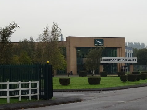
Seren Stiwdios

Seren Stiwdios (formerly Pinewood Studio Wales) is a Welsh film and television studio in Cardiff, Wales. Founded in 2015, the studio complex was operated...

Cardiff Capital Region

The Cardiff Capital Region (CCR; Welsh: Prifddinas Ranbarth Caerdydd) is a city region in Wales, centred on the capital city of Wales, Cardiff, in the...

St Peter's Church, Wentlooge

The Church of St Peter is the former parish church of the village of Peterstone, to the south west of the city of Newport, south Wales. Perpendicular...

Nearby Amenities

Located within 500m of 51.507596,-3.0782872
Source: PGS
Lat/Long: 51.5033593/-3.0763316
Source: PGS
Lat/Long: 51.503623/-3.0751492
Source: PGS
Lat/Long: 51.5038112/-3.0748037
Source: PGS
Lat/Long: 51.5043865/-3.0736849
Power: tower
Lat/Long: 51.5096434/-3.0818517
Source: PGS
Lat/Long: 51.5040748/-3.0738061
Direction: SSE
Generator Method: photovoltaic
Generator Output Electricity: yes
Generator Solar Modules: 16
Generator Source: solar
Generator Type: solar_photovoltaic_panel
Location: roof
Power: generator
Lat/Long: 51.5083568/-3.0752304
Direction: 145
Generator Method: photovoltaic
Generator Output Electricity: yes
Generator Solar Modules: 16
Generator Source: solar
Generator Type: solar_photovoltaic_panel
Location: roof
Power: generator
Lat/Long: 51.5081765/-3.0772448
The data included in this document is from www.openstreetmap.org. The data is made available under ODbL.

Have you been to Broadstreet Common?

Leave your review of Broadstreet Common below (or comments, questions and feedback).