Bridge Trafford

Settlement in Cheshire

England

Bridge Trafford

Sluice gates off River Gowy These sluice gates lead to Mill Brook. I've not looked into how long ago the channel was dug, but it is present on the original 1860s OS map of this area. The mill it served -  Stanney Flour Mill -  was around two miles away, so it must have been quite an undertaking - either the mill owners were very optimistic, or just very sure of making a profit. The big mill is no more, but maps still show a 'Stanney Mill Bridge' North of here, at the Western edge of Stanlow oil refinery.
The picture was taken just North of a footpath which forms part of the North Cheshire Way, a 70-mile trail leading from Ellesmere Port to the Peak District created by the council about 15 years back.
Just to the South was one of many already slightly-dilapidated small bridges crossing the network of  straight channels that criss-cross these fields, obscured by brambles. There have been bridges here for a long time though - that first OS map shows a track following the same route as the modern trail from the obscured bridge to the point at which it reaches the road North of Picton.
It is hard to know for sure whether the numerous water channels are drainage ditches leading to, or overflow channels leading from the River Gowy, to minimise flooding. Or a bit of both.
Sluice gates off River Gowy Credit: Ian Dodds

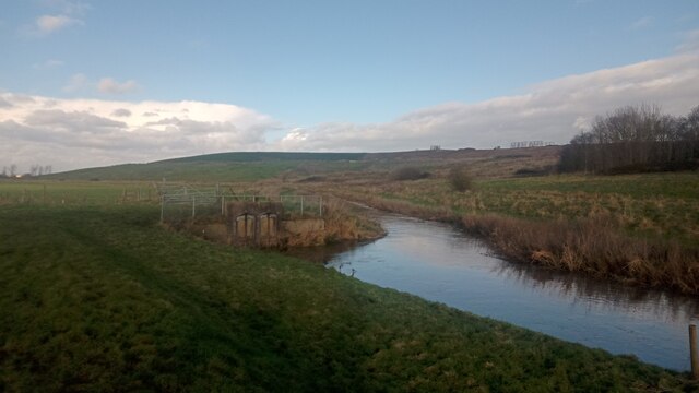
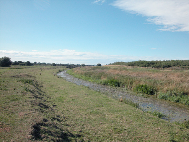
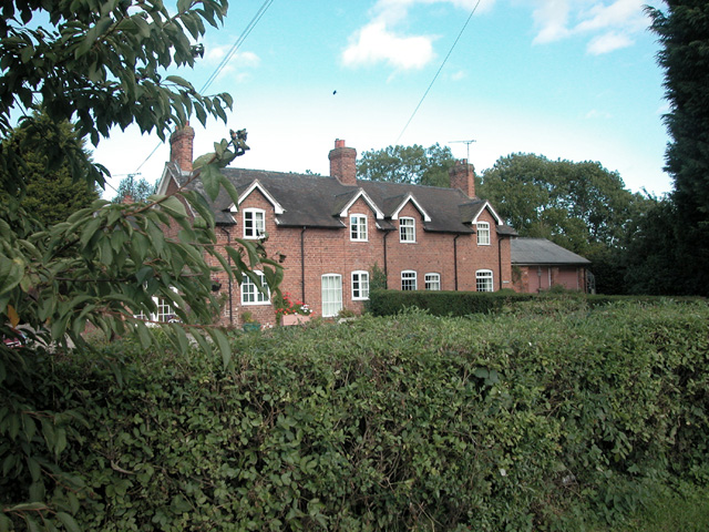
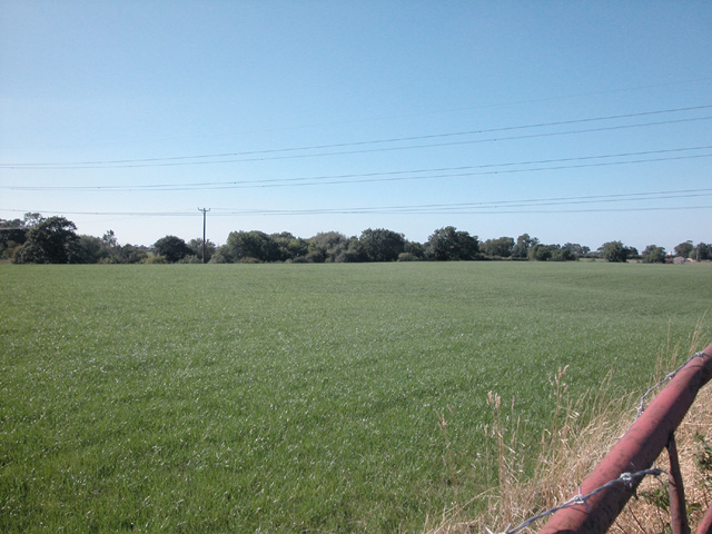
Bridge Trafford is a small village located in the county of Cheshire, England. Situated approximately 5 miles southwest of the city of Chester, Bridge Trafford falls within the Cheshire West and Chester local government district. The village is bounded by the River Gowy to the east and is surrounded by picturesque countryside, offering residents and visitors a peaceful and idyllic setting.

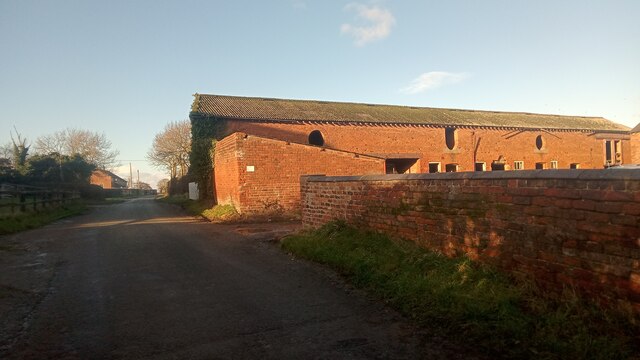
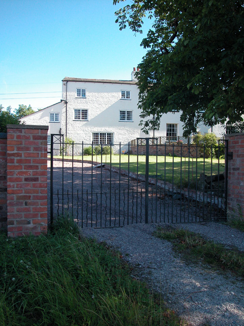
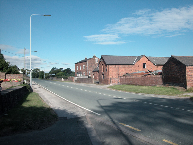
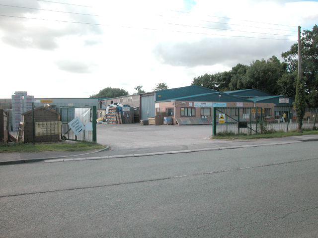
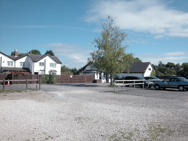
The community of Bridge Trafford consists primarily of residential properties, including a mix of traditional cottages and modern houses. The village also features a local pub, The Golden Lion, which serves as a social hub for residents and visitors alike. Additionally, there are several businesses and services in the area, such as a garden center and a car dealership.

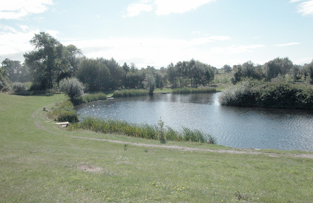
Nature enthusiasts will find plenty to explore in Bridge Trafford, as the village is located close to a number of parks and green spaces. The nearby Grosvenor Park in Chester, for example, offers beautiful gardens, a miniature railway, and a riverside walk, providing a tranquil escape from the hustle and bustle of city life.

For those seeking cultural and historical experiences, Bridge Trafford is conveniently located near several notable attractions. Just a short drive away is the historic city of Chester, famed for its well-preserved Roman walls, medieval architecture, and iconic landmarks such as Chester Cathedral and Chester Rows.

With its charming rural setting, proximity to amenities, and easy access to nearby attractions, Bridge Trafford offers a delightful place to live or visit for individuals seeking a tranquil village lifestyle with the convenience of nearby urban amenities.

If you have any feedback on the listing, please let us know in the comments section below.

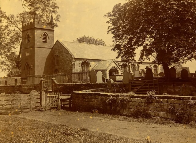
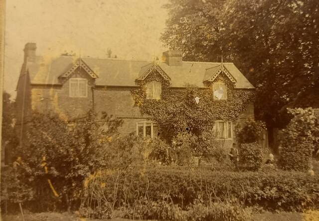
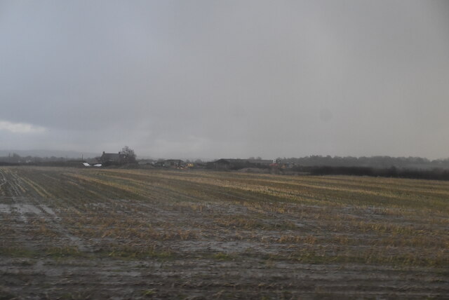
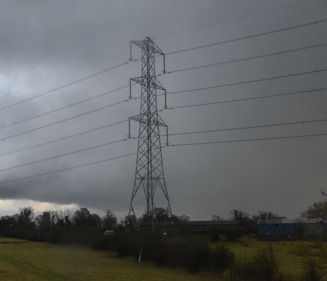
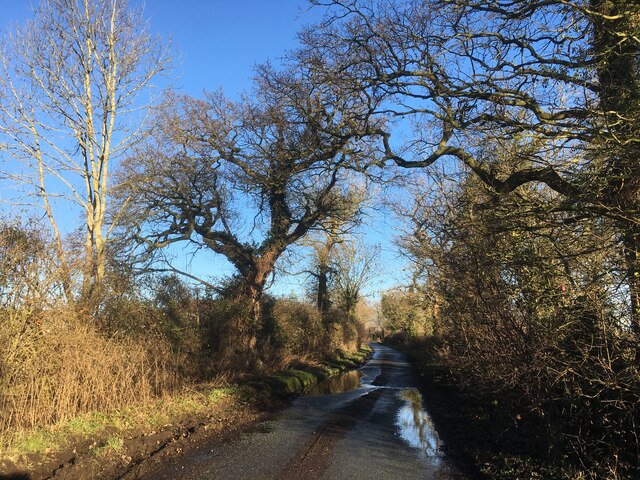
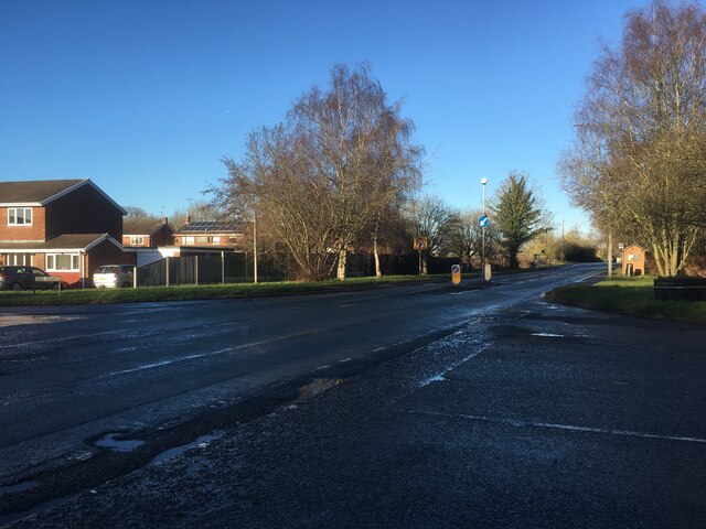
Bridge Trafford Images

Images are sourced within 2km of 53.2377/-2.8231981 or Grid Reference SJ4571. Thanks to Geograph Open Source API. All images are credited.

Sluice gates off River Gowy These sluice gates lead to Mill Brook. I've not looked into how long ago the channel was dug, but it is present on the original 1860s OS map of this area. The mill it served -  Stanney Flour Mill -  was around two miles away, so it must have been quite an undertaking - either the mill owners were very optimistic, or just very sure of making a profit. The big mill is no more, but maps still show a 'Stanney Mill Bridge' North of here, at the Western edge of Stanlow oil refinery.
The picture was taken just North of a footpath which forms part of the North Cheshire Way, a 70-mile trail leading from Ellesmere Port to the Peak District created by the council about 15 years back.
Just to the South was one of many already slightly-dilapidated small bridges crossing the network of  straight channels that criss-cross these fields, obscured by brambles. There have been bridges here for a long time though - that first OS map shows a track following the same route as the modern trail from the obscured bridge to the point at which it reaches the road North of Picton.
It is hard to know for sure whether the numerous water channels are drainage ditches leading to, or overflow channels leading from the River Gowy, to minimise flooding. Or a bit of both.
Sluice gates off River Gowy
These sluice gates lead to Mill Brook. I've not looked into how long ago the channel was dug, but it is present on the original 1860s OS map of this area. The mill it served - Stanney Flour Mill - was around two miles away, so it must have been quite an undertaking - either the mill owners were very optimistic, or just very sure of making a profit. The big mill is no more, but maps still show a 'Stanney Mill Bridge' North of here, at the Western edge of Stanlow oil refinery. The picture was taken just North of a footpath which forms part of the North Cheshire Way, a 70-mile trail leading from Ellesmere Port to the Peak District created by the council about 15 years back. Just to the South was one of many already slightly-dilapidated small bridges crossing the network of straight channels that criss-cross these fields, obscured by brambles. There have been bridges here for a long time though - that first OS map shows a track following the same route as the modern trail from the obscured bridge to the point at which it reaches the road North of Picton. It is hard to know for sure whether the numerous water channels are drainage ditches leading to, or overflow channels leading from the River Gowy, to minimise flooding. Or a bit of both.
Hill Farm outbuilding, Picton Picton is a very small place with lots of very big buildings. Both the farms and houses all seem to be a bit bigger than the norm, though there is a fair bit of building going on at the moment, which looks like it will bring the average building size down a little.
The farm name on the map looks quite odd; this is very low-lying ground and the farm's altitude can't be much more than 15 metres. However, everything is relative, and it is definitely close to the top of the local high point.
The windowless windows in the outbuilding are nice and quirky. Presumably there are no windows as stuff was brought up and down through them once upon a time.
Hill Farm outbuilding, Picton
Picton is a very small place with lots of very big buildings. Both the farms and houses all seem to be a bit bigger than the norm, though there is a fair bit of building going on at the moment, which looks like it will bring the average building size down a little. The farm name on the map looks quite odd; this is very low-lying ground and the farm's altitude can't be much more than 15 metres. However, everything is relative, and it is definitely close to the top of the local high point. The windowless windows in the outbuilding are nice and quirky. Presumably there are no windows as stuff was brought up and down through them once upon a time.
St Peter's Church at Plemstall, around 1900 A family archive photo from some recently-discovered pictures in a small suitcase. Relations on my father's side hail from the area, and several are buried in the churchyard, plus the wording on the reverse of this picture says "The gate in the foreground is access to our farm" which suggests the nearby Holme Farm just to the south.
St Peter's church itself dates from the 15th/16th centuries, although the tower is early 19th, and was Grade I listed <span class="nowrap"><a title="https://britishlistedbuildings.co.uk/101279021-church-of-st-peter-mickle-trafford-and-district#.Y7QSzHbP3IU" rel="nofollow ugc noopener" href="https://britishlistedbuildings.co.uk/101279021-church-of-st-peter-mickle-trafford-and-district#.Y7QSzHbP3IU">Link</a><img style="margin-left:2px;" alt="External link" title="External link - shift click to open in new window" src="https://s1.geograph.org.uk/img/external.png" width="10" height="10"/></span> and <span class="nowrap"><a title="https://historicengland.org.uk/listing/the-list/list-entry/1279021" rel="nofollow ugc noopener" href="https://historicengland.org.uk/listing/the-list/list-entry/1279021">Link</a><img style="margin-left:2px;" alt="External link" title="External link - shift click to open in new window" src="https://s1.geograph.org.uk/img/external.png" width="10" height="10"/></span> in 1967.
St Peter's Church at Plemstall, around 1900
A family archive photo from some recently-discovered pictures in a small suitcase. Relations on my father's side hail from the area, and several are buried in the churchyard, plus the wording on the reverse of this picture says "The gate in the foreground is access to our farm" which suggests the nearby Holme Farm just to the south. St Peter's church itself dates from the 15th/16th centuries, although the tower is early 19th, and was Grade I listed LinkExternal link and LinkExternal link in 1967.
Bridge House, Bridge Trafford, around 1910 A photo from our family archive of the house where my father was born, and relatives lived in the early 20th century. Members of the family are in the garden, although there are no clues written on the original as to who the lady, and the two gentlemen in hats actually are.
The same three semi-dormer windows of Bridge House are visible in <a href="https://www.geograph.org.uk/photo/2160099">SJ4471 : Bridge Trafford</a> just to the right of the pub sign.
Bridge House, Bridge Trafford, around 1910
A photo from our family archive of the house where my father was born, and relatives lived in the early 20th century. Members of the family are in the garden, although there are no clues written on the original as to who the lady, and the two gentlemen in hats actually are. The same three semi-dormer windows of Bridge House are visible in SJ4471 : Bridge Trafford just to the right of the pub sign.
Waterlogged stubble field
Pylon near Cornhill Farm
Plemstall Lane
Plemstall Lane
Junctions on the A56 in Mickle Trafford
Trafford Hall, Wimbolds Trafford A very fine mid-C18th brick house, decorated with wedge lintels, quoins and a Venetian and Diocletian window to the return. Built in 1756 for George Edward Gerard. Grade II* listed.
It was occupied by the National Communities Resource Centre, a charity, but now appears to be "owned by The Regenda Group and operated as a youth hostel and training centre by the Youth Hostels Association" (Wikipedia).
Trafford Hall, Wimbolds Trafford
A very fine mid-C18th brick house, decorated with wedge lintels, quoins and a Venetian and Diocletian window to the return. Built in 1756 for George Edward Gerard. Grade II* listed. It was occupied by the National Communities Resource Centre, a charity, but now appears to be "owned by The Regenda Group and operated as a youth hostel and training centre by the Youth Hostels Association" (Wikipedia).
The Hall Picton Almost the centre of the grid square.
The Hall Picton
Almost the centre of the grid square.
River Gowy At this point the river borders the Gowy landfill site and flow of the river is monitored and controlled.
River Gowy
At this point the river borders the Gowy landfill site and flow of the river is monitored and controlled.
Farm at Bridge Trafford On A56.
Farm at Bridge Trafford
On A56.
Cottages on A56 Close to milepost
Cottages on A56
Close to milepost
Milestone More than 100 years old.
Milestone
More than 100 years old.
Builders Merchants Located on the outskirts of Mickle Trafford alongside A56
Builders Merchants
Located on the outskirts of Mickle Trafford alongside A56
Picton Grassland Fertile farmland near Green Lane Picton, close to the M56 motorway.
Picton Grassland
Fertile farmland near Green Lane Picton, close to the M56 motorway.
Meadow Fishery Mickle Trafford The fishery occupies almost 25% of the grid square. Access to the fishery to make Geographs was with the kind permission of Meadow Fishery. <span class="nowrap"><a title="http://www.meadowfishery.co.uk/" rel="nofollow ugc noopener" href="http://www.meadowfishery.co.uk/">Link</a><img style="margin-left:2px;" alt="External link" title="External link - shift click to open in new window" src="https://s1.geograph.org.uk/img/external.png" width="10" height="10"/></span>
Meadow Fishery Mickle Trafford
The fishery occupies almost 25% of the grid square. Access to the fishery to make Geographs was with the kind permission of Meadow Fishery. LinkExternal link
Fishing Lake Access to the Fishery with the kind permission of Meadow Fishery.
Fishing Lake
Access to the Fishery with the kind permission of Meadow Fishery.
Show me another place!

Bridge Trafford is located at Grid Ref: SJ4571 (Lat: 53.2377, Lng: -2.8231981)

Unitary Authority: Cheshire West and Chester

Police Authority: Cheshire

What 3 Words

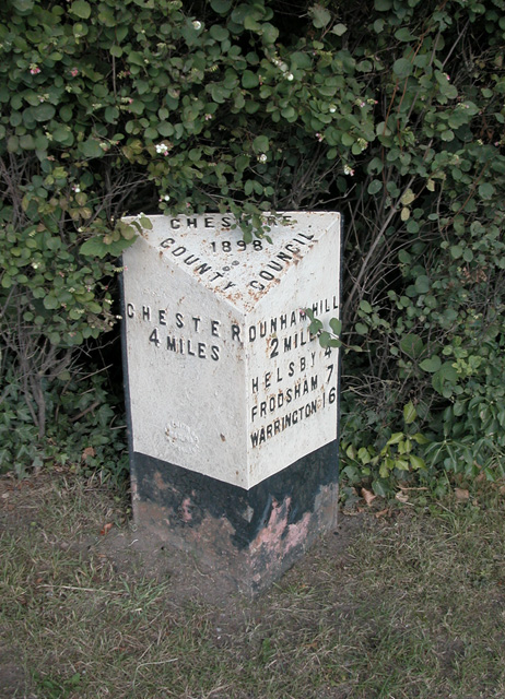
///strumming.option.races. Near Mickle Trafford, Cheshire

Nearby Locations

Bridge Trafford

Related Wikis

Bridge Trafford

Bridge Trafford is a hamlet and former civil parish, now in the parish of Mickle Trafford and District, situated near to Chester, in the unitary authority...
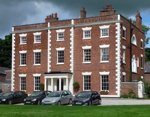
Trafford Hall

Trafford Hall is an 18th-century country house standing to the east of the village of Wimbolds Trafford in Cheshire, England, about 4+1⁄2 miles (7 km)...

Trafford Mill

Trafford Mill is a water mill ¾ mile (1.2 km) to the north of the village of Mickle Trafford, Cheshire, England (grid reference SJ449705). It is recorded...

Wimbolds Trafford

Wimbolds Trafford is a hamlet and former civil parish, now in the parish of Mickle Trafford and District, in the unitary authority area of Cheshire West...

St. Plegmund's well

St. Plegmund's well lies about 220 yards (201 m) to the west of St Peter's Church, Plemstall near the village of Mickle Trafford, Cheshire, England (grid...

St Peter's Church, Plemstall

St Peter's Church, Plemstall stands in an isolated position at the end of a country lane near the village of Mickle Trafford, Cheshire, England. It is...

Plemstall

Plemstall (formerly Plemonstall) is a hamlet in the civil parish of Mickle Trafford and District, Cheshire, England. It lies northeast of the village of...

Dunham-on-the-Hill

Dunham-on-the-Hill is a village and former civil parish, now in the parish of Dunham-on-the-Hill and Hapsford, in the unitary authority of Cheshire West...

Nearby Amenities

Located within 500m of 53.2377,-2.8231981
Restaurant
The Chester Field
Addr Postcode: CH2 4JR
Addr Street: Warrington Road
Fhrs Id: 370940
Source Addr: FHRS Open Data
Lat/Long: 53.2354287/-2.8246614
Barrier: kissing_gate
Foot: yes
Lat/Long: 53.2348824/-2.8270227
Barrier: stile
Foot: yes
Lat/Long: 53.2364094/-2.8216282
Post Box
Collection Times: Mo-Fr 09:00; Sa 07:00; Su off
Drive Through: no
Operator: Royal Mail
Operator Wikidata: Q638098
Post Box Type: lamp
Ref: CH2 7D
Lat/Long: 53.2352422/-2.8259115
Barrier: stile
Foot: yes
Lat/Long: 53.234993/-2.8178651
Barrier: stile
Foot: yes
Lat/Long: 53.2348983/-2.8176346
Barrier: stile
Foot: yes
Lat/Long: 53.2406639/-2.8223069
Barrier: stile
Foot: yes
Lat/Long: 53.2416855/-2.8234639
Barrier: kissing_gate
Foot: yes
Lat/Long: 53.235093/-2.8271086
Barrier: stile
Foot: yes
Lat/Long: 53.2390194/-2.8245712
Bus Stop
Bridge Trafford, Warrington Road / Ince Lane
Bus: yes
Naptan AtcoCode: 0610CH1203
Naptan Bearing: NE
Naptan CommonName: Ince Lane
Naptan Crossing: Ince Lane
Naptan Indicator: nr
Naptan Landmark: Sandfield Farm
Naptan LocalityName: Bridge Trafford
Naptan NaptanCode: chwjwam
Naptan ShortCommonName: Ince Lane
Naptan Street: Warrington Road
Naptan Verified: no
Public Transport: platform
Source: naptan_import
Lat/Long: 53.2367866/-2.8211761
Bus Stop
Bridge Trafford, Warrington Road / Ince Lane
Bus: yes
Naptan AtcoCode: 0610CH1204
Naptan Bearing: SW
Naptan CommonName: Ince Lane
Naptan Crossing: Ince Lane
Naptan Indicator: opp
Naptan Landmark: Sandfield Farm
Naptan LocalityName: Bridge Trafford
Naptan NaptanCode: chwjwap
Naptan ShortCommonName: Ince Lane
Naptan Street: Warrington Road
Naptan Verified: no
Public Transport: platform
Source: naptan_import
Lat/Long: 53.2358872/-2.8238559
Bus Stop
Bridge Trafford, Warrington Road / Nag's Head PH
Bus: yes
Naptan AtcoCode: 0610CH2474
Naptan Bearing: NE
Naptan CommonName: Nag's Head PH
Naptan Crossing: Hassals Lane
Naptan Indicator: nr
Naptan Landmark: Nag's Head PH
Naptan LocalityName: Bridge Trafford
Naptan NaptanCode: chwdjpm
Naptan ShortCommonName: Nag's Head PH
Naptan Street: Warrington Road
Naptan Verified: no
Public Transport: platform
Source: naptan_import
Lat/Long: 53.2354068/-2.8257195
Bus Stop
Bridge Trafford, Warrington Road / Nag's Head PH
Bus: yes
Naptan AtcoCode: 0610CH2475
Naptan Bearing: S
Naptan CommonName: Nag's Head PH
Naptan Crossing: Hassals Lane
Naptan Indicator: opp
Naptan Landmark: Nag's Head PH
Naptan LocalityName: Bridge Trafford
Naptan NaptanCode: chwdjpt
Naptan ShortCommonName: Nag's Head PH
Naptan Street: Warrington Road
Naptan Verified: no
Public Transport: platform
Source: naptan_import
Lat/Long: 53.2345671/-2.8262577
Power: tower
Lat/Long: 53.2395182/-2.8222245
Power: tower
Lat/Long: 53.2405041/-2.8178748
Power: tower
Lat/Long: 53.2385082/-2.8268749
Note: obstructed by heap of rubble and earth July 2007
Lat/Long: 53.2390771/-2.8245109
Foot: yes
Lat/Long: 53.2364078/-2.8217013
Mini Roundabout
Lat/Long: 53.2411415/-2.8278582
Give Way
Direction: backward
Lat/Long: 53.2364843/-2.8226937
The data included in this document is from www.openstreetmap.org. The data is made available under ODbL.

Have you been to Bridge Trafford?

Leave your review of Bridge Trafford below (or comments, questions and feedback).