Bourton Westwood

Settlement in Shropshire

England

Bourton Westwood

Gaskell Arms Hotel, Much Wenlock
Gaskell Arms Hotel, Much Wenlock Credit: Chris Whippet

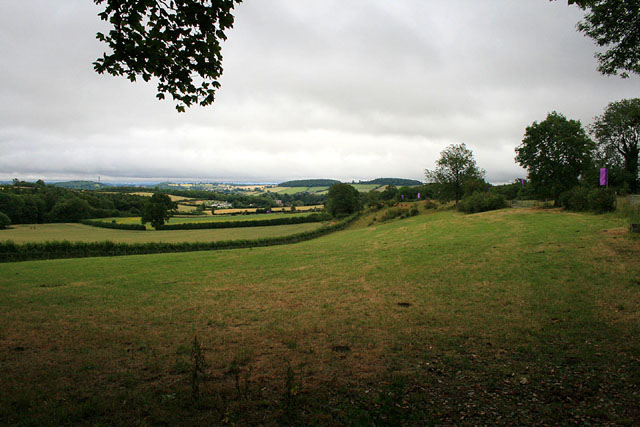
Bourton Westwood is a picturesque village located in the county of Shropshire, England. Situated on the western edge of the county, it is surrounded by beautiful countryside and offers a tranquil and idyllic setting for its residents and visitors alike.

The village is known for its quaint and charming atmosphere, with a population of around 500 people. It boasts a variety of traditional stone-built houses, many of which date back several centuries, giving the village a sense of historical character.

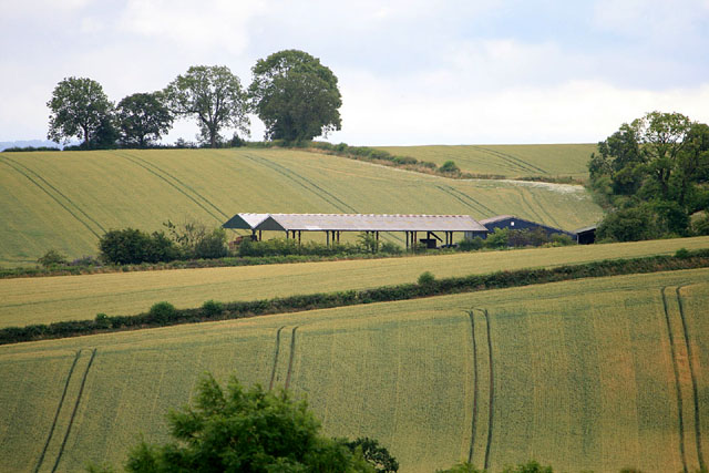
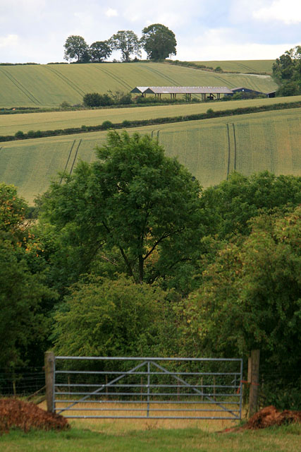
Nature lovers will be in their element in Bourton Westwood, as the village is surrounded by rolling hills, green fields, and meandering streams. The nearby Westwood Nature Reserve is a haven for wildlife, with an array of bird species and other animals making their homes there.

Despite its small size, Bourton Westwood offers a range of amenities for its residents. The village has a local pub, which serves as a gathering place for both locals and visitors, as well as a village hall that hosts various community events throughout the year.

For those seeking outdoor activities, there are numerous walking and cycling paths that crisscross the countryside, allowing visitors to explore the area's natural beauty. The village is also within easy reach of larger towns and cities, such as Shrewsbury and Telford, which offer a wider range of amenities and attractions.

Overall, Bourton Westwood is a charming village that offers a peaceful and picturesque escape from the hustle and bustle of urban life. Its natural beauty and sense of community make it an appealing destination for those seeking a slower pace of life in the heart of rural England.

If you have any feedback on the listing, please let us know in the comments section below.

Bourton Westwood Images

Images are sourced within 2km of 52.578742/-2.5744554 or Grid Reference SO6198. Thanks to Geograph Open Source API. All images are credited.

Gaskell Arms Hotel, Much Wenlock
The Hand to Mouth Theatre Performing at the Festival at the Edge story-telling event <span class="nowrap"><a title="http://www.festivalattheedge.org/" rel="nofollow ugc noopener" href="http://www.festivalattheedge.org/">Link</a><img style="margin-left:2px;" alt="External link" title="External link - shift click to open in new window" src="https://s1.geograph.org.uk/img/external.png" width="10" height="10"/></span> . Hand to Mouth Theatre are Martin Bridle (here with only wellies and puppets visible) and Su Eaton (playing the hurdy gurdy and various whistles and bells) <span class="nowrap"><a title="http://www.handtomouth.co.uk/" rel="nofollow ugc noopener" href="http://www.handtomouth.co.uk/">Link</a><img style="margin-left:2px;" alt="External link" title="External link - shift click to open in new window" src="https://s1.geograph.org.uk/img/external.png" width="10" height="10"/></span> . 

A wonderfully witty performance of a piece called "Piggery Jokery".
The Hand to Mouth Theatre
Performing at the Festival at the Edge story-telling event LinkExternal link . Hand to Mouth Theatre are Martin Bridle (here with only wellies and puppets visible) and Su Eaton (playing the hurdy gurdy and various whistles and bells) LinkExternal link . A wonderfully witty performance of a piece called "Piggery Jokery".
The Silver Marquee Awaiting the start of the 2011 Festival at the Edge <span class="nowrap"><a title="http://www.festivalattheedge.org" rel="nofollow ugc noopener" href="http://www.festivalattheedge.org">Link</a><img style="margin-left:2px;" alt="External link" title="External link - shift click to open in new window" src="https://s1.geograph.org.uk/img/external.png" width="10" height="10"/></span> .

The Silver Marquee hosts the musical performances.
The Silver Marquee
Awaiting the start of the 2011 Festival at the Edge LinkExternal link . The Silver Marquee hosts the musical performances.
Parking Area Early on the Saturday of the Festival at the Edge <span class="nowrap"><a title="http://www.festivalattheedge.org/" rel="nofollow ugc noopener" href="http://www.festivalattheedge.org/">Link</a><img style="margin-left:2px;" alt="External link" title="External link - shift click to open in new window" src="https://s1.geograph.org.uk/img/external.png" width="10" height="10"/></span> and no one has yet driven to the site for the day's events.
Parking Area
Early on the Saturday of the Festival at the Edge LinkExternal link and no one has yet driven to the site for the day's events.
Field near Stokes Barn
The Green Marquee Before the afternoon story-telling starts on the last day of the 2011 Festival at the Edge <span class="nowrap"><a title="http://www.festivalattheedge.org/" rel="nofollow ugc noopener" href="http://www.festivalattheedge.org/">Link</a><img style="margin-left:2px;" alt="External link" title="External link - shift click to open in new window" src="https://s1.geograph.org.uk/img/external.png" width="10" height="10"/></span> .
The Green Marquee
Before the afternoon story-telling starts on the last day of the 2011 Festival at the Edge LinkExternal link .
Hay Barn Near to the B4378 near Much Wenlock.  Not that you can see the road from this view point near Stokes Barn.
Hay Barn
Near to the B4378 near Much Wenlock. Not that you can see the road from this view point near Stokes Barn.
Sink in a field I don't know if this was here as a facility for the Festival at the Edge which was taking place in the adjoining field (from which the picture was taken).  It certainly looked incongruous.
Sink in a field
I don't know if this was here as a facility for the Festival at the Edge which was taking place in the adjoining field (from which the picture was taken). It certainly looked incongruous.
Gate near Stokes Barn With a view of <a href="https://www.geograph.org.uk/photo/2557425">SO6199 : Hay Barn</a>.  The field from which this was taken at the time contained <a href="https://www.geograph.org.uk/photo/2557201">SO6099 : The Green Marquee</a>.
Gate near Stokes Barn
With a view of SO6199 : Hay Barn. The field from which this was taken at the time contained SO6099 : The Green Marquee.
The Pound, Much Wenlock The Pound is owned and maintained by Much Wenlock Town Council
The Pound, Much Wenlock
The Pound is owned and maintained by Much Wenlock Town Council
Empty chairs Awaiting within <a href="https://www.geograph.org.uk/photo/2557201">SO6099 : The Green Marquee</a> soon to be fully occupied for the final session of the 2011 Festival at the Edge.
Empty chairs
Awaiting within SO6099 : The Green Marquee soon to be fully occupied for the final session of the 2011 Festival at the Edge.
Wenlock Edge Wenlock Edge is a limestone escarpment running for 24 km (15 miles) between Craven Arms and Much Wenlock. This is at the National Trust car park in the former quarry at Much Wenlock.
Wenlock Edge
Wenlock Edge is a limestone escarpment running for 24 km (15 miles) between Craven Arms and Much Wenlock. This is at the National Trust car park in the former quarry at Much Wenlock.
Path to Shropshire Way Looking from the National Trust's Wenlock Edge car park to the gate and steps which lead to the Shropshire Way long-distance footpath.
Path to Shropshire Way
Looking from the National Trust's Wenlock Edge car park to the gate and steps which lead to the Shropshire Way long-distance footpath.
Wenlock Edge Wenlock Edge is a limestone escarpment running for 24 km (15 miles) between Craven Arms and Much Wenlock. This is at the far end of the National Trust car park in the former quarry at Much Wenlock.
Wenlock Edge
Wenlock Edge is a limestone escarpment running for 24 km (15 miles) between Craven Arms and Much Wenlock. This is at the far end of the National Trust car park in the former quarry at Much Wenlock.
The Shropshire Way, Wenlock Edge The Shropshire Way is a waymarked long distance footpath part of which traces Wenlock Edge, a limestone escarpment running for 24 km (15 miles) between Craven Arms and Much Wenlock. This is above the National Trust car park in the former quarry at Much Wenlock.
The Shropshire Way, Wenlock Edge
The Shropshire Way is a waymarked long distance footpath part of which traces Wenlock Edge, a limestone escarpment running for 24 km (15 miles) between Craven Arms and Much Wenlock. This is above the National Trust car park in the former quarry at Much Wenlock.
Shropshire Way, Wenlock Edge The Shropshire Way is a waymarked long distance footpath part of which traces Wenlock Edge, a limestone escarpment running for 24 km (15 miles) between Craven Arms and Much Wenlock. This about half a mile from the National Trust car park in the former quarry at Much Wenlock.
Shropshire Way, Wenlock Edge
The Shropshire Way is a waymarked long distance footpath part of which traces Wenlock Edge, a limestone escarpment running for 24 km (15 miles) between Craven Arms and Much Wenlock. This about half a mile from the National Trust car park in the former quarry at Much Wenlock.
Farm below Wenlock Edge Looking down from the Shropshire Way.
Farm below Wenlock Edge
Looking down from the Shropshire Way.
View from Wenlock Edge Looking across the farmland near Much Wenlock.
View from Wenlock Edge
Looking across the farmland near Much Wenlock.
Show me another place!

Bourton Westwood is located at Grid Ref: SO6198 (Lat: 52.578742, Lng: -2.5744554)

Unitary Authority: Shropshire

Police Authority: West Merica

What 3 Words

///spectacle.extreme.tugging. Near Much Wenlock, Shropshire

Related Wikis

Westwood Halt railway station

Westwood Halt railway station was a station in Stretton Westwood, Shropshire, England. The station was opened on 7 December 1935 and closed to passengers...

Stretton Westwood

Stretton Westwood is a hamlet in Shropshire, England. It is located in the parish of Much Wenlock and is two miles southwest of the town, on the B4371...

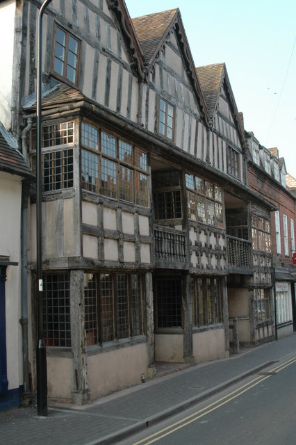
55–56 High Street, Much Wenlock

55–56 High Street is an historic building in Much Wenlock, Shropshire, England. The property dates to the early 15th century, and is now a Grade II* listed...

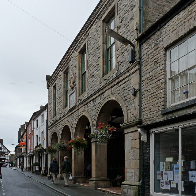
Corn Exchange, Much Wenlock

The Corn Exchange is a commercial building in the High Street in Much Wenlock, Shropshire, England. The structure, which is currently used as a library...

Have you been to Bourton Westwood?

Leave your review of Bourton Westwood below (or comments, questions and feedback).