Bottom o' th' Moor

Settlement in Lancashire

England

Bottom o' th' Moor

The Bowling Green, Tonge Fold Boarded up pub on the Bury Road.
The Bowling Green, Tonge Fold Credit: Richard Webb

Bottom o' th' Moor is a small village located in the county of Lancashire, in the northwest of England. Situated near the town of Burnley, it is nestled in the picturesque countryside, offering beautiful views of rolling hills and lush green fields.

With a population of around 500 residents, Bottom o' th' Moor maintains a close-knit community atmosphere. The village is characterized by its charming stone cottages and traditional architecture, which give it a timeless and quaint appeal. It is known for its peaceful and idyllic setting, making it an ideal place for those seeking a tranquil and rural lifestyle.

Although small in size, Bottom o' th' Moor offers a range of amenities to its residents. The village has a primary school, ensuring that local children have convenient access to education. Additionally, there is a community center that serves as a hub for social gatherings and events, fostering a strong sense of community spirit.

The surrounding area provides ample opportunities for outdoor activities, with numerous walking and cycling routes to explore. Bottom o' th' Moor is also close to several nature reserves and country parks, allowing residents to enjoy the beauty of the Lancashire countryside.

While the village may lack some of the amenities found in larger towns, the nearby town of Burnley offers a wider range of services, including shops, supermarkets, and leisure facilities. Bottom o' th' Moor benefits from its proximity to Burnley, as residents can access these amenities within a short drive.

Overall, Bottom o' th' Moor is a charming and peaceful village that offers an escape from the hustle and bustle of city life, while still providing access to essential services and a strong sense of community.

If you have any feedback on the listing, please let us know in the comments section below.

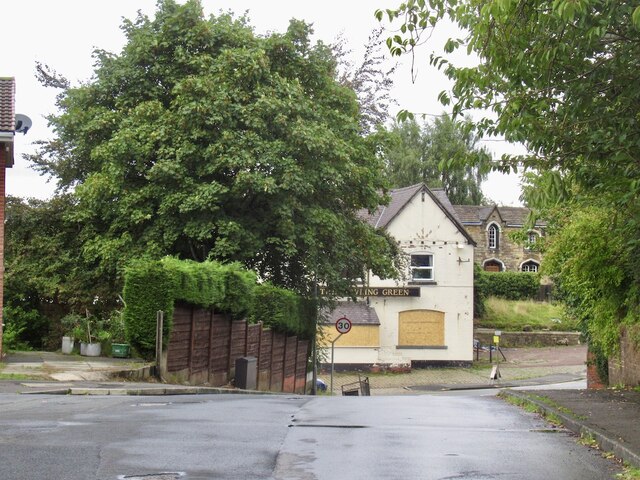
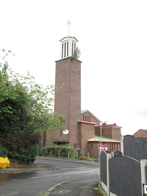
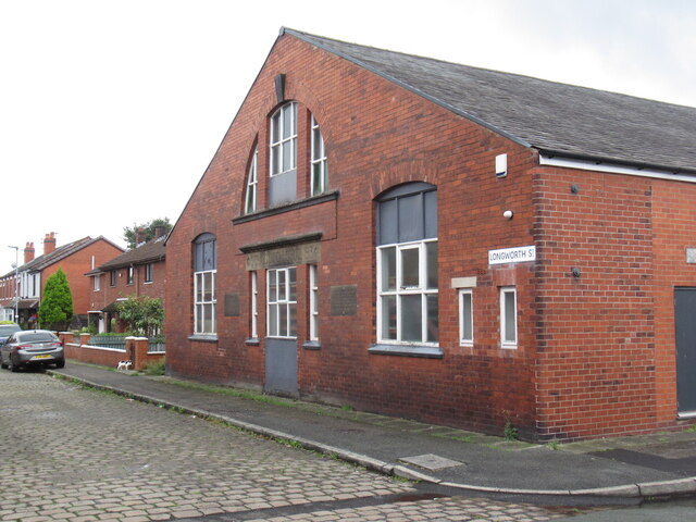
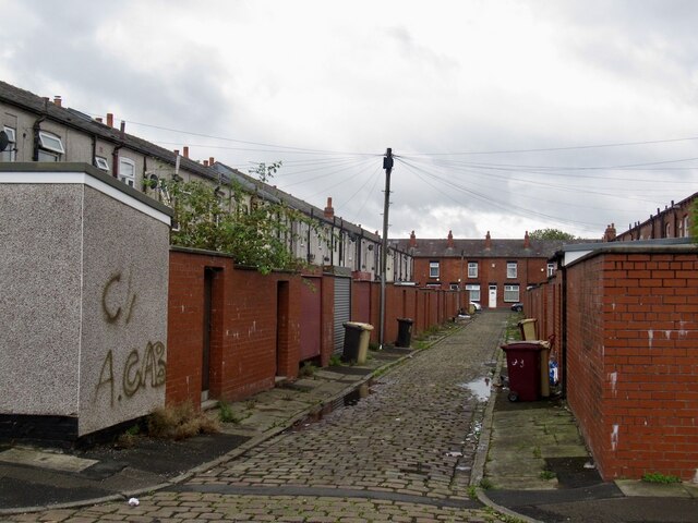
Bottom o' th' Moor Images

Images are sourced within 2km of 53.594282/-2.3925009 or Grid Reference SD7410. Thanks to Geograph Open Source API. All images are credited.

The Bowling Green, Tonge Fold Boarded up pub on the Bury Road.
The Bowling Green, Tonge Fold
Boarded up pub on the Bury Road.
Tower, St Chad's Church, Tonge Fold The bush on the tower has appeared since this <a href="https://www.geograph.org.uk/photo/2735785">SD7309 : St Chad's Church, Tonge Fold</a> was taken in 2011.
Tower, St Chad's Church, Tonge Fold
The bush on the tower has appeared since this SD7309 : St Chad's Church, Tonge Fold was taken in 2011.
Longworth Street, Tonge Fold The building, possibly in industrial use has a stone carving stating that it was St Chad's Sunday School.
Longworth Street, Tonge Fold
The building, possibly in industrial use has a stone carving stating that it was St Chad's Sunday School.
Back Dunstan Street, Tonge Fold
Breightmet United clubhouse
Bury Road, A58
Bury Road, A58
Footbridge over Bradshaw Brook In Seven Acres Country Park.
Footbridge over Bradshaw Brook
In Seven Acres Country Park.
River Tonge Flowing under Turner Bridge on Folds Road
River Tonge
Flowing under Turner Bridge on Folds Road
Comings and goings Starlings on a late August evening.
Comings and goings
Starlings on a late August evening.
Four starlings and a rainbow A fleeting glimpse of an early evening rainbow.
Four starlings and a rainbow
A fleeting glimpse of an early evening rainbow.
Harwood, Longsight Lane
Grey squirrel A regular garden visitor.
Grey squirrel
A regular garden visitor.
Shepherd's delight Early evening after a bright November day.
Shepherd's delight
Early evening after a bright November day.
Bungalows on Hough Fold Way Residential area in Harwood, Bolton.
Bungalows on Hough Fold Way
Residential area in Harwood, Bolton.
Oaks Lane, Bradshaw Leading to the now closed Oaks railway station on the Bolton to Blackburn line.
Oaks Lane, Bradshaw
Leading to the now closed Oaks railway station on the Bolton to Blackburn line.
Laburnum Park, Bradshaw Residential development off Oaks Lane.
Laburnum Park, Bradshaw
Residential development off Oaks Lane.
Post early for Christmas At Bradshaw post office on Lea Gate, Harwood.
Post early for Christmas
At Bradshaw post office on Lea Gate, Harwood.
Show me another place!

Bottom o' th' Moor is located at Grid Ref: SD7410 (Lat: 53.594282, Lng: -2.3925009)

Unitary Authority: Bolton

Police Authority: Greater Manchester

What 3 Words

///clubs.useful.focus. Near Bolton, Manchester

Nearby Locations

Bottom o' th' Moor

Related Wikis

Bolton St Catherine's Academy

Bolton St Catherine's Academy is a mixed Church of England all-through school. The school is located in the Breightmet area of Bolton in the English county...

Seven Acres Country Park, Bolton

Seven Acres Country Park is a country park and Local Nature Reserve in Bolton, Greater Manchester. It lies between the areas of Tonge and Breightmet, and...

Harwood, Greater Manchester

Harwood is a suburb to the north-northeast of Bolton, Greater Manchester, bordering Bury in North West England. Harwood is also part of the historic county...

South Turton

South Turton is an area of the Metropolitan Borough of Bolton, in Greater Manchester, England. There is no settlement or administrative area of South Turton...

Nearby Amenities

Located within 500m of 53.594282,-2.3925009
Bus Stop
Stitch Mi Lane/The White Horse
Bus: yes
Naptan AtcoCode: 1800WA03641
Naptan Bearing: W
Naptan CommonName: Stitch Mi Lane/The White Horse
Naptan Indicator: Opp White Horse
Naptan Landmark: THE WHITE HORSE
Naptan NaptanCode: manjwgpa
Naptan PlusbusZoneRef: MNCRPIC
Naptan ShortCommonName: The White Horse
Naptan Street: STITCH MI LANE
Naptan Verified: no
Network: TfGM
Public Transport: platform
Source: naptan_import
Lat/Long: 53.5943672/-2.3878519
Bus Stop
Stitch Mi Lane/Longsight Lane
Bus: yes
Naptan AtcoCode: 1800WA03781
Naptan Bearing: W
Naptan CommonName: Stitch Mi Lane/Longsight Lane
Naptan Indicator: Os House 2
Naptan Landmark: HOUSE 2
Naptan NaptanCode: manjwgpm
Naptan PlusbusZoneRef: MNCRPIC
Naptan ShortCommonName: Longsight Lane
Naptan Street: STITCH MI LANE
Naptan Verified: no
Network: TfGM
Public Transport: platform
Source: naptan_import
Lat/Long: 53.59433/-2.3920988
Bus Stop
Stitch Mi Lane/Longsight Lane
Bus: yes
Naptan AtcoCode: 1800WA05291
Naptan Bearing: E
Naptan CommonName: Stitch Mi Lane/Longsight Lane
Naptan Indicator: Fields
Naptan Landmark: FIELDS
Naptan NaptanCode: manjwgwt
Naptan PlusbusZoneRef: MNCRPIC
Naptan ShortCommonName: Longsight Lane
Naptan Street: STITCH MI LANE
Naptan Verified: no
Network: TfGM
Public Transport: platform
Source: naptan_import
Lat/Long: 53.5945244/-2.3919757
Bus Stop
Stitch Mi Lane/The White Horse
Bus: yes
Naptan AtcoCode: 1800WA06821
Naptan Bearing: E
Naptan CommonName: Stitch Mi Lane/The White Horse
Naptan Indicator: White Horse Pub
Naptan Landmark: WHITE HORSE PUB
Naptan NaptanCode: manjwjdp
Naptan PlusbusZoneRef: MNCRPIC
Naptan ShortCommonName: The White Horse
Naptan Street: STITCH MI LANE
Naptan Verified: no
Network: TfGM
Public Transport: platform
Source: naptan_import
Lat/Long: 53.5944401/-2.3875201
Bus Stop
Padbury Way/New Lane
Bus: yes
Naptan AtcoCode: 1800WA07711
Naptan Bearing: SE
Naptan CommonName: Padbury Way/New Lane
Naptan Indicator: Os House 5
Naptan Landmark: HOUSE 5
Naptan NaptanCode: manjwmad
Naptan Notes: INDICATOR AMENDED
Naptan PlusbusZoneRef: MNCRPIC
Naptan ShortCommonName: New Lane
Naptan Street: PADBURY WAY
Naptan Verified: no
Network: TfGM
Public Transport: platform
Source: naptan_import
Lat/Long: 53.5908486/-2.3945729
Bus Stop
New Lane/Padbury Way
Bus: yes
Naptan AtcoCode: 1800WA07931
Naptan Bearing: SW
Naptan CommonName: New Lane/Padbury Way
Naptan Indicator: O/s House 40
Naptan Landmark: HOUSE 40
Naptan NaptanCode: manjwmaj
Naptan PlusbusZoneRef: MNCRPIC
Naptan ShortCommonName: Padbury Way
Naptan Street: NEW LANE
Naptan Verified: no
Network: TfGM
Public Transport: platform
Source: naptan_import
Lat/Long: 53.5906754/-2.3953267
Bus Stop
New Lane/Padbury Way
Bus: yes
Naptan AtcoCode: 1800WA12211
Naptan Bearing: N
Naptan CommonName: New Lane/Padbury Way
Naptan Indicator: The Rocket
Naptan Landmark: HOUSE 45
Naptan NaptanCode: manpadmt
Naptan PlusbusZoneRef: MNCRPIC
Naptan ShortCommonName: Padbury Way
Naptan Street: NEW LANE
Naptan Verified: no
Network: TfGM
Public Transport: platform
Source: naptan_import
Lat/Long: 53.5915667/-2.3948818
Bus Stop
South Drive/Dewhurst Road
Bus: yes
Naptan AtcoCode: 1800WA12611
Naptan Bearing: N
Naptan CommonName: South Drive/Dewhurst Road
Naptan Indicator: Opp Houses 35/37
Naptan Landmark: HOUSE 37
Naptan NaptanCode: mantmwpa
Naptan Notes: New Stop
Naptan ShortCommonName: Dewhurst Road
Naptan Street: SOUTH DRIVE
Naptan Verified: no
Network: TfGM
Public Transport: platform
Source: naptan_import
Lat/Long: 53.5974342/-2.3900105
Bus Stop
Stitch Mi Lane/South Drive
Bus: yes
Naptan AtcoCode: 1800WA12651
Naptan Bearing: W
Naptan CommonName: Stitch Mi Lane/South Drive
Naptan Indicator: Opp Houses 97/99
Naptan Landmark: HOUSE 97
Naptan NaptanCode: mantmwpw
Naptan Notes: New Stop
Naptan ShortCommonName: South Drive
Naptan Street: STITCH-MI-LANE
Naptan Verified: no
Network: TfGM
Public Transport: platform
Source: naptan_import
Lat/Long: 53.5943891/-2.3894083
Bus Stop
South Drive/Stitch Mi Lane
Bus: yes
Naptan AtcoCode: 1800WA12671
Naptan Bearing: N
Naptan CommonName: South Drive/Stitch Mi Lane
Naptan Indicator: O/S house 90/92
Naptan Landmark: HOUSE 90
Naptan NaptanCode: mantpadw
Naptan Notes: NEW STOP
Naptan ShortCommonName: Fair Acres
Naptan Street: SOUTH DRIVE
Naptan Verified: no
Network: TfGM
Public Transport: platform
Source: naptan_import
Lat/Long: 53.5952668/-2.3903834
Power: tower
Lat/Long: 53.5926182/-2.3862087
Power: tower
Lat/Long: 53.5938229/-2.3893545
Power: tower
Lat/Long: 53.5957135/-2.3951679
Fast Food
Sunny's Fish & Chips
Addr City: Bolton
Addr Housenumber: 29-31
Addr Postcode: BL2 5BN
Addr Street: New Lane
Fhrs Id: 1097131
Source Addr: FHRS Open Data
Lat/Long: 53.5909454/-2.3955811
Bolton at Home
Office: yes
Lat/Long: 53.5910001/-2.3955526
P & R Off Licence
Shop: alcohol
Lat/Long: 53.5910637/-2.3955191
Shop: yes
Lat/Long: 53.5911213/-2.3954907
Post Office
Top O'th Brow Post Office
Addr City: Bolton
Addr Postcode: BL2 5BN
Brand: Post Office
Brand Wikidata: Q1783168
Contact Website: https://www.postoffice.co.uk/branch-finder/3804062/top-o'th-brow
Ref Pol Id: 140429
Lat/Long: 53.5911422/-2.3954136
Shop: yes
Lat/Long: 53.5908958/-2.3955677
Crossing
Crossing: zebra
Lat/Long: 53.5939308/-2.3887766
School
Firwood High School
Description: School for disabled children on same site as St Catherine's
Lat/Long: 53.5930001/-2.3885493
Post Box
Lat/Long: 53.5910736/-2.3954073
Barrier: cycle_barrier
Lat/Long: 53.5918553/-2.3977909
Barrier: cycle_barrier
Lat/Long: 53.5918436/-2.3977002
Crossing
Crossing: traffic_signals
Crossing Ref: pelican
Lat/Long: 53.5911638/-2.3950771
Barrier: bollard
Foot: yes
Lat/Long: 53.5956298/-2.3872892
Entrance: yes
Lat/Long: 53.5941506/-2.3936966
Turning Circle
Lat/Long: 53.593764/-2.3916627
Turning Circle
Lat/Long: 53.5936083/-2.389811
Crossing
Crossing: marked
Lat/Long: 53.5937979/-2.3889644
Direction: SSW
Generator Method: photovoltaic
Generator Output Electricity: yes
Generator Solar Modules: 15
Generator Source: solar
Generator Type: solar_photovoltaic_panel
Location: roof
Power: generator
Lat/Long: 53.5971899/-2.3878828
Direction: SSW
Generator Method: photovoltaic
Generator Output Electricity: yes
Generator Solar Modules: 16
Generator Source: solar
Generator Type: solar_photovoltaic_panel
Location: roof
Power: generator
Lat/Long: 53.5976651/-2.3884025
Direction: SSW
Generator Method: photovoltaic
Generator Output Electricity: yes
Generator Solar Modules: 17
Generator Source: solar
Generator Type: solar_photovoltaic_panel
Location: roof
Power: generator
Lat/Long: 53.5977507/-2.3886559
Direction: SSW
Generator Method: photovoltaic
Generator Output Electricity: yes
Generator Solar Modules: 18
Generator Source: solar
Generator Type: solar_photovoltaic_panel
Location: roof
Power: generator
Lat/Long: 53.597896/-2.3880645
Direction: SSW
Generator Method: photovoltaic
Generator Output Electricity: yes
Generator Solar Modules: 12
Generator Source: solar
Generator Type: solar_photovoltaic_panel
Location: roof
Power: generator
Lat/Long: 53.598021/-2.3884246
Direction: 185
Generator Method: photovoltaic
Generator Output Electricity: yes
Generator Solar Modules: 15
Generator Source: solar
Generator Type: solar_photovoltaic_panel
Location: roof
Power: generator
Lat/Long: 53.5956935/-2.3879733
Direction: 185
Generator Method: photovoltaic
Generator Output Electricity: yes
Generator Solar Modules: 15
Generator Source: solar
Generator Type: solar_photovoltaic_panel
Location: roof
Power: generator
Lat/Long: 53.595744/-2.3890475
Direction: 185
Generator Method: photovoltaic
Generator Output Electricity: yes
Generator Solar Modules: 10
Generator Source: solar
Generator Type: solar_photovoltaic_panel
Location: roof
Power: generator
Lat/Long: 53.5946137/-2.3882818
Direction: 185
Generator Method: photovoltaic
Generator Output Electricity: yes
Generator Solar Modules: 3
Generator Source: solar
Generator Type: solar_photovoltaic_panel
Location: roof
Power: generator
Lat/Long: 53.5942083/-2.3899675
Direction: SSE
Generator Method: photovoltaic
Generator Output Electricity: yes
Generator Solar Modules: 16
Generator Source: solar
Generator Type: solar_photovoltaic_panel
Location: roof
Power: generator
Lat/Long: 53.5940317/-2.3914595
Direction: SSE
Generator Method: photovoltaic
Generator Output Electricity: yes
Generator Solar Modules: 16
Generator Source: solar
Generator Type: solar_photovoltaic_panel
Location: roof
Power: generator
Lat/Long: 53.5939939/-2.3915809
Direction: 215
Generator Method: photovoltaic
Generator Output Electricity: yes
Generator Solar Modules: 18
Generator Source: solar
Generator Type: solar_photovoltaic_panel
Location: roof
Power: generator
Lat/Long: 53.5938002/-2.3937662
Direction: 195
Generator Method: photovoltaic
Generator Output Electricity: yes
Generator Solar Modules: 11
Generator Source: solar
Generator Type: solar_photovoltaic_panel
Location: roof
Power: generator
Lat/Long: 53.5939938/-2.3942322
Direction: 170
Generator Method: photovoltaic
Generator Output Electricity: yes
Generator Solar Modules: 16
Generator Source: solar
Generator Type: solar_photovoltaic_panel
Location: roof
Power: generator
Lat/Long: 53.5940031/-2.3944257
Direction: 170
Generator Method: photovoltaic
Generator Output Electricity: yes
Generator Solar Modules: 15
Generator Source: solar
Generator Type: solar_photovoltaic_panel
Location: roof
Power: generator
Lat/Long: 53.5939098/-2.3948753
Direction: 125
Generator Method: photovoltaic
Generator Output Electricity: yes
Generator Solar Modules: 15
Generator Source: solar
Generator Type: solar_photovoltaic_panel
Location: roof
Power: generator
Lat/Long: 53.5936932/-2.395397
Direction: 215
Generator Method: photovoltaic
Generator Output Electricity: yes
Generator Solar Modules: 14
Generator Source: solar
Generator Type: solar_photovoltaic_panel
Location: roof
Power: generator
Lat/Long: 53.5936279/-2.3980122
Direction: 105
Generator Method: photovoltaic
Generator Output Electricity: yes
Generator Solar Modules: 8
Generator Source: solar
Generator Type: solar_photovoltaic_panel
Location: roof
Power: generator
Lat/Long: 53.5925881/-2.396142
Direction: 285
Generator Method: photovoltaic
Generator Output Electricity: yes
Generator Solar Modules: 8
Generator Source: solar
Generator Type: solar_photovoltaic_panel
Location: roof
Power: generator
Lat/Long: 53.5925948/-2.3961943
The data included in this document is from www.openstreetmap.org. The data is made available under ODbL.

Have you been to Bottom o' th' Moor?

Leave your review of Bottom o' th' Moor below (or comments, questions and feedback).