Borough

Settlement in Cornwall Torridge

England

Borough

The centre of Bridgerule There is a signpost on the right pointing to Whitstone down the road on the left. On the immediate right is the Bridge Inn.
The centre of Bridgerule Credit: John Baker

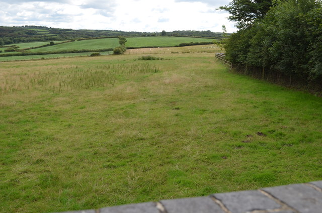
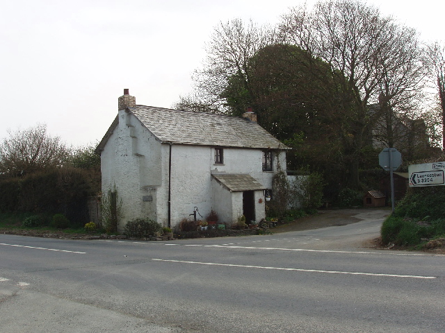
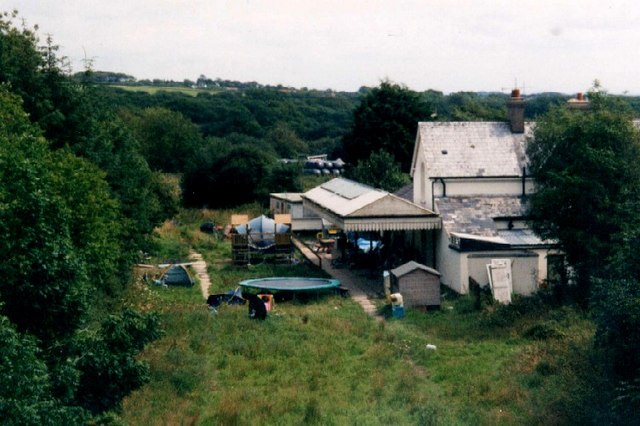
Borough is a small village located in the county of Cornwall, England. It is situated in the southern part of the county, approximately 5 miles southeast of the town of St. Austell. The village is nestled within the picturesque countryside, surrounded by rolling hills and farmland.

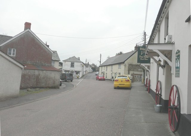
Borough is known for its quaint and traditional character, with charming stone cottages and narrow winding streets that add to its rural appeal. The village is home to a close-knit community, with a population of around 500 residents.

Despite its small size, Borough offers several amenities to its residents. The village has a local primary school, a post office, and a village hall that serves as a hub for community events. There is also a small convenience store and a pub, providing essential services and a place for locals to socialize.

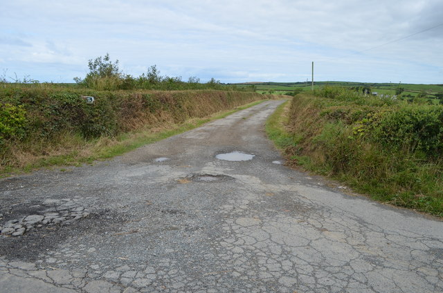
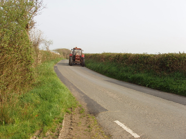
The surrounding area of Borough offers plenty of opportunities for outdoor activities. There are numerous walking and cycling trails that take visitors through the stunning countryside, allowing them to explore the natural beauty of Cornwall. Additionally, the nearby coastline offers sandy beaches and rugged cliffs, perfect for seaside walks and water activities.

Overall, Borough is a tranquil and idyllic village in Cornwall, offering a peaceful lifestyle amidst stunning natural surroundings. Its close community and range of amenities make it an attractive place to live for those seeking a slower pace of life in a beautiful rural setting.

If you have any feedback on the listing, please let us know in the comments section below.

Borough Images

Images are sourced within 2km of 50.797894/-4.4706425 or Grid Reference SS2502. Thanks to Geograph Open Source API. All images are credited.

The centre of Bridgerule There is a signpost on the right pointing to Whitstone down the road on the left. On the immediate right is the Bridge Inn.
The centre of Bridgerule
There is a signpost on the right pointing to Whitstone down the road on the left. On the immediate right is the Bridge Inn.
Track of old railway line Taken from a bridge at Titson, all trace of the line has been eliminated here.
Track of old railway line
Taken from a bridge at Titson, all trace of the line has been eliminated here.
Road to Great Beer Farm and  Public Footpath
Road to Great Beer Farm and Public Footpath
Unnamed lane and hedge Near Jewell's Cross, although that is in Devon, this is just over into Cornwall.
Unnamed lane and hedge
Near Jewell's Cross, although that is in Devon, this is just over into Cornwall.
Jewell's Cross A rural road and petrol station on the boundary of Devon and Cornwall near Bridgerule - one of the few areas where Cornwall is north of Devon
Jewell's Cross
A rural road and petrol station on the boundary of Devon and Cornwall near Bridgerule - one of the few areas where Cornwall is north of Devon
Bridgerule All quiet on a Sunday morning.
Bridgerule
All quiet on a Sunday morning.
The Tamar Where it flows through Bridgerule, it looks swollen after a night of heavy rain.
The Tamar
Where it flows through Bridgerule, it looks swollen after a night of heavy rain.
Bridgerule Parish Hall
The Bridge Mill, Bridgerule This little mill was rebuilt in the late 19th century and is at present under restoration
The Bridge Mill, Bridgerule
This little mill was rebuilt in the late 19th century and is at present under restoration
Tractor on Tackbear Road, Cornwall This is in Cornwall, but close to the Devon boundary.
Tractor on Tackbear Road, Cornwall
This is in Cornwall, but close to the Devon boundary.
Hedley Wood Caravan and Camping Park The caravan park <span class="nowrap"><a title="http://www.hedleywood.co.uk/" rel="nofollow ugc noopener" href="http://www.hedleywood.co.uk/">Link</a><img style="margin-left:2px;" alt="External link" title="External link - shift click to open in new window" src="https://s1.geograph.org.uk/img/external.png" width="10" height="10"/></span> nestles into the hillside so it is only just visible. View from Tackbear Road, which at this point is the county boundary with Devon to the north.
Hedley Wood Caravan and Camping Park
The caravan park LinkExternal link nestles into the hillside so it is only just visible. View from Tackbear Road, which at this point is the county boundary with Devon to the north.
House at Borough Cross The house is by the B3254, which at this point is the watershed between the Atlantic 4 miles away to the west and the English Channel 30 miles away down the Tamar to the south-east.
House at Borough Cross
The house is by the B3254, which at this point is the watershed between the Atlantic 4 miles away to the west and the English Channel 30 miles away down the Tamar to the south-east.
Farm track to Knowle View into Devon  from road which is the county boundary with Cornwall.
Farm track to Knowle
View into Devon from road which is the county boundary with Cornwall.
Grass field near Sensham View from the road opposite the track to Sensham. The road is the county boundary, this is a view into Cornwall.
Grass field near Sensham
View from the road opposite the track to Sensham. The road is the county boundary, this is a view into Cornwall.
Field near Titson, view towards Knowle The white blossom in the hedge is blackthorn. View from road.
Field near Titson, view towards Knowle
The white blossom in the hedge is blackthorn. View from road.
Plant hire depot At the junction of the B3254 and the roads to Bridgerule and Knowle.
Plant hire depot
At the junction of the B3254 and the roads to Bridgerule and Knowle.
Field at Borough Cross, view to Bridgerule View from B3254 road. This area is in a small area of Devon west of the Tamar - for most of its length Devon is only east of the Tamar.
Field at Borough Cross, view to Bridgerule
View from B3254 road. This area is in a small area of Devon west of the Tamar - for most of its length Devon is only east of the Tamar.
Road near Sensham View from the end of the track to Sensham. The car is the photographer's. In the morning we walked along the cliffs north of Bude and back on the beach. For our afternoon expedition we drove around, stopping every kilometre or so  to take photos in a new grid square.
Road near Sensham
View from the end of the track to Sensham. The car is the photographer's. In the morning we walked along the cliffs north of Bude and back on the beach. For our afternoon expedition we drove around, stopping every kilometre or so to take photos in a new grid square.
Show me another place!

Borough is located at Grid Ref: SS2502 (Lat: 50.797894, Lng: -4.4706425)

Administrative County: Devon

District: Torridge

Police Authority: Devon and Cornwall

What 3 Words

///valuables.deserved.stupidly. Near Bude, Cornwall

Nearby Locations

Borough North Wood

Related Wikis

Buttsbear Cross

Buttsbear Cross is a hamlet in the parish of Launcells, Cornwall, England. Buttsbear Cross lies on the B3254 road and is 2.7 miles (4.3 km) south-east...

Whitstone and Bridgerule railway station

Whitstone and Bridgerule (Cornish: Mengwynn ha Ponsrowald) was a railway station on the Bude Branch that closed in 1966. The station was opened in 1898...

Bridgerule

Bridgerule (Cornish: Ponsrowald) is a village and civil parish in Devon, England, a mile from the border with Cornwall. The parish is divided by the River...

Titson

Titson or Budd's Titson is a hamlet in the parish of Marhamchurch, Cornwall, England, United Kingdom. == References == == External links == Media related...

Nearby Amenities

Located within 500m of 50.797894,-4.4706425
Direction: 150
Generator Method: photovoltaic
Generator Output Electricity: yes
Generator Solar Modules: 6
Generator Source: solar
Generator Type: solar_photovoltaic_panel
Location: roof
Power: generator
Lat/Long: 50.7973978/-4.4746408
Direction: SSE
Generator Method: photovoltaic
Generator Output Electricity: yes
Generator Solar Modules: 9
Generator Source: solar
Generator Type: solar_photovoltaic_panel
Location: roof
Power: generator
Lat/Long: 50.79733/-4.4748406
The data included in this document is from www.openstreetmap.org. The data is made available under ODbL.

Have you been to Borough?

Leave your review of Borough below (or comments, questions and feedback).