Bodermid

Settlement in Caernarfonshire

Wales

Bodermid

The beach at Aberdaron The Tŷ Newydd Hotel is on the left.
The beach at Aberdaron Credit: Steve Daniels

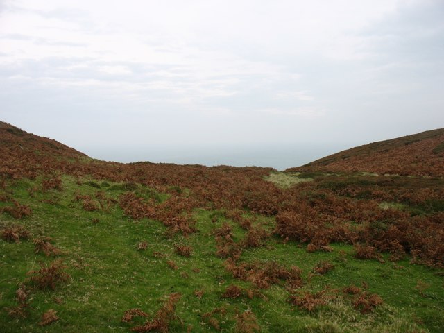
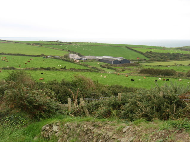
Bodermid is a small village located in the historic county of Caernarfonshire, Wales. Situated in the picturesque Welsh countryside, it is nestled between the towns of Caernarfon and Pwllheli. The village is surrounded by rolling hills, lush green fields, and breathtaking views of the nearby mountains.

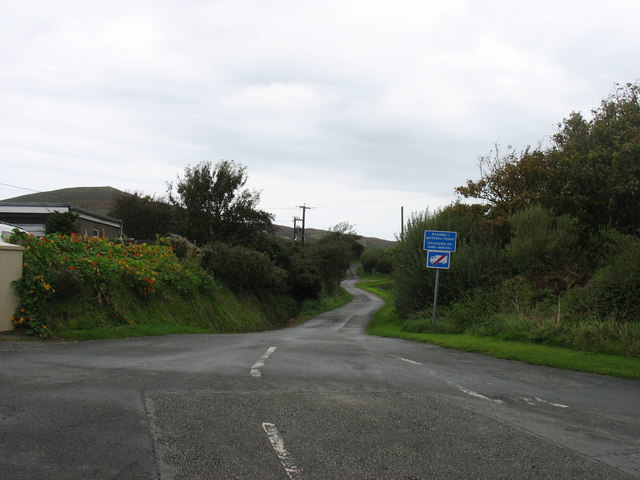
With a population of around 500 residents, Bodermid retains its rural charm and tranquility. The village features a delightful array of traditional stone houses, many of which date back centuries, giving it a sense of historical significance. The community is tight-knit, with a strong sense of pride in its Welsh heritage.

Despite its size, Bodermid offers several amenities for its residents and visitors. The village boasts a local pub, a community center, and a small convenience store for everyday essentials. Additionally, there are various recreational opportunities available nearby, including scenic walking trails, cycling routes, and picturesque picnic spots.

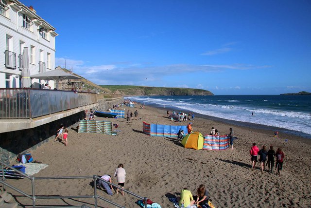
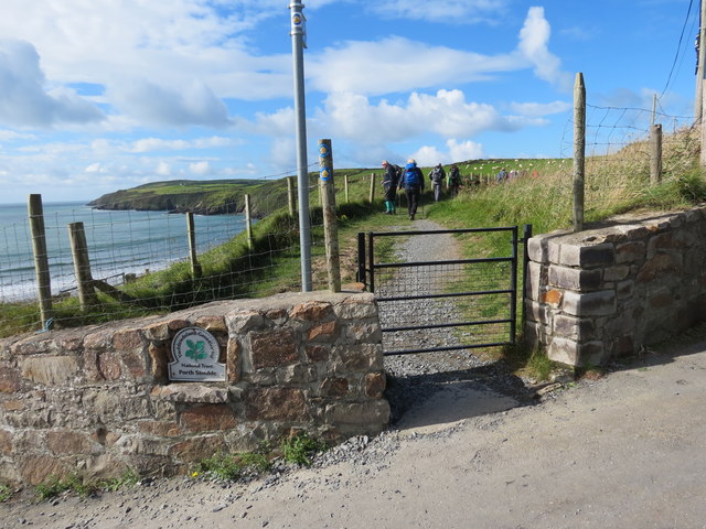
Bodermid's location makes it an ideal base for exploring the natural wonders of the surrounding area. The nearby Snowdonia National Park offers endless opportunities for outdoor activities, such as hiking, climbing, and wildlife spotting. Additionally, the stunning coastline of Cardigan Bay is just a short drive away, where visitors can enjoy sandy beaches, water sports, and even spot dolphins and seals.

Overall, Bodermid is a charming and idyllic village that provides a peaceful retreat amidst the beauty of the Welsh countryside. Its rich history, breathtaking scenery, and proximity to natural wonders make it a hidden gem for those seeking a relaxing and authentic Welsh experience.

If you have any feedback on the listing, please let us know in the comments section below.
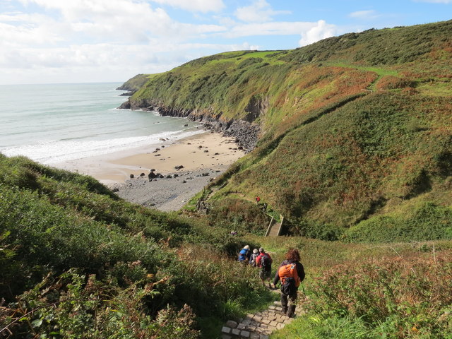
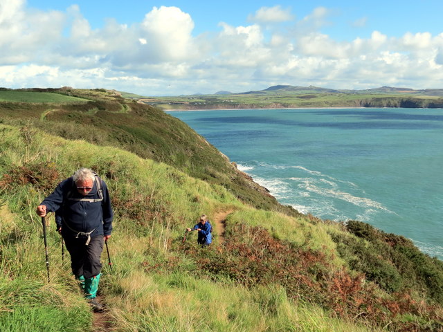
Bodermid Images

Images are sourced within 2km of 52.793716/-4.7366765 or Grid Reference SH1525. Thanks to Geograph Open Source API. All images are credited.

The beach at Aberdaron The Tŷ Newydd Hotel is on the left.
The beach at Aberdaron
The Tŷ Newydd Hotel is on the left.
Resurfaced car park at Porth y Swnt
Porth Meudwy Leaving Porth Meudwy for a trip to Ynys Enlli.
Porth Meudwy
Leaving Porth Meudwy for a trip to Ynys Enlli.
Bagét ar y Traeth - Baguette on the Beach A seasonal takeaway facing the beach.
Bagét ar y Traeth - Baguette on the Beach
A seasonal takeaway facing the beach.
Bwydlen ddwyiethog Bilingual menu Fare on offer at <a href="https://www.geograph.org.uk/photo/4845125">SH1726 : Bagét ar y Traeth - Baguette on the Beach</a>
Bwydlen ddwyiethog Bilingual menu
Milestone
Milestone
The southern slopes of Mynydd Mawr Bardsey Island in the hazy background.
The southern slopes of Mynydd Mawr
Bardsey Island in the hazy background.
North-eastern slopes of Mynydd Mawr
Steps to the summit of Mynydd Mawr I presume that the steps, and the concrete platform at their foot, are the remains of constructions during World War II.
Steps to the summit of Mynydd Mawr
I presume that the steps, and the concrete platform at their foot, are the remains of constructions during World War II.
The summit of Mynydd y Gwyddel This small hill is 99m high. Bardsey Island is in a rather misty distance.
The summit of Mynydd y Gwyddel
This small hill is 99m high. Bardsey Island is in a rather misty distance.
The lane to Anelog
The lane to Anelog
Cwrt Farm Aberdaron Bay beyond.
Cwrt Farm
Aberdaron Bay beyond.
Llwybr Arfordir Cymru / Wales Coastal Path Cerddwyr yn dilyn Llwybr Arfordir Cymru uwchben Aberdaron.

Walkers following the Wales Coastal Path above Aberdaron (trans. mouth of the river Daron).
Llwybr Arfordir Cymru / Wales Coastal Path
Cerddwyr yn dilyn Llwybr Arfordir Cymru uwchben Aberdaron. Walkers following the Wales Coastal Path above Aberdaron (trans. mouth of the river Daron).
Porth Simdde Cerddwyr yn dilyn Llwybr Arfordir Cymru ym Mhorth Simdde.

Walkers following the Wales Coast Path at Porth Simdde.
Porth Simdde
Cerddwyr yn dilyn Llwybr Arfordir Cymru ym Mhorth Simdde. Walkers following the Wales Coast Path at Porth Simdde.
Tuag at Abardaron / Towards Aberdaron Cerddwyr yn dilyn Llwybr Arfordir Cymru tuag at Aberdaron, yr anheddiad yn y pellter.

Walkers following the Wales Coast Path towards Aberdaron (trans. mouth of the river daron), the settlement in the distance.
Tuag at Abardaron / Towards Aberdaron
Cerddwyr yn dilyn Llwybr Arfordir Cymru tuag at Aberdaron, yr anheddiad yn y pellter. Walkers following the Wales Coast Path towards Aberdaron (trans. mouth of the river daron), the settlement in the distance.
Ger Porth y Pistyll / Near Porth y Pistyll Cerddwyr yn dilyn Llwybr Arfordir Cymru ger Porth y Pistyll.

Walkers following the Wales Coast Path near Porth y Pistyll (trans. spring port).
Ger Porth y Pistyll / Near Porth y Pistyll
Cerddwyr yn dilyn Llwybr Arfordir Cymru ger Porth y Pistyll. Walkers following the Wales Coast Path near Porth y Pistyll (trans. spring port).
Ger Pen y Cil / Near Pen y Cil Gat fochyn ar Lwybr Arfordir Cymru ger man o'r enw Pen y Cil

A kissing gate on the Wales Coast Path near a location known as Pen y Cil (trans. top of the recess).
Ger Pen y Cil / Near Pen y Cil
Gat fochyn ar Lwybr Arfordir Cymru ger man o'r enw Pen y Cil A kissing gate on the Wales Coast Path near a location known as Pen y Cil (trans. top of the recess).
Trwy'r gat / Through a gate Cerddwyr yn mynd trwy gat yn Uwchfynydd.

Walkers going through gate at Uwchfynydd (trans. above mountain).
Trwy'r gat / Through a gate
Cerddwyr yn mynd trwy gat yn Uwchfynydd. Walkers going through gate at Uwchfynydd (trans. above mountain).
Show me another place!

Bodermid is located at Grid Ref: SH1525 (Lat: 52.793716, Lng: -4.7366765)

Unitary Authority: Gwynedd

Police Authority: North Wales

What 3 Words

///pitch.goofy.sporting. Near Nefyn, Gwynedd

Related Wikis

St Hywyn's Church, Aberdaron

The Church of St Hywyn, Aberdaron, Gwynedd, Wales, is a parish church dating from the 12th century. Its origins are earlier, as a clas church from the...

Aberdaron

Aberdaron (Welsh pronunciation: [abɛrˈdarɔn]) is a community, electoral ward and former fishing village at the western tip of the Llŷn Peninsula in the...

Bardsey Bird and Field Observatory

Bardsey Bird and Field Observatory is a bird observatory on Bardsey Island, off the Welsh coast. It was founded in 1953 by a group of ornithologists from...

Bardsey Island

Bardsey Island (Welsh: Ynys Enlli), known as the legendary "Island of 20,000 Saints", is located 1.9 miles (3.1 km) off the Llŷn Peninsula in the Welsh...

Nearby Amenities

Located within 500m of 52.793716,-4.7366765
Barrier: kissing_gate
Foot: yes
Lat/Long: 52.7977125/-4.7390839
Barrier: stile
Foot: yes
Lat/Long: 52.7977868/-4.7398181
Barrier: kissing_gate
Foot: yes
Lat/Long: 52.7975192/-4.7344657
Bodermid
Place: hamlet
Source: OS Open Names
Lat/Long: 52.7937342/-4.7366853
The data included in this document is from www.openstreetmap.org. The data is made available under ODbL.

Have you been to Bodermid?

Leave your review of Bodermid below (or comments, questions and feedback).