Bledisloe

Settlement in Gloucestershire Forest of Dean

England

Bledisloe

View to The Severn, 1 From near The Haie, the whole of the Arlingham bend can be seen.
Lush green spring pasture in between.
View to The Severn, 1 Credit: Jonathan Billinger

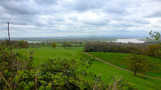
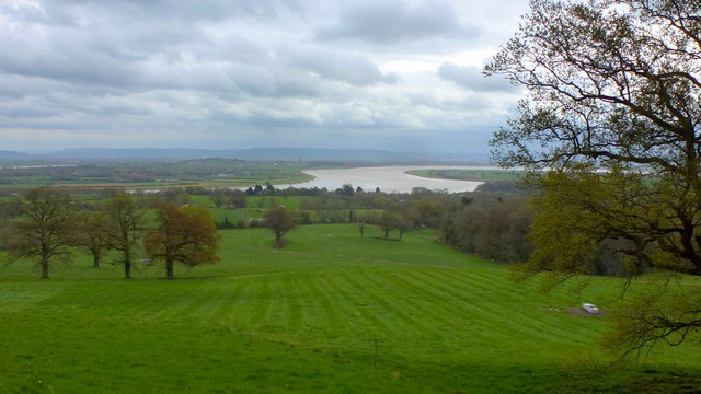
Bledisloe is a small village located in the county of Gloucestershire, England. Situated in the picturesque Cotswold Hills, it is surrounded by rolling countryside, offering a tranquil and idyllic setting for its residents and visitors alike.

The village is known for its charming and quaint character, with traditional stone houses and thatched cottages lining its streets. It exudes a sense of history, as evidenced by the historic Bledisloe Court, a Grade I listed manor house that dates back to the 16th century. The manor has served as a residence for several notable families throughout its history and is an architectural gem.

Although Bledisloe is a small village, it is well-connected to nearby towns and cities. Gloucester, the county town, is approximately 12 miles away, offering a range of amenities and services. The village is also within easy reach of Cheltenham, renowned for its vibrant cultural scene and the famous Cheltenham Racecourse.

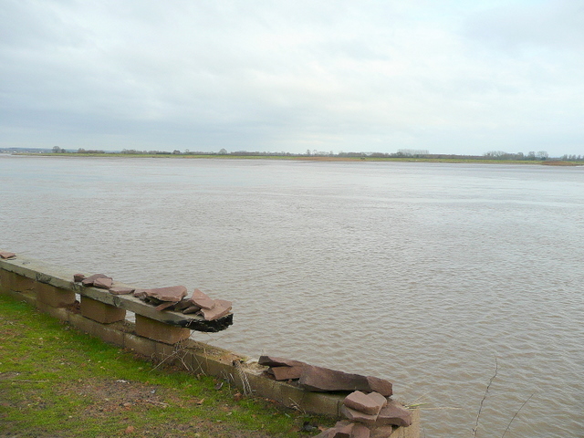
For nature enthusiasts, Bledisloe provides ample opportunities for outdoor activities. The surrounding countryside is crisscrossed with walking and cycling paths, allowing residents to explore and enjoy the natural beauty of the area. Additionally, the nearby River Severn provides opportunities for boating and fishing.

While Bledisloe may be a quiet village, it offers a close-knit community where residents can enjoy a slower pace of life. The village hosts various social events throughout the year, fostering a sense of community and providing opportunities for residents to come together and celebrate.

If you have any feedback on the listing, please let us know in the comments section below.
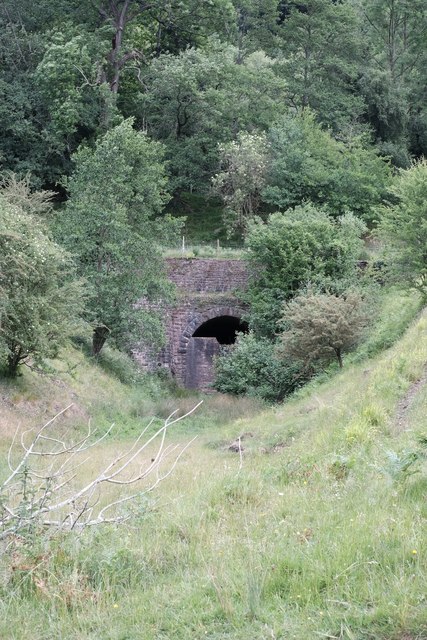
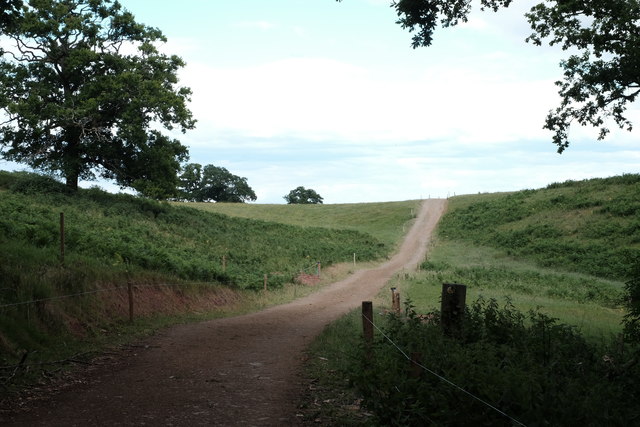
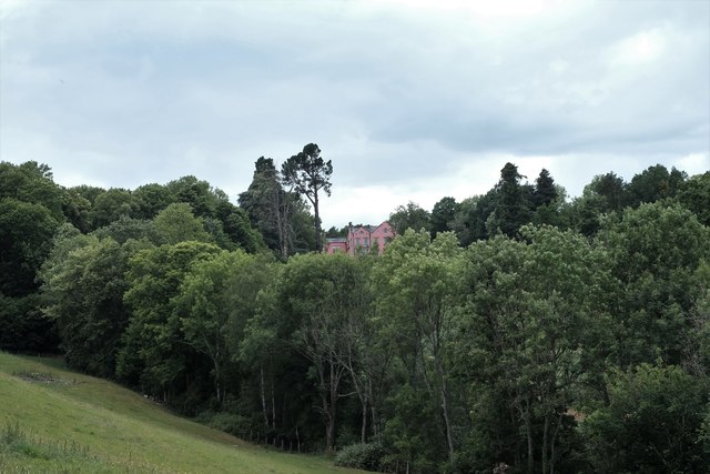
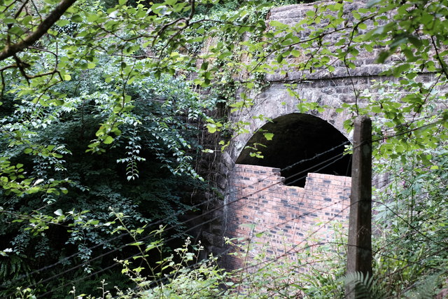
Bledisloe Images

Images are sourced within 2km of 51.776628/-2.470533 or Grid Reference SO6708. Thanks to Geograph Open Source API. All images are credited.

View to The Severn, 1 From near The Haie, the whole of the Arlingham bend can be seen.
Lush green spring pasture in between.
View to The Severn, 1
From near The Haie, the whole of the Arlingham bend can be seen. Lush green spring pasture in between.
View to The Severn, 2 The Severn estuary seen from near The Haie.
Lush spring pastures in the foreground.
View to The Severn, 2
The Severn estuary seen from near The Haie. Lush spring pastures in the foreground.
Farm building off the A48
Grassland off the A48
Lay-by on the A48 Towards Gloucester.
Lay-by on the A48
Towards Gloucester.
Railway trackbed at Soudley Taken from the site of Soudley No.1 crossing, a level crossing over a minor road between Haie Hill and Bradley Hill tunnels. The short stretch of line pictured here provided a welcome breath of fresh air for loco crews after struggling up the 1:56 gradient through Haie Hill tunnel, and before plunging into the shorter but steeper Bradley Hill tunnel, the Eastern portal of which is just out of sight behind the trees. Deceptively, given the bucolic nature of the location today, this was once a busy industrial site, featuring a tramway interchange, a loading dock (for the products of the nearby leather works, now the Dean Heritage Centre), an ironworks and a reasonably extensive network of sidings.
Railway trackbed at Soudley
Taken from the site of Soudley No.1 crossing, a level crossing over a minor road between Haie Hill and Bradley Hill tunnels. The short stretch of line pictured here provided a welcome breath of fresh air for loco crews after struggling up the 1:56 gradient through Haie Hill tunnel, and before plunging into the shorter but steeper Bradley Hill tunnel, the Eastern portal of which is just out of sight behind the trees. Deceptively, given the bucolic nature of the location today, this was once a busy industrial site, featuring a tramway interchange, a loading dock (for the products of the nearby leather works, now the Dean Heritage Centre), an ironworks and a reasonably extensive network of sidings.
Western portal of Haie Hill tunnel Haie Hill tunnel (sometimes Hay Hill) was completed in 1810 by the Bullo Pill Railway to carry their four foot gauge tramway under Haie Hill. The tramway tunnel, 1,083 yards long on opening in 1810, was at the time the longest tunnel in the world, although it lost 19 yards when it was enlarged for the Great Western's broad gauge in 1851 (a task Brunel described as "the most difficult task I have yet undertaken", as the tunnel remained open for traffic throughout). The tunnel was unpopular with loco crews, being on a rising gradient east to west of 1:56; it could take a train of empties five minutes to get through the tunnel, and within a few hundred yards of the portal pictured here, the train had to tackle the shorter but steeper 1:46 gradient of Bradley Hill tunnel. The line closed in 1967, the final death knell being sounded when Berry Wiggins moved their bitumen works from Whimsey, at the Cinderford end of the line, to Lydney. More pictures at <span class="nowrap"><a title="http://www.forgottenrelics.co.uk/tunnels/gallery/haiehill.html" rel="nofollow ugc noopener" href="http://www.forgottenrelics.co.uk/tunnels/gallery/haiehill.html">Link</a><img style="margin-left:2px;" alt="External link" title="External link - shift click to open in new window" src="https://s1.geograph.org.uk/img/external.png" width="10" height="10"/></span>
Western portal of Haie Hill tunnel
Haie Hill tunnel (sometimes Hay Hill) was completed in 1810 by the Bullo Pill Railway to carry their four foot gauge tramway under Haie Hill. The tramway tunnel, 1,083 yards long on opening in 1810, was at the time the longest tunnel in the world, although it lost 19 yards when it was enlarged for the Great Western's broad gauge in 1851 (a task Brunel described as "the most difficult task I have yet undertaken", as the tunnel remained open for traffic throughout). The tunnel was unpopular with loco crews, being on a rising gradient east to west of 1:56; it could take a train of empties five minutes to get through the tunnel, and within a few hundred yards of the portal pictured here, the train had to tackle the shorter but steeper 1:46 gradient of Bradley Hill tunnel. The line closed in 1967, the final death knell being sounded when Berry Wiggins moved their bitumen works from Whimsey, at the Cinderford end of the line, to Lydney. More pictures at LinkExternal link
Farm track Looking at aerial pics of the area this track appears to have been built fairly recently. Taken from above the eastern portal of the long-disused Haie Hill railway tunnel.
Farm track
Looking at aerial pics of the area this track appears to have been built fairly recently. Taken from above the eastern portal of the long-disused Haie Hill railway tunnel.
The Haie Now in a striking shade of pink, the house was originally known as "Ruddle Manor" and was constructed by Rolyon Jones around 1770. Not a lot of the original house survives: it was largely rebuilt in the 1850s and renamed "Newnham Park". It was sold on after rebuilding and extended in the 1880s when it was renamed "The Haie", the name it retains to this day. It was converted into apartments (one of which is home to a noisy dog, as we discovered when we accidentally wandered down the drive!) after WWII. The original builder, Ronyon Jones, was one of the promoters of the Bullo Pill Railway Company, who constructed the Bullo Pill tramroad (which passed directly beneath the house in Haie Hill tunnel), and his son, upon inheriting the house and all his father's industrial interests including the tramroad, complained of the tunnel drawing off all the water from the springs which supplied the house. Which is ironic. The approach cutting to the tunnel is marked by the line of trees in the foreground: note the surviving railway fencing.
The Haie
Now in a striking shade of pink, the house was originally known as "Ruddle Manor" and was constructed by Rolyon Jones around 1770. Not a lot of the original house survives: it was largely rebuilt in the 1850s and renamed "Newnham Park". It was sold on after rebuilding and extended in the 1880s when it was renamed "The Haie", the name it retains to this day. It was converted into apartments (one of which is home to a noisy dog, as we discovered when we accidentally wandered down the drive!) after WWII. The original builder, Ronyon Jones, was one of the promoters of the Bullo Pill Railway Company, who constructed the Bullo Pill tramroad (which passed directly beneath the house in Haie Hill tunnel), and his son, upon inheriting the house and all his father's industrial interests including the tramroad, complained of the tunnel drawing off all the water from the springs which supplied the house. Which is ironic. The approach cutting to the tunnel is marked by the line of trees in the foreground: note the surviving railway fencing.
Old level crossing gatepost Even I cannot pretend that this is not quite a dull subject! Nonetheless, this is the only remaining gatepost of Soudley No.1 level crossing, which carried the GWR's Forest of Dean branch over a minor road in between Haie Hill and Bradley Hill tunnels. Haie Hill tunnel's western portal is hidden behind the post.
Old level crossing gatepost
Even I cannot pretend that this is not quite a dull subject! Nonetheless, this is the only remaining gatepost of Soudley No.1 level crossing, which carried the GWR's Forest of Dean branch over a minor road in between Haie Hill and Bradley Hill tunnels. Haie Hill tunnel's western portal is hidden behind the post.
Bradley Hill tunnel, eastern portal Not an easy one to photograph, this: I had to walk a few hundred yards up a busy main road then wade through waist-deep nettles to get this shot! Bradley Hill tunnel was opened in 1854 when the GWR converted the Bullo Pill tramroad into a real railway. The tramroad had skirted Bradley Hill, on the route now used by the Blakeney - Cinderford road, but the railway burrowed through instead. The tunnel was not popular with steam-era loco crews, not only being on a rising gradient (east to west) of 1 in 46, but also being on a curve which restricted ventilation. Add to that the fact that trains plunged into it only a few hundred yards after exiting the much longer Haie Hill tunnel, and you have a recipe for asphyxiation. See <span class="nowrap"><a title="http://www.forgottenrelics.co.uk/tunnels/bradleyhill.html" rel="nofollow ugc noopener" href="http://www.forgottenrelics.co.uk/tunnels/bradleyhill.html">Link</a><img style="margin-left:2px;" alt="External link" title="External link - shift click to open in new window" src="https://s1.geograph.org.uk/img/external.png" width="10" height="10"/></span> for a fireman's account of travelling through the tunnel on a struggling steam locomotive in 1964.
Bradley Hill tunnel, eastern portal
Not an easy one to photograph, this: I had to walk a few hundred yards up a busy main road then wade through waist-deep nettles to get this shot! Bradley Hill tunnel was opened in 1854 when the GWR converted the Bullo Pill tramroad into a real railway. The tramroad had skirted Bradley Hill, on the route now used by the Blakeney - Cinderford road, but the railway burrowed through instead. The tunnel was not popular with steam-era loco crews, not only being on a rising gradient (east to west) of 1 in 46, but also being on a curve which restricted ventilation. Add to that the fact that trains plunged into it only a few hundred yards after exiting the much longer Haie Hill tunnel, and you have a recipe for asphyxiation. See LinkExternal link for a fireman's account of travelling through the tunnel on a struggling steam locomotive in 1964.
Great Western boundary marker An old GWR boundary marker in the grass, near Tump House at Soudley. This is some way from where the GWR's Forest of Dean branch ran, but is at the edge of the land once occupied by the tramway serving Soudley Iron Works, which had ceased production in 1877. I wonder if the GWR also owned the tramway route? Detail of a similar boundary post, up the line near Ruspidge, can be seen at <a href="https://www.geograph.org.uk/photo/6500361">SO6511 : Great Western boundary post detail</a>.
Great Western boundary marker
An old GWR boundary marker in the grass, near Tump House at Soudley. This is some way from where the GWR's Forest of Dean branch ran, but is at the edge of the land once occupied by the tramway serving Soudley Iron Works, which had ceased production in 1877. I wonder if the GWR also owned the tramway route? Detail of a similar boundary post, up the line near Ruspidge, can be seen at SO6511 : Great Western boundary post detail.
Tramway route at Soudley iron works Now a bridleway, this was once the route of a tramway serving Soudley iron works. Iron making was a pretty fickle business, with the works changing hands many times before ceasing production in 1877. Most of the buildings were cleared in 1899, but the tramway is marked on the 1914 map. The stone building to the right is part of the old iron works. The tramway route is now a bridleway. The presence of a GWR boundary marker post in the grass some distance down the tramway route suggests that the tramway may have been included in the agreement for the GWR to purchase the Bullo Pill tramway and convert it to a railway.
Tramway route at Soudley iron works
Now a bridleway, this was once the route of a tramway serving Soudley iron works. Iron making was a pretty fickle business, with the works changing hands many times before ceasing production in 1877. Most of the buildings were cleared in 1899, but the tramway is marked on the 1914 map. The stone building to the right is part of the old iron works. The tramway route is now a bridleway. The presence of a GWR boundary marker post in the grass some distance down the tramway route suggests that the tramway may have been included in the agreement for the GWR to purchase the Bullo Pill tramway and convert it to a railway.
Track and solar farm The Bushy Hill solar farm can be seen as a block of grey in the distance.
Track and solar farm
The Bushy Hill solar farm can be seen as a block of grey in the distance.
Stone Stile, Blakeney Hill On Gloucestershire footpath DAW37 at Hewell's Farm, Cinderford Road. This looks West to road, the view East is <a href="https://www.geograph.org.uk/photo/7301708">SO6607 : Stone Stile, Blakeney Hill</a>.
Stone Stile, Blakeney Hill
On Gloucestershire footpath DAW37 at Hewell's Farm, Cinderford Road. This looks West to road, the view East is SO6607 : Stone Stile, Blakeney Hill.
Stone Stile, Blakeney Hill On Gloucestershire footpath DAW37 at Hewell's Farm, Cinderford Road. This looks East, the view to the road is <a href="https://www.geograph.org.uk/photo/7301707">SO6607 : Stone Stile, Blakeney Hill</a>.
Stone Stile, Blakeney Hill
On Gloucestershire footpath DAW37 at Hewell's Farm, Cinderford Road. This looks East, the view to the road is SO6607 : Stone Stile, Blakeney Hill.
Stone Stile, Blakeney Hill On Gloucestershire footpaths DAW38 & DAW39 from Cinderford Road opposite Hewell's Farm looking from the road. The view looking to the road is <a href="https://www.geograph.org.uk/photo/7301717">SO6607 : Stone Stile, Blakeney Hill</a>.
Stone Stile, Blakeney Hill
On Gloucestershire footpaths DAW38 & DAW39 from Cinderford Road opposite Hewell's Farm looking from the road. The view looking to the road is SO6607 : Stone Stile, Blakeney Hill.
Stone Stile, Blakeney Hill On Gloucestershire footpaths DAW38 & DAW39 from Cinderford Road, looking towards Hewell's Farm. The view from the road is <a href="https://www.geograph.org.uk/photo/7301715">SO6607 : Stone Stile, Blakeney Hill</a>.
Stone Stile, Blakeney Hill
On Gloucestershire footpaths DAW38 & DAW39 from Cinderford Road, looking towards Hewell's Farm. The view from the road is SO6607 : Stone Stile, Blakeney Hill.
Show me another place!

Bledisloe is located at Grid Ref: SO6708 (Lat: 51.776628, Lng: -2.470533)

Administrative County: Gloucestershire

District: Forest of Dean

Police Authority: Gloucestershire

What 3 Words

///regress.victory.pothole. Near Cinderford, Gloucestershire

Nearby Locations

Bledisloe Stretfield Hill

Related Wikis

Bledisloe Tump

Bledisloe Tump was a castle in the village of Awre in Gloucestershire, England. == History == The first castle on the site was built in the 11th or early...

Bullo Cross Halt railway station

Bullo Cross Halt railway station is a disused railway station opened by the former Bullo Pill Railway, later known as the (Great Western Railway) Forest...

Blakeney, Gloucestershire

Blakeney is a village in Gloucestershire, England. It in the parish of Awre and has views of the Forest of Dean. It was the site of a Roman villa, dating...

Severn tunnel (1810)

The Severn tunnel of 1810 was an unsuccessful plan for a tramroad tunnel beneath the River Severn. The tunnel was to cross the river at Arlingham Passage...

Dean Heritage Centre

The Dean Heritage Centre is located in the valley of Soudley, Gloucestershire, England in the Forest of Dean and exists to record and preserve the social...

Brain's Green

Brain's Green is a hamlet in Gloucestershire, England. == References ==

Awre for Blakeney railway station

Awre for Blakeney railway station is a closed railway station in Gloucestershire, England, which served both the village of Awre and the town of Blakeney...

Upper Soudley Halt railway station

Upper Soudley Halt railway station is a disused railway station that was opened by the Great Western Railway (GWR) on the former Bullo Pill Railway, later...

Nearby Amenities

Located within 500m of 51.776628,-2.470533
Bus Stop
Underdean House
Naptan AtcoCode: 1600GLF131
Naptan Bearing: S
Naptan CommonName: Underdean House
Naptan Indicator: Opp
Naptan NaptanCode: gloajwjt
Naptan Street: A48
Naptan Verified: no
Source: naptan_import
Lat/Long: 51.7746238/-2.4705581
Bus Stop
Underdean House
Naptan AtcoCode: 1600GLF132
Naptan Bearing: N
Naptan CommonName: Underdean House
Naptan NaptanCode: gloajwjg
Naptan Street: A48
Naptan Verified: no
Source: naptan_import
Lat/Long: 51.7746768/-2.4707905
Bus Stop
Kingsland
Naptan AtcoCode: 1600GLF133
Naptan Bearing: S
Naptan CommonName: Kingsland
Naptan NaptanCode: gloajwgj
Naptan Street: A48
Naptan Verified: no
Source: naptan_import
Lat/Long: 51.7722822/-2.4716002
Bus Stop
Kingsland
Naptan AtcoCode: 1600GLF134
Naptan Bearing: N
Naptan CommonName: Kingsland
Naptan Indicator: Opp
Naptan NaptanCode: gloajwga
Naptan Street: A48
Naptan Verified: no
Source: naptan_import
Lat/Long: 51.7722579/-2.4717823
Severn Lodge
Fixme: OK 'Severn Lodge' is shown on opendata, but OS 1:25k historic shows 'New House'. The area is currently an industrial area. There is a 'Severn Lodge', but much further south in Alvington.
Place: locality
Source: OS Opendata Streetview;OS 1:25k historic
Lat/Long: 51.7767478/-2.4663801
Crossing
Crossing: unmarked
Lat/Long: 51.7745921/-2.4707217
Crossing
Crossing: unmarked
Lat/Long: 51.7733097/-2.4709584
The data included in this document is from www.openstreetmap.org. The data is made available under ODbL.

Have you been to Bledisloe?

Leave your review of Bledisloe below (or comments, questions and feedback).