Maesyfed

Settlement in Radnorshire

Wales

Maesyfed

War Memorial, New Radnor Surprisingly grand for such a small and remote place. For those who fell in the Great War, which did not end all wars as hoped.
War Memorial, New Radnor Credit: Philip Pankhurst

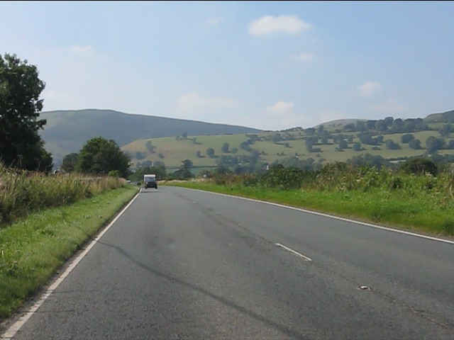
Maesyfed is a historic region located in Radnorshire, Wales. It is known for its picturesque landscapes, rolling hills, and charming villages. The area is rich in history, with evidence of human settlement dating back to prehistoric times.

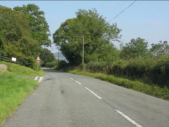
Maesyfed is a popular destination for outdoor enthusiasts, offering a variety of activities such as hiking, cycling, and fishing. The region is also home to several nature reserves, providing opportunities for birdwatching and wildlife spotting.

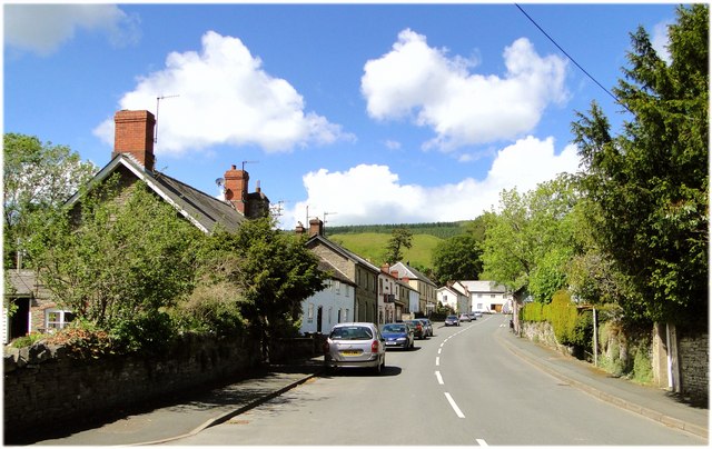
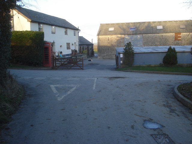
The villages in Maesyfed are quaint and traditional, with many historic buildings and landmarks to explore. The local community is known for its warm hospitality and strong sense of tradition.

Overall, Maesyfed is a peaceful and idyllic destination for those looking to escape the hustle and bustle of city life and immerse themselves in the beauty of the Welsh countryside.

If you have any feedback on the listing, please let us know in the comments section below.

Maesyfed Images

Images are sourced within 2km of 52.240182/-3.154269 or Grid Reference SO2160. Thanks to Geograph Open Source API. All images are credited.

War Memorial, New Radnor Surprisingly grand for such a small and remote place. For those who fell in the Great War, which did not end all wars as hoped.
War Memorial, New Radnor
Surprisingly grand for such a small and remote place. For those who fell in the Great War, which did not end all wars as hoped.
New Radnor Seen from the mighty castle motte. A planned medieval town that didn't get much beyond the planning stage. The castle was sacked by Owain Glyndwr and never recovered. In the 19th century the railway came en route to the coast, but got no further and was closed in 1951.
New Radnor
Seen from the mighty castle motte. A planned medieval town that didn't get much beyond the planning stage. The castle was sacked by Owain Glyndwr and never recovered. In the 19th century the railway came en route to the coast, but got no further and was closed in 1951.
St  Mary, New Radnor An early Victorian replacement for the medieval parish church, once on this site. Built 1843-5 by Thomas Dashwood, and by that time, somewhat outdated. Seen from the path up from the village.
St Mary, New Radnor
An early Victorian replacement for the medieval parish church, once on this site. Built 1843-5 by Thomas Dashwood, and by that time, somewhat outdated. Seen from the path up from the village.
Monument, New Radnor Erected to commemorate Sir George Cornewall Lewis, former Chancellor of the Exchequer. Dating from 1864, the architect was John Gibbs. Bits are now falling off.
Monument, New Radnor
Erected to commemorate Sir George Cornewall Lewis, former Chancellor of the Exchequer. Dating from 1864, the architect was John Gibbs. Bits are now falling off.
Broad Street, New Radnor With the earthworks of the castle looking down on the tiny town.
Broad Street, New Radnor
With the earthworks of the castle looking down on the tiny town.
St Mary, New Radnor
St Mary, New Radnor
A44 at Frostal House
Hills around New Radnor from the A44
A44 - eastern junction for New Radnor
Southern entry to New Radnor
New Radnor - Broad Street
B4372 begins the climb out of New Radnor
B4372 near Knowle House
B4372 near Knowle Farm
B4372 at the entrance to Knowle Farm
B4372 at Upper Bank
B4372 at Upper Bank
The Eagle, New Radnor A once fine pub, no longer with us.
The Eagle, New Radnor
A once fine pub, no longer with us.
Closed shop, New Radnor The village shop has gone. There was a shop operating out of a garden off a stall.
Closed shop, New Radnor
The village shop has gone. There was a shop operating out of a garden off a stall.
Show me another place!

Maesyfed is located at Grid Ref: SO2160 (Lat: 52.240182, Lng: -3.154269)

Unitary Authority: Powys

Police Authority: Dyfed Powys

Also known as: New Radnor

What 3 Words

///sparrows.craftsmen.holdings. Near Whitton, Powys

Related Wikis

New Radnor

New Radnor (Welsh: Maesyfed) is a village in Powys, Wales, to the south of Radnor Forest, and was the county town of Radnorshire. In the 2001 census, the...

New Radnor railway station

New Radnor railway station was a station in New Radnor, Powys, Wales. The terminus station opened in 1875 and closed in 1951. The Kington and Eardisley...

Radnor Valley F.C.

Radnor Valley Football Club is a Welsh football team based in New Radnor, Presteigne. The team currently play in the Ardal NE, which is at the third tier...

Yardro

Yardro (Welsh: Yr Ardro) is a hamlet in Powys, Wales, in the historic county of Radnorshire. The nearest significant towns are Kington, Herefordshire...

Nearby Amenities

Located within 500m of 52.240182,-3.154269
New Radnor
Is In: Powys,Wales,UK
Name Cy: Maesyfed
Name En: New Radnor
Place: village
Source: npe
Wikidata: Q3100165
Lat/Long: 52.2407038/-3.1520621
Pub
Radnor Arms
Brewery: free_house
Wikidata: Q80858933
Lat/Long: 52.2399163/-3.1542287
Historic: memorial
Monument: war_memorial
Lat/Long: 52.2406085/-3.1565066
Turning Circle
Lat/Long: 52.240028/-3.1514722
Historic: monument
Inscription: To the memory of her most distinguished son the Right Honourable Sir George Cornewall Lewis Baronet Died
Lat/Long: 52.2390973/-3.1526755
Post Box
Fixme: check ref value
Ref: LD8 212
Lat/Long: 52.2396305/-3.1527874
Recycling
Lat/Long: 52.2394622/-3.1503391
Hutton Copse
Natural: wood
Operator: Woodland Trust
Lat/Long: 52.2390219/-3.1529833
Bus Stop
Bus: yes
Public Transport: platform
Lat/Long: 52.2404625/-3.1543966
Post Box
Post Box Type: wall
Postal Code: LD8
Ref: LD8 244
Royal Cypher: GR
Royal Cypher Wikidata: Q33102273
Lat/Long: 52.2407609/-3.1555679
Telephone
Defibrillator
Booth: K6
Covered: booth
Defibrillator Location: inside old red telephone box, High Street, New Radnor
Emergency: defibrillator
Listed Status: Grade II
Man Made: telephone_box
Lat/Long: 52.2407433/-3.1556629
Brookside Farm
Tourism: holiday_cottage
Lat/Long: 52.2412107/-3.1538797
Bicycle: yes
Designation: public_bridleway
Lat/Long: 52.2439676/-3.1570787
Barrier: stile
Lat/Long: 52.2398665/-3.1492532
Barrier: stile
Lat/Long: 52.2399432/-3.150117
Barrier: stile
Lat/Long: 52.2404357/-3.1512792
Information: guidepost
Tourism: information
Lat/Long: 52.240647/-3.151394
Information: guidepost
Tourism: information
Lat/Long: 52.2404368/-3.1512801
Bicycle: yes
Designation: public_bridleway
Lat/Long: 52.2437739/-3.1569005
Bicycle: yes
Designation: public_bridleway
Lat/Long: 52.2435697/-3.1569171
Power: pole
Lat/Long: 52.2362136/-3.1561178
Power: pole
Lat/Long: 52.2361611/-3.154546
Power: pole
Lat/Long: 52.236143/-3.1516841
Direction: SSE
Generator Method: photovoltaic
Generator Output Electricity: yes
Generator Solar Modules: 18
Generator Source: solar
Generator Type: solar_photovoltaic_panel
Location: roof
Power: generator
Lat/Long: 52.2405497/-3.1508878
Direction: SSE
Generator Method: photovoltaic
Generator Output Electricity: yes
Generator Solar Modules: 8
Generator Source: solar
Generator Type: solar_photovoltaic_panel
Location: roof
Power: generator
Lat/Long: 52.2394141/-3.1509693
Direction: SSE
Generator Method: photovoltaic
Generator Output Electricity: yes
Generator Solar Modules: 5
Generator Source: solar
Generator Type: solar_photovoltaic_panel
Location: roof
Power: generator
Lat/Long: 52.2393649/-3.1512228
Direction: SSE
Generator Method: photovoltaic
Generator Output Electricity: yes
Generator Solar Modules: 4
Generator Source: solar
Generator Type: solar_photovoltaic_panel
Location: roof
Power: generator
Lat/Long: 52.2393838/-3.1512643
Direction: SSE
Generator Method: photovoltaic
Generator Output Electricity: yes
Generator Solar Modules: 3
Generator Source: solar
Generator Type: solar_photovoltaic_panel
Location: roof
Power: generator
Lat/Long: 52.2394273/-3.1512979
Direction: 235
Generator Method: photovoltaic
Generator Output Electricity: yes
Generator Solar Modules: 16
Generator Source: solar
Generator Type: solar_photovoltaic_panel
Location: roof
Power: generator
Lat/Long: 52.242056/-3.1526926
Direction: SSE
Generator Method: photovoltaic
Generator Output Electricity: yes
Generator Solar Modules: 14
Generator Source: solar
Generator Type: solar_photovoltaic_panel
Location: roof
Power: generator
Lat/Long: 52.2411732/-3.1545447
Direction: SSE
Generator Method: photovoltaic
Generator Output Electricity: yes
Generator Solar Modules: 16
Generator Source: solar
Generator Type: solar_photovoltaic_panel
Location: roof
Power: generator
Lat/Long: 52.2406189/-3.1541155
Direction: 260
Generator Method: photovoltaic
Generator Output Electricity: yes
Generator Solar Modules: 5
Generator Source: solar
Generator Type: solar_photovoltaic_panel
Location: roof
Power: generator
Lat/Long: 52.2393033/-3.1542631
Direction: SSE
Generator Method: photovoltaic
Generator Output Electricity: yes
Generator Solar Modules: 8
Generator Source: solar
Generator Type: solar_photovoltaic_panel
Location: roof
Power: generator
Lat/Long: 52.2399972/-3.1547579
Direction: SSE
Generator Method: photovoltaic
Generator Output Electricity: yes
Generator Solar Modules: 20
Generator Source: solar
Generator Type: solar_photovoltaic_panel
Location: roof
Power: generator
Lat/Long: 52.2399865/-3.1558365
Direction: SSE
Generator Method: photovoltaic
Generator Output Electricity: yes
Generator Solar Modules: 16
Generator Source: solar
Generator Type: solar_photovoltaic_panel
Location: roof
Power: generator
Lat/Long: 52.2408653/-3.1545071
Information: guidepost
Tourism: information
Lat/Long: 52.2407887/-3.1597266
Barrier: kissing_gate
Lat/Long: 52.2407942/-3.1596584
Description: 2022 Jan: stones used. Large, (permanent).
Ford: yes
Lat/Long: 52.2408004/-3.1595809
Barrier: kissing_gate
Lat/Long: 52.2405681/-3.158047
Barrier: kissing_gate
Lat/Long: 52.2410491/-3.1569924
Covered: no
Natural: peak
Lat/Long: 52.2393821/-3.1595846
The data included in this document is from www.openstreetmap.org. The data is made available under ODbL.

Have you been to Maesyfed?

Leave your review of Maesyfed below (or comments, questions and feedback).